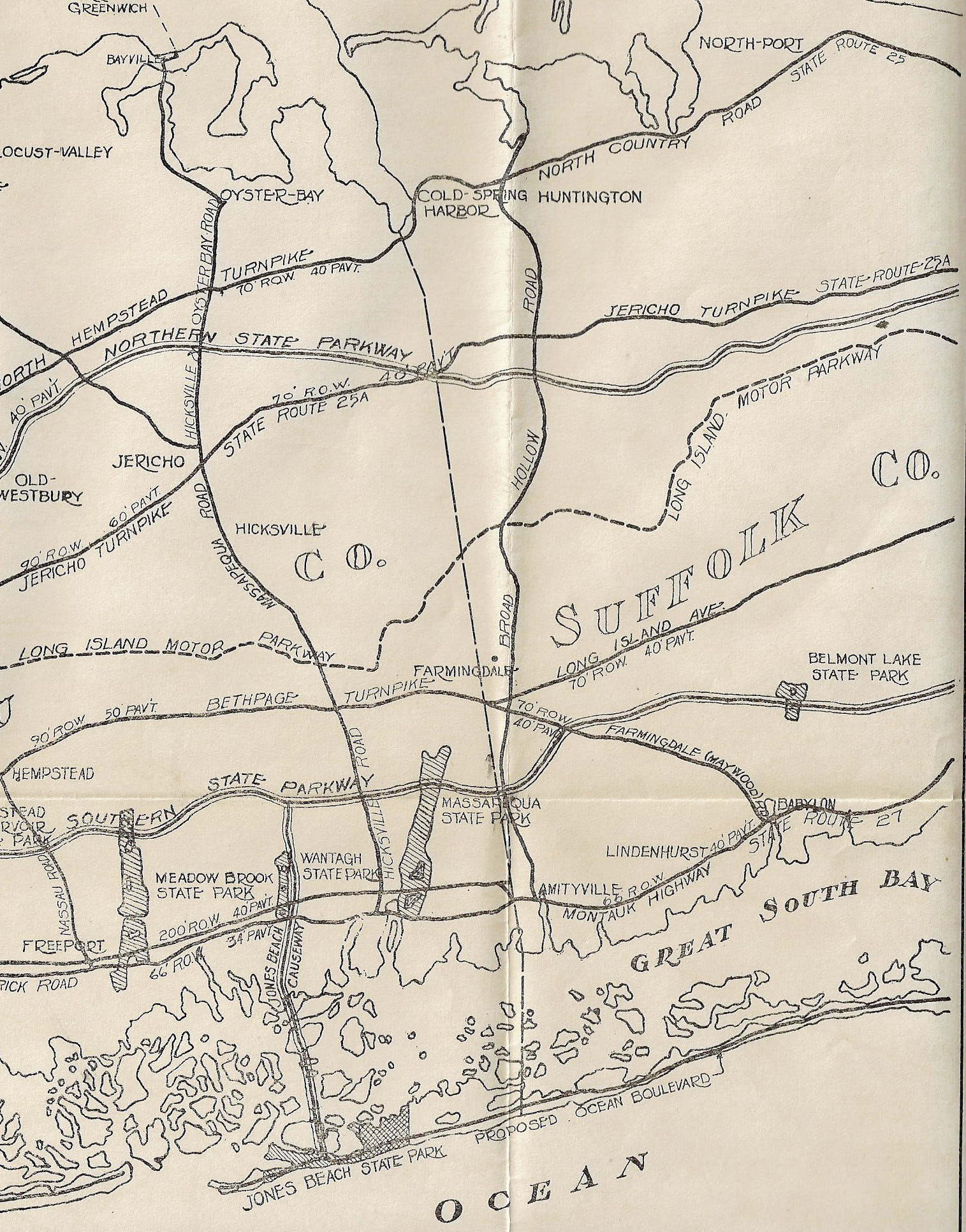
1927 Map Showing the Long Island Motor Parkway and Proposed Highways & Parkways East of Queens
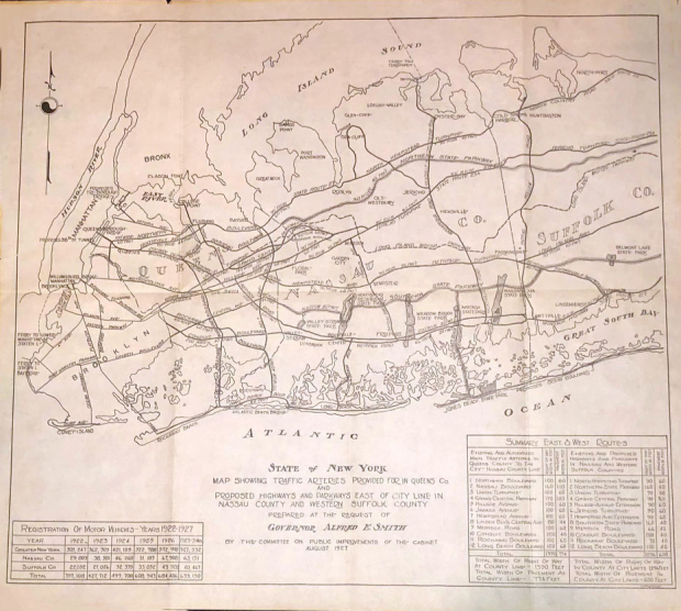
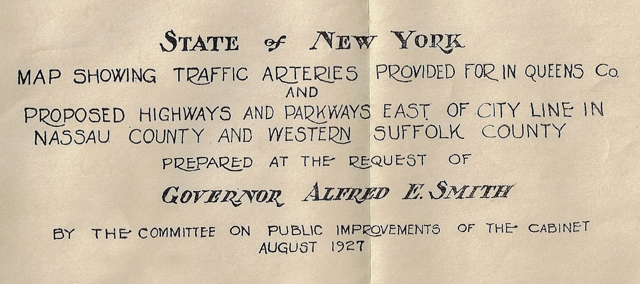
In August 1927, New York Governor Alfred E. Smith requested that his Cabinet's Committee on Public Improvements develop a map of the proposed highways and parkways in Nassau County and Western Suffolk County. The map also featured the Long Island Motor Parkway and a table of motor vehicle registrations from 1922 to May 1927.
Enjoy,
Howard Kroplick
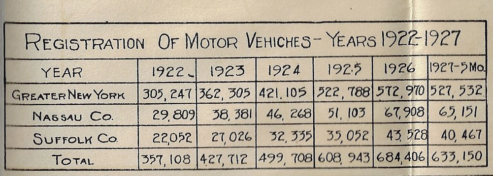
Car registrations from 1922 to May 1927 increased 77% led by Nassau County (+119%), Suffolk County (+83%) and New York City (+73%).
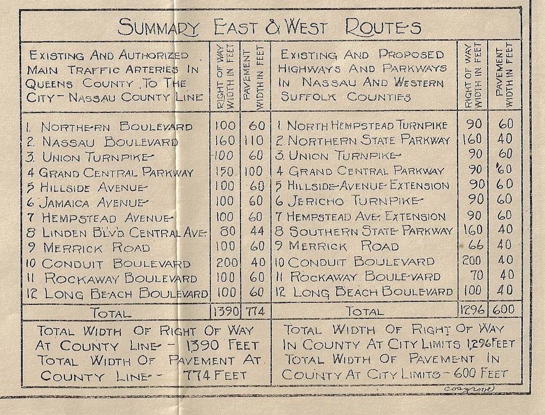
Summary of East and West Routes
Queens
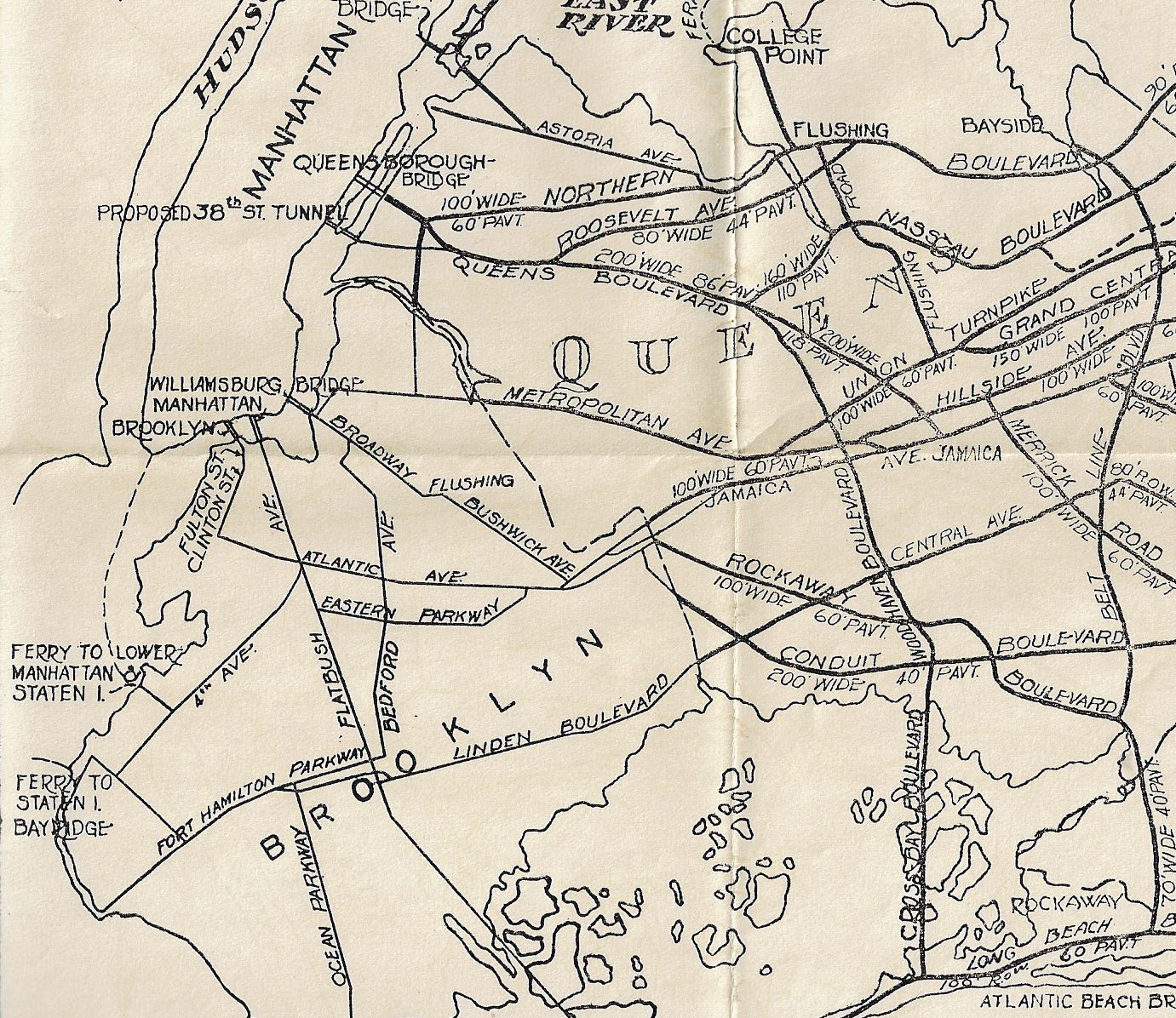
The dotted line in the right corner is the Long Island Motor Parkway.
Nassau County
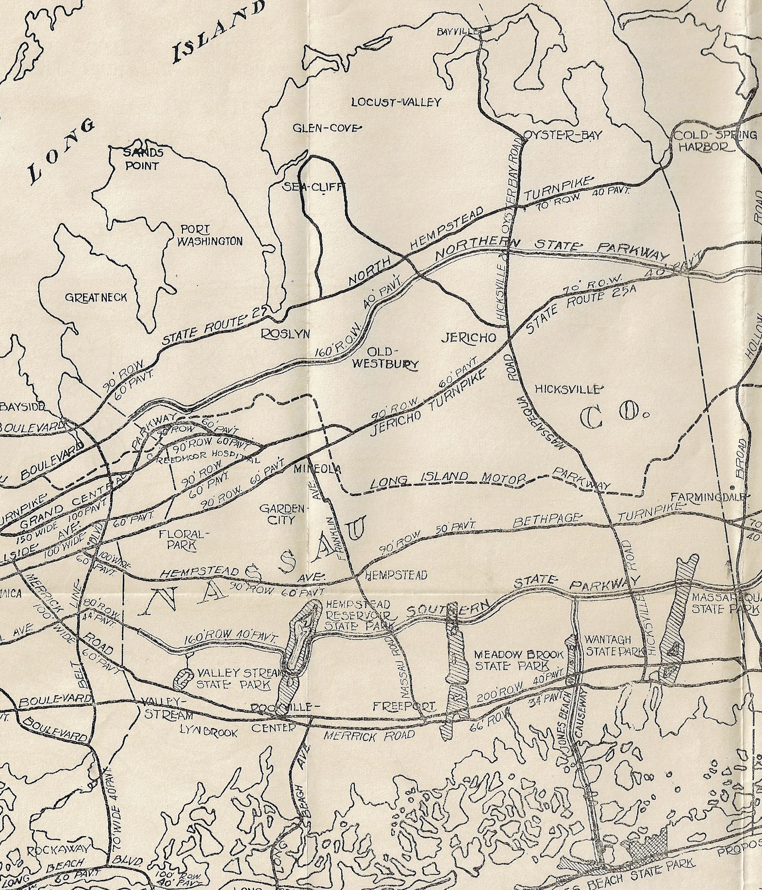
The map highlights the proposed routes of the Northern State Parkway and Southern State Parkway.
Note the Long Island Motor Parkway dotted line.
Western Suffolk County


Comments
I love the hand lettering! It’s very much a lost art these days.
Even the least width of the roadways doubled the LIMP. My driveway is 20 ft wide and 2 vans can comfortably park side by side. Toll cost was lower for the LIMP at this time period, too. Still had to be the best route until the State Pkwys took over.
Nice to see that map. I live in Dix Hills only a short distance north of the LIMP and drive on it quite often.