1958-1967 tours of the Long Island Motor Parkway #3: New Hyde Park & Searingtown
From 1958 to 1967, an unidentified couple documented their tour of the Motor Parkway with over 70 photos taken from the Western Terminus in Queens to the Eastern Terminus (Lake Ronkonkoma). In the third of this series, these five photos feature our favorite parkway in New Hyde Park & Searingtown.
Enjoy,
Howard Kroplick
Searingtown (1959)
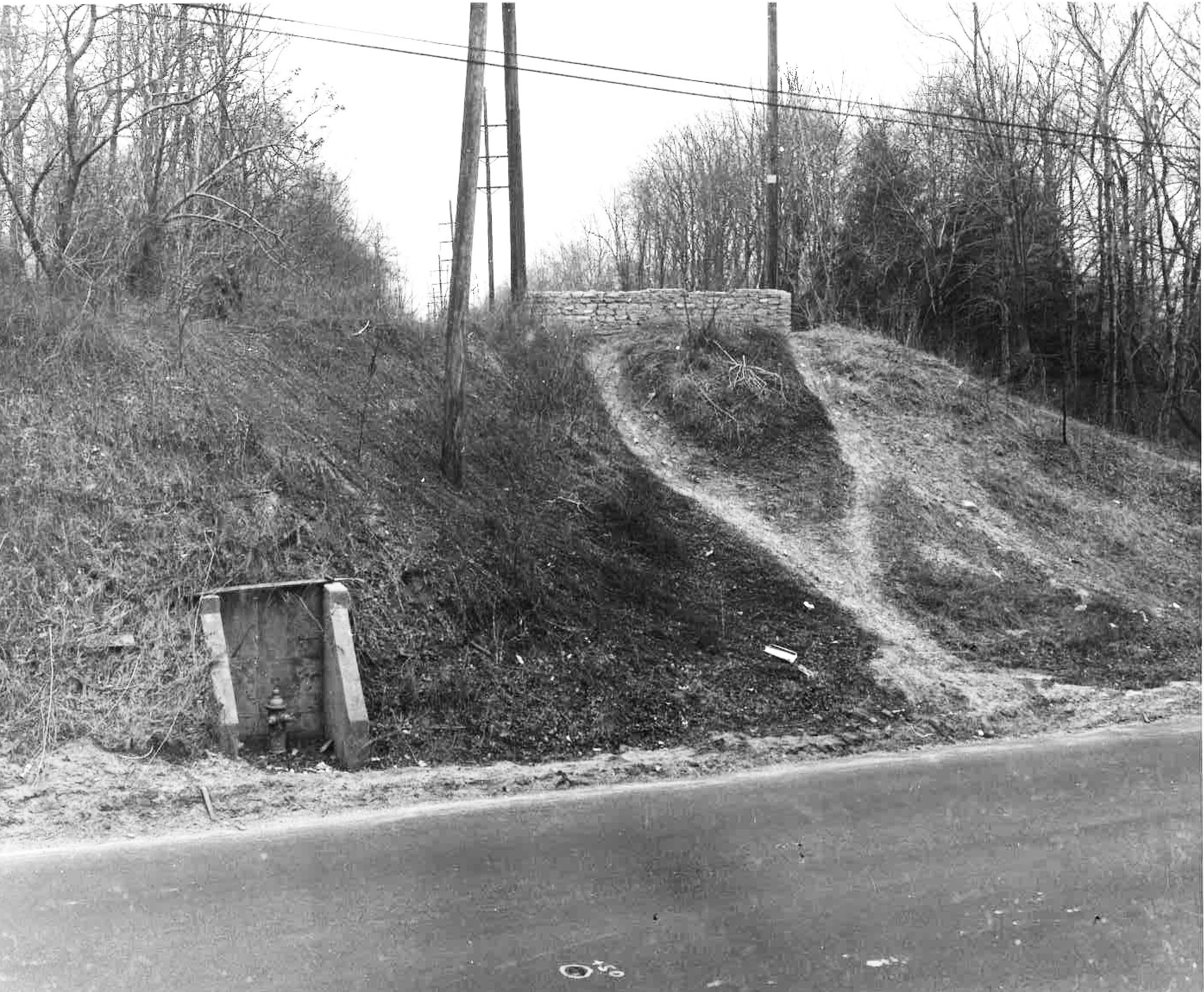
The east embankment of the New Hyde Park Road Motor Parkway Bridge.
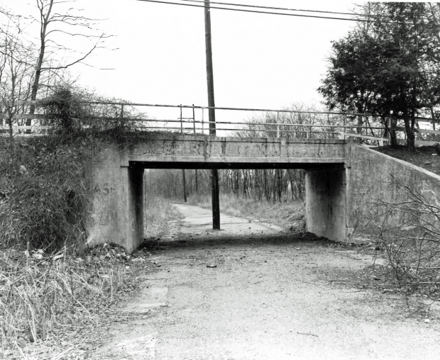
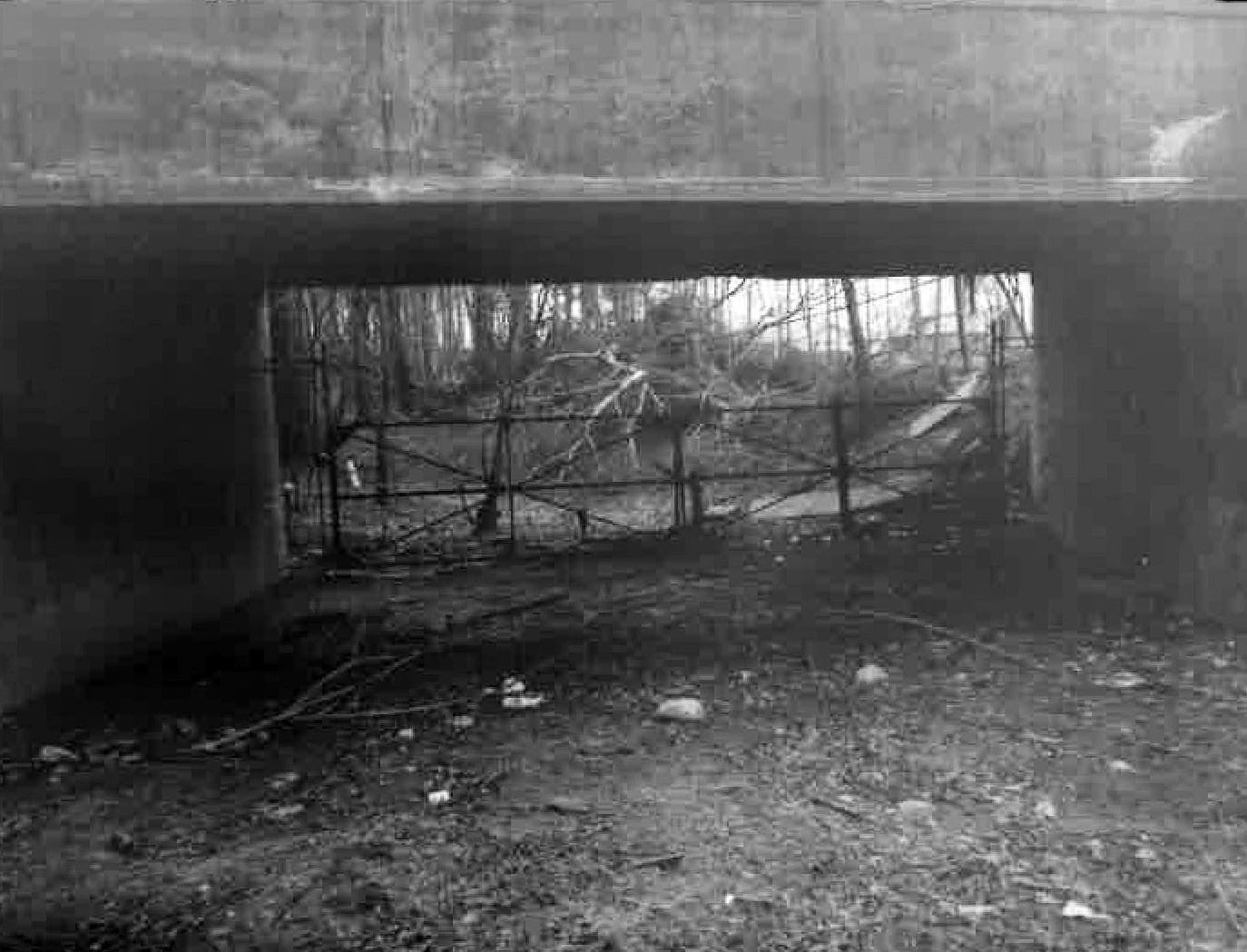
Old Courthouse Road Motor Parkway Bridge
Searingtown (1960)
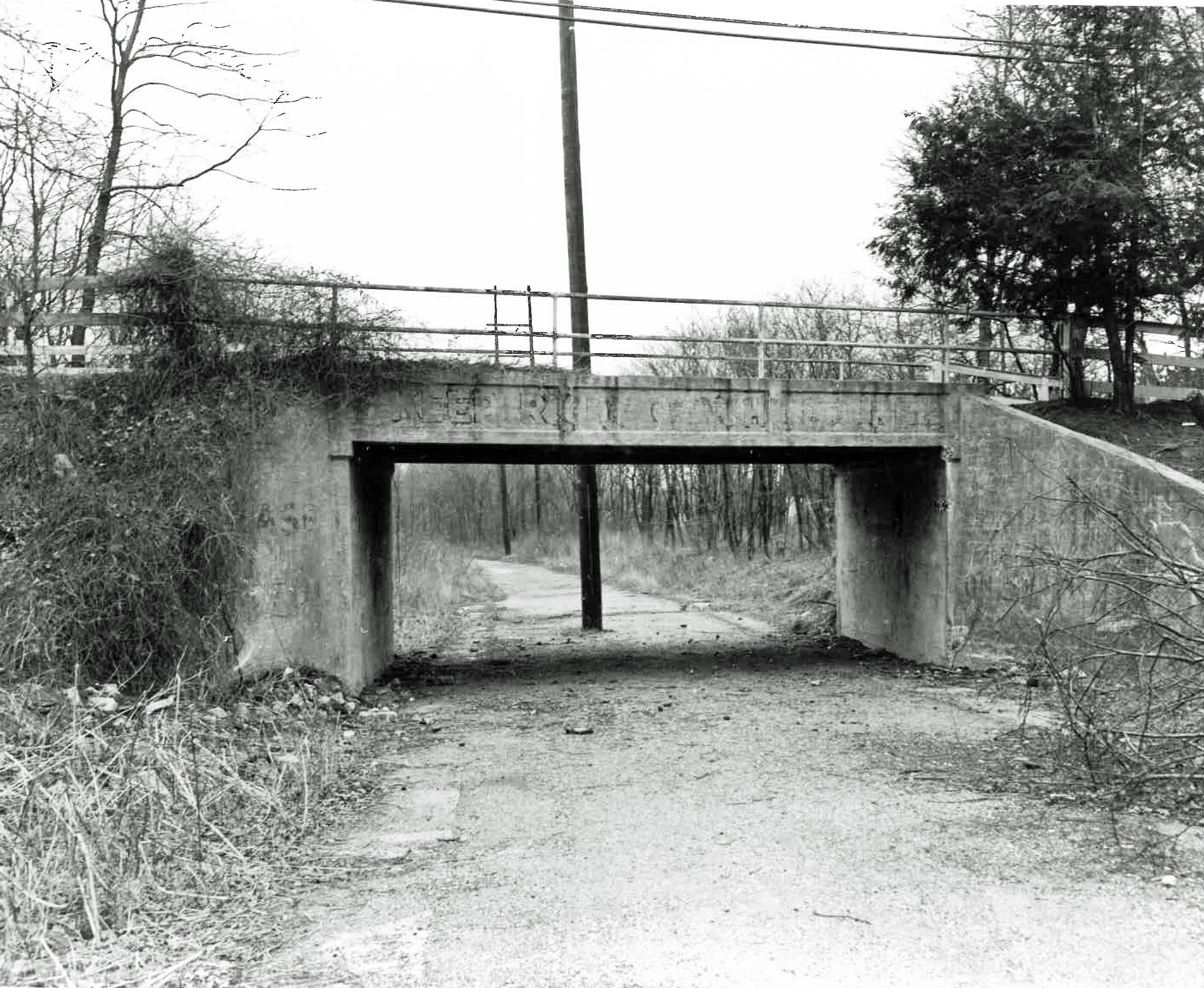
I.U. Willets Motor Parkway Bridge
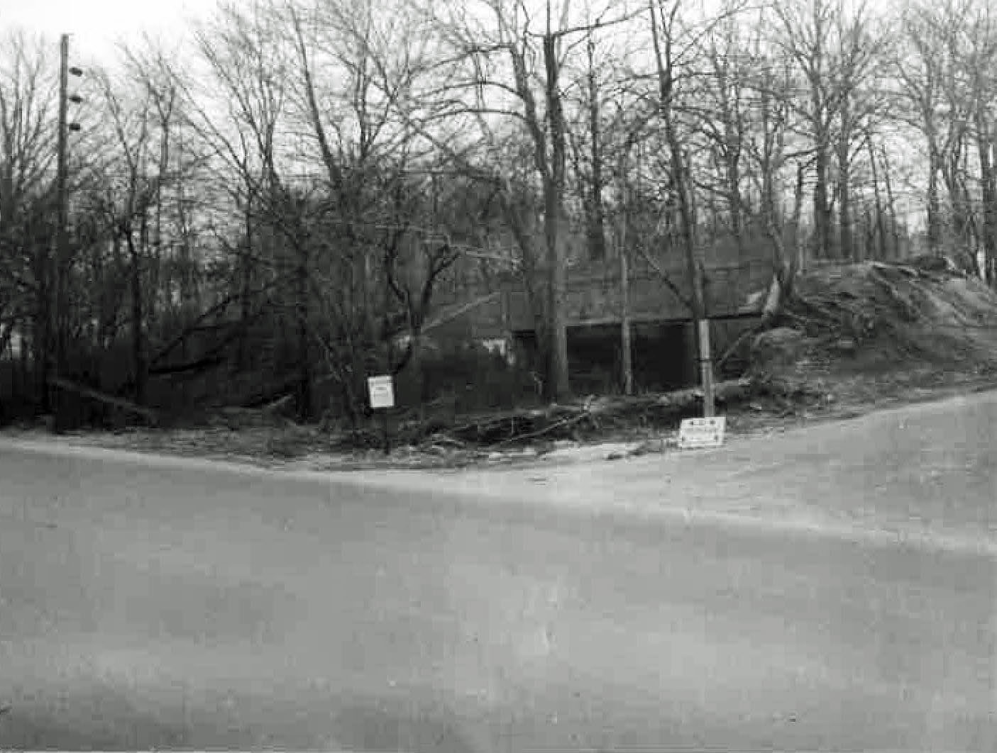
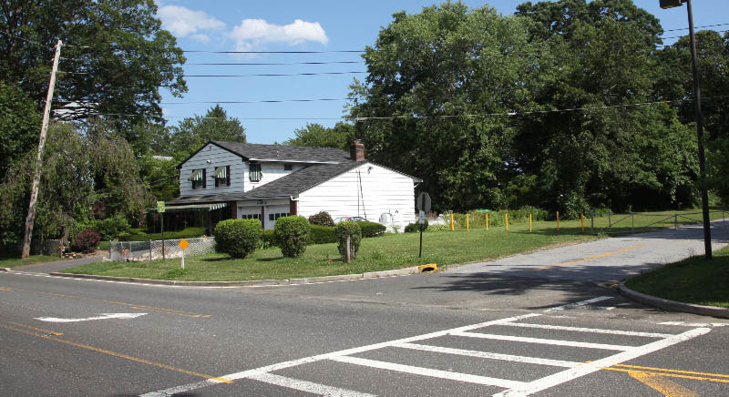
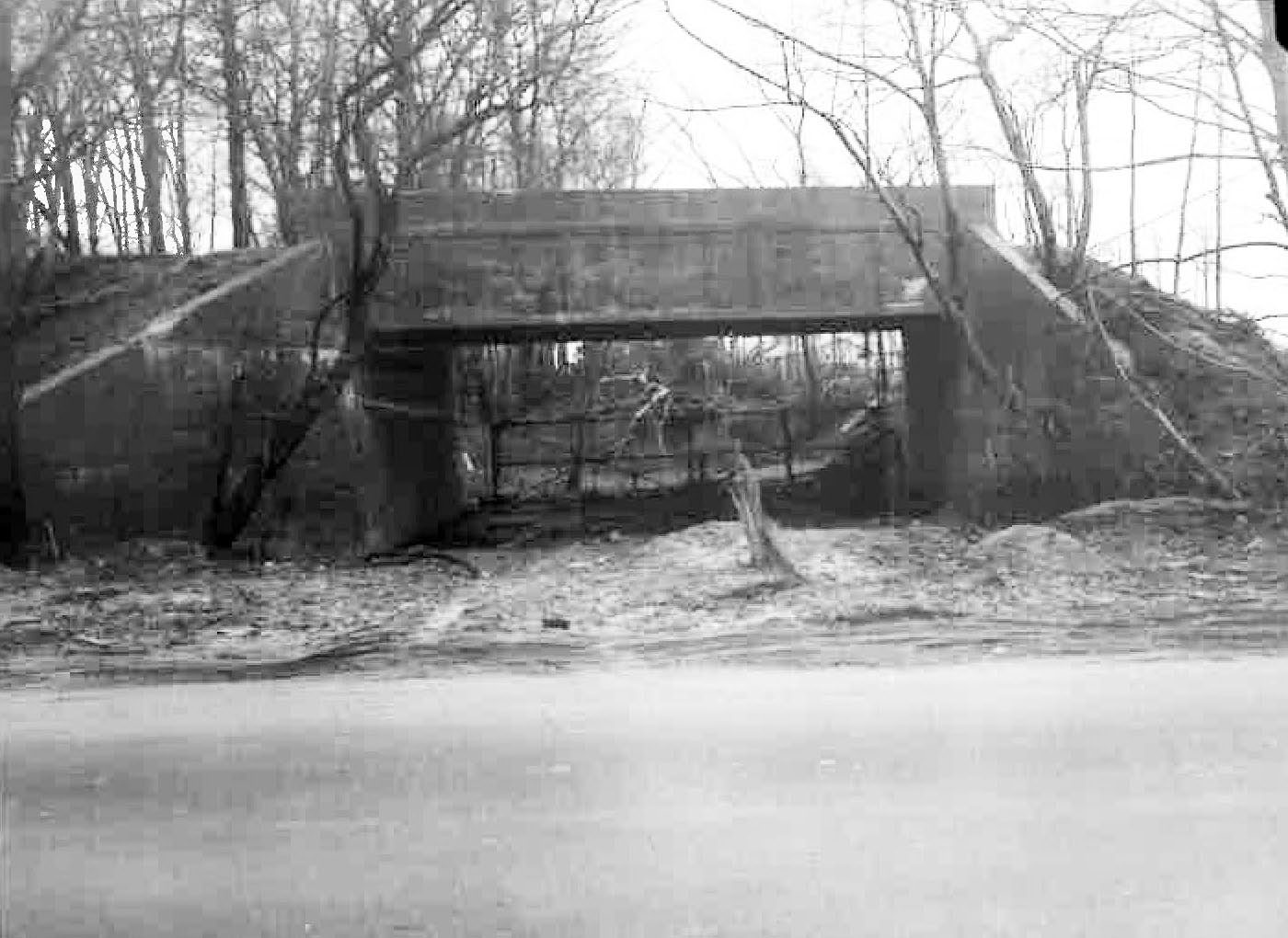
The same view as the above photo as seen in 2012. The utility pole on the left appears to be in the same location.


Comments
The Old Courthouse Bridge photo is viewed east, the signage was fading but visible. Look at the high walls of the pkwy bridge near IU Willets Rd, no need for railings there.
Spectacular photos in this collection. OCR bridge sign partially legible. “KEEP RIGHT of _H______. Keep right of Highway?
Howard, The photos of the bridge off of I. U. Willits Rd. .... I’ve always thought that the roadway under the bridge became the I. U. Willits Rd. entrance to the Herricks High School. Not so sure now. One of the photos shows what appears to be a roadway on the west side of the bridge. Looking at the two photos with the utility poles, it appears that the house is sitting where the bridge was. Any other photos of this area?
Al, you may be right. The Nassau County website map is indicating the bridge right on top of the house. (https://lrv.nassaucountyny.gov/map/). Neither of the two roadways in the photo collection existed in 1926
Below is part of an aerial from the site here. Was a mystery foto a few years ago, deemed as 1963. The 2 #‘s I marked off of IU Willets and Reed shows where 2 homes are now, both built in 1964. Right off the high school entrance rd, bridge has been demolished. Remains of the slope is likely the dark area.
Al
I think you’re right it always seem this way to me