Documenting A 1950 Melville Driveway-The Former Entrance to the Huntington Lodge
After documenting her childhood home (the moved Huntington Lodge) last month, Maureen Standish provides new evidence that the driveway to her home was the former entrance to the Motor Parkway.
Enjoy,
Howard Kroplick
Entrance to the Huntington Lodge (Circa 1930s)
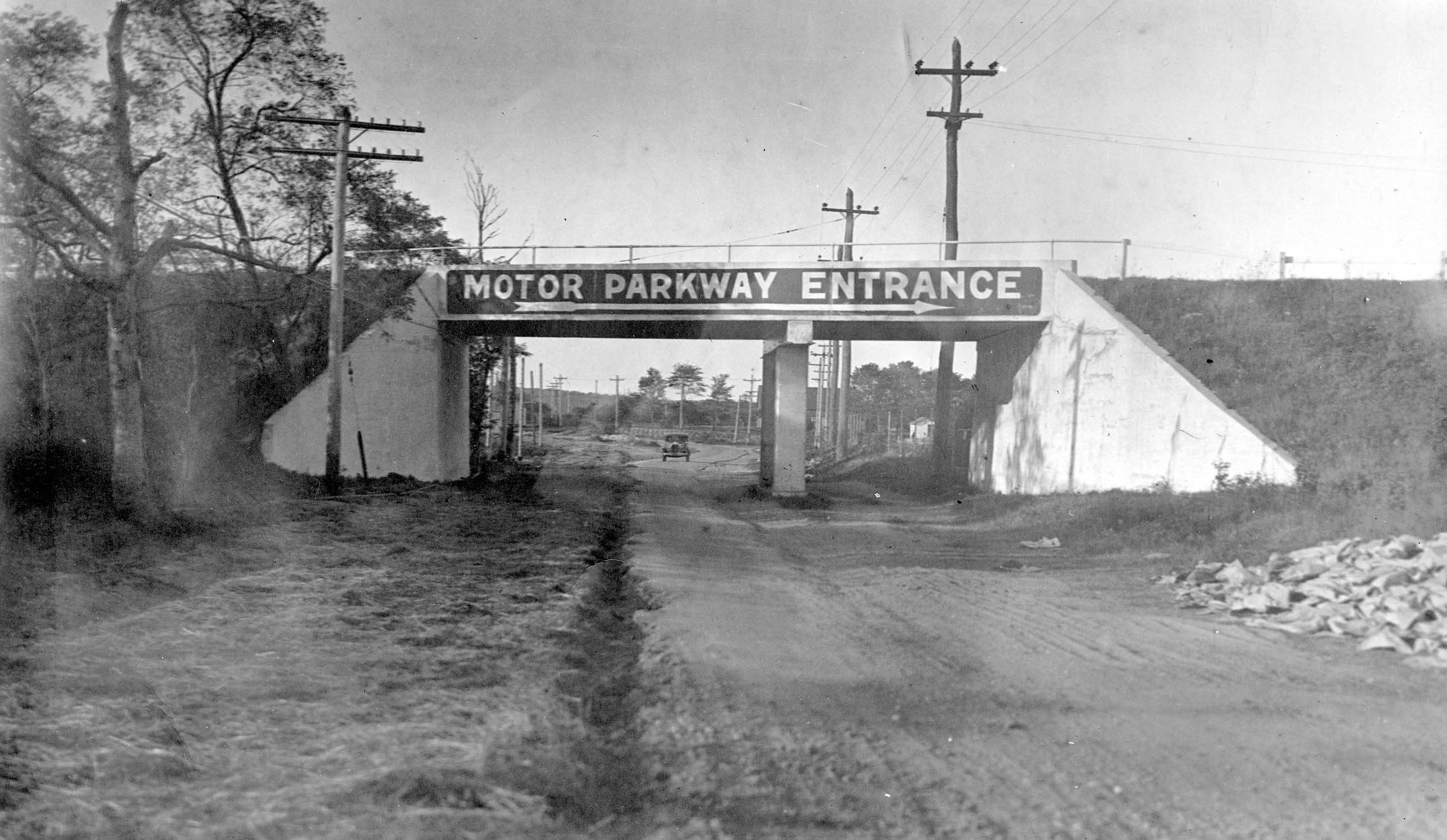
The entrance to the Motor Parkway in Melville was on the right. As described by Maureen Standish, this entrance later became the driveway to her childhood home.
1947 Aerial (Submitted by Frank Femenias)
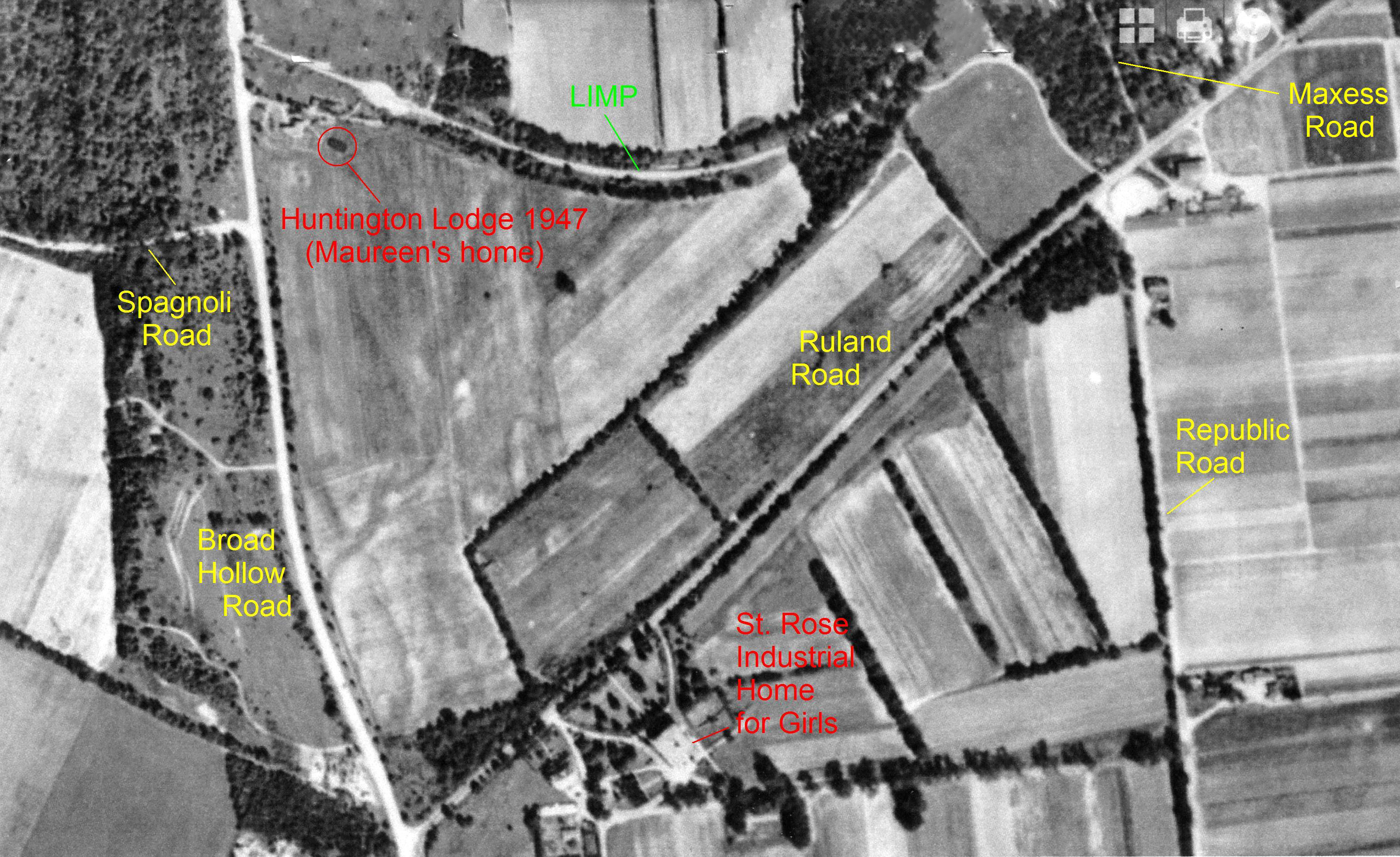
Maureen Standish: This morning I have been on the Vanderbilt Cup Races website and was so pleased to see an aerial map again of the area where I lived. This confirms a theory I have been kicking around in my head for the last week or so. After seeing the map of the Long Island Motor Parkway and our driveway (the former entrance to the parkway), I did another deep dive into the family picture box and came up with a few more family pics of the out buildings around the Huntington Lodge location as of 1950, +/- about two years.
Maureen Standish Family Photos
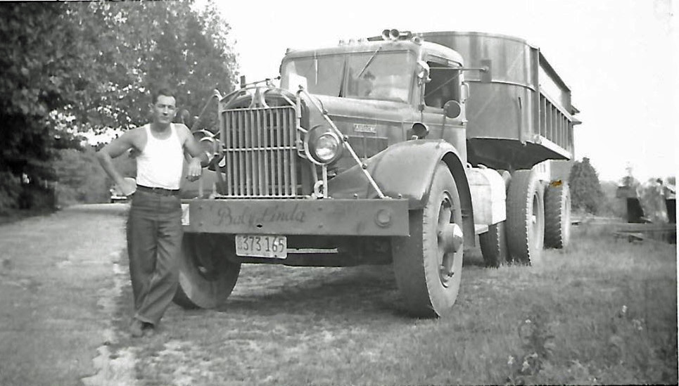
I always knew as a child, the driveway material and the parkway material were one of the same, asphalt with a cement base. My first picture of the truck and driveway seem to confirm this. As you can see, some of the asphalt has eroded away giving way to a base of cement. The same sand color cement as on the parkway and the bridge abutments where I played..

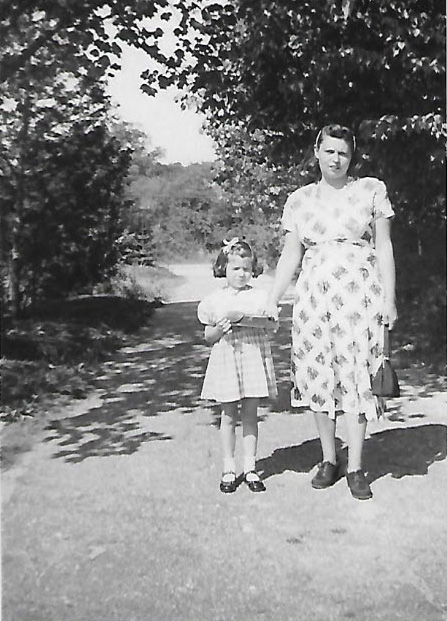
Looking west down the driveway from the photo of my mom and me (first day of school), you can see Route 110 at the mouth of driveway and very dense tree growth across the road. At the base of the picture you can see where the driveway continues east.
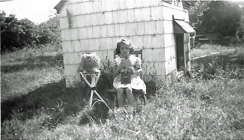
This is a photo taken by my playhouse from the location just northeast of the driveway where it seemed to end. When I look in the upper left corner of this picture, I see a tree line going at an angle in a northeast direction. As indicated on the aerial map, the driveway seems to curve in that same direction. This was the direction we would always walk to get on the parkway, just west of the playhouse and northeast. With so much over growth of grass, weeds, and brush, I always assumed, at that time, it was a dirt path. Also please note, to the right upper picture, a pile of beams or something. I wonder if this was part of the material used to move/skid the Huntington Lodge to where I called home.
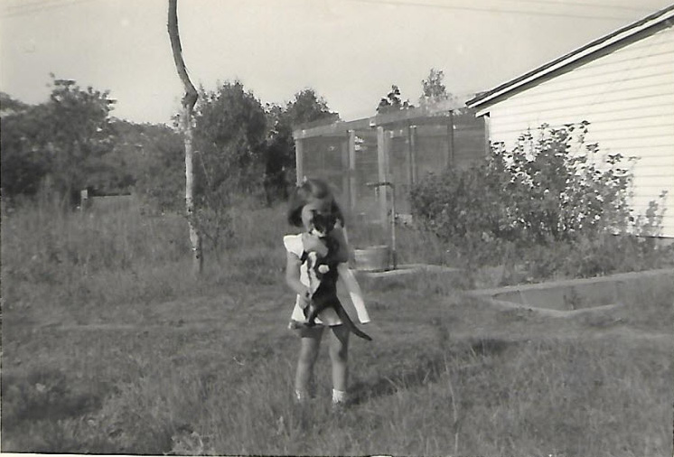
Most revealing of all, this photo shows in the upper left corner the old tree line that ran just south of the parkway from west to east. To the left of the pole and water well (mid photo), in the background, you can see a natural opening in the tree line. I think this is where the driveway connected to the parkway and would be about the same area where the old foundation was just north of the parkway.
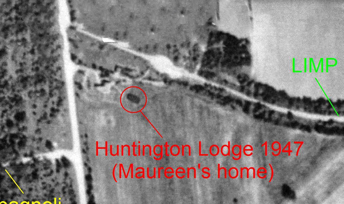
On the aerial map, you can see the parkway with some type of a circle of pavement. Perhaps this is where cars would get on and off the parkway, go up or down our driveway to Rte. 110 Broadhollow road depending if they were going north or south on 110. Another reveal in this photo, at the tree opening, appears to be some type of a post on the left side of the opening. I don't recall any posts on the parkway in my travels but some of you might be better able to determine this with your experience and knowledge of the parkway. I have no idea what the pole or water well is about mid photo. Did not remember any of this until I found this photo.
All of the above makes so much more sense when I compare it all to the aerial map. You can see how it all ties in together. This is so exciting. Look forward to the feedback.


Comments
Hi Maureen:
What a great surprise on our website today !! It brought back many memories of
our travels and we must have passed you so many times. Blessings to you again for
your efforts to bring back history to many of us.
Cordially, Ron Ridolph
Ron,
You are welcome. It has been a thrill to travel down this road again in so many ways. Thanks to Howard and all he has done to make this possible and the many that hold a kindred spirit to the LIMP.
Maureen
Spectacular series! Hats off to Maureen for reviving these historic photos.
That does indeed look like a post by the entrance; this bulkier one possibly made of wood.
And the beams on the side could also be remnants of the Broad Hollow bridge, removed around 1950.
Thanks to all involved for making this possible.
Just want to express my thanks for sharing your photos here means so much more than “verification of LIMP, etc.” These images display just how much fun you had growing up in this area.
Thank you for sharing your photographs and memories. Priceless!
Hi Maureen,
I’m so glad to see you’re investigating your roots. I’m still at it too. Annie, Derek, and I organized a family reunion 2 years ago, with 96 people showing up! That helped fill in many of the gaps in our family genealogy.
Hope you are well, happy, and thriving.
Grace and peace,
Peter
Awesome pictures. Thanks for sharing.