Documenting the Location of the Bethpage Lodge
Johnny Karate is looking for documentation on the location of the Bethpage Lodge.
Enjoy,
Howard Kroplick
Johnny Karate:
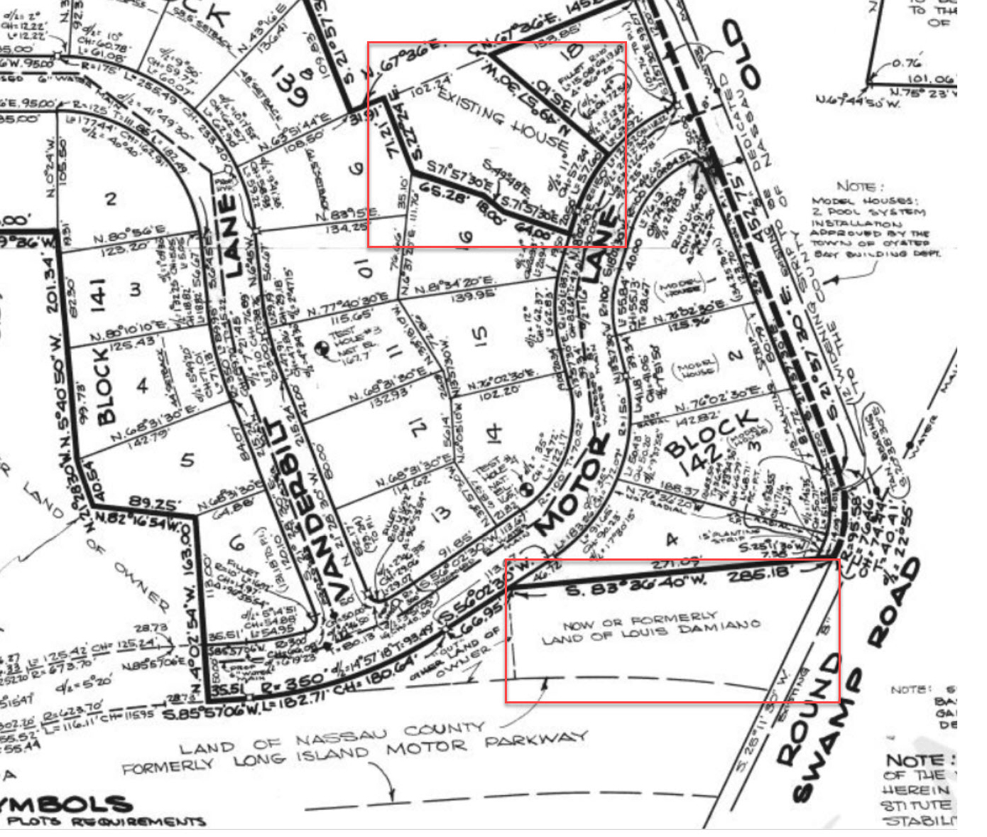
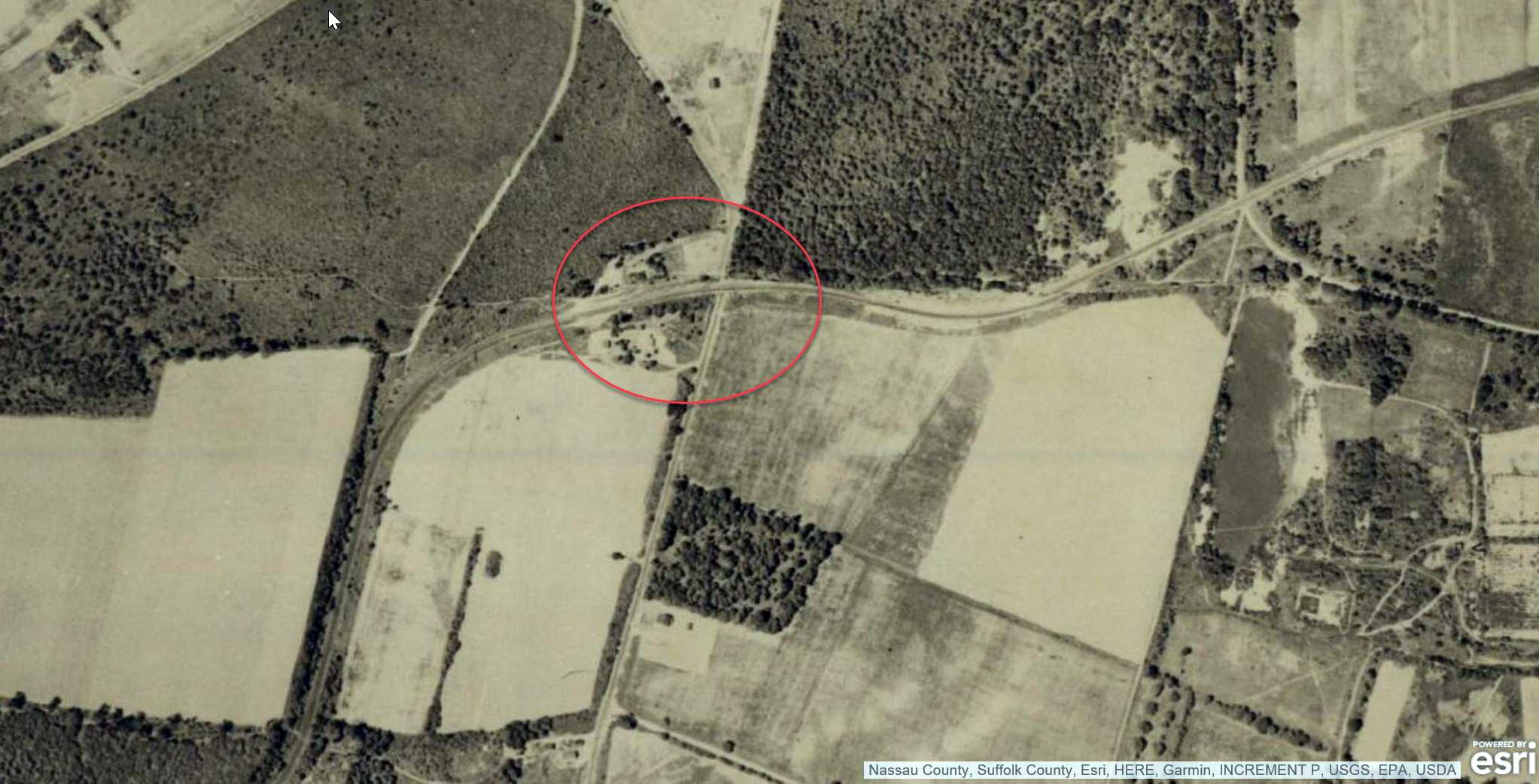
Hi Howard, I was on your Motor Parkway site the other day and noticed this image by Frank Femenias on your site. It denotes that the Bethpage Lodge was on the south side of Motor Lane and emptied out onto the southwest corner of Round Swamp and Old Bethpage Roads. However, on this map of the plans of Greentree Acres, it shows that although Louis Damiano owned land near the lodge at the time, it didn't say there was an existing house there, unlike on the north side Motor Lane near Old Bethpage Road. My question is, is there any concrete proof that the lodge really was where most people think it was? Or is this "existing house" just another existing house?
Johnny Karate:
However, on this July 13,1960 map of the plans of Greentree Acres, it shows that although Louis Damiano owned land near the lodge at the time, it didn't say there was an existing house there, unlike on the north side Motor Lane near Old Bethpage Road.
My question is, is there any concrete proof that the lodge really was where most people think it was? Or is this "existing house" just another existing house?
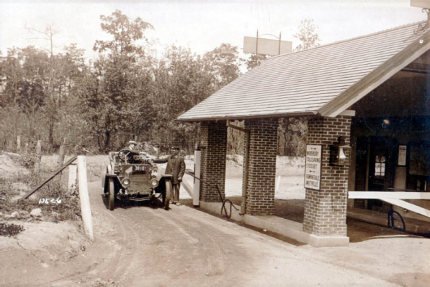
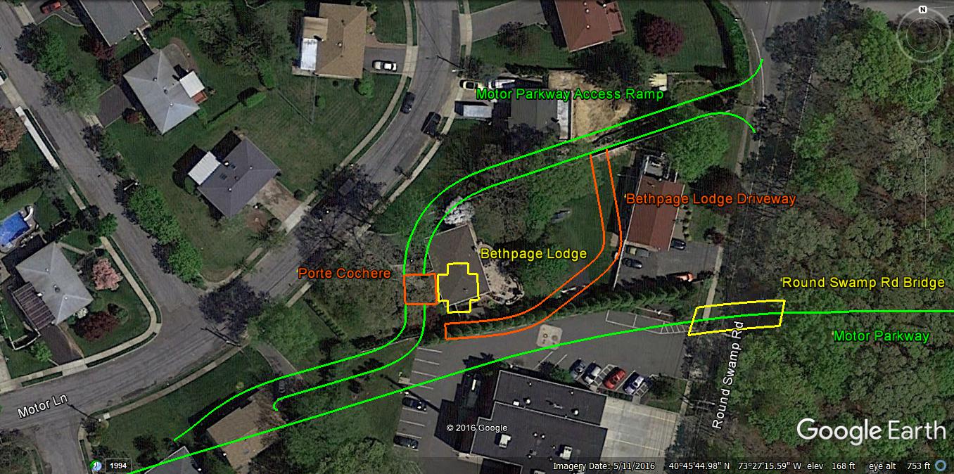
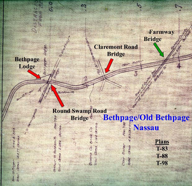
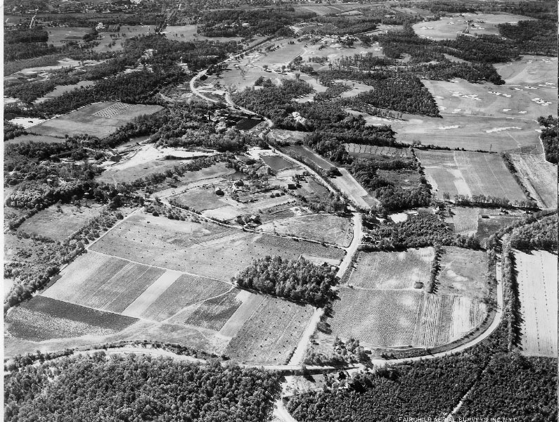
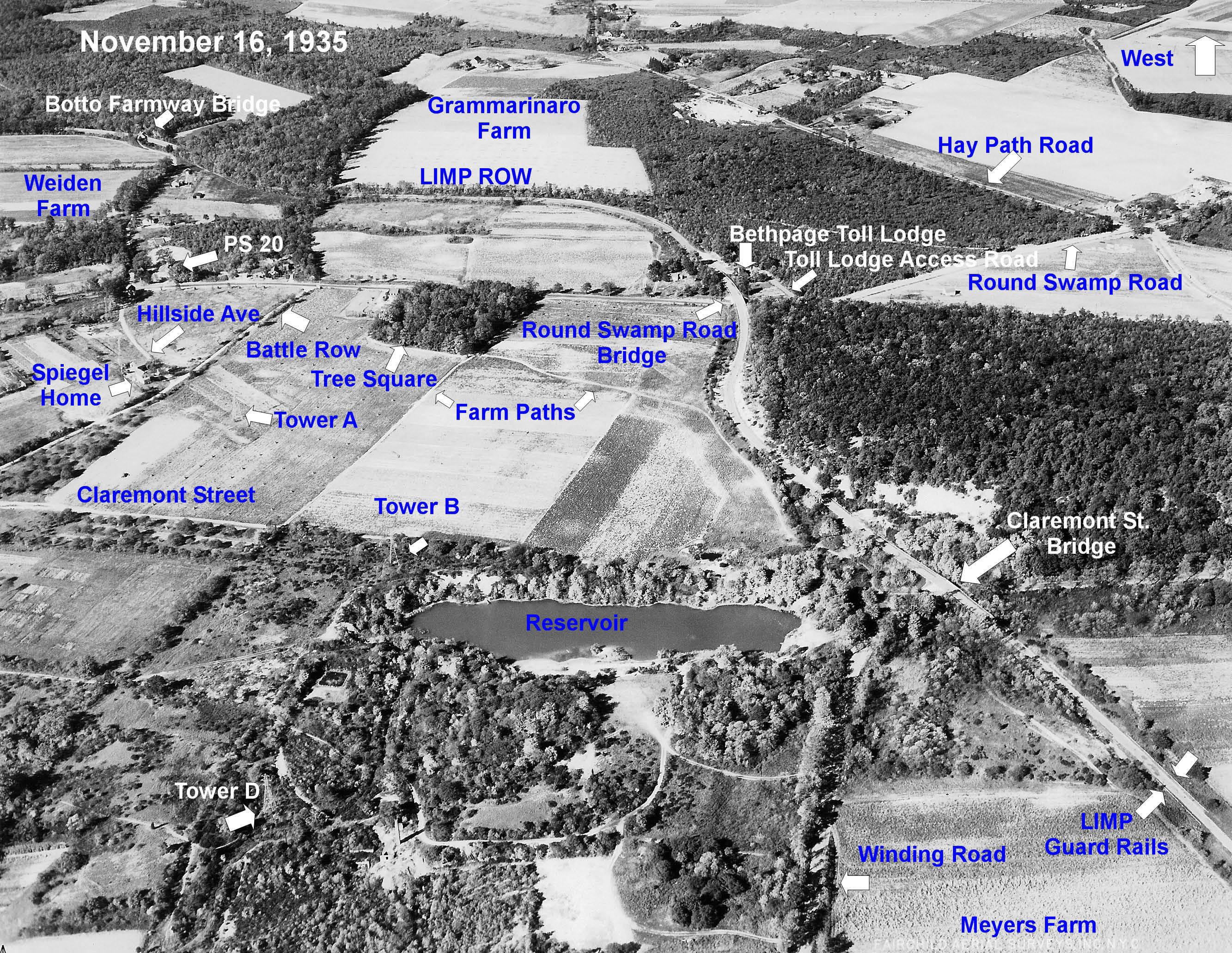
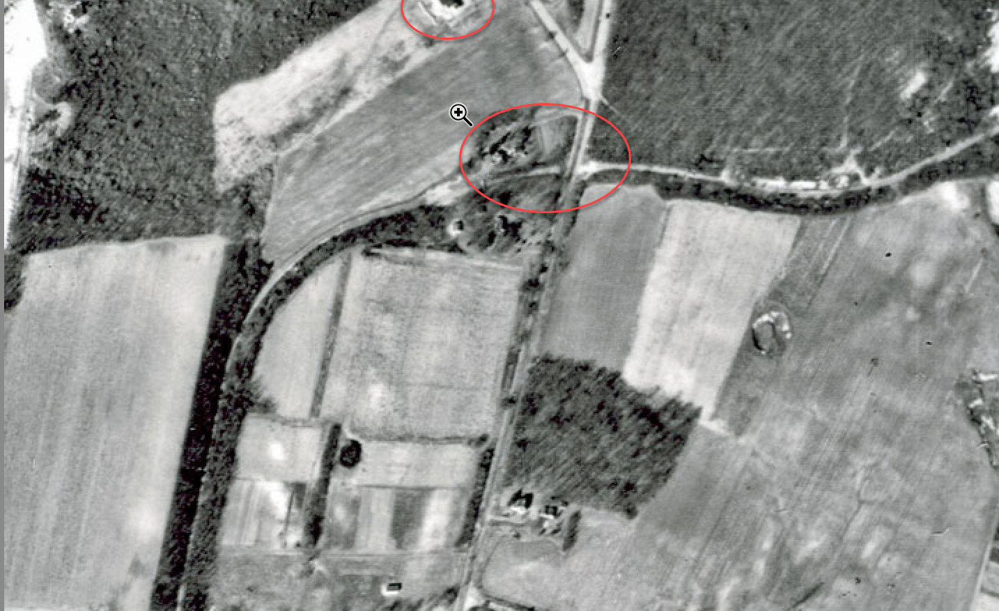
Johnny, thanks for the question and the 1960 survey. Here is documentation confirming the Bethpage Lodge was just north of the Motor Parkway with its entrance/exit on Round Swamp Road.
1910 Motor Parkway Survey Bookmap
1926 Aerial
October 16, 1935 Aerial
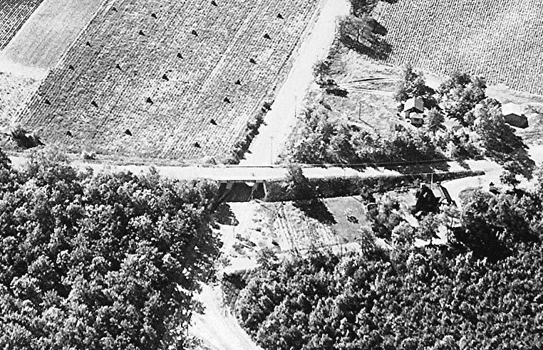
1936 Aerial
1950 Aerial
Confirms the location of the Bethpage Lodge and the "Existing House".


Comments
I’ll stay out of this except to question the marked aerial at the top. The horizontal (W-E) row of heavy shrubs just north of the Plainview maintenance building driveway-cum-parking-area marks a tall berm that was still there last I looked. The lodge driveway would not have run up on the berm. I can’t find my oldest pic of the berm but here’s one ca. 2002 looking NNW (pre-parking-area). [See also 17
Sep 2014 Bridge Series #50.] Sam, III
Amazing detailed 1960 lot survey revealed, pre house construction, which includes the former Motor Pkwy Bethpage Lodge property lines, and future environs post 1960. Great stuff Johnny, thank you for sharing this gem. The “existing house” up north, north of Motor Lane on lot 17, (Sec47, Blk139, Lot17) was once part of a larger property in 1960. This area likely was subdivided for additional houses. This house today, photo below, remains a cape, the only one of its kind in the area. I believe it’s the original, only modified somewhat.
As for the Bethpage Lodge absence in the
‘60s survey,, I believe it may been already slated for removal at the time. Its removal was sometime in the ‘60s
I forgot to include, the former lodge entrance/exit ramp from Round Swamp Road, now resides on adjacent property north of the former lodge property (Sec47, Blk142, Lot25). The ramp now follows the fence line north of this property, north of the original lodge. As always, please respect owner’s privacy when exploring historic sites.
Hello Frank,
This is John(ny), replying because I’m unsure if you got my email. Those maps can be found on the Nassau County records site here: https://i2f.uslandrecords.com/NY/Nassau/D/Default.aspx
I spend hours on that site looking at maps. To find subdivision names and such, you need to find the deed of a specific plot, take the subdivision name listed in the deed, and search for the name as a map.
John
Great stuff John! Thanks for the link and directions how to obtain rare info/maps on Nassau properties. This is an additional tool that will come in handy in the future.
Sorry, I did not receive an email. Your hunch was correct. Please direct further to .(JavaScript must be enabled to view this email address)