First of a Series: Motor Parkway Bridge Removals
Nassau County took control of the Motor Parkway in the county in 1938 and began to determine what to do with the various parts it now owned as well as developing plans to remove the parkway's bridges. Over time most bridges were removed, however in the beginning not all were initially set to be removed - some were just going to get a new coat of paint and others were to remain untouched. With the assistance of the Nassau County Dept. of Public Works (NCDPW) documents are presented here that detail the removal of the bridges. This post is the first in a series and shows maps produced in 1938, 1939 and 1968. Future posts will highlight plans that were developed for specific bridges.
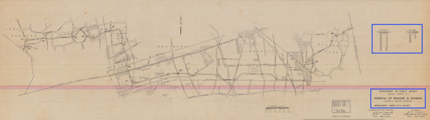
1938 - Full View of Nassau County
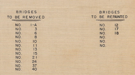
On the right hand side you can see the bridges that were planned to be removed and those that were to be painted. (Credit: NCDPW)
Not all bridges were to be removed, however over time the remaining bridges became safety hazards or got in the way of other public works projects and were demolished. Let's hope that the last two remaining bridges in Nassau County stay as they are (Old Courthouse Road and in the Old Bethpage Village Restoration).
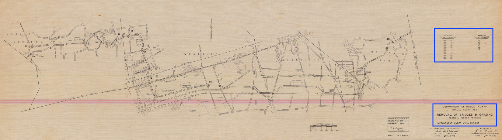
1938 - Zoomed View of Western Nassau
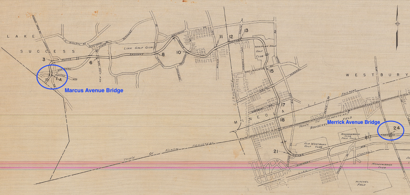
Credit: NCDPW
1929 image of Bridge 1A - the Marcus Avenue Bridge. From The Long Island Motor Parkway by Howard Kroplick and Al Velocci.
1910 image of Bridge 24 - the Merrick Avenue Bridge with the Meadowbrook Lodge on the left.
1938 - Zoomed View of Eastern Nassau
Credit: NCDPW
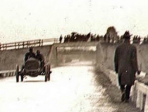
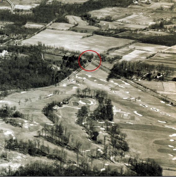
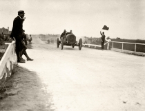
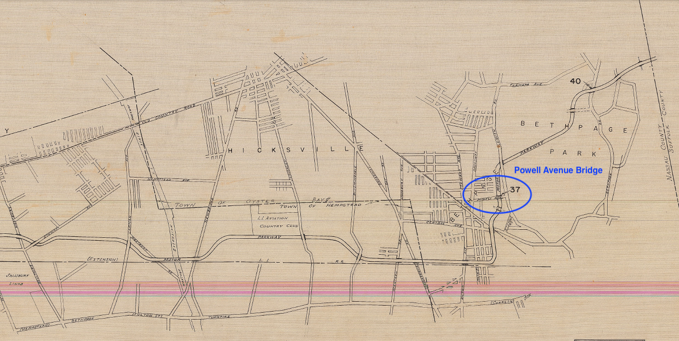
1908 image of Bridge 37 - the Powell Avenue Bridge on the opening day of the Motor Parkway (Oct. 10).
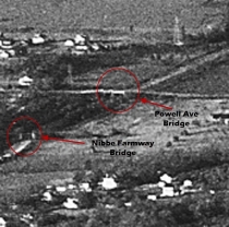
1935 Image of the Powell Avenue Bridge also showing the Nibbe Farmway Bridge
1939 - Full view of Nassau County
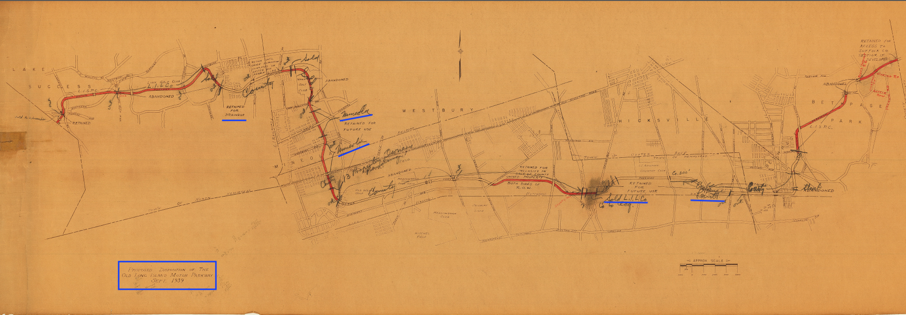
Interesting notes added in pertaining to an exchange of land between Nassau County and Levitt and ownership assumed by Mineola. (Credit: NCDPW)
1939 - Zoomed View of Western Nassau
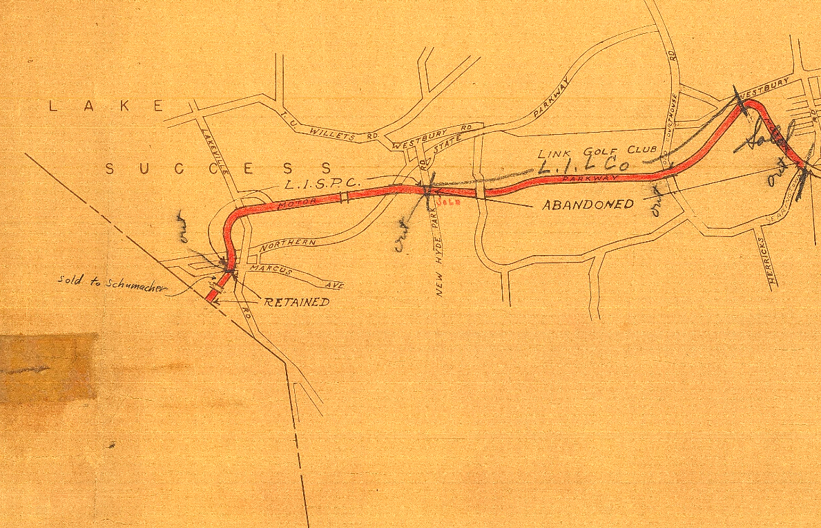
Future posts in this series will provide plans for the removal of specific bridges. (Credit: NCDPW)
1939 - Zoomed view of Central Nassau
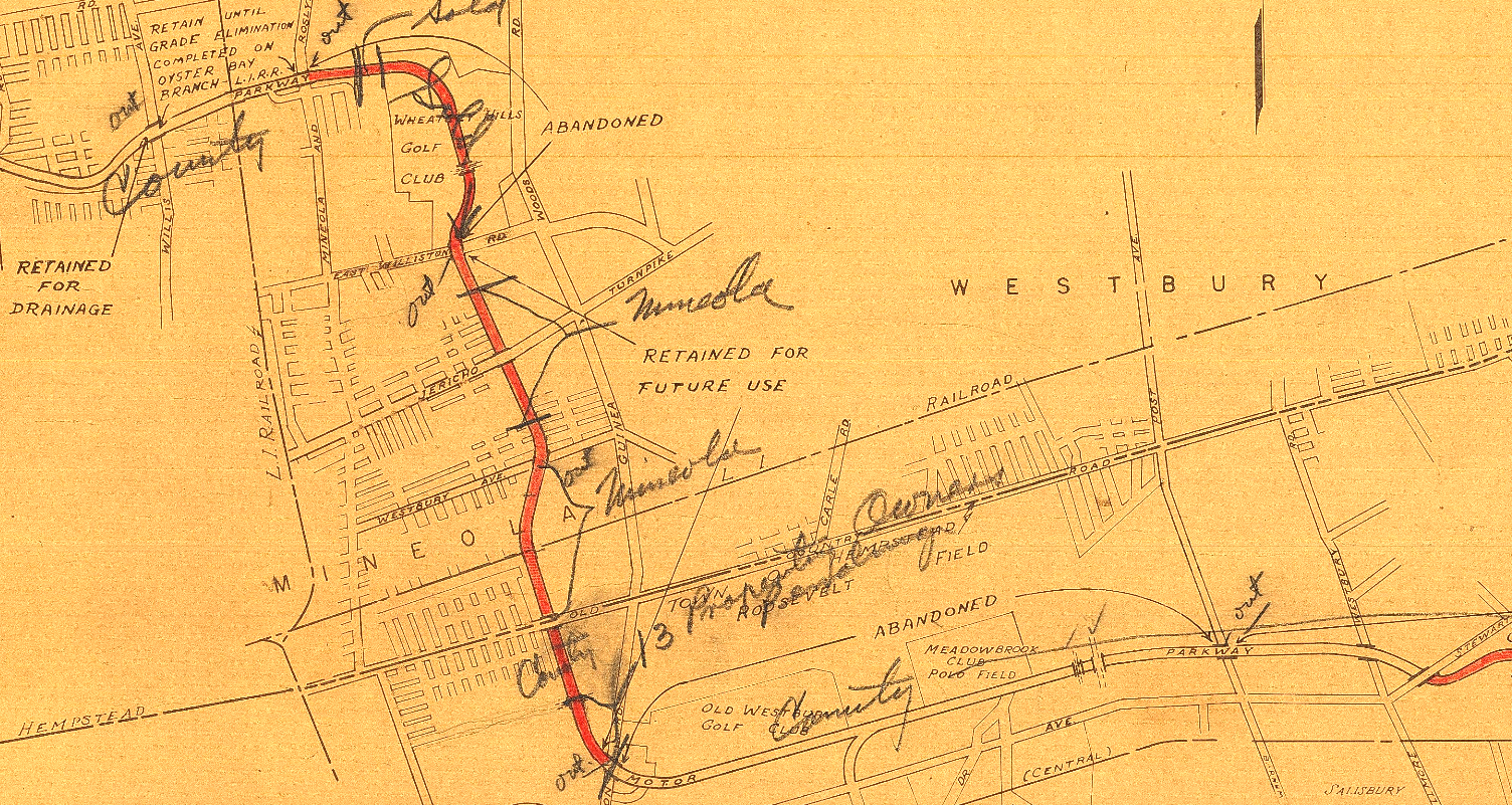
Credit: NCDPW
1968 - Full View of Nassau County (showing which parts of the parkway were still in possession of Nassau)
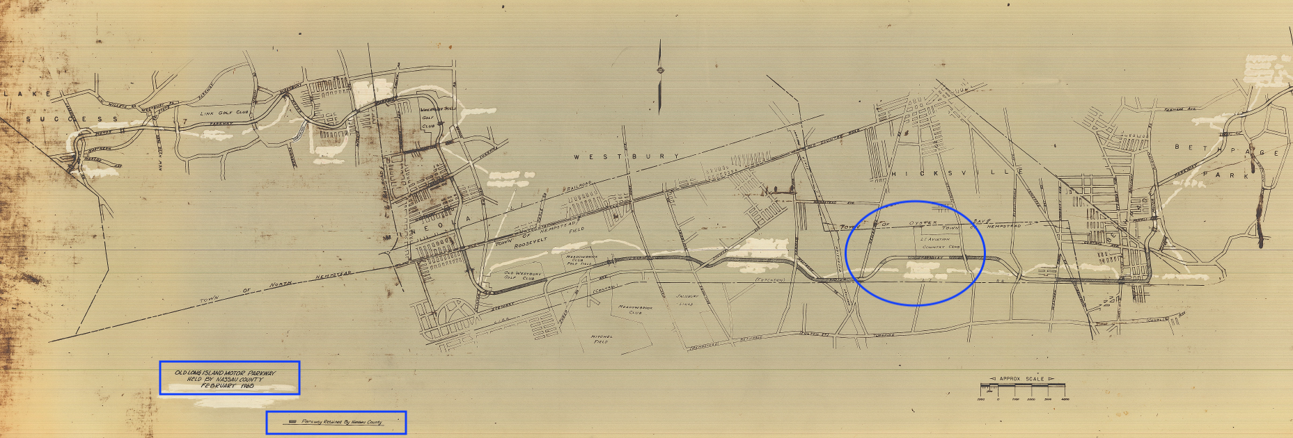
Some discrepancy here as the map is dated 1968 but the LI Aviation Club is still shown (it had ceased to operate two decades earlier) and Levittown does not appear to be developed yet. Also with what looks to be many areas whited out, it might be that an earlier map was used as the base map and that only the areas in grey on the Parkway roadway were added in 1968. (Credit: NCDPW)
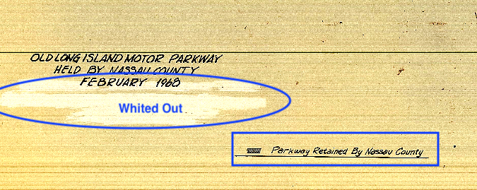
Even the title of the map shows it to be altered.
1968 - Zoomed view of Western Nassau
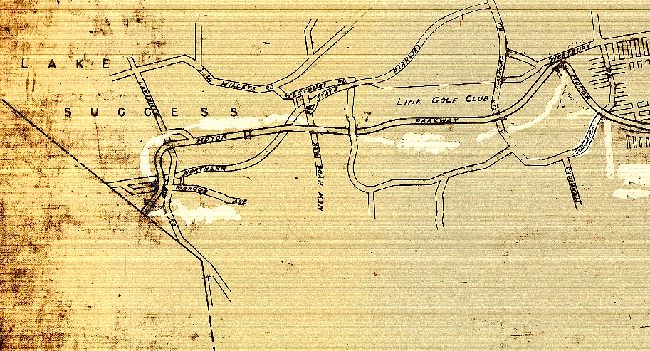
Credit: NCDPW
1968 - Zoomed view of Central Nassau
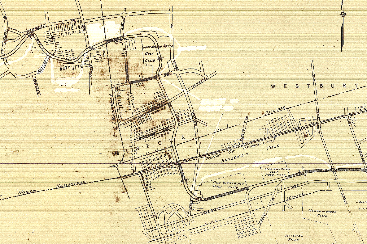
Credit: NCDPW


Comments