Greg O’s Garage: A section of Motor Parkway in Bethpage rediscovered
A piece of The Motor Parkway has been recently rediscovered in the backyard of a private home.
Alerted to us by reader Dan Deluca while searching on Google Earth, a previously unknown section that still exists was noticed in the backyard of a Bethpage home prompting a visit to document this 'new' section.
Greg O.
The 1908 Course
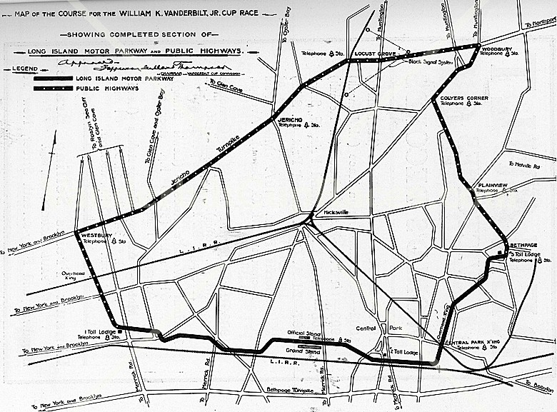
The section of the Motor Parkway between Hicksville Rd (Rt 107) and Dead Man's curve was a long, flat straight that was not particularly remarkable and was only utilized for the 1908 race course.
For the 1909 & 1910 courses, a new route had drivers turning North onto Hicksville Road just after the Massapequa Lodge.
1926 Aerial
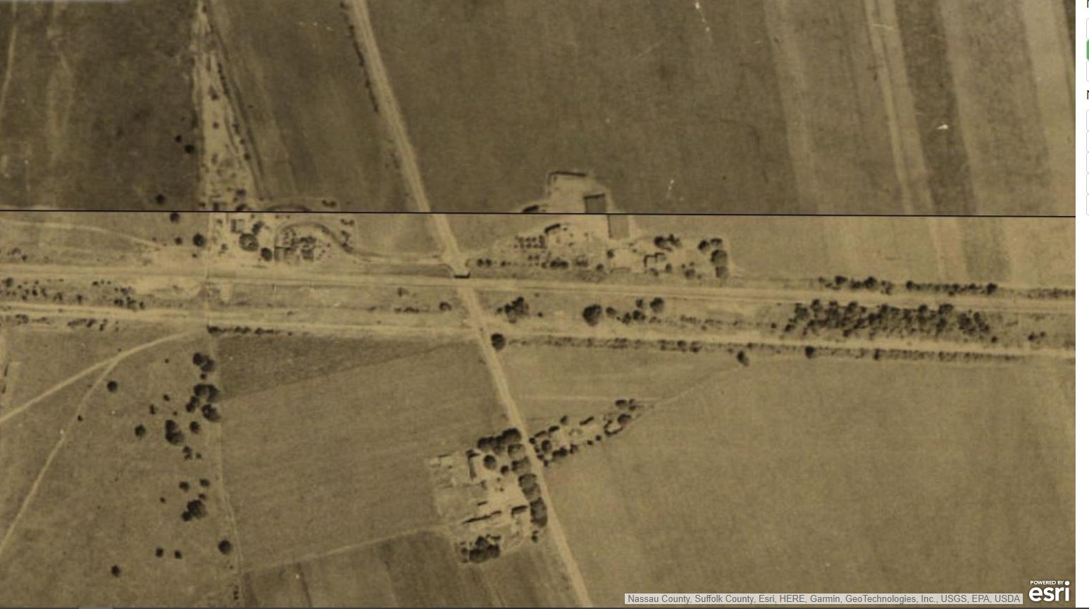
When the Parkway closed in 1938, the Nassau County section became right-of-way for the Long Island Lighting Company's large towers and power lines. In the Bethpage area, the power line ROW was more on top of the old Central Railroad ROW than the Motor Parkway leaving strips of the parkway in between the LILCO power line ROW and newly constructed houses in 1951.
The section to the East of Hicksville Road in 1926 during the Parkway's use. Gatelodge and Hicksville Road bridge are visible.
1908 Ground view
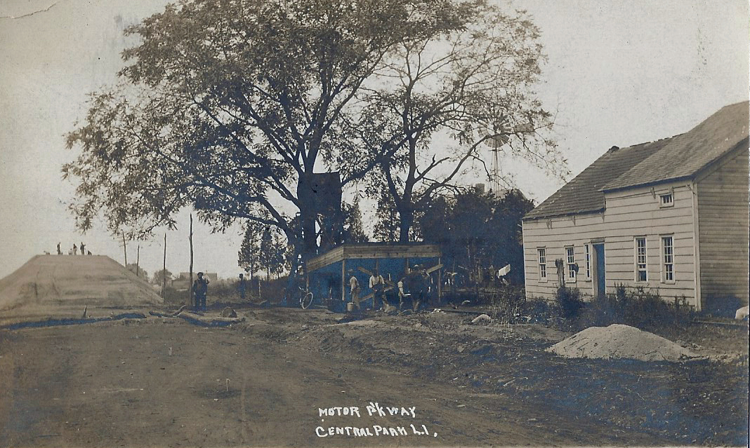
This 1908 Motor parkway construction photo shows the Massapequa-Hicksville Road Motor Parkway Bridge under construction with the photographer looking west toward the Massapequa Lodge. The photographer's location on the parkway is approximately 50-100 feet west of the surviving pavement still seen today.
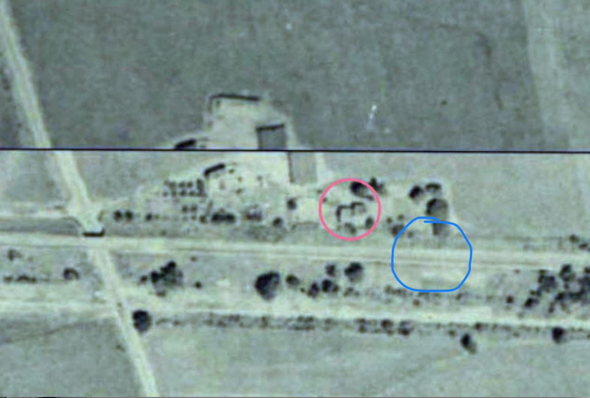
For comparison with the 1926 aerial, the house was the residence of Joe Walsh, (who sold the property for the Massapequa Lodge across the street) and where the photographer stood next to the house in 1908, is circled in red. The Motor Parkway pavement still seen today is circled in blue.
The Walsh house was later moved a few hundred feet to the south on Massapequa-Hicksville Road and still stands today.
1950 Aerial
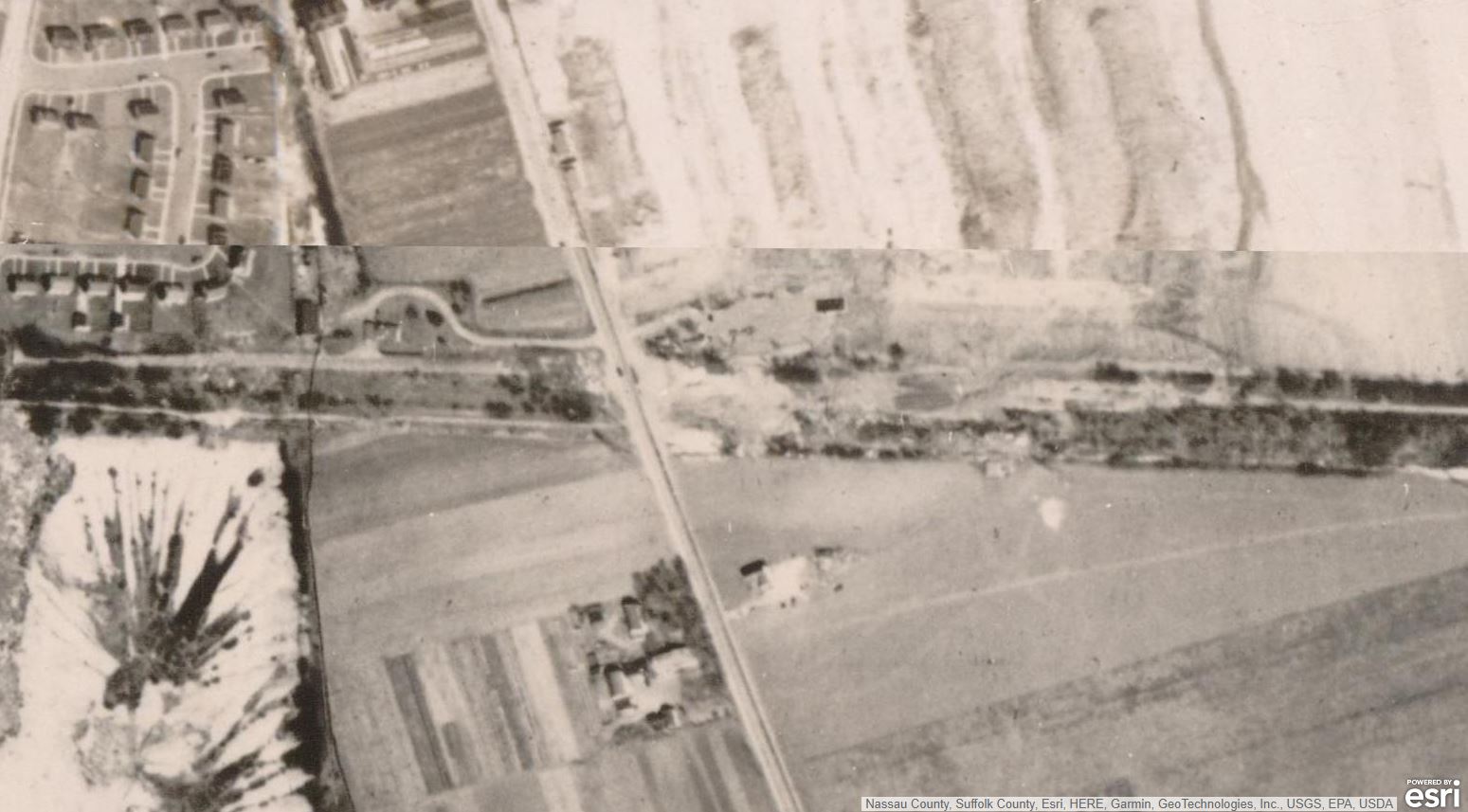
The same section seen in 1950, twelve years after the parkway closed, and one year before construction of the neighborhood to the north. Lodge and Bridge were both gone.
1953 Aerial
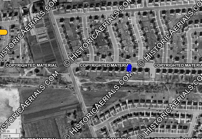
This 1953 Historicaerials.com image clearly shows the Motor Parkway still mostly intact behind the homes sandwiched between them and the power lines.
Remnants as Seen Today
On August 19th, Dan Deluca sent an email into VanderbiltCupRaces.com saying he has spotted a stretch of parkway in the backyard of a Bethpage home on Google Earth.
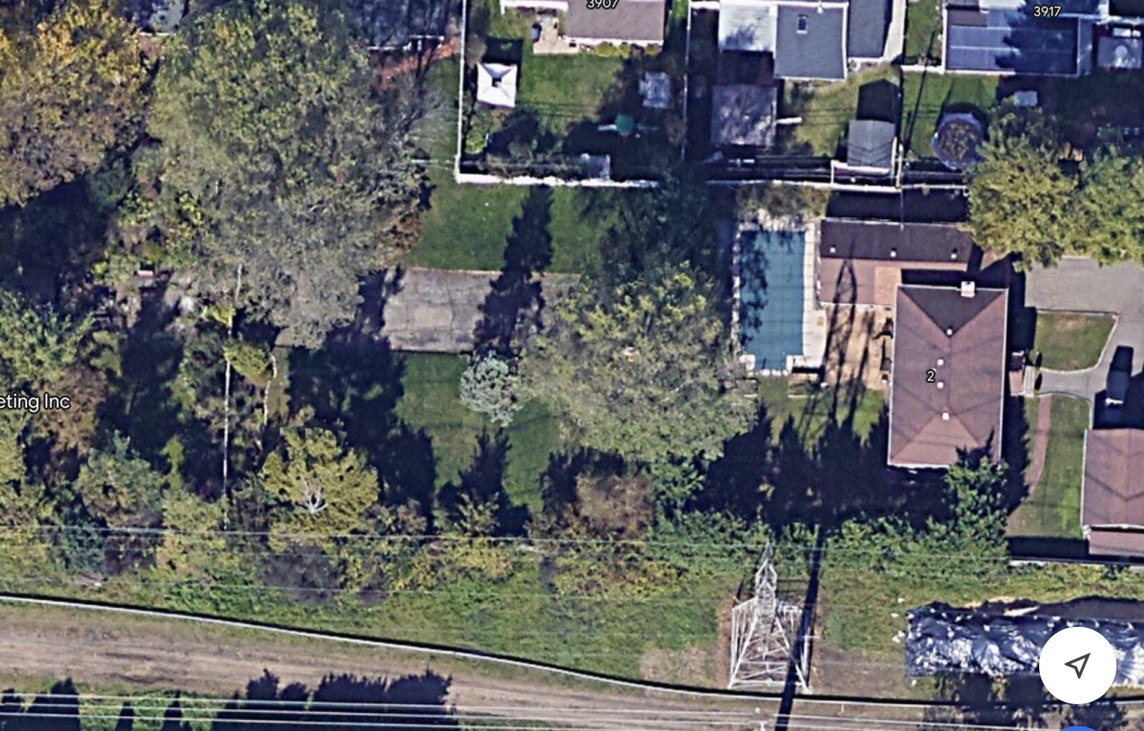
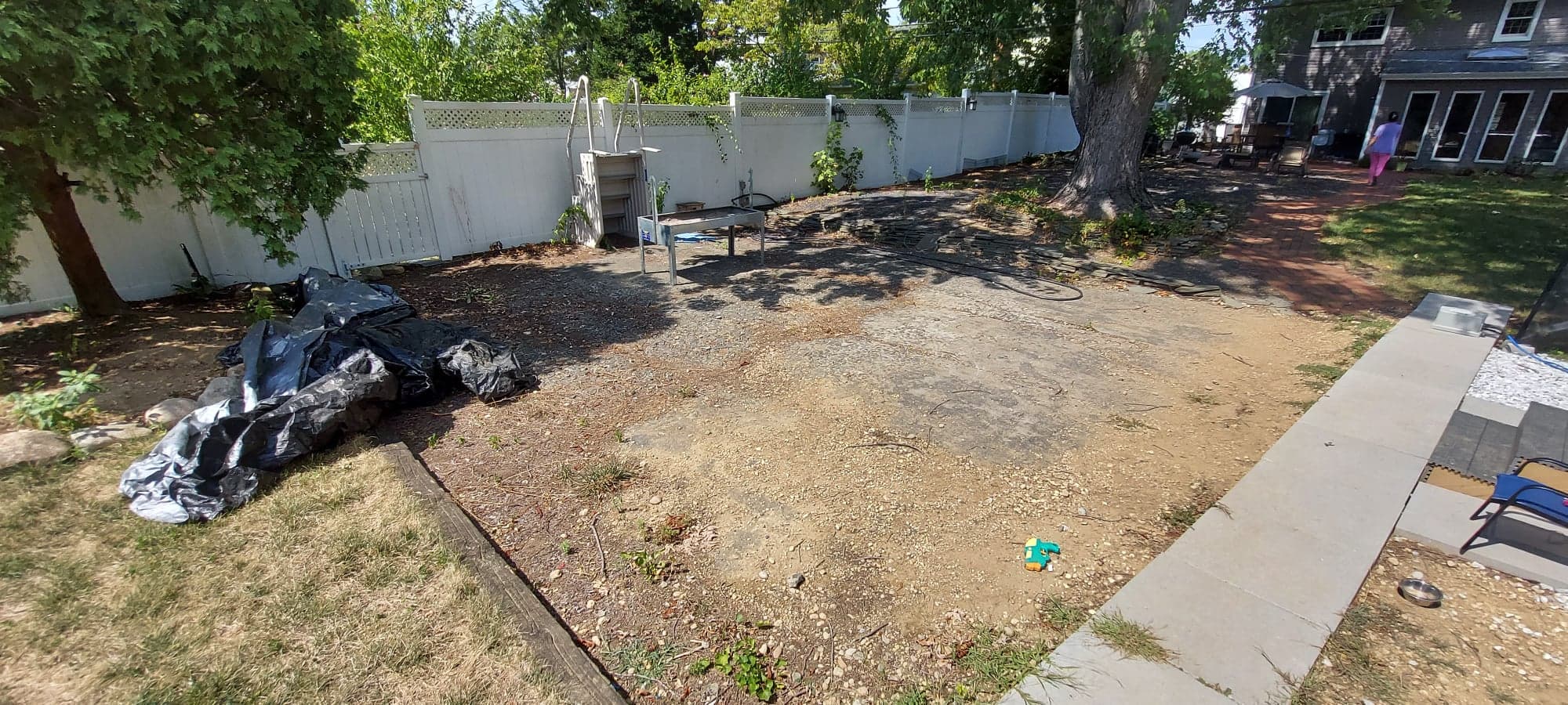
After some Internet sleuthing, it was uncovered that in 1981, the plots of land behind the homes could be purchased by the adjoining homes to double the size of their property. Original 1951 homeowners, The Pranges, opted to buy not only the plot of land behind their house, but also the neighboring plot behind their next-door neighbor's house making their property 3 lots in size. The Pranges never developed their lots and retained an approximately 100-foot-long section of the Motor Parkway in the south end of their newly expanded property. After 60 years in the home, the Prange's home was sold and lived in for another 8 years before being sold again.
A visit to the property was necessary to confirm what we were seeing on Google Earth.
Since this pavement is on private property, the owners must be respected, and their property is not trespassed. As with many Motor Parkway explorations, permission was absolutely necessary.
Upon arrival, I was met by the very kind, current homeowner of the last 2 years, Tatiana. Many of the homeowners in the area are aware of the Motor Parkway and had informed Tatiana and her husband about the Motor Parkway in their backyard.
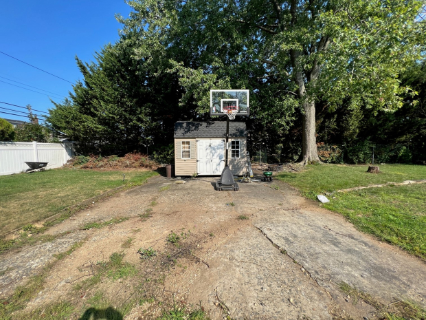
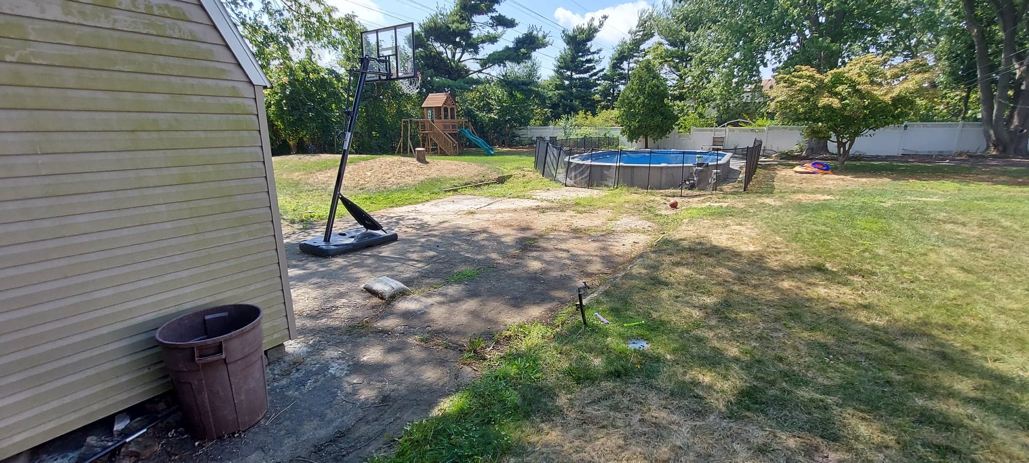
She happily led me to the backyard where the pavement was, and it is indeed the original Motor Parkway pavement. Unfortunately, before they knew of the history, they recently placed a semi-inground pool directly on top of the pavement, but there is still enough for us Motor Parkway enthusiasts to see and appreciate. She was also very happy to learn further details about its history.
This view is looking west from the far side of the entire stretch.
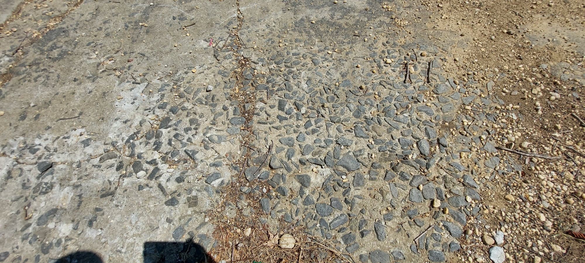
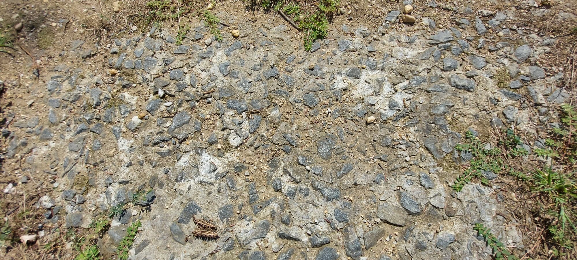
More close-ups of the original parkway pavement.
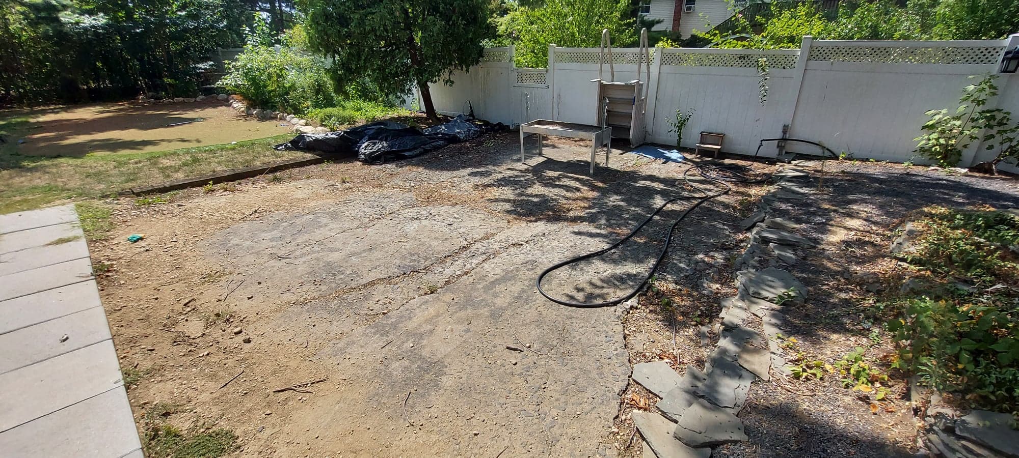
The west end of the pavement between the pool and the property edge.
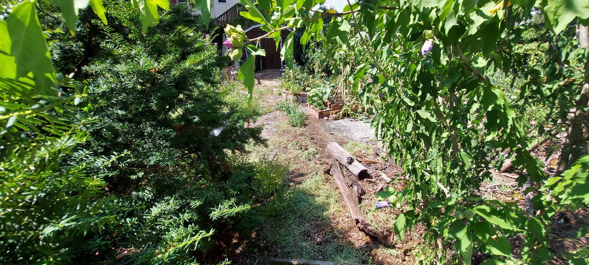
As observed looking over the neighbor's fence, the parkway even stretches a little further into the neighboring yard to the west.
Looking easterly at the larger section on the east side of the property.
A huge thank you goes out to current owners Tatiana and Alan who assisted in this incredible new discovery. And as always, this is private property and cannot be visited, nor seen from any public property, so it is not recommended to explore this site. Always respect property owners and their privacy.


Comments
wow,great shots. i was wondering if the tree on the neighbors property over looking the fence was a fig tree or chestnut tree. great that the owners did not destroy the road.
Nice catch, Dan Deluca : ) Like others here, I suspected there is pavement through some of these yards. Glad a proper visit was done here, little surprised some of the neighbors didn’t invite you in their yards, Howard : ) Also good to know the roadway is being used for recreational activities. Nice find!
Brian, since we learned of this a couple of weeks ago, we’ve been scouring the area for any more pavement, but this is the only remaining pavement between Massapequa-Hicksville Rd. and Dead Man’s Curve. Just about every other part of the LIMP ROW has been built on. The only other possible area for undiscovered pavement could be around the water reclamation sump just west of Dead Man’s Curve, but that’s fenced off town or county property and inaccessible.
Dan Deluca, Fabulous find Dan, thank you for sharing.
Nice work Dan and Greg! The parkway pavement is unmistakable when you see it.
Because it’s private property future preservation isn’t assured. Glad you got these pictures to document it.
I like how the pool seems to line up evenly with the parkway. Like a really big puddle.
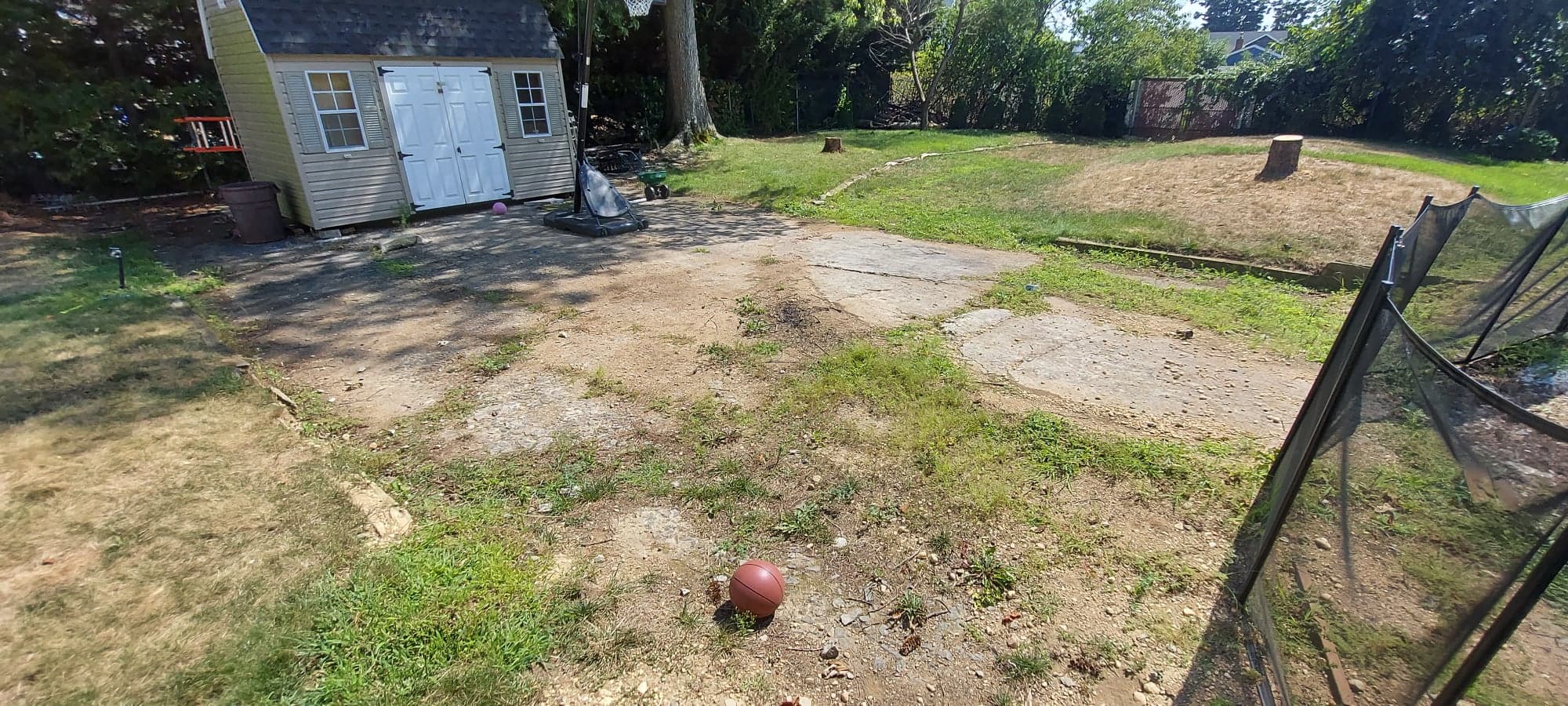
I took this picture about a month ago at the polaris ballfields in Levittown (facing west at the east field). Some pavement is still present under the faded grass. I remember as a kid playing little league for Island Trees here. I played the outfield once and jumped for a ball hit over my and landed on my back. I couldn’t understand why my landing was so hard. Why was the ground in this part of the outfield so damn hard I thought?
Howard Kroplick: David, this is an amazing photo of the former Long Island Motor Parkway.
This seems to be the strip of land that runs south of (parallel to) ***** (address withheld for owner privacy)
Seeing this reminded me of the section alongside Bagatelle Road that I would hike on as a kid 60 years ago when it was all woods. While it was residentially developed many years ago, I always wonder if anything remains in the backyards of the possibly unsuspecting homeowners on the west side. Further up the road it crossed over to the east side, passing next to the former mansion which became Madonna Heights. Fond memories of the halfway hollow hills.
Pete - That must’ve been a nice hike back then, around 1960 I guess. There is pavement still just south of the LILCO/PSEG substation, and just north of there into Butterfly Park. Very difficult & hairy near Madonna Heights and a bit north, but it’s all still there. If you do a ‘Search’ on the main page here, you’ll find images, info of Half Hollow Hills etc.
This is what I love most….finding history, and the LIMP is amazing history. Great find Dan.
Greg, you are not correct! There are other LIMP remnants between 107 and Dead Mans Curve.
Pic 1 and 2 - at the site of the Stewart Ave bridge - original pavement remains.
Then….as you move further east towards the original McDonalds (Halfway House Tea Room Drive Thru) there is a nice stretch of LIMP.
Then as you pass the tea house and before you get to Dead Mans Curve, there is some more.
And notice how the LIMP stays left of the power lines (when heading east) the entire way throughout. This is a reference to the Caroline Street posts—it doesn’t change 😊
And David….sorry about your Little League outfield fall! Not sure why they would just build a field over the LIMP instead of ripping it out first?
I took this pic back in 2019 - facing Jerusalem Ave.
Dave- I did remember the remnants along Arthur Ave at either end of the water reclamation sump (by Broadway and Stewart) but since they are just before Dead Mans Curve, I somewhat lump it all together as ‘the curve’ in my mind. But yes, technically you’re right, I should have said Stewart instead of Dead Mans Curve.
I know the sump along Arthur is fenced off, but have you been inside there to see if there’s any remnants?
You know, I sent in the question about [address private]., with kind of a disclaimer stating that I was apologizing for possibly rehashing something that had been reviewed several times. It’s cool to know it was not. Thank you to Greg for the reconnaissance work, as it was pretty mint to see it for real in 2022. Google Maps is a valuable instrument…I feel better know that I know I use my phone for more than fantasy hockey, my Stop N’ Shop card, and the McDonald’s app.
Question to the MotorParkway explorers;
Has anyone explored the wooded area (circled in red) between the Polaris ball fields in Levittown? If sections were left under the ballfields, it stands to reason there may be an undisturbed section in the woods.
I never was inside that sump area, Greg. Going by your aerial, it’s possible that the pavement may be existing.
Brian- Technically we’re not allowed in there since it’s a Nassau Co. sump.
According to this 1966 aerial, the sump next to the ‘new Polaris Field’, immediately to the east, might also be a great place to explore if accessible.
I might have to make a visit…
I’ve been in there. There’s nothing in there. It’s a sump so they dug everything out. There was one spot along the ballfield fence where a small piece of LIMP remained, I thought I took a picture of it but I can’t find it.
After you go through the first sump, there is another baseball field, then another sump and then the LIMP turns to exit out by Polaris Dr - and I recall a small LIMP piece in that area, right before it reaches Polaris Dr.
If anyone would know, it’s you Dave!
After noticing they were both sumps now, I considered that they’d be dug out as well. Too bad. Nassau County has been losing more and more pavement by the minute making this discovery in Bethpage that much more special. I’m also happy that the owners are now well-aware of his historic nature of their backyard and as long as they are in the home, it is somewhat safe.
Is this the piece that’s left? This would be the exit of the eastern sump on Polaris, right before Bloomingdale.
Yea Dan, that is exactly the piece I was talking about exiting from the sump to Polaris.
I pass that every day and have wondered if it is but I’m pretty sure it is not. I would say its just a concrete apron poured for an entrance to the sump. You can see how it stops at the gate. The way it flares out on the right side makes you think it could have been the LIMP as it swung southeast to the Stewart Line but it also flares on the left side (not shown in the photo) so there goes that theory. The location looks about dead-on in relation to where the LIMP crosses Bloomingdale Rd.
Great research and photos!