Greg O’s Garage: Newly discovered Motor Parkway remnants in Wheatley Heights
Newly uncovered Motor Parkway remnants were discovered near Bagatelle Road in Wheatley Heights.
Greg O.
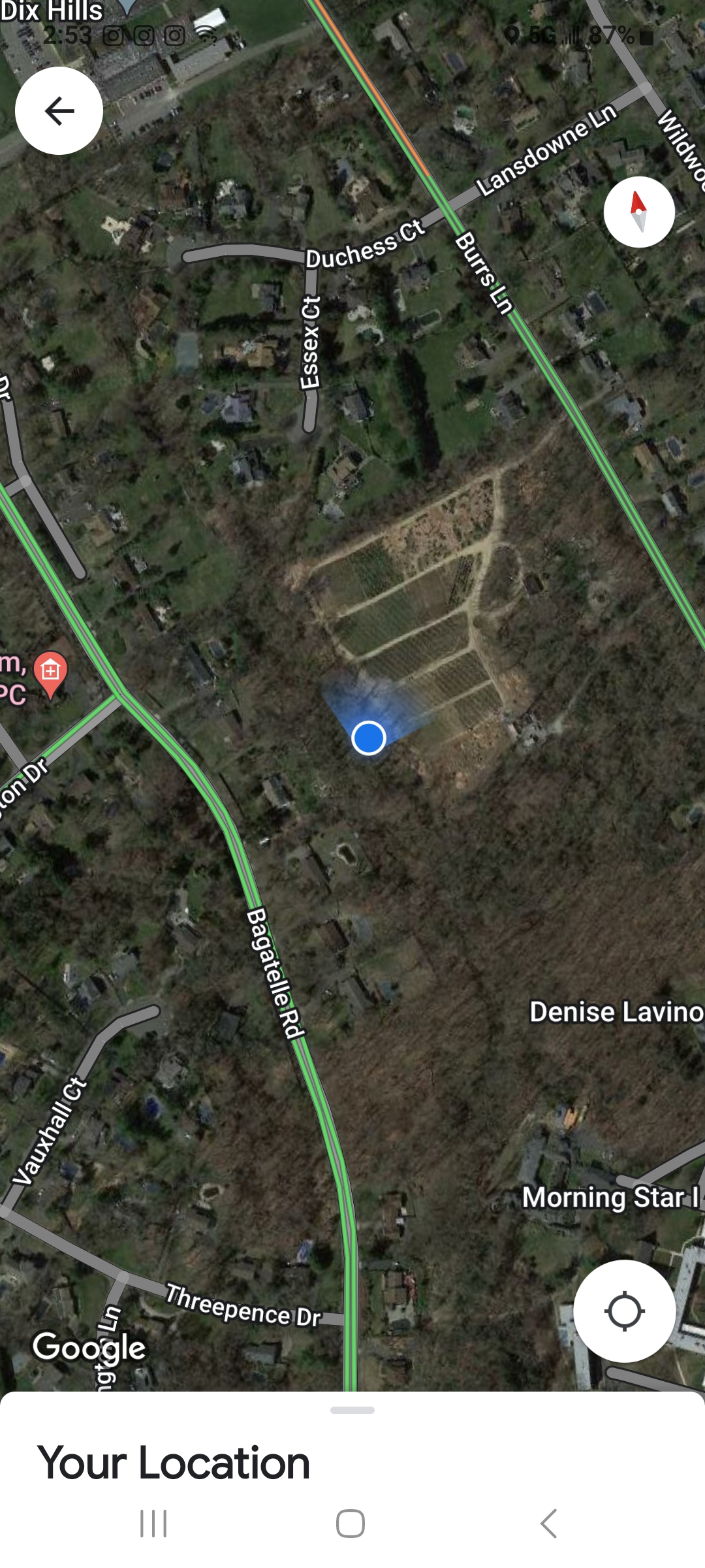
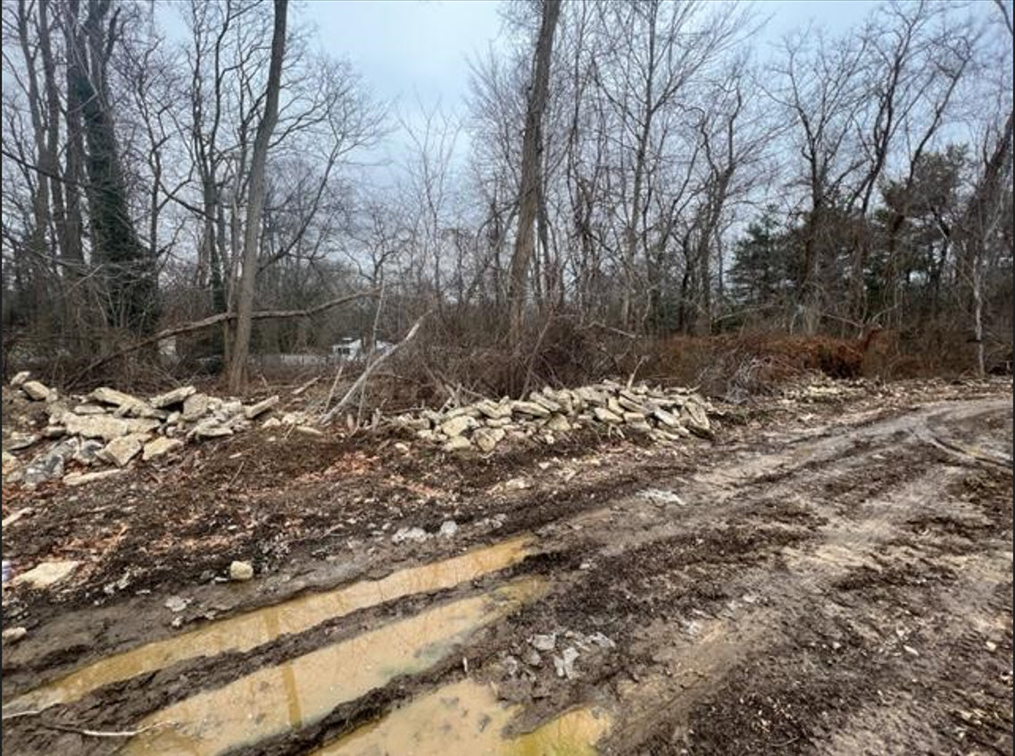
Between Bagatelle and Burrs
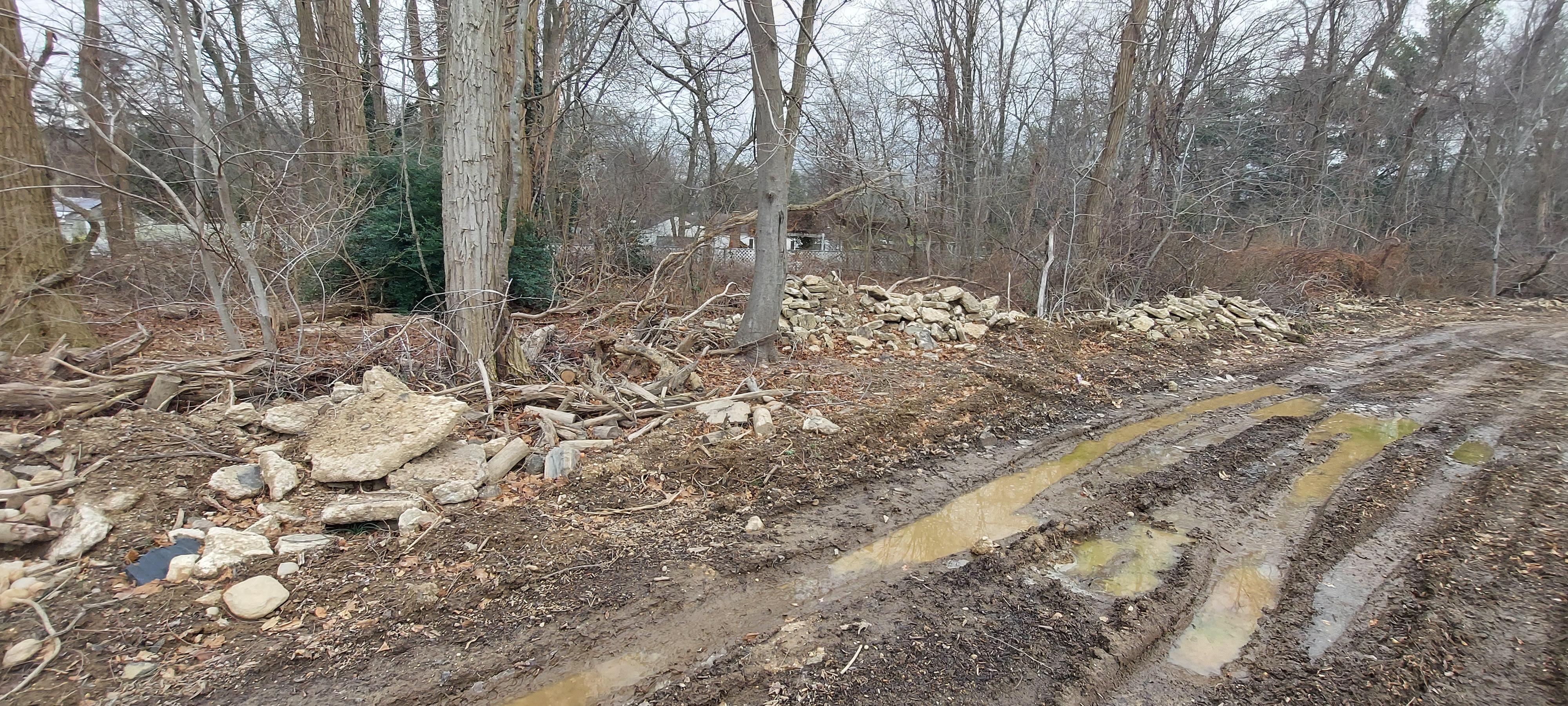
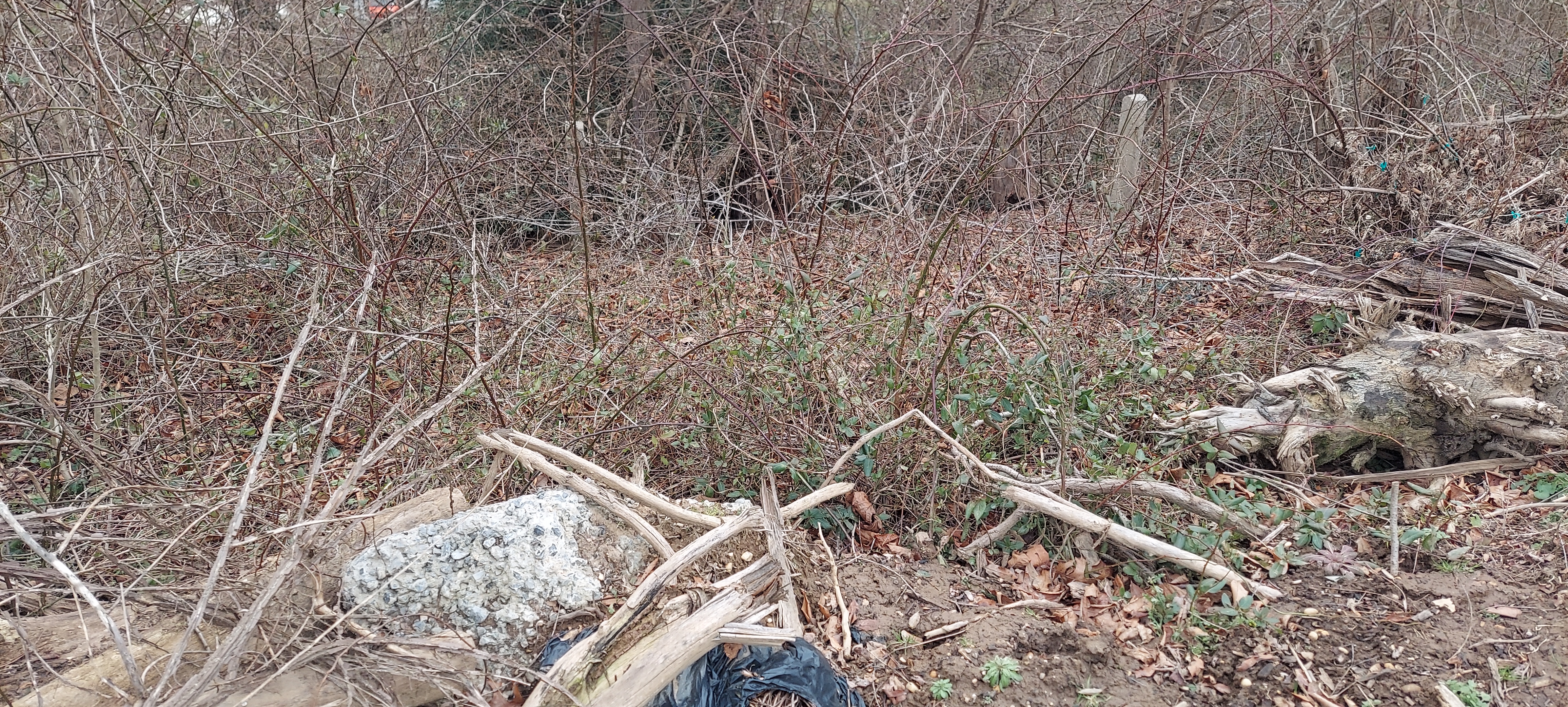
Bagatelle Road in Wheatley Heights has always been a challenging location for Motor Parkway exploration. Very thorny brush, poison ivy and rough terrain tends to keep casual explorers away from the area keeping the Motor Parkway hidden to curious eyes.
Despite this, over the years, many of us like Al Velocci, Sam Berliner, Art Kleiner, Frank Femenias and Brian McCarthy, as well as some others have braved the overgrown area to catch a glimpse of the 115-year-old pavement and posts in the area.
However, due to the very private nature of a particular 25-acre property, there is one 700-foot section that may have never been seen before. The property in question is a 40-year-old tree farm and cell tower site hidden neatly in between Bagatelle Road and Burrs Lane. The owners prefer to keep very private, so please respect their wishes in conducting any future exploration of the surrounding areas.
1924 Aerial
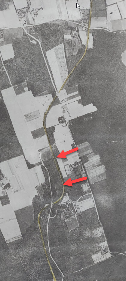
The property between the arrows has been a farm since the 1920's as seen here in this 1924 aerial. Past property owners were witness to cars zooming past their property until 1938 when the parkway officially closed.
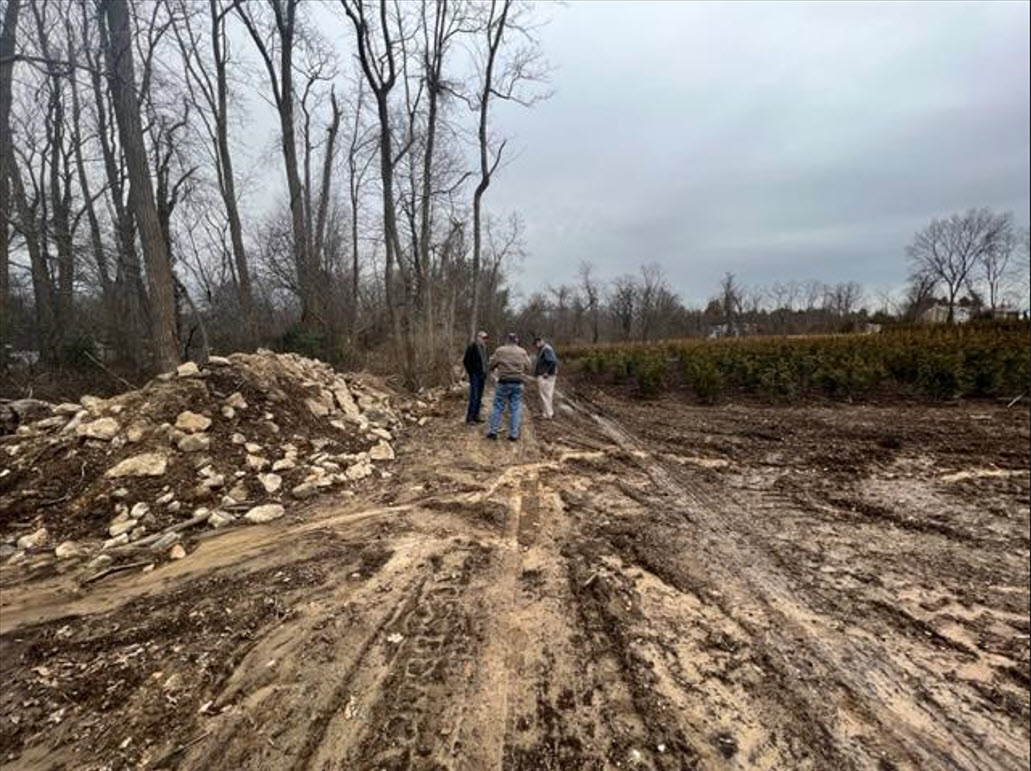
Contacted by the current property caretakers to help identify what they uncovered while expanding to the west on their property, Howard Kroplick and I set out to see if what they found was truly Motor Parkway remnants.
Turns out, it was our favorite historic parkway!
Speaking with the caretakers about the history of their property and the Motor Parkway in the area, we learned a lot of the farm's history, and in turn, they learned a bit of the old road bordering their property.
Parkway Pavement Piles Everywhere!
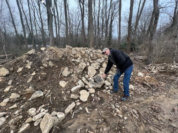
While cultivating the soil for future plantings, their equipment kept hitting solid concrete that was mostly broken up that they would pile up along the boundaries of the property. It's unclear to them, and us, as to why it was as broken up as it was.
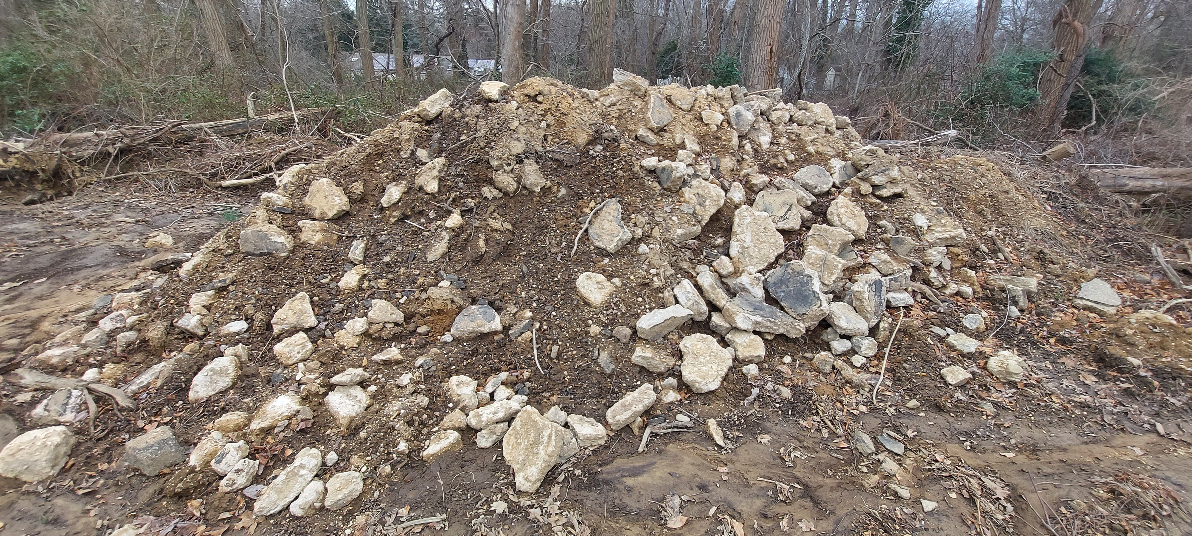
An impressively large pile of pavement.
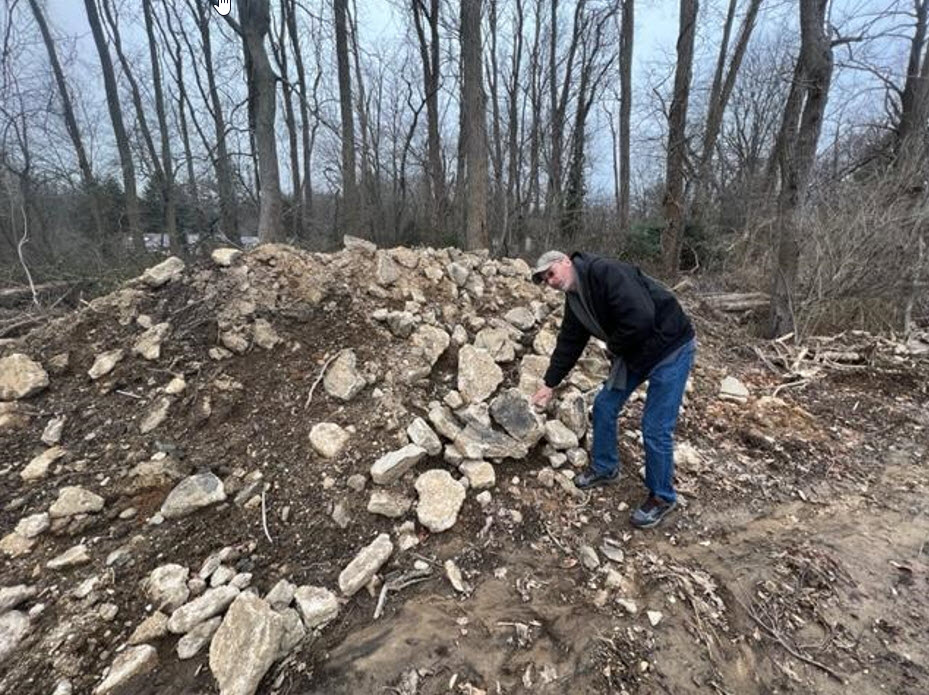
In this photo for scale, I'm describing the aggregate and asphalt to the property owners.
We may have not had to contend with thorns or poison ivy, but the muddy road on top of the right-of-way was enough to make me rethink my footwear choices.
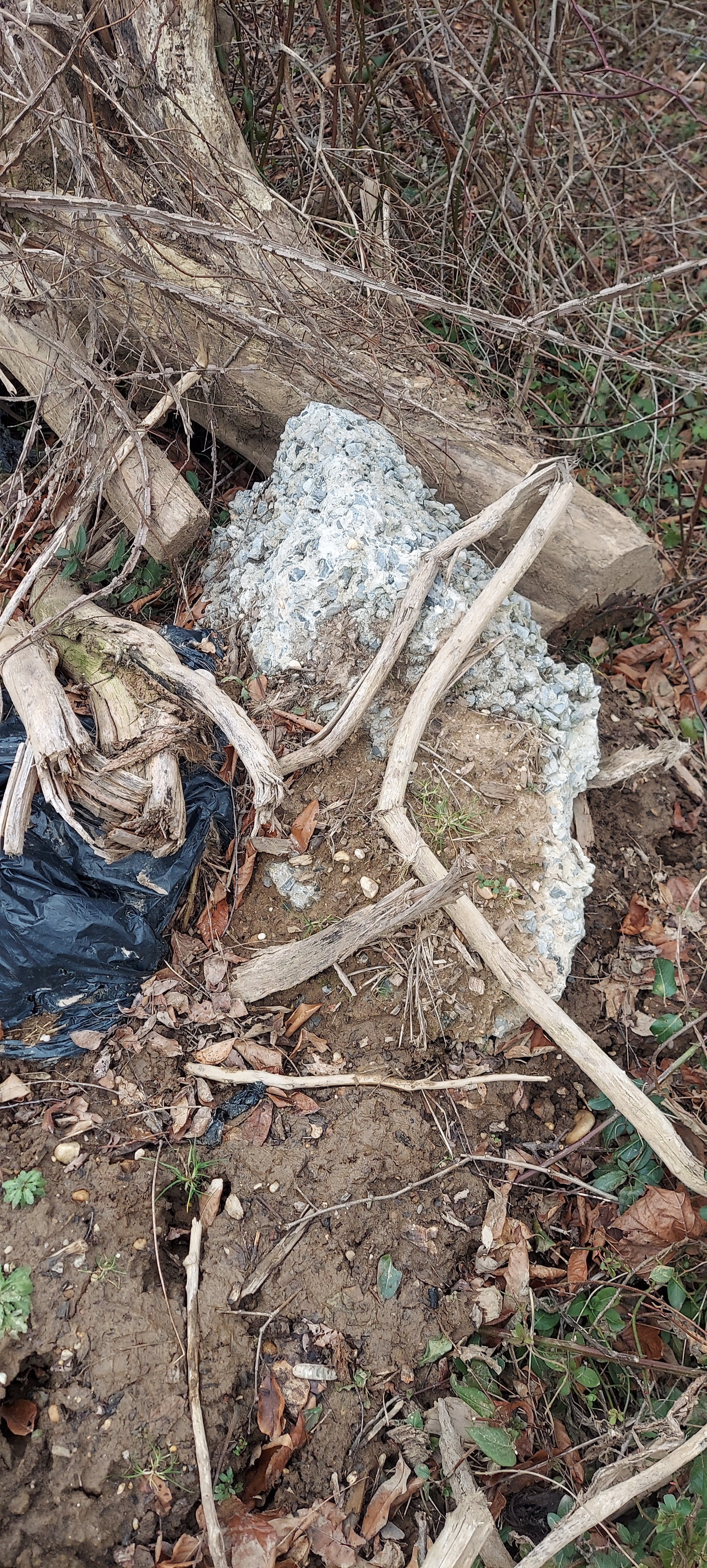
Closeup of a sizable chunk of pavement
Concrete Posts
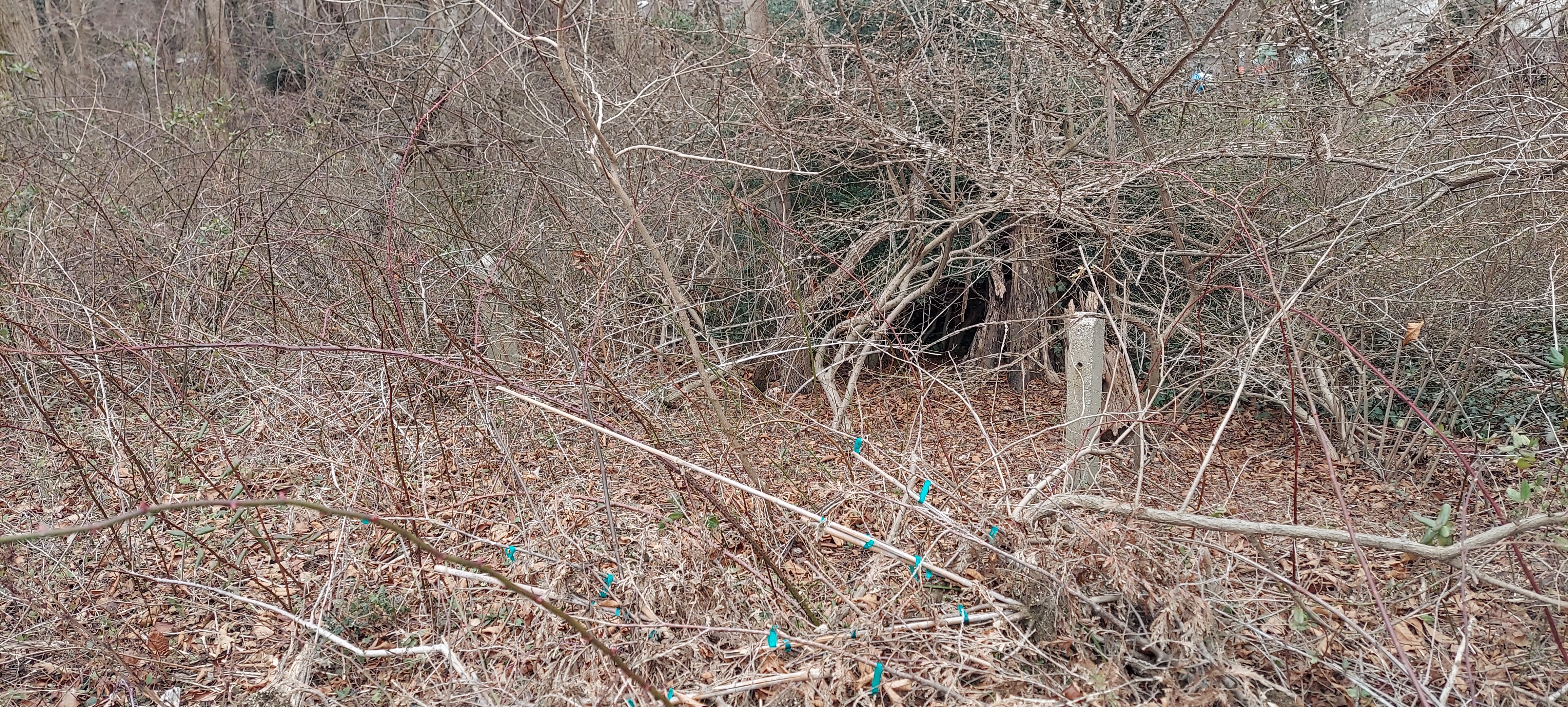
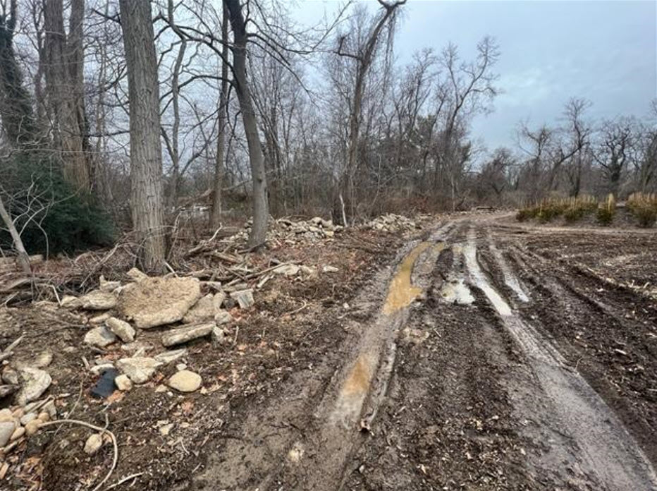
There may have not been much pavement intact, but we did come across about 7-9 posts in a line that would have been on the west side of the parkway. Beyond the line of posts was a drop-off denoting the elevated nature of the parkway in the area.
Not explained was the absence of other concrete posts in other areas of this section.
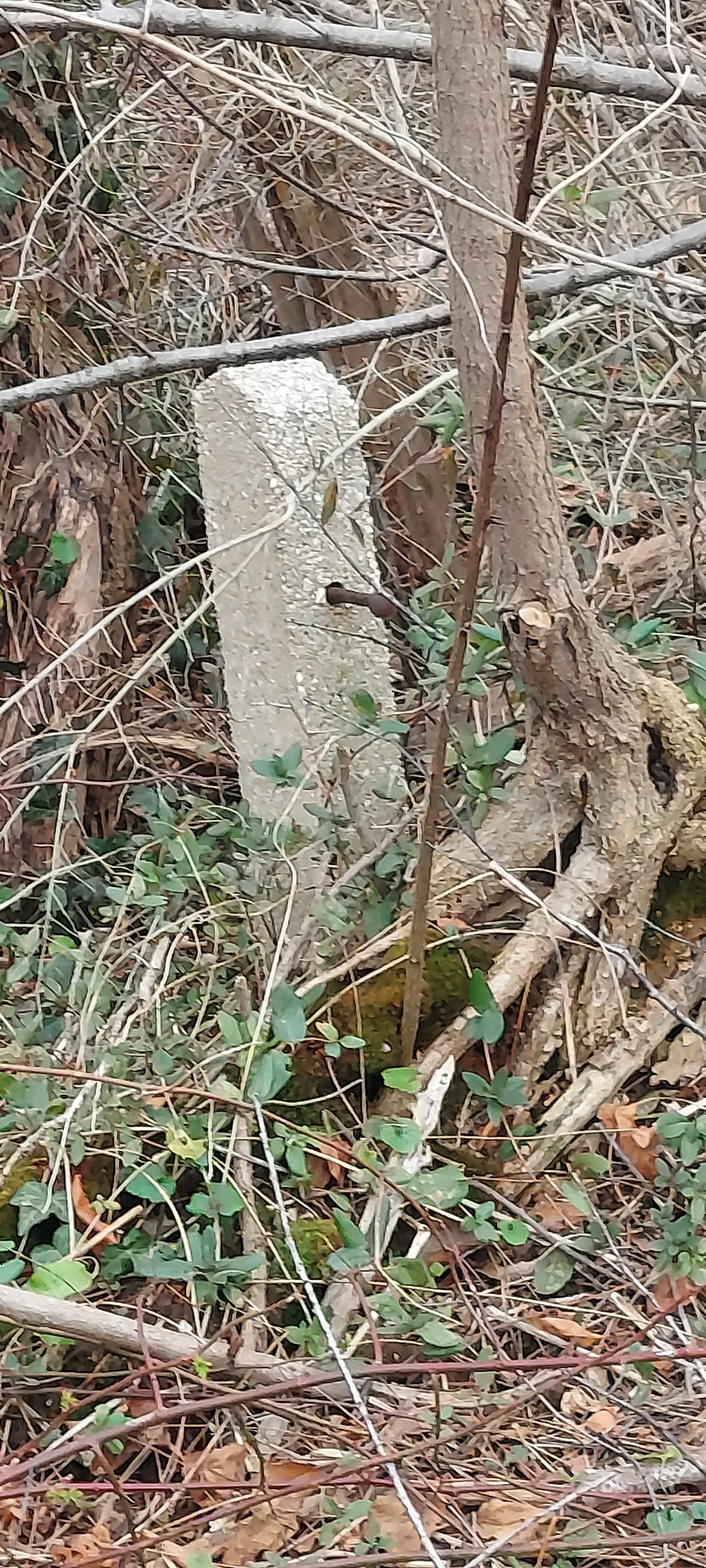
The posts in this area were not the usual 3-hole posts with the twisted wire through them, nor the other style found by Brian McCrathy and Frank Femanias close by to the south featuring a large square hole for the wooden rails to go through. The posts here utilized boards bolted to the posts as seen by the remaining bolt sticking out of the post.
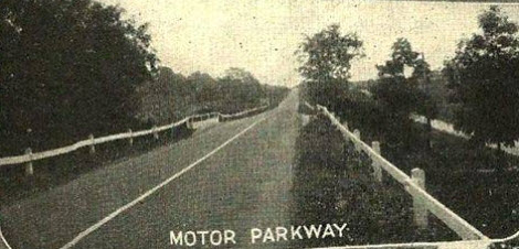
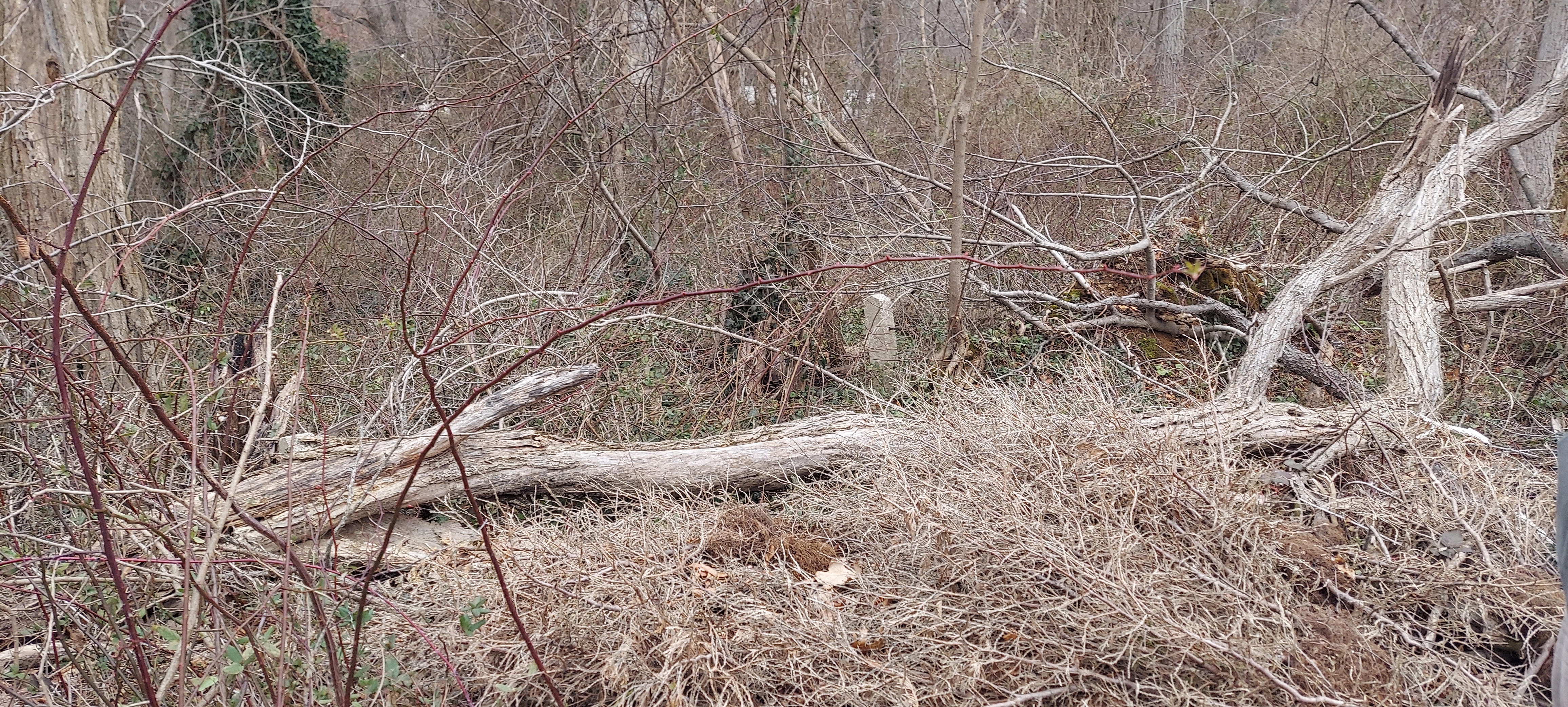
An original view of what the posts and railings looked like in this section of the farm
(Image courtesy of Art's Long Island Motor Parkway Site)
A huge thank you to the John, and his friend Jerry, for calling us and inviting us on to the property to explore this section. Kudos also to Justin Kelly who initially placed us in contact with John.


Comments
Nice going, Howard & Greg. Glad you were formally invited to investigate this area. You’re right, from way back, this farm was under the ownership of Holmes. Kind of neat if their descendants still own this property. Then the history would be passed down. Sure you noticed the Cell Tower nearby, which according to older maps, was initially a Radio Tower. Perfect time of the year to explore through here as well.
Brian,
What station was the radio tower for?
Thanks!
Just seeing this. Great post Greg! I love exploring these things, digging up history.
Frank—-according to your LIMP map the parkway is west of this location! There are aerial factors involved when doing this, that’s why there are many spots that are not correct on the map. Nothing better than digging it up on the ground! Can’t argue with that.
Attached are a few pics I took with Sammy in this zone on our 2017 Vanderbilt Day. Once you get past the convent grounds it is very difficult to navigate in these woods, but you gotta do what you gotta do when you’re exploring!
Hi Lee - I haven’t been able to identify what radio station the Tower is associated with, yet. This tower is named on a 1967 topographical map. Found a NEWSDAY article from 1970 mentioning this tower along with farm & nursery buildings nearby. There was talks of developing this area between Bagatelle & Burrs for a school ( just south of the Chestnut Elementary School ) But it never happened. Then a NEWSDAY article from 2012 mentioning the installation of cell antennas etc on this tower. Tower seems to be the same address as the Tree Farm. Next time I’m at the library, I’ll look through some local history books. Sometimes I get lucky doing that lol : )
Thanks, Brian. It’s very common nowadays to use abandoned radio towers (usually AM) for cell phone relays and so forth. In fact, that’s what happened to the very first station I worked at professionally out of college.
When developing the land surrounding the towers, many are surprised to learn that copper ground radials are buried about a foot underground emanating from the base of the tower outwards in a circular fashion, usually every 3 degrees or so. The length of these radials is equal to the height of the original antenna. Ground conductivity of the signal is accomplished this way in addition to through the air with the vertical part of the antenna.
Great update Howard and Greg, surprised to see the Motor Parkway demolished in the secluded section in Wheatley Heights. I thought this half-mile stretch in the Long Island countryside would’ve survived the test of time.
Lee, interesting fact about increased radio signal transmission from just a one-foot insertion into the ground. Amazing!
Dave, GPS guidance was essential in locating the parkway in a concealed area by the Dix Hills Preschool. I’d like to show you why someday. Perhaps before this spring arrives.
Wish now I had taken a photo of it, but the cell tower is now in the wide open since the tree farm practically surrounds it. They are impressive when you can walk right up to the base as we did. The owners say it’s a great source of income from leasing the property of the footprint of the tower to the cell providers.
Al V.-
As discussed, here is a closeup of some of the 4 in. concrete with a layer of asphalt on top (much of the asphalt was worn off)
Greg - great post! I remember clearly that section which was one of the hardest to explore as you note. But my trips back 12+ years ago were well worth the effort! On one such trip I wandered around the radio tower and ended up in the tree farm where numerous workers saw me. Rather than evade them I walked up to them and explained what I was doing. Very politely they explained it was private property and I should probably exit. With shovels and saws in their hands I elected not to object. They pointed me to Burr’s Lane and I ended up walking the long way back (albeit safer without having to worry about thorns, debris, etc.) to my car off of Bagatelle. Would definitely favor a return trip at some point to see the additional section they were clearing.
Lee - I’m interested in the radio aspect of this post as well. And I definitely know what you mean about the copper radials as I’m a ham radio operator - these radials are used today to improve an antenna’s performance. Actually I know of one ham on Long Island who said he’s buried 125 of them in his yard!
Greg / Art,
Many a property owner where an old tower still resides is reaping the benefits of leasing space on their towers to cell phone operators. It’s so much more cost efficient to stick a cell relay on an existing stick than to have to acquire property and raise a tower of their own. As long as the tower lights are still functioning, life is grand!
Here’s the nearest screenshots I could capture of this now Cell Tower. This is a steel pole, perhaps the original tower was a lattice type.
I’m wrong, this is a lattice tower. But not a particular wide one, guess it doesn’t need to be.
Brian,
Tower height is only critical for FM (and pre-digital TV). Notice the tower has a concrete foundation, typical to support a tall, heavy tower. It’s possible this stick is higher than the original AM one was.
Looks like there are two towers registered with the FCC here both with a registration address of 127 Burrs Lane. Registrants/owners are Crown-Castle USA, Pinnacle Towers, LLC and Holmes Farms, LLC. The first two are subsidiaries of one another. Towers are listed as 99.1 feet and 100.3 feet. For more info: https://www.city-data.com/towers/cell-Dix-Hills-New-York.html#mapFCC_Antenna_towers
I was able to screenshot a couple of aerials of this area in 1962. Neat because the LIE is being built, the Bagatelle Nursery is in operation, the Radio Tower is visible and the LIMP of course. If you want to visit the website, think you’ll have better luck on a computer rather than a phone.
https://gisapps.suffolkcountyny.gov/gisviewer/