Kleiner’s Kolumn:Update-Historical Markers for the Long Island Motor Parkway & Vanderbilt Cup Races
One way to keep the memories of the Motor Parkway and the Vanderbilt Cup Races alive is to memorialize their existence with historical markers throughout Long Island.
Various government and private organizations have undertaken the purchase and placement of the markers. We thank them for their efforts!
In this post, several new markers have been added to the previous 2017 update on VanderbiltCupRaces.com.
Overall, the current count is 21 markers at 18 different locations. One Old Country Road marker remains missing since the 1960s.
If you know of any other markers, please leave a Comment and jpeg.
Art Kleiner
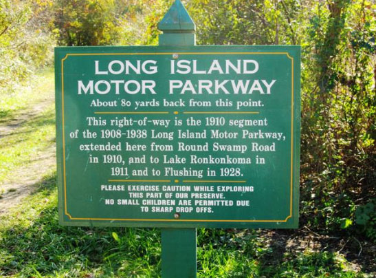
Queens Greenway
Placed by New York City Parks & Recreation in 2010 at three locations on the Queens Greenway, replacing damaged markers
Suggested copy tweaks: See the comments section of this post.
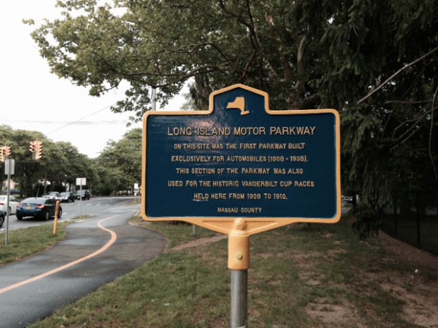
Nassau County
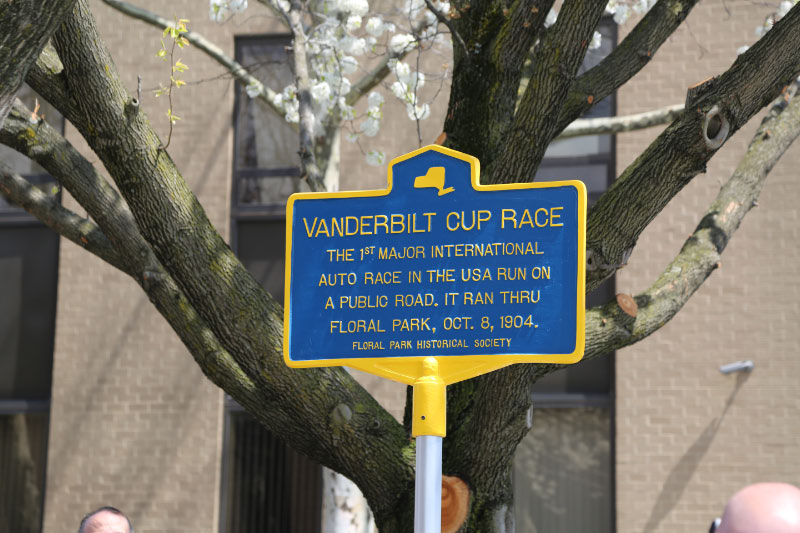
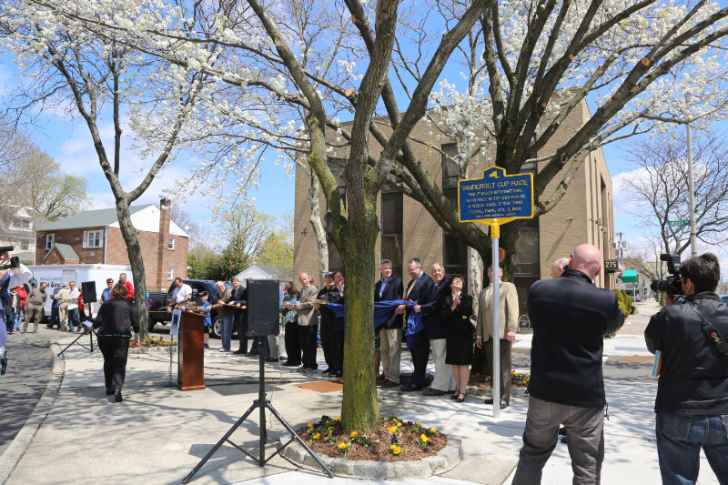
Floral Park
Manhasset Hills
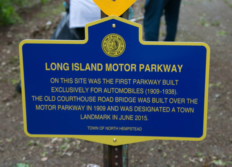
Adjacent of one of the two remaining Nassau County Motor Parkway bridges. The bridge was dedicated as a Town of North Hempstead landmark in June 2015. Placed by Howard Kroplick.
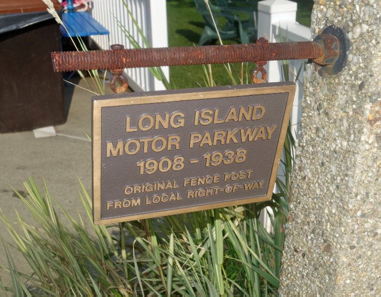
Williston Park
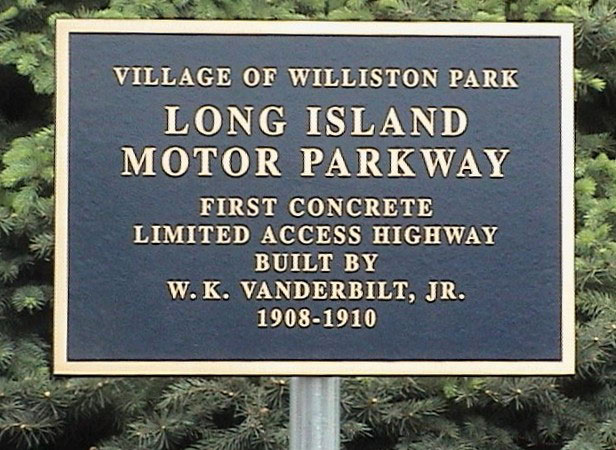
Willis Avenue
Williston Park
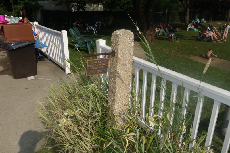
Village Pool
Placed by Village of Williston Park. Concrete post donated by Al Velocci.
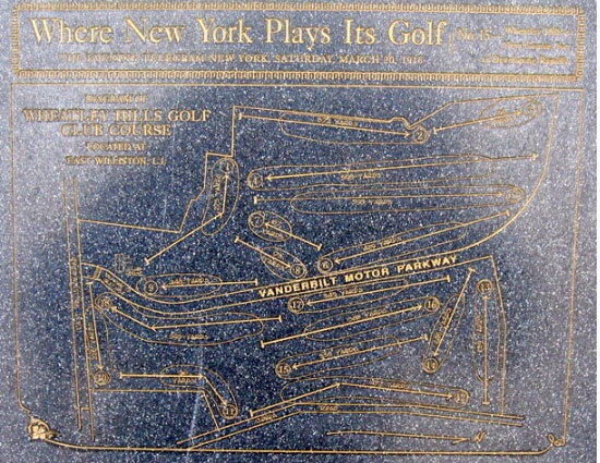
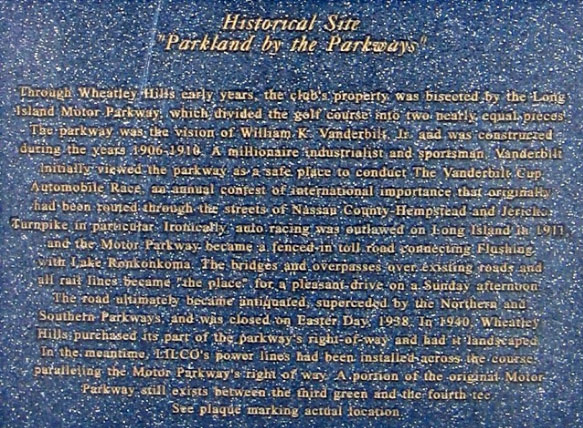
East Williston
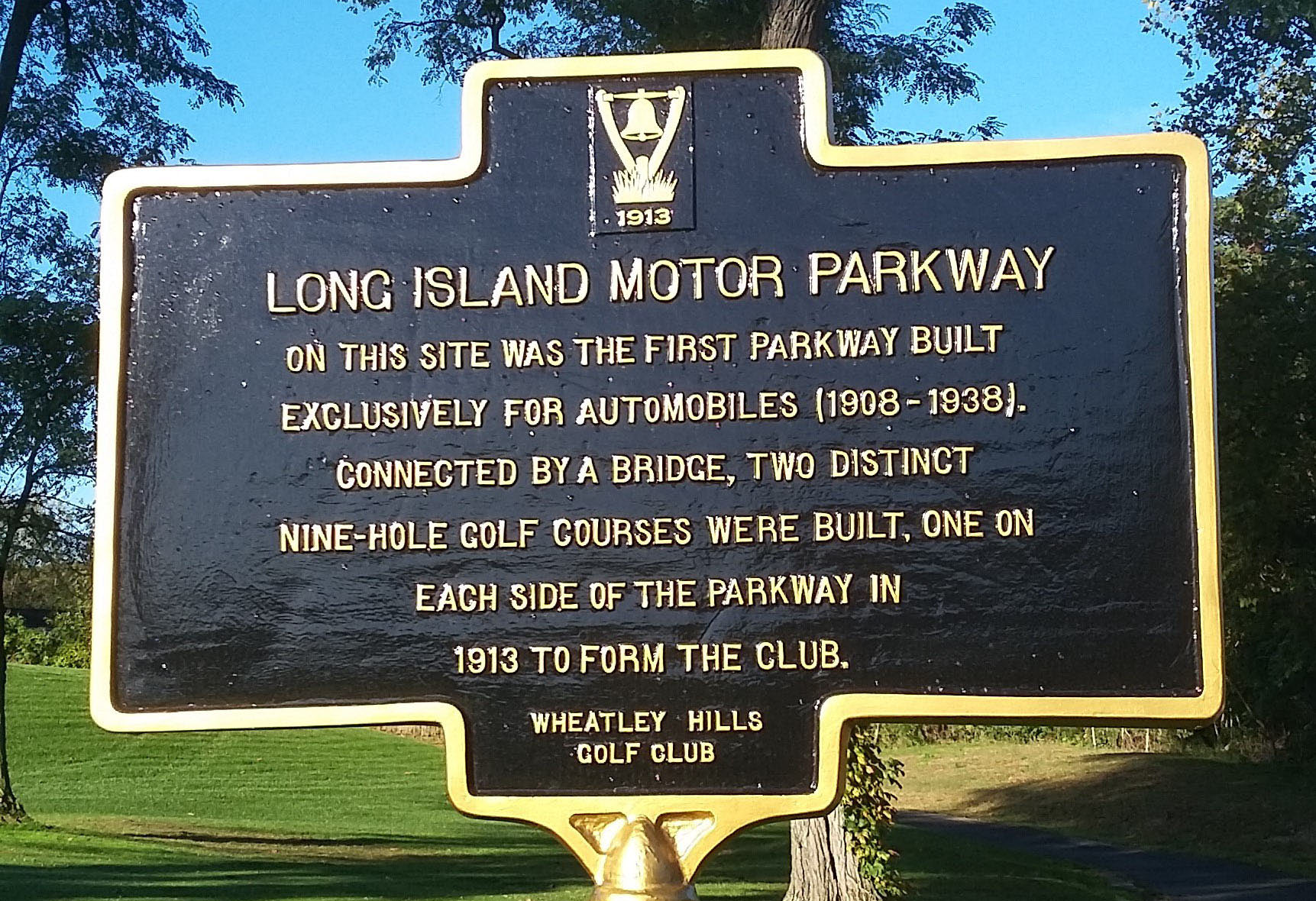
Wheatley Hills Golf Club-Near 4th Tee
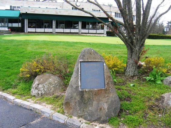
Placed by the Wheatley Hills Golf Club. Courtesy of Art Kleiner.
Garden City
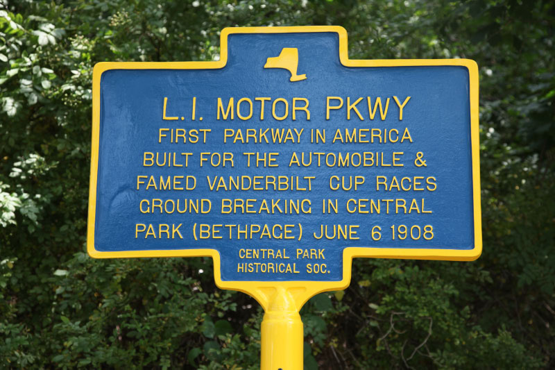
Garden City Chamber of Commerce, Seventh Avenue
Placed by Garden City Chamber of Commerce in 2013.
Suggested copy tweak: There were 20 toll collection structures built for the Long Island Motor Parkway.

The marker has a bar code that takes you to the Garden City Department of Recreation's website that provides corrected information on the Motor Parkway. Note their excellent source material provided in the last paragraph.:
-----------------------------------
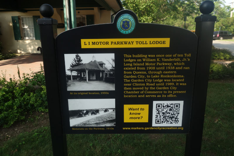
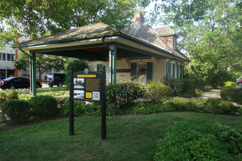
Long Island Motor Parkway Toll Lodge
The Toll Lodge marker is located near the relocated Toll Lodge on Seventh Street east of Franklin Avenue, now occupied by the Garden City Chamber of Commerce.
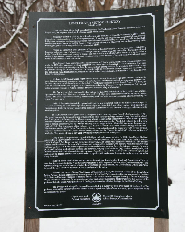
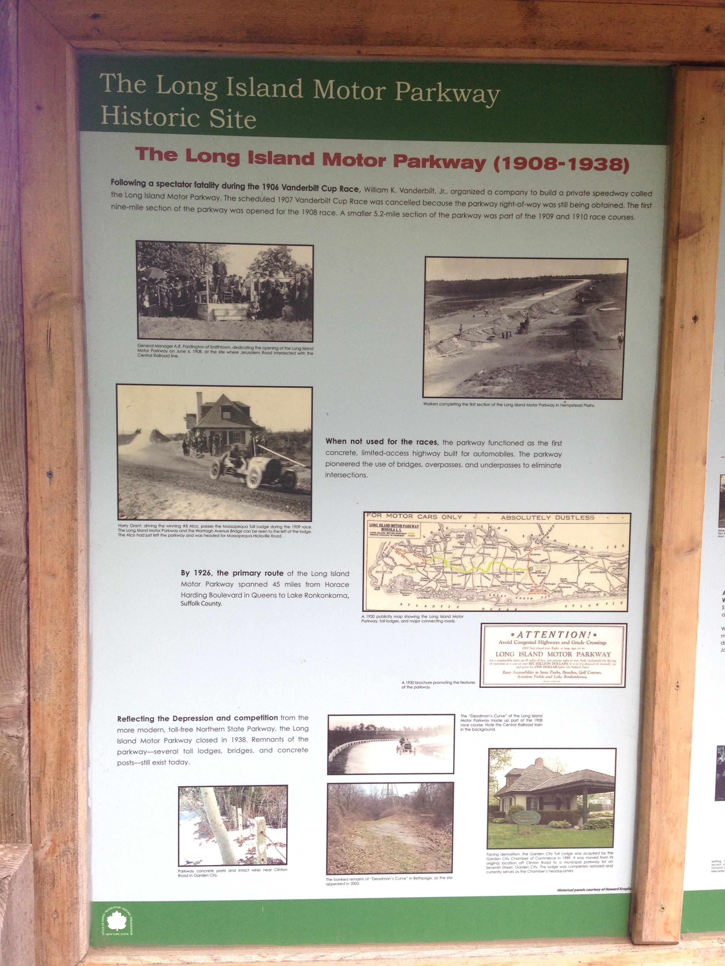
The Garden City Toll Lodge was one of some twenty structures built for the Long Island Motor Parkway to collect tolls. The Parkway was designed by William K. Vanderbilt, Jr. as a private automobile toll road with grade separations from public roads and railroads – the first limited-access highway in America. It ultimately extended from Queens, through eastern Garden City, to Lake Ronkonkoma and existed from 1908 until 1938.
This lodge was built in 1911, and was originally located near Clinton Road, at the entrance to the Parkway at the end of what is now called Vanderbilt Court. It and five others were designed in French Provincial style by John Russell Pope, subsequently famous for his designs of buildings such as the Jefferson Memorial and the National Archives in Washington, DC.
The lodge had living accommodations for the toll collector and his family. The two-story building was of brick covered with stucco, with a cedar-shingled roof. On the first floor was an office, living room with fireplace, and kitchen. The second floor contained two bedrooms. A porte cochere sheltered the toll collector as he collected tolls (initially a round trip for $2.00, about $45 at today’s prices) or inspected annual toll plates mounted on the cars. The original porte cochere was extended at a later date to accommodate cars entering and exiting at the same time.
When the Parkway closed in April 1938, the Garden City Lodge was sold to gatekeeper Christian Ernst, who continued living there until 1977. In 1987, when the next property owner wanted to rebuild, the Garden City Chamber of Commerce raised funds to have the building moved to its present location on Seventh St. and renovated for use as its offices. The move occurred in March 1989. A complete photo history of the Long Island Motor Parkway itself can be obtained from the book “The Long Island Motor Parkway” by Howard Kroplick and Al Velocci (2008) or from the website maintained by Kroplick www.VanderbiltCupRaces.com.
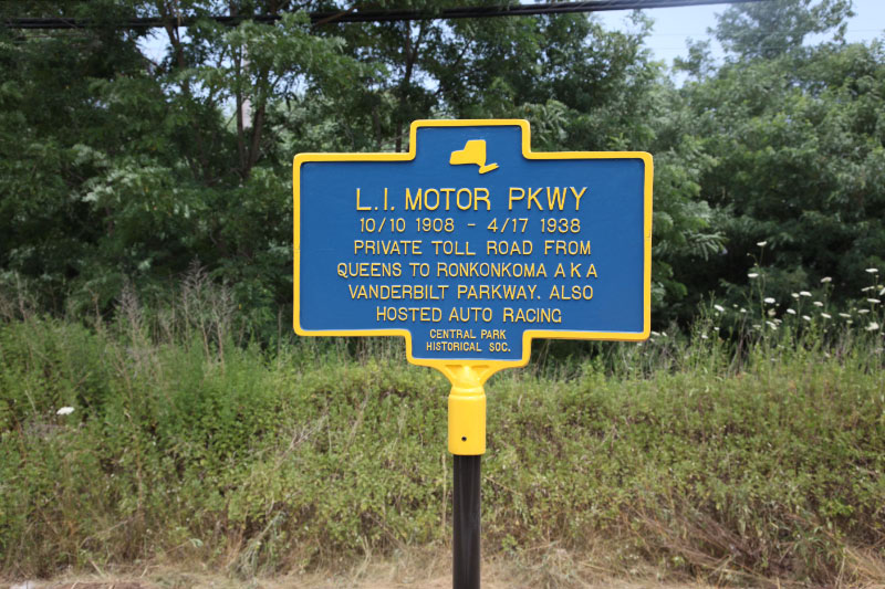
Mineola/Garden City
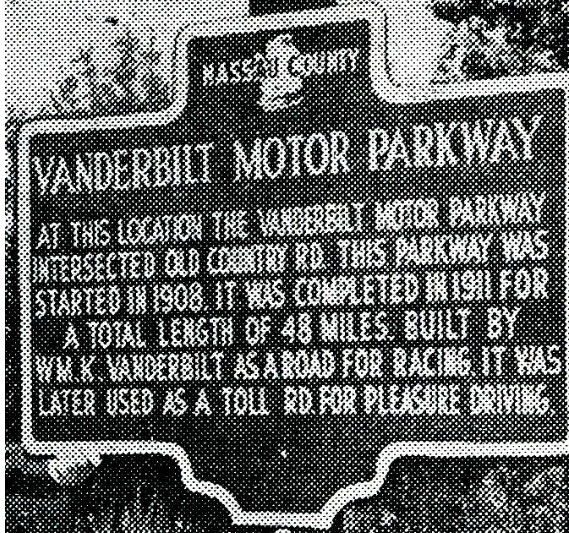
Old Country Road (no longer standing)
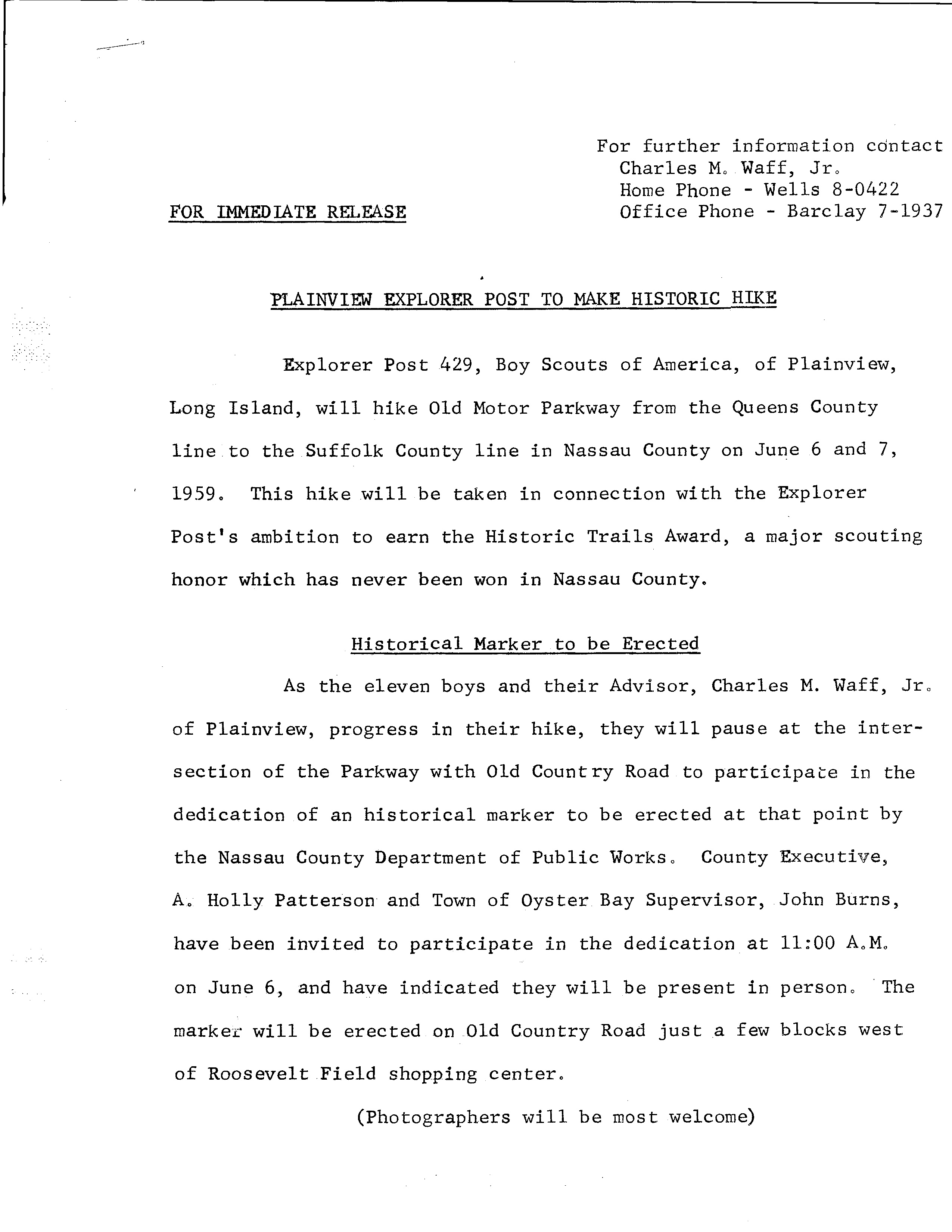
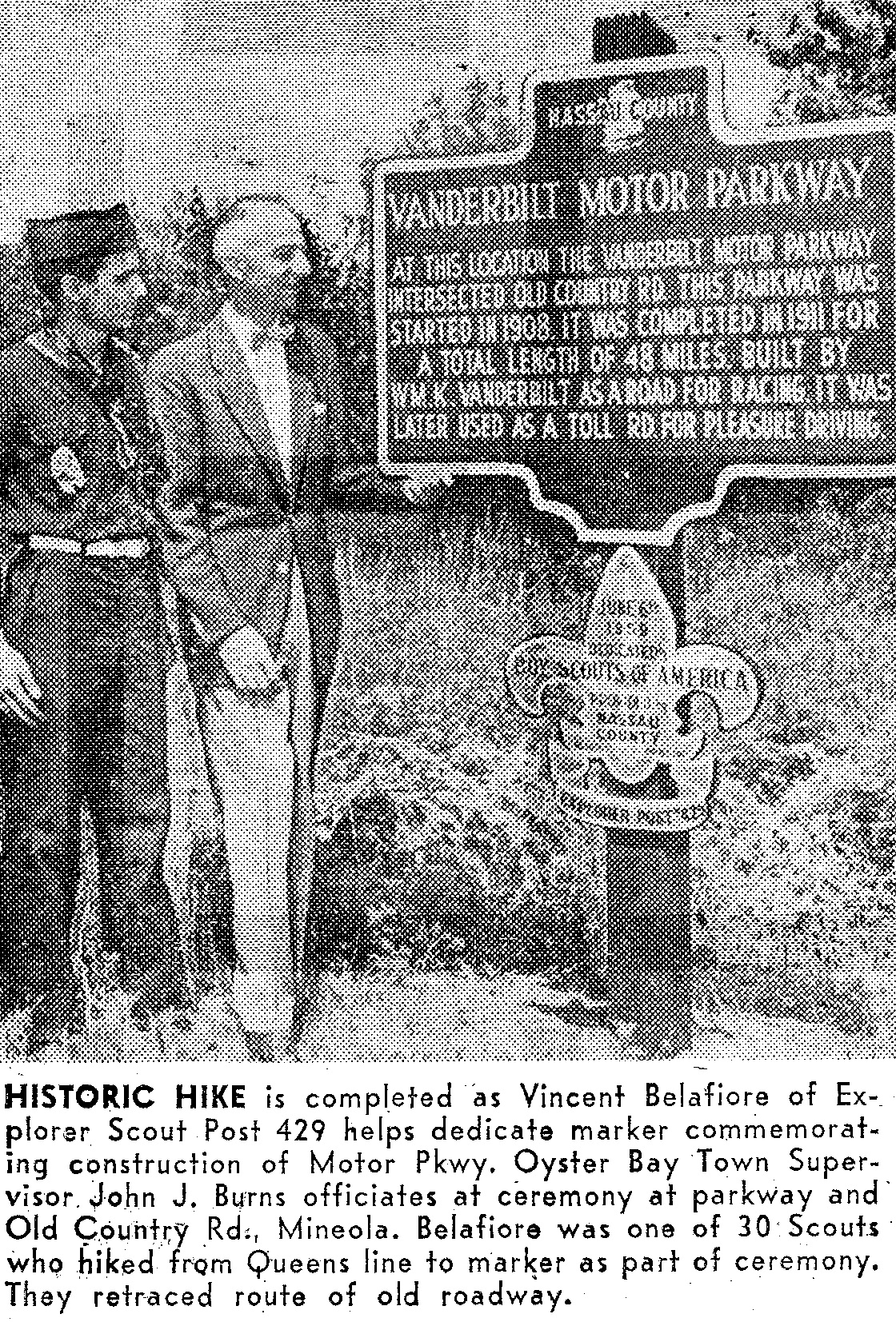
This marker was placed by Boy Scouts of America Explorer Post 429, Plainview, on June 6, 1959. The marker was taken down soon after during the widening of the road. The marker is still missing today.
From Art's Motor Parkway Historical Marker Page
"The next marker (using an incorrect version of the Parkway's name, as was used above left) was dedicated in June, 1959 by the Boy Scouts of America Explorer Post 429, Plainview, as they took a break in their hike retracing the route of the Motor Parkway. The hike was done in connection with the post's ambition to earn the Historic Trails Award, a major scouting honor which had never been won in Nassau County. The site of the marker was the intersection of the Motor Parkway and Old Country Road in Mineola, a few blocks west of the Roosevelt Field shopping center. This information was taken from a press release issued from the post's advisor, Charles M. Waff, Jr. and the photograph is from the June 9, 1959 edition of Newsday."
"Having been to this location several times and never noticing the marker, my guess it was probably taken down as part of improvements made to Old Country Road and the erection of an office building and an apartment complex. Several calls to the Nassau County Dept. of Public Works proved of no value as no one appeared to have any recollection of where the marker may have ended up. "
Westbury
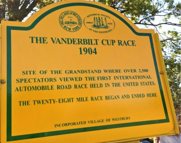
Jericho Turnpike
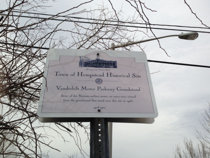
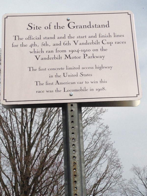
Commemorates the location for the 1904 Vanderbilt Cup Race grandstand and start/finish line. Placed by the Village of Westbury.
East Meadow
Salisbury Park Drive
In 2015, three historical markers were placed along the pilot section of the Motor Parkway Trail in East Meadow.
Levittown
Orchid Road (2 markers)
Erected by Town of Hempstead in 2014 in 2 locations, replacing damaged markers.
Suggested copy tweak: It was called the Long Island Motor Parkway grandstand.
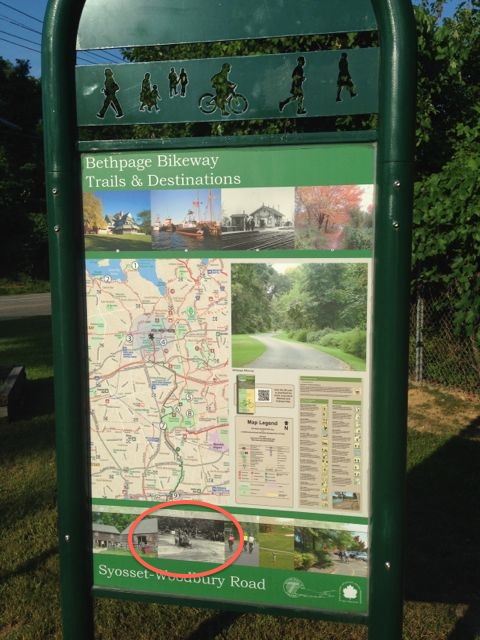
Woodbury
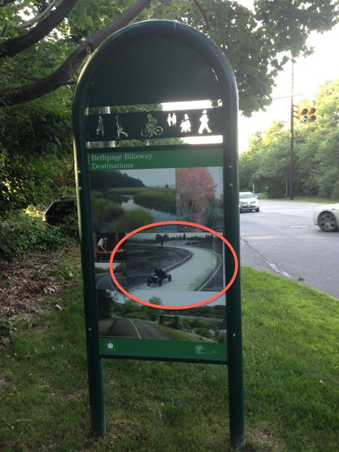
Woodbury-Syosset Road
While not actually on the Motor Parkway, these markers highlight the route as part of the Bethpage Bikeway.
Bethpage
Stewart Avenue
Central Avenue
Farmingdale
Entrance to a parking lot in Bethpage State Park. Technically not on the Motor Parkway. Copy and images provided by Howard Kroplick.
Old Bethpage
Old Bethpage Village Restoration
Melville
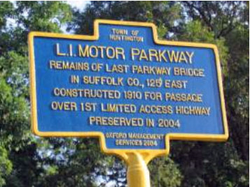
Maxess Road
Erected by Oxford Management Services in 2004.
Suggested copy tweak: The bridge over Deer Park Avenue was the most easterly Suffolk County bridge for the Long Island Motor Parkway.
Dix Hills
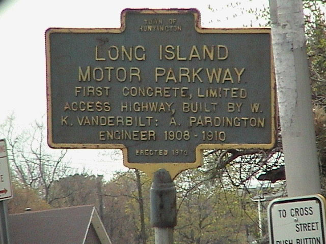
Vanderbilt Parkway
Erected by Town of Huntington in 1973.
Suggested copy tweaks: The parkway was built by William K. Vanderbilt Jr.. A. Pardington was the general manager of the Motor Parkway and E. G. Willams was the engineer.
Commack

Commack Road and Vanderbilt Parkway
Erected by Town of Huntington in 1973
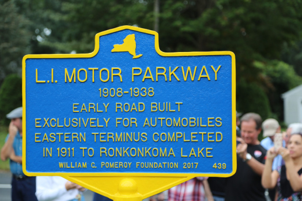
Lake Ronkonkoma
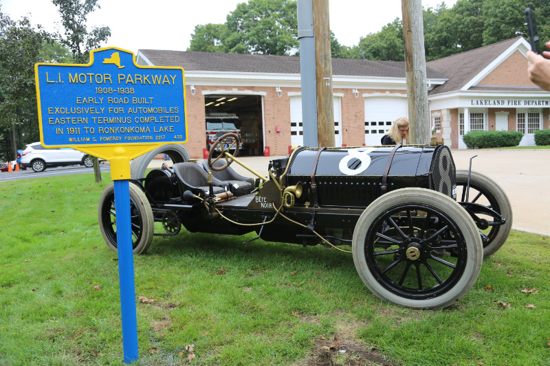
Motor Parkway
Placed in 2018 with the assistance of the William G. Pomeroy Foundation.


Comments
Too bad about the 1959 pkwy marker sign. I imagine the scouts probably witnessed remnants of the LIMP tunneling under Old Country Rd there. Must have been a lot of fun. You never know, somebody might have tucked this sign away.
From Gary Hammond:
Nice piece - at one time a marker existed at the Battle Row Campground - I gave them copy which I think they used at the time (1990’s). Was alongside the small stretch of parkway still there, for the benefit of the campers. I don’t know if its still there now.
Gary
I haven’t yet restored my <http://sbiii.com/limpkwy5.html#grndstnd> LIMP Page 5 (I’ll do it later today - promise!) but the old grandstand markers (two sets of two signs) are there and the pix can be seen here:
http://sbiii.com/limppix/grndstnd.jpg (together on post),
http://sbiii.com/limppix/grndstdu.jpg (upper), and
http://sbiii.com/limppix/grndstdl.jpg (lower).
The locations, one set on Orchid and one on Skinner, was here:
http://sbiii.com/limppix/grndstnd.gif.
Sam, III
Whoops! Missed the second 1973 Dix Hills marker, in front of the Half Hollow Hills Community Library at 55 Vanderbilt Parkway, Dix Hills, north side, opposite Half Hollow Hills School! You can see it (on 17 May 2000) up top on on my LIMP Panel page:
http://sbiii.com/limpanel.html
or directly here:
http://sbiii.com/b-uattwn/meiii4/pix/limpmark.jpg
Of course, it repeats (or fostered) the erroneous listing of A. Pardington as Engineer (and omits WKV’s “Jr.”).
Sam, III
howard how about get a motor parkway history sign for eisenhower park salisbury links the golf course.
____________________________________
From Howard Kroplick
Nassau County is planning to install markers on the site.
After reading Gary’s comment above, taking a careful look thru Battle Row for the LIMP marker is a good idea.
The marker at the corner of Commack Rd. & Vanderbilt
pkwy was recently restored. The restoration was initiated on the Long Island Needs A Dragstrip Facebook page. There was a discussion about the parkway and the markers. Someone mentioned that this marker was in bad shape. A member of the group said that he worked for the town of Huntington highway dept. and he would see about getting it restored. It took some time, but the new restored marker was recently installed back in it’s original place.
Thanks for the new info., Peter and all - FYI - the county is currently digging out the walking trail around Eisenhower Park as part of the Motor Parkway Trail Program Trail This section will be along Old Country Road and Salisbury Park Drive. Will provide pictures later.
https://www.nassaucountyny.gov/2893/Motor-Parkway-Trail-Program
[Had to back into this thread; no comment section on opening.] What a kick to see dear John Burns; what a dynamo he was! Mayhap the Preservation Society should make it a goal to (help) restore any missing markers; I never realized there were so many. How about one for the Aviation CC and its hangar roof and a pair, one at each end of Harned Road (the Commack Spur)? Ditto for the backing at I. U. Willets Road and especially at Deadman’s Curve at the south end of North Hermann Avenue. Way to go, Howard; one great thread after another; thanks as always! Sam, III
First of all, fantastic work lately Art. Great stuff.
There is a lot to see at Battle ROW, but no historical marker is there now.
Oops - typo. Sorry. “Banking”, NOT “backing”. Sam, III