Update #2: In Search of the Mystery Camp Mills “New York” Road

Lee Chambers, who grew up in Mitchel Field, has been determined to document a mysterious Camp Mills road that ran east to west and disappeared when Mitchel Field was reconfigured in 1927 to 1932. Bill Bellmer's recent aerials and documents have help Lee solve the mystery.
Enjoy,
Howard Kroplick
Lee Chambers: Thanks for posting the link from Bill Bellmer to the New York Heritage Digital Collections at the Garden City Library with all the vintage photos of Camp Mills.
For many years, I have attempted to locate the name of a major East-West route that once ran laterally across what would become Mitchel Field but was eliminated with the Base Reconfiguration, occurring between 1927-1932. The most obvious reason for this was the creation of the Parade Grounds (aka, Quadrangle) and the relocation of the Main Entrance to Stewart Avenue.
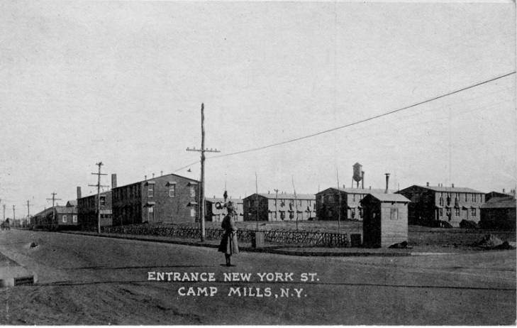
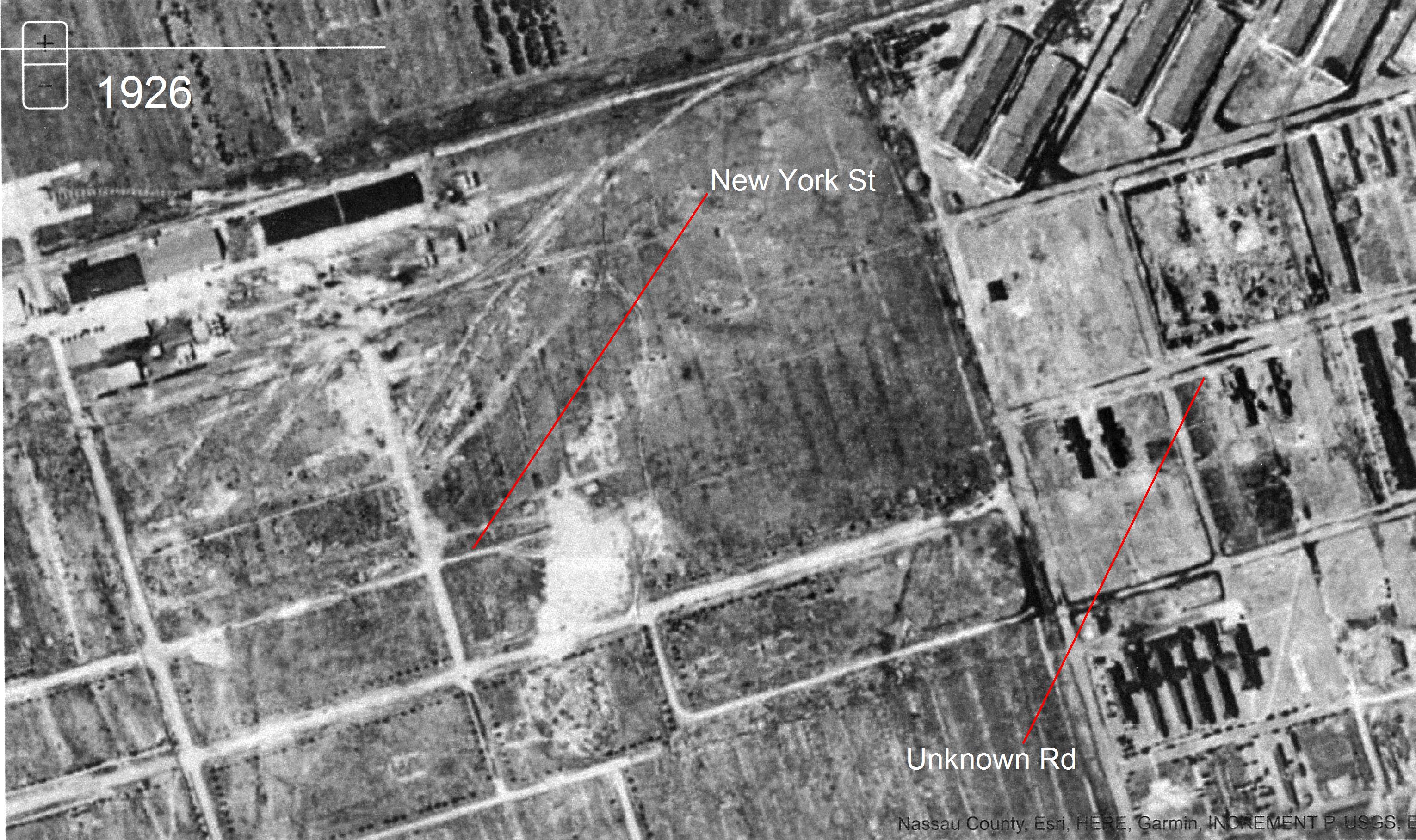
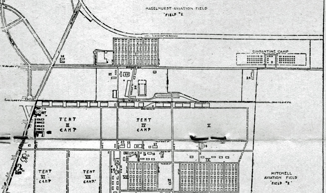
Using this 1918 photo from Camp Mills, I have been able to determine the Main Entrance to the camp was off of present day Clinton Road via New York Street to the East, in almost perfect alignment with Locust Street in East Garden City on the other side of Clinton Road.

New York Street can also be seen running parallel to Main Street in the 1918 map posted from Bill (very close to the staples in the photo!).
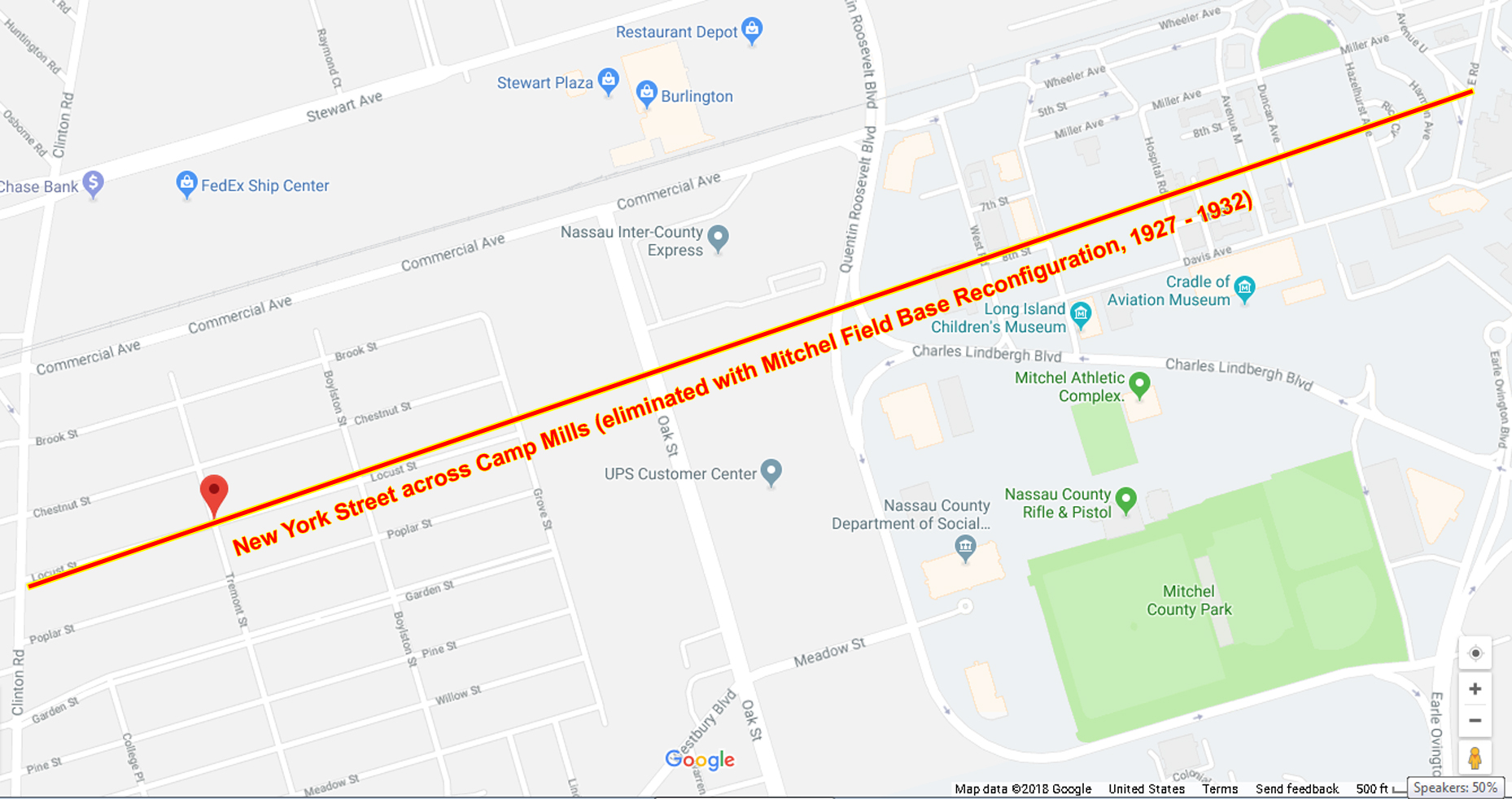
Using a modern day Google map of Mitchel Field, I have projected the approximate route of New York Street:
Continuing Eastbound from Clinton Road, it soon crossed Oak Street (originally Ave. 'E' on Camp Mills and another of the plethora of tree named roads in that immediate area), next crossing West Road. then quickly making it's way roughly midway between 7th and 8th Streets on Mitchel Field before bisecting the site where the Hospital (still in use by NCC today) would be built (on the aptly named, 'Hospital Road').
From there, it paralleled Miller and Davis Avenues, through the cluster of wooden buildings from the WW1 era that were all razed to create open space for the Quad. Immediately after crossing Hazelhurst Ave., it veered directly through the exact spot where the Commanding Officer's Quarters would be constructed in 1931, virtually right down the front sidewalk where the house stands today in the middle at 363 Rice Circle, my childhood home before dead-ending a few yards further East at (where else?) East Road along the border of the Polo Grounds.
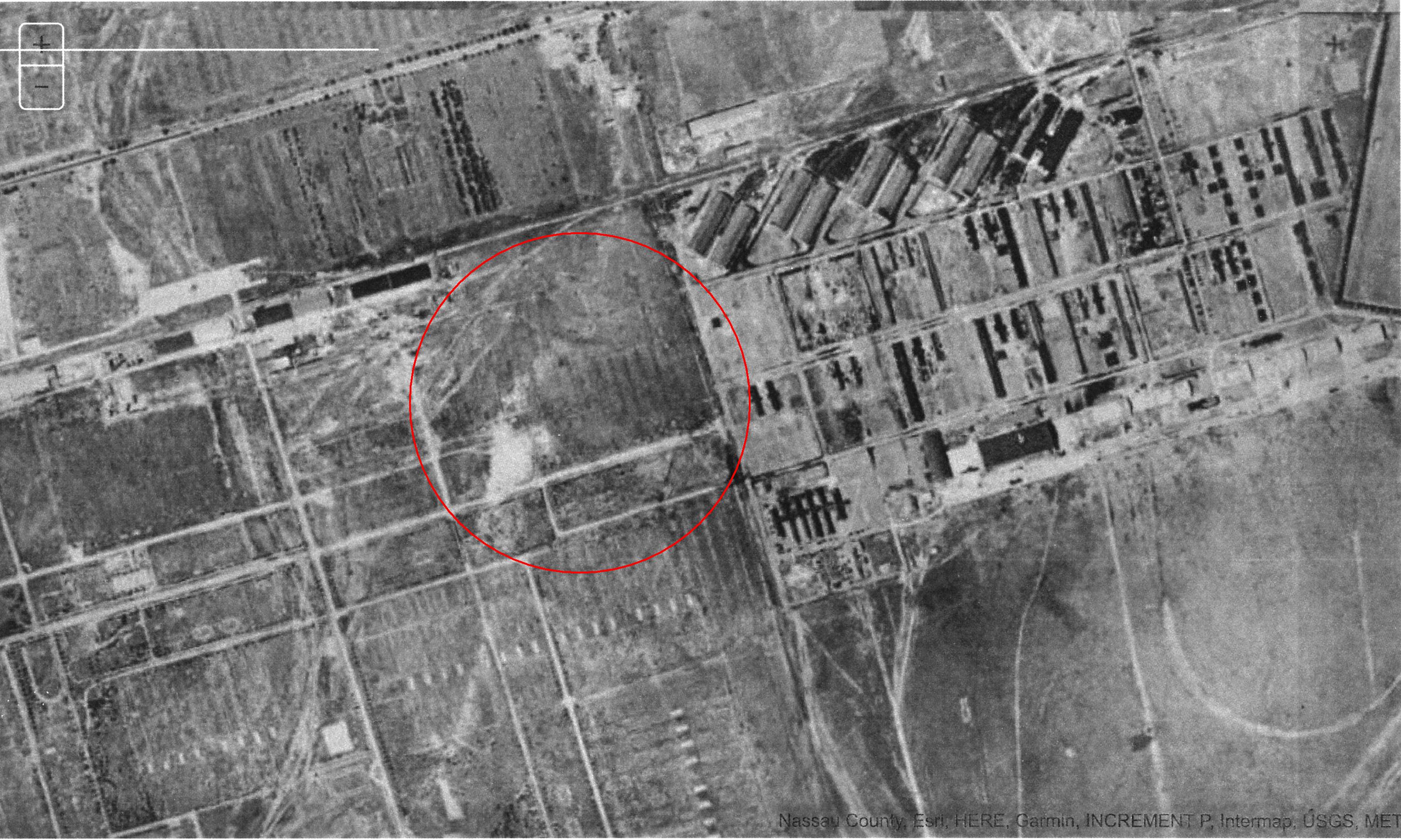
You may recall I solicited guesses in response to a Mystery Photo as to what the name of the road was earlier this year. I cannot recall who it was, but they correctly surmised it must have been a road originating in East Garden City. That was remarkably precise as it turns out. Here is an aerial from 09/19/31 with an overlay indicating the unknown road that we now have identified as New York Street.
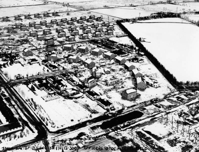
A portion of the Eastern end of the road still in existence on 01/10/31 while the Officer's Quarters were under construction (along with several of the wooden buildings not yet cleared from the soon to be Quad) can be seen here..
So at long last, the 'Mystery Road' through Mitchel Field is no longer a mystery (then again, it's no longer a road either!).
The Roosevelt Field Motor Parkway bridge can be seen in the upper left corner of the 1931 aerial.
Submitted by Brian McCarthy
1926
1950 Note: Mitchel Field is blacked out.
Update: Femenias' Findings (Submitted by Frank Femenias)
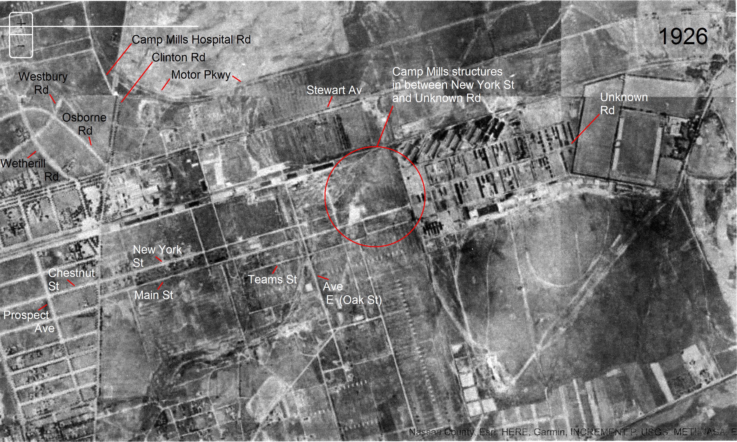
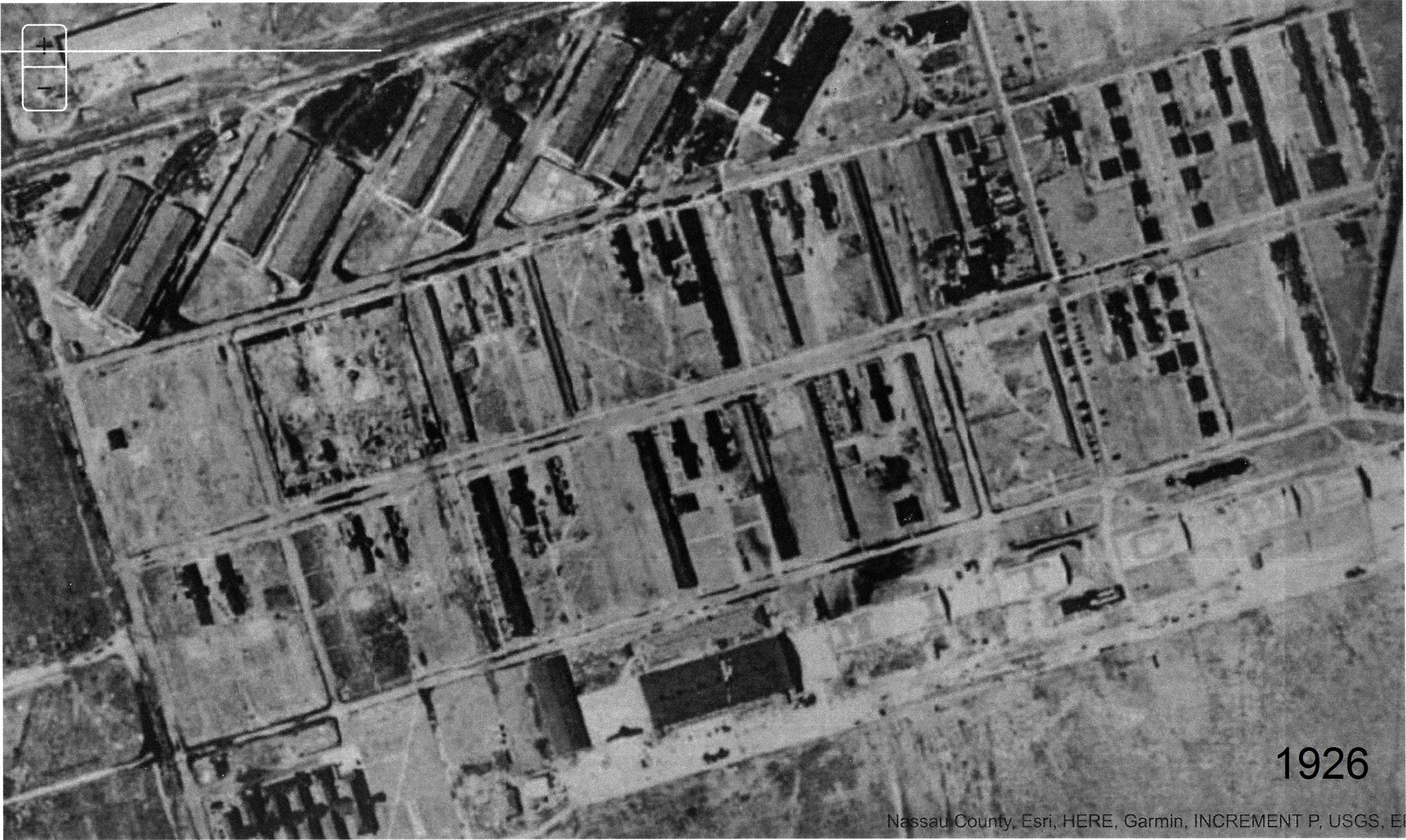
Frank Femenias: Although New York Street is the best guess so far for Lee's childhood street name, I'm not so sure. The 1926 aerial shows remnants of Camp Mill structures in between New York St and Lee's Unknown Road, severing a continuous roadway. Were both roadways named the same? Possibly, but Lee's neighborhood roadways seem of newer construction and could've taken on a different name. Mitchel Field would be reconfigured one year later from this photo. Howard, sending more aerials. What fun!
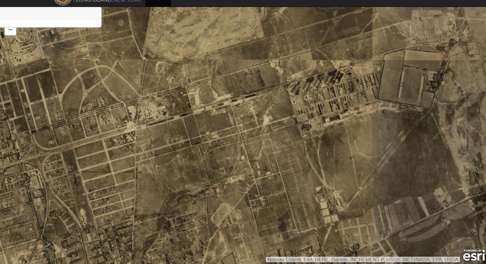
Zoom on Mitchel Field and Camp Mills
New York Street.
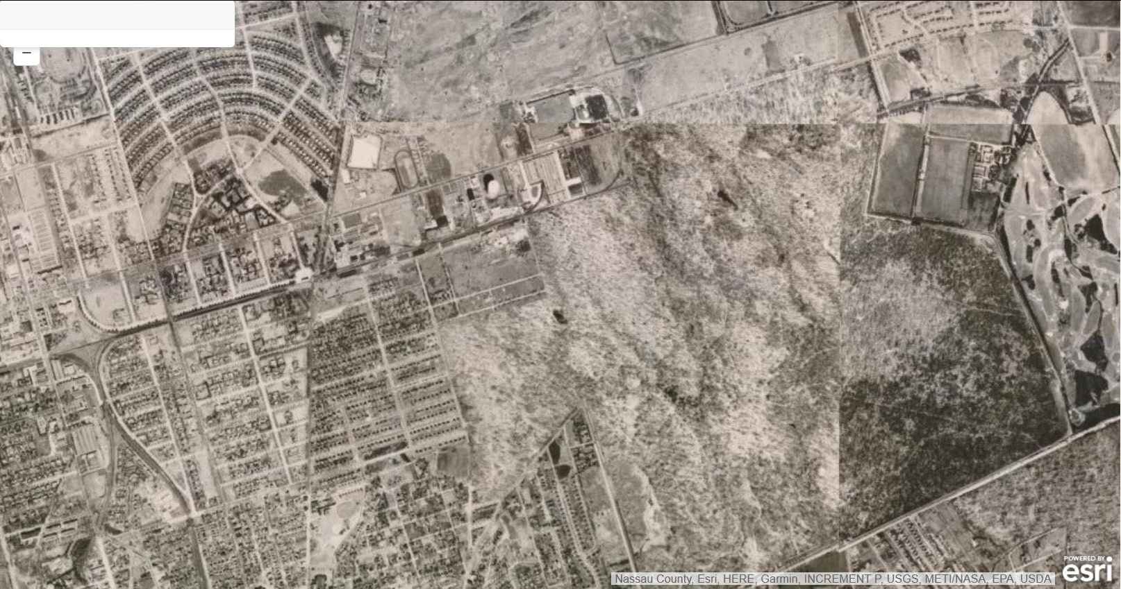
Lee's neighborhood


Comments
Nice work. Would be a fun adventure to walk these sites with all of the knowledgeable members pointing out just where roads, bridges, buildings and other landmarks once stood.
Check out this: https://lrv.nassaucountyny.gov/
Year 1926 Aerial: New York St. and surrounding areas in their former glory.
Year 1950 Aerial: Homes established between Clinton Rd and Oak St. Then it literally looks like a GIANT puzzle piece was removed between Oak St., LIRR, Merrick Ave., and Hempstead Tpke. Most of us know why this area was in it’s then state, but still interesting to view.
We all know what’s here now 😊
Update: A few corrections made to the post.
Although New York St is the best guess so far for Lee’s childhood street name, I’m not so sure. The 1926 aerial shows remnants of Camp Mill structures in between New York St and Lee’s Unknown Road, severing a continuous roadway. Were both roadways named the same? Possibly, but Lee’s neighborhood roadways seem of newer construction and could’ve taken on a different name. Mitchel Field would be reconfigured one year later from this photo. Howard, sending more aerials. What fun!
Update #2: Frank Femenias has added an analysis of a 1926 aerial to the post.
A few follow up thoughts:
1) Judging by the modern day map of Mitchel Field, I would have guessed New York Street would have been opposite Chestnut Street in East Garden City (which was Frank’s initial guess back in September), not Locust Street. Similarly, I would have also guessed that Main Street through Camp Mills aligned directly with Locust Street.
2) It is possible the picture postcard of the entrance to Camp Mills at New York Street and Clinton Road at the Garden City Library, the source of the reference to Locust Street to the bottom left may be incorrect.
3) Bill Bellmer’s posting of the 1918 map shows New York Street crossing Eastward beyond Ave. ‘E’ (later, Oak Street) [just to the left of the two staples on the right] with no indication of the roadway changing its name heading toward the Polo Grounds.
4) In any event, I think it’s safe to conclude New York Street continued at least as far East as West Road, which was as far East as Camp Mills extended (Mitchel Field and Camp Mills overlapped between Oak Street and West Road).
5) In all my years of research, I have never found any evidence to suggest an alternate name for New York Street as it veered Eastward past West Road. Can anyone provide a street map from the post 1919 decommissioning of Camp Mills and the pre 1927 Base Reconfiguration of Mitchel Field? Calling Bill Bellmer!
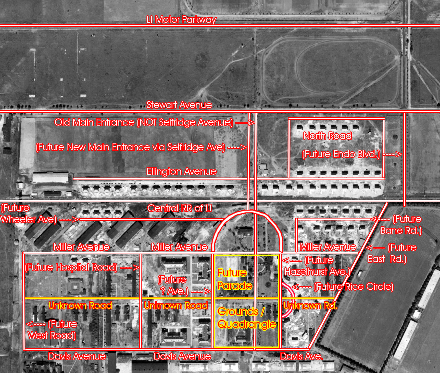
The wooden buildings seen in the general vicinity of what would become the Parade Grounds / Quad are neatly divided by the newer section of New York Street that Frank refers to.
Buildings to the North of NY St. are neatly bordered by Miller Avenue while those to the South of NY St. are just as sharply partitioned by Davis Ave., running parallel along the Flight Line.
It is not out of the realm of possibility that when Miller and Davis were constructed, NY St. may have been widened and/or repaved, consistent with Miller and Davis.
As for the discontinuity of New York Street to the West of that area, it would seem unlikely the two segments were not the same roadway at one time. They simply line up too perfectly to have been two discreet roads. The only question mark is if the Eastern portion went by a different name for which I can find no evidence.
Further bringing into question the validity of the caption of the picture postcard of the entrance to Camp Mills from Clinton Road at New York Street, the first photo Frank posted would certainly suggest the Main Entrance may NOT have been at New York Street at all. Rather, it may have been slightly South of there at the intersection of Clinton Road and Main Street.
Logically, does it not stand to reason that the ‘Main Entrance’ would connect to a road called, ‘Main Street’? Duh! This also supports the indication in the caption that Locust Street would be at the bottom left of the photo in the picture postcard, just as it appears in the aerial photo Frank provided!
Short of a street map of the area between 1919 and 1927, the only real solution is to go out there with a handheld GPS unit and check the latitudinal coordinates of those streets mentioned in East Garden City as well as the corresponding streets still in existence on Mitchel Field, which I plan on doing upon my next visit to the area in August 2019!
I’m with you Lee. This one’s a little tougher than usual. The answer’s out there somewhere. It’s just a matter of time. Stand by
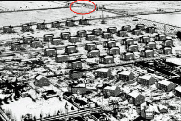
Thought to submit the below aerials showing Panoramic views of Mitchel Field before and during the reconfiguration. The last aerial actually shows the footprint of the road west from the Base Hospital, which was built right over the former road. All courtesy of The Cradle of Aviation Collection.
Aerial photo of Camp Mills. From “Aerial Age Weekly, Nov. 18, 1918”.