Kleiner’s Kolumn: The Long Island Motor Parkway in Maps (Part I)
As a follow up to the November 20, 2019 post showing the Motor Parkway on a 1927 map, here a number of other maps I've collected and/or saved from various newspapers including the The Brooklyn Daily Eagle, Brooklyn Life and The New York Times.
Maps were used to promote the Parkway itself, Long Island or nearby businesses. One was even used to report the location of a crash between a train and a motorist. Pick some favorite maps and comment on what you see! Part II in the near future will provide additional maps.
Art Kleiner
Thru 1914
1907: Notice how the northward branch heads towards Port Jefferson which was home to Dean Alvord's Belle Terre development which used access to the Motor Parkway in its sales pitch.
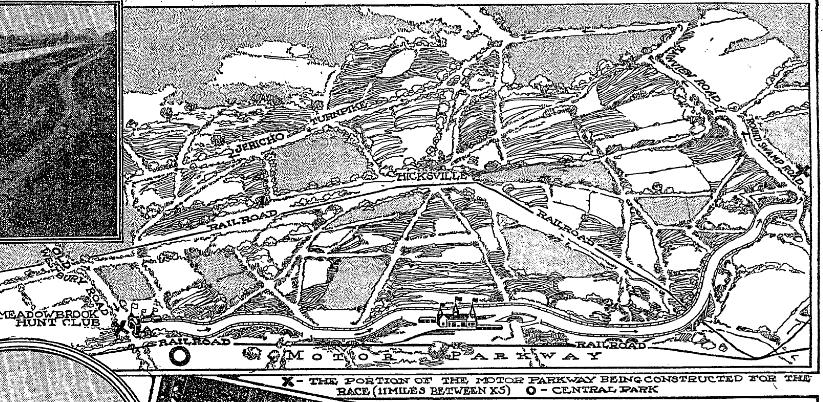
1908: Nice rendering of the grand stand and Deadman's Curve.
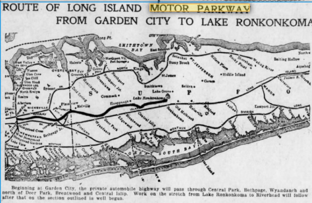
This map is from an early 1900s multi-view postcard booklet published by A. Biren, Brooklyn, NY - "Souvenir Folder of Long Island, NY - The Land of the Sunrise Trails".
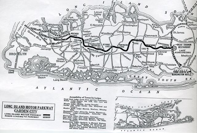
Undated: shows towns and lodges and Petit Trianon
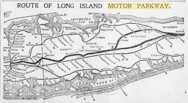
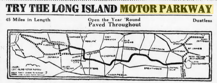
1910
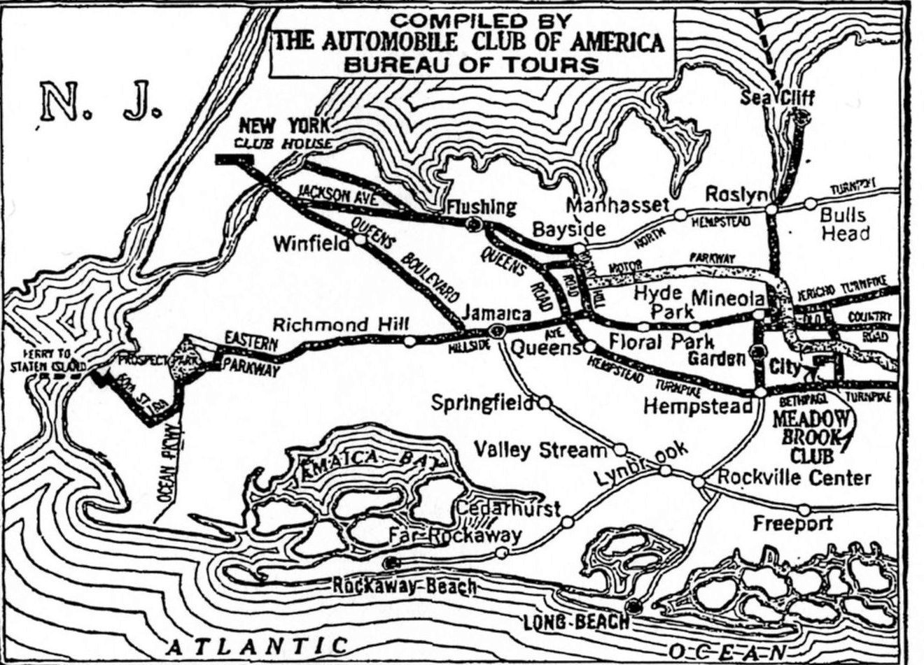
1911
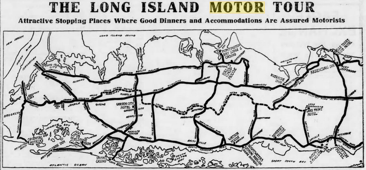
1913: Restaurant and Inns - Eastern terminus at Lake Ronkonkoma shows the Lake Front Hotel
1914: This shows the Petit Trianon once again.
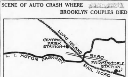
1914: Showing the site of an accident between a car and a train.
1926 - 1936
1926 Socono
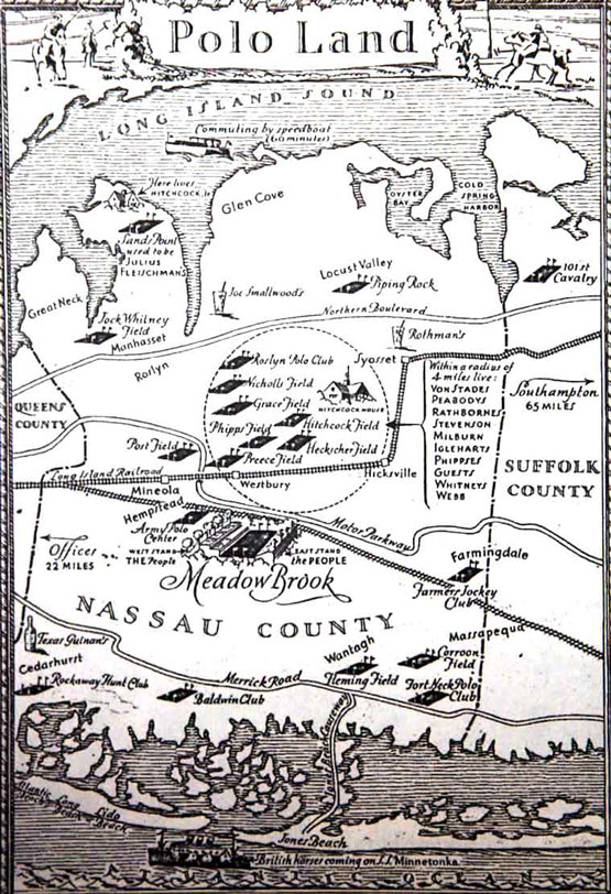
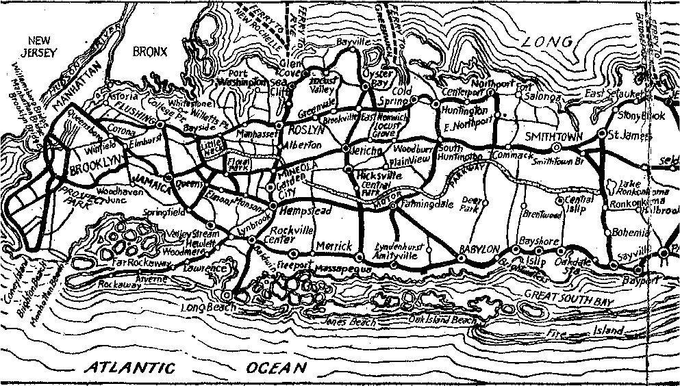
Undated: Long Island was the polo capital of the US and this map shows the relationship of the major polo fields to the Motor Parkway: the parkway was a major route to get to the polo games by automobile.
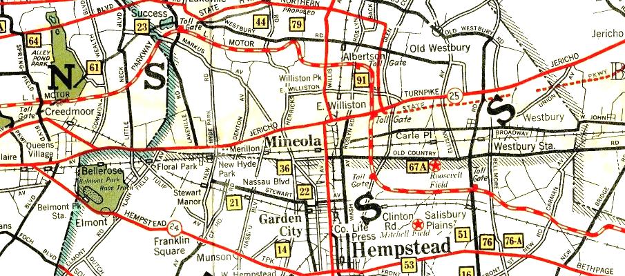
1935 Showing Toll Gates
1936 Socono
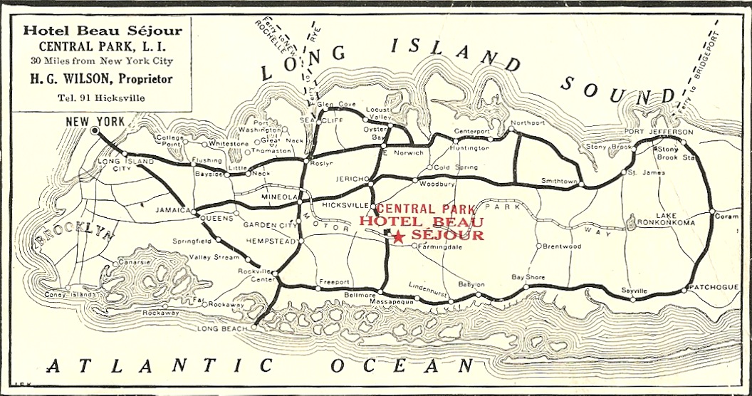
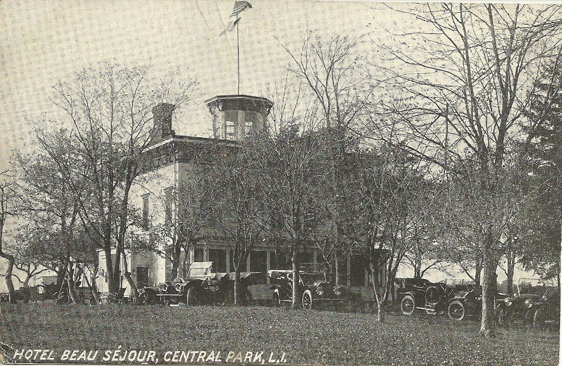
Not sure of the date of this, but it was the reverse side of an advertising card for the Hotel Beau Sejour which was located in Central Park (today's Bethpage) until its closing in 1974.
1939 +
1939
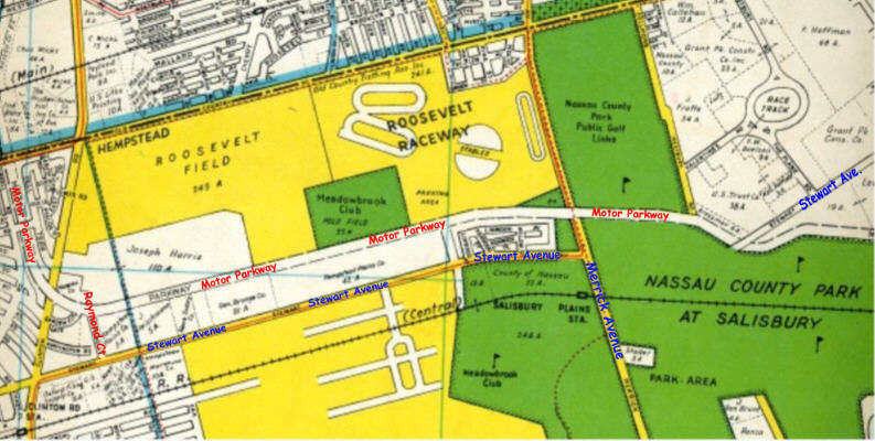
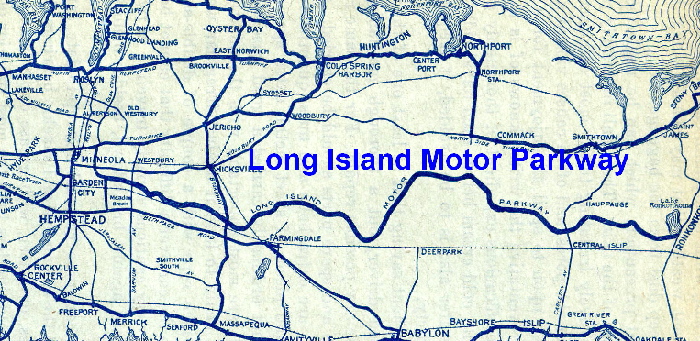
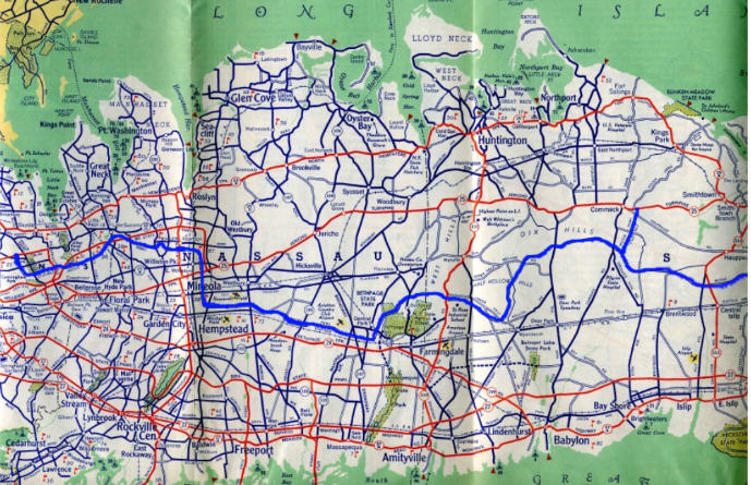
1950 Clinton Ave. in Garden City on the west to Eisenhower Park (Salisbury Park at the time) .


Comments
Great map collection Art! Regarding the undated maps, I believe the top map is 1926 or after - showing the western terminus at Nassau Blvd. The middle is 1911 or after - showing the Motor Parkway traveling west of Lakeville Rd. The bottom is also 1911 or after - showing the western terminus at Rocky Hill Rd. This collection of maps must’ve taken some time to acquire. Thanks for sharing these
Neat maps Art!
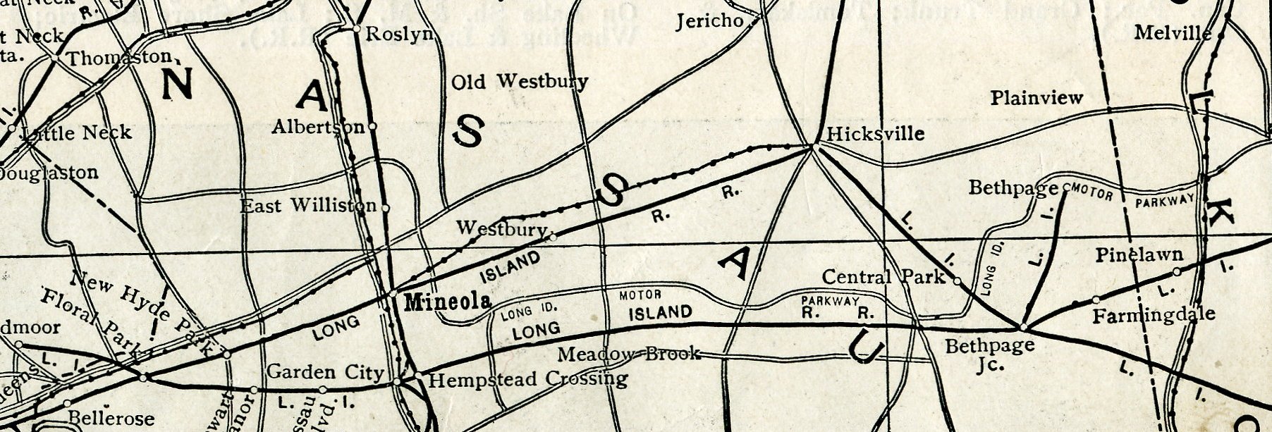
The 1911 maps display the Trolley Lines that the parkway bridged over - Willis Ave, Future Westbury Ave, and Broad Hollow Rd. Think the Hempstead Spur that was planned ( south to Hempstead Tpke, Garden City ) is shown, I don’t think it became a reality.
On the 1935 maps, I think the ‘Yellow Squares w/Numbers’ are highlighting Golf Courses.
The Beau Sejour map shows the parkway terminated near Lake Success, so maybe dated 1910+
Nice catch on the 1911 Hempstead Spur Brian! I overlooked it. On that map the parkway terminated at Lakeville Road.
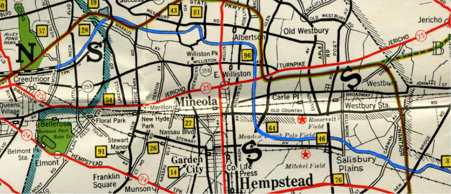
Art, any chance to get the circled street names of the 1950 map below, particularly the one with the pointed arrow? This could be the street name that Lee Chambers of Garden City was searching for while living his childhood at Mitchel Field. Any help identifying the street name(s) in this area would be appreciated.
1950 map
Brian, I believe the yellow boxes are golf courses but will confirm when I get a chance to pull the map out.
Frank/ Lee - does this help?
Chestnut St. pops up again! I was testing the waters if anything new appears in the long search for Lee’s childhood street name. New York St. remains the top contender. Thank you much Art, and Bill Bellmer too for your assistance!!
http://www.vanderbiltcupraces.com/index.php/blog/article/in_search_of_the_mystery_camp_mills_new_york_road
Art, Frank, et al,
Yes it does help. It’s clear the extension of Commercial Avenue east of Oak Street led to the western entrance to the Base.
It would appear that Chestnut Street in East Garden City also continued eastward through the Base but likely changed its name after crossing Oak Street, most likely New York Street. Traveling eastward, that’s the street that bisected the yet to be created Parade Grounds as part of the 1927-1932 Base Reconfiguration with Miller Ave. running parallel to it to the north and Davis Ave. doing the same to the south of NY Street.
My next visit to LI, I plan on bringing a handheld GPS unit with me to verify which streets in East Garden City align with those on the Base.
Art - a clue re Beau Sejour - “Hicksville 91”. Four digit numbers (without exchnges) were around by 1935 or so. Shouldn’t be too hard to find out when the 91 phased out. Sam, III
Lee - no need for GPS - see attached; they basically do NOT line up. Sam, III
Brian - confirmed - yellow boxes are golf courses. See attached. The key to the map also denotes aviation fields, state parks, yacht clubs and cities, towns and places.
Sam - It does line up. Lee’s house was located in the center of the semi circle where the red line travels through
Frank - that’s quite different from Lee’s “street” aligning; the house location you describe is not only deep in Officer’s Territory, if it’s the center house on Rice Circle, it was, as I recall, the CO’s house. Even behind it, on Harmon Avenue, was Top Brass housing. From this and the the 05 Sep 2018 blog pic, I would guess that Lee’s dad was Dr. George F. Chambers, Pres. of NCCC (and other such - as at U. Pitts.), which would account for the residence. This is one of those multi-faceted threads I love so dearly. Sam, III
Sam - correct again, Rice Circle where Lee once lived.
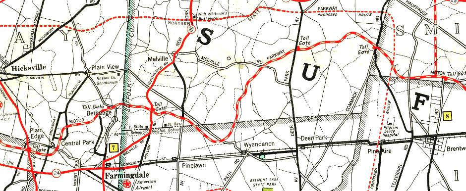
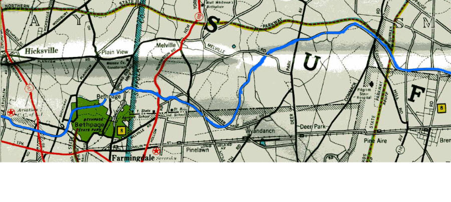
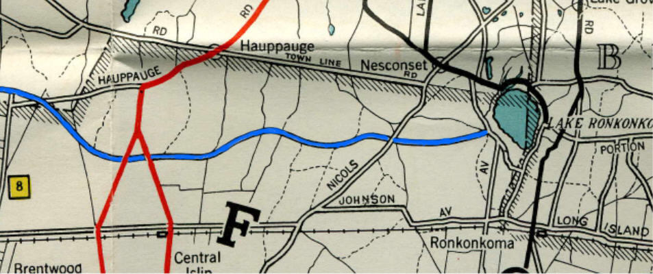
I was looking at USGS Topo Maps of the LIMP etc. Happened to notice a “creative route” of the motor parkway in the Central Islip area on the Year 1919 map. For comparison, below is the 1904, 1919 and 1947 maps. On the 1919 map, the parkway is north of Bridge Rd ( rather than south of ), and the curves aren’t right. Thought this was interesting ????
I see what you mean, Brian. Maybe the topographer in 1919 was having a rough day (or feeling the effects of a joyful previous night). Thanks for highlighting.
Brian, As you noted, Bridge Rd. ran along side the north side of the Motor Parkway. There was a Highland Ave along the southside of the Parkway in the same area that ended at Joshua’s Path. At one time the three roads ran side by side by side; Today the western terminus of Bridge Rd. is just east of Joshua’s Path. Before the construction of the L.I.E. the western terminus was north of the L.I.E and just west of Caleb’s Path, It appears that the section of Bridge Rd., between Caleb’s Path and Joshua’s Path was done away with or incorporated into the Parkway.