Kleiner’s Korner: William Geiger’s Motor Parkway Property in Wyandanch
William Geiger owned much of the property near the Motor Parkway in Wyandanch in Suffolk County however, two of the projects relating to the Parkway never materialized, a farmway bridge and a golf course.
Art Kleiner
The Farmway Bridge Never Built
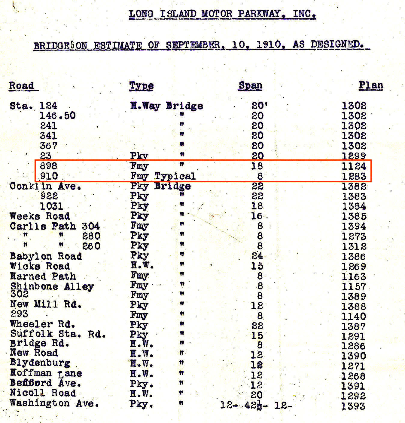
Farmway Bridges were erected to connect a landowners' property that was bisected by the Motor Parkway. Several were meant to be built as shown on this 1910 document prepared by the Motor Parkway. However, many were not built, including one to be built on the Geiger Property.
A general view of the Wyandanch site in 1952.
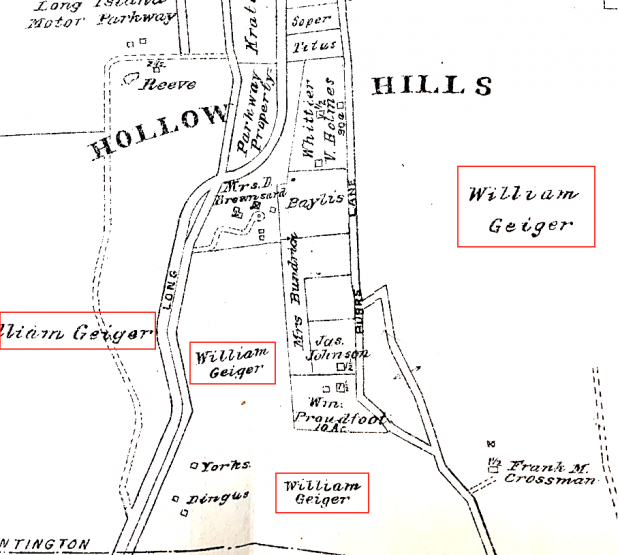
This is the area of William Geiger's property in Wyandanch which was on both sides of the Motor Parkway. Geiger was a prominent real estate investor whose developments included Wheatley Heights Estates and Colonial Springs Park. The Town of Babylon Geiger Park is named after him. (E. Belcher Hyde, 1909)
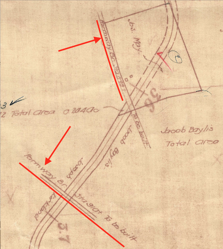
The 1910 Motor Parkway Survey Book shows Farmway Bridges near stations 898 and 910 to be erected on the property near Jacob Baylis and Joseph Kirkland, north of Geiger's property. Conklin Avenue would be to the right of the Motor Parkway.
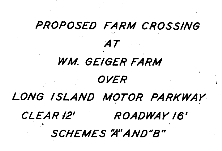
This 1929 survey indicates a proposed farm crossing at the Geiger farm.
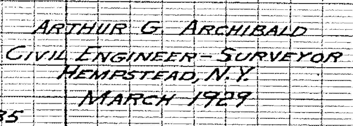
The survey was conducted by Arthur G. Archibald, Civil Engineer and Surveyor.
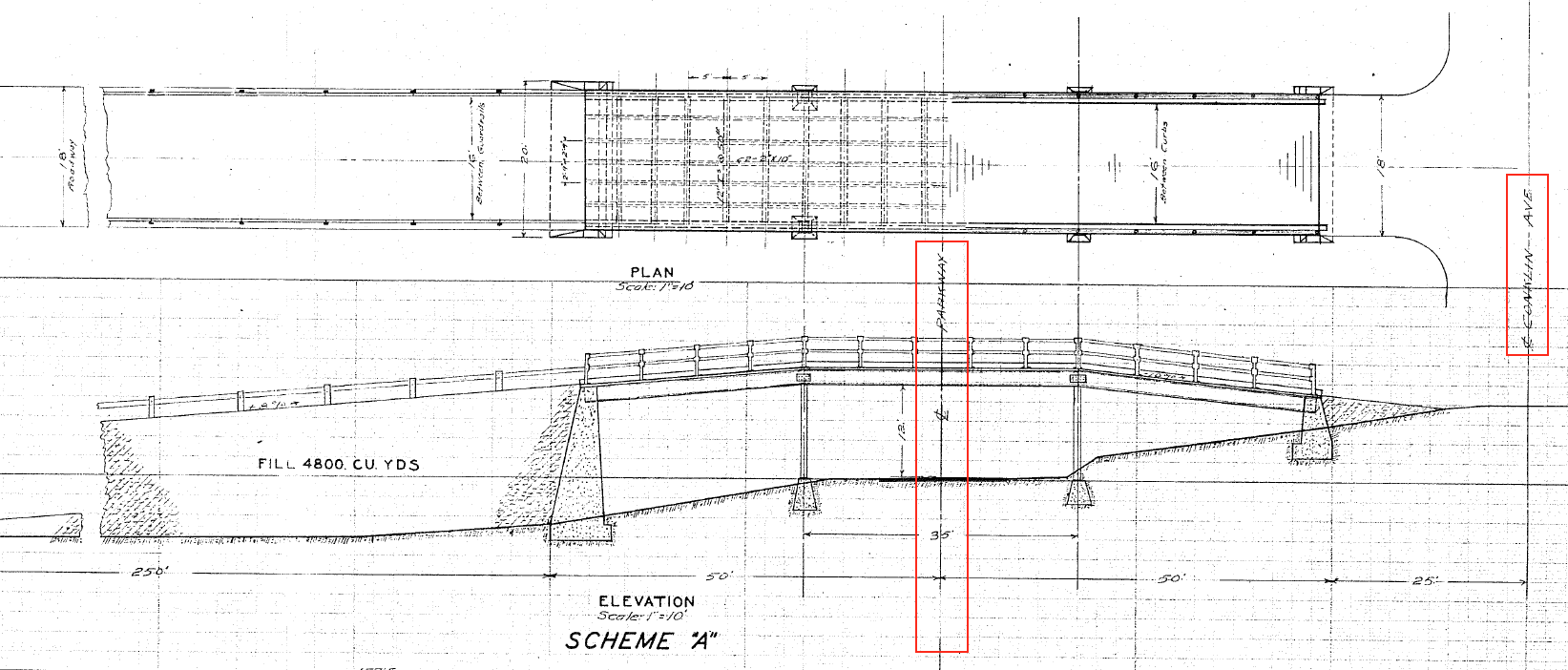
Two "schemes" were proposed for the Farmway Bridge: "A" and "B" with different construction and cost estimates for each. Which scheme in your position would be most adviseable? Why? Here is Scheme "A".
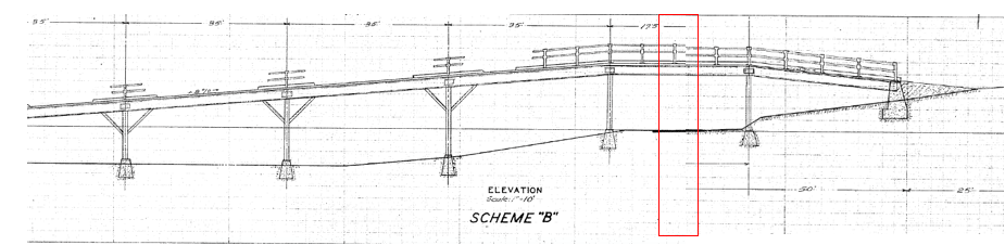
Scheme "B"
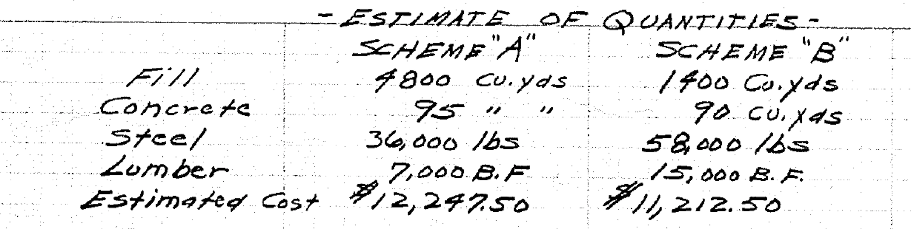
To guide your decision, here are the different estimates for each.
The Gieger Golf Course That Never Materialized
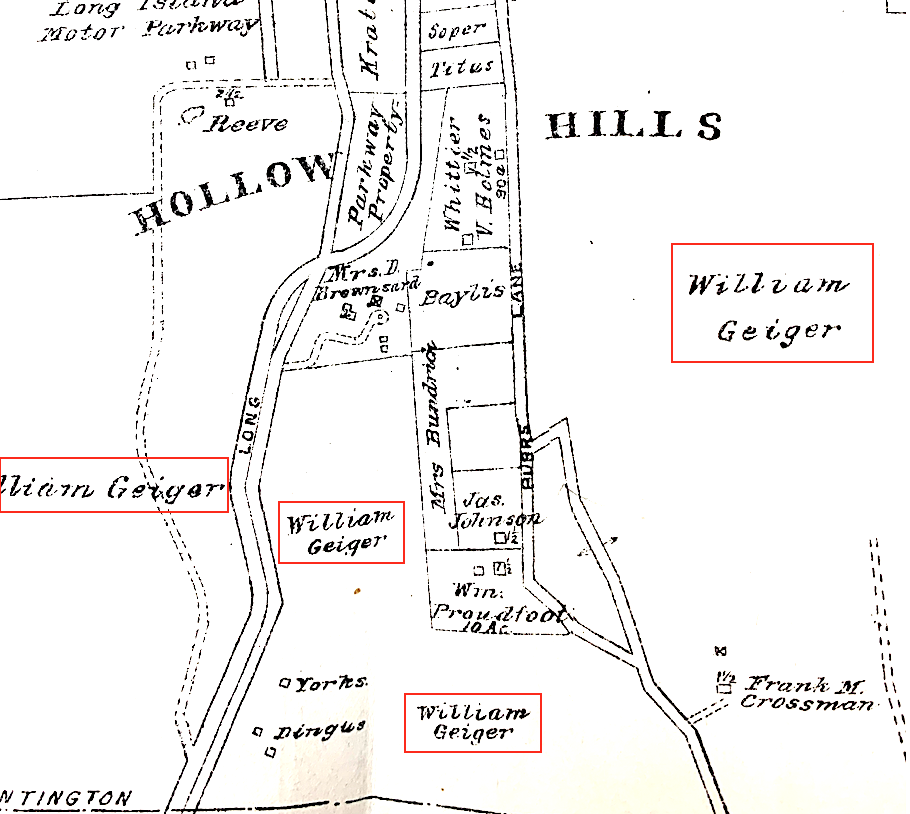
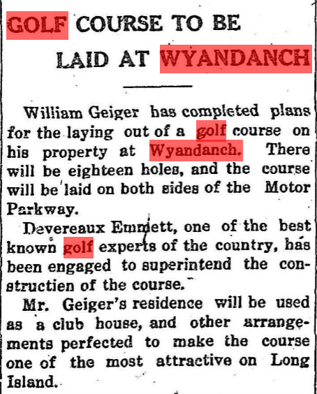
As shown on this 1917 map, William Geiger held a large amount of property on both sides of the Motor Parkway, large enough for an 18 hole golf course. Several newspapers reported a course was being planned.
Premier golf expert Deveraux Emmet was engaged to lead construction. Emmet was the key designer of several LI courses including Bethpage, the Garden City Golf Club, Brentwood Country Club and several others. (South Side Signal, Nov. 17, 1916)
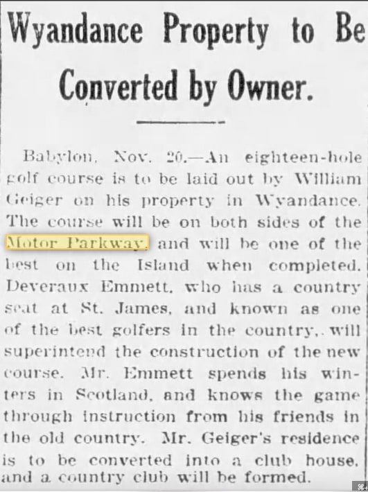
Geiger offered his residence as a clubhouse for a country club which was to be formed. (Brooklyn Times Union Nov. 17, 1916)
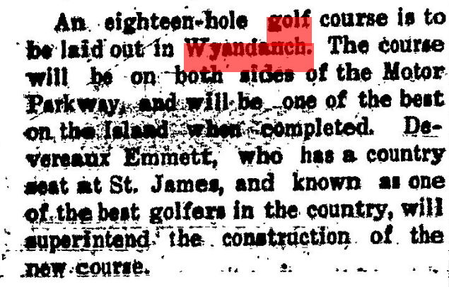
Unfortunately plans seemed to not have worked out for the golf course as it was never built. (Southampton Press Nov. 30, 1916)


Comments
Even though this area is literally impossible to explore in the warmer months, it interests me the most due to portions of the parkway existing. Correct me if I’m wrong, but I’m thinking the farmway bridges were going to be over the parkway south of Conklin/Bagatelle Rd? Guessing Conklin was a narrow dirt road then, and maybe the bridges would’ve spanned over Conklin too. Maybe not, Conklin may have acted as a connecting farm road rather than a strictly north & south thruway.
I’ll have to put myself in that time period and go Scheme B. Whole lot more of dirt and work is required for the slope in Scheme A. Present day explorers would prefer Scheme A, maybe leaving us evidence of the past bridges.
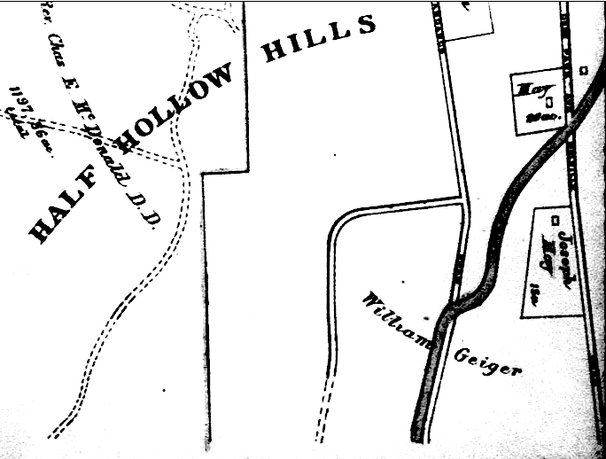
All maps indicate the property in question was not in Wyandanch at all, but north of the Huntington/Babylon Town line. Hence, in Melville, Huntington, if I’m not mistaken. Can you verify?
Thanks Brian, yes quite hard to explore - see my pages for my travels there.
https://limparkway.webs.com/wyandanch.htm
https://limparkway.webs.com/bagatelleroadeast.htm
Bill - I see what you mean, but this 1915 map shows Geiger’s property extending south of the town borders. Perhaps the farmway bridge was intended to be in Huntington and the golf course in Babylon. Thanks for the note.
Just noticed you mentioned that Conklin would be to the right of the LIMP, Art. So the bridges would’ve been just south of the intersection of Conklin & LIMP. Below is the 1928 Motor Parkway Atlas showing mostly the Town of Babylon side.
Thanks for the 1928 map! I have a photo (somewhere) of the Colonial Springs Road bridge before it was demolished. In the woods on the north side (years ago) you could still see the fill that was used to raise the incline toward the bridge abutments (next to and behind the VFW hall). I live off Bagatelle and near the Town line in Wheatley Heights and have walked most of the LIMP in the area. Where the LIMP runs on the west side of Conklin/Bagatelle north of the Huntington line, one homeowner took the LIMP ROW as their own and put up fences cutting it off. Likely, illegally. Where the LIMP crosses to the east side of Bagatelle, I assume, there was never a bridge constructed. Is that one of the “farmway” bridges you refer to that was never built? I’m a bit unclear as Bagatelle (Conklin) was not a farm road. Thanks for all your good work on this.
Art, the farmway bridge list, the bridge at sta. 898 is listed with an 18’ width. The1910 Parkway map shows it is much wider than the standard 8’ width farmway bridge planned at sta. 910. It is labeled “typical” so I don’t think the 18’ designation is a typo. My guess ? The Parkway planned to bridge the “dip o death” crossing at Burr’s Lane in short order.
If you’re still paying attention here and live nearby Bill, I’m thinking of area known as Butterfly Park just north of the substation. Remember walking the LIMP with someone and noticed the home down below us to the right. Kind of felt we were walking through their property so we didn’t proceed as far north as possible. Now I realize this was really parkland, probably until one reaches the home that extended their fence over the ROW. Realize there’s a sump too that maybe severed the ROW.
I’m with you. I know the Butterfly Park area. I, too, remember walking the ROW there with someone many, many years ago Maybe it’s us! Do you know anything about the LIMP crossing of Bagatelle? I assume without a bridge.
Likely planned, but not built. Financial reasons mostly. Lots of warning signs at intersections, maybe traffic lights eventually?