Long Island Motor Parkway Bridge Series:#23 Roslyn Road Parkway Bridge in East Williston
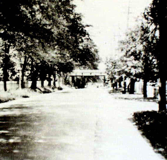
The 23rd bridge in the series documenting the 65 bridges built by the Long Island Motor Parkway is the parkway bridge over Roslyn Road in East Williston. Thanks to Motor Parkway legend Sam Berliner III for providing this ground image of the bridge.
Enjoy,
Howard Kroplick
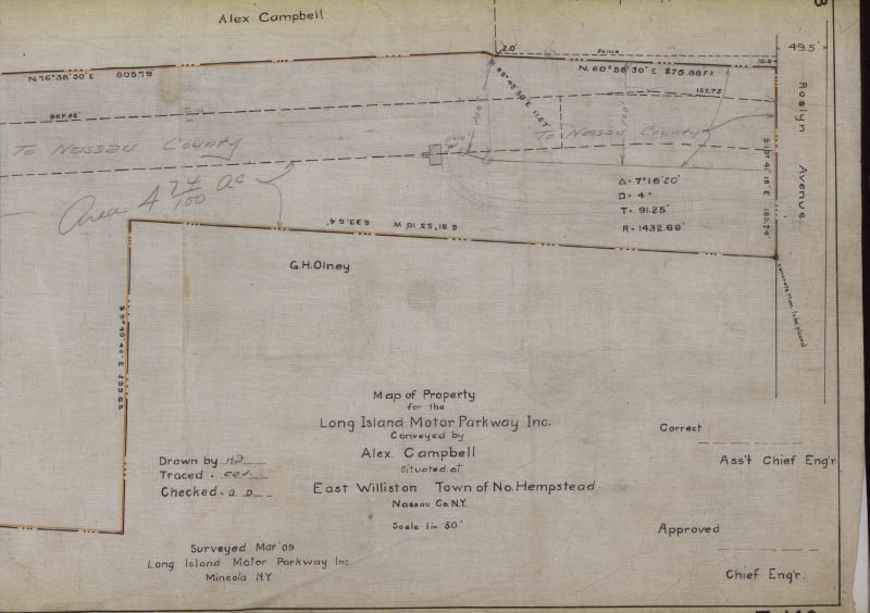
1909 Surveys
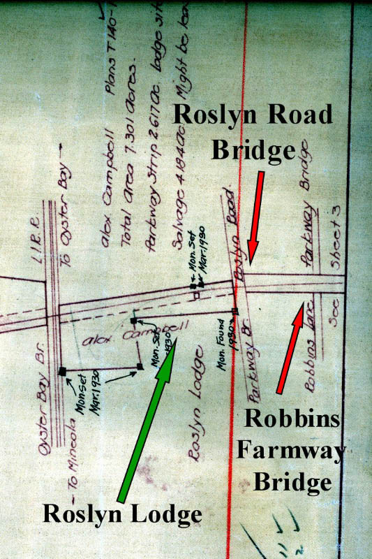
These 1909 surveys show the property built around the bridge was purchased from Alexander Campbell (west) and Richard H. Robbins (east)
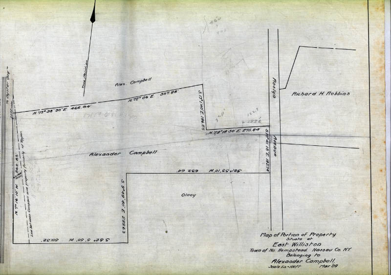
The penciled notes on this survey shows the location of the Roslyn Lodge off Roslyn Road. Another note indicates the property west of Roslyn Road went "to Nassau County".
1923 Belcher-Hyde Map
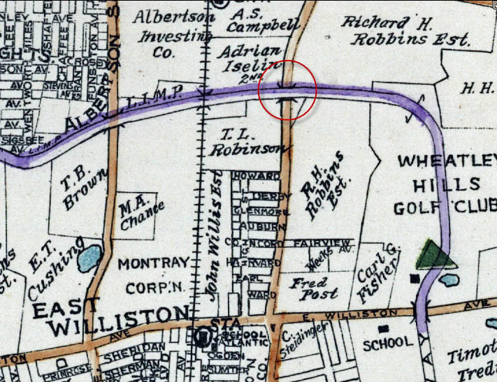
The location of the Roslyn Road Bridge.
1927 Photo
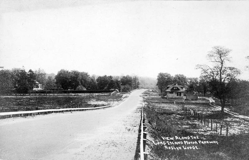
A view looking east towards the Roslyn Lodge and the Roslyn Road Bridge.
The same view as seen in 2007. Note the 3-foot concrete extensions on both sides of the parkway.
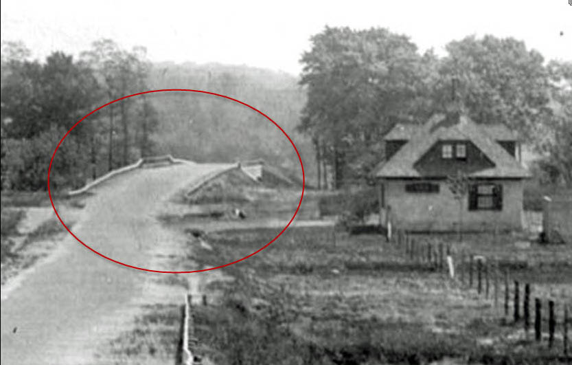
A close-up of the Roslyn Road Bridge and the Roslyn Lodge.
1928 Motor Parkway Atlas
The Motor Parkway purchased a total of 10.5 acres from Albert Campbell with only 2.6 acres used for the parkway and 0.5 acre for the lodge.
1929 Photo
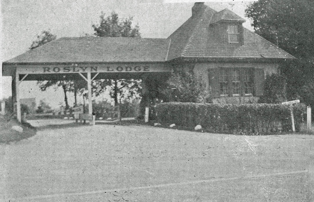
The Roslyn Lodge looking south.
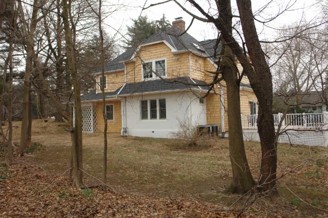
The same view in 2007 with the Lodge converted into a private residence.
1930s Photo

A view looking north. Courtesy of Motor Parkway legend Sam Berliner III.
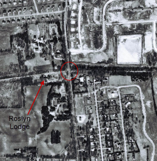
1950 Aerial
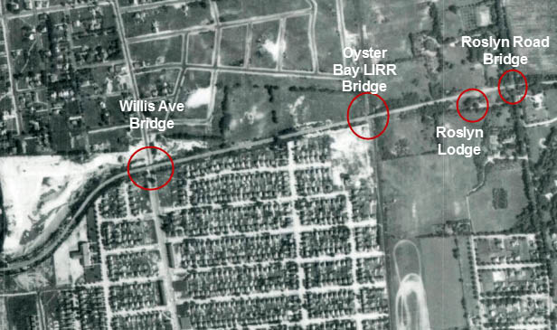
The bridge was taken down soon after the Motor Parkway closed in 1938.
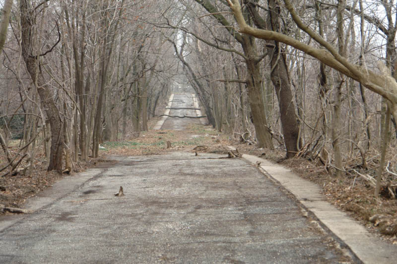
Current Views
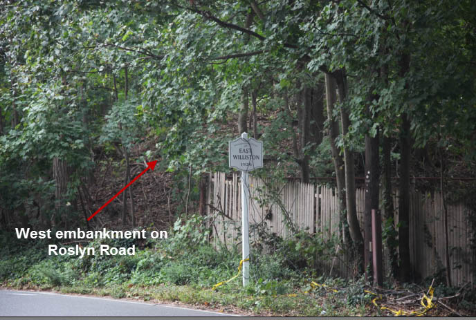
The west embankment of the bridge is still standing!
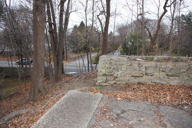
The concrete wall at the top of the embankment was constructed after the bridge came down.
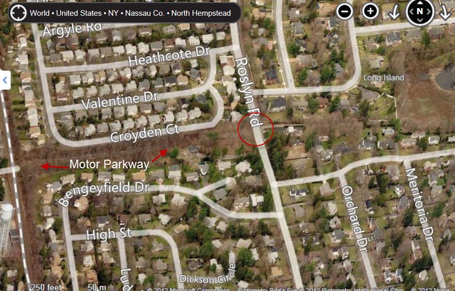
A Bing "Bird's Eye" view of the location of the Roslyn Road Parkway Bridge.


Comments
As always, nice work Howard. I’ve walked down the driveway that leads to the Roslyn Water District many times (For work purposes). I had no clue there was a farmway underpass in this area. If you look right as you walk towards the district, a portion of the LIMP is upwards(private property).
This is just amazing. it would be awesome if was still in use
I love this as it is on my street and I’ve taken many students and visitors there. I used to ride along the Parkway on my bike as a kid when the bridge over the LITT was still there. What happened to the idea of restoring it as a bicycle path?
Love the photos you put up Howard ~
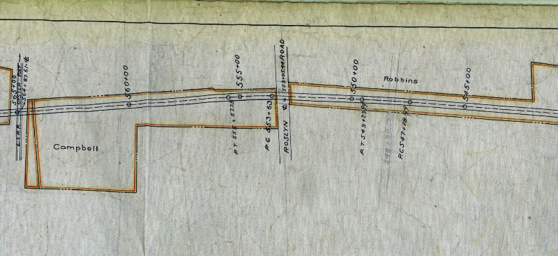
This comment is intended for the 11/7/12 blog LIMP bridge series #24 Robbins La Pkwy bridge. I’ve been poking around the ” lrv.nassaucounty.gov ” website, the land record viewer has 1926 and 1950 Nassau County aerial maps, displaying our favorite pkwy of course. This pkwy bridge is about 0.9 miles E/O Roslyn Rd ( which ends up being the R/O #30 and 31 Robbins Dr, which is also where the existing LIMP roadbed is “severed”). Your footage estimate is on mark, Joe Oesterle. Like I mentioned before, working for LIPA at the time; I’ve walked down that driveway many times towards the water district inspecting the towers, etc. Could never resist the urge to scale the slope upwards to the LIMP roadbed. I guess the residents didn’t want a bridge in their backyards. If I lived there, so would this bridge.
Came back to correct myself. I previously stated that if the Robbins Lane Pkwy Bridge still existed, it would be in the R/O #30 and 31 Robbins Dr. The bridge would actually be in the R/O #19 and 23 Robbins Dr.