Long Island Motor Parkway Bridge Series #56: The Ruland Road Parkway Bridge in Melville
The 56th bridge in the series documenting the 60 bridges built by the Long Island Motor Parkway is the Ruland Road Parkway Bridge in Melville.
The bridge was built around 1910 over Ruland Road, which was then called the Melville and Farmingdale Road and the Melville Road.
Enjoy,
Howard Kroplick
May 1910 Survey
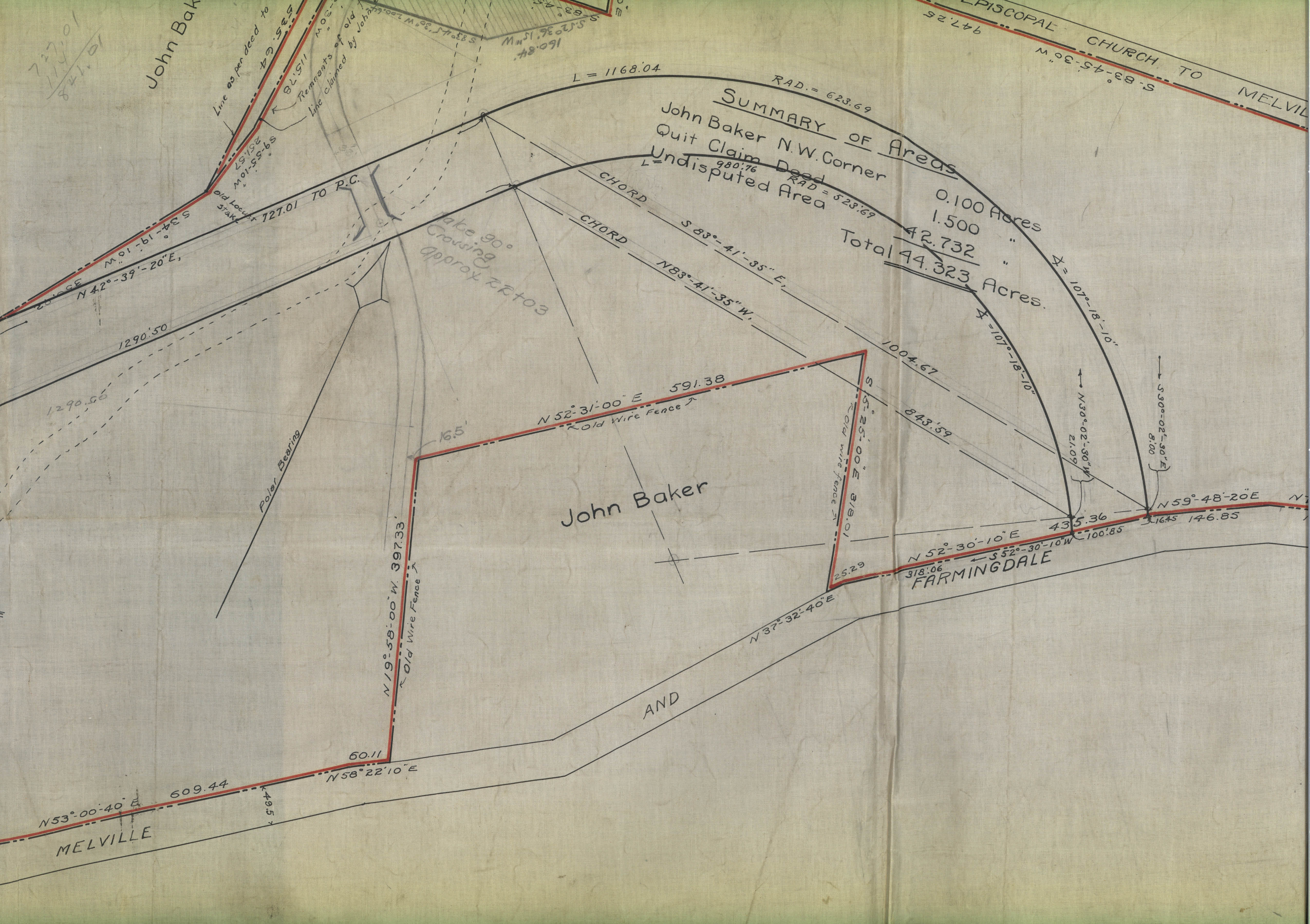
The northern enbankment of the bridge was built on the former property of Ezekiel Smith. The entire 44-acre Smith farm was purchased by the Motor Parkway to build this section in Melville.
1928 Motor Parkway Atlas
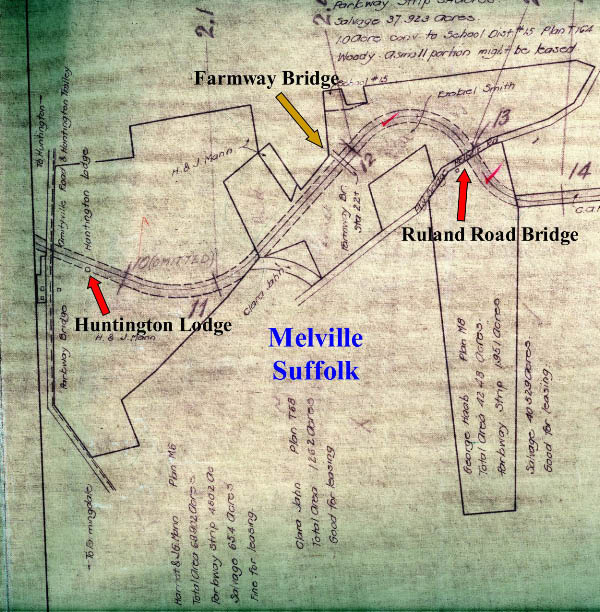
The notation on the Atlas read:
Total Area: 44.323 acres
Parkway Strip: 5.4 acres
Salvage: 37.923 acres
1928 Aerial
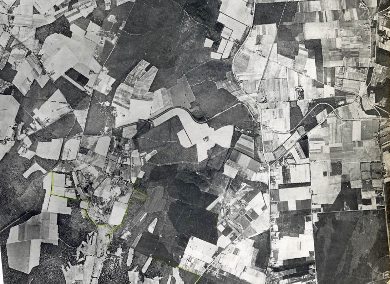
A spectacular aerial of Bethpage, Old Bethpage and Melville. The Motor Parkway can be seen approximately in the middle of the aerial.

A close-up of the Ruland Road bridge.
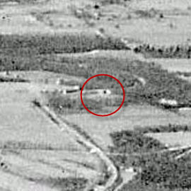
February 3, 1930 Aerial
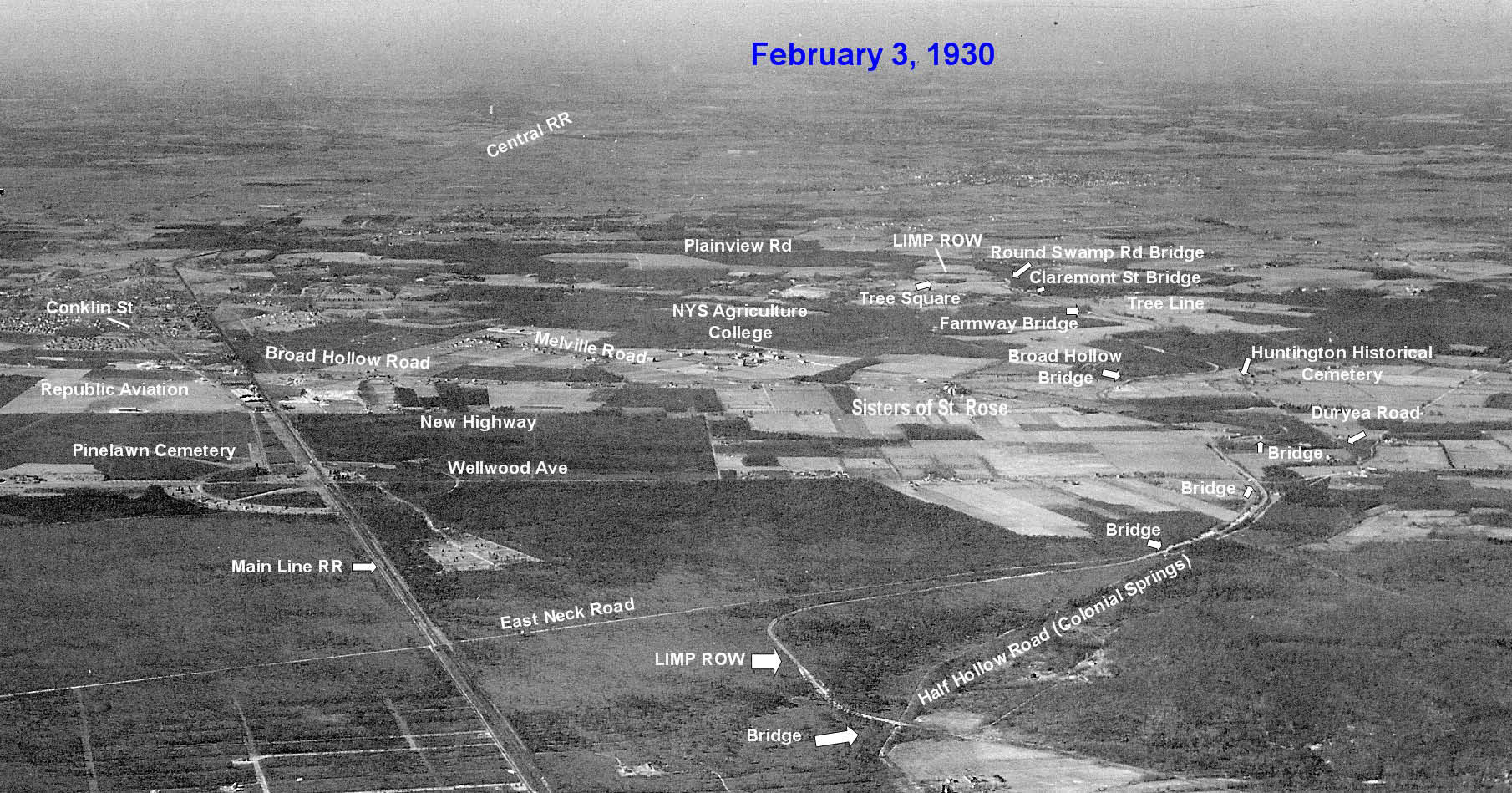
Look very closely and you can see eight Motor Parkway bridges.
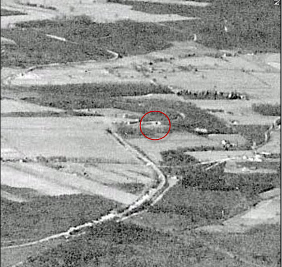
A close-up shows the Ruland Road Bridge.
1953 Aerial
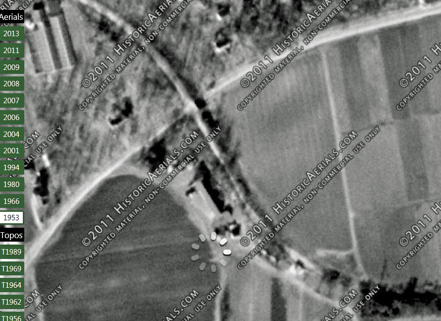
1955 Aerial
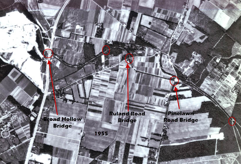
It appears that the bridge was taken down by 1955.
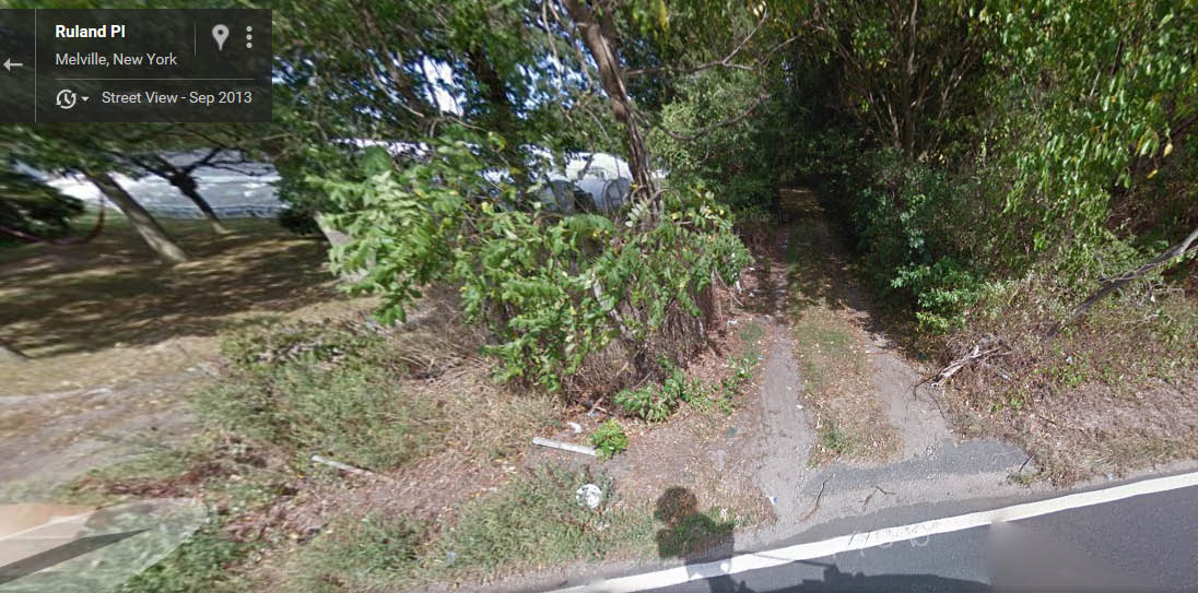
1980
By 1980, only a path to a nursery marked the location of the bridge. Courtesy of Ron Ridolph.
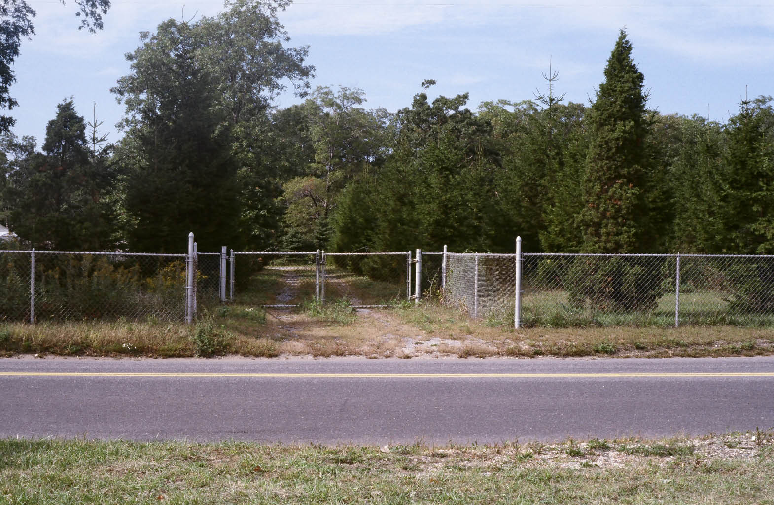
2013
The bridge's location as it looks today.
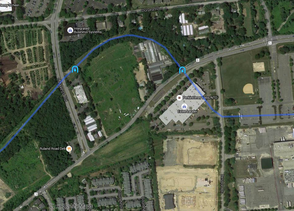
Check out Wayne Consolla's online Motor Parkway map, to find the location of the Ruland Road Parkway Bridge.


Comments
I worked in that building on Ruland Road that the bridge/parkway is shown as crossing through. Funny but, I walked into that building every day not knowing I was following the path of motorists of the past!