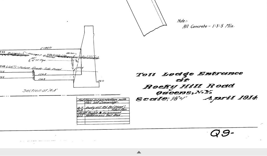
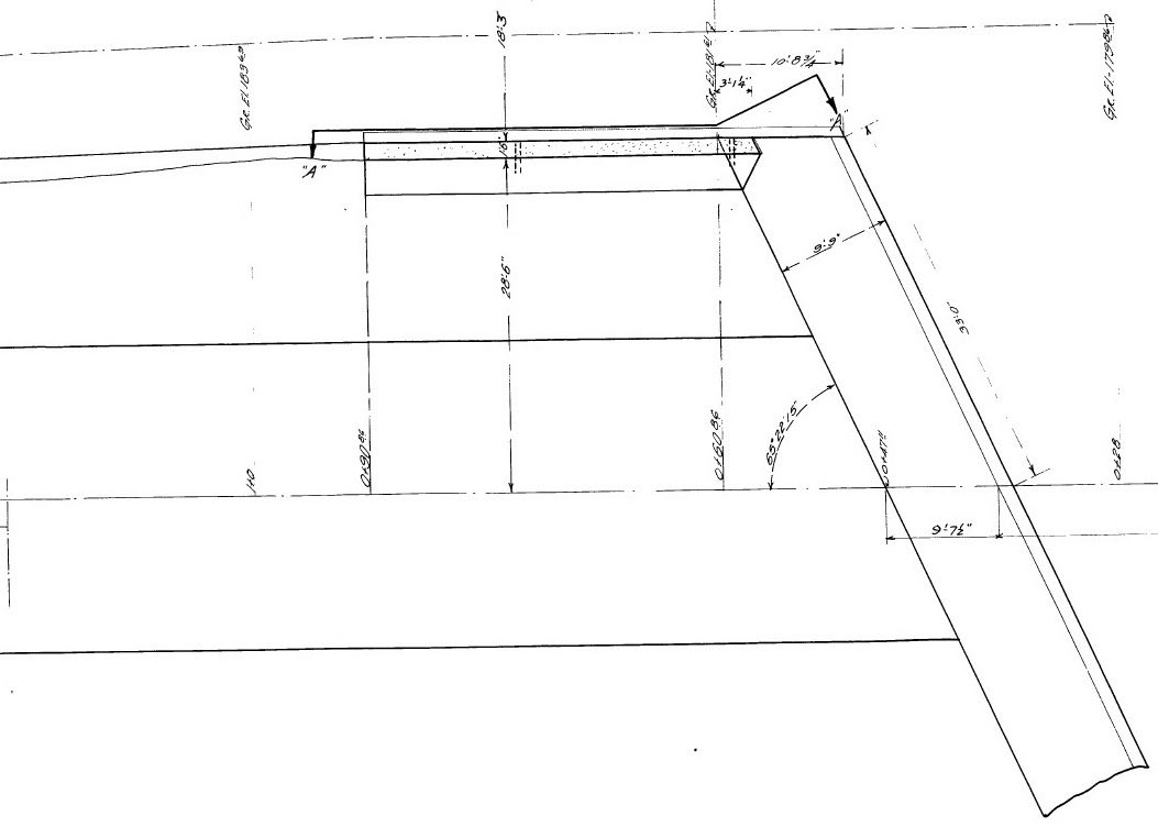
Malverne Treasure #5: Survey of “Toll Box” and Entrance/Exit Lanes at Rocky Hill Road (April 1914)
Over 200 Long Island Motor Parkway surveys, maps, blueprints, documents and drawings discovered by Roy Knoernschild in a Malverne basement in February 2017 are being categorized, repaired and scanned. This April 1914 Motor Parkway survey documented the then Western Terminus at Rocky Hill Road, Queens (Springfield Boulevard).
Enjoy,
Howard Kroplick
April 1914 Survey
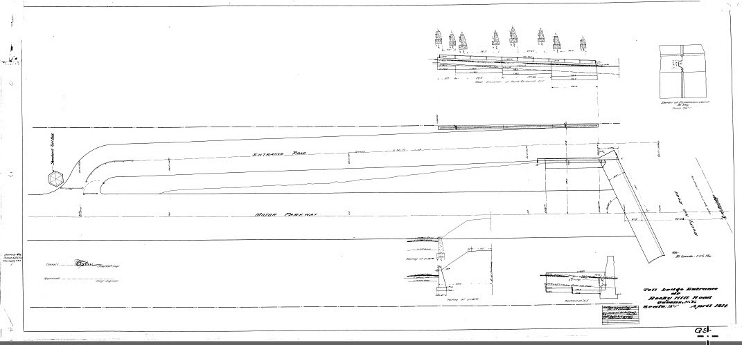
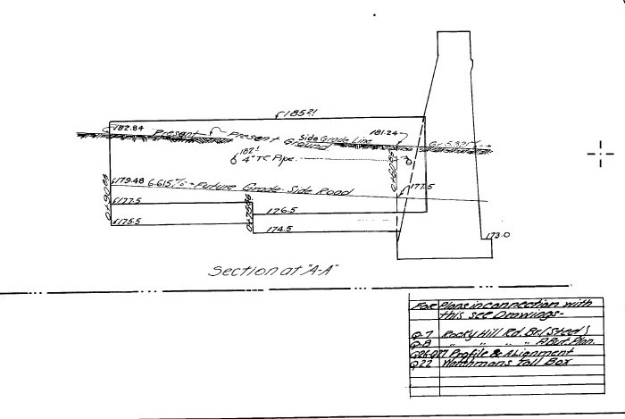
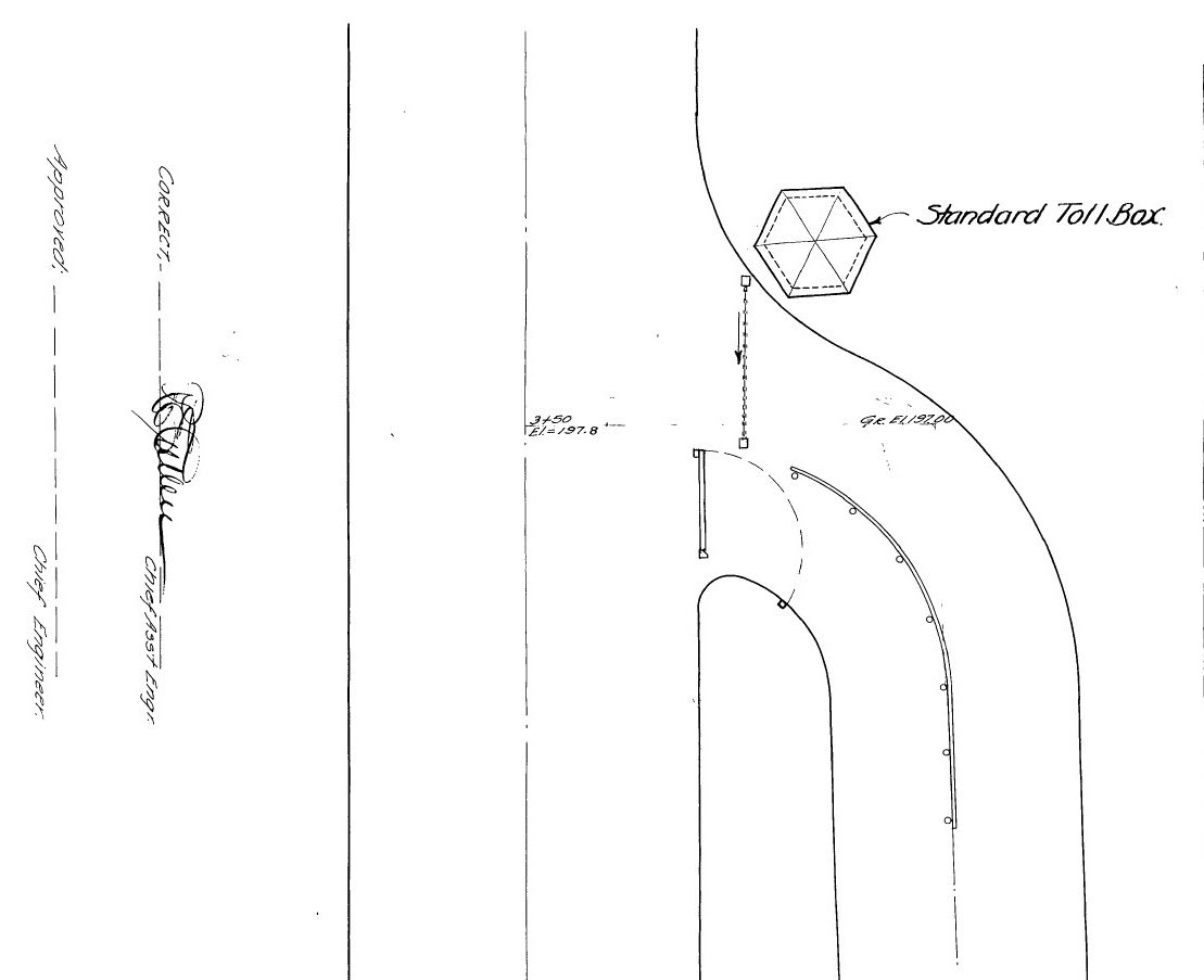
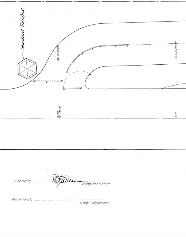
The lodge was referred to as a "Standard Toll Box". Note: a two lane entrance/exit was planned.
There is no documentation that this "toll box" or two-lane entrance/exit was ever built.
New York City Aerial-July 15, 1924
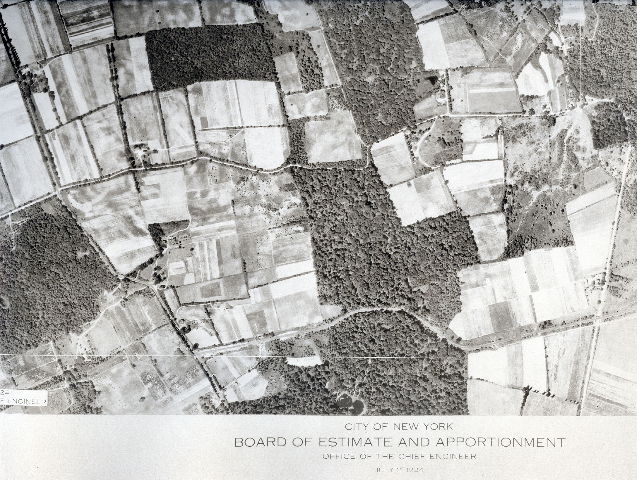
Rocky Hill Road can be seen heading north on the left. The Motor Parkway is across the bottom.
No real sign of the entrance/exit lanes.
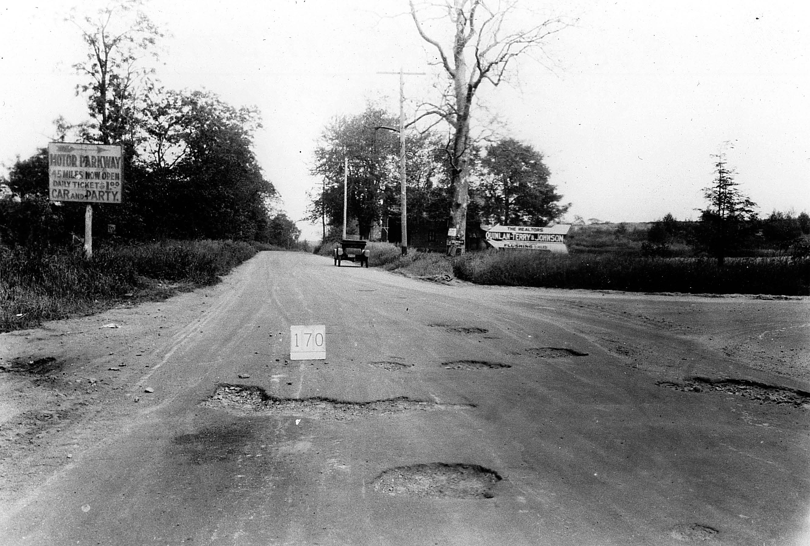
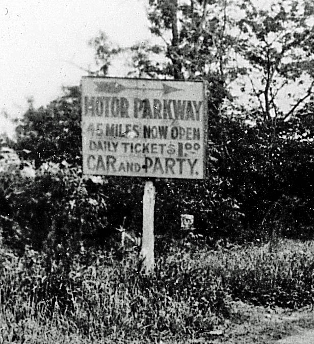
Ground Level Image


Comments
Great historic photos as it was. These shall come in handy someday with further findings of the historic roadway. Thank you Howard for preserving these gems.
The survey depicting the single two-lane ramp was likely a proposal before finalising on the two ramp system. How chaotic it would have been to squeeze two vehicles on that narrow ramp which is still evident today, especially when the entrance once served as the western terminus.
What a great shot looking down the ramps! Now why didn’t I think to do that (or did I)? It shows just how the ramps were arranged better than any plan or map. I now remember questioning in an early blog post how one entered or exited from an opposing ramp; I still wonder - sounds awfully dangerous. Just for examples, how did you go west from RHR or exit E/B on the LIMP to RHR? U-turns? Sam, III
Great questions Sam! I’m sure those odd maneuvers were attempted/challenged by the locals at least. In either scenario, a u-turn would’ve resulted in multiple reverses at the plaza, just to execute the turn, with the limited turning radius of the cars of those days. On the other hand, executing this maneuver in front of the gate keeper would be deemed cheating the roadway, especially with non-existent toll booths in between the two points. And I’m also sure the locals knew when the gatekeeper was not present at the booth, so to execute the “quick” shortcut. But one main problem still remains. When exiting the LIMP at HHB westbound, only eastbound traffic access was available, not westbound. I believe most travelers (not all) would’ve been seeking eastbound instead to head towards the city.
Frank, HHB wasn’t divided then; why wouldn’t W/B motorists simply make a left turn? Sam, III
Sam - I now believe you are correct. I was under the impression Nassau Blvd (HHB), though undivided, was too congested to allow a left turn from LIMP. But that extra wide LIMP exit lane in your aerial suggests both exit turns were likely permitted. It also appears motorists were executing u-turns on the north side of HHB. I’m guessing this temporary turn-around was created by HHB westbound traffic to safely access the single-lane LIMP entrance ramp. As we all know this roadway remains one of the busiest in the city.
Also, those parking stalls at the LIMP entrance ramp. For who were these parking stalls assigned to, the golf crowd? I have no clue on this. Help, anyone!
I forgot to include, this IS the best photo of the Western Terminus to date. Thank you Sam for clarifying the truth.
Frank, Regarding the parking stalls, they were for bicyclists. Al
Al, far be it for me to quiz you but I REALLY would like to know how you know about those bicycle stalls (it isn’t 01 Apr). Sam, III
Further to my immed. comment, why would anyone want to leave bikes at the Western Terminus? Also, what is the chain or dotted line [-o-o-o-] all about in the lane opposite the “turn” pike, by the box? Might that have been a scissors gate [XXXX]? Sam, III
Sam, I should have made it clearer, the stall are for bicyclists who arrive by automobile. A booth, which was manned, was erected in the middle of the Parkway ROW just south of Nassau Blvd. Its not clear if one could rent a bike at that point or it was there to stop any automobiles from entering. Perhaps both, Moses made sure the Parkway ROW in Queens would never be used as an automobile road again.
It makes perfect sense. The stalls on both sides of the terminus where placed to park vehicles carrying bicycles. That places this aerial’s date close to July 9, 1938, the official day the bike path opened. I’m guessing the “No through traffic” sign was placed on the gate just north of the booth, or both. That must’ve been an eyesore for Willie K having tried to ride out the unexpected depression collapse. What bad timing! Thanks Al
Oh, my! I was thinking pre-closure and the aerial is post-closure. Sorry ‘bout that. The kiosk is shown on the 06 Feb 2009 blog post, “The Opening of the Motor Parkway Bike Path- July 9, 1938”. Sam, III
Sam, not sure which dotted line but if it’s the line just south of the traffic divider, in the middle of the LIMP entrance between the stalls, that could be the flagpole.
http://www.vanderbiltcupraces.com/blog/article/the_motor_parkway_western_terminus_in_fresh_meadows_curca_1938
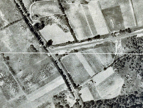
Frank, dotted line [-o-o-o-] and scissors (or expansion) gate [XXXX] refer to the 1914 plan, where I marked it as “XXXX” on this excerpt. I can’t see any such on the 1938 photo; what I do see are barrier posts and rails. The arrow shows that something moved away from the box to a post across the inbound{?} (outer) lane. I’m thinking now that that may have designated a padlocked chain across the lane. Why a chain (or whatever) on one side and the familiar “turn” pike-cum-swinging gate on the other eludes me. Sam, III
Sam - I can see a possible sissor gate, hand operated from the kiosk window, but cannot understand the swing gate requiring to exit the kiosk. Was the plan for this gate a buried-cable pull from the kiosk?
The toll keeper pix HK has posted show the keepers outside but there’s always the window frame of that east-facing window at the Mineola Lodge, originally 191 Jericho Turnpike and now 284 Rudolph Road. The owner I met back on 06 Jun 2000 said the wall under the bottom of the frame (under the sill) had been stuffed with ticket stubs when he renovated that window, which would indicate direct access. Hmm? Sam, III
That’s great info Sam. I hope the owner kept those ticket stubs and not discatded. I’d love to see a copy of one today.
When were the ground level photos taken? The sign is worn out and the road has huge potholes.
________________________________________________________________
Howard Kroplick
John, dates and details have been added.
Frank, no such luck; he said he had no idea what the tickets were all about and ditched the lot. My LIMP history Page 0 has some but hasn’t been reposted yet; see them at http://sbiii.com/limphist/lmphst07.jpg, http://sbiii.com/limphist/lmphst08.jpg, http://sbiii.com/limphist/lmphst09.jpg, and http://sbiii.com/limphist/lmphst10.jpg. As soon as I get the page up, it also has rubber stamps, a traffic ticket, season passes, etc. Having trouble with images; guess I’ll just have to repost it as best I can, at: <http://sbiii.com/limphst0.html>. Sam, III