Mystery Foto #24 Solved: The Commack Spur of the Long Island Motor Parkway- Updated 1/30/16
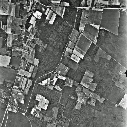
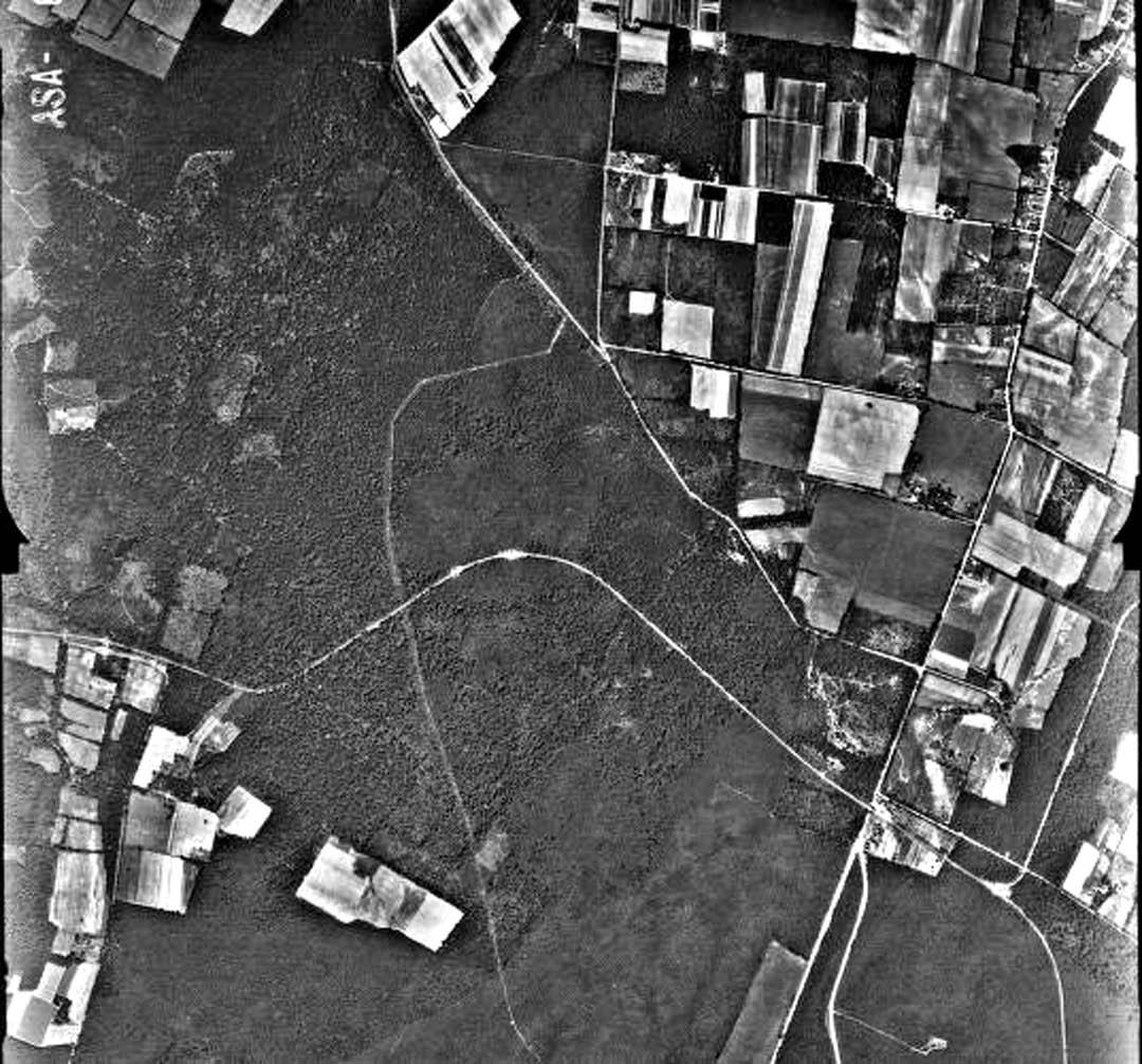
Frank Feminas offered last week's Mystery Foto challenge with two aerials of the "Commack Spur" taken in August 1938, 5 months after the Long Island Motor Parkway closed.
Mystery Foto questions:
-What are the locations of the two aerials?
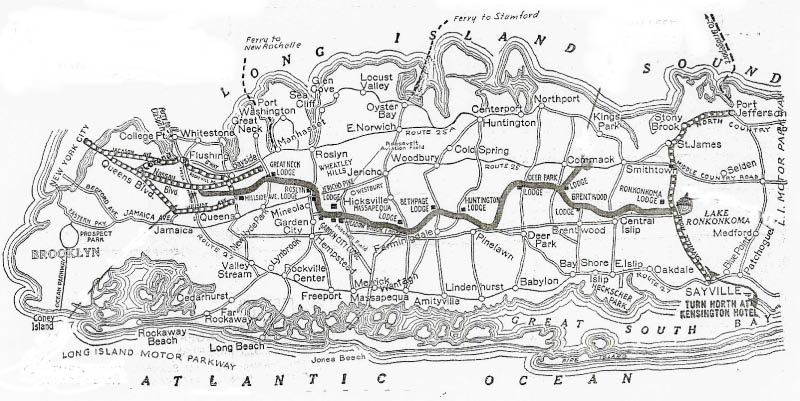
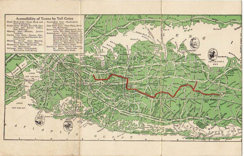
The Long Island Motor Parkway in Commack and the "Commack Spur" connecting Jericho Turnpike to the Motor Parkway
-Which Motor Parkway structures were built in these locations?
The four "Brentwood" toll collection structures
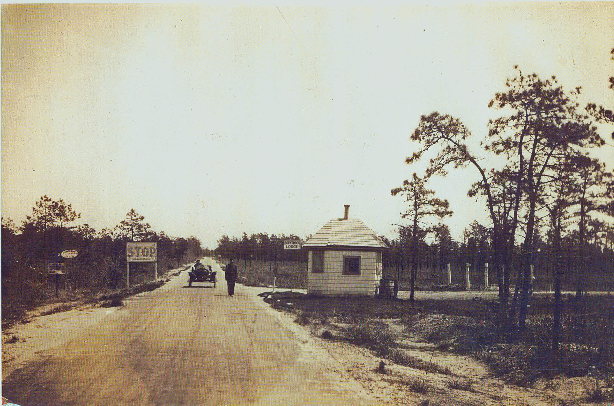
Brentwood Lodge (Kiosk) (1911-1915)- Ticket booth kiosk at Washington Avenue, Brentwood (Moved to Commack Road 1922)
Brentwood Lodge at Commack Road (Kiosk) (1922-1923)- Kiosk from Washington Avenue was relocated to northeast corner of Commack Road and the Motor Parkway in Commack (Moved in 1924)
Brentwood Lodge (December 1923-1928) Located on southeast corner of Commack Road.
Brentwood Lodge at the Commack Spur Road (September 1928- January 1934) - Toll gate near the Spur Road (Harned Road) to Jericho Turnpike- No living quarters. Also known as the Smithtown Lodge or the Smithtown Gate. (Destroyed before August 1938)
-What was the special purpose of a road seen in the aerials?
The "Commack Spur" connected Jericho Turnpike to the Long Island Motor Parkway. A little more than two miles long, it was located 1,500 feet east of the Commack Road intersection on the Motor Parkway. Construction started in 1927 and officially opened for traffic in September 1928. It was the last section of the parkway built by Long Island Motor Parkway, Inc.
Congrats to Joe Osterle, Greg Oreiro, Lee and Steve Lucas for correctly identifying the Commack location. Special kudos to Frank Feminas for the Mystery Foto submission.
If you have any suggested Mystery Fotos, please send me a jpeg at [email protected] .
Enjoy,
Howard Kroplick

Details from Frank Feminas
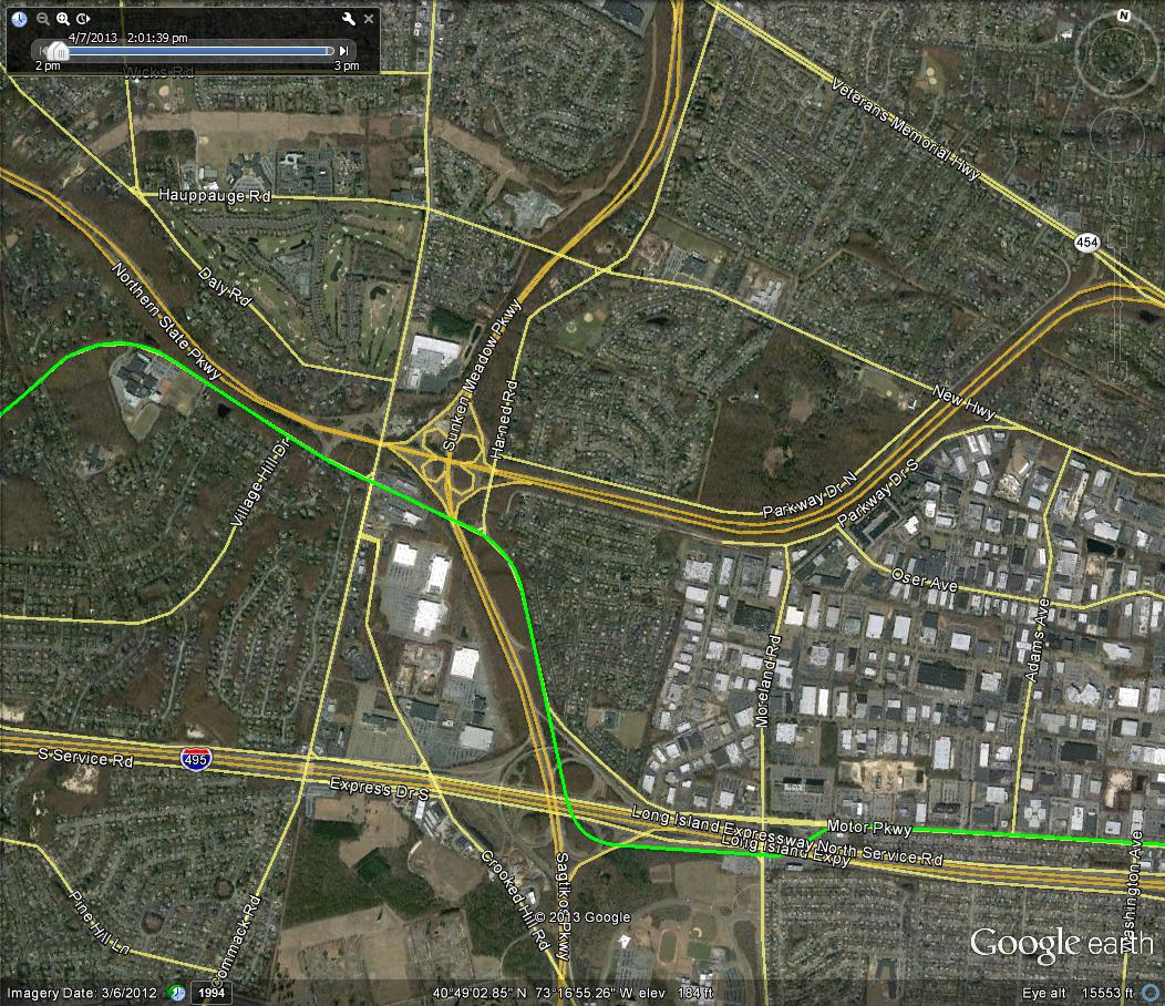
The Motor Parkway in Commack and Brentwood
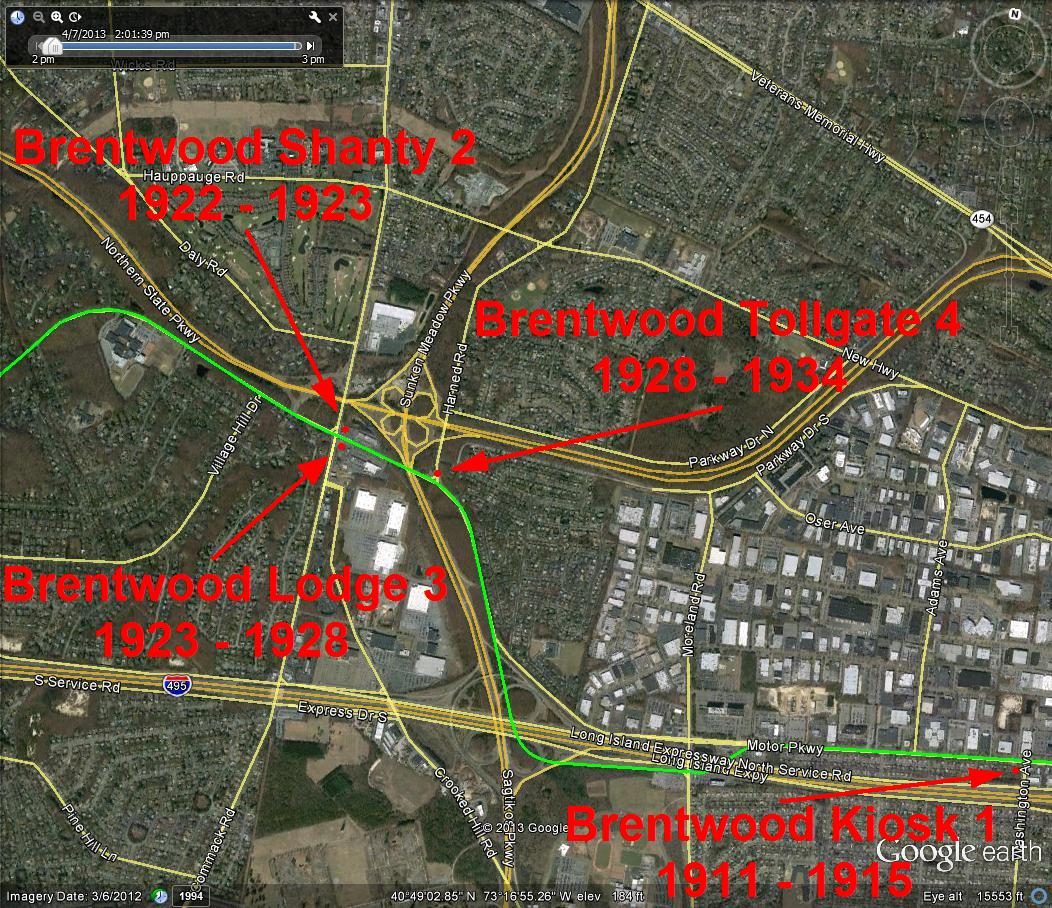
The four "Brentwood" toll collection structures
Brentwood Lodge at Washington Avenue (1911-1915)
1928 Motor Parkway Atlas
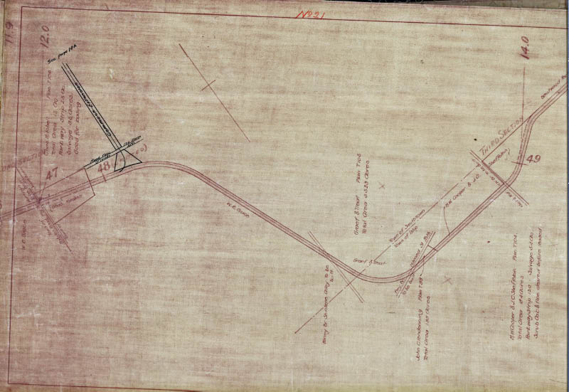
The "Commack Spur" was hand-written on my copy of the Atlas.
1928 Aerial
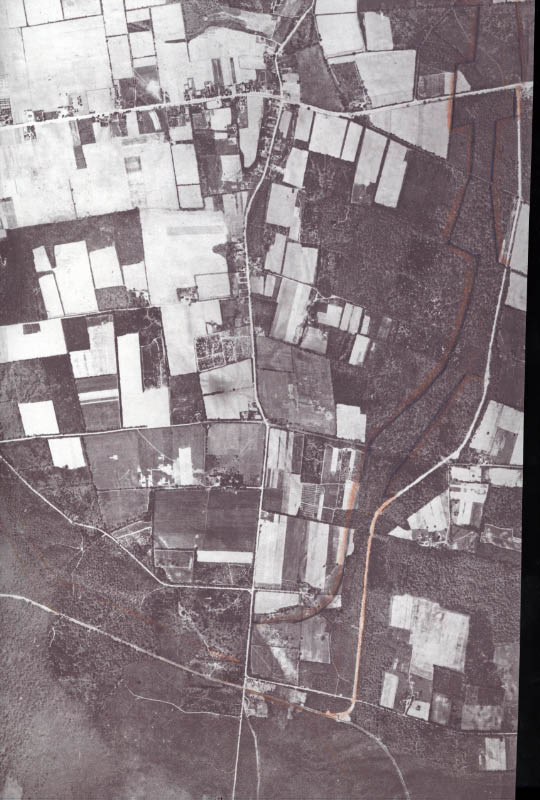
Look closely and you can see the outline of the Brentwood Lodge at the Commack Spur. Notice the angle of the construction.
Motor Parkway Maps Showing the Commack Spur
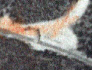
1964 Photo of the Roof of the Brentwood Lodge at the Commack Spur
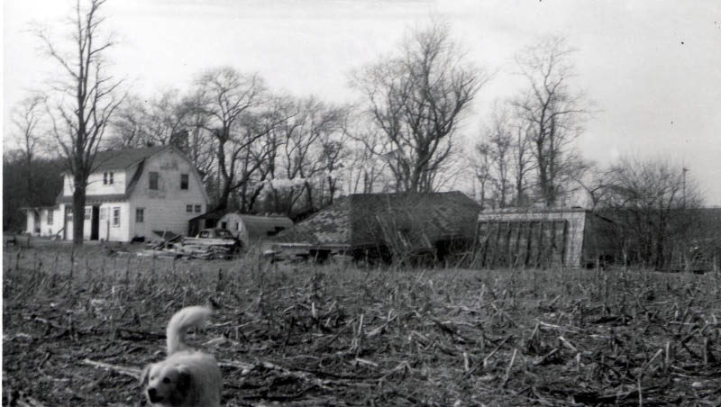
Check out the bird! Look again..It's a dog!
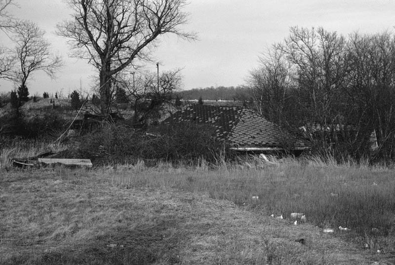
The lodge's roof was located on a field west of Harned Road until the 1970s when a shopping center was built on the site.


Comments
It took a few seconds. Commack Rd and the LIMP. Bottom picture shows the spur north to Jericho Tpke.
To be perfectly honest I haven’t got the slightest clue on these two aerails,nothing looks familar to me,
This is Harned Rd in Dix Hills/Commack. Designed to bring more traffic onto the LIMP. Located here would be the Brentwood Lodge.
Looked at these aerials and said to myself.“What and Where is this"no idea at all. Good Luck guys. Don’t laugh at me,I just thought it might be in Queens,everything is so close together
Harned Road, Extension, Commack
Commack Road Toll and Bridge
Both of these photos show the Motor Parkway in the Commack Rd - Harned Rd area.
The north / south road seen more readily in the 2nd photo was the spur or connector road that was built to hopefully attract more traffic from Jericho Tpke. The 2nd, 3rd and 4th “Brentwood” lodges (ticket booths) were at the NE corner of Commack Rd & LIMP; SE corner of Commack Rd & LIMP; Intersection of the spur and LIMP. The spur later became Harned Rd.
Boy was I way off or what.You guys are just too good at the mystery solving,it all seems so easy to you guys most of the time. I guess I still don’t know enough yet,there’s too much that I missed in all these years
Howard: Funny, at first I thought it was a bird too but then as I turned away in the corner of my eye, I caught that the bird actually had a dog’s head fixed to its tail. Lol… On a sadder note, hard to believe what the Brentwood Tollgate was reduced to, so that someone could extract the 8 x 12 ticket booth inside and leave the remains out on the field. Ugh!
Ted: I use a Google Earth file that shows the original LIMP path in its entirety to help identify sections of the LIMP. I find it useful most of the time! With Howard’s permission, I’ll send it so anyone can view. Happy motoring.
The dog was going after the photographer! Lol. Calm down doggy, here’s a bisquit.