Mystery Fotos #10 Solved: Road Testing the Motor Parkway During the Summer of 1908
The Garden City Archives challenged you to identify this series of unique photos of three automobiles on a road test prior to the Motor Parkway's opening.
Mystery Foto questions:
- Identify the location where these photos were taken. Provide a rationale and be specific (ie. between which current roads). Update: See below 1926 Motor Parkway aerials.
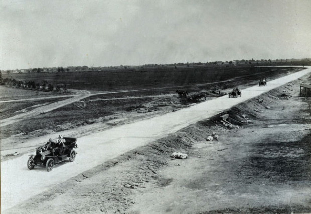
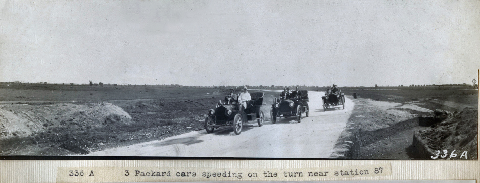
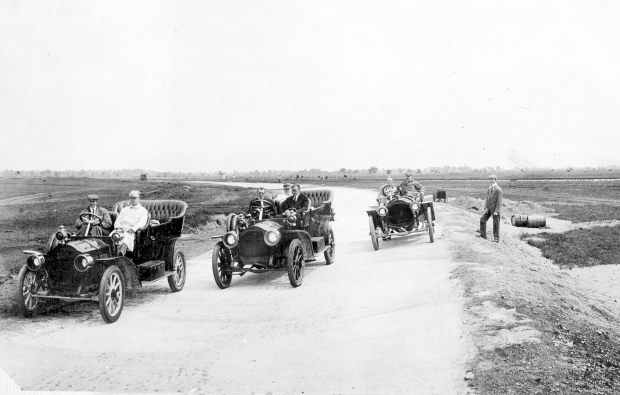
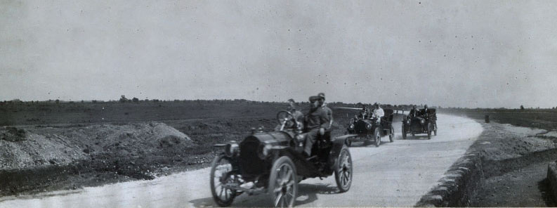
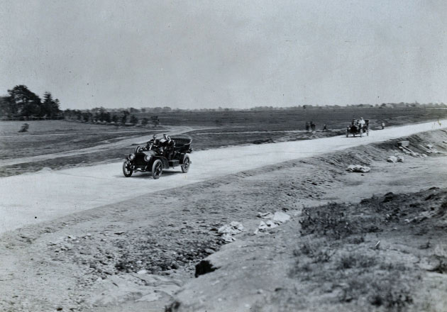
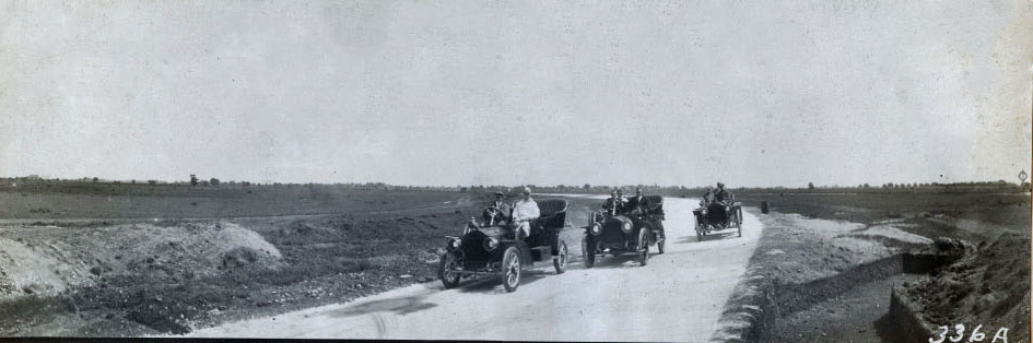
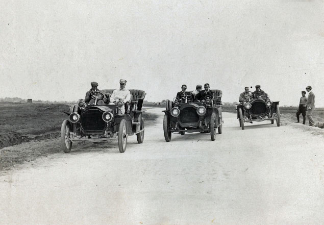
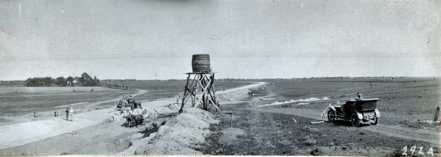
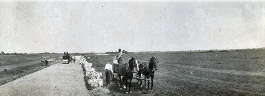
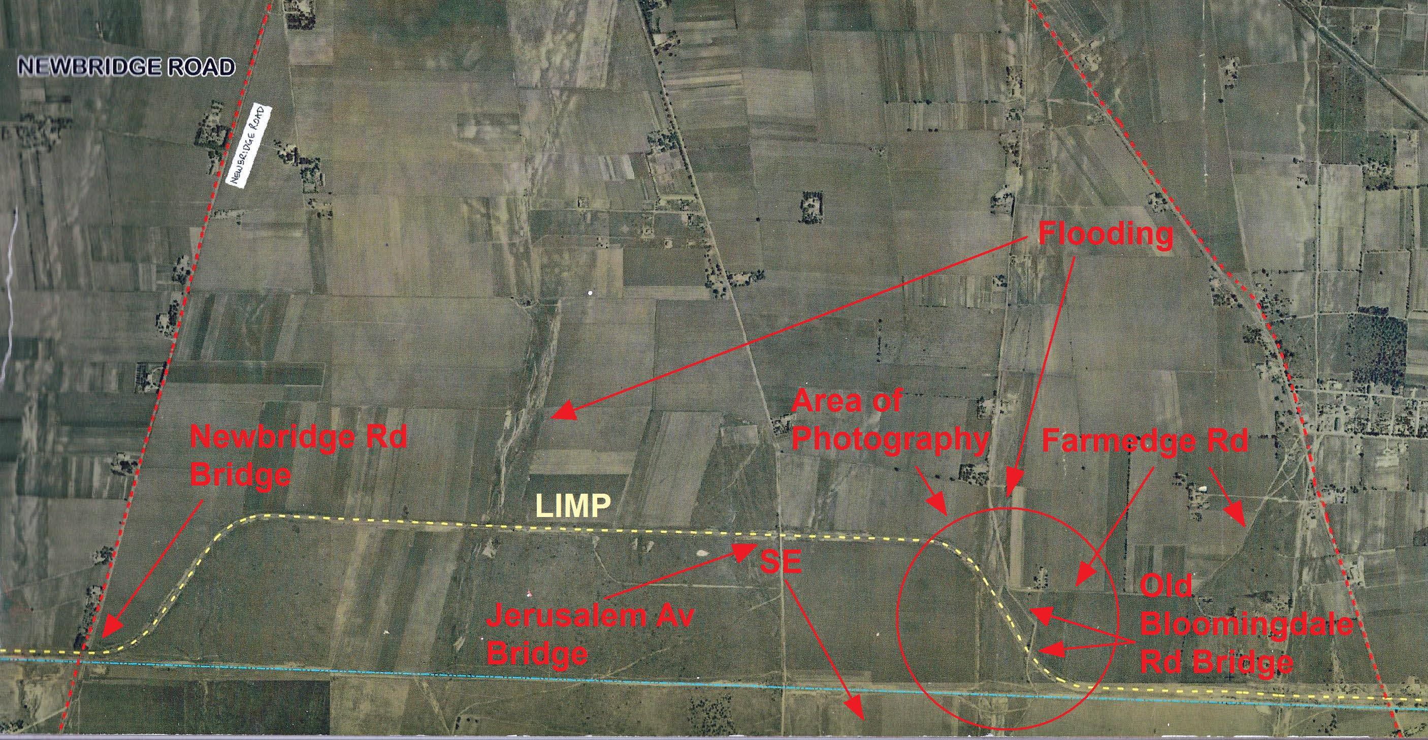
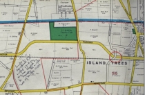
The photos were taken in the area east of Jerusalem Avenue, heading south towards the future Bloomingdale Road Bridge in the Hempstead Plains (now Levittown) and then east towards Central Park (Bethpage). The Garden City Archives captions identify the photos from "near Station 87."
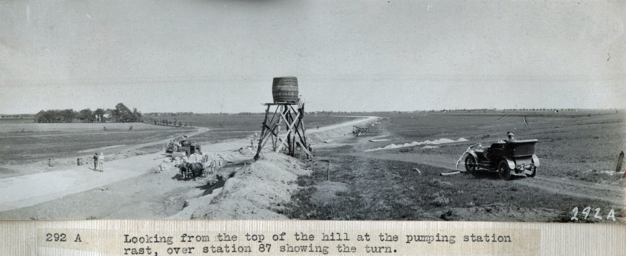
- On what type of structure was the top photo taken? Hint: It was not a bridge.
The photo was taken from the water pumping station located right after the first curve.
- Identify the three automobiles in the photos.
The three Packards were driven by "Shepard, Caldwell and their party."
- What pioneering characteristics of the Motor Parkway are shown in the photos?
- The width of the concrete road.
- Banked curve
- The bridge over a future planned road
- A culvert for flood control
- What is the approximate date of photos? Provide a rationale.
The likely date is between July and August 1908. The key is that the Bloomingdale Road Bridge had not been built yet. Several photos show a ditch where the bridge would later be built.
Congrats to Greg O., Frank Femenias (see Frank's Findings) and Art Kleiner (see Kleiner's Korner) for correctly identifying the location near the Bloomingdale Road in the Hempstead Plains. Kudos to Frank Femenias and Art Kleiner for identifying the water pumping tower as the photographer's location for the above lead photo.
Enjoy,
Howard Kroplick
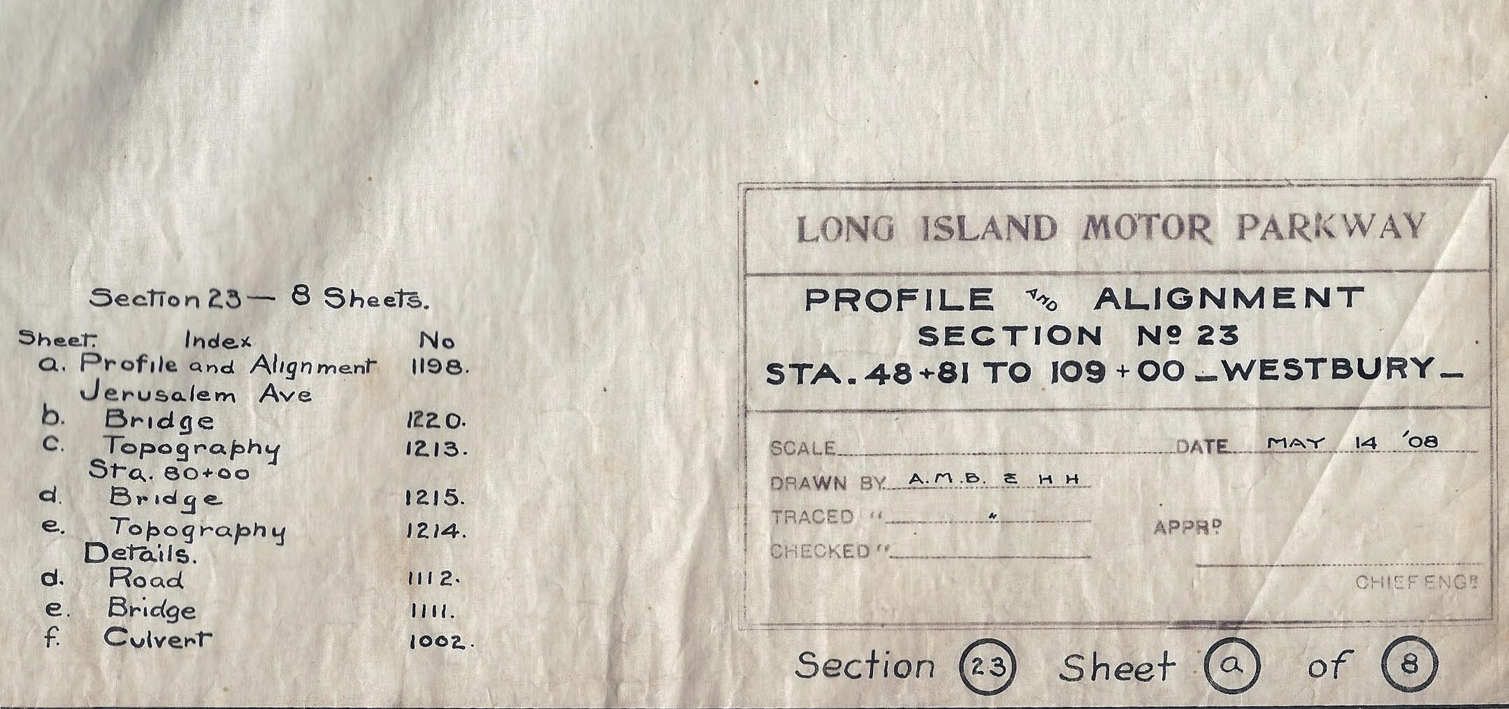
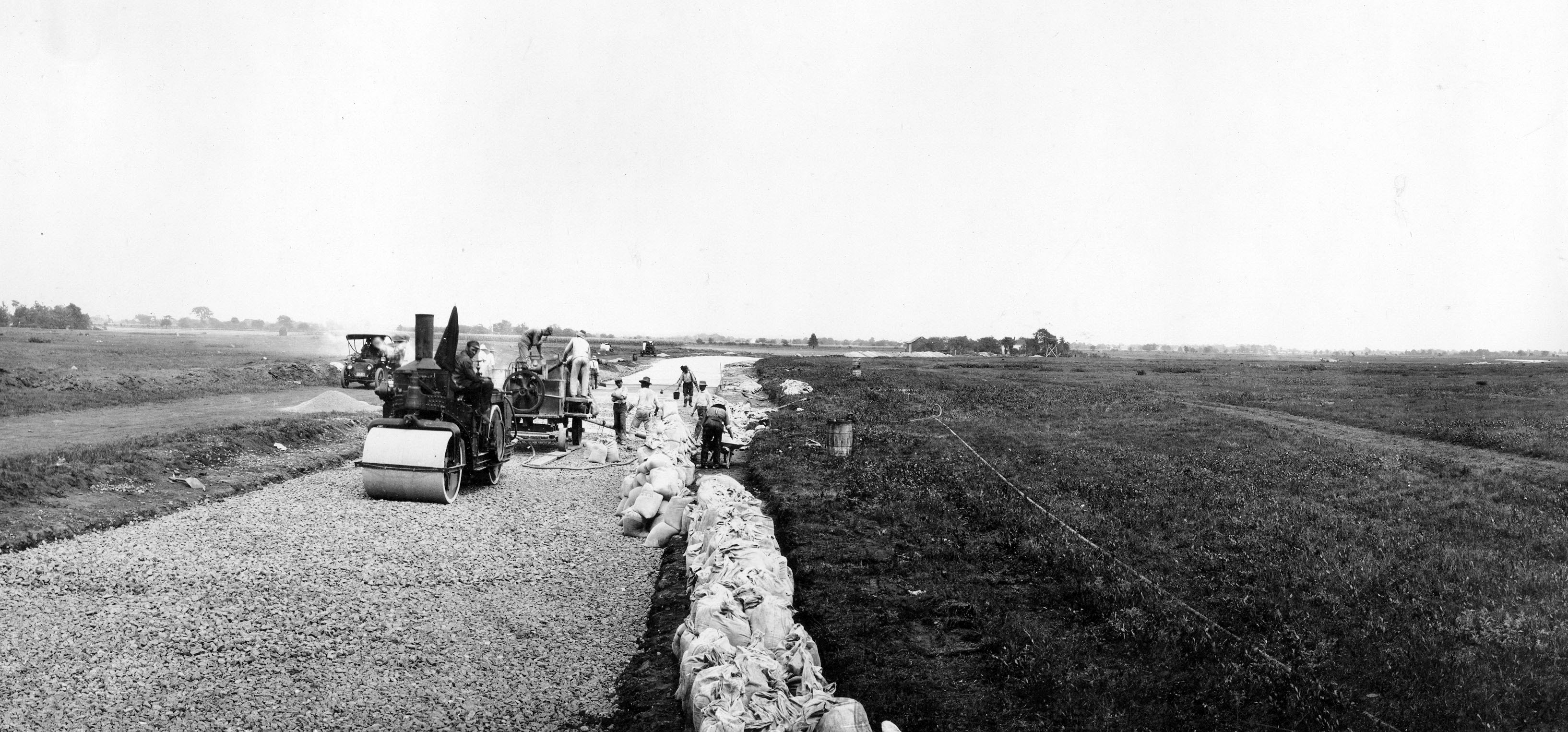
May 14, 1908 Motor Parkway Survey
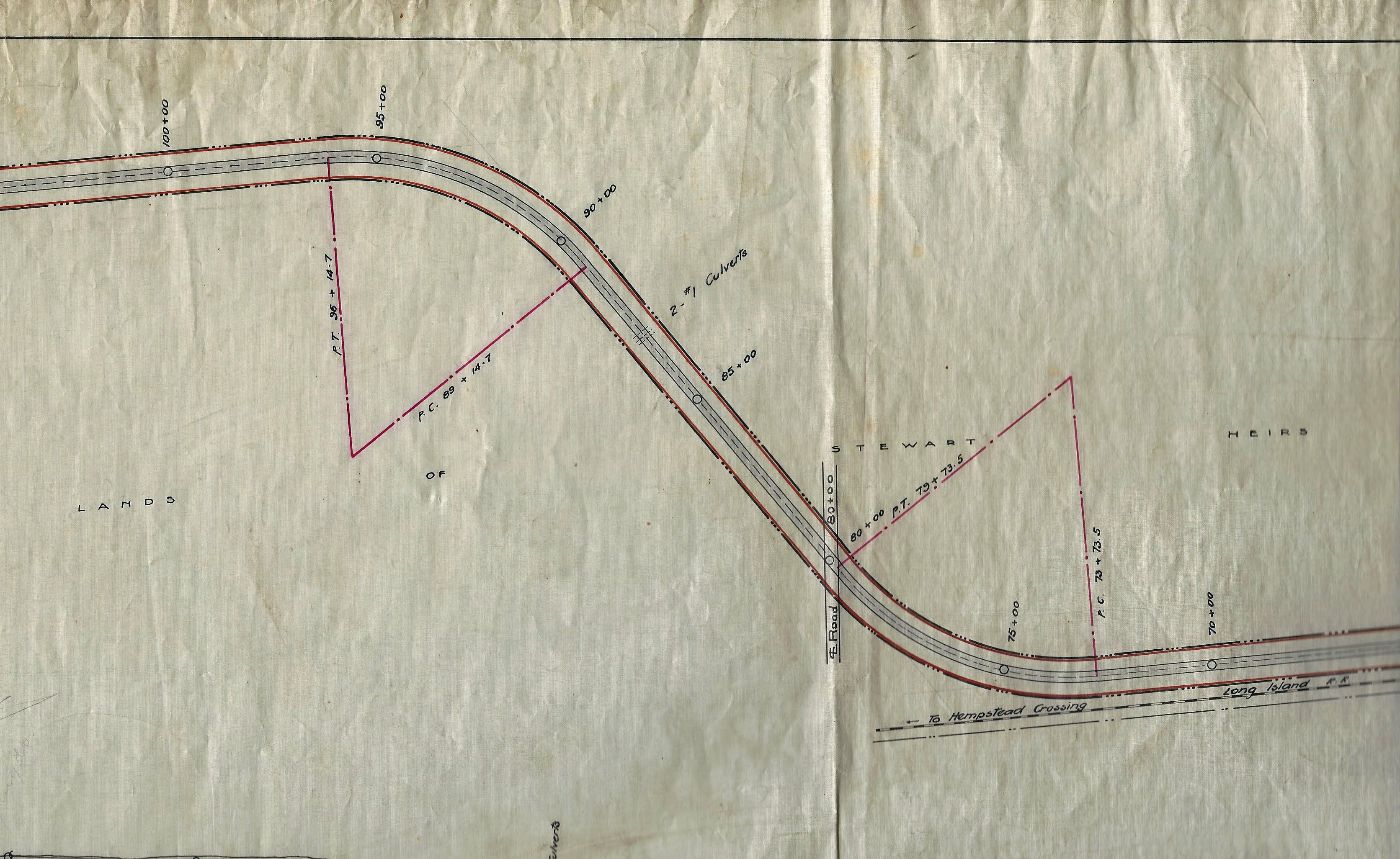
A survey of the Motor Parkway from east of Jersusalem Avenue (Station 100) to east of Bloomingdale Road (Station 80).
Note: The notations for the culverts and bridge near the southern curve.
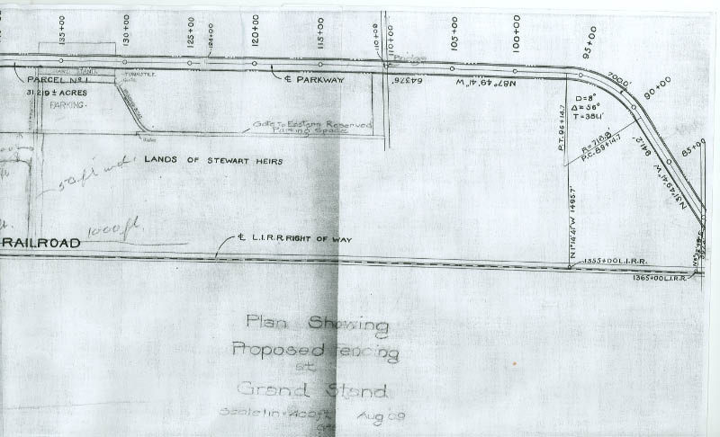
Survey showing the relationship of the grandstand and the stations 135 to 87.
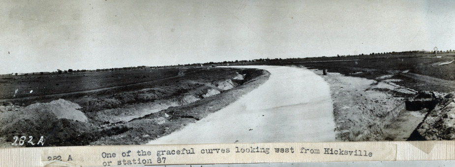
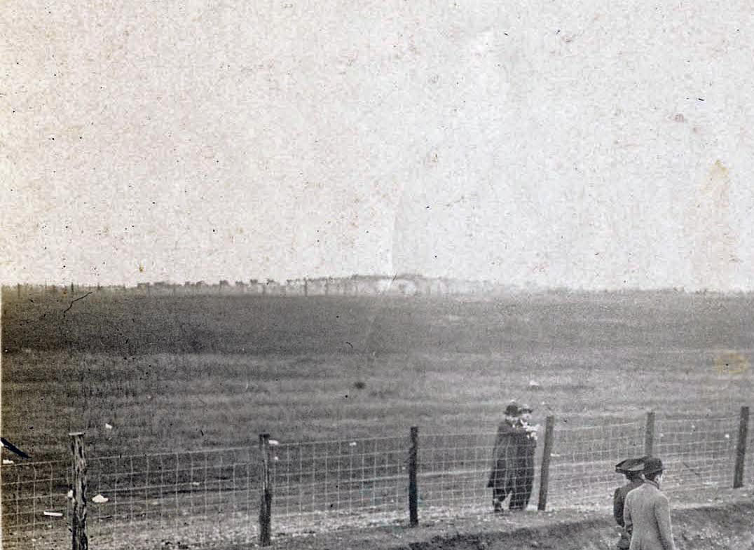
Looking Southeast (Courtesy of the Garden City Archives)
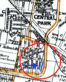
Looking southeast, the caption reads the "turn near station 97."
Note: The Central Branch Railroad track and crossing in the background. The pit on the right was likely the beginning of the Bloomingdale Road Bridge, which was completed in time for the opening of the Motor Parkway on October 10, 1908.
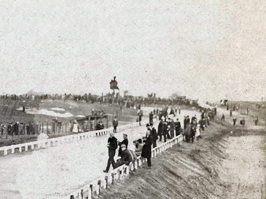
An earlier view from the same spot.
Earlier Construction Views of the Same Location
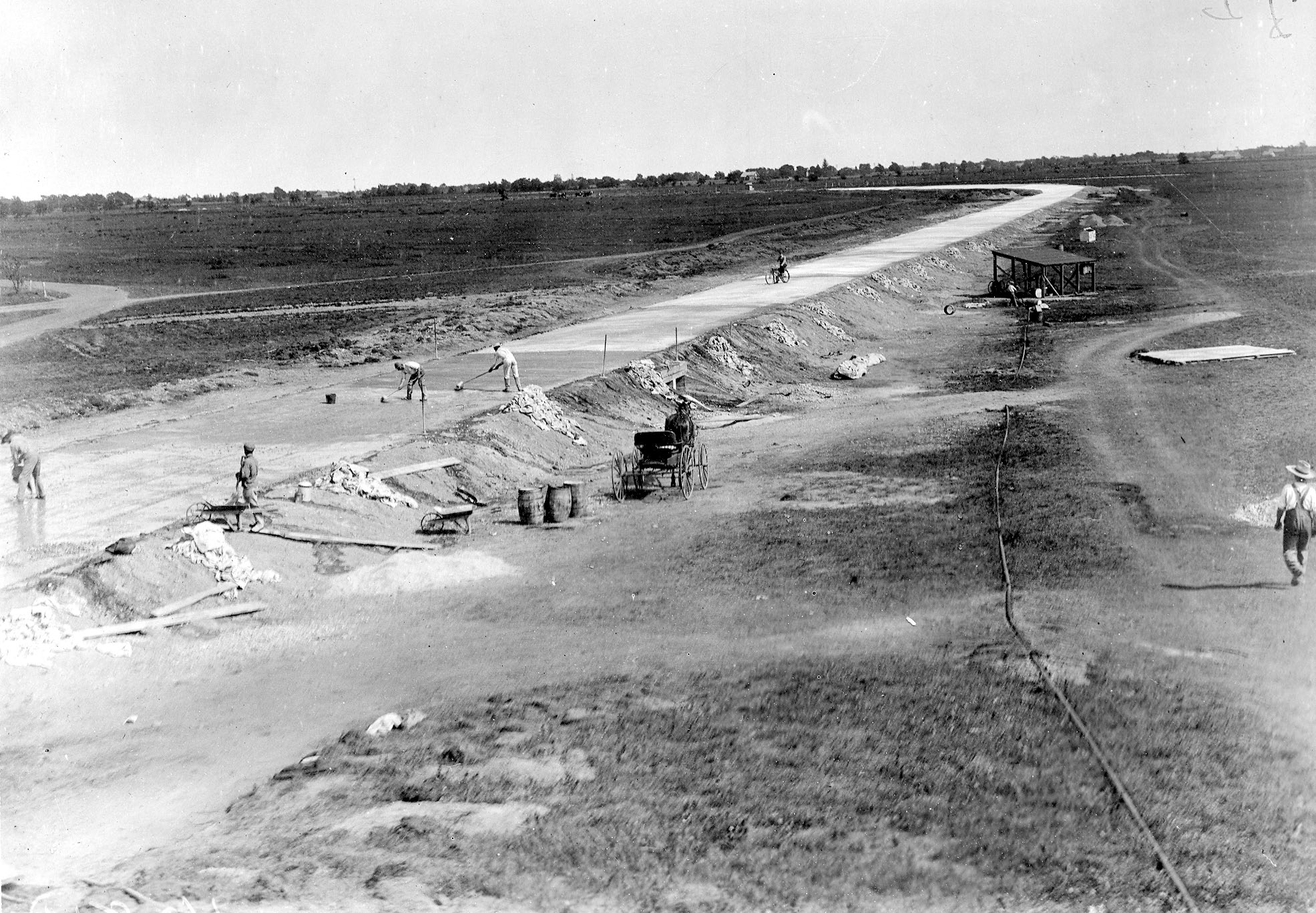
This photo was taken by a photographer on top of the water pumping station.
Looking east from Jerusalem Avenue
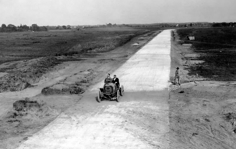
In September 1908, veteran Vanderbilt Cup Race driver Joe Tracy was paid to road test the parkway. This photo was taken from the Jerusalem Avenue Bridge looking east. Note: The tree patterns seen in the background.Submitted by Frank Femenias.
An earlier construction photo of the above location. The tree patterns match.
View Looking North
Note the water pumping tower in the background.
A surveyor in action.
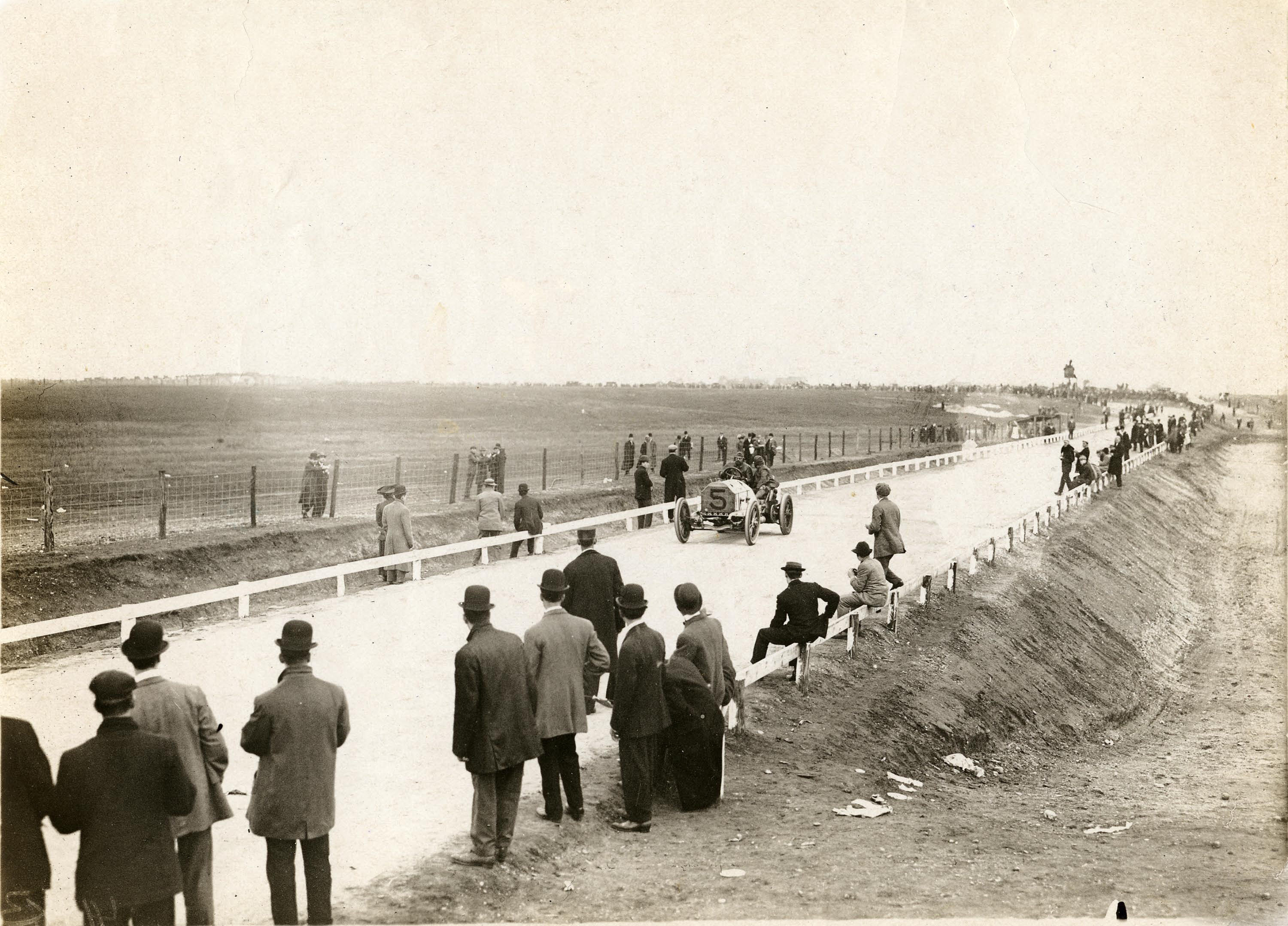
1908 Vanderbilt Cup Race Course
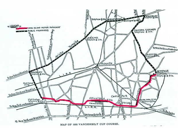
Nine miles of the Long Island Motor Parkway were used for the 1908 Vanderbilt Cup Race from just west of Merrick Avenue in East Meadow to Round Swamp Road in Bethpage.
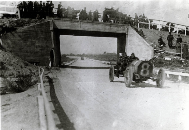
Bloomingdale Road Motor Parkway Bridge
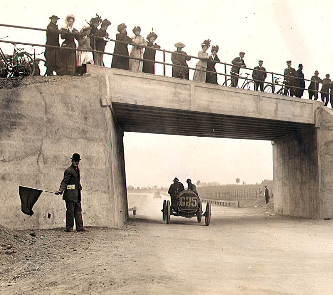
A wonderful view of the bridge on the opening day of the Long Island Motor Parkway on October 10, 1908. H. Tuttle was seen here driving the #G25 Stoddard-Dayton ahead of another racer.
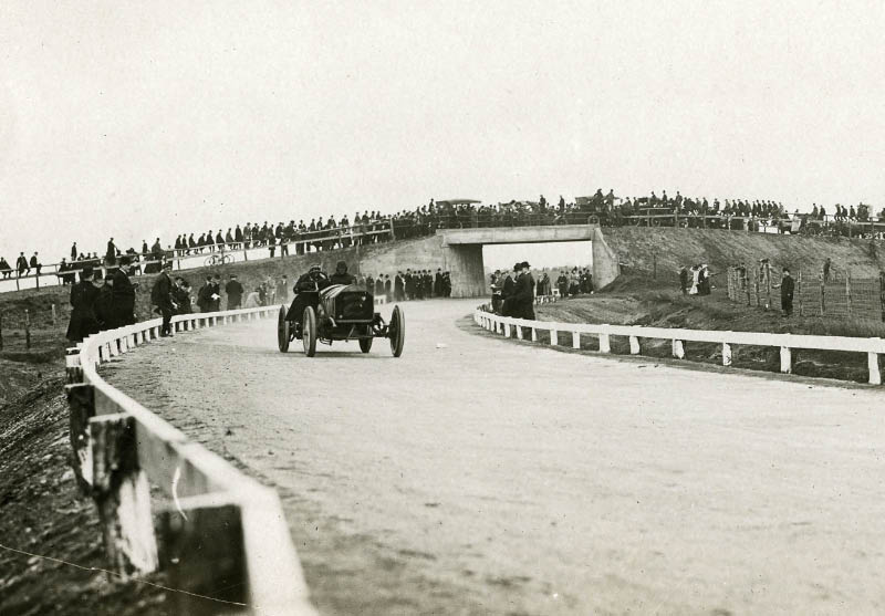
The #2 Knox driven by Al Denison during the 1908 Vanderbilt Cup Race.
This photo looking northwest was likely taken from the abutment of the Bloomingdale Road Bridge.
Note: The water pumping tower and work shed in the background.
Look carefully and you can see the Jerusalem Avenue Bridge in the left corner, filled with people, horses and automobiles.
The Alco Black Beast passing the Bloomingdale Bridge during the 1909 Vanderbilt Cup Race.
1936 Aerial
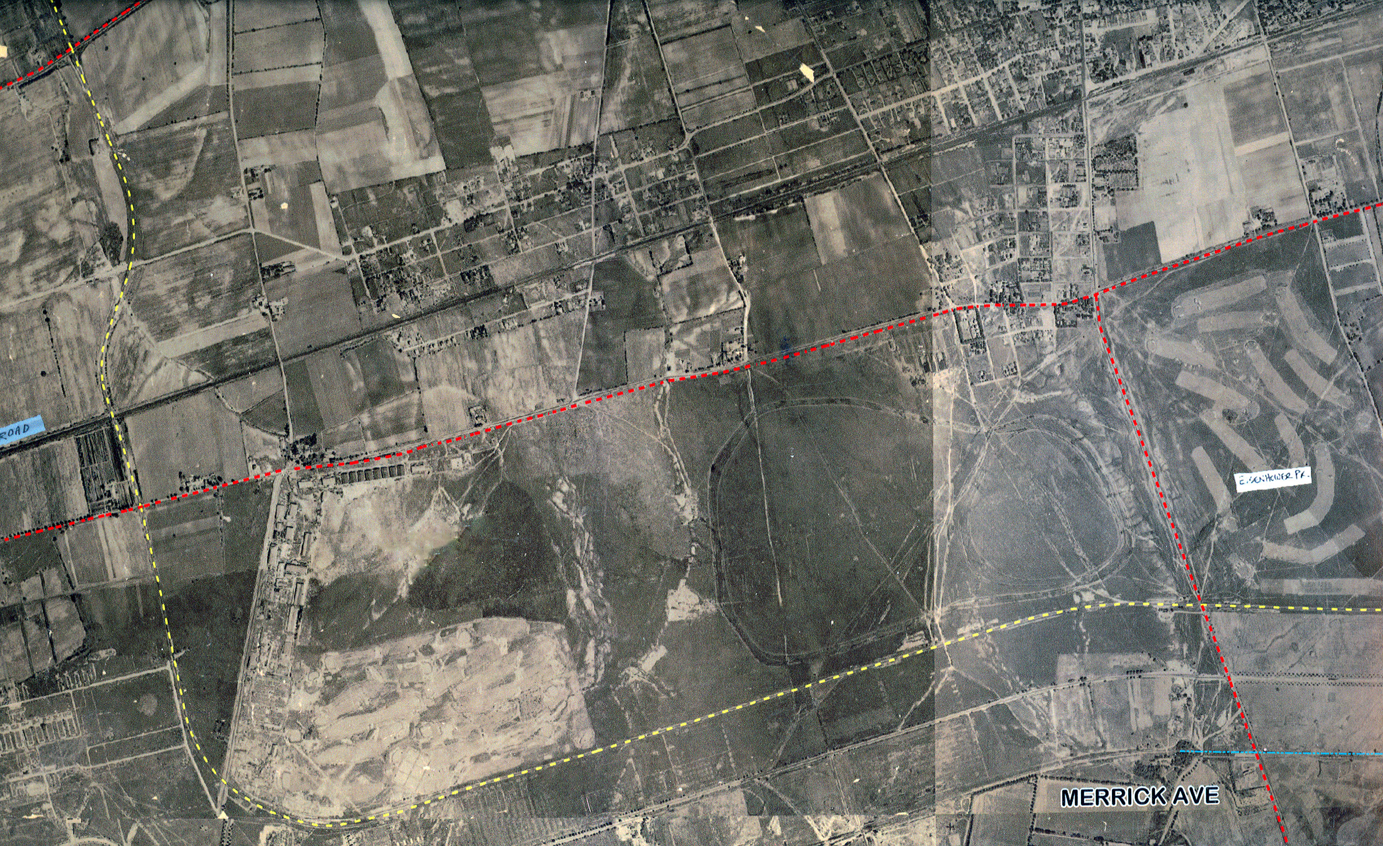
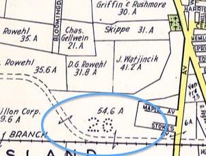
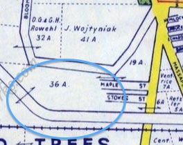
1926 Aerials
Motor Parkway:Carle Place/Mineola to East Meadow.
Note: The temporary road connecting Ellison Avenue to the Motor Parkway (west of Merrick Avenue) for the 1908 Vanderbilt Cup Race can still be seen in this aerial.
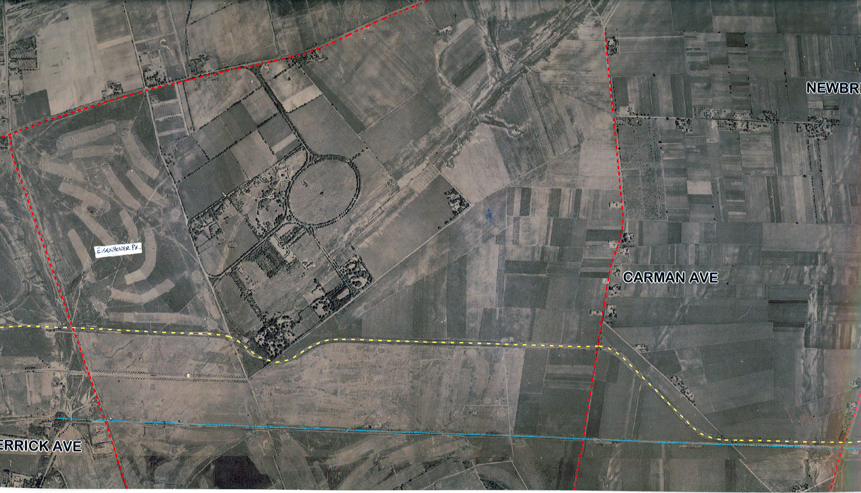
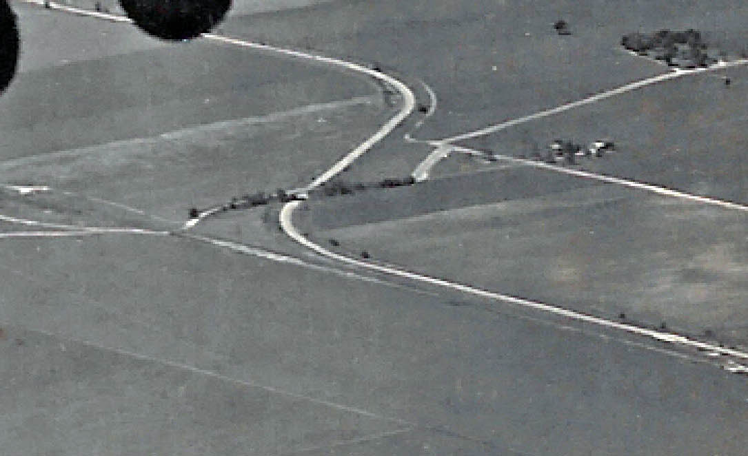
Motor Parkway: East Meadow to Levittown (Hempstead Plains)
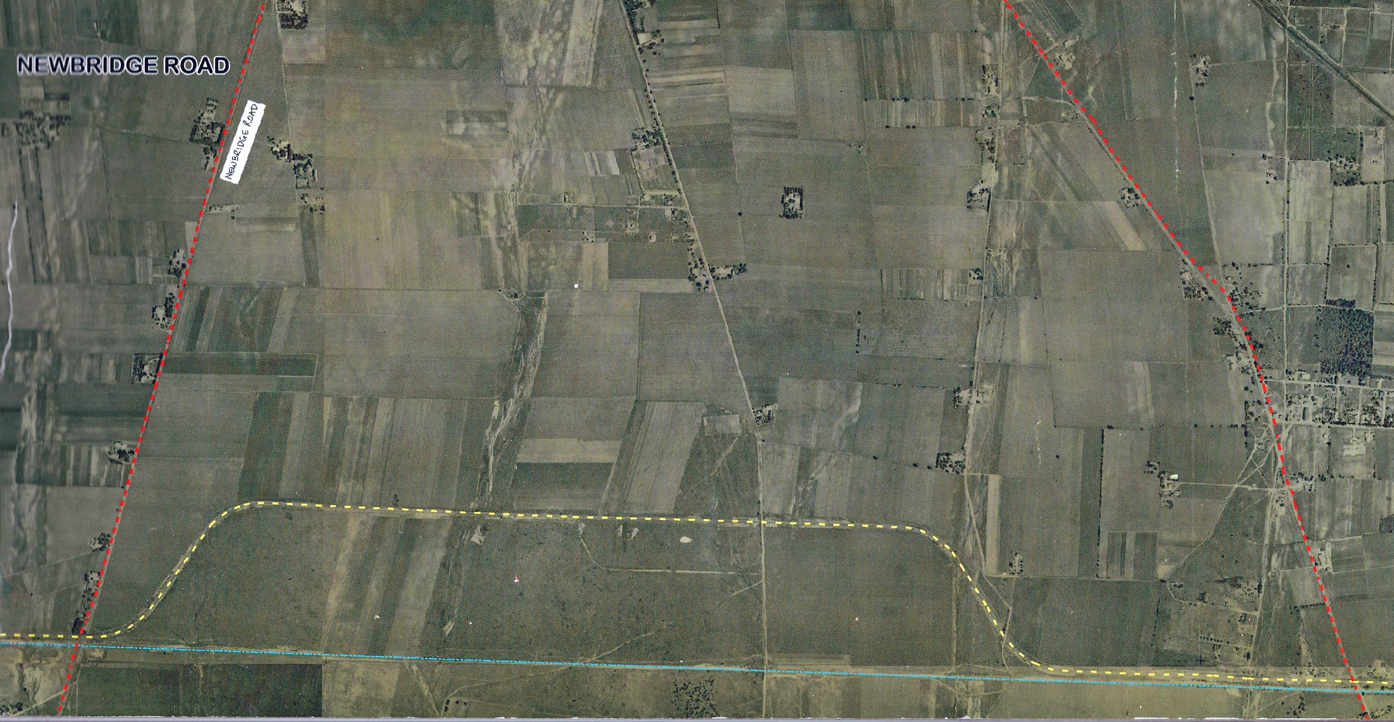
Motor Parkway: Levittown (Hempstead Plains).
Note: The road that led to the grandstands (1908-1910) can still be seen in this aerial connecting to Jerusalem Avenue.
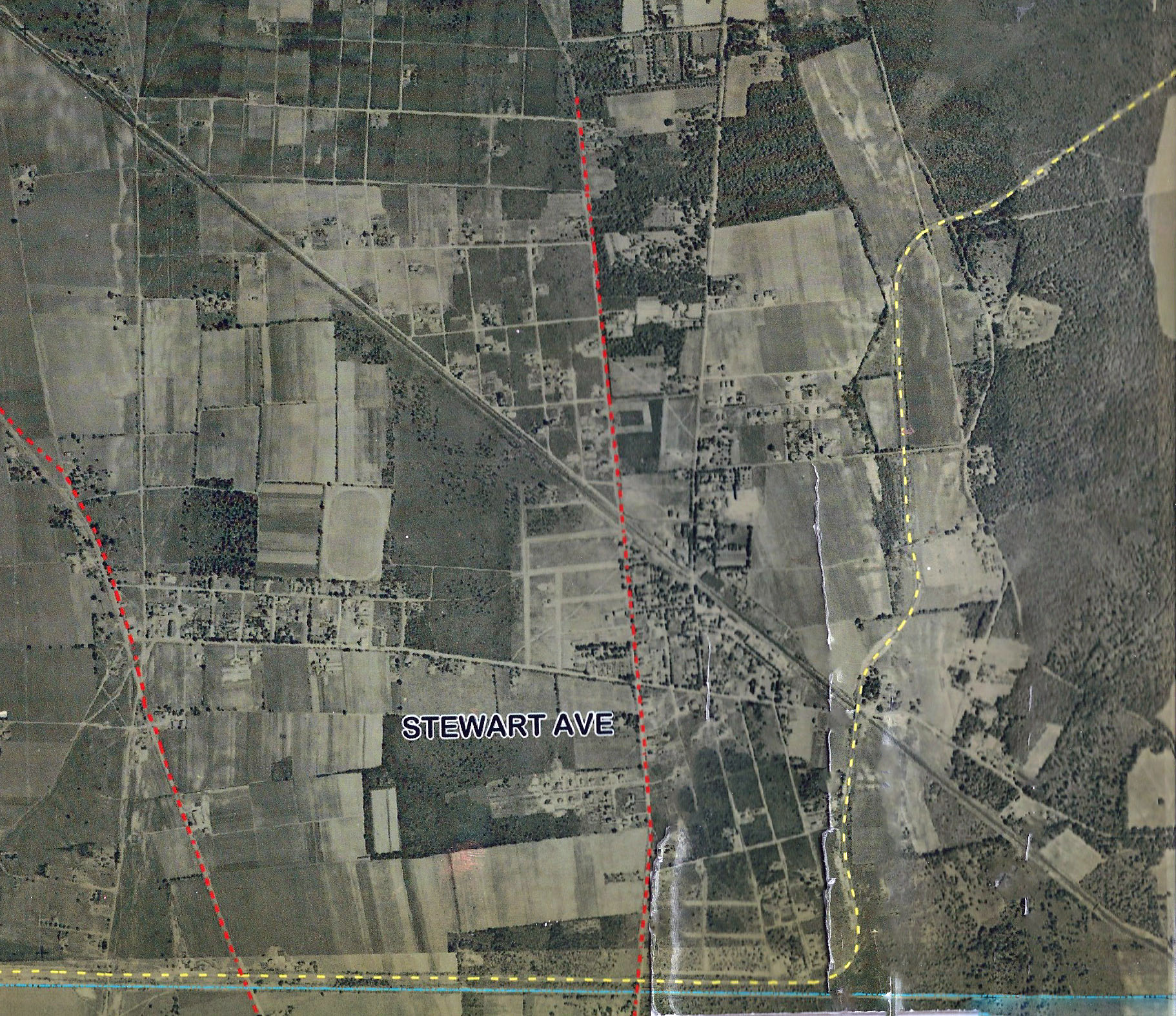
Motor Parkway: Bethpage
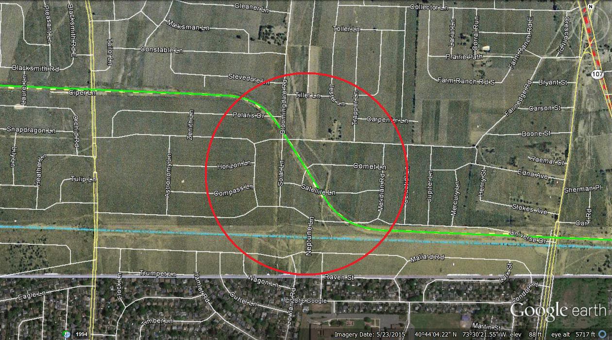
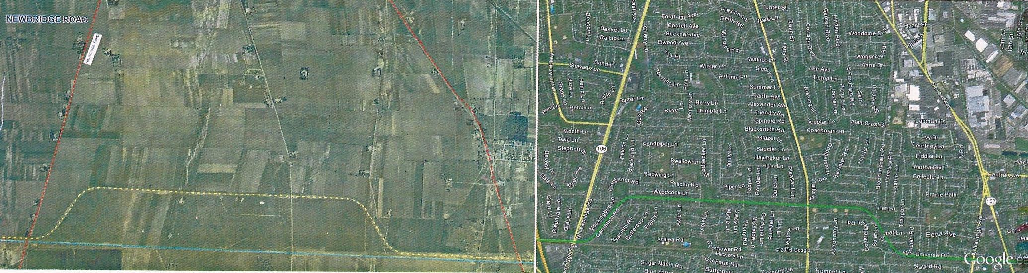
Current Google Map of the Long Island Motor Parkway
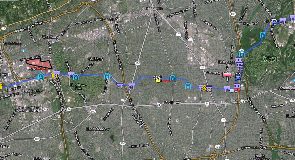
Check out Wayne Consolla's online Motor Parkway map to help solve this weekend's Mystery Fotos.
Frank's Findings (Submitted by Frank Femenias)
Kleiner's Korner (Submitted by Art Kleiner)
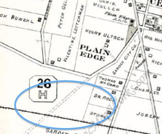
1906 Map
Before the Motor Parkway, a road (close to today's Bloomingdale Road) was planned.

1914 Map
1924 Map
1927 Map
1939 Map
1946 Map


Comments
Identify the location where these photos were taken. Provide a rationale.
Hempstead Plains, what is now Levittown
On what type of structure was the top photo taken? Hint: It was not a bridge.
Banked turn, possibly a culvert.
Identify the three automobiles in the photos.
All 3 are Packards
What pioneering characteristics of the Motor Parkway are shown in the photos?
Width of the roadway and the ability to pass other vehicles and also displays banked road surface on turns.
What is the approximate date of photos? Provide a rationale.
The inspection team tested the roadway just before opening in October 1908
My 1st guess would be Sept 1908, about a month before the first race, traveling east on the straightaway in Levittown toward the grandstand. The structure is a drain culvert for passing water under the roadway (maybe the same culvert as the one in the 2 photos that the 2 boys were playing near in the 1950s photo from a previous mystery photo. Looks like the road to the left could be Division Avenue which did not quite make it up to the roadway at the time. I Can’t name the cars, sorry about that. My 2nd guess was going to be Deadman’s Curve #2 at section 23 traveling east into Bethpage Park, but there are no water towers on the bend so i’m going to stick with my 1st guess. Good one, very little reference points to work from.
These are three Packards 30 H.P., one runabout and two touring cars driving on the LIMP somewhere on Hempstead Plains. The structure is a culvert, probably the one east of (the future location of) the grandstand. Another photo exists, where one of these Packards (the one with the passenger in the white coat) is passing the Newbridge Road Bridge under construction. As this bridge was finished at August 20th, 1908, these photos must have been made shortly before this date. Unfortunately I didn’t have time to find out the identity of the passengers and what they were doing.
Another great mystery photo. Check out all this open space. I believe all of the photos are in the same general area and facing in the same direction, thanks to the shadows. This is about Jul/Aug 1908 during the rush to complete this section of Motor Parkway, just before the Oct 10, 1908 Sweepstakes and two weeks later, Oct 24 Vanderbilt Cup Race. I believe there are two possible locations: Dead Man’s Curve 1 eastward approach in Bethpage (Central Park) before it turns left towards the north, or the Levittown curve southeastward approach between the Jerusalem Avenue highway bridge and the Bloomingdale Road highway bridge that is not yet built. My best guess is the latter. Besides the flat terrain and culverts under the roadway to address Hempstead Plains flooding, the banked curve in the photo with the 3 vehicles is not as pronounced as the curve at Dead Man’s. Also, there is a storm basin today in this immediate area. The barely visible railroad tracks in the background come in on a diagonal and are not parallel with this roadway stretch, as it is at Dead Man’s Curve. The winding roadway on the left could be Farmedge Rd in Levittown (still there today). The bird’s eye view photo was taken from atop the water tower, where same photographer was captured on the water tower in a separate photo. Some of the latest pioneering techniques used on the roadway are (some not apparent in the photos): under roadway flood control, traffic intersection elimination, pedestrian/equestrian/bicyclist elimination, and high speed banked curves with guardrail protection. I’m leaving the autos to the experts. Great stuff as always, looking forward to this week’s answers. Howard, I’m sending attachments.
Driver Joe Tracy also tested the new roadway before the races.
http://www.vanderbiltcupraces.com/images/blog/B0196600.jpg
I guess just simply saying the location Levittown in the Hempstead Plains was a ‘phone-it-in’ answer! This was a fun one that is quite deceptive.
I think this is the second turn heading East after the grandstand. I believe the Packards are heading in the West on the LIMP. I could be wrong, because the Bloomingdale Rd bridge should be there unless it was built after these photos.
Identify the location where these photos were taken. Provide a rationale and be specific (ie. between which current roads). Update: See below 1926 Motor Parkway aerials.
Hempstead Plains/Levittown - south of Bloomingdale Road between Wantagh & Jerusalem Avenues.
On what type of structure was the top photo taken? Hint: It was not a bridge.
Water tower
Identify the three automobiles in the photos.
Packards
What pioneering characteristics of the Motor Parkway are shown in the photos?
The width of the roadway for passing capabilities, banking of the road surface in curved sections
What is the approximate date of photos? Provide a rationale. 1908 - prior to the opening of the Motor Parkway. no rails, no bridge?
I think the biggest kudos also need to go to Frank and Art for reading comprehension on this one!
It appears I misread the question looking for the location of the PHOTOGRAPHER and NOT the Packards sitting on the turn in the top cover photo! Funny too because in my mind I did notice that’s the location where the other photos were taken from!
Again, fun photo this week! And to have all the supporting photos for the reveal, very nice! For some reason I especially like the perspective of that 1936 aerial.
Didn’t have the time this weekend,am in the process of maybe makiing another move to The Villages in Florida,just driving down to check out renting and looking around to get an idea to what there’s to offer. Right now it very tempting,but it’s only the first day,need to see more to make that big decision