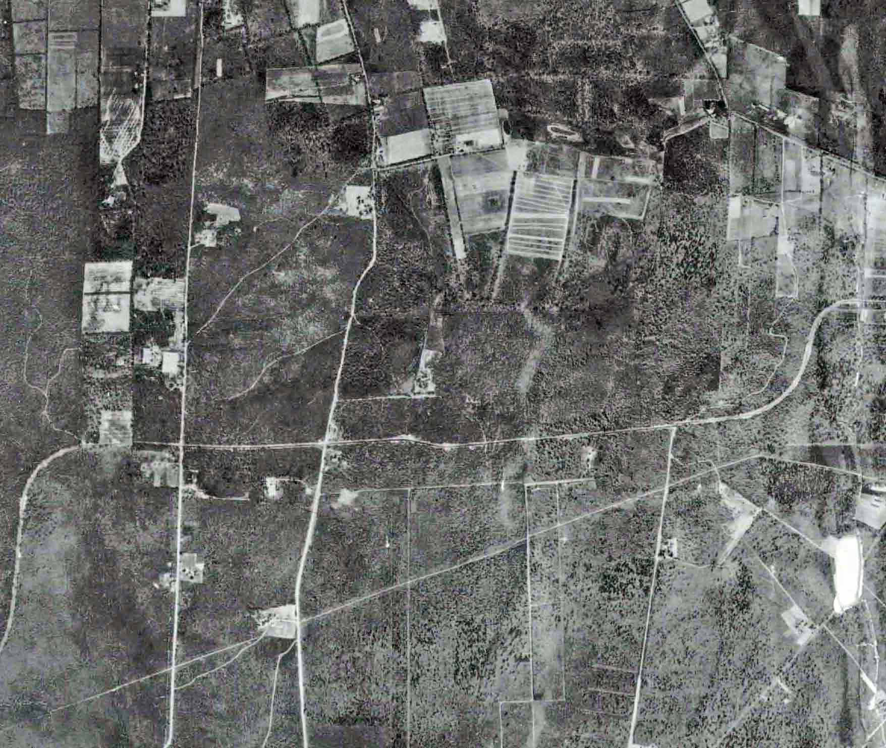
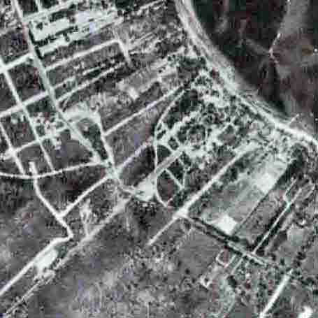
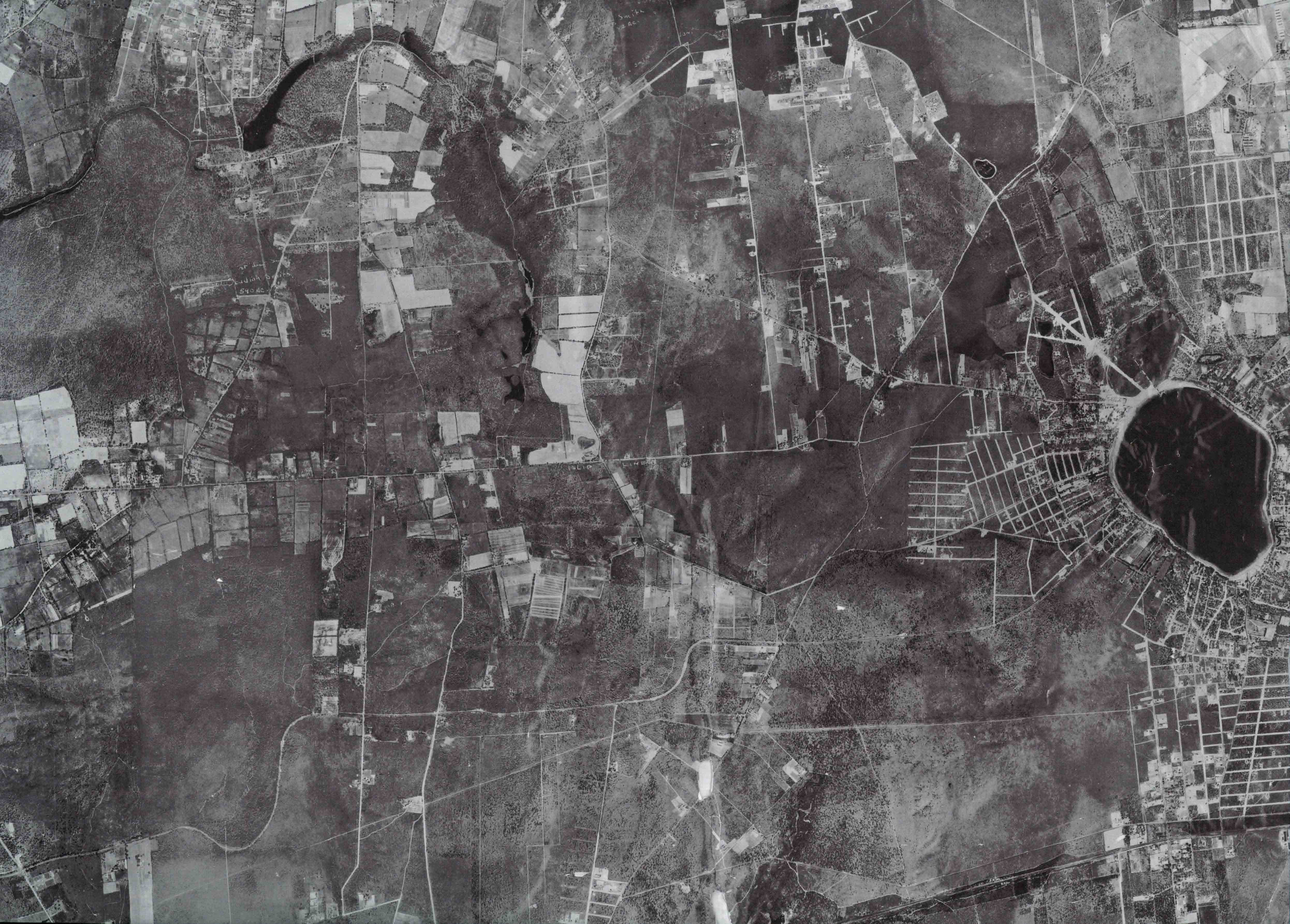
Mystery Foto #16 Solved:1930 Aerial of the Long Island Motor Parkway at Lake Ronkonkoma-Updated 9/18
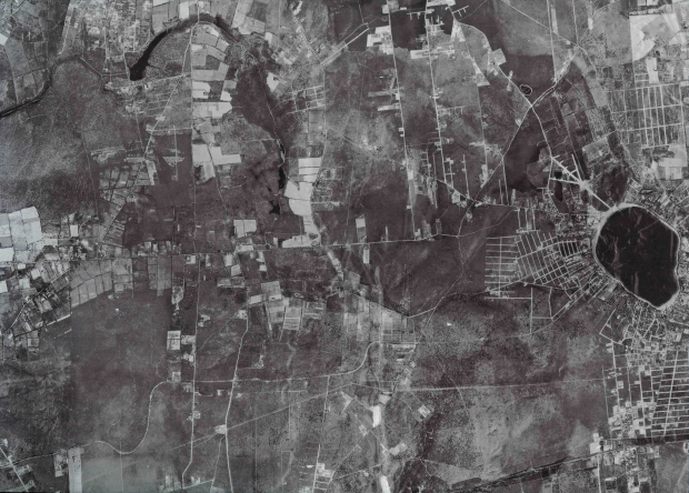
This weekend's Mystery Foto documented an early aerial of a large section of the Motor Parkway.
Updated April 26, 2017: Frank Femenias has subbmitted mappings of the possible Ronkonkoma Lodge locations.
Answers to Mystery Foto questions:
- Identify the location of the aerial from left to right
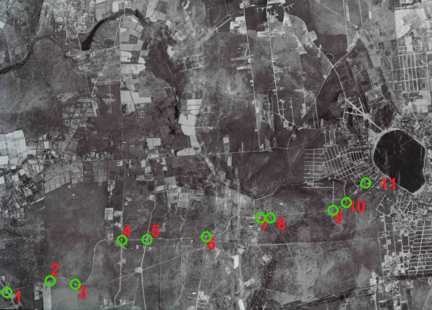
The Long Island Motor Parkway from Wheeler Road to Rosevale Avenue
- Identify the major roads in the aerial
See below Femenias Findings
- How many Motor Parkway bridges can be seen in the aerial?
Bridges were planned for eight intersections in the aerial but none were built.
- What Motor Parkway structures are in the aerial?
Ronkonkoma Lodge, Petit Trianon and the Petit Trianon Annex
- How wide was the Motor Parkway in this section?
16 feet
- When was this photo taken and why?
1930 as part of an aerial survey by Suffolk County
Comments (10)
Congrats to Dave Russo, Paul DiNatale, Tim Ivers, Frank Femenias (see Femenias Findings), Steve Lucas, Art Kleiner (see Kleiner's Korner maps), Greg O., and Dick Gorman for identifying the biggest lake on Long Island. Kudos to Tim Ivers and Art Kleiner for nailing the 16-foot width, the 1930 date and the reason for the survey.
Enjoy,
Howard
Motor Parkway Specifications
A1936 memo from the Long Island Motor Parkway, Inc.: The width of the road from Bethpage to Lake Ronkonkoma was 16 feet wide.
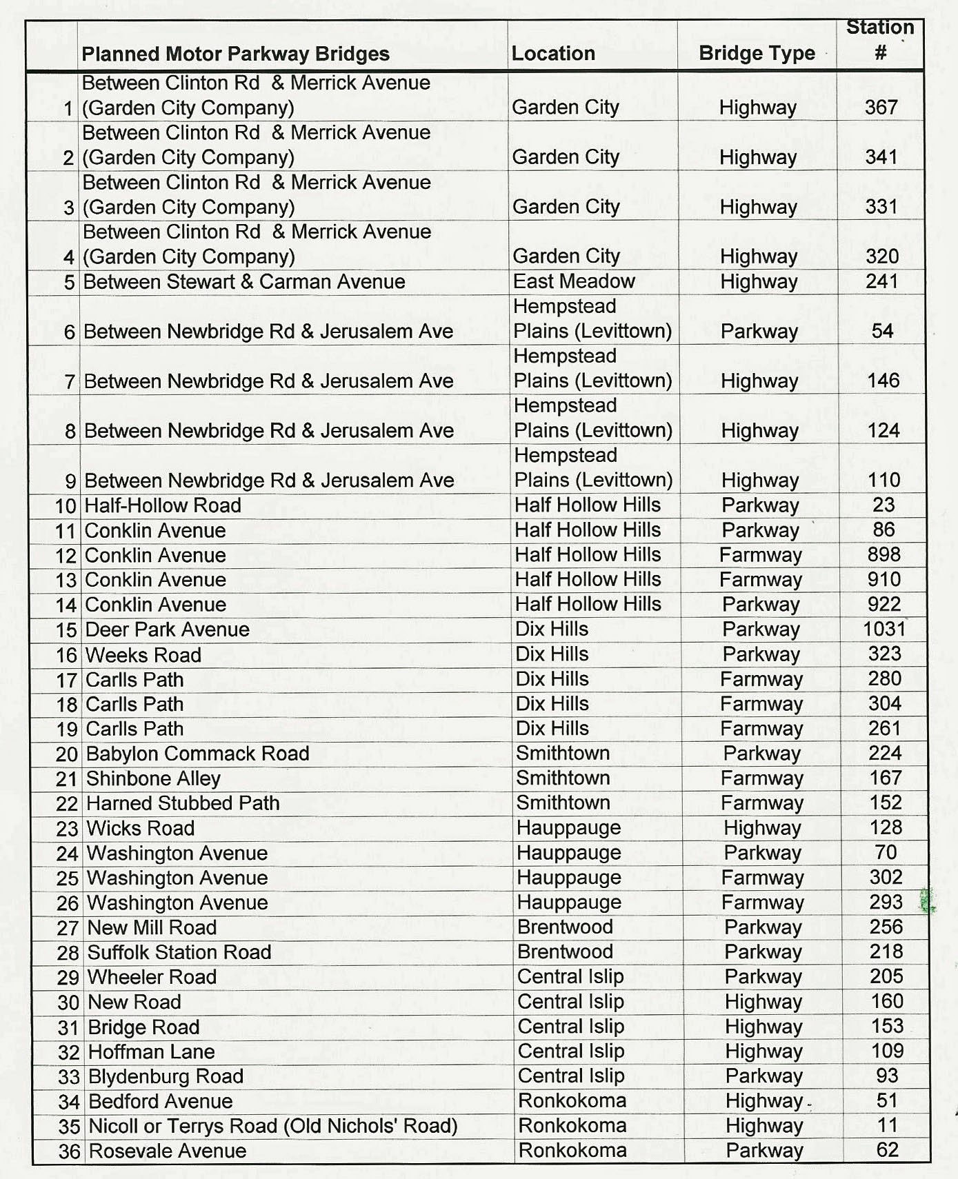
The 36 Motor Parkway bridges that were never built.
Close-Ups
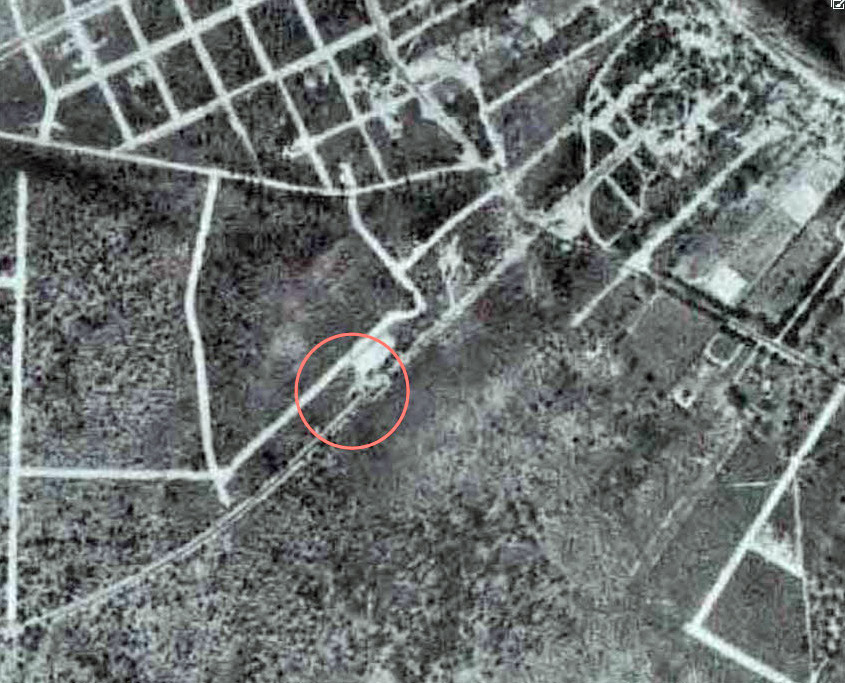
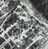
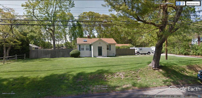
Likely location of the Ronkonkoma Lodge
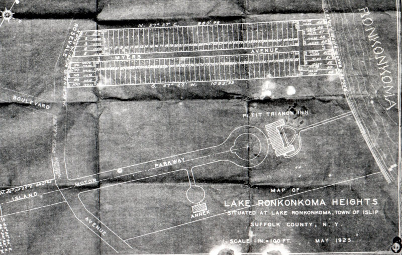
1925 schematic of Petit Trianon and the Annex
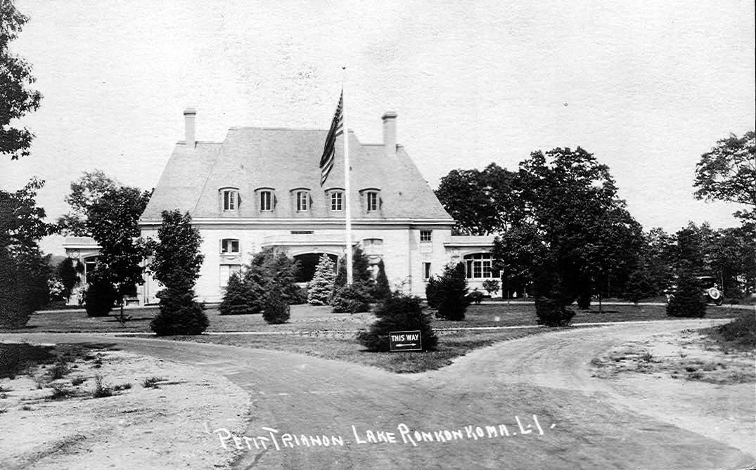
Petit Trianon
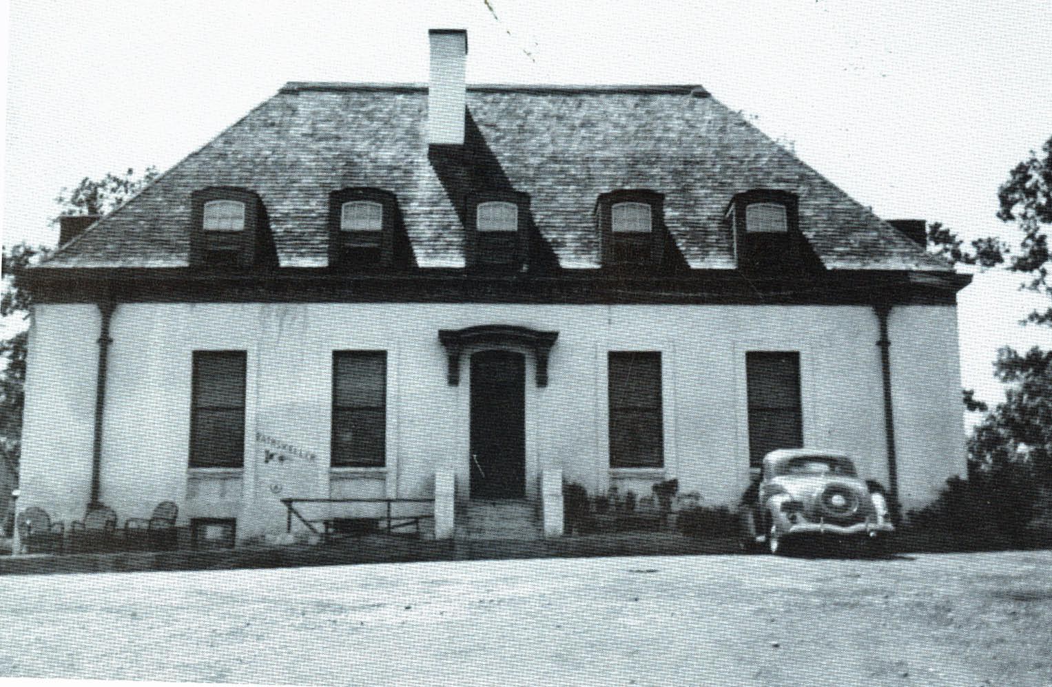
The Petit Trianon Annex
Femenias' Finding (Submitted by Frank Femenias)
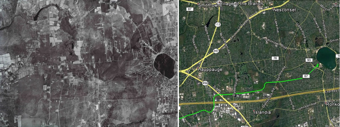
Then & Now
.
.
.
.
1. Wheeler Rd.
2. Roosevelt Bl.
3. Hawthorne Av.
4. Hoffman Ln.
5. Blydenburgh Rd.
6. South Bedford Av.
7. Old Nichols Rd.
8. Terry Rd.
9. Parkway Bl.
10. Oakdale Av.
11. Rosevale Av.

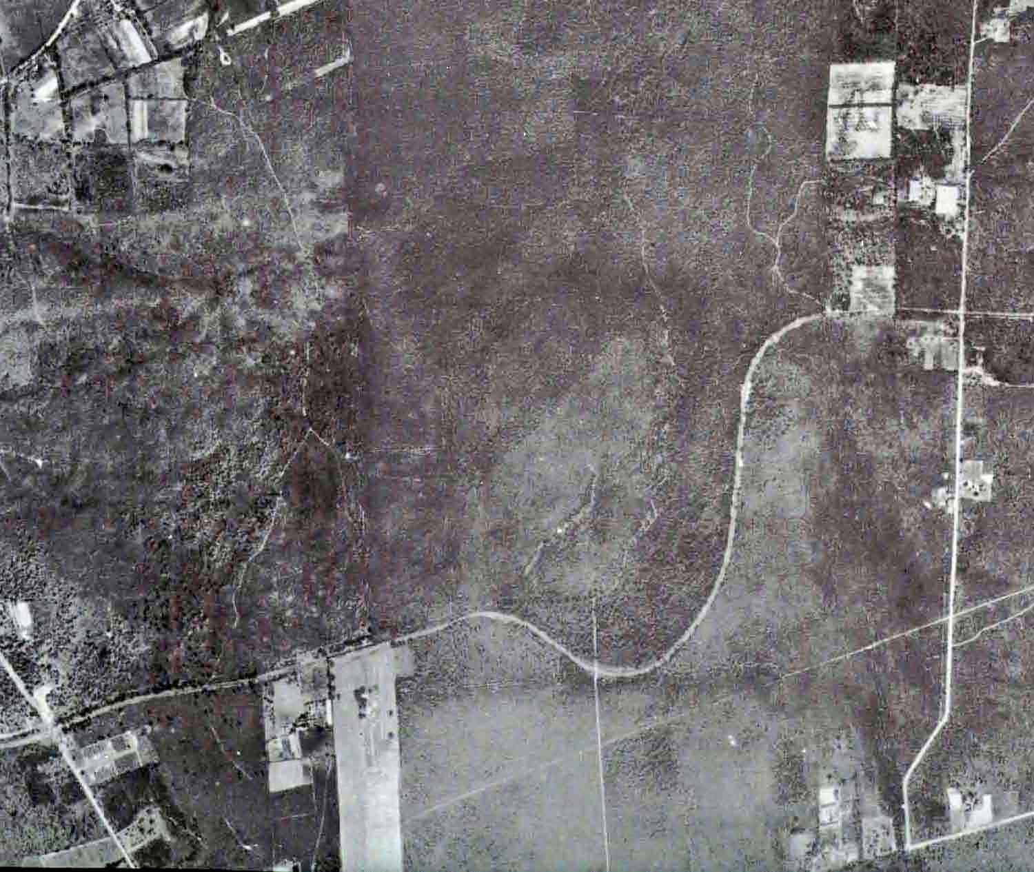
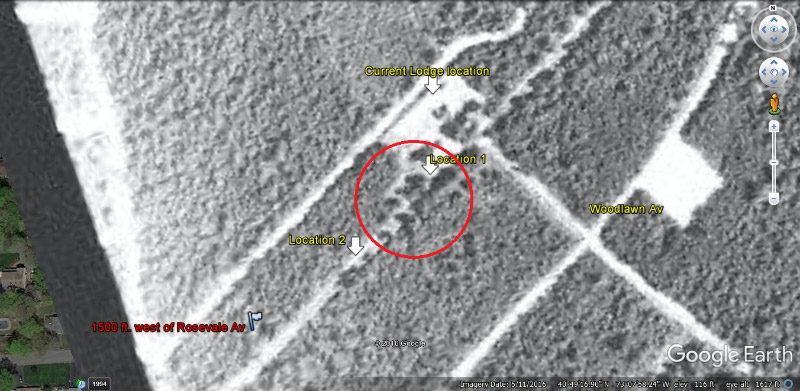
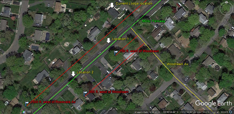
Possible locations of the Ronkonkoma Lodge, west of Woodlawn Avenue. Any comments if any of these two circles are correct?
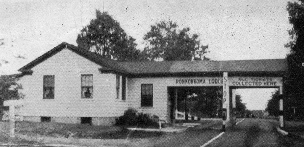
Ronkonkoma Lodge
Ronkonkoma Lodge (Circa 2012)Submitted by Frank Femenias
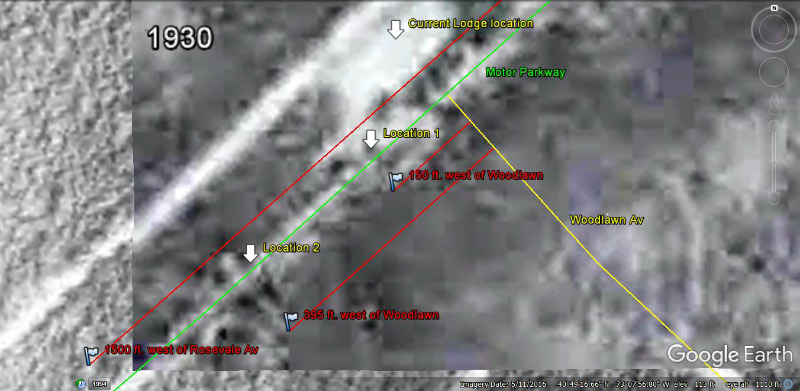
1930 Aerial (Submitted by Frank Femenias)
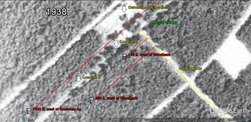
1938 Aerial (Submitted by Frank Femenias)
1938 Location (Submitted by Frank Femenias)
Frank Femenias: In the 1938 aerial, location 1 shows something on the road, and where location 2 comes up empty this time. Still not sharp enough to make anything out. A real mystery.
Kleiner's Korner (Submitted by Art Kleiner)

1925

1928
1931


Comments
From left to right, west to east, we are looking at the easternmost portion of the LIMP from Brentwood/Islip out to Lake Ronkonkoma.
The Ronkonkoma lodge, The Petit and Annex are visible. I’m not aware of any bridges in this portion.
Jericho Tok is visible. I’m assuming that is the northern state dumping out into 347 so we must be talking early 1940s at least. Probably later then that as Ronkonkoma area looks pretty built up. I’ll go with late 1940s as my guess.
photo # 17 looks like the eastern end of the pkwy by lake ronkonkoma.
gee- i meant #16 MYSTERY PHOTO IS LAKE RONKONKOMA
photo # 16 looks like the eastern end of the pkwy by lake ronkonkoma.
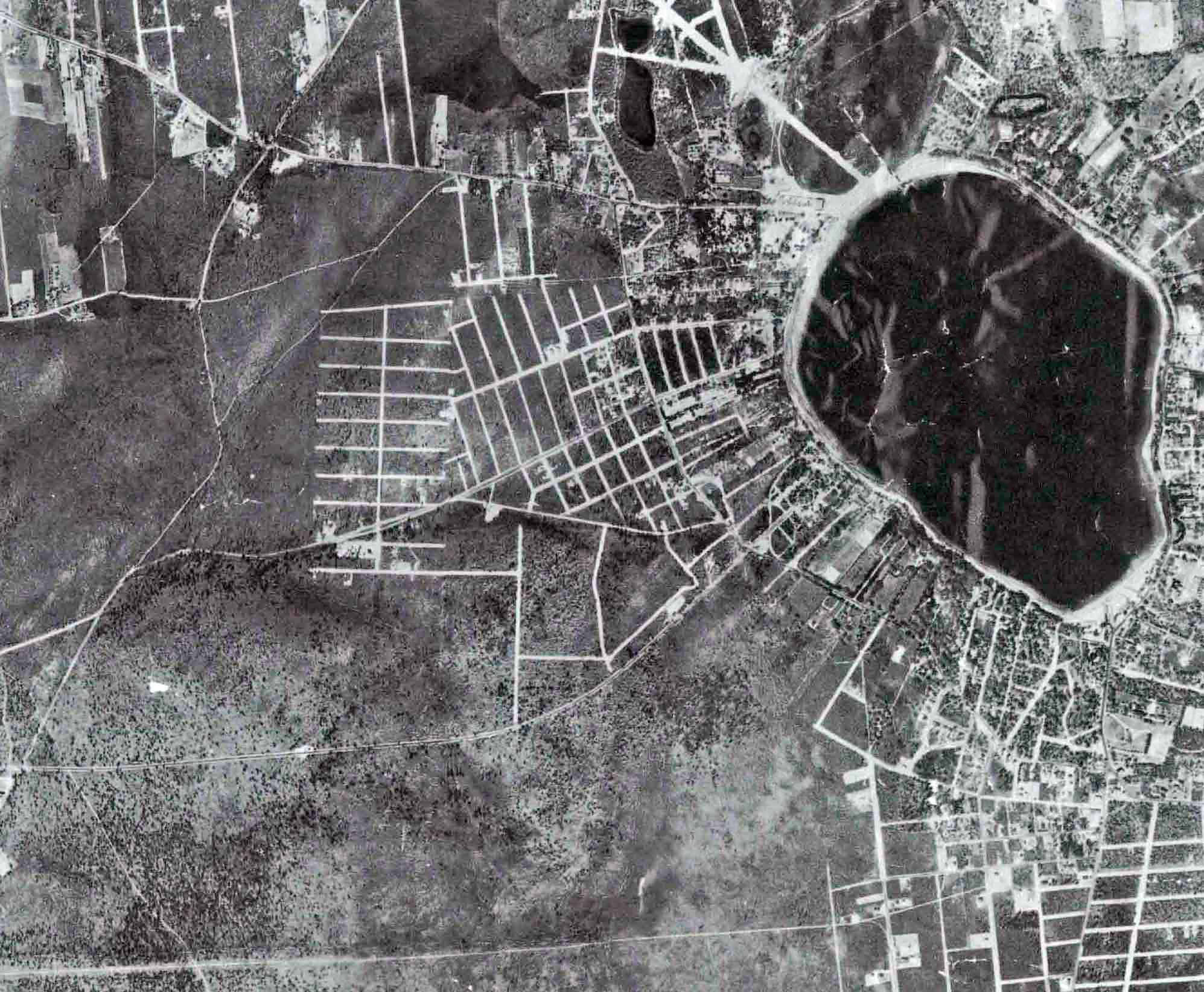
Lake Ronkonkoma and area west in 1930 from a Suffolk County aerial photo of county properties. Rosevale Avenue circles the western portion of the lake and vertically on the left are Old Nichols Road and Terry Road. The LIMP was only 16 feet wide here.
The Ronkonkoma toll house and Petit Trianon are visible on the left side of the lake.
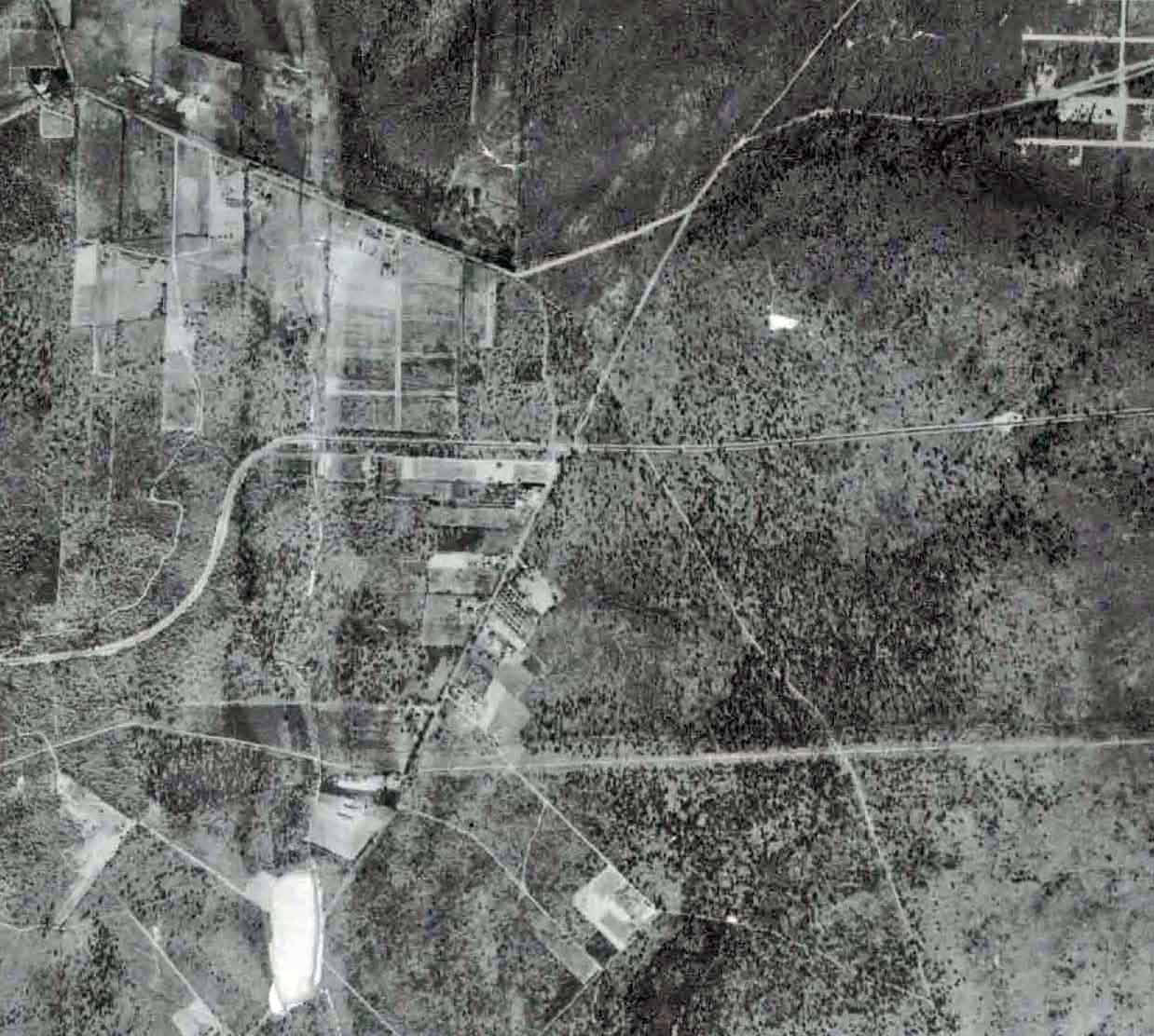
The last 5 miles of the Motor Parkway. If you reached this far, you’ve made it!
This aerial covers Central Islip to the LIMP’s eastern terminus in Lake Ronkonkoma, and Smithtown to Islandia north to south.
Neither bridges nor underpasses in this limp section. I counted 11 crossings that drivers had to deal with before reaching the end:
1. Wheeler Rd.
2. Roosevelt Bl.
3. Hawthorne Av.
4. Hoffman Ln.
5. Blydenburgh Rd.
6. South Bedford Av.
7. Old Nichols Rd.
8. Terry Rd.
9. Parkway Bl.
10. Oakdale Av.
11. Rosevale Av.
Veterans’ Memorial Hwy Rt. 454 would later enter this picture in 1950
Nesconset Hwy. Rt. 347 in 1951
Long Island Expwy I-495 1964.
Motor parkway structures include Petit Trianon, the Annex, and the Lake Ronkonkoma lodge.
Motor Parkway was 16 feet wide here.
Hard to determine if the LIMP is still open but Lake Dr. at the eastern terminus is still very wide. Guessing we’re still open, sometime before 1938.
I believe we are looking at o portion of Suffolk County from Central Islip through Ronkonkoma to the lake on the right edge. With the LIMP crossing Wheeler’s Road in the lower left corner, we can also see Nicoll’s Road, Smithtown Blvd., and possibly Middle Country Road (Rte. 25). As for bridges, I don’t think there are any (trick question?) since I believe the eastern-most bridge was Deer Park Road which is not in the photo. Although it’s tough to tell, the structures should be the Ronkonkoma Lodge and Petit Trianon. Not sure, but I think the width of the LIMP here was still the original 16 feet. Just a guess, but the date could be 1938 in preparation for Suffolk County acquiring the LIMP.
Identify the location of the aerial from left to right: Western Suffolk County (Melville) going east to Lake Ronkonkoma
Identify the major roads in the aerial: Some are Commack Road, Motor Parkway, Nichols Road, Hauppauge Road, Smithtown Blvd., sure there are more
How many Motor Parkway bridges can be seen in the aerial? Little East Neck, Wellwood, Wicks Road, Colonial Springs Road, Deer Park, Half Hollow Hills
What Motor Parkway structures are in the aerial? Petit Trianon, Commack Road Lodge, Brentwood Lodge, Deer Park Toll, Half Hollow Hills, Lodge Ronkonkoma Lodge
How wide was the Motor Parkway in this section? 16 feet across
When was this photo taken and why? 1930 - part of a Suffolk County project to have all “roads, terrain and property” in the county recorded.
Didn’t have time this weekend, so I’ll just guess at a few here..
The end of the LIMP from Wheeler Road to the end at Lake Ronkonkoma. There were no bridges beyond Deer Park Road, so no bridges, but we have the Petit Trianon and Annex. Unsure of the year and reason for the aerial, but if it’s after 1923, there should be a lodge across the road, but resolution isn’t good enough to make it out. The parkway was 16 feet wide at this section.
Mystery Foto #15….My research came up a bit short but here are some of the answers. Location from left to right… Hauppauge on the left and Lake Ronkonkoma on the right. South of Hauppauge now called Islandia. Majors roads are LIMP, Town Line road, Old Nichols Road, Johnson Avenue. I find no LIMP bridges as shown in the aerial. There are two LIMP Toll Houses showing in the aerial.The Motor parkway was 22’ wide at this point. Maybe. Don’t know when or why on the photo.
I’ve read all the past blogs concerning the Ronkonkoma Lodge. Most of them state the original location was about 1500 ft W/O Rosevale Ave, and that the lodge itself became a private residence when the LIMP ceased. The lodge was relocated 150 ft W/O it’s original location. I’m thinking to measure the 1500 ft from “Old Rosevale Ave”. Without measuring yet, the structure in the Blue Circle looks right.
Part 2: I revisited the “suffolkcountyny.gov” website. This site has the 1928-1930 Suffolk County Airmaps, along with “imaps” that date from 1947 thru 2016. Utilizing the DRAW TOOL within the imaps, the footage from the Petit Trianon west to #2561 LIMP ( relocated and renovated former Ronkonkoma Toll Lodge ) is about 1650 FT. The footage from the Petit Trianon to #2571 LIMP is about 1500 FT ( previous Ronkonkoma Toll Lodge location ).
I know it’s stated in past blogs that this lodge was originally about 1500 ft from Rosevale Ave, and then relocated another 150 ft west at it’s present location. But when measuring from Rosevale Ave and Old Rosevale Ave, these footages just land the 2 lodge locations to far west on the LIMP. I hope this doesn’t offend anyone. The assumed footages only work out when measuring from the former Petit Trianon.
Part 3: Please disregard my Part 2 comment. The house #“s I stated are not correct. The only facts that I’m confident with is that the former lodge is #2553 Motor Pkwy, and the footages had to be estimated from the Petit Trianon; not Old Rosevale or Rosevale Ave. I know the footages were estimates, and the measuring I performed were rough estimates as well.
Nice work with the overlays, Frank. I’ll need to study them for a while LOL.
Update: September 8, 2018
Close-Up of the likely location of the Ronkonkoma Lodge.