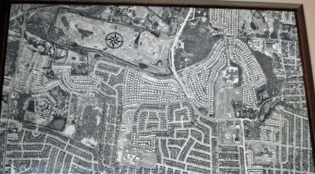
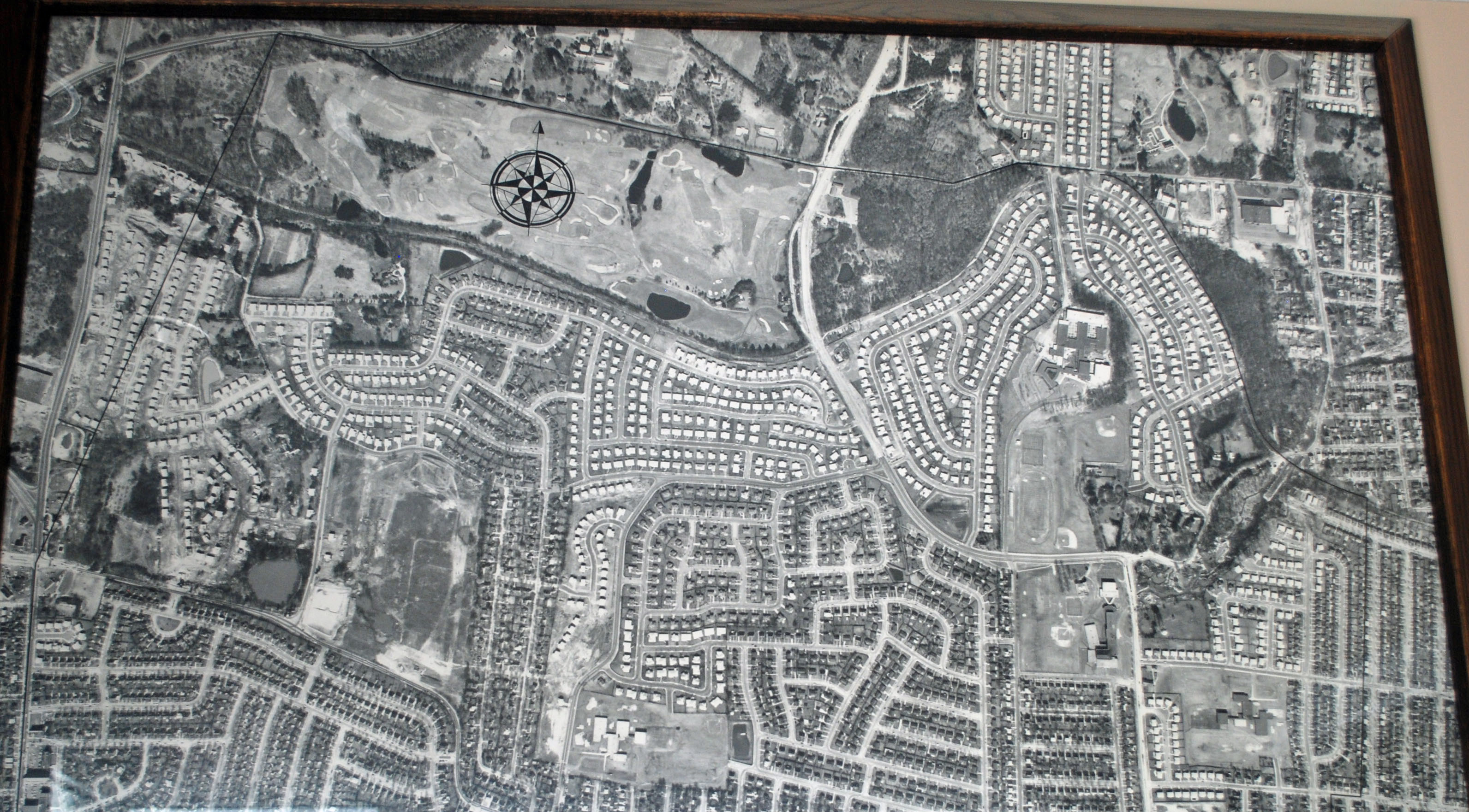
Mystery Foto #17 Solved: An Aerial of the Garden City Park Water District (Circa 1963)
My favorite co-author Al Velocci forwarded this large Motor Parkway aerial, which he discovered in a public place. Julianne Quinn and Jaime Cutinella assisted with the photography.
Mystery Foto questions:
- What is the location of this aerial (including the below close-ups)?
The aerial shows the Garden City Water District (follow the black line). Founded in 1922, the district includes Garden City Park, Manhassett Hills and sections of the following villages: New Hyde Park, Mineola , North Hills , Roslyn, Williston Park , Albertson , and Garden City
- What is the approximate date of the aerial? Provide a rationale.
Circa 1963.
Rationale:
- The Manhasset Hills residential development was built in 1958.
- Herricks High School opened in 1958.
- TheThe I.U. Willets Road Motor Parkway Bridge was still standing in 1960.
- Henry Viscardi School was built in 1962.
- Northern State Parkway Bridge #2 was taken down in the early 1960s.
- The Garden City Park Water District building opened in 1964.
How manyMotor Parkway bridges were built in the area of this aerial?
Six bridges (From west to east):
- Northern State Parkway Bridge #2 (Built by Robert Moses)
- New Hyde Park Road
- Old Courthouse Road (a Town of North Hempstead Landmark)
- Shelter Rock Road
- I.U. Willets Road
- Old Searingtown Road
- How many Motor Parkway bridges were still standing in the Mystery Foto?
Two bridges:
- Northern State Parkway
- Old Courthouse Road
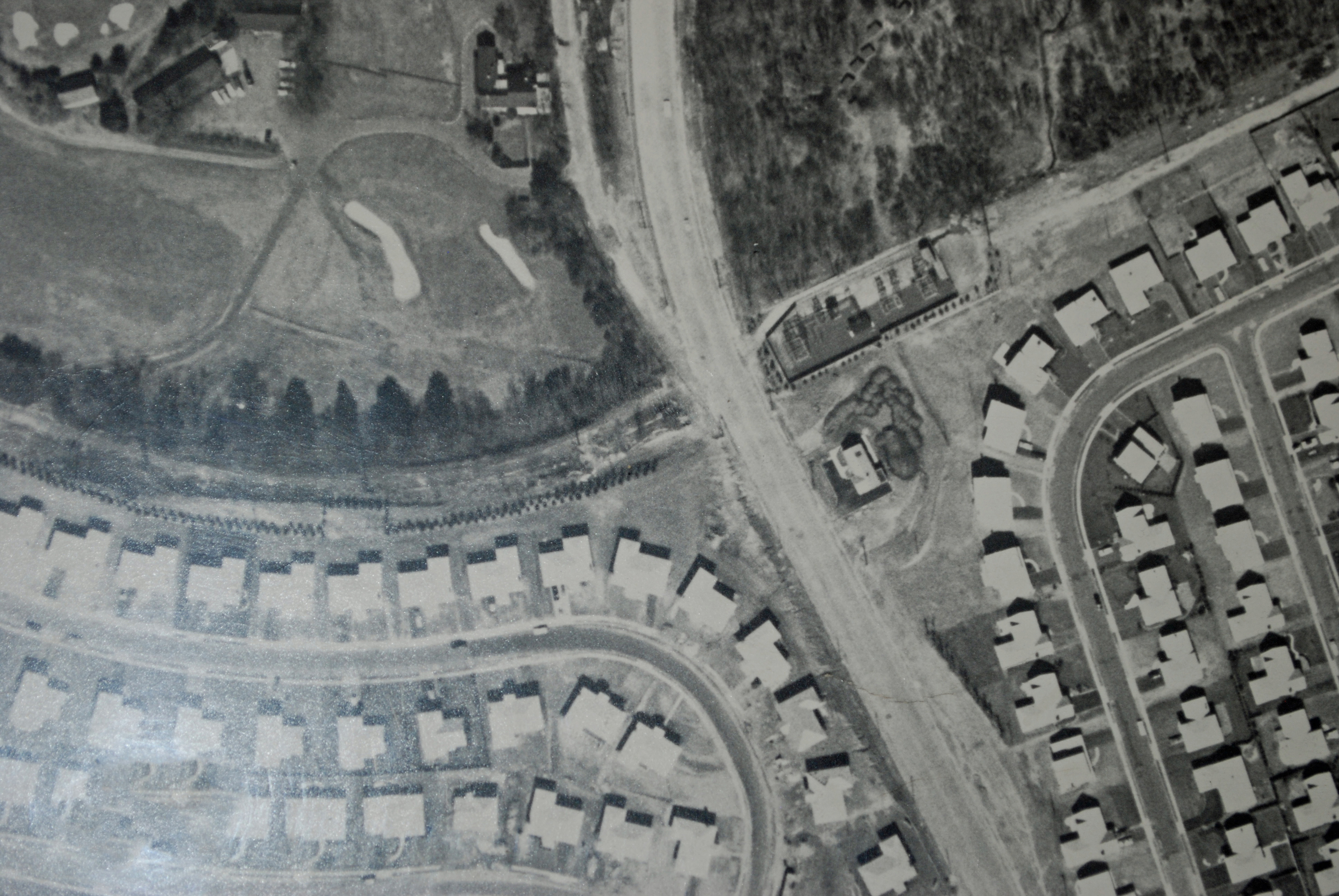
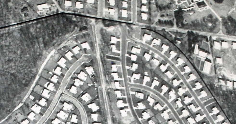
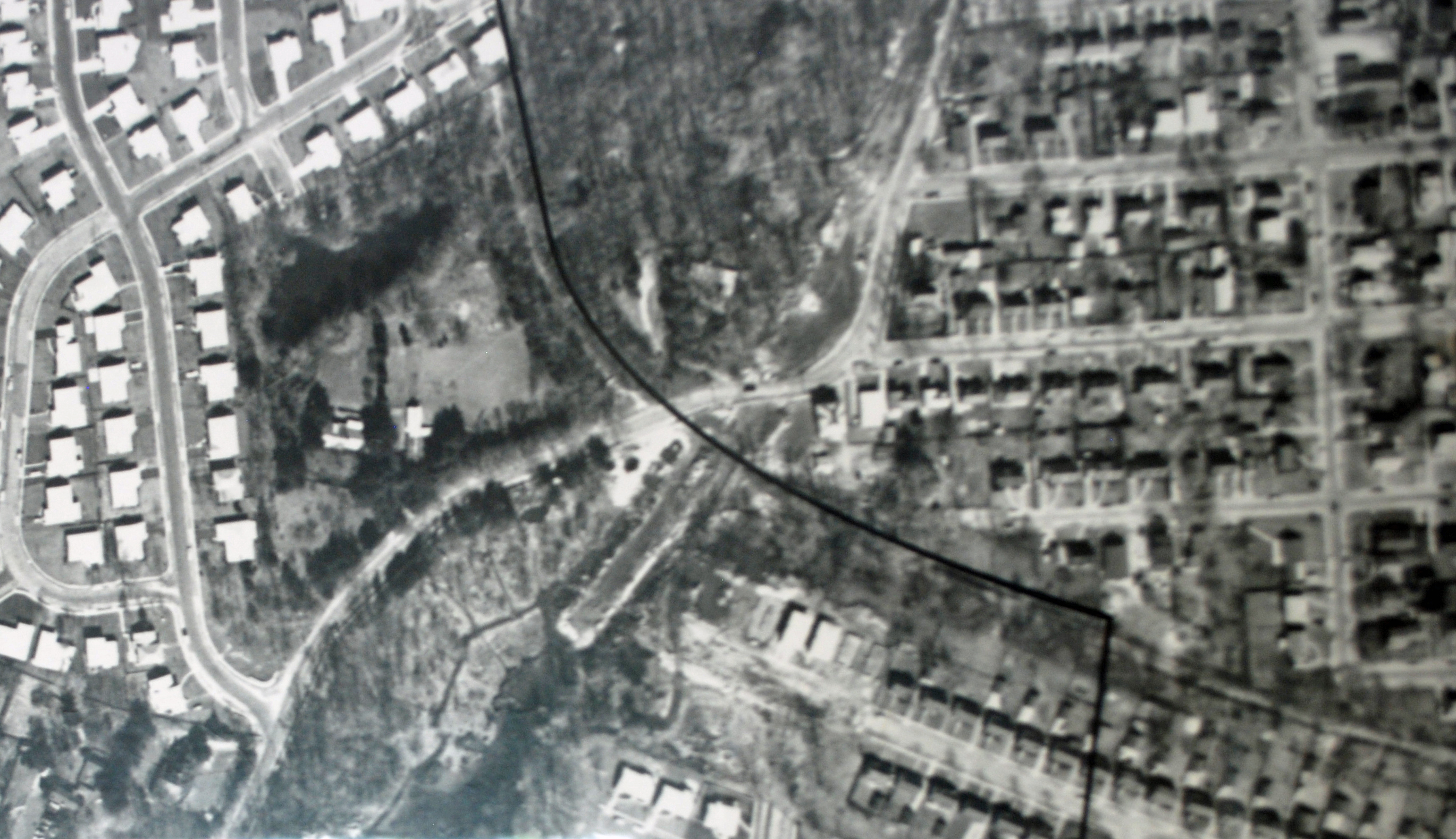
- Identify the golf course and schools in the Mystery Foto.
The Links Golf Club in Searingtown and Herricks High School, which opened in 1958. Other schools in the aerial include: Herricks Junior High School, Denton Ave Elementary School, Center Street Elementary School, Henry Viscardi School, Buckley Country School and part of Notre Dame School.
- Where is a copy of this aerial hanging today? Hint: Note the black line.
The aerial is hanging in the lobby of the Garden City Park Water District building at 333 Marcus Avenue in Garden City Park.
Comments (17)
Congrats to Joe Oesterle, Brian, Steve Lucas, Greg O., Art Kleiner, Sam Berliner III, Tom Hutchins, Pat Masterson (Hi Pat!), Andy, Greg O., Dave Russo, Mark Lanese, Tim Ivers, Frank Femenias, and Frank Mendyk for correctly identifying the location of the Mystery Foto.
Kudos to Mark Lanese and Frank Mendyk for correctly identifying the Garden City Park Water District building as the the location for the Mystery Foto.
Enjoy,
Howard Kroplick
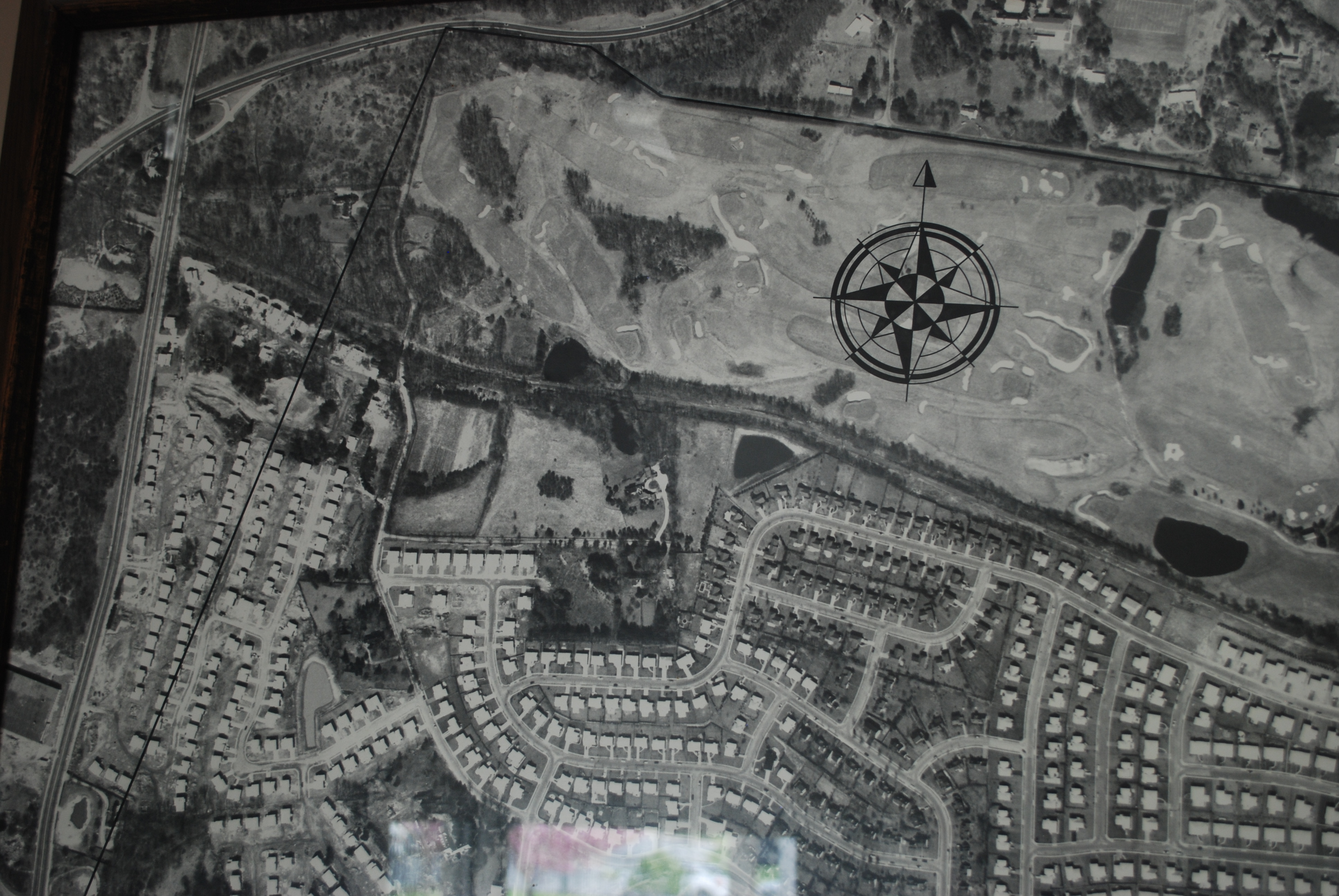
A great view of the Links Golf Club. Note: The black line indicating the water district.
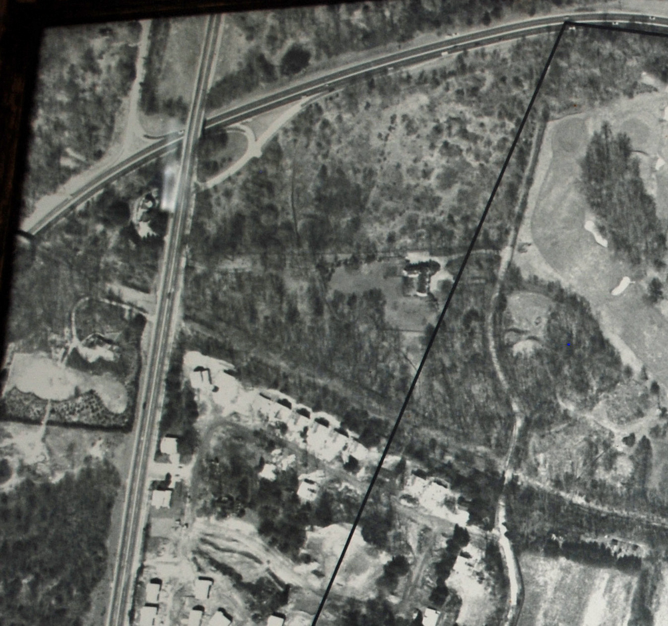
Two Motor Parkway bridges can be seen here: Northern State Parkway #2 and Old Courthouse Road.
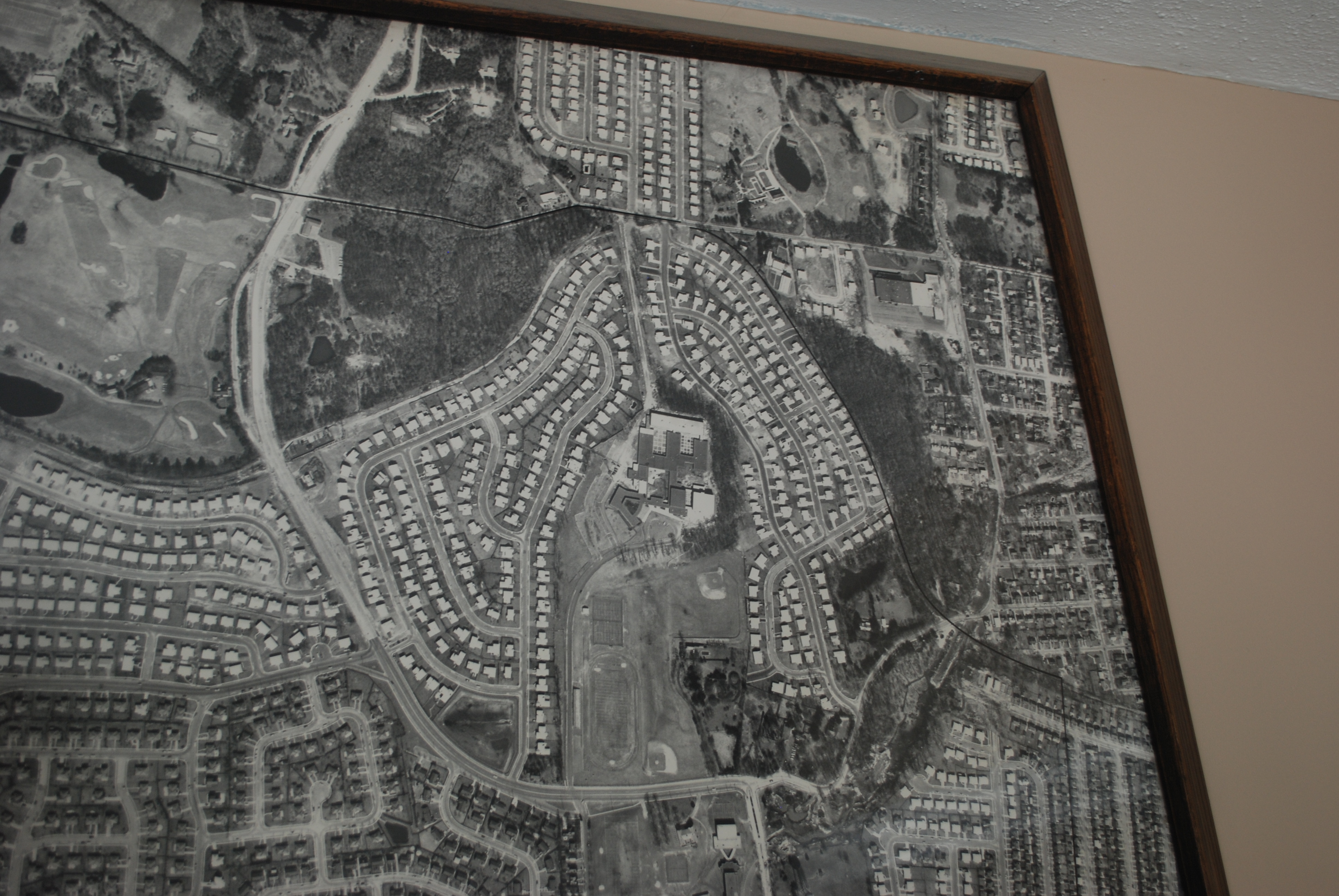
Note how the resident streets following the layout of the Motor Parkway.
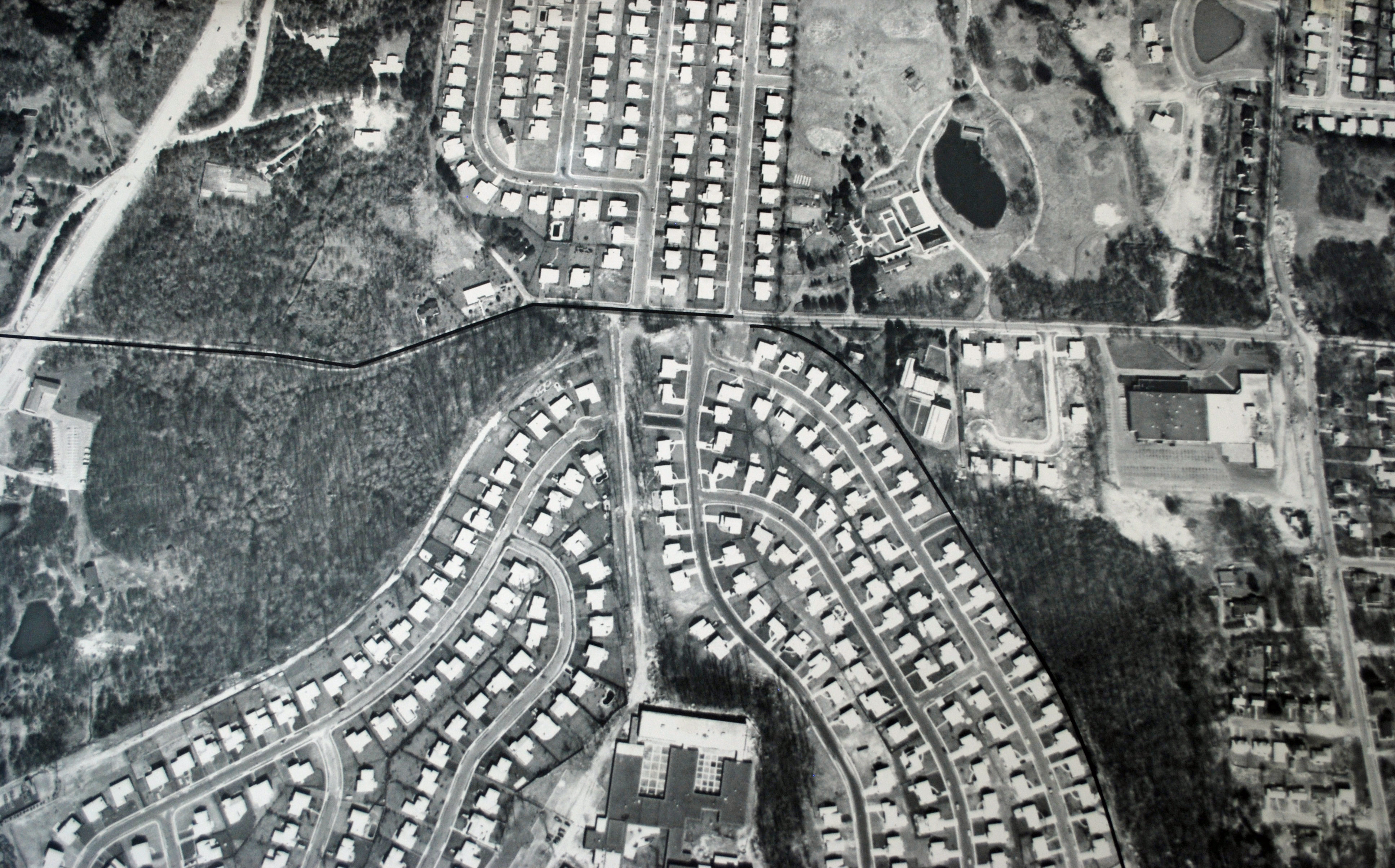
The I.U. Willets Motor Parkway Bridge appears to have been taken down, dating the aerial after 1960.
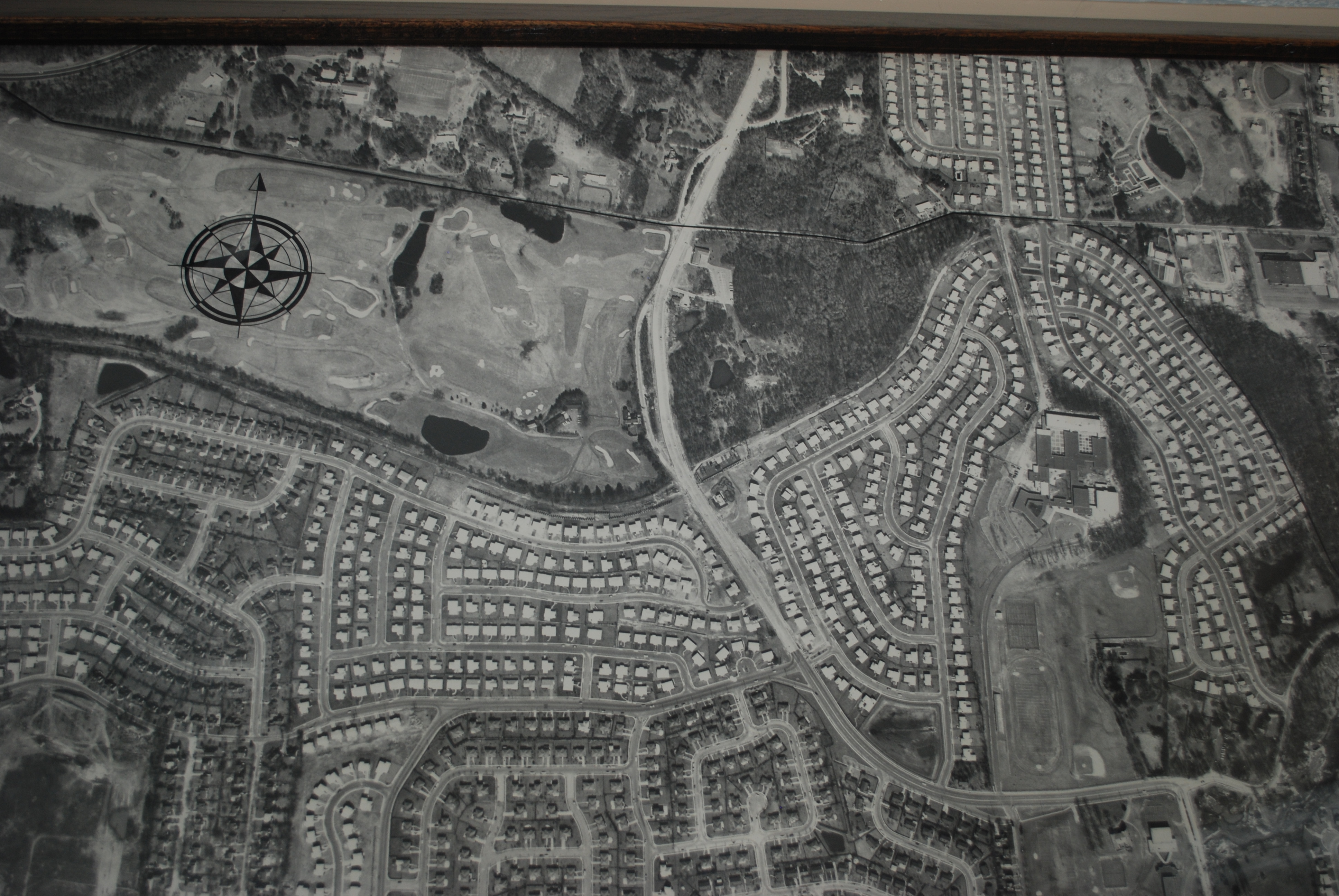
The Old Shelter Rock Road Bridge was gone in the aerial. It appears the new Searingtown Road was being built. In the middle of the aerial was the former private Motor Parkway gate entrance to the Links Golf Club.


Comments
I should be just a good sport and provide the answers for these mystery, but do realize this locale. Just want to say this framed map is of great detail of the old and new. Great find and thanks for providing this map to us, Mr. Velocci.
With the old Links Golf Club in the top Left, and Herricks High School in the upper right half, this picture shows the quick advances of the Long Island suburbs. The picture is right about 1960-61. Since the neighborhood of Sugar Maple Drive is already complete, yet the new expansion of Searingtown Rd into its current 4 land form has not yet occurred. The Albertson VFW and Shelter Rock Public Library, built in the mid 60’s also do not appear. I am not sure, but the black line could be the Herricks School District. The LIMP is seen from the Northern State near New Hyde Park Road, all the way to the ROW out behind Schley Ave in Albertson.
Great Picture. But an easy one.
Searingtown
Herricks HS
Links golf course
late 50’s early 60’s
3 bridges 1 still stands
Hangs in north hills village hall?
This photo is almost directly over my childhood home on Quaker Street in the Herricks section of North New Hyde Park. Since the Links Golf Course is still there, Shelter Rock Road is widened but Searingtown Road is not, I’ll guess a date of about 1980. There were six LIMP bridges built in this section: NSP #2, NHP Road, Old Courthouse Rd, Shelter Rock Road, I.U. Willets Rd. (farmway), and Searingtown Road. Only the I. U. Willets was still standing when the photo was taken. The school is my alma mater, Herricks High School. The black line seems to delineate some political boundary which could be the local fire district so I’ll guess fire house for where the photo is hanging.
-What is the location of this aerial (including the below close-ups)?
Recognized the area instantly as Dee’s old neighborhood of Manhasset Hills directly in the center.
-What is the approximate date of the aerial? Provide a rationale.
Judging by the look of her parents newly-built house and neighborhood, I’ll say 1958 since I know that was when their house was built.
-How many Motor Parkway bridges were built in the area of this aerial?
5 (+Robert Moses NSP Bridge)
New Hyde Park Rd PW Bridge
Old Courthouse Road HW Bridge
Shelter Rock Rd PW Bridge
IU Willets PW Bridge
Old Searingtown Rd PW Bridge
-How many Motor Parkway bridges were still standing in the Mystery Foto?
Aside from the Robert Moses bridge over the NSP on the very left edge of the photo, the only bridge left standing would be the Old Courthouse Bridge, as it is today.
-Identify the golf course and school in the Mystery Foto.
Formerly the Links Golf Club, was one of the most exclusive clubs of the Gold Coast era. Now a high end housing development. Before becoming a golf course the property was a farm belonging to I.U. Willets. The original farm house was used as clubhouse but was torn down in the 1980’s
-Where is a copy of this aerial hanging today? Hint: Note the black line.
Unsure, but a complete guess; maybe the North Hills Village Hall on Shelter Rock Rd or the Shelter Rock Public Library.
I forgot to mention the school is Herricks High School.
North New Hyde Park, Herricks, Manhasset Hills, Searingtown
Early 1960s - Herricks High School is already built 1958), Links Golf Course still there, houses in the area built around that time.
Motor Parkway bridges - Old Courthouse Road, New Hyde Park Road, Shelter Rock Rd., I.U. Willets Parkway Bridge, Old Searingtown Road. One left in photo (Old Courthouse Road)
Links Golf Club and Herricks High School in photo
Most likely in a library - possibly HIllside in New Hyde Park since Al is a resident.
I’m not going to do any research on this one. One thing is abundantly clear though; we are above Plattsdale (just SW of Searingtown), looking at the jog where the RoW stlll touches I. U. Willets Road at upper right. That’s Shelter Rock Road coming down the upper middle and meeting Searingtown Road coming down at upper right at the north end of Herricks Road. The school just south of the I. U. Willets juncture is Herricks H. S. and the golf course under the compass rose is North Hills C. C., with Deepdale G. C. to its left (west) and N. S. Univ. Hosp. is now just off-screen at upper left. Dunno about the black line but, if memory serves, this aerial hangs in the North Hills Village Hall on the west side of Shelter Rock Road just north of Links Drive. [Gotta restore my pp. 8 and 10 covering this area ‘way back when but all those old pix may be lost.] Sam, III
shelter rock rd on left, herricks high school in center, searingtown rd on the right
north hills golf course
after 1945
2 bridges
north hills village hall
Herricks High School is the large building on the right side. IU Willets road running across just above it. The golf course is the “Links” just west of Shelter Rock road. It was owned by the exclusive “Links Club”. Eisenhower played golf there sometimes.
The Court House Road bridge is visible on the left side of the picture.
THe most important piece of land I see is the Harness Boy Scout Camp Ground. THe land was a large land area of virgin forest across the street from Shelter Rock Road Golf Course.
THe land had been donated by Mr. Harkness whom was a large contributor to the original Motor Parkway and a friend and business associate of WKVanderbilt Jr.
THe camp provided the local boys scout with an area we never new before. We can from Garden City Park as 12-14 years old and with our Scout Pack meet to hike and join Jamborees with scouts from across Long Island. What a place, you would have all loved if you never saw it. THis was the late 60’s and early to mid-70’s.
OF course the Boys Scouts started selling it off in the 1980’s and right now they are growing big old houses that no one can afford.. The BSA was having debt problems and the camp was an asset.
I realized I need to revise my answer and include the IU Willets Parkway Bridge as still being standing along with the Old Courthouse Bridge if this aerial is indeed from 1958.
OK from west to east we start at the Northern State Parkway bridge location and quickly come to New Hyde Park Road (former bridge #2) and we are on our way to the Old Courthouse Road bridge (3) which is obviously still in tact because it is currently still in tact. Heading east (this is my favorite remaining section of LIMP) we have The Links golf course on our north and we arrive at Shelter Rock Road former bridge location (4). Now we divert north a bit and come to the IU Willets Road former bridge spot (5) and where Herricks High School is located just to our south. Next we make a southward turn coming to Searingtown Road former bridge (6). At the easternmost point of the map we are approaching Willis Ave former bridge but we don’t quite get there so there are 5 former bridges in this map and 1 remaining bridge.
As far as date is concerned I leave this stuff up to the cartographical masters. All I know is the Northern State is opened and things do look rather developed again so my guess would be early 1950’s.
This aerial picture was taken above part the Town of North Hempstead, including North Hills, Manhasset Hills, New Hyde Park, Searingtown, Williston Park and Albertson. Best guess as to when picture was taken would be 1963 based on my knowledge of when parts of Manhasset Hills was built as well as the existence of the Henry Viscardi School that was built in 1962. If we include the Northern State Pkwy, (although the picture cuts off the intersection of LIMP and NSP, and that bridge was built by Moses) there would have been 6 Limp bridges; Northern State, NHP Rd., Old Courthouse Rd, Shelter Rock Rd, bridge over what is now rear entrance to Herricks High School and Searingtown Rd. I can only be certain that the Old Courthouse Rd bridge was still standing at the time this photo was taken. The Links golf course. Herricks High School, Herricks Junior High School, Denton Ave Elementary School, Center Street Elementary School, Henry Viscardi School, Buckley Country School and part of Notre Dame School. This picture is in the Garden City Park water district office.
I don’t participate as often as I would like to, but I do enjoy each and every news letter you send out. Look forward to seeing you soon Howard.
Looking north over North Hills about 1960.
The Links golf course is visible near top left but was replaced by homes and streets.
A LIMP bridge is seen crossing Shelter Rock Road near the Links.
Another bridge crossed Searington Road.
Herricks High School is visible inside the cluster of streets and homes at center.
I think the black line delineates the boundaries of the village of North Hills.
Maybe the framed photo is somewhere in that village hall, built where the Links clubhouse once stood.
Herricks/Searingtown, IU Willets Rd on top
The location of the mystery aerial photo; is the towns and villages of Manhasset Hills, North Hills,, Searingtown, Herricks, Albertson and Williston Park.
The date of the photo was taken approximately around the time of 1964. This is the time the building in which the photo is displayed was built. The location of the building is 333 Marcus Ave, Garden City Park ( Garden City Park Water District /FD. The map was of the GCP water district coverage area.}
There were 6 bridges built in the photo
Remaining Bridges
1} Northern State Parkway bridge {parkway bridge} a portion can be seen
2} Old Courthouse Rd bridge #17 {highway bridge)
3} I.U. Willets Rd bridge #19 parkway bridge} remnants still remained
in 1965
The golf course is the old Links Golf Club. You can plainly see on the photo the old private entrance to the course from the parkway. {just north of the house on 235 Robby Lane.}
There are 5 schools in the photo. The main large school near the center is the Herricks High School (built in 1958}.
Having time now to properly respond to the mystery question (too late for me), I’m amazed of all the historic information collected from responses here. Hope to hear more from all again soon