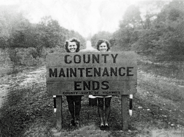
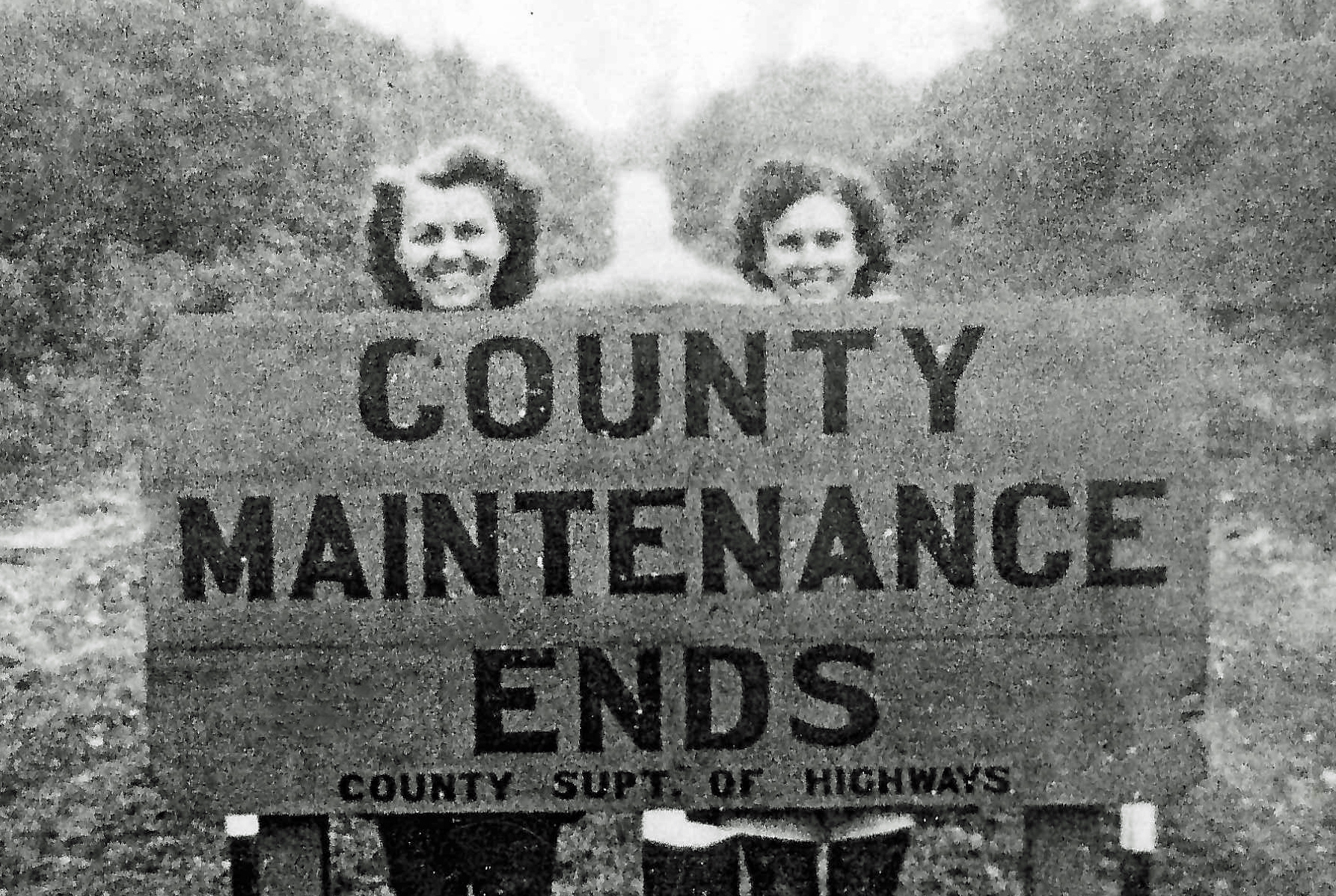
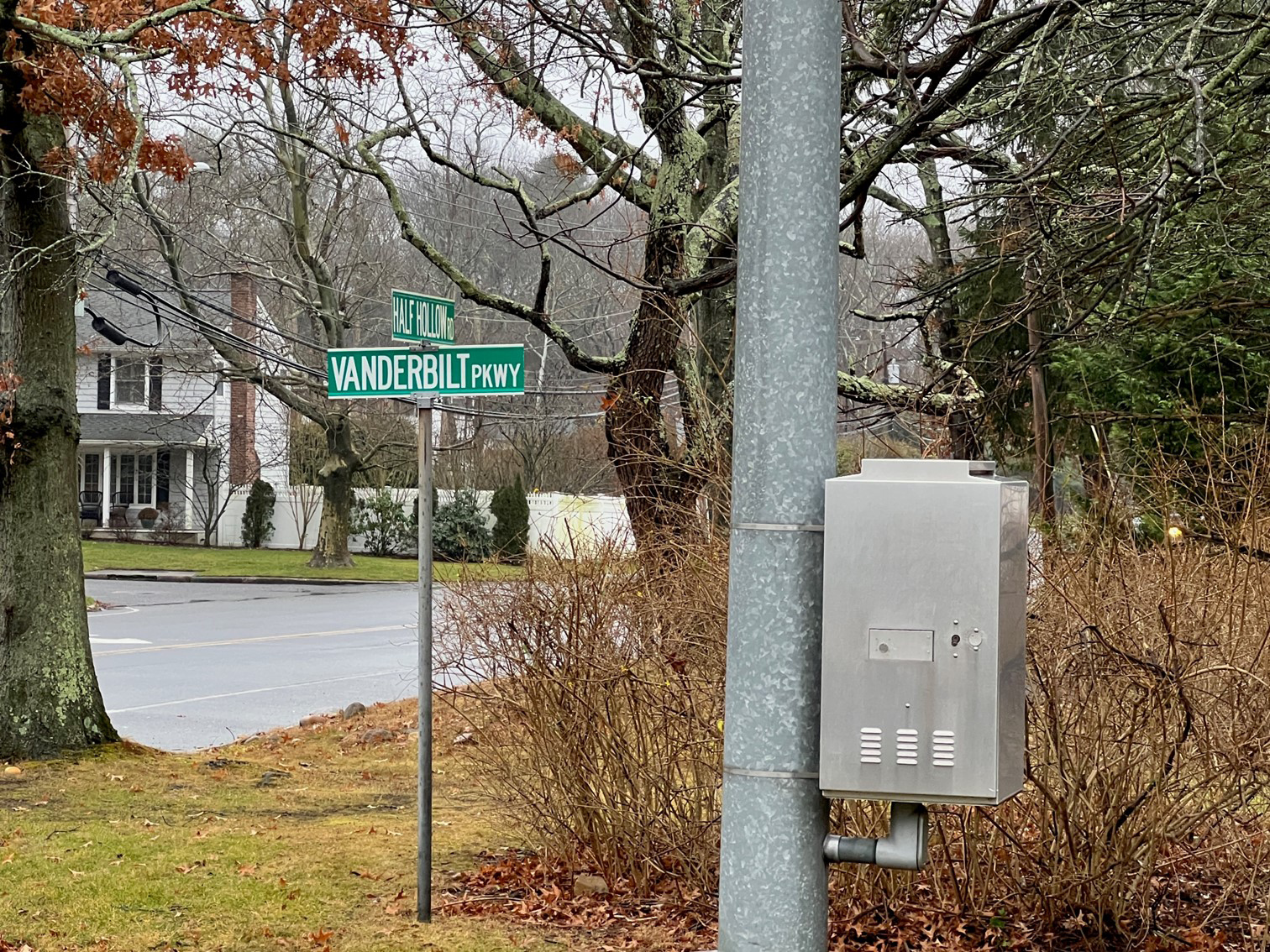
Mystery Foto #1 Solved: A 1940 view of the Motor Parkway at Half Hollow Road in Dix Hills
My favorite co-author Al Velocci challenged you to identify the first Mystery Foto to be solved in the New Year.
Answers to the Mystery Foto questions:
- Identify the location of the Mystery Foto and the orientation of the photographer
The location is the current intersection of Half Hollow Road and the Vanderbilt Parkway in Dix Hills. The view is looking west.
- Explain the meaning of the sign
The 1940 sign indicated the location where the maintenance ended for the abandoned Motor Parkway (heading west) by Suffolk County Department of Highways. The 13-miles heading east of this location became and remains an active public road (Vanderbilt Parkway and Route 67.)
Comments (7)
Congrats and kudos to Al Prete, Steve Lucas and Brian McCarthy for correctly identifying this fun Mystery Foto.
Happy New Year,
Howard Kroplick
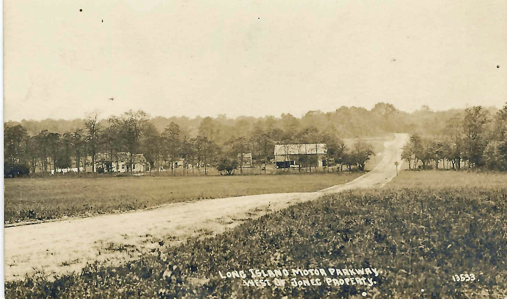
Hint
This postcard shows the same location of the Motor Parkway.
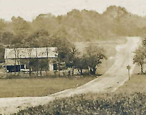
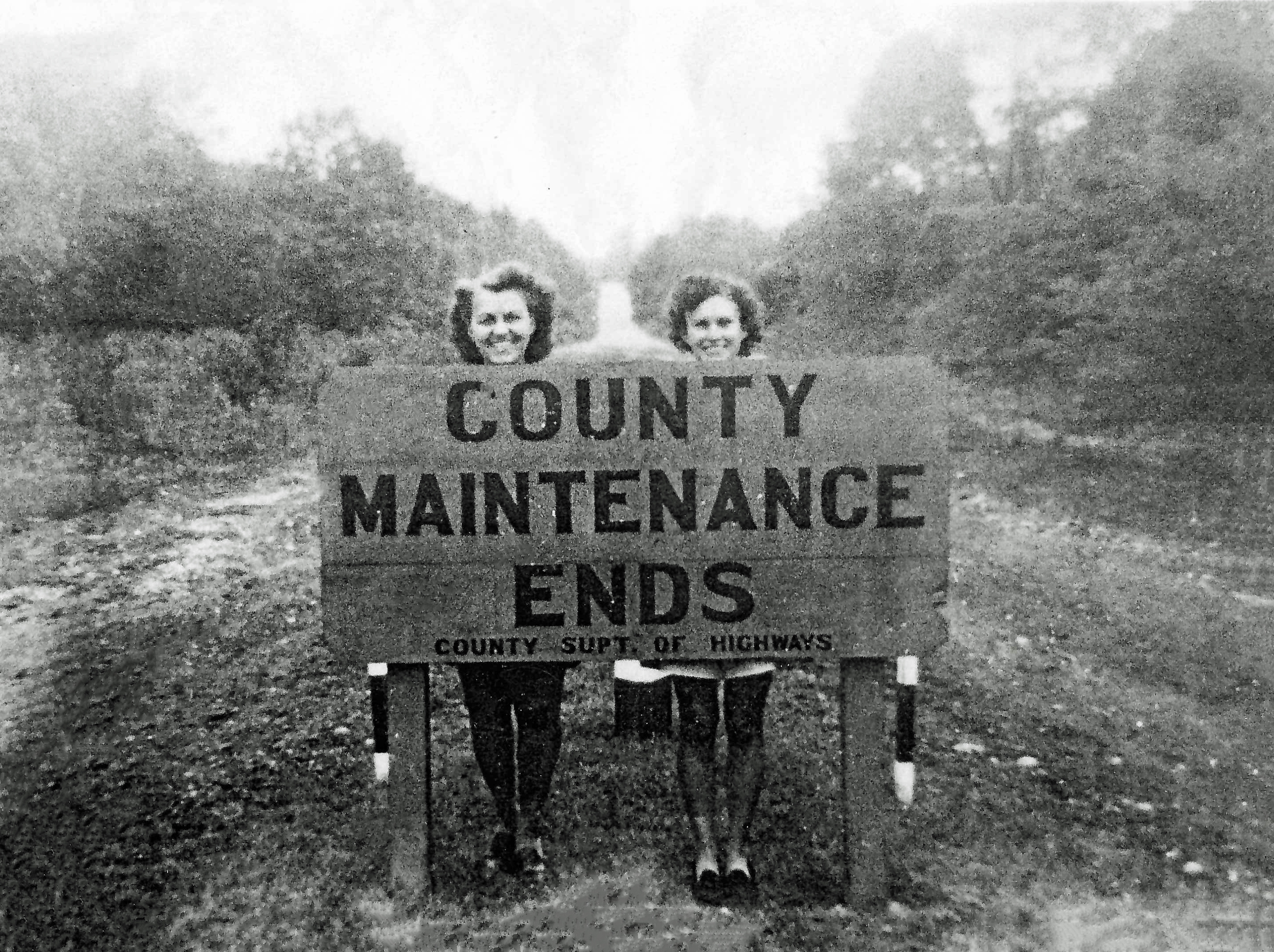
Close-Ups
July 1907 Survey
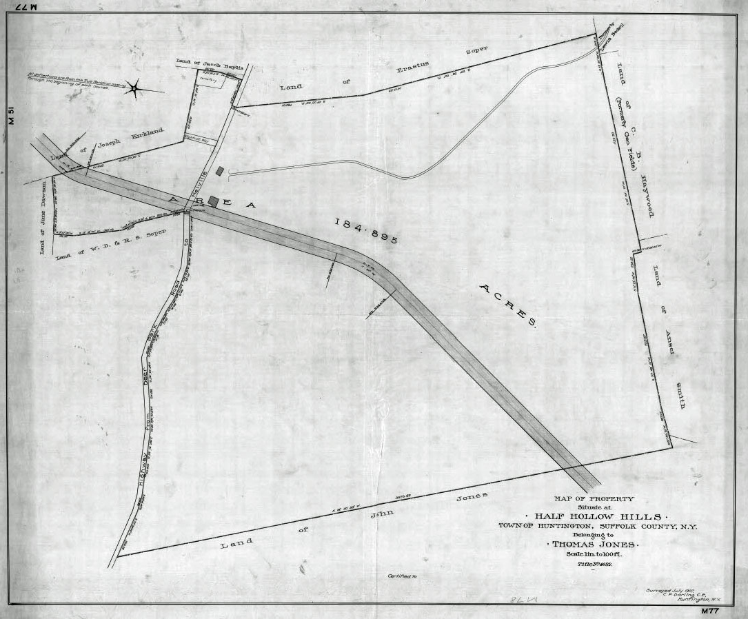
The Motor Parkway through the Thomas Jones property in Half Hollow Hills. The road on the left running north/south is Half Hollow Road.
2008 View
View looking east at the intersection of Half Hollow Road and the Vanderbilt Parkway as seen in 2008 by Al Velocci.
2021 Views
The intersection of Half Hollow Road and the Vanderbilt Parkway in Dix Hills
View looking west at the intersection.
Confirmation of a hill west of the intersection as seen here at nearby Fox Lane.
Then & Now
Then-1940
Now- 2021. The model is the lovely Roz.


Comments
This is just a stupid wild guess. Since the present-day Vanderbilt Parkway/Motor Parkway in Suffolk County is a county route (CR 67), could this be the western end of the present road? If it is, the photographer would be looking south. Behind the sign (and the ladies) would be a section of the (closed) Motor Parkway sold to private developers, while behind the photographer would be a section that was sold to (or taken by) the county and became the present highway.
I’m curious who the ladies are.
Happy New Year to all!
Guessing here - Somewhere in Commack - possibly east of Commack Road looking east. Or Harned Road extension that connected the Motor Parkway and Jericho Turnpike. In 1941 the latter was given to the Town of Smithtown the sign indicating Suffolk County was not responsible.
I think we’re looking south (or slightly southwest) on the LIMP at the intersection with today’s Half Hollow Road in the Dix Hills / Half Hollow Hills area. After the LIMP closed in 1938, it is from this point heading east to Lake Ronkonkoma that Suffolk County continued to maintain and improve the road that would eventually become CR67. Behind the sign toward the Nassau-Suffolk border, much of the LIMP right-of-way would be sold by the county, subdivided, and developed or left to nature for us fanatics to explore.
Great foto, Al! I think the photographer was standing where the LIMP & Half Hollow Rd intersect, facing west. The 2 ladies behind the maintenance sign are smiling east. The parkway wasn’t maintained west of this sign & onwards.
The cool postcard shows the parkway west of the Jones property. The 1917 map below shows Jones properties largely just east of Half Hollow Rd, & a property just west of Half Hollow Rd. I’m also showing reference to a couple of photos taken by the mystery duo during the 1960’s. Think the postcard & the 1960’s show the the same curve in the parkway from opposite directions. Then the gated private rd, which I think is where the maintenance sign was.
My only guess with help from the hint photo - two beauties at the Nassau-Suffolk county line, photographer looking west into Old Bethpage Village just two years after the LIMP closed. The elevation in the far rear could be the Claremont Ave parkway bridge, to be removed ~10 years later in the 1950s. The meaning of the sign could be Nassau County’s limit of maintenance responsibility at the county line.
Perhaps the women are related to Al during a LIMP exploration near the Old Bethpage Village
WOW! Could that be Al Velocci’s wife and daughter? Looking forward to this week’s answer
I have family living on Fox Lane. They showed me where their neighbor’s property is irregularly shaped, because the Motor Parkway ran through it.
As a fan of classic theatrical cartoons, I can’t resist posting this picture, from the 1948 MGM cartoon “Lucky Ducky,” directed by Tex Avery:
I’m accustomed to viewing maps northbound, so here’s the 1907 survey & 1917 Belcher Hyde Map.
Al Prete - could this be the irregular property in Dix Hills? Homeowners Arlene and Carmine have a 275ft section of Motor Pkwy in their yard!
https://www.vanderbiltcupraces.com/blog/article/long_island_motor_parkway_preservation_society_visits_a_hidden_section_of_t
Regarding the identities of the two women…. the original photo is owned by the Huntington Historical Society. Some 20 years ago I was allowed to make a copy. My recollection was that the photo was part of a particular family’s gift to the Society. They could possibly identify the two young ladies.
Frank - It’s hard to tell from the photos on the website and the overhead photos on Google Maps. The irregularly-shaped property is across the street from my family members. It’s small and fenced in, and doesn’t look like it has any old pavement on it. I’ll ask.
Frank - We couldn’t come to any conclusions about where Arlene and Carmine’s house is in relation to theirs.
Thanks to Al Prete for the cartoon reference - love that ! ( you have to understand that I taught art for 35+ years so this would be a treat to see!)
Al Prete - I believe below is Arlene and Carmine’s stretch of Motor Parkway in Dix Hills. Amazing how they managed to uncover, and then preserve the historic roadway!!
I did some internet sleuthing, and I know the address. I won’t reveal it here.
Thanks Al. This section is now on private property. No way to access unless granted permission.
It’s been 10 years since the LIMPPS visited Arlene and Carmine’s place. Perhaps another visit will happen soon.
I remember the cartoon “Lucky Ducky”, cool image.
From 1967 - 2014, my family lived at 5 Vanderbilt Parkway in Dix Hills. This postcard includes a piece of my then-future / now-past front lawn in it. It’s the vegetation in the lower right portion of the photo. It’s odd seeing Vanderbilt cross Half Hollow close up, but I recognize that downward slope approaching Half Hollow Road. Lotta memories.