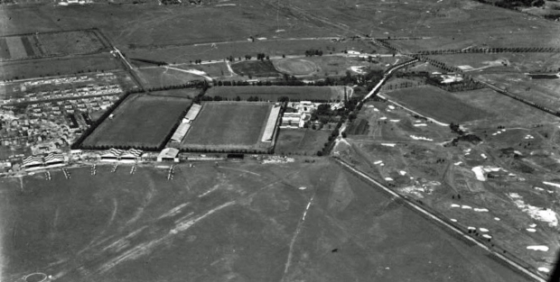
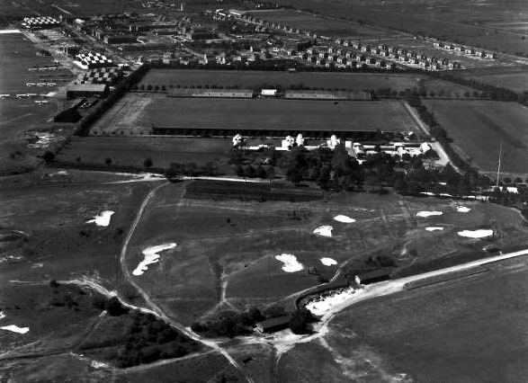
Mystery Foto #1 Solved: 1932 Aerial of the Meadow Brook Hunt Club from the SMU Ritchie Collection
The first Mystery Foto of 2018 was an aerial from an online university digital collection. It is one of 83 images of Long Island including over 35 aerials of estates.
Mystery Foto questions:
Identify the following:
- Location of the aerial and the photographer's orientation
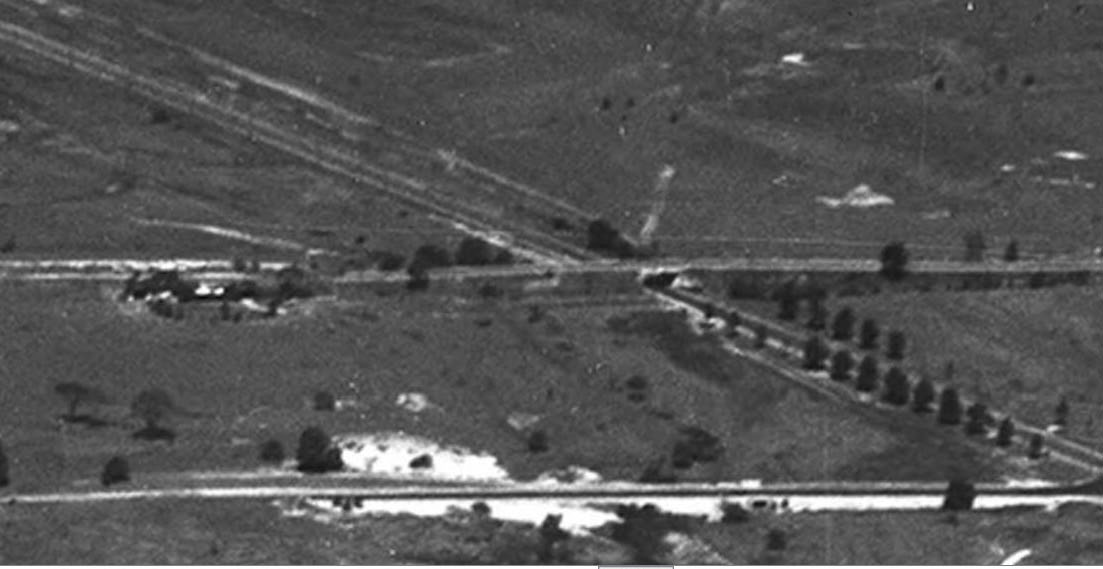
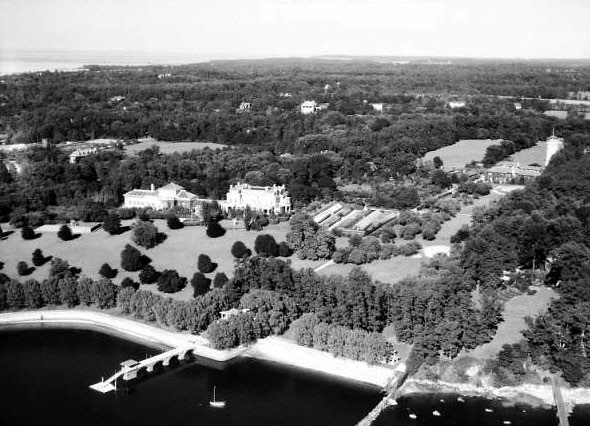
Looking northeast over Mitchel Field and the Meadow Brook Hunt Club.
- The Long Island Motor Parkway bridges and structures
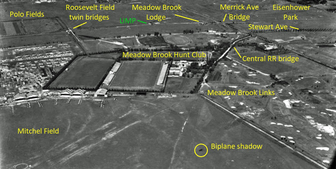
Merrick Avenue Motor Parkway Bridge
Roosevelt Field Motor Parkway Bridge and its adjacent Meadow Brook Hunt Club Bridge
- Other historic properties that can be seen in the aerial
- The estimated year of the aerial. Provide a rationale.
Circa 1932-1934. Mitchel Field runways were still not paved and the hangars have a checkerboard pattern (painted after 1931).
- The name of the digital collection and its university location
The Robert Yarnall Richie Photograph Collection of SMU Central University Libraries
Robert Yarnall Richie (1908-1984) worked as a free-lance commercial and industrial photographer for many large corporations including those in the automobile, aviation, chemical, mining, petroleum, railroad, shipping, steel and other industries, both in the U.S. and overseas. Richie's work is significant for its artistic qualities as well as documentary information.
The Robert Yarnall Richie Photograph Collection, held by the DeGolyer Library, contains corporate and industrial photographs made by Richie from 1932-1975.
Richie often worked for Fortune, Life, Scientific American, The American Magazine, Time, National Geographic and other magazines, in addition to illustrating annual reports for Fortune 500 companies including General Motors, U.S. Steel, Gulf Oil, Phelps Dodge, and Dresser Industries among many others.
An avid pilot, Richie's work also contains thousands of aerial photographs from many locales, including hundreds of estates and clubs in Palm Beach, FL, Long Island, NY, Newport, RI, and other wealthy suburbs. Other aerials include well-known buildings in New York City, as well as bridges and other landmarks.
As a pioneer in the field, he excelled in making artistic views of corporate industrial subjects in a mid-century modernist style. Richie often took unusual angle shots creating dramatic photographs of what could have been mundane subjects.
Bonus: Where is the flying biplane in the aerial?
East of the polo field.
Comments (13)
Congrats to Greg O., Joe Oesterle, Sam Berliner III, Art Kleiner (see Kleiner's Korner), Tim Ivers, Dan Templeton, Ernie M., Steve Lucas, Brian McCarthy, Frank Mendyk and Frank Femenias for correctly identifying the location for the Mystery Foto.
Kudos to Sam Berliner III, Art Kleiner, and Tim Ivers for finding the flying biplane to the east of the polo field.
Enjoy,
Howard Kroplick
Femenias' Findings (Submitted by Frank Femenias)
Close-Ups
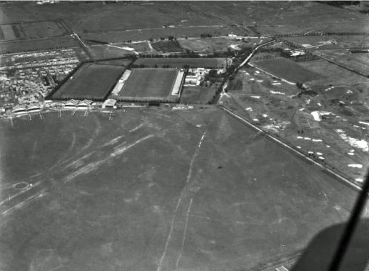
Meadow Brook Hunt Club, Westbury, Long Island, New York
An online interactive link is provided for each photo on the SMU website.
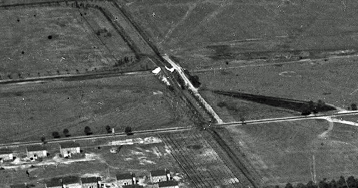
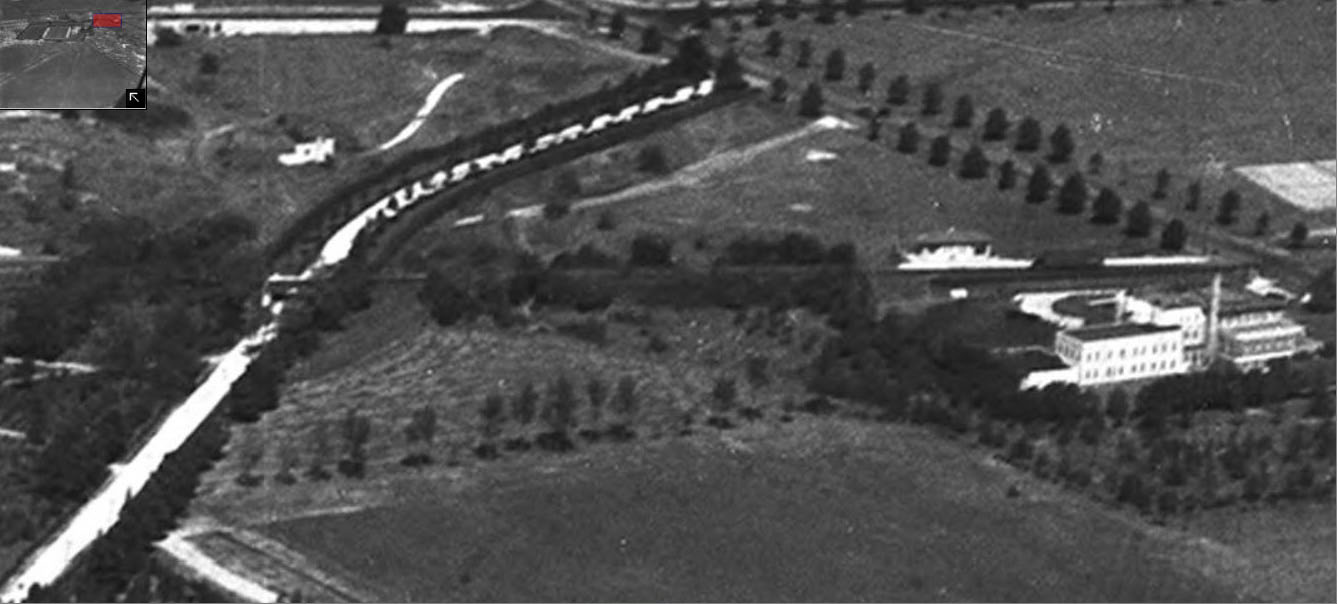
The Roosevelt Field Motor Parkway Bridge on the right. The parallel bridge on the left was built by the Meadow Brook Hunt Club to reach their northern polo field.
The Motor Parkway can be seen across the middle of the close-up. Stewart Avenue can be seen across the bottom.
On the Motor Parkway: The Meadow Brook Lodge (left) and the Merrick Avenue Motor Parkway Bridge (right).
The entrance to the Meadow Brook Hunt Club (white road).
Central RR Bridge, Salisbury Plains Railroad Station,and the Salisbury Golf Club clubhouse
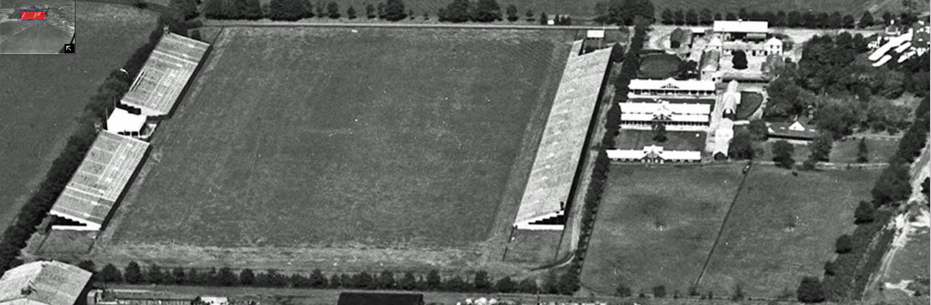
The polo fields, stables and clubhouse of the Meadow Brook Hunt Club.
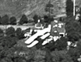
A biplane can be seen at the right corner of the above close-up.
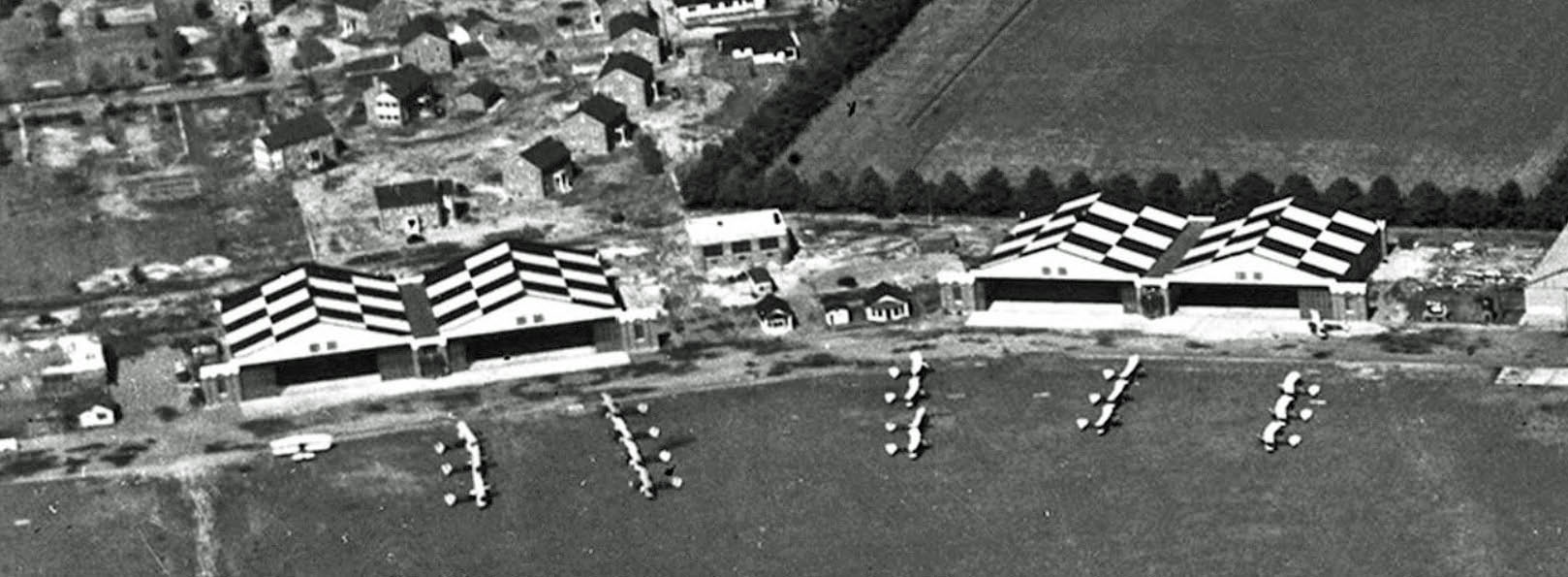
The hangars of Mitchel Field.
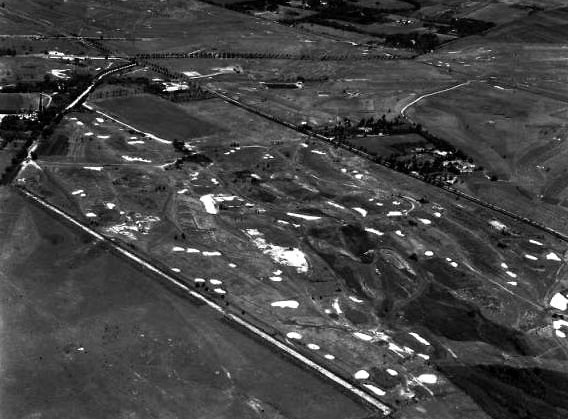
Other Meadow Brook Hunt Club Aerials from the Ritchie Collection
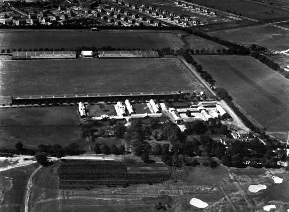
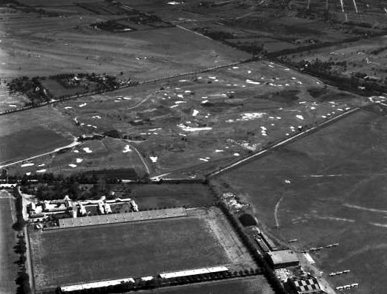
Check out the Meadow Brook links golf course
The Ladenburg estate and the Motor Parkway can be seen in the top of the aerial.
Mitchel Gardens can be seen in the right corner.
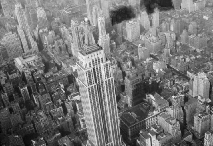
Other Images in the Collection
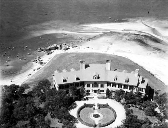
Herbert Bayard Swope's 'Keewaydin' Estate, Sands Point, NY 1932-1934
The Land's End mansion which may have inspired F. Scott Fitzgerald.
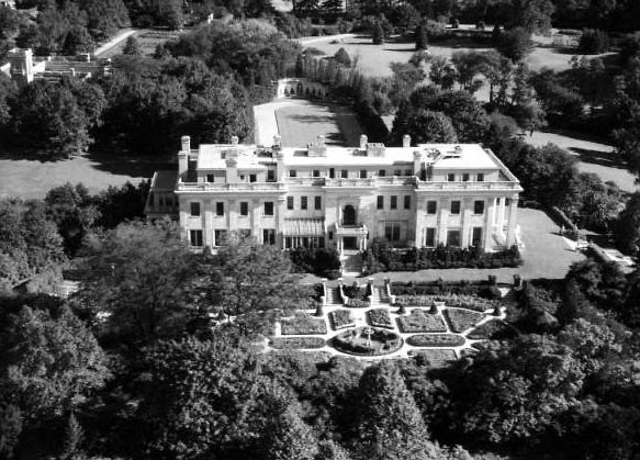

Harry Guggenheim's 'Falaise' Estate, Sands Point, NY 1932-1934
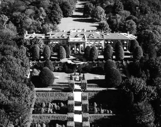
Arthur Loew, Sr.'s 'Pembroke' Estate, Glen Cove, NY 1932-1934
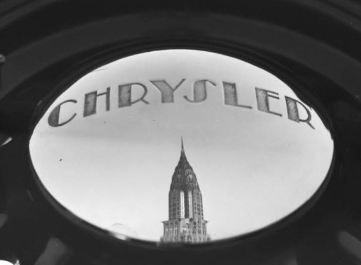
Chrysler Building Reflected in Chrysler Hubcap, New York, NY 1932-1934
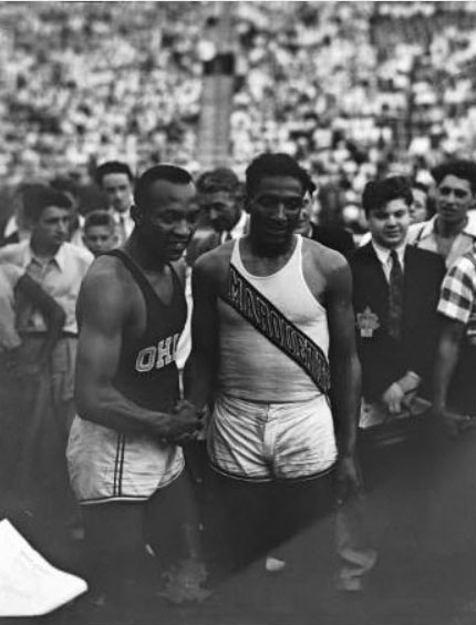
Jesse Owens and Ralph Metcalfe at the 1936 Randall's Island Olympic trials, New York, NY
Kleiner's Korner (Submitted by Art Kleiner)
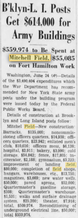
Brooklyn Daily Eagle, June 25, 1933


Comments
-Location of the aerial and the photogrpher’s orientation
Looking North directly over Mitchel Field.
-The Long Island Motor Parkway bridges and structures
Roosevelt Field Bridge, Meadowbrook lodge, Merrick Ave bridge
-Other historic properties that can be seen in the aerial
Mitchel Field, N & S Meadowbrook Polo fields, Meadowbrook Golf Club
-The estimated year of the aerial. Provide a rationale.
1927ish-Concrete runways not present at Mitchel, LIMP operational, no Roosevelt racetrack
-The name of the digital collection and its university location
Unknown-still looking
-Bonus: Where is the flying biplane in the aerial?
Biplane and it’s shadow are in the foreground over Mitchel’s runway
Mitchell Field. Early. Before they paved the runways. And the planes seem like old bi-planes. The Roosevelt Field Motor Parkway Bridge, the Merrick Ave Bridge, and the Meadowbrook Lodge are all there to see.
-joe
Looking NE at NE corner of Mitchel Field ca. 1939-1945 {?} at Ellison Avenue and Meadowbrook (Post Ave.) bridges. Meadowbrook Lodge. Mitchell hangars still standing. Biplane flying NW just E of NE corner of polo {?} field (YAY!). I’ll trade that for collection (LI Studies at Hofstra?). Ol’ Eagle Eye - a.k.a. Sam, III
Location of the aerial and the photographer’s orientation: Mitchell Field looking north
The Long Island Motor Parkway bridges and structures: Roosevelt Field bridge, Merrick Ave. bridge, Meadowbrook Lodge
Other historic properties that can be seen in the aerial: Meadowbrook Club/Int. Polo Fields, Salisbury Train Station, Salisbury Links
The estimated year of the aerial. Provide a rationale.: 1933 - no concrete runways, checkerboard roofs of hangers
The name of the digital collection and its university location: I’ll go with the Edith Hay Wykoff Collection/LI Estates & Historical Photo Collection which is housed at Hofstra’s LI Studies. Even if this is incorrect, its on my activity list to visit.
Just realized the photo is from an online collection so my prior answer may be incorrect. Further research warranted.
Answer to Bonus Question - the biplane in flight can be seen in the third photo, to the right of the polo fields in the upper right hand corner above the trees.
It looks like an aerial of the Mitchel Field area.
Looking north.
From the Dept. Of Agricultur digital collection at Stony Brook, August 1938.
The Mitchel runways were yet unsaved.
Stewart Avenue running left to right across top.
LIMP funnng left to right parallel to Stewart and on top of Stewart.
LIMP bridge to Roosevelt Field at top.
Meadowbrook Golf Club at right.
Meadowbrook Polo fields shown in the rectangular areas.
Merrick Avenue running bottom to top at extreme right.
Biplane is visible just to right of the buildings to the right of the Polo fields.
Northeast corner of Mitchell Field ... Polo grounds and golf course where the Meadowbrook Parkway sits today. I’d say mid to late 1920’s, no paved runways @ Mitchell yet.
We’re looking generally north down at Mitchel Field. Running left to right from the top are Old Country Road, Stewart Avenue, and the LIRR. The Polo Grounds of the Meadow Brook Club can be seen. Lower right is the Salisbury Links golf course.
Features on maps at historicmapworks.com put this after 1914 (before Mitchel Field). Most of these features appear in the 1927 map. I don’t know when the o-housing was built at Mitchel, nor when biplanes stopped flying there.
There should be at least two LIMP bridges in this area, along with the Meadow Brook Lodge, but I cannot be sure I see them in the photo.
I would love to know what appears to be two parallel overpasses at top right corner.
We are looking north-north-east over Mitchel Field in Uniondale. We can see the LIMP bridge over Merrick Avenue as well as the Meadowbrook Lodge. Additionally, the two side-by-side bridges to Roosevelt Field and Meadowbrook Polo Club can be seen. Also visible are the polo fields, the Meadowbrook Golf Club, and possibly the Salisbury Plains LIRR station. I think the date of the photo is about 1932 since the new Mitchel Field hangars are there but the officers housing is still under construction. Just a guess but the photo may be part of the Long Island Studies collection at Hofstra University. There could be a flying biplane just to the right of center, slightly above the bottom border.
Hello to all.
*Location/Orientation: E Garden City, Westbury, East Meadow. Northeast view.
*LIMP bridges/structures: Bridges…Merrick Rd Pkwy Type, Roosevelt Field Hwy Type. Meadowbrook Club Bridge over LIMP, and Central RR Trestle over Meadowbrook Rd. Meadowbrook Lodge ( LIMP )
*Historic Properties: Meadowbrook Golf Course/Polo Fields, Mitchel Field, and Salisbury Links.
*Aerial Year/Rationale: Early 1930’s ( Runways on Mitchel Field not built until 1938 )
*Digital Collection/ University: Hofstra University Library Special Collections, Hempstead NY.
*Biplane location: shadow on Mitchel Field ( towards bottom of image, more to the right than left. Looks like Batman symbol.
A aerial photo of Mitchell Field air base looking towards the northeast
The LIMP bridges in the photo are the twin bridges(polo field and Roosevelt raceway), Meadowbrook Rd Merrick Ave and Meadowbrook Lodge.
Mitchell army air base, Meadowbrook Polo fields and golf course, LIRR Central branch, future Roosevelt field raceway.
The year of the photo I would say is 1933(5-2-33 ?). The photos of the field on 9/29/31 did not have the tops of the hangers painted. The photo on 5-2-33 had the hangers roofs painted. The photo on 7/30/36 had concrete aprons in front of the hangers which was not in this photo.
The collection of aerial photos I would say is from Stony Brook University digital archives
The flying biplane is in the lower right center of the photo.
East Garden City looking north over Mitchel Field. Much details in this aerial. Sending attachment
Another fantastic aerial. Thanks Howard again for sharing these gems.
______________________________________
Howard Kroplick
Franks, thanks for your Femenias’ Findings. Much appreciated!
Great old pics of the estates. The Falaise and Pembroke pics are the better ones as he got the best view of these. Strange how he got the backyard of Winfield / Woolworth - which is such an amazing house and still stands, it seems like upon my last look the renovation from the recent fire has taken place. He also got the back of Keewaydin. The Meudon pic doesn’t do that estate justice. It fails to capture the magnificence of that place which I believe is one of the most beautiful Gold Coast estates of all time. You don’t read as much about this one, but it was amazing. Perhaps we can discuss more on Howard’s new Gold Coast web site? Coming soon??????
Dave - re Winfield - that’s because the formal gardens were (what’s left is) out back; the front “only” has the majestic 250’-long double driveway and the portico. I only just now learned of the fire - I worked for and with Pall Corp. and know the building quite well. Well, Howard IS the North Hempstead historian and most of the rest of the Gold Coast IS in his bailiwick. Hmm. Sam, III
Sam III, I remember when I was little seeing the PALL signs out front. Cool that you were in there. The backyard still has formal gardens, not taken care of very well, -a few very overgrown statues and such but a lot is still there. I have lots of pics. There is a great tree line on the west side of the house which leads to a gate. I recently learned that there was once an amphitheater on the property, on the southern portion of the property. Did you ever see this? I have to check this out but I highly doubt there will be anything to see at this time but did you ever see this?
Test
Test2
The photo of the hangers at Mitchel Field is significant in that in coincides with the culmination of the Base Reconfiguration between 1927 - 1932 in which virtually all of the brick buildings (many of which are still standing and in use today) were constructed.
Of particular interest is just to the North of the hangers where the Parade Grounds / Quadrangle (the focal point of the new Base layout) had not yet been established. The foundations of much older wooden buildings left over from the WW1 Camp Mills era are still visible, in some cases, literally feet away from the new brick structures. These wooden structures were torn down to make way for the Officers’ reviewing area of troops.
For example, although the houses in a semi-circle have been erected, notice how Rice Circle (and the back alley behind the houses) have not yet been built. From this shot I can not only see the Commanding Officer’s Quarters that I grew up in, but actually see my side bedroom window!
Also missing is Hazelhurst Avenue running North towards Stewart Ave., this despite the lone house at the intersection of what would become Hazelhurst and Miller Avenues is already standing (it became 359 Hazelhurst). In the ‘70’s, that house was used by NCC as the Faculty Club for a while.
More significantly, and speaking of Miller Ave., a long gone road from the Camp Mills era which I have never been able to locate a name for is seen cutting laterally across what will become the Quad, parallel to Miller leading in a straight line into my house at 363 Rice Circle. This road also ran parallel to Davis Ave. and ran as far East as the edge of the property, bordering the Westernmost fringe of the Polo Grounds at East Avenue.
Does anyone know of the name of this ‘Unknown Road’ outlined in yellow?
Photo with road overlay attached.
“Photo with road overlay”??? Sam, III
Sam,
I think Howard meant to post the overlay photo on this page. It can be seen here however:
http://www.vanderbiltcupraces.com/images/blog/Base_Reconfiguration_House_Construction_1932.jpg
Same shot without the overlay is found here:
http://www.vanderbiltcupraces.com/images/blog/2018-01-04_12-28-49_edited-1-1.jpg