Mystery Foto 2015 #2 Solved: Cunningham Park, the Motor Parkway and Union Turnpike in 1938
This weekend's Mystery Foto was another spectacular aerial of the Motor Parkway from the New York City Parks Photo Archives.
Answers to the Mystery Foto questions:
-Identify the location and the aerial's orientation
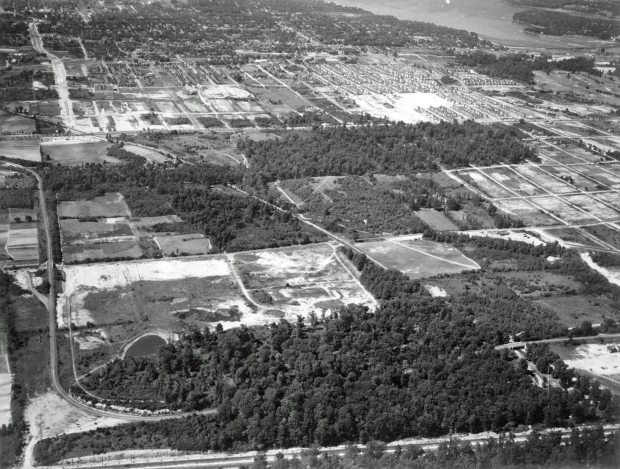
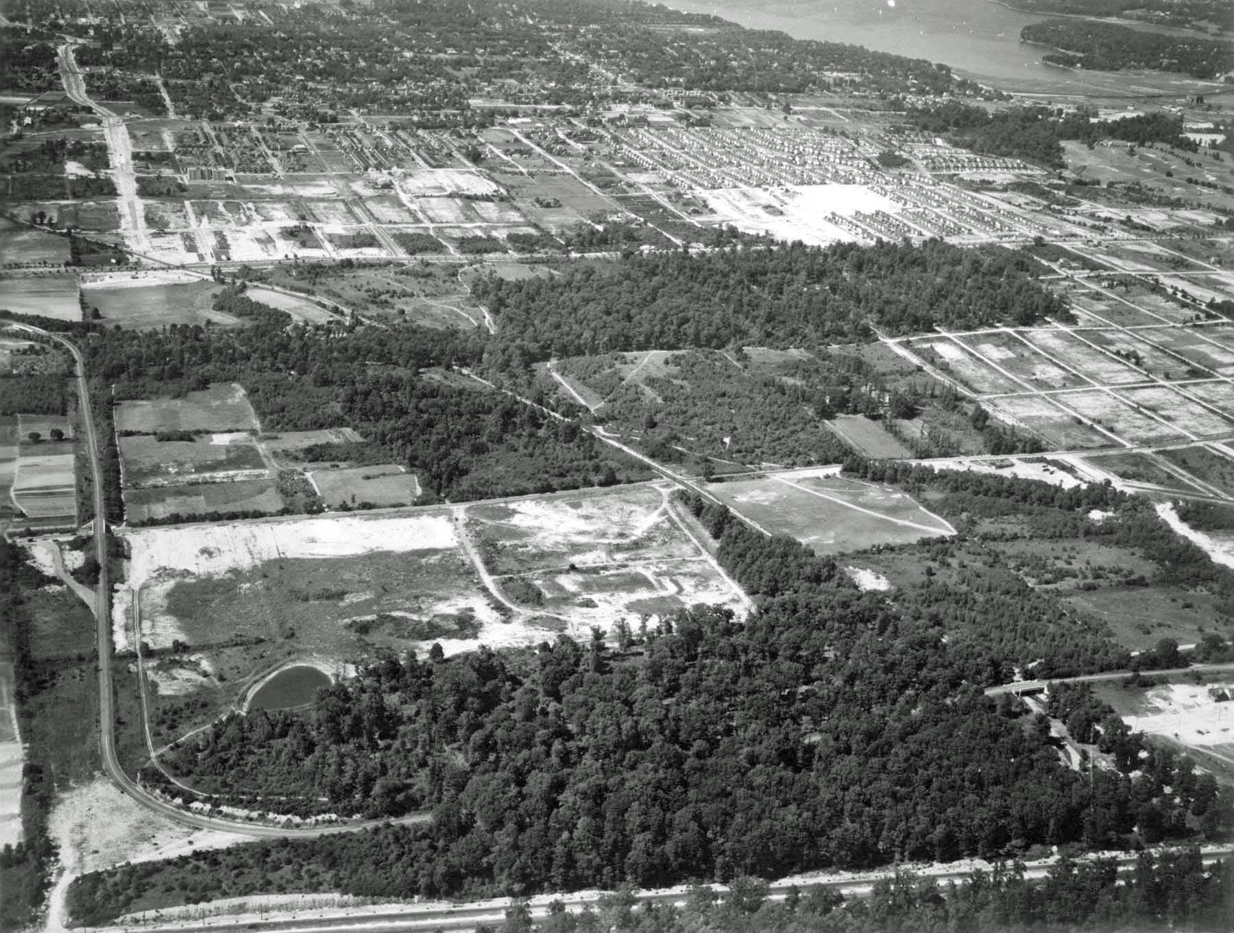
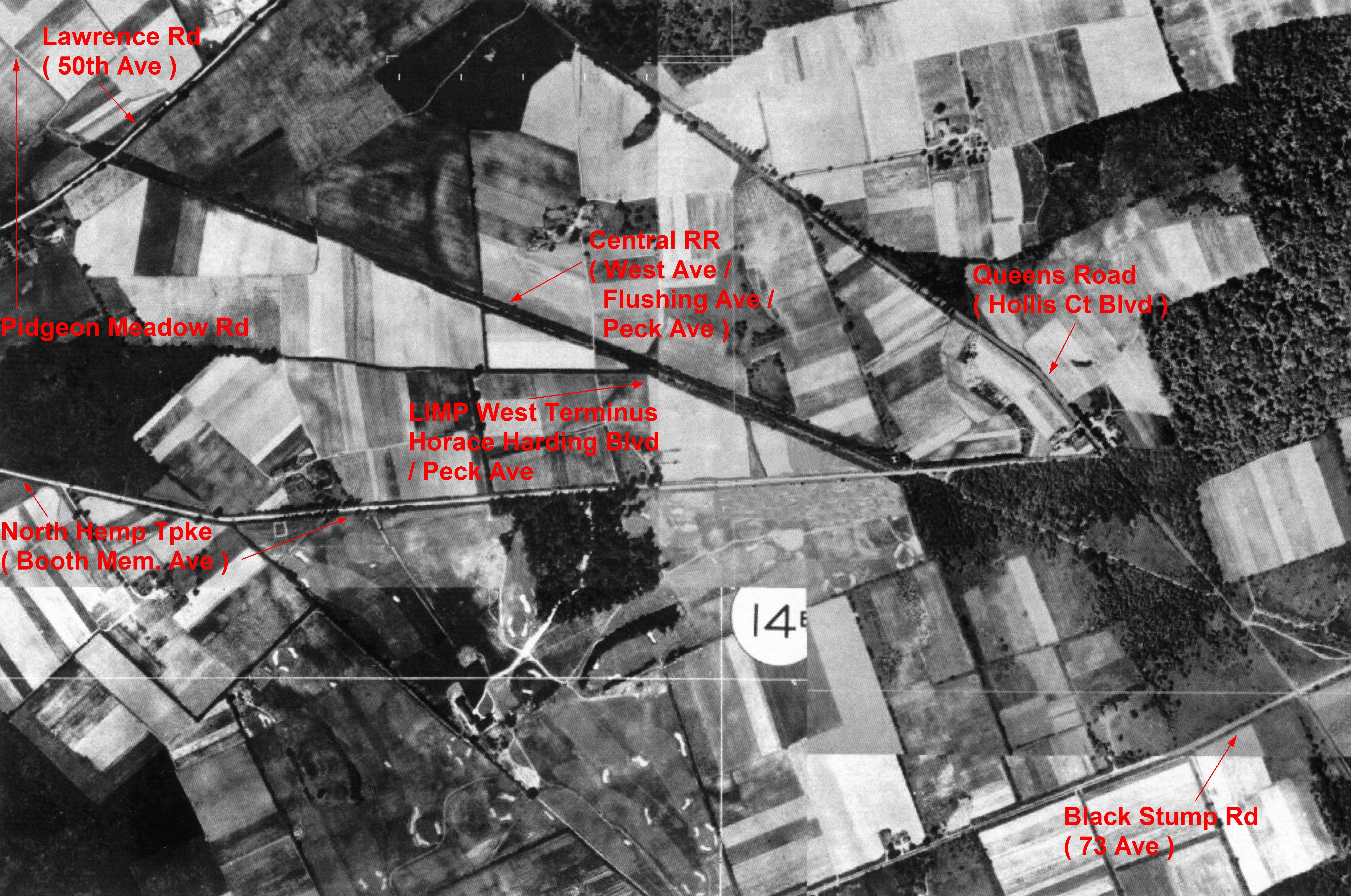
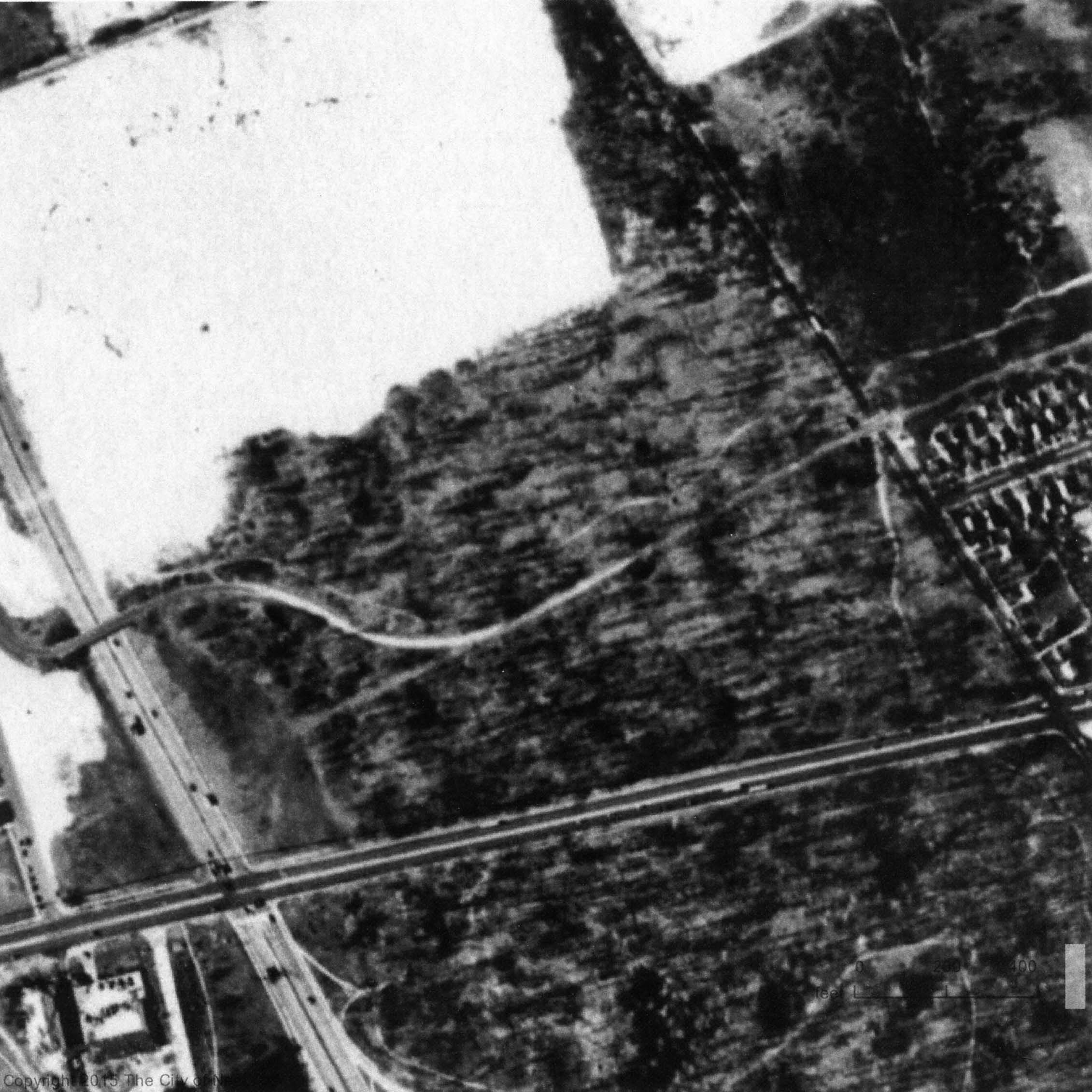
The aerial shows the Fresh Meadows/Hollis Hills section of the Motor Parkway and Cunningham Park looking north.
The New York City Parks Photo Archive's official caption read: Cunningham Park, Motor Parkway, Bicycle Path, view north from Union Turnpike showing park
-Identify the key roads and features
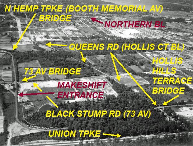
-Motor Parkway is the L-shaped road on the left and bottom.
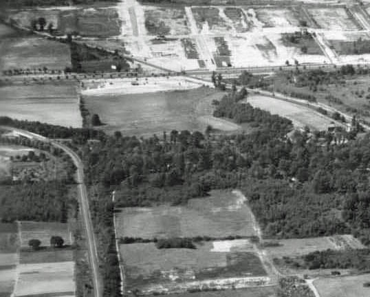
-Three Motor Parkway bridges: North Hempstead Turnpike, 73rd Avenue and Hollis Court Boulevard (now Hollis Hills Terrace).
-Temporary Motor Parkway entrance off 73rd Avenue.
-The road on the diagonal is Hollis Hills Boulevard
-Northern section of Francis Lewis Boulevard under construction
-Union Turnpike is across the bottom
-What is the approximate date of the aerial? Provide your rationale.
The aerial was taken on June 24, 1938, two months after the closing of the Motor Parkway. Clues included the absence of the Francis Lewis Boulevard adjacent to the parkway and the construction in the northern section.
Congrats to Frank Femenias (see below findings), Tim Ivers, Greg O., Roy Warner, Eric Shaffer, Robert Greenhaus, Joseph Oesterle, Steve Lucas, Art Kleiner and Sam Berliner III for correctly identifying the correct Queens location. Kudos to Robert Greenhaus, Eric Shaffer, Roy Warner, Greg O., Art Kleiner, Steve Lucas and Frank Femenias for estimating the 1938-1939 approximate date of the aerial.
Enjoy,
Howard Kroplick
Closeups
North Hempstead Turnpike Motor Parkway Bridge is still intact. Just south of the bridge, there is a small black line which may be a wall blocking traffic from the closed parkway.
The Western Terminus of the Motor Parkway was just north of the bridge.
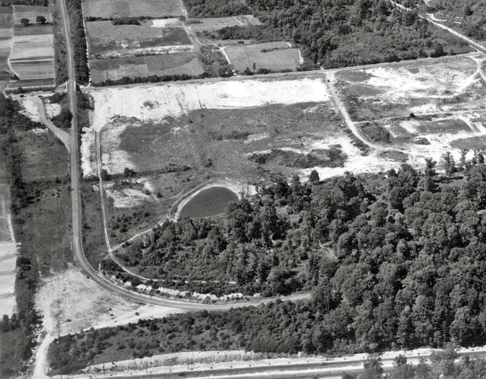
The 73rd Avenue Bridge and the curve before Union Turnpike. Note the temporary entrance at 73rd Avenue also appears to be blocked off.
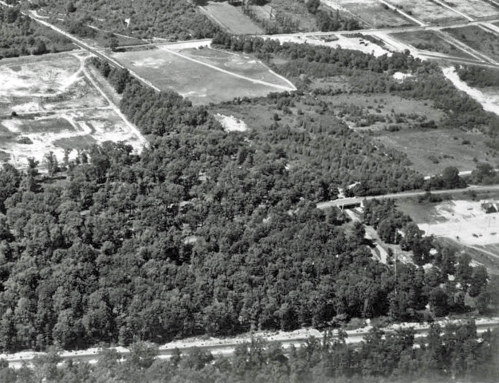
The Hollis Court Boulevard Boulevard Bridge.
Femenias' Findings (Submitted by Frank Femenias)
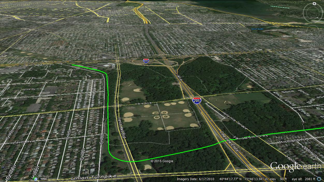
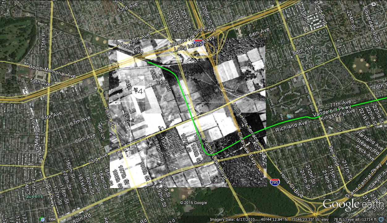
Mystery Foto location today.
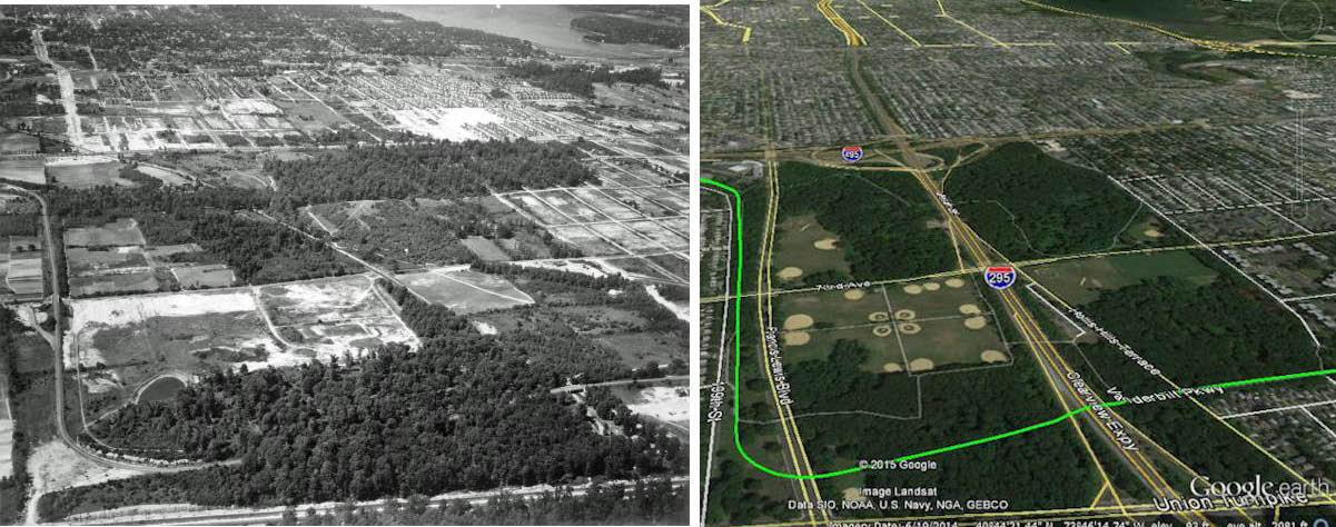
Then & Now: Mystery Foto:
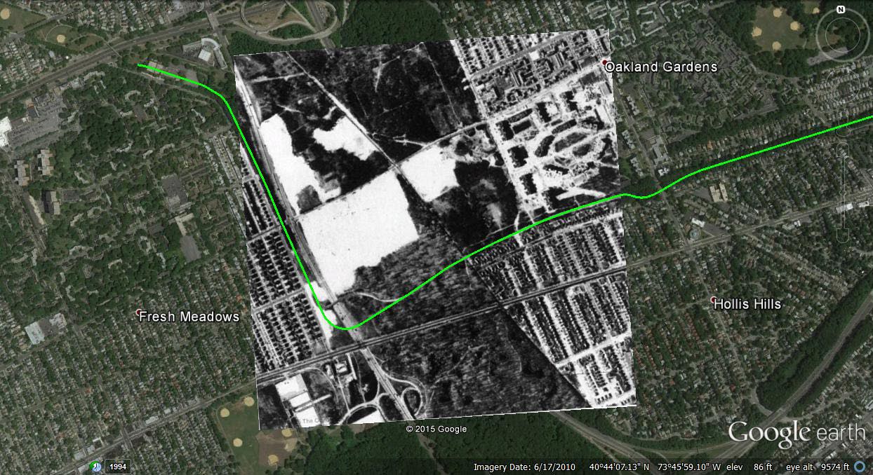
Then (1924): Mystery Foto before the Motor Parkway was built in this section
1924 Overlay over today's Google Earth aerial
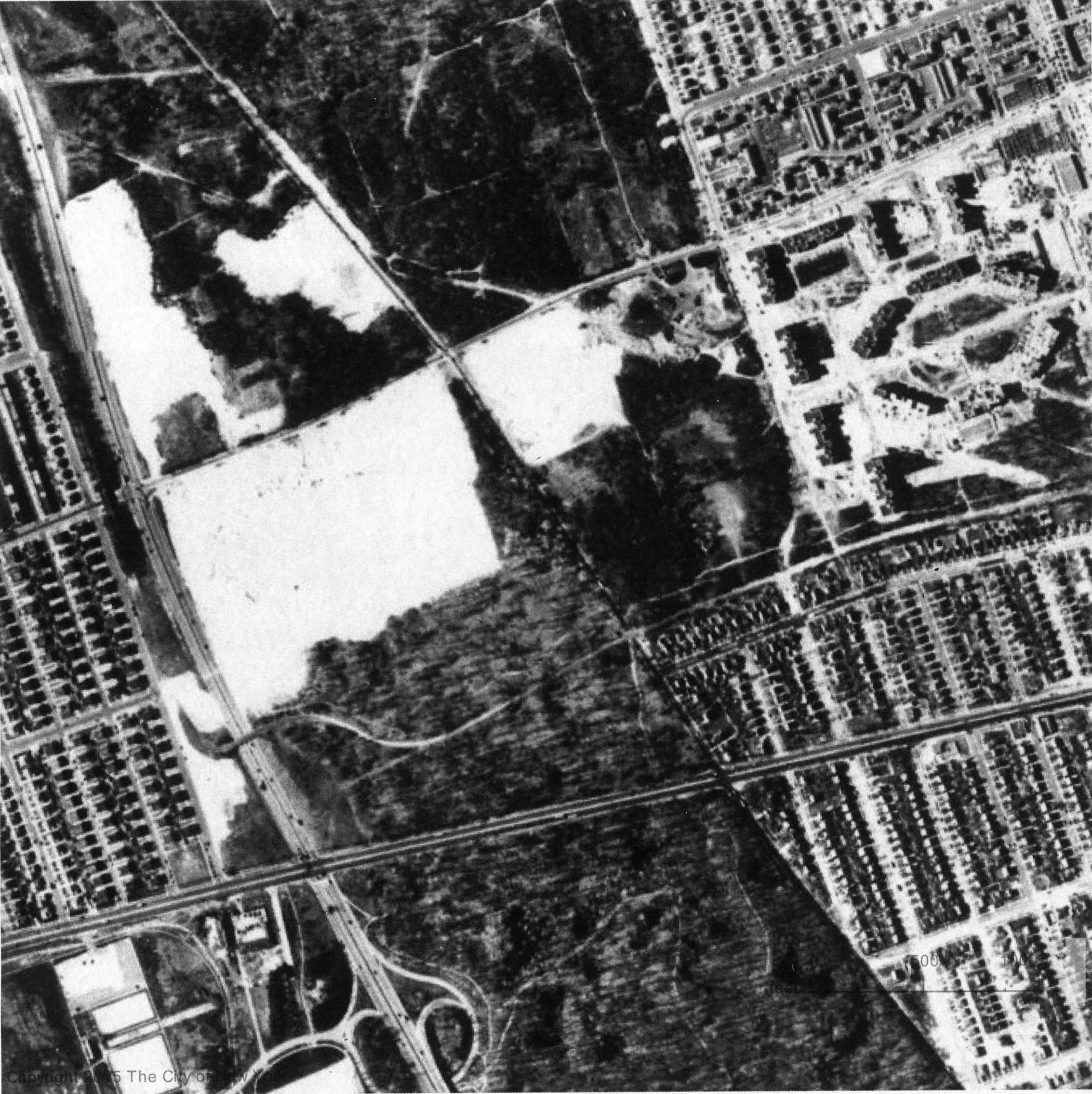
Update: Submitted by Frank Femenias
Frank Femenias: "A view of this temporary alternative access to the LIMP that lasted less than 19 years. Also a tee-off range surrounded by farmland further north!"
1951
1951
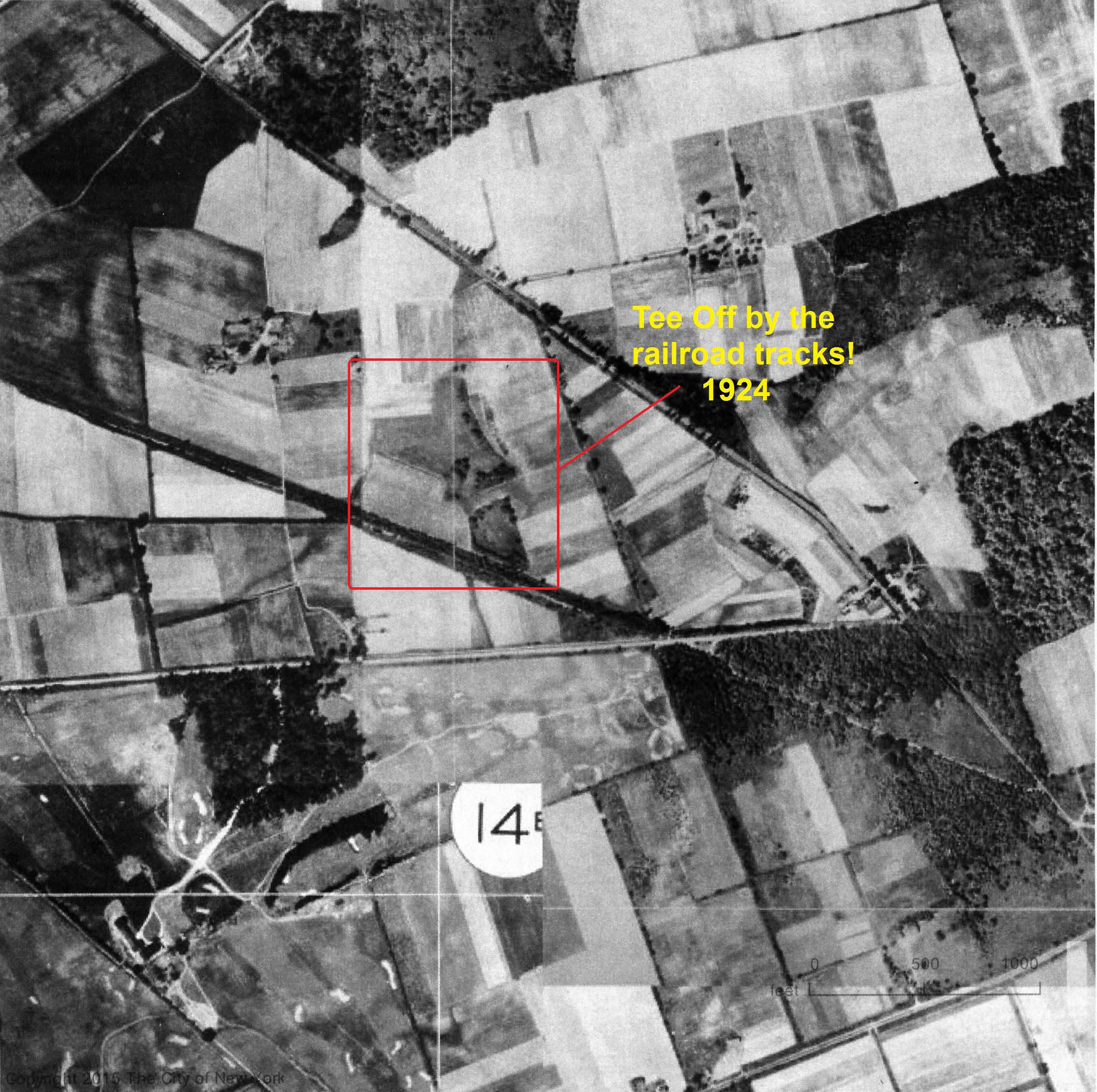
1924
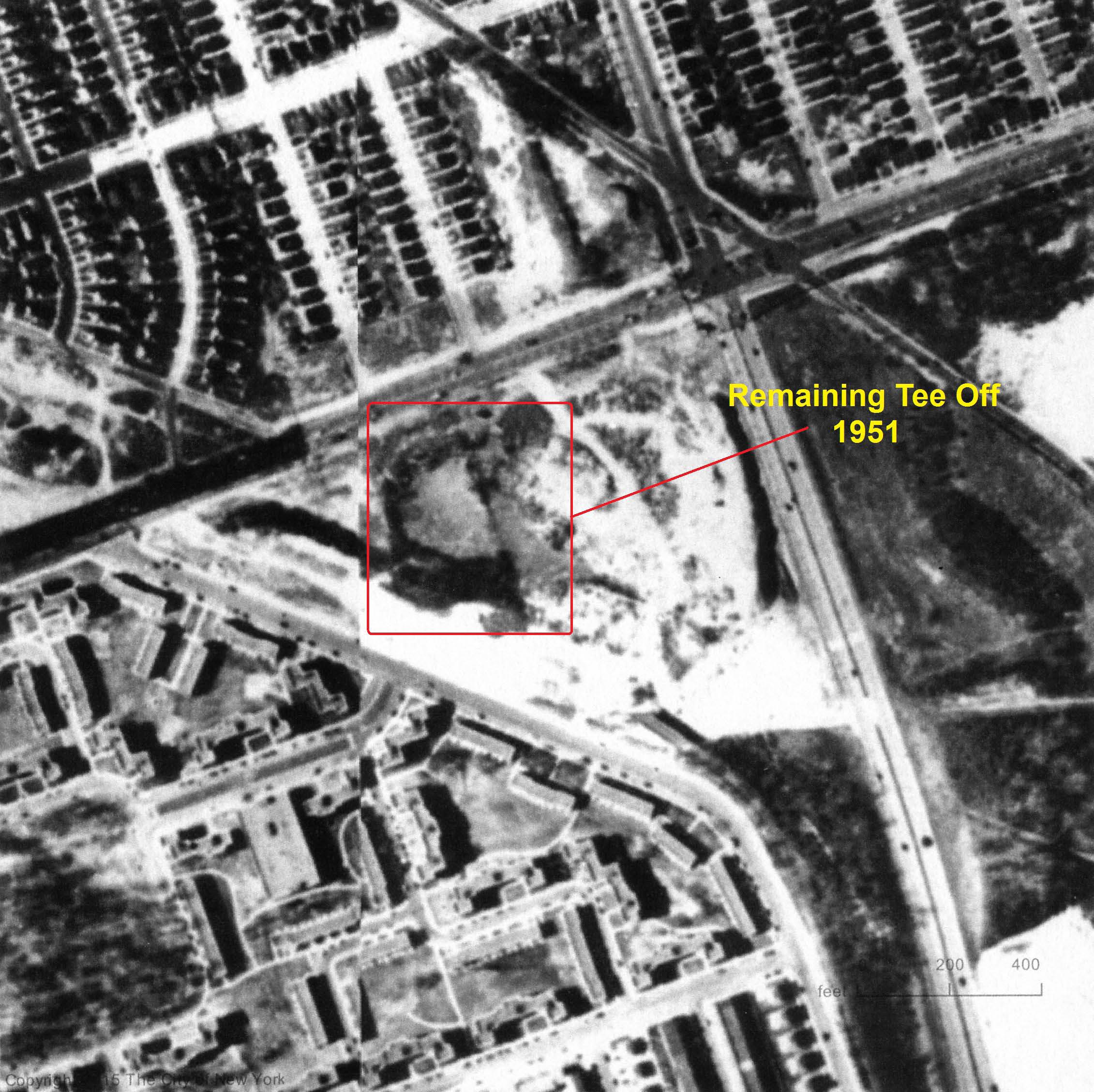
1951
Happy Birthday Roz
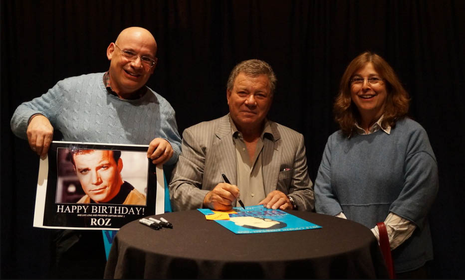
William Shafner helped celebrate Roz' birthday last Saturday!


Comments
It took a couple of seconds to get my bearing. Looking north, near the western end of the LIMP. We see the 73rd Ave & Hollis Ct Blvd bridges. The bridge over North Hemp Tpke is hidden up there too. It is obviously after 1926, when this extension of the parkway was completed. It is also before the Clearview Expressway, The LIE, and even before Francis Lewis Blvd was done. I would say 1930.
The mystery aerial was taken at Fresh Meadows, looking north, circa 1939. Union Turnpike appears at the bottom of the photo running East/West. The 73rd Avenue Parkway Bridge (#2) appears near the middle of the left edge of the photo. The temporary 73rd Ave. Motor Parkway entrance ramp can be seen to the South of the 73rd Avenue Bridge. The Hollis Court Blvd. Parkway Bridge (#3) appears near the lower right corner of the photo. Little Neck Bay can be seen in the upper right corner of the photo. The final section of Francis Lewis Blvd., completed in 1940, does not appear in the photo. However, the photo shows that the Northern section of the boulevard, which appears running North/South in the upper left of the frame, has been widened and a median constructed; placing the date of the photo between 1938 and December 1940.
Recusing myself!! 😊
1)Over Queens looking north
2)Extreme bottom Union Turnpike. Left side Motor parkway curving east directly above Union Turnpike. Slanting across middle Hollis Hills Blvd. Upper center running east /west Horace Harding Blvd.
3)1935-40 Motor parkway still in use
The photo is of the Fresh Meadows terminus of the Vanderbilt’s Long Island Motor Parkway and the surrounding area; I grew up in Fresh Meadows during the ‘50s on the other side of Horace Harding. I can see PS 162 in the upper right, which is where I went to grade school. Given that PS 162 opened in 1936, the photo is after that date, but was before Francis Lewis Blvd. cut through Cunningham Park (Hillside Park). Because the gap in Francis Lewis Blvd. between Horace Harding and Hillside Ave. can be seen, the photo shows the turn in the parkway from south to east across what was to become Francis Lewis Blvd. And because construction on Francis Lewis was done during the War, and was not opened until 1946, I’d have to say that the photo was taken between 1937 and 1941. I also can see the completely wooded area where my boyhood house was eventually built; 199th St. and 51st Ave. two blocks west of PS 162.
Identify the location and the aerial’s orientation
The Western end of the LIMP looking Northwards in Queens.
-Identify the key roads and features
Union Tpke across the bottom. Hollis Court Blvd and LIMP bridge diagonally across the photo.
-What is the approximate date of the aerial? Provide your rationale.
Approx. 1939. Union Tpke looks to be completed but Francis Lewis Blvd has not been built.
It looks like the Fresh Meadows-Hollis Hills area looking west with the LIMP running bottom to top and the 73rd Street bridge visible near the bottom and North Hempstead Tpke and Horace Harding Expy running across the distant top
About 1938, looking N at Cunningham Park in Fresh Meadows before Francis Lewis Blvd (1941)/Clearview Expwy (1960). Judging the foliage, it’s about June. This may be just before or after the LIMP closed in 1938. Where are the bicycles, where are the cars?
The large radius curve location was site of the planned junction where the LIMP would have had two western terminating points.
The existing pedestrian bridge over Francis Lewis Blvd is about 380ft. north of here, following Francis Lewis Blvd’s center line, and continues to keep the Motor Pkwy connected today.
That temporary entrance ramp from 73rd Av must have caused some headaches for gatekeeper Sidney Jones at the Rocky Hill Lodge, where he’d greet unsuspecting toll evaders, and kindly redirect them down the ramp back onto Springfield Blvd. Ugh! No matter. That free 1.5 mile park ride through canopied trees was well worth the trip. The wide toll plaza seems intentionally built to accommodate U-turns.
-Identify the location and the aerial’s orientation
Fresh Meadows, Queens, looking north.
-Identify the key roads and features
Union Turnpike at the bottom left to right, Motor Parkway parallel to Union and thru the trees of Cunningham Park until it curves north on the bottom left. See the 73rd Avenue Motor Parkway Bridge (and entrace onto the Motor Parkway), Hollis Hills Terrace (aka Court) Bridge, North Hempstead Bridge, Horace Harding Blvd., Oakland CC Golf Course just below Little Neck Bay.
-What is the approximate date of the aerial? Provide your rationale.
1939 before the building of Francis Lewis Blvd. and opening of Union Turnpike.
This is a view of the Fresh Meadows area looking north, near the western terminus of the Long Island Motor Pkwy. The LIMP enters on the left side, heads south and then makes a 90 degree turn to the east through a large group of trees. Union Tpke. runs east - west along the bottom of the photo with Little Neck Bay in the upper right. The three LIMP bridges that can be seen are North Hempstead Tpke., 73rd. Ave., and Hollis Hills Terrace. Horace Harding Blvd. runs east - west just above where the LIMP enters the photo. Since there is no Francis Lewis Blvd. to the east of the LIMP and no major development of Cunningham Park, I’m going to guess the date of the photo to be about 1939.
Yay! One I can actually spot without question (for a change)! No. Blvd. across top, Cross Is. Blvd. (early Francis Lewis) and Western terminus at upper left, Horace Harding above terminus, No. Hempstead Tpke. bridge, 73rd St. bridge, Union Tpke. across the bottom, and Hollis Court Terrace/Blvd. bridge at lower right, Little Neck Bay at upper right. We’re over Jamaica Estates, looking compass north (LI NNE). Very early on; no trace of Fresh Meadows development or the ball fields or the H. S. yet. Such fun! Sam, III
This is so cool! First Janet Guthrie, then Roz’s Birthday, then William Shatner, what next….....? Scotty, beam me up! * Happy Birthday Roz! *
Two additional comments (correct me if I’m wrong):
-when Francis Lewis Blvd. was completed, a bridge was built by the city for the LIMP to cross over it (just north of Union Turnpike). Instead of following the exact curve of the LIMP, the bridge was built slightly north of the original curve. East of Francis Lewis, a “new” roadway had to be built, which eventually met the old roadway a short distance from there.
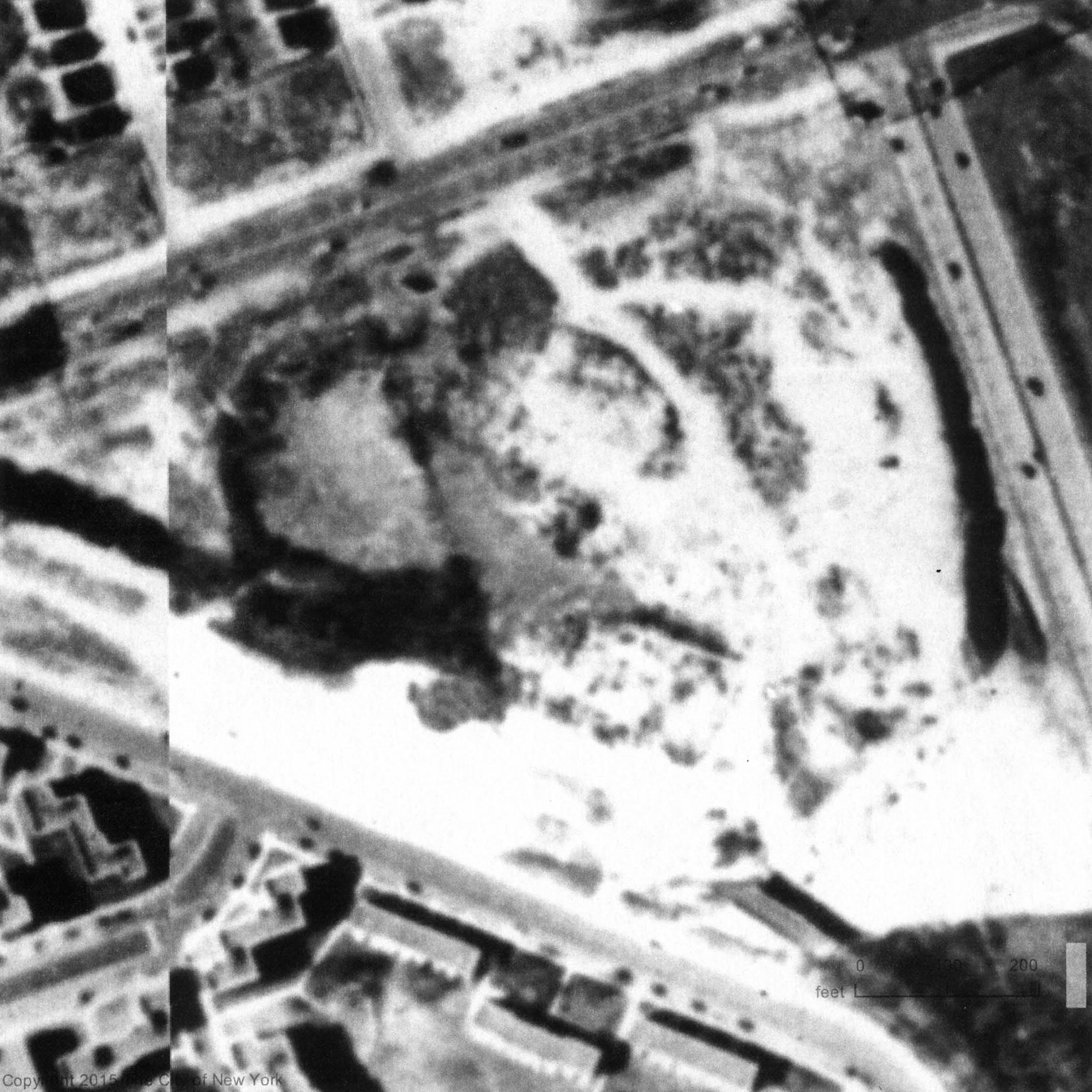
-new discovery (for me): the sandy area just south of Francis Lewis, where it meets Horace Harding Blvd., was a golf driving range at the time of this picture.
Hi Mitch!
I believe you are double-correct. Your interesting facts began a fun investigation. Howard, I’m submitting photos of the finds. Thanks Mitch and Howard.
_________________________
From Howard Kroplick
Jpegs have been posted above.
Thanks Frank! I think you’re a little off. The driving range stood exactly on top of the Francis Lewis Blvd. extension south of Horace Harding Blvd. I’m sending Howard three JPGs showing a closeup of the range. You’ll know what I’m saying when you see them.
PS: the bridge taking the LIMP over Francis Lewis was later replaced by the one that is there today.