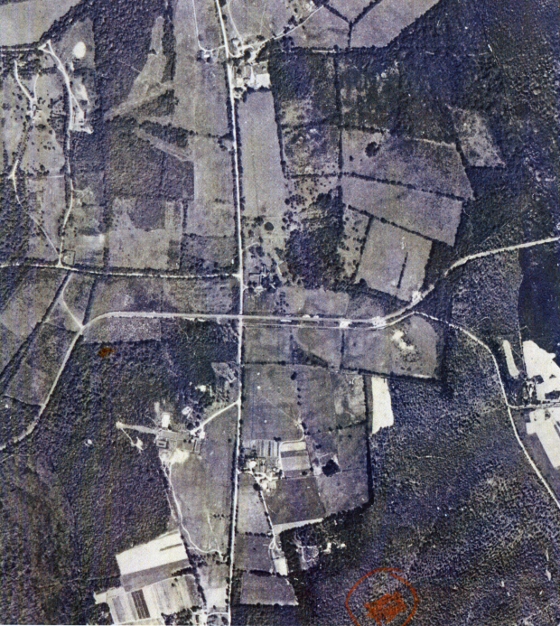
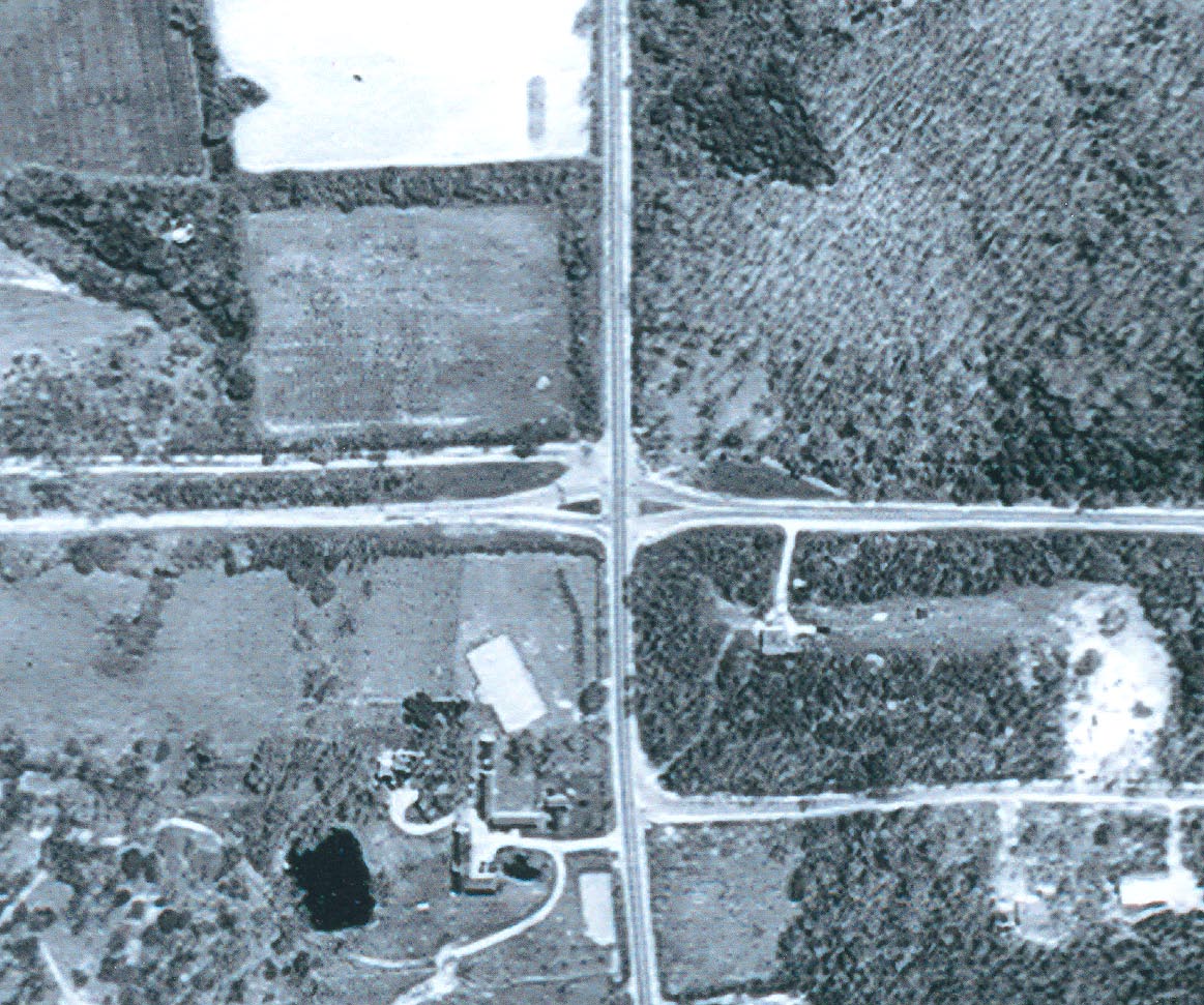
Mystery Foto #21 Solved: The Motor Parkway at Deer Park Avenue, Dix Hills in 1928
Yikes, was it Friday already? Time for another Mystery Friday Foto!
Mystery Foto questions:
- Identify this section of the Monday Parkway
The Dix Hills section of the Long Island Motor Parkway (running west/east) with Deer Park Avenue (running north/south in the middle of the aerial)
- What year was this aerial taken?
1928
- What structure seen in this photo makes this aerial very noteworthy?
The Motor Parkway Bridge over Deer Park Avenue was the most easterly bridge built in Suffolk County. This is one of the few known images of the bridge.
- Bonus: What unusual feature of the Motor Parkway can be seen in this aerial?
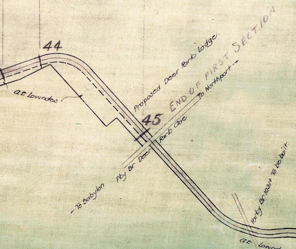
There appears to be entrances to the Motor Parkway west and east of Deer Park Avenue. The Deer Park Lodge at Deer Park Avenue appears in various Motor Parkway maps. The lodge was never built.
Congrats to Joseph Oesterle, Greg O., Steve Lucas, and Frank Femenias (See Femenias' Findings) for correctly identifying Deer Park Avenue. Kudos to Greg O., Steve Lucas and Frank Femenias for identifying the significance of the Deer Park Avenue Bridge and the year of the photo.
Enjoy,
Howard Kroplick
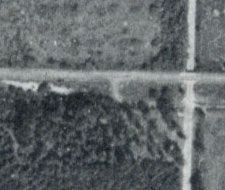
The Deer Park Avenue Motor Parkway Bridge. Note: The possible entrance west of Deer Park Avenue.
Another "makeshift" entrance to the Motor Parkway can be seen further to the west.
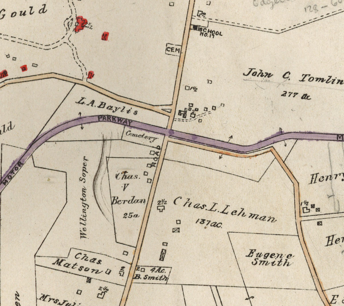
This map did not indicate any entrance or exits at Deer Park Avenue.
This 1920 Motor Parkway map listed the Deer Park Lodge.
Femenias Findings (Submitted by Frank Femenias)
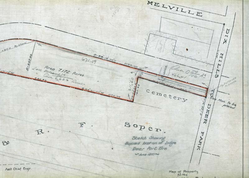
On the 1910 Deer Park survey sketch, the lodge and entrance was to be built approx 300 feet west of Deer Park Ave.
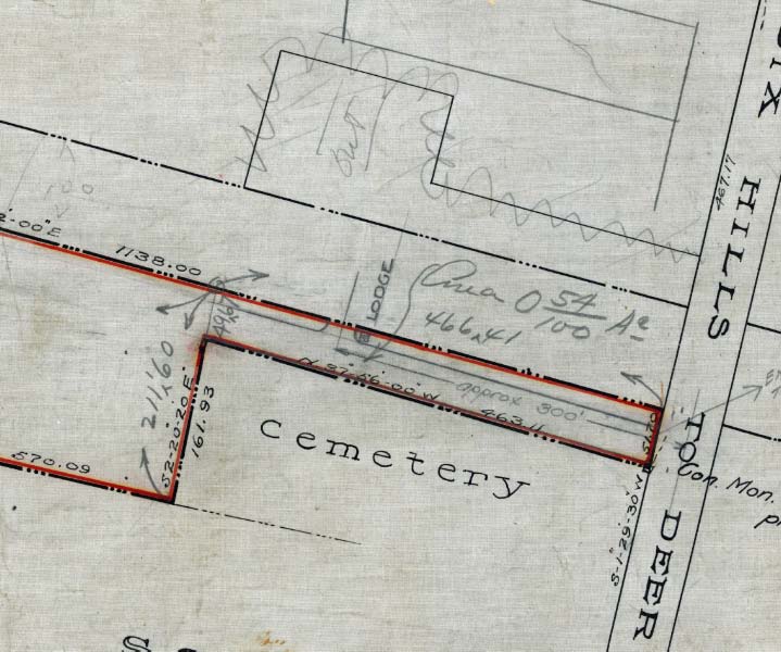
The 1910 Motor Parkway Atlas shows the "entrance" closer than that.
On the 1950 aerial, it shows Motor Parkway split after the bridge was taken down in 1947. Why remains a mystery. My best assumption was to reroute traffic to help relieve congestion at the busy intersection before further expansion occurred. Today it is straight once more.
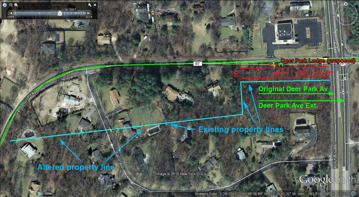
Current Google view with proposed Deer Park Lodge location.
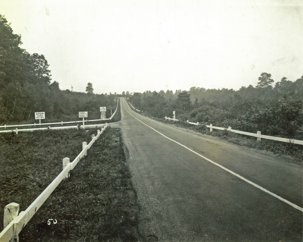
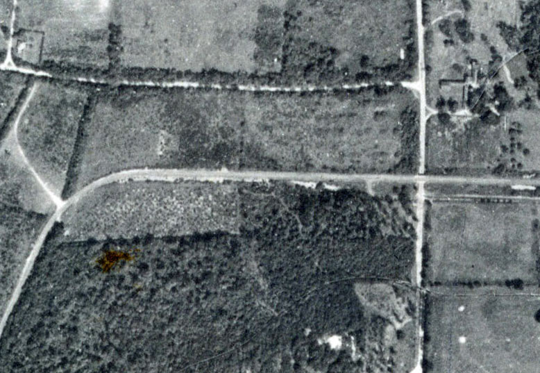
A view looking west on the Long Island Motor Parkway from Deer Park Avenue.


Comments
LIMP Crossing Deer Park Ave.
Identify this section of the Monday Parkway
In Deer Park/Dix Hills
Deer Park Ave running North/South in the center, LIMP is the curved road running left/right.
What year was this aerial taken?
1928
What structure seen in this photo makes this aerial very noteworthy?
A Motor Parkway Bridge over Deer Park Avenue. It was the most easterly bridge. However, there were no entrance/exit ramps on to the Motor Parkway from Deer Park Avenue
Bonus: What unusual feature of the Motor Parkway can be seen in this aerial?
There was a possible southern entrance to the Motor Parkway east of Deer Park Avenue which became Candlewood Path.
I believe the photo shows a view looking north with Deer Park Avenue running down the center; not sure about the year but I think it’s around 1928. The noteworthy structure could be the LIMP bridge over Deer Park Avenue which was subsequently removed after the LIMP was taken over by Suffolk County making the intersection in need of traffic control devices. The unusual feature(s) could be entrances to the parkway just west of Deer Park Avenue even though there is no toll lodge present. There also appears to be one or two entrances to the parkway just east of Deer Park Avenue connecting it with Candlewood Path.
1928, Deer Park Ave and the Motor Pkwy, Dix Hills, Suffolk County. The Deer Park Ave parkway bridge seen here, was taken down in ‘47. This bridge was the most easterly bridge built for the Motor Pkwy. Candlewood Path running parallel to the LIMP (east of Deer Park Ave) served as the entrance to the Motor Pkwy when the proposed Deer Park Lodge (to the west) never established. The proposed Deer Park Lodge lot and property lines can be seen in its entirety. It was one of the houses that Jack never built.
The best I can do with this is that I see the structure and unusual feature,but don’t know what they are and I know the area,but can’t pinpoint it.Have a Happy Memorial Day to all.
Happy Memorial Day Ted and to all
Sorry i missed this one, im there a lot passing thru that way , and the cemetery in the first map is directly against the road, as it is today (although high up on the hillside) , in the survey of 1910 it looks like they wanted to use some cemetery land for an entrance, but maybe they were not allowed to do so.
Thanks Howard. I’ll try to make it on 6/2.Will be in touch.
What became of the bridge ? As a boy living in North Babylon in the late forties & early fifties I rode my bike up Deer Park Ave past this spot many times. I remember a old wooden toll gate on the east side of Deer Park Ave. in the woods at about this location.