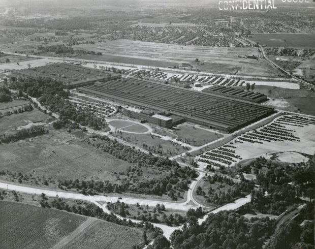
Mystery Foto #28 Solved: The Sperry Gyroscope Plant in Lake Success on September 27, 1952
This weekend's Mystery Foto was originally classified as "Confidential" by the U.S. Defense Department.
Answers to the Mystery Foto questions:
- Identify the historic building in the aerial.
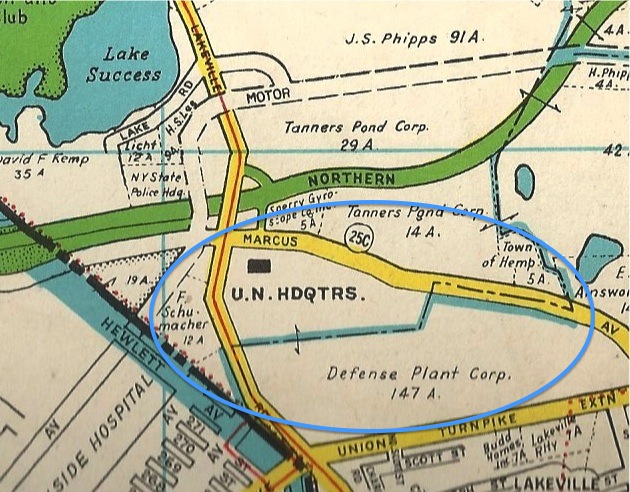
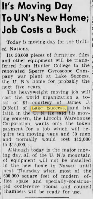
As pulished in the wonderful book North Hempstead, the building was the Sperry Gyroscope Plant bordered by Marcus Avenue, Lakeville Road and Union Turnpike in Lake Success.
- How is this building related to Israel?
This building served as the temporary headquarters for the United Nations from 1946 to 1952. On November 29, 1947, the United Nations voted in this building in favor of establishing a Jewish State in Israel.
- What is the orientation of the aerial?
South/Southeast
- What is the date of the aerial? Provide a rationale.
The photo was marked with the date September 27, 1952. It was likely marked "Confidential" due to the Korean War.
- How is this aerial related to the Long Island Motor Parkway?
Robert Moses' Motor Parkway Bridge over the Northern State Parkway can be seen in the lower right corner, just west of the Lakeville Road Bridge over the Northern State.
Congrats to Joseph Oesterle, Lee, Michael Waldeyer, Dave Russo, Roger DeCurzio, Edith Klarmann, Roy Warner, Mark Lanese, Art Kleiner (see Kleiner's Korner), Tim Ivers, David I., Alan Sadwin, Steve Lucas, Sam Beliner III, Len Williams, Greg O., Frank Femenias, and Gary Hammond (see Hammond's Historical Happenings).
Kudos to Dave Russo, Mark Lanese, Art Kleiner, Tim Ivers, Steve Lucas, Sam Berliner III, Len Williams, Greg O., Frank Femenias and Gary Hammond for correctly identifying the abandoned Robert Moses' Motor Parkway Bridge over Northern State Parkway.
Enjoy,
Howard Kroplick
Sperry Plant, circa 1952
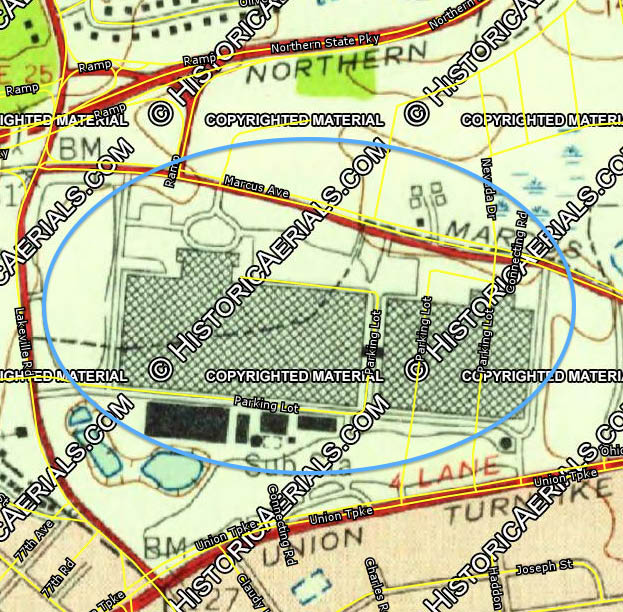
Current View
Hammond's Historical Happenings (Submitted by Gary Hammond) All items from the Gary Hammond Collection
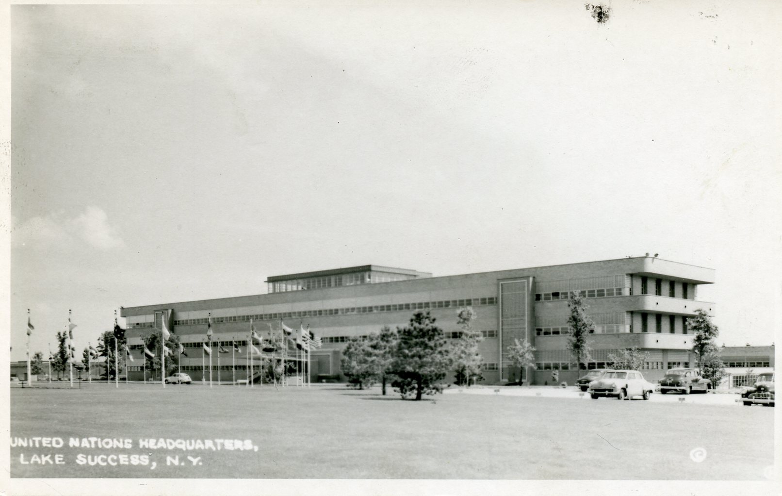
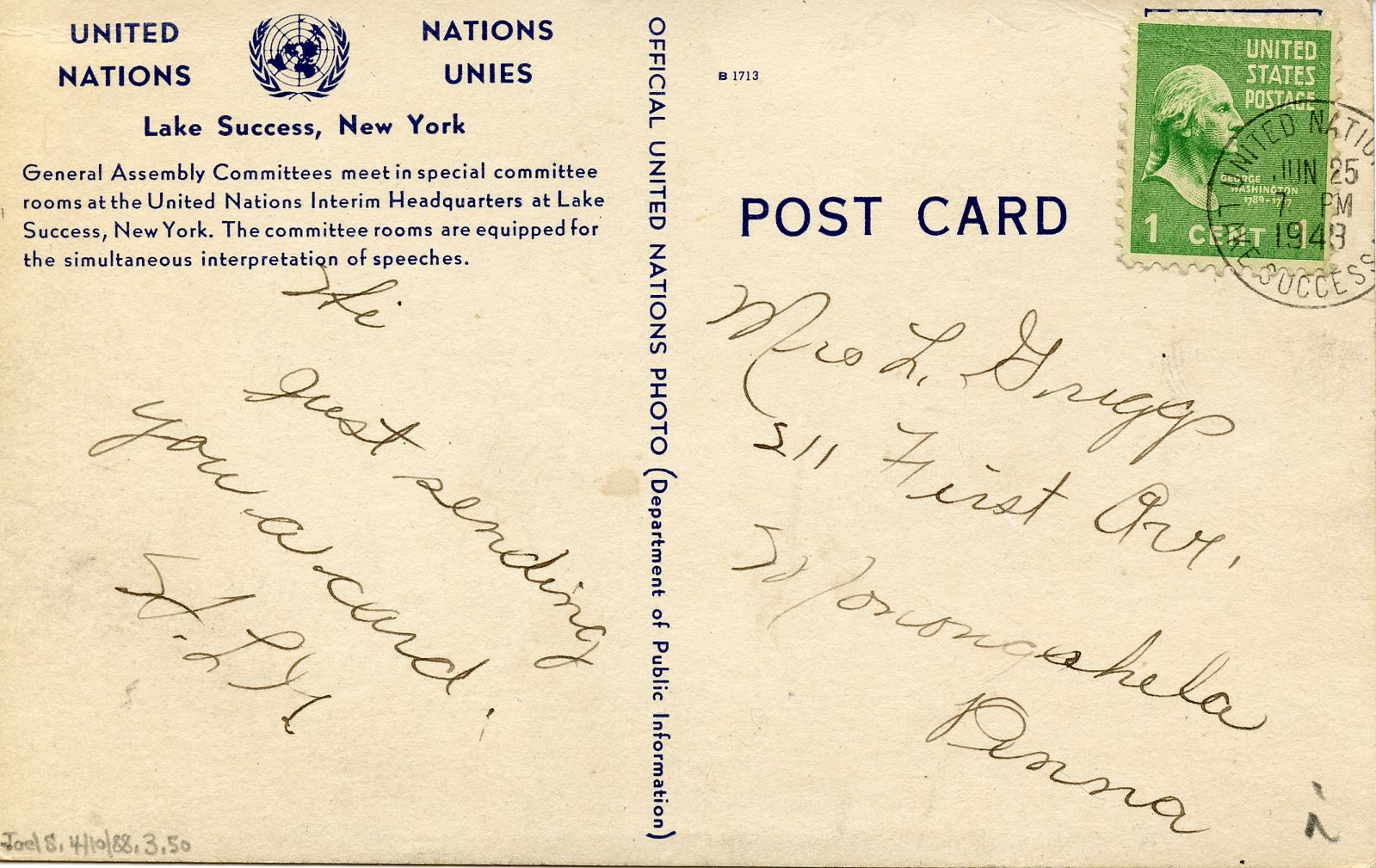
Real photo postcard of UN at Sperry Plant
UN postcard front
Reverse caption for above postcard
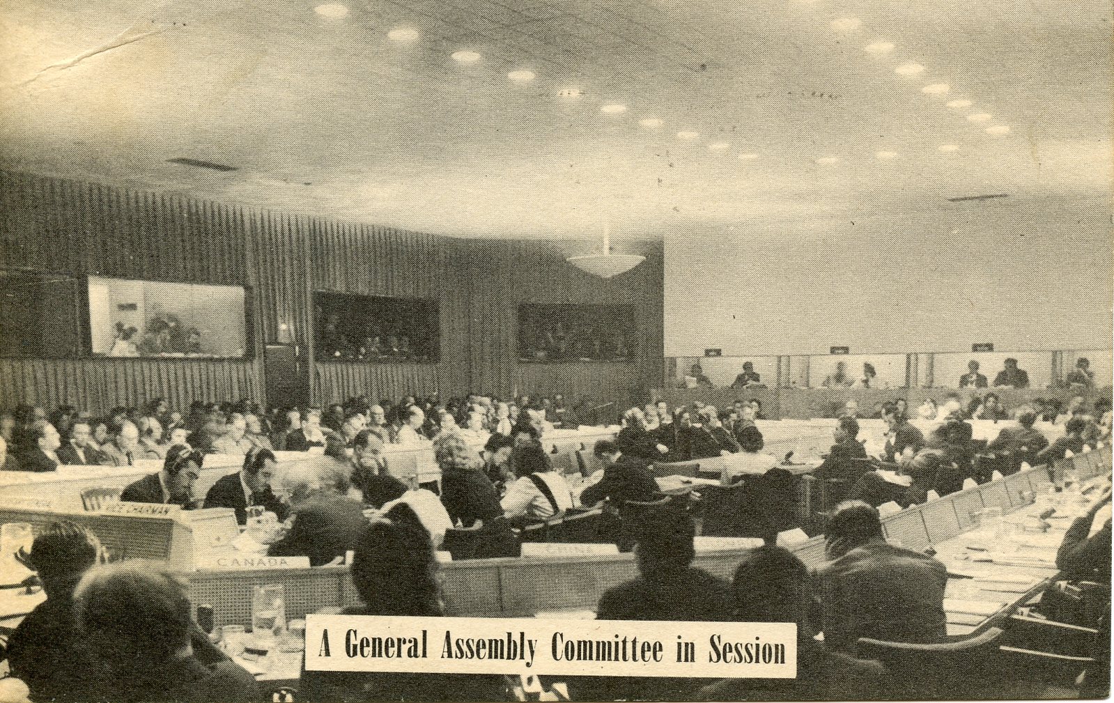
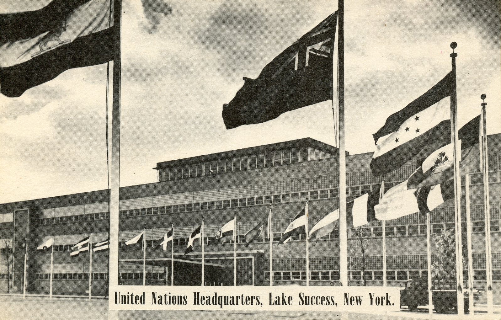
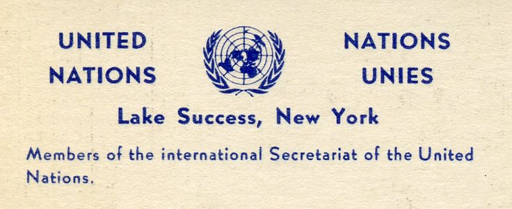
General Assembly Committee postcard
Reverse caption for above postcard, including the “United Nations / Lake Success” cancellation
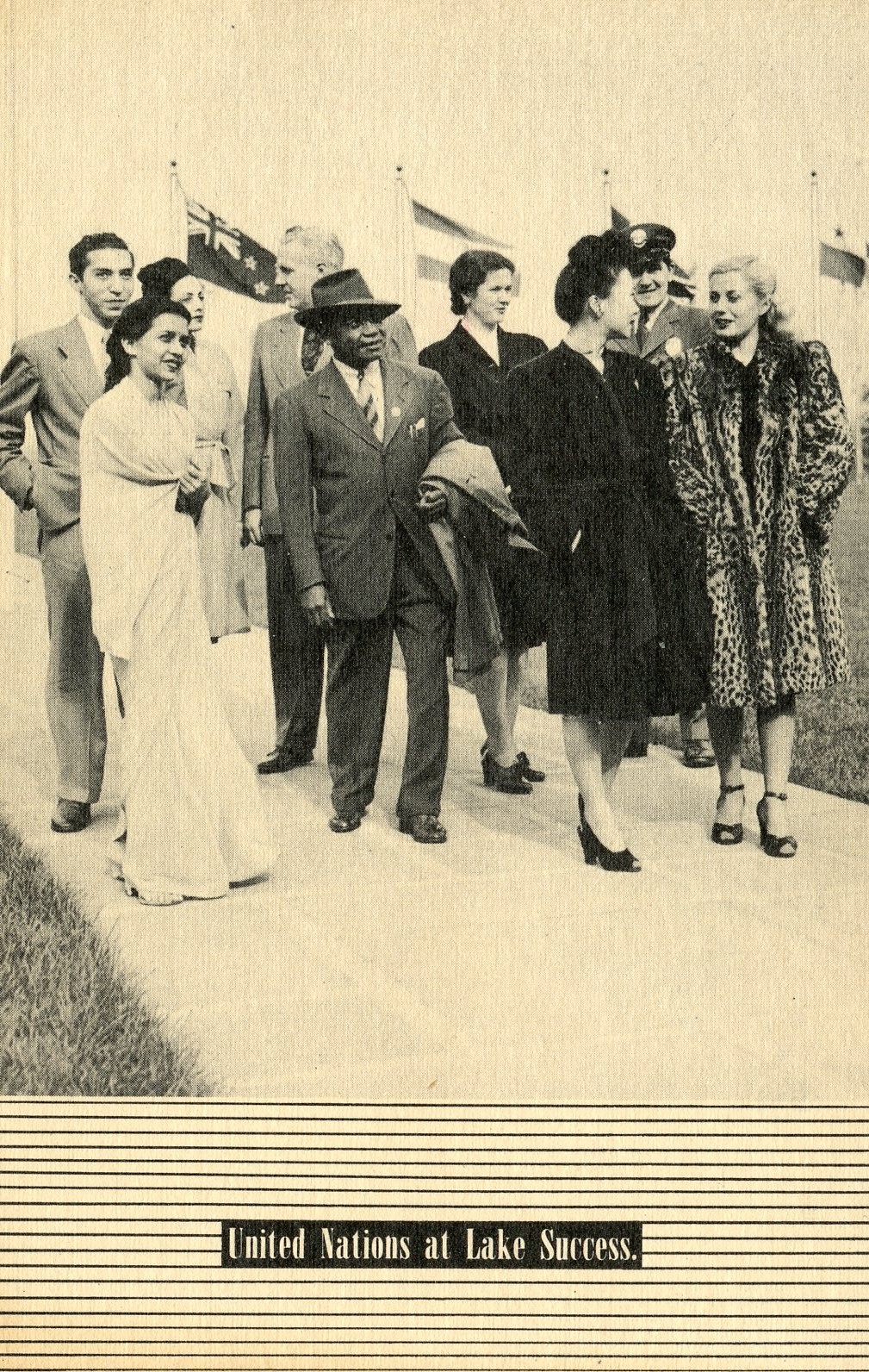
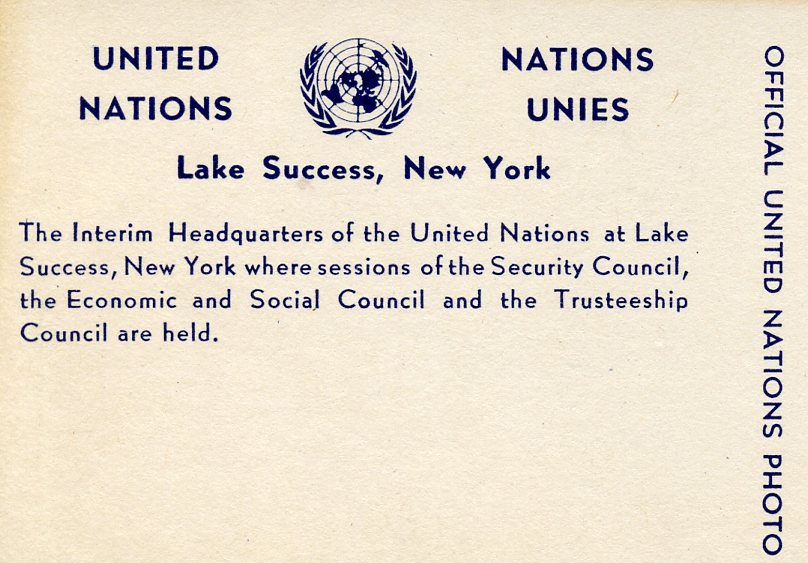
Diplomats' postcard
Reverse caption for above postcard
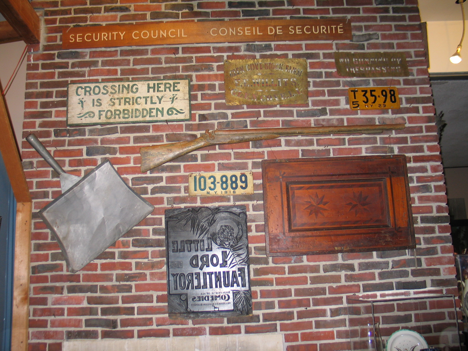
Top item mounted on wall in photo is a wood sign (Security Council) used at the UN when located in the Sperry Building at Lake Success. Removed and saved by Sperry President Preston R. Bassett and later given to the Nassau County Museum (NCM #64.17.3). Bassett’s office had been used as the U.N. Secretary General’s office during their stay at Sperry. Shown when exhibited at Old Bethpage Village Restoration back in October 2006 as part of a special exhibit “Selections from the Collections of the Nassau County Division of Museum Services” that I setup.
“Sperry Employees’ Handbook” cover, c.1945
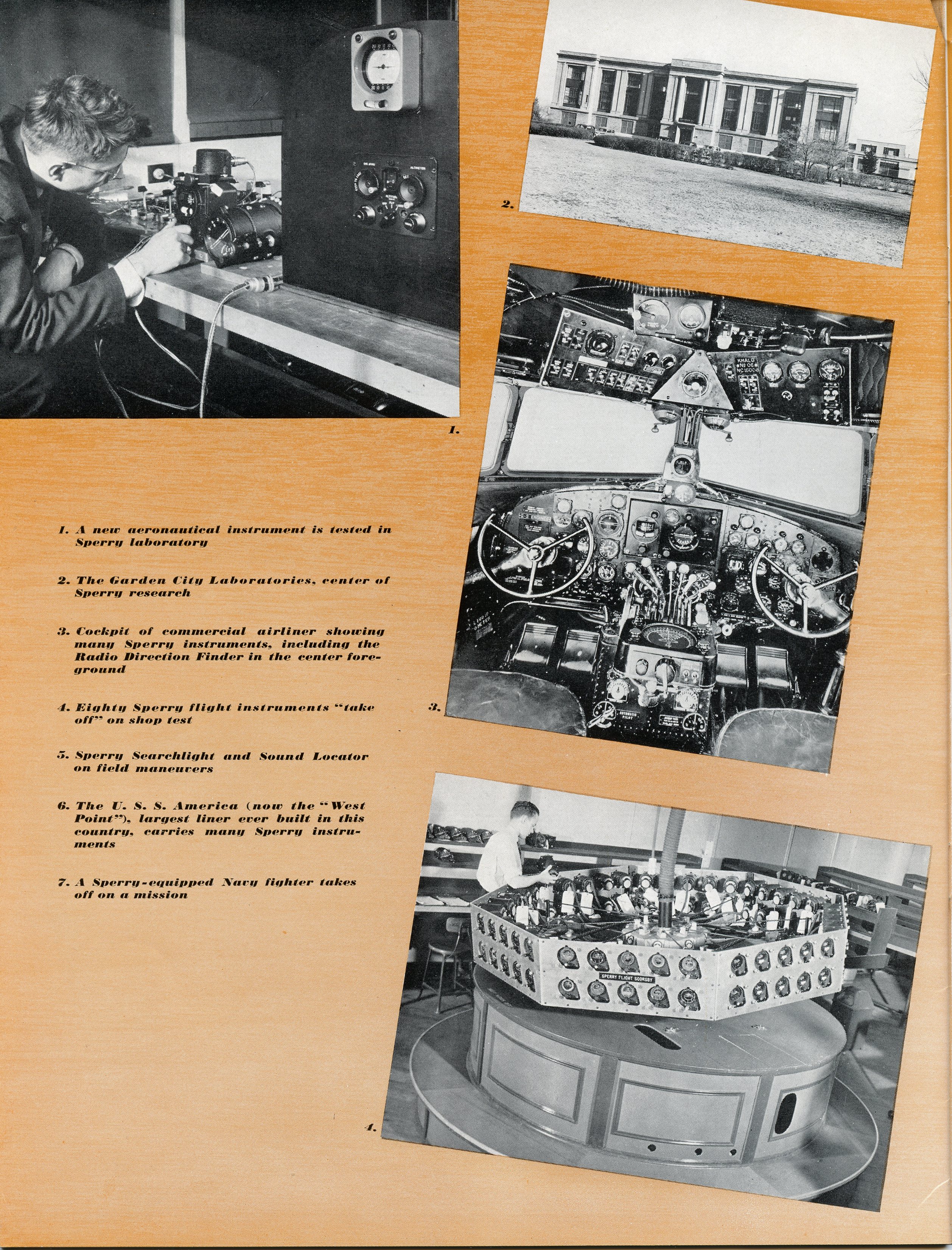
Photos of Sperry products & Garden plant (former Curtiss plant)
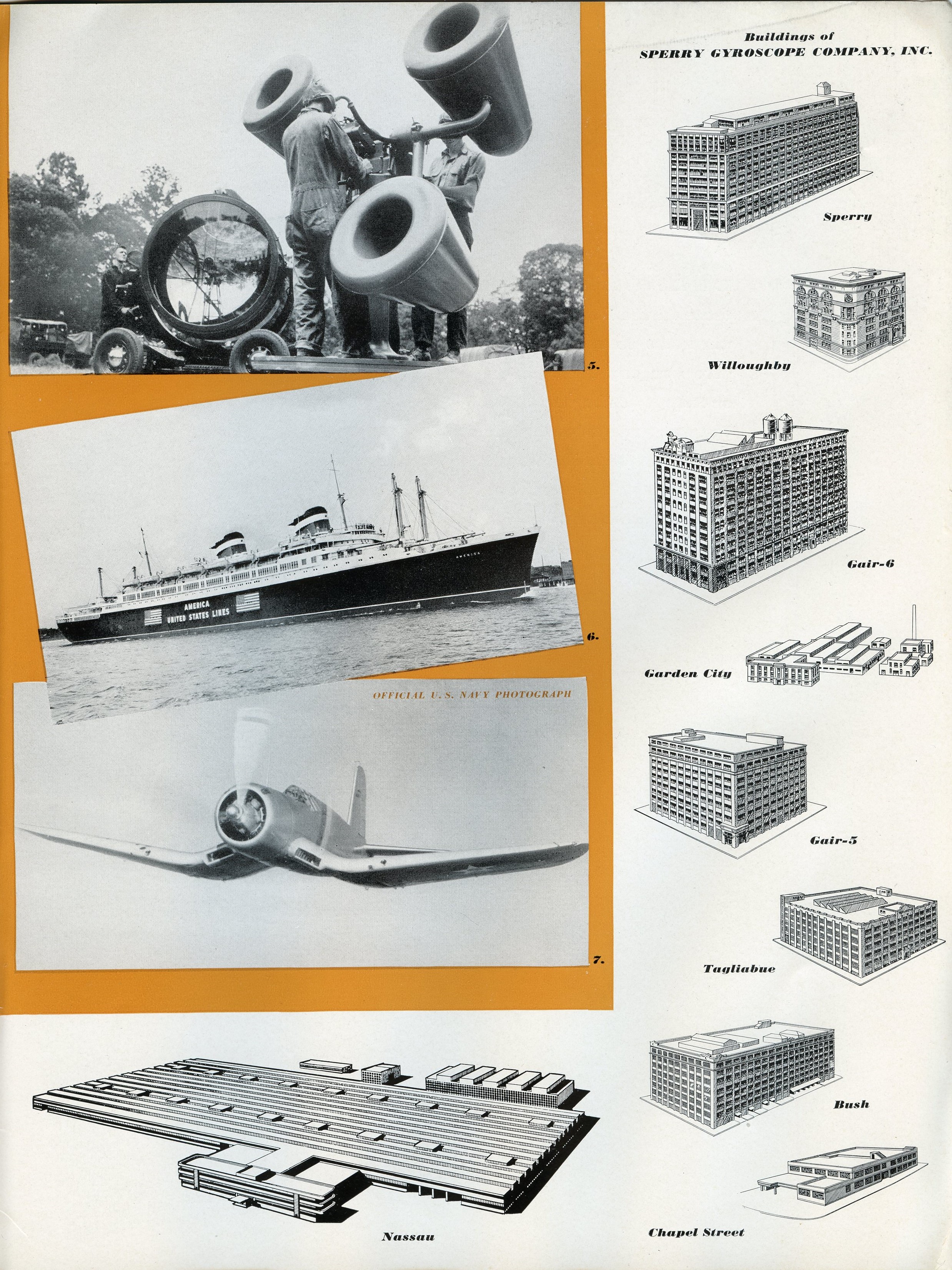
Photos of products & drawings of Sperry facilities, including Lake Success on bottom (Nassau)
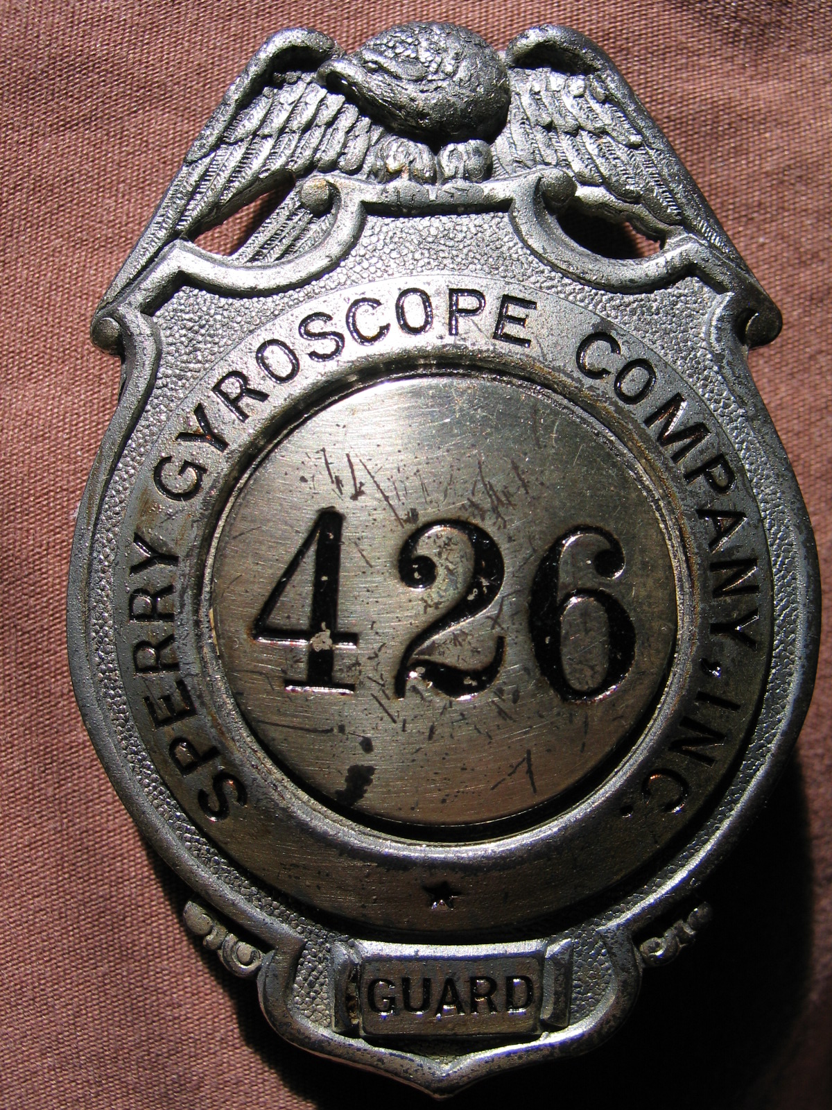
Badge, “Sperry Gyroscope Company, Inc. / Guard / 426”, c.1940's
Kleiner's Korner (Submitted by Art Kleiner)
1950 Map
1957
The Brooklyn Daily Eagle, April 8, 1946
The Brooklyn Daily Eagle, April 11, 1946
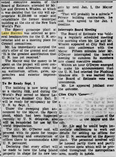
The Brooklyn Daily Eagle, April 11,1946
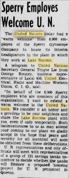
The Brooklyn Daily Eagle, April 16, 1946
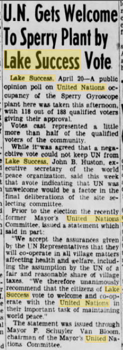
The Brooklyn Daily Eagle, April 21, 1946
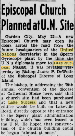
The Brooklyn Daily Eagle, May 22, 1946
The Brooklyn Daily Eagle, August 16, 1946
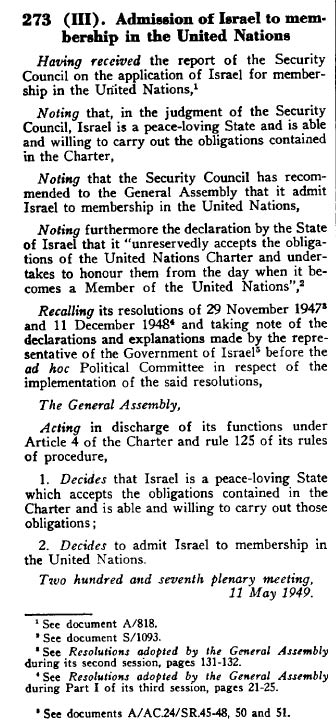
General Assembly Resolution #273


Comments
Date is before 1969, since I can still see the LIMP in the bottom corner. The picture is the original United Nations building, where Israel was founded. The picture is taken from (approximately) above the Vanderbilt Lakeville Mansion. It looks to the south east. With the Northern State Parkway at the bottom running left to right, and Marcus Ave running slightly higher in the picture.
Original UN Building in Lake Success (Became the Sperry Building)
Looking South East - South of Northern state
LIMP - bridge located on the right
Lakeville road - bridge on the right (Parallel to LIMP)
1945-1947 Time Range - just after WWII
UN Declared Israel Independence from this location
It’s the original UN, home to Sperry Corp. for many years, the creation of Israel was done there, photo Is facing south, mid 1940, car on northern state is 1940 41 ford or Willys, motor parkway can be seen in bottom right corner of picture, dark roadway passing over northern state
I got this one:
This is New Hyde Park. Motor parkway bridge at the bottom of the pic and we are looking southeast, we are pretty much right above where the Deepdale Vanderbilt estate was/is. The building we are looking at was once the HQ for the United Nations while the NYC location was being built. This was from 1947-52 approximately.
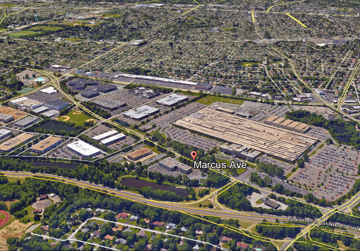
The was the location of a Sperry Rand Defense plant. The plant was acquired by Loral Corp, then Unisys and later by Lockheed Martin before being closed.
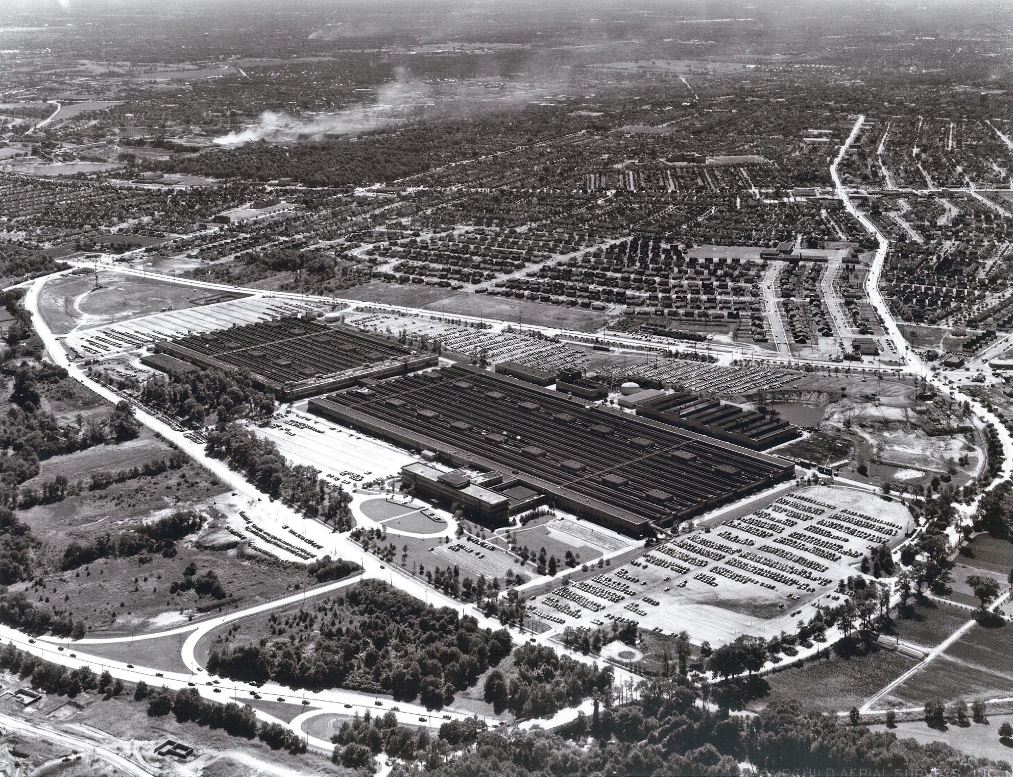
In 1939 the United States government bought a large tract between Marcus Avenue, Lakeville Road and Union Turnpike, to be the home to the Sperry Gyroscope Company which built a variety of maritime, military, aerospace and navigation products. During World War II the plant had 22,000 employees
BOO YAHHHH!!!!
This is the Sperry plant,
the shopping center is not there, on what would be Union Turnpike so it is `40` to 50`s ?
the office or the mane entrance became the UN. start up.
Aerial is north west
Sperry Plant at Lake Success, adjacent to the Long Island Motor Parkway, with orientation being towards the East.
I would speculate that “Confidential” was marked on the foto as the foto was most likely taken in the early 40s during WW2, and that the connexion to Israel would be the use of this facility as original headquarters of the United Nations when Israel became a member of the United Nations.
My office was across the street. So I should know.
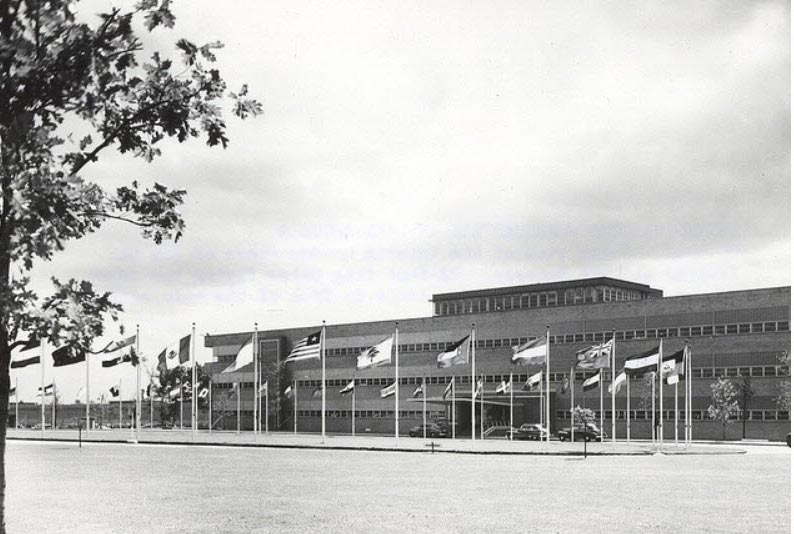
1. Sperry/Gyroscope. Norden bombsight. The executive offices in the front, with the factory in the rear.
2. I don’t think the vote to partition the British Mandate of Palestine took place here. I though the UN General Assembly met in the NYC pavilion of the 39-40 World’s Fair until the present UN on First Avenue opened. However, based upon your question, I’d have to state that at least part of the decision to end the British Mandate was made in the building, which was the then Secretariat Building, if not the General Assembly vote.
3. Looking southeast.
4. The photo is marked confidential. I suspect that it was taken during the War. The question, however, states that the Defense Department marked it confidential. The DOD was created in 1947 with the “merging” of the services and the creation of the US Air Force. Before the DOD, the US Army was called the War Department and the Navy was called the Navy Department. Now both are under the umbrella of the DOD. So if the question is correct, the DOD marked the photo as confidential after the War, not during it. As for the date, it was taken after Sperry moved from Brooklyn to the site. My guess in 1943.
5. The Northern State Parkway is visible on the bottom of the photo (north). Both the eastbound exit and entrance from and to the Northern State Parkway at Marcus Avenue is visible, as is the westbound exit and entrance from and to Middle Neck Rd. To the right of the Middle Neck Bridge is the Vanderbilt Parkway Bridge.
Sperry Gyroscope bldg. Served as United Nations temporary home from 1946- 1951. It was here that the United Nations council recognized Israel as a state. The picture was taken looking South- South East. Picture was probably taken in mid to late 1940’s. The Northern State Pkwy was open by 1938, Sperry opened early 1940’s. Lake success shopping center isn’t built yet and was probably built mid 1950’s. Looks like Long Island Motor Pkwy is crossing over the Northern State Pkwy in the lower right corner of the picture.
NIce picture, Howard. I’ll be sending some material for Kleiner’s Korner later
Identify the historic building in the aerial.: United Nations General Assembly during the period 1946-1952 when a permanent site was being decided.
How is this building related to Israel?: Site of the UN Security Council vote to approve Israel’s admission to the UN by a vote of 9 to 1 (March 4, 1949) and then followed up by the General Assembly’s vote to do the same by a vote of 37 to 12 (May 11, 1979).
What is the orientation of the aerial?: South/Southeast. Northern State and Marcus avenue of at the bottom of the picture, Union Turnpike in the middle, Lakeville Road and Motor Parkway bridges lower right corner.
What is the date of the aerial? Provide a rationale. 1950-1951. Before the Episcopalian Church was built in 1952 across from the UN.
How is this aerial related to the Long Island Motor Parkway? As stated above, Motor Parkway bridge shown at the lower right corner, leading into the Great Neck lodge area.
The building is the former Sperry Plant in Lake Success
It was used as a temporary headquarters for the United Nations and
it was there that the discussions took place for the creation of the State of Israel and its
recognition and admission to the UN.
The view is looking southeast, with the road running diagonally top left to lower right just below the circle being Marcus Avenue. Left to right across the bottom is the Northern State Pkwy. It looks like a LIMP overpass at the lower right, just to the right of the Lakeville Rd. Overpass.
My guess would be 1946.
The view is south, southeast at Lake Success & New Hyde Park (approx. over the east end of the lake itself). The building above the circular (oval) entrance drive was the first temporary home of the United Nations at Lake Success (later at Fresh Meadows). Above that is the Sperry (Sperry/Rand) defense plant. Above that is it’s parking lot with entrances from Union Turnpike, crossing at right is Lakeville Road.
Centered below the oval entrance drive is it’s entrance from Marcus Ave. Below that is the Northern State Parkway, which at the right is going under the Lakeville Rd (white) & LIMP (dark, looks tree lined) bridges. (LIMP over Marcus Av bridge is gone)
I don’t know the date but by 1952, Olive St. would be showing in the lower left corner (though without houses yet). Also that’s the original eastbound NSP Lakeville Rd exit starting right at the bridge out to Marcus Av. At some point, between 1950-52, it was moved about 500 feet further east.* If (??) the UN took over an existing Sperry headquarters building, then I’d guess the pic is during or right after WWII (hence the ‘CONFIDENTIAL’ ??) so maybe 1945,6,7.
* You have a 1950 aerial, viewN, showing the old exit at: http://www.vanderbiltcupraces.com/vcrsys/Images/Alco/12-26-2007-09-13-19-128_edited-1.jpg
Also a 1952 aerial, viewE, showing the new exit, the old removed but not yet overgrown, plus Olive St. & the tail (east) end of Tanners Rd. at: http://www.vanderbiltcupraces.com/vcrsys/Images/Alco/FNeg521891_LakeSuccess_10Ju-1.jpg
It is Sperry Rand in Lake Success. Photo taken from Northwest probably during WW2 so I am gong to guess 1942. This building was also the first home of the United Nations. Israel was declared a state in this building. The company was assembling bomber gun turrets during the war.
Lakeville Road goes from the bottom of photo to right. The Long Island Motor Parkway ran along what is now Lakeville Road
That’s the Sperry Gyroscope building located at 1111 Marcus Avenue in Lake Success. From 1946 to 1951 it was the temporary headquarters for the United Nations. In 1947 the U.N. General Assembly passed Resolution 181 which divided the British Mandate of Palestine into separate Jewish and Arab sections. This was the legal basis which lead to the establishment of the independent nation of Israel. The orientation appears to be south-south-east. Since the photo is marked “confidential” because Sperry was an important defense contractor during World War II, yet the parking fields don’t appear to be completely full, I’m thinking the date is 1945-1946. Along with Lakeville Road, Union Tpke., Marcus Avenue, and Northern State Pkwy. (top to bottom), there is the Long Island Motor Parkway going over the NSP in the lower right corner.
Another give-away! Sperry Gyroscope plant in Lake Success looking SSE. On 29 Nov 1947 and 14 May 1948, while it was the temporary home of the UN, Palestine was to be partitioned and Israel was then formally partitioned out of Palestine. Probably taken sometime between 1942 and 1945 (WWII security classification). NS Pkwy across bottom, with Marcus Ave. just beyond; Lakeville Rd. at top right and lower right with abandoned LIMP bridges over NSP and Marcus at far lower right; Hillside Ave. is beyond plant with Union Tpke. and Jamaica Ave. (to right/W)-cum-Jericho Tpke. (to left/E) in far distance. Oval driveway at 1111 Marcus Ave. still there in front of former Sperry office building which once housed UN.
From Len Williams:
Howard,
I believe this is the Sperry Gyroscope property which was also the first location of the United Nations immediately after World War II. I think this is where the UN voted on the formation of the State of Israel.
The photo was taken looking southeast.
It was taken sometime before 1953 because ground had not yet been broken for the Lake Success Shopping Center.
The northern State parkway runs left and right across the bottom of the page and the LIMP bridge crosses the Northern State at the lower right corner of the page.
Sent from my iPad
Len Williams
McCready & Rice Plumbing Inc.
From Sam Coleman:
1?
2 east to west looking north
3 looks like in the late 40’s cause of the confidential they were making a lot of war products, lakeville road is still 2 lanes,
4 northern state is right there, was that the base for the Long Island Motor Parkway at that point
sam colman
now from NC
was from NHP
Anything to do with Grumann?
I’ve been too busy this summer and haven’t had time to research mystery photos as much as I’d like to, so it’s nice to see when I can answer them mostly off the cuff!
Identify the historic building in the aerial.
-United Nations original, temporary location, (then later, Sperry where my Grandfather was engineering, designing and building gyroscopes for flight systems.)
How is this building related to Israel?
-The U.N. established Isreal. From Wikipedia;
On 29 November 1947, the United Nations General Assembly adopted a Partition Plan for Mandatory Palestine. This specified borders for new Arab and Jewish states and an area of Jerusalem which was to be administered by the UN under an international regime. The end of the British Mandate for Palestine was set for midnight on 14 May 1948. That day, David Ben-Gurion, the executive head of the Zionist Organization and president of the Jewish Agency for Palestine, declared “the establishment of a Jewish state in Eretz Israel, to be known as the State of Israel”, which would start to function from the termination of the mandate. The borders of the new state were not specified in the declaration
What is the orientation of the aerial?
-Looking South/SouthEast
What is the date of the aerial? Provide a rationale.
-It was the U.N. from 1946-1952. I throw a guess out there, go in the middle and say 1948.
How is this aerial related to the Long Island Motor Parkway?
-The LIMP ran close by. The Moses N.State parkway bridge in the very lower right of the photo.
Those look like Robert Moses’ ‘twin’ bridges in bottom right corner that once stood apart just ~225’ above the NSP; the Lakeville Rd bridge (still there) and the abandoned, overgrown Motor Pkwy bridge (removed). So we must be above Willie K’s Deepdale Estate overlooking Lake Success towards the SE. Year is post 1938 after Motor Pkwy’s closing. That’s a rare view of the former Marcus Av/Lakeville Rd exit ramp off the NSP in bottom center. The historic building at center is Sperry Gyroscope Corporate offices but before it was used as United Nations HQ (1946-1952). So year of photo is 1938-1946. Today’s ramp was extended with NSP’s extension to handle heavier traffic.
From Gary Hammond:
Mystery Photo # 28 – Hammond’s Historical Happenings
ID of Building – Sperry Gyroscope Plant, Marcus Ave., Lake Success (bordered by Marcus Ave. / Lakeville Road / Union Turnpike; P.O. address is 1111 Marcus Ave.)
How is this building related to Israel? – The property was acquired in 1939 by the U.S. Government for use by Sperry. The United Nations was established October 24, 1945; in August 1946 it moved to the Sperry Gyroscope plant in Lake Success; on November 29, 1947 a resolution was adopted by the U.N. General Assembly – “United Nations General Assembly Resolution 181 (II) Future Government of Palestine”, part of which included the boundaries of the Jewish State.
What is the orientation of the aerial? – looking South
What is the date of the aerial? - circa 1945 (WWII) due to the Confidential marking, and the dark coloration of the buildings; no evidence of UN flagpoles in front; Sperry received at least four Army-Navy “E” for Excellence Awards during WWII
How is this aerial related to the Long Island Motor Parkway? Bottom right hand corner shows the Northern State Parkway Motor Parkway Bridge
I realized after that my Grandfather was a gyroscope engineer at Sperry in the 30’s as well as post-war. I wish I had more memorabilia from his time there.
Hi all,don!t have much time for mystery solving anymore,busy here almost every day,many activities during the day and also at night,I’m lucky I have a chance to check things out here,to keep up to date what’s going on. I’m really enjoying it here.I can amagine how you are enjoying Shorty Howard,showing it off and driving it to the car shows,I hope. I don’t know if you know it or or not,but they have Classic Car Golf Carts here,what beauties they are,Antiques too,there’s one with electric windows and I think it’s the only one in existence,what do you think about that?he rates like you Howard. They have shows,cruise ins and all,just like cars. Like I said before,This Is The Place To Be,everything at your fingertips and a golf cart away, what can be better than that?. I’ll keep in touch when I can.
Seems odd that a top secret building in the defense business would house the UN, it probably would not happen that way these days, with all the turmoil going on around the world. But even back then why would they put internationals there at the start of the Cold War and Korea ?
There’s an earlier connection between Sperry and the Long Island Motor Parkway. Sperry tested the first “cruise missile”, the Sperry Aerial Torpedo, on the parkway during WWI.
“Sperry’s assistant, N. W. Dalton, was able to get his hands on a newfangled Marmon automobile, so the team strapped the Flying Bomb to the car’s roof and sped down the Long Island Motor Parkway at 80 mph to calibrate and optimize the flight controls.”
http://gizmodo.com/this-flying-bomb-failure-was-americas-wwi-cruise-missi-1184824802
___________________________________
From Howard Kroplick
Ike, here is a link to my post on the Sperry Cruise Missile:
http://www.vanderbiltcupraces.com/blog/article/the_role_of_the_motor_parkway_in_the_development_of_the_cruise_missile
A scene from “The House on 92nd Street” (1945)
Great materials, thank you everyone! My father worked for Sperry Rand right until he shifted to the brand new IBM plant being built in Dutchess County. I hadn’t realized he designed a patent and upon discovery of such, I was led to this collection of interesting factoids.