Updated: Mystery Foto #34 Solved: A Historic Photo of a Road Sign in Front of Max Levi’s Hotel
My favorite co-author Al Velocci challenged you to solve this weekend's Mystery Foto.
Mystery Foto questions:
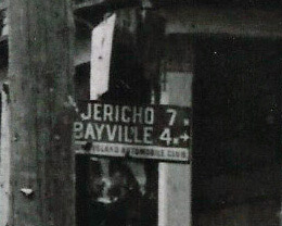
- Identify the inn.
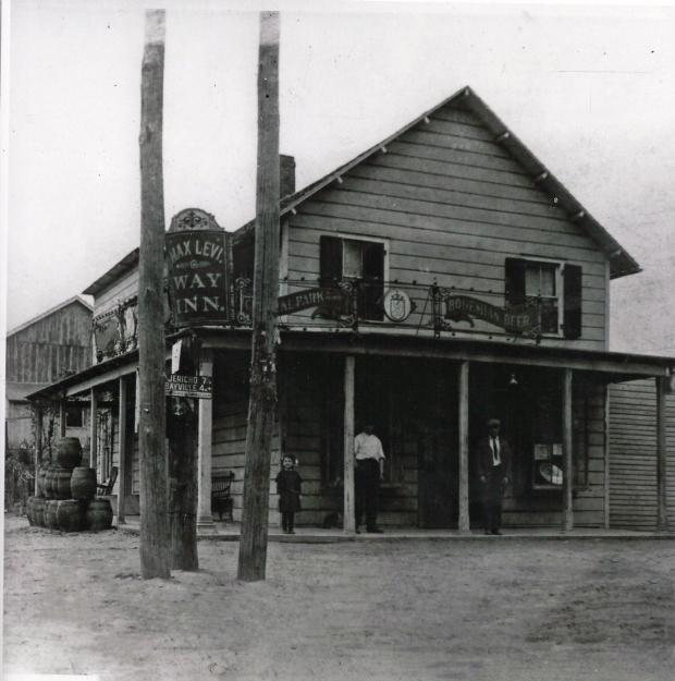
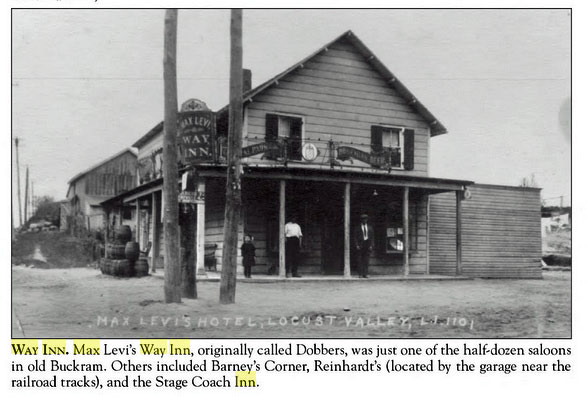
Max Levi's Way Inn located in Locust Valley on Buckram Road (the road to Glen Cove). State records indicate the Way Inn was also located on Bayville Road which may have become Birch Hill Road.
Where is the exact location of the sign?
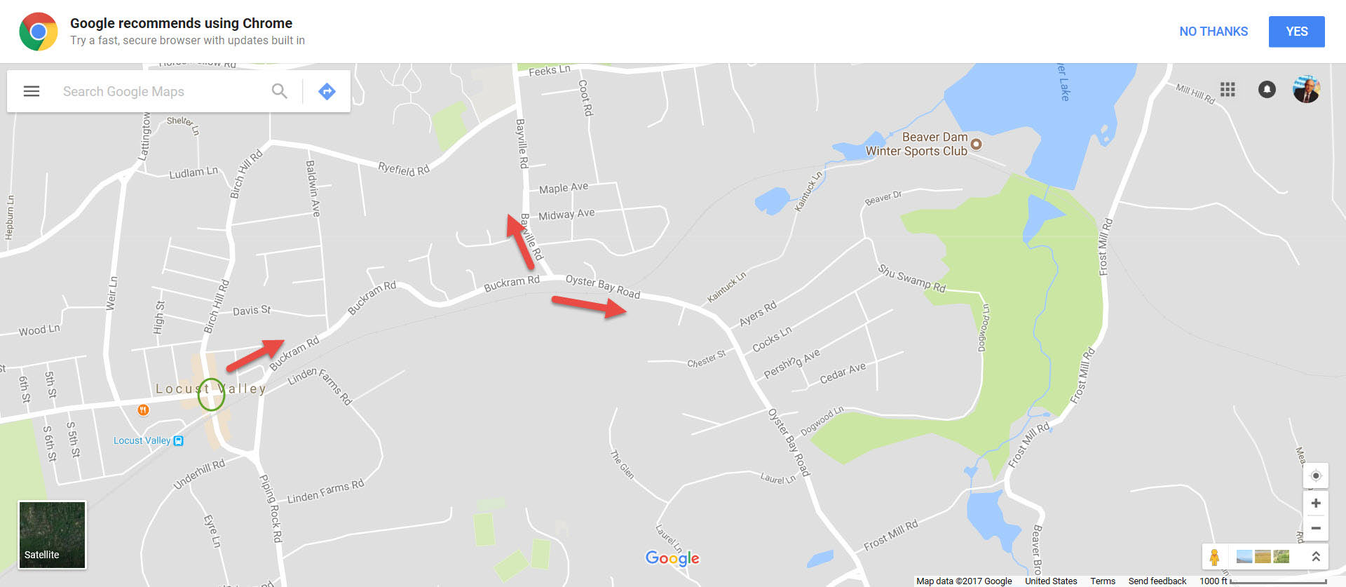
Al Velocci believes the sign was placed at the intersection of Birch Hill Road and Buckram Road. It assumes the sign is pointing east to both Bayville (4 miles) and Jericho (7 miles). This works since Buckram Road becomes Oyster Bay Road which heads south.
- Which oganization placed the sign at the location and when?
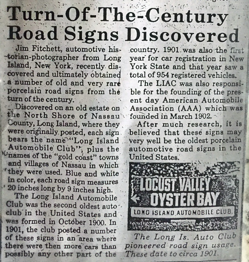
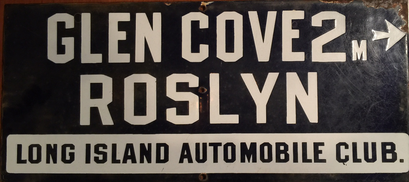
The Long Island Automobile Club placed these porcelain road signs in 1901 on the major roads of Long Island.
- Why is this photo historically significant?
Uodate August 31, 2017: This is one of only three known photos showing a Long Island Automobile Club sign in place in its original location.
Comments (8)
Congrats to Tim Ivers, Greg O., Steve Lucas, Art Kleiner and Frank Femenias for identifying Max Levi's Way Inn in Locust Valley.
Kudos to Greg O., Steve Lucas and Art Kleiner for identifying the Long Island Automobile Club as responsible for the road signs.
Enjoy,
Howard Kroplick
Update August 31, 2017:
Eagle eye Greg O. has discovered tow other Long Island Automotive Club road signs seen on the course of the 1908 Vanderbilt Cup Race Course.
Update: September 3, 2017
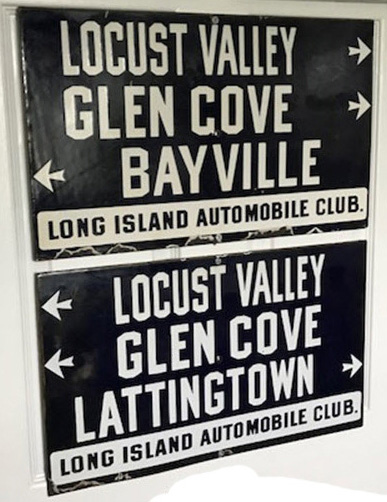
Long Island Automobile Club road signs. Submitted by Roeger Monfitt.
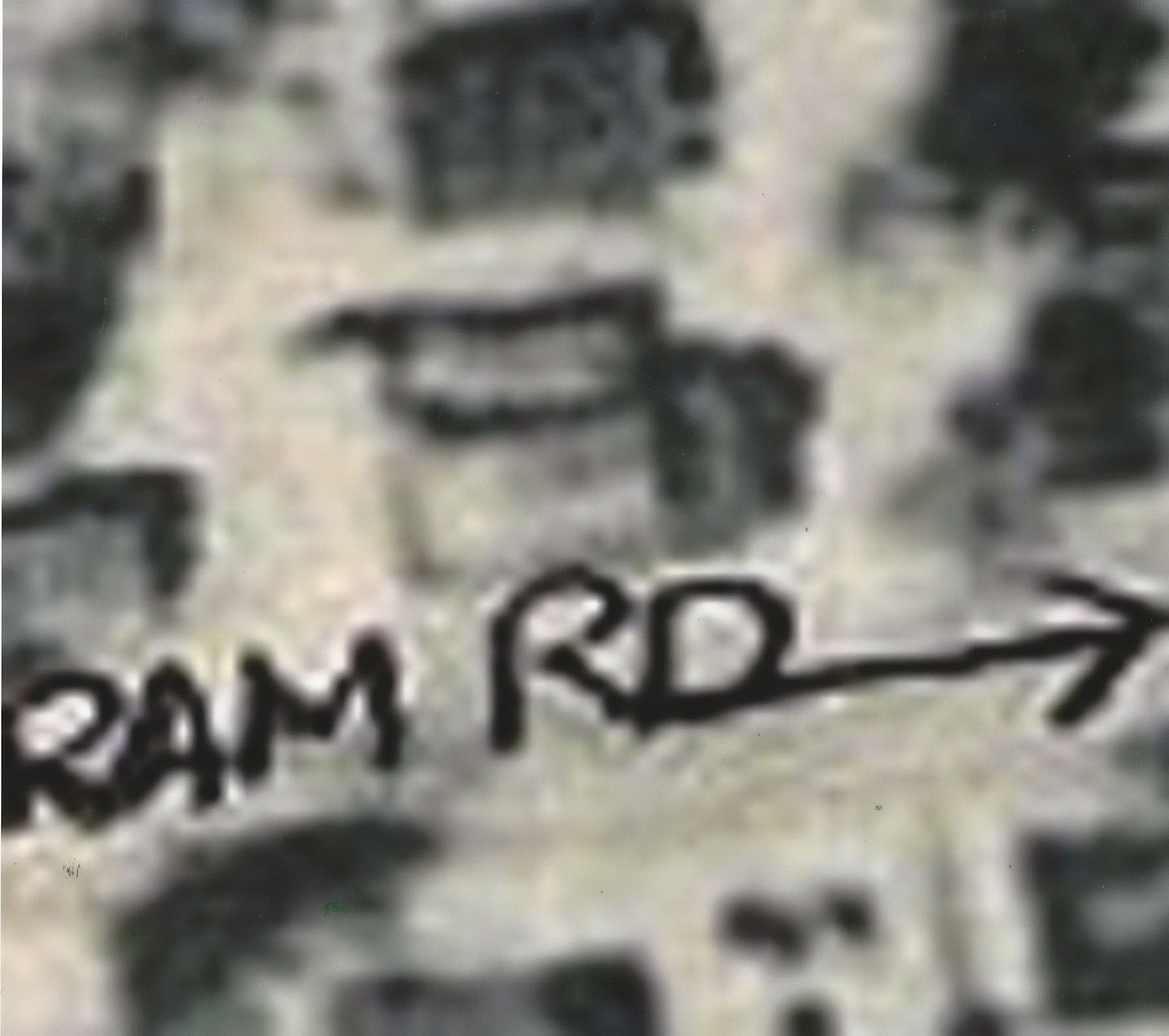
Close-Ups
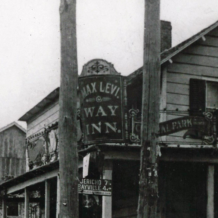
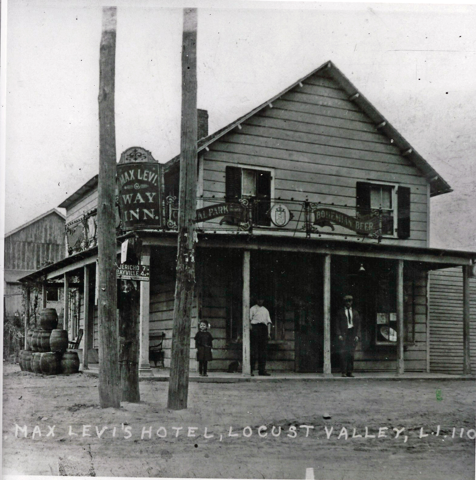
Caption: Max Levi's Hotel, Locust Valley, L.I.
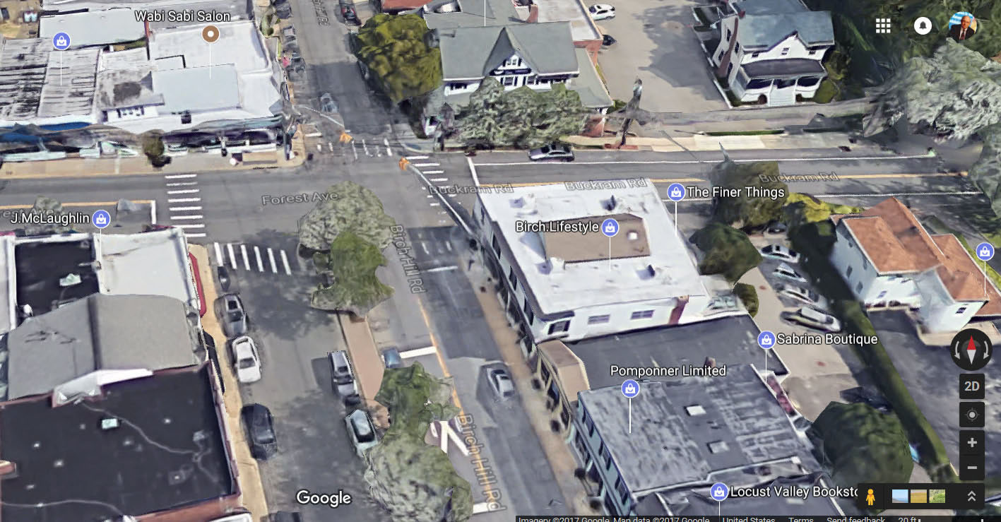
Possible Location in Locust Valley
McCarthy's Maps (Submitted by Brian McCarthy)
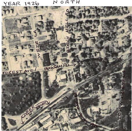
Brian McCarthy: This 1926 aerial shows the intersection at Birch Hill Road and Buckram Road.
Brian McCarthy: The Hotel appears to be facing Birch Hill Road.
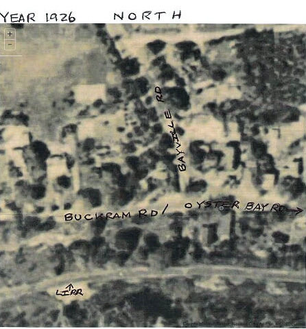
This 1926 aerial shows the intersection of Bayville Road and Buchram Road.
Long Island Automobile Club Signs
My favorite Long Island Automobile Club sign.
Kleiner's Korner (Submitted by Art Kleiner)
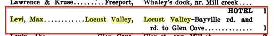
State Excise Report -1912
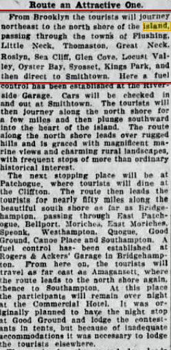
Brooklyn Daily Eagle, August 7, 1910
Brooklyn Daily Eagle, August 8, 1010
Brooklyn Daily Eagle, August 9, 1910


Comments
Long Island Automobile Club put the sign there, somewhere between Bayville and Jericho I’ll take a wild guess this is East Norwich at Rt 106 where the bend of the 1905 race made the big turn west. Given all the empty barrels on the side of Max Levi’s Way Inn, it looked like a fun place to stop.
The Way Inn, a saloon owned by Max Levi in Locust Valley, about 1910
Omg,I remember this,but can’t place where it is and the signs are leading you to Jericho & Bayviille.The street sign ends with Park.I think this was a meeting place during a race or before one.Is it Max-Levit Way Inn?
-Identify the inn.
Max Levi’s Way Inn formerly known as Dobbers
-Where is the exact location of the sign?
Locust Valley (A guess at exact location would be Buckram and Bayville Rds.)
-Which organization placed the sign at the location and when?
Long Island Automobile Club. LIAC placed these signs in 1901.
-Why is this photo historically significant?
Unsure and still looking…can’t wait for the answer!
Formerly called Dobber’s, that’s Max Levi’s Way Inn which was in Locust Valley. I think it was located on the corner of Forest Avenue and Birch Hill Road (Piping Rock Road). The sign was placed there around October, 1900 or early 1901 by the Long Island Automobile Club which was a forerunner of AAA. Among the first porcelain signs, it was part of the first series of road signs to aid travelers.
Identify the inn. Max Levi’s Way Inn, originally named Dobbers in Locust Valley (originally named Buckram).
Where is the exact location of the sign? Intersection of Buckram, Oyster Bay and Bayville Roads. Nassau County tax records show two buildings at that location (315 Buckram Road and 7A Oyster Bay Road) having been built in the 1880s and 1850s, respectively, that may be related to the Way Inn). Need more evidence to be sure. More recently Barney’s Restaurant and an antiques shop occupy the buildings.
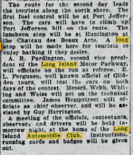
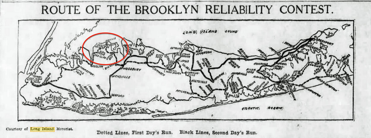
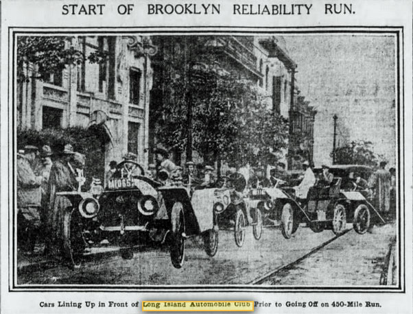
Which organization placed the sign at the location and when? Long Island Automobile Club to guide racers in the August 9/10 1910 Brooklyn Reliability Run.
Why is this photo historically significant? Prior mentioned Reliability Run which was a 450 endurance test from the Auto Club’s headquarters in Brooklyn to Montuak Point, Orient Point and everything in between.
Revision to my original response: The building that occupies Barney’s Restaurant at 315 Buckram Road is not the Way Inn as they both existed around the same time. And one of the roads where the Way Inn may have been Bayville Road. Taken from documentation sent to Howard.
It looks like 7mi.W to Jericho and 4mi.N to Bayville. This is unlikely because if location is in Oyster Bay, Rt. 106 to Jericho runs south, not west. And that stretch is only 5mi.
My best guess we’re in the heart of Locust Valley near the train station, on Buckram Rd/Forest Av facing west and Birch Hill Rd. Hoping there’s a caption with the photo.
Update: Found it.
https://books.google.com/books?id=rS3GP0GAtXQC&pg=PA54&lpg=PA54&dq=max+levi+way+inn&source=bl&ots=euJ606h-kq&sig=22KgwBUnqeLOMMUenJyVd3-uYjM&hl=en&sa=X&ved=0ahUKEwjBvcbFr_rVAhViwYMKHSHnBooQ6AEIOjAD#v=onepage&q=max levi way inn&f=false
Hi guys. I know this Mystery has been solved, but there’s something about the location of this former Inn that’s stopping me from going to sleep.
The location is believed to be at the intersection of Birch Hill Rd/Buckram Rd. After viewing all 4 corners w/streetview, only the N/W corner makes sense to me. The front of the Inn would have to be facing Birch Hill Rd. The road sign would direct one North towards Bayville,and Jericho towards the South ( even though the arrow for Jericho looks to be SW ). One can travel south down Piping Rock, Wolver Hollow Rd, and then cross Northern Blvd. Then Wheatley Rd leads to Cedar Swamp Rd. Or, head down Brookville Rd, which leads to East Norwich Rd. Either way will lead to Jericho.
If the Inn was at the intersection of present day Bayville Rd/Buckram Rd, then the front of the Inn would be facing Bayville Rd. The road would still direct one North towards Bayville, and then the SW arrow directing to Jericho would still lead towards Piping Rock Rd, etc.
What also led to these thoughts is Art’s photo of the Inn. There’s a wood pole line that presumably runs West and East ( Forest Ave/Buckram Rd ) . You can see the poles to the photo’s left. These poles currently run East and West at the 2 locations I described. Maybe my assumptions don’t jog right with the mileages. just had to get this out of my head, then go to bed.
Thanks to all with regard to Levi’s Way Inn. I was initially attracted to the photo because of the porcelain signage. I had never seen a picture of one of those signs in it’s original location. I first turned to the Locust Valley Historical Society to determine the exact location of Levi’s Hotel but after two e-mails and no response, I asked Howard to put it up as a mystery photo. My own opinion of the location is the northeast corner of Forest Ave./Buckram Rd. and Birch Hill Rd. I believe the view is to the north. Up until a few years ago that corner was occupied for many years by Caminari’s Restaurant. Prior to that it was Weeks Hotel. Will try the L.V. H. S. one more time. Al
Interesting map find Brian. It appears on the Birch Hill/Buckram intersection you can make out the Inn, front porch, side yard, three wood poles in front where the mystery road sign is attached, and the house directly behind the Inn.
I checked a 1906 Belcher-Hyde and all main roads between Bayville and Jericho remain the same today. The shortest distances from Birch Hill Rd/Buckram Rd were 7.3 and 4.0, and from Bayville Rd/Buckram Rd were 7.6 and 3.3. LIAC were rounding their signs to the nearest mile.