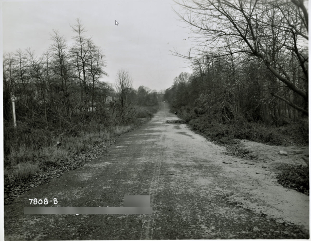
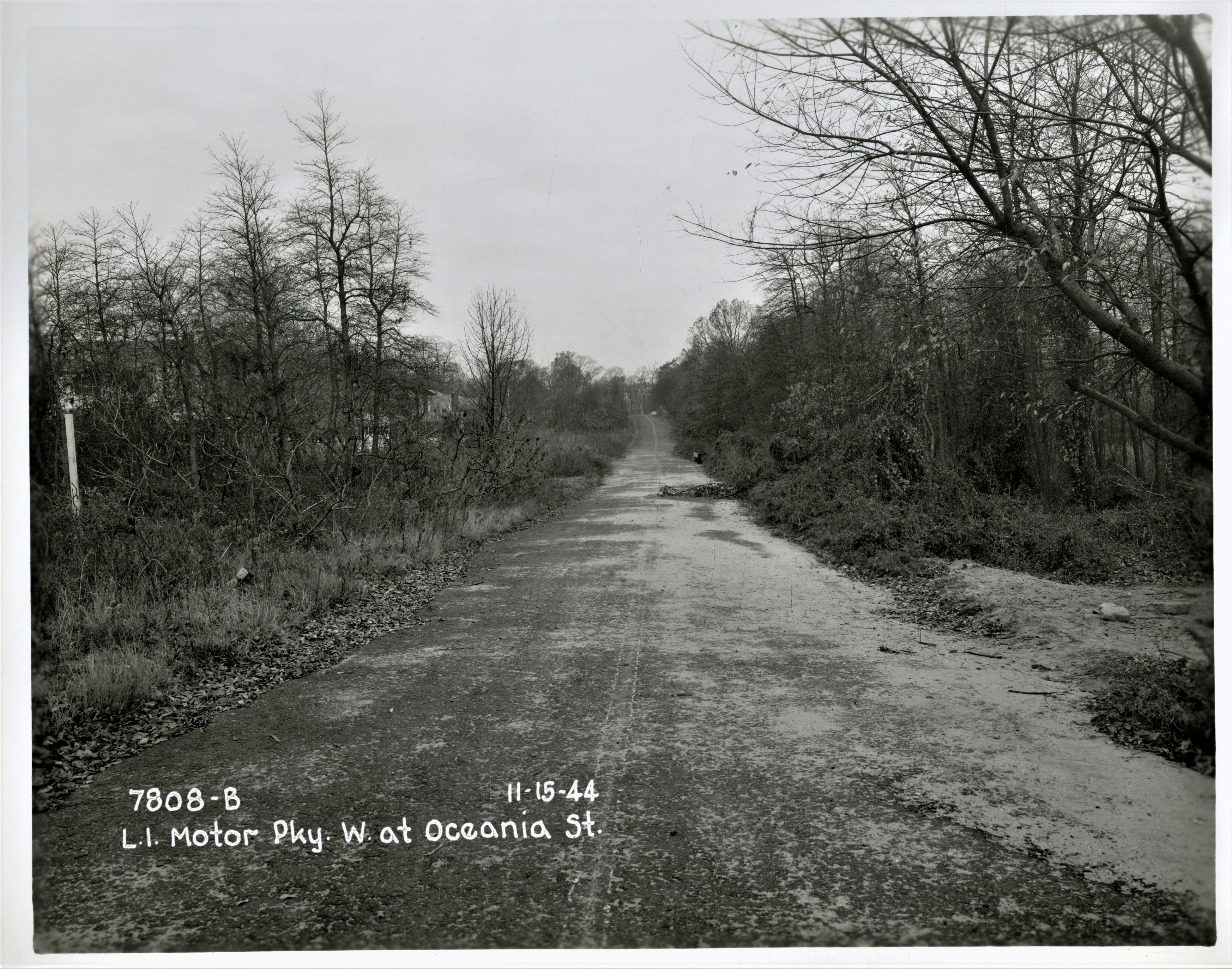
Mystery Friday Foto #36: Solved; On the Long Island Motor Parkway looking West towards the Hollis Court Boulevard Motor Parkway Bridge at 209th Street.
Frank Femenias challenged you to identify this difficult mystery Motor Parkway location.
Identify:
- Location and orientation of the photographer Hint: Sterlingshire Homes
Looking West down the Motor Parkway towards the Hollis Court Boulevard Motor Parkway Bridge at 209th Street.
See Femenias Findings and Art Kleiners Korner jpegs in the comments below.
- Approximate date and rationale
November 15, 1944 as per the captions
- Motor Parkway Structures
The Hollis Court Boulevard Motor Parkway Bridge
Congrats to Eddie, Joseph Oesterle, Mitchell (Mitch) J Paluszek, Roy Warner, David Miller and Steve Lucas for identifying the location.
Greg O. & Howard Kroplick
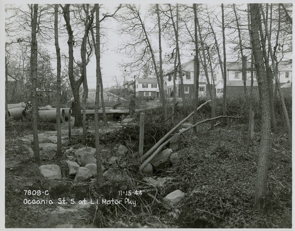
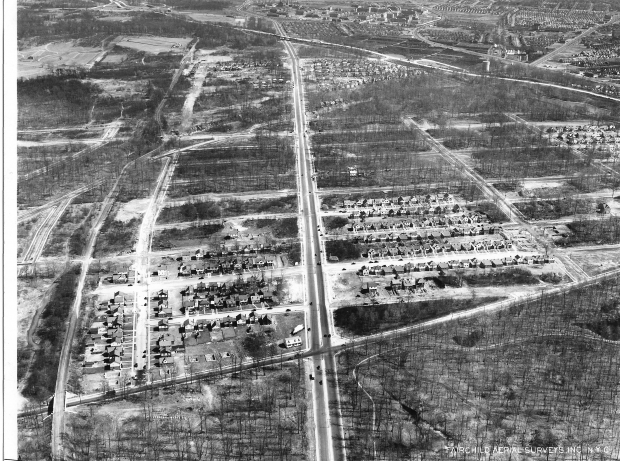
Same location looking south at Sterlingshire Homes built in 1938.
Queens Aerials
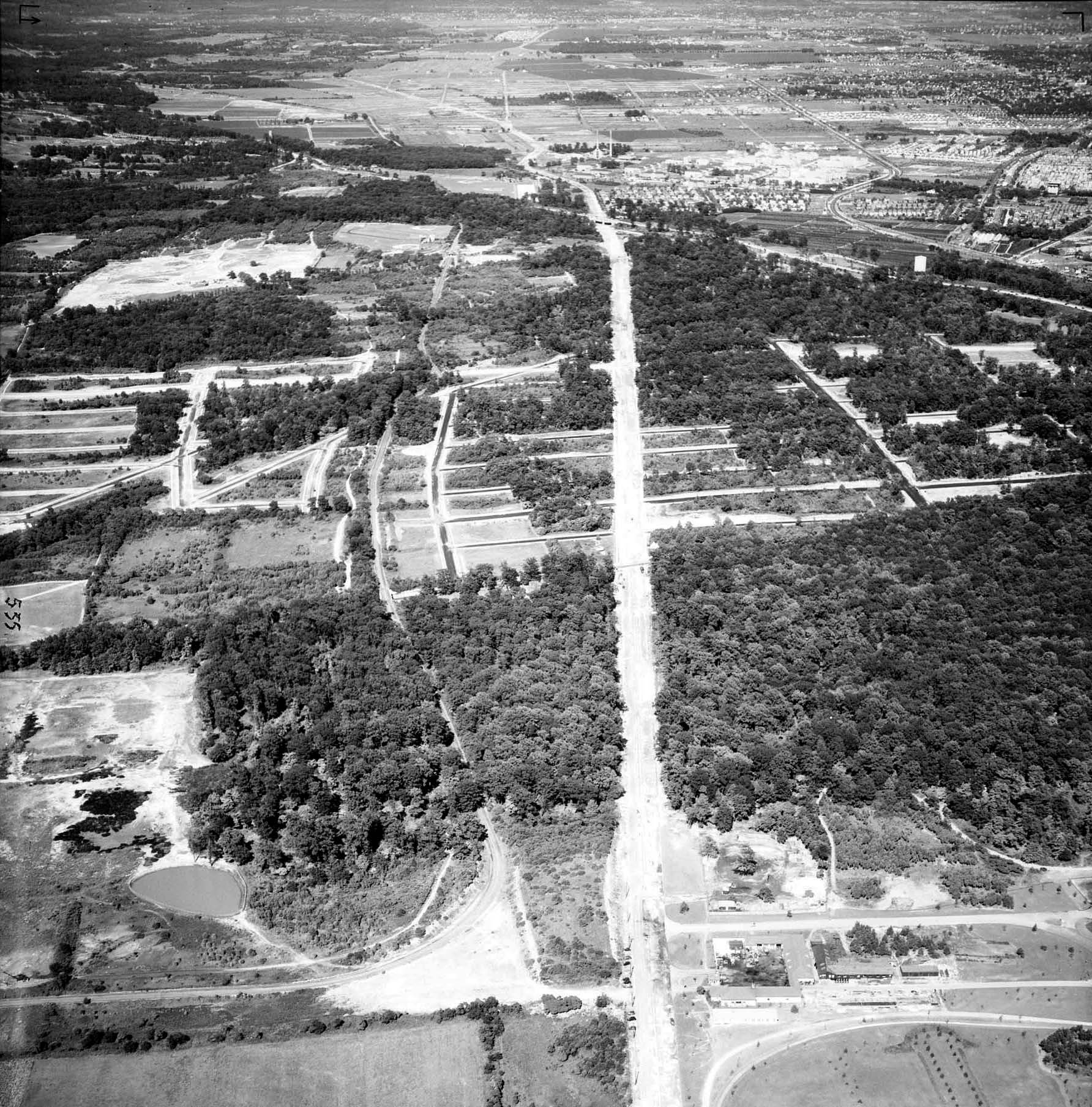
Aerial of Hollis Hills looking east taken on June 24,1938. The severe 90-degree curve of the Motor Parkway can be seen in the lower left section of the aerial. Note that Union Turnpike was still under construction and Francis Lewis Boulevard still has not been built. This aerial was found in the archives of the New York City Parks Department.
1941 aerial showing the Motor Parkway in Hollis Hills looking east. The photo is courtesy of the Fairchild Collection at the Benjamin and Gladys Thomas Air Photo Archives located in the UCLA Department of Geography.


Comments
Definitely Oakland gardens/212 street area.
I had it right away. But the 2nd picture really gave it away. Looking south on 229th Street from the LIMP ROW in Queens. The initial clue was the line painted in the middle. Which made me think bike path. Which made me think Queens.
I’m guessing the Motor Parkway in Oakland Gardens (Bayside) Queens, commonly referred to now as “the Bicycle Path”.
In fact, I will go as far to say the corner of Richland Avenue and 209th Street.
I used to ride my 3- speed English racer on this section - Fresh Meadows/Hollis - but, of course, two decades after the Sterlingshire homes were built. This stretch was near the bridge over Hollis Court Blvd. We moved from Kew Gardens Hills to a new home on the other side of Horace Harding Blvd in 1953; 199th St & 51st Ave, one block from Francis Lewis Blvd and two blocks from PS 162 on 201st St and 53rd Ave, my grade school. I’m now 75 y/o and remember it as though it were yesterday, which is how time gets compressed at my stage of life.
Then and now.
I think we are looking westbound on the LIMP between 209th st and Hollis ct blvd. At the top middle of the photo we can see a rise in the roadway. I believe this is the parkway bridge that carries the LIMP over Hollis ct blvd. The backyards to the left in the photo probably belong to the homes located on Richland ave. In the second picture is the dead end of 209th st looking south. Not too sure about the date of the picture though. I’m just going to guess sometime in the 1950’s.
I think we might be looking west from about 214th. Street in the north Queens Village area. In the distance appears to be a bridge, possibly going over Hollis Court Blvd. Based on the condition of the LIMP, overgrowth on the sides, and debris on the roadway, I’ll guess the date to be about 1940.
Intersection of the Motor Parkway and Hollis Court Blvd. in Queens.
Late 20s or early 30s before Sterlingshire Homes development was built. Development was east of Hollis Court Blvd. between Union Turnpike and the Grand Central Parkway.
More . . .
I’m guessing this is viewing East on the LIMP, between the Rocky Hill Toll Lodge ( photographer positioned East of the Lodge ) and the Grand Central Pkwy ( not seen, East of the slight curve seen ) Newer housing to the left is the neighborhood West of Cloverdale Blvd. After close of LIMP, around 1940. Screenshots below - First one is my answer, other two are nearby views in different directions.