Mystery Foto #37 Solved: Cherry Valley Club, Garden City Hotel & Roosevelt Field in 1936
Author Richard Panchyk challenged you again to find the Motor Parkway and more in another classic aerial.
Answers to the Mystery Foto questions:
- Identify the location and orientation of the photographer
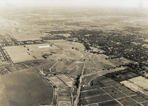
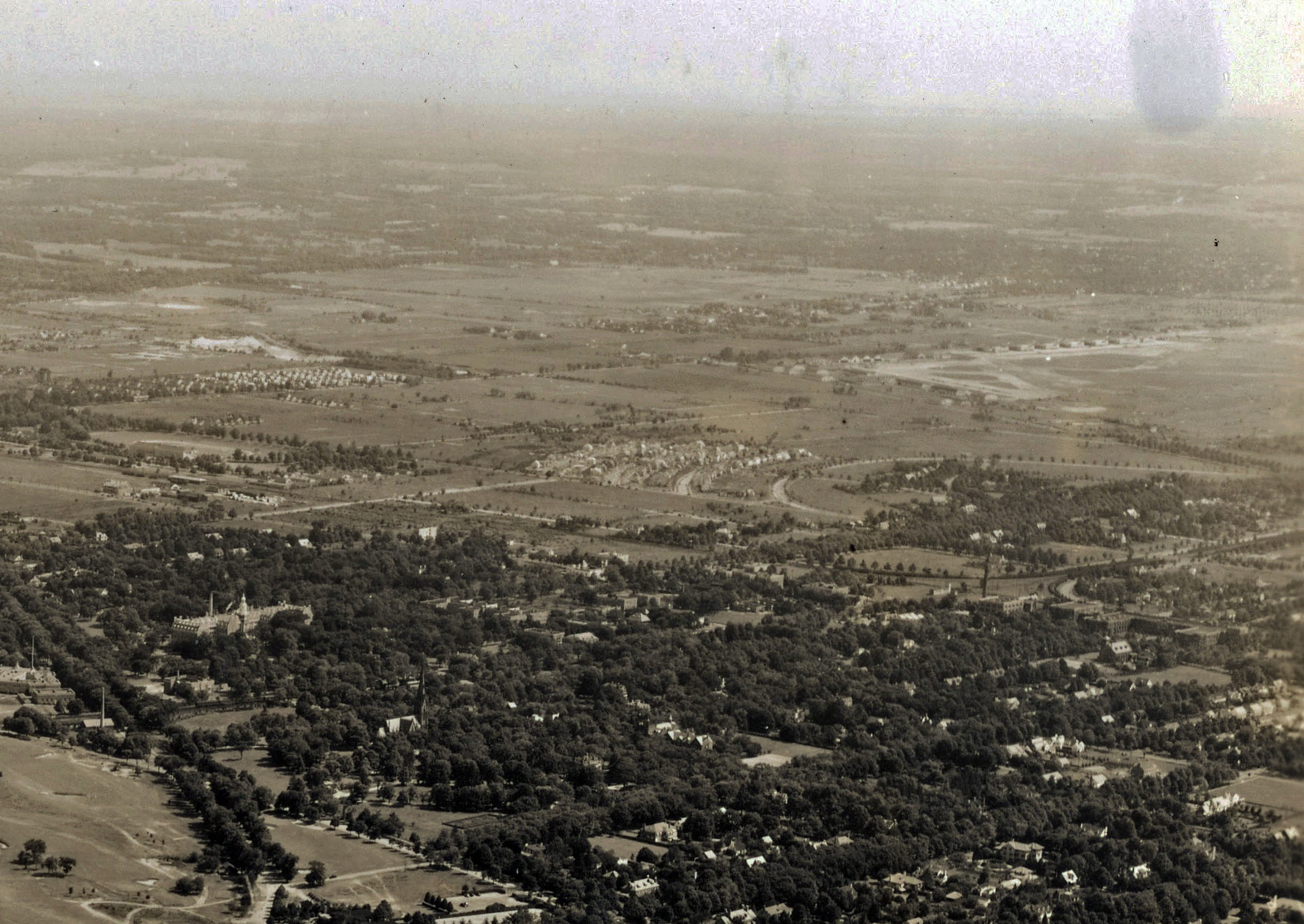
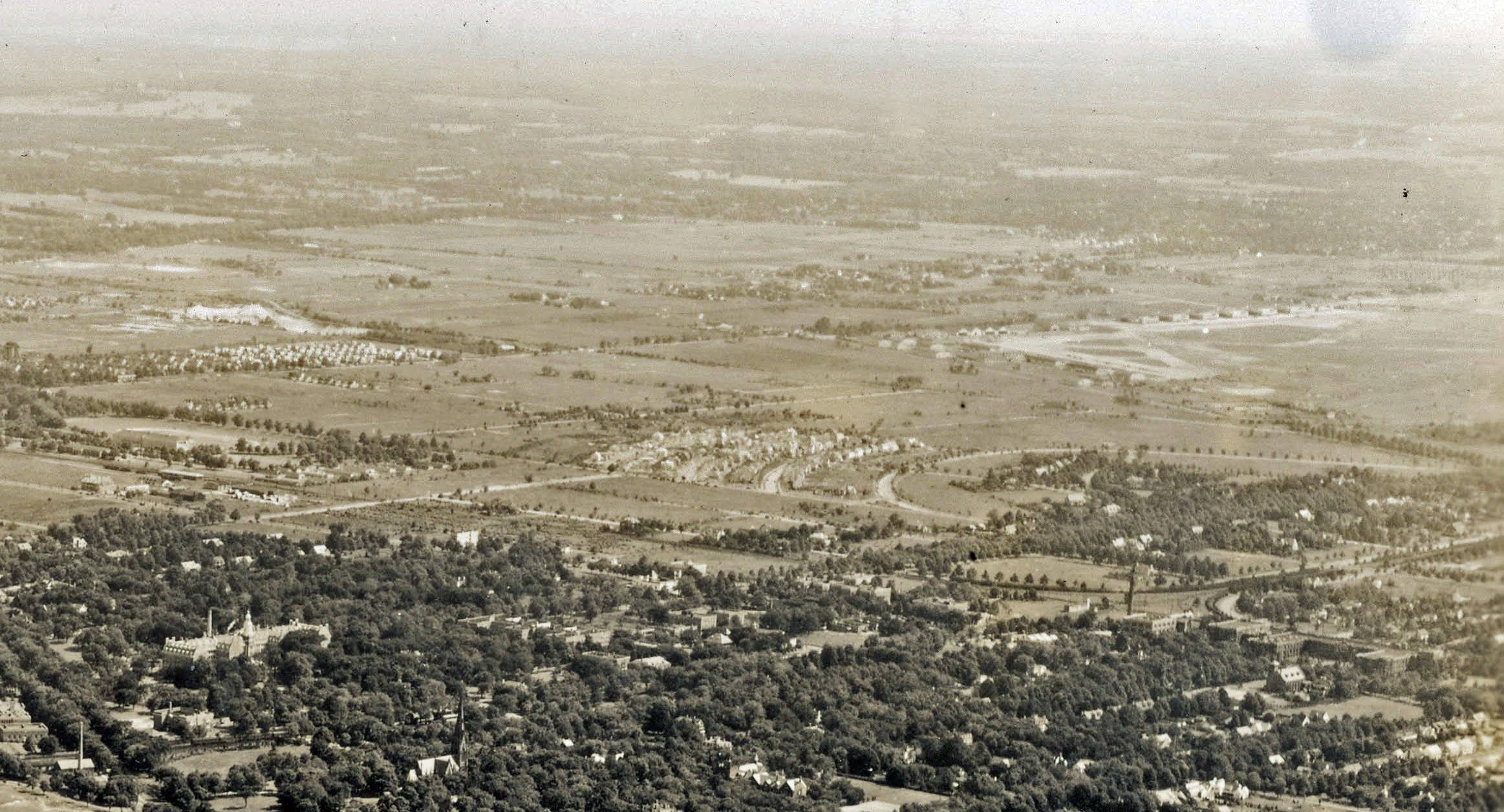
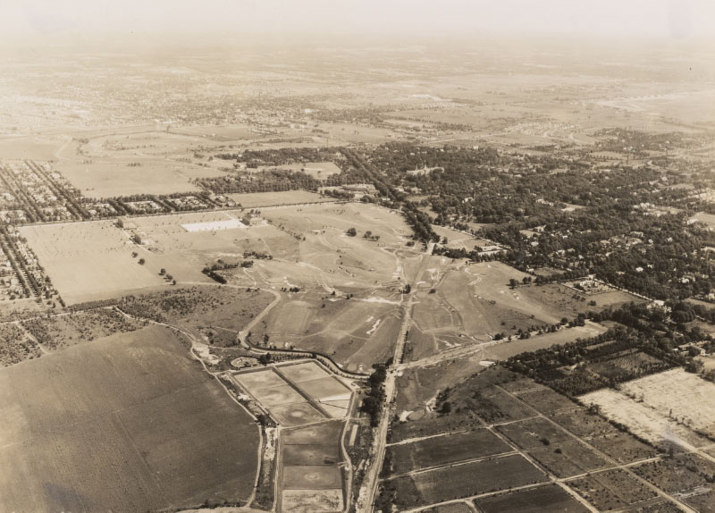
Looking northeast over Garden City towards Mineola
- Where is the Motor Parkway?
A bit hidden, the Motor Parkway can be seen in the upper left to the right center of the aerial (from around Jericho Turnpike to the west section of Roosevelt Field airport). See images C & D.
- Which Motor Parkway structures are hidden in this aerial?
Motor Parkway bridges (from top to bottom):Westbury Avenue, Jericho Turnpike, Mineola LIRR, Old County Road and "Mayan Ruins"
- Identify the major roads
Clinton Road, Stewart Avenue, Cherry Valley Road, Washington Avenue, Old Country Road (note the active hangars of Roosevelt Field -Image D), Motor Parkway, Franklin Avenue, Cherry Valley Road, Rockaway Avenue, Transverse Road, and Cambridge Place (near golf course)
- Link a building in this aerial to the Vanderbilt Cup Races
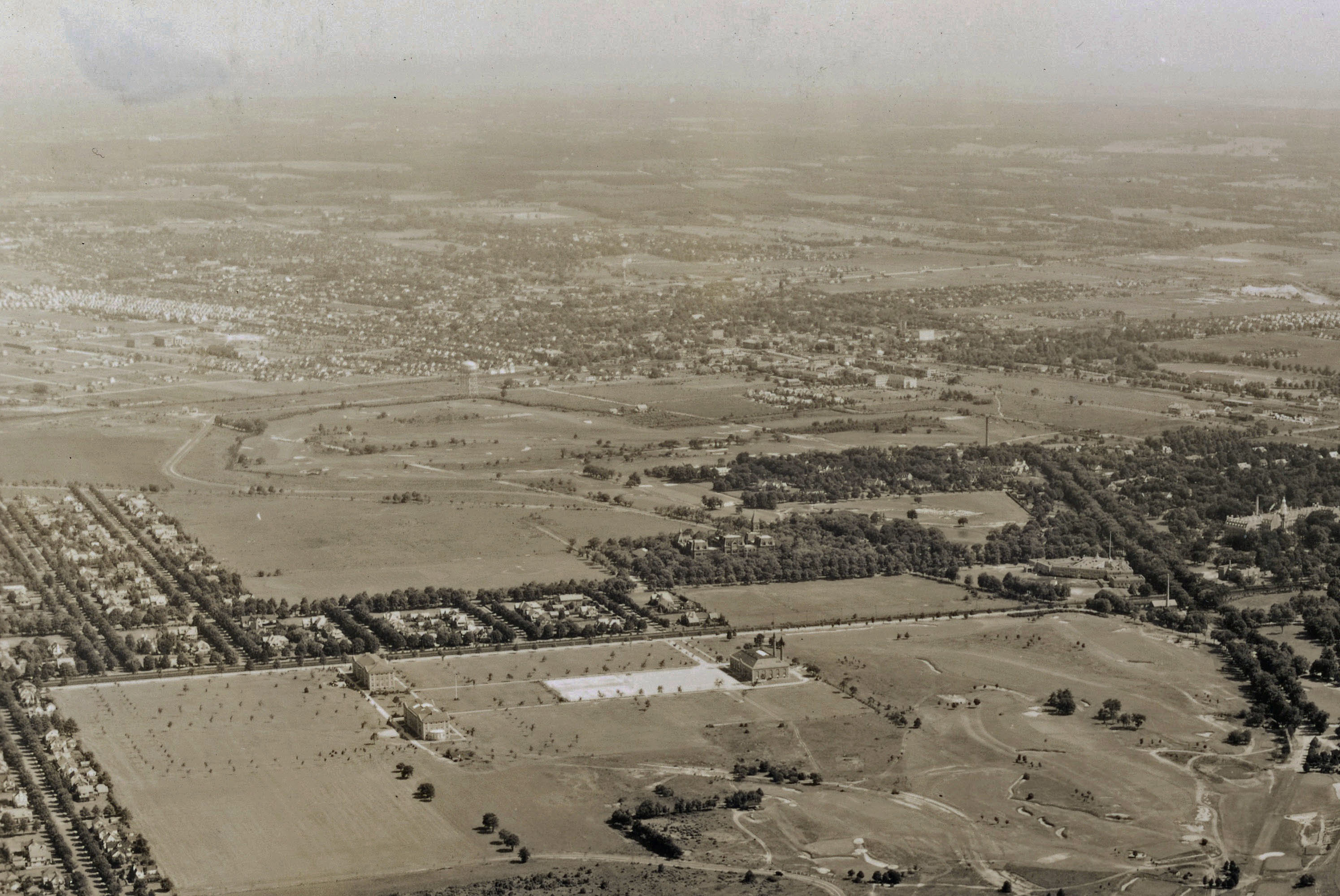
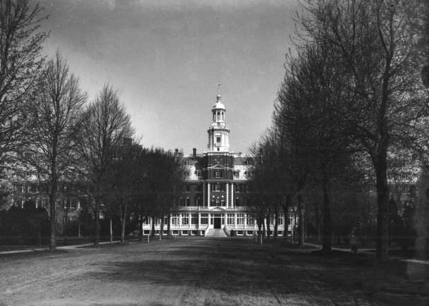
The Garden City Hotel was the headquarters for the Vanderbilt Cup Races from 1904 to 1910. See image F.
- Identify the golf course(s)
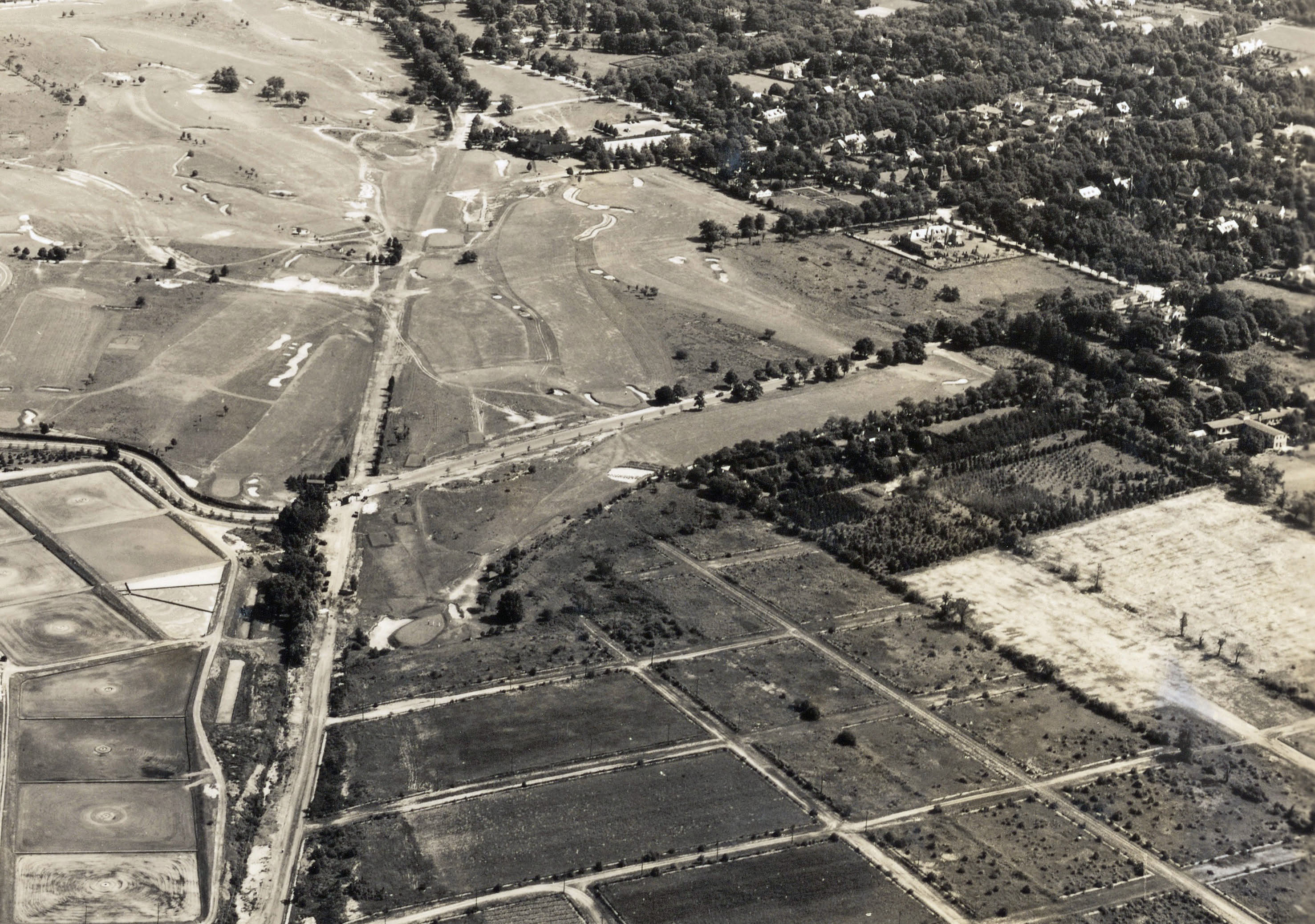
Cherry Valley Club (Images A & F) and in the northern background Garden City Golf Club (Image B).
- Where is there a train in the aerial?
A LIRR train can be seen leaving the station in front of the Garden City Hotel (image E).
- What is the date of the aerial? Provide a rationale.
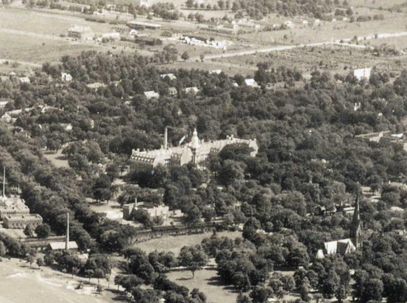
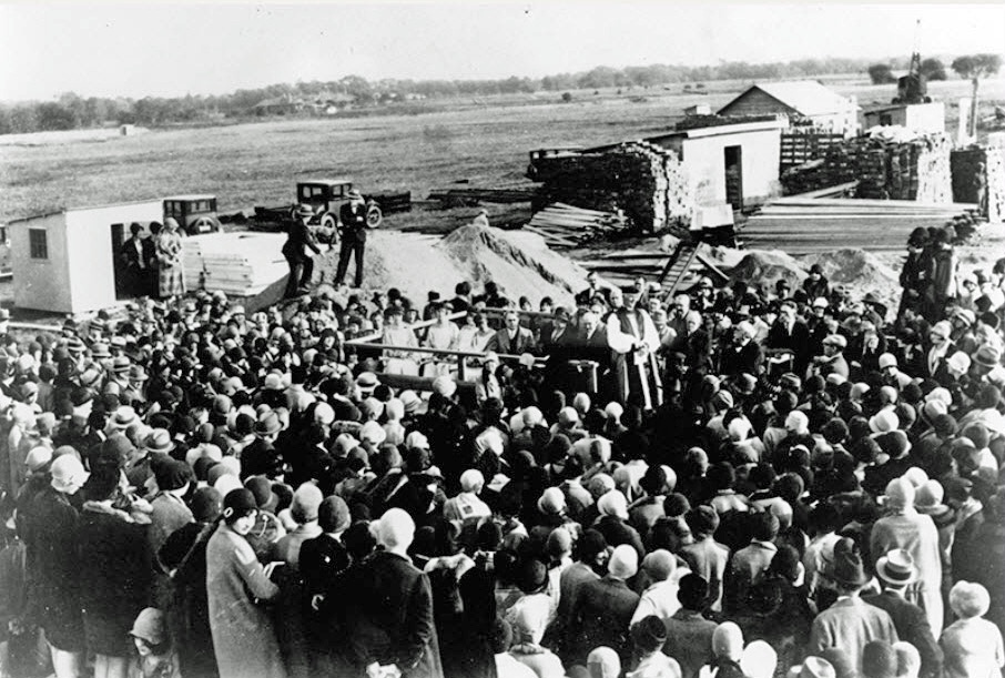
1936. Rationale: The inital buildings of Adelphia College/University -ground-breaking in Garden City in 1928 (Image B). The early development of houses in the Mott section (Image C).
Comments (11)
Congrats to Greg O.,Dave Kilkenny, Steve Lucas, Roy Warner, Lee Chambers, Art Kleiner, Brian McCarthy, Robert Stambaugh, Frank Femenias and Frank Mendyk for identifying Garden City.
Kudos to Richard Panchyk for forwarding all the amazing Mystery Foto aerials!
Enjoy,
Howard Kroplick
Close-Ups
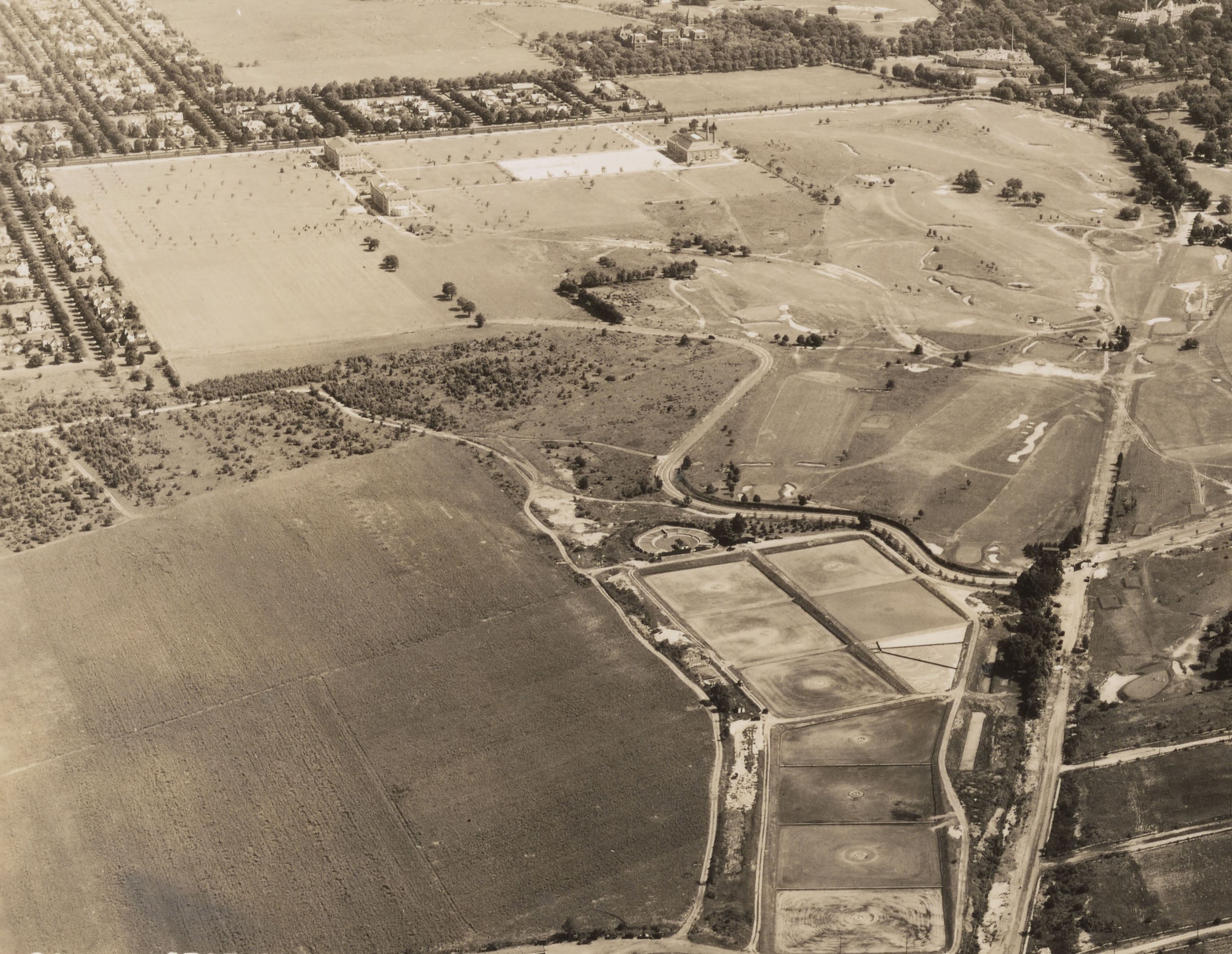
A. Early buildings of Adelphia College and the Cherry Valley Club.
B
C Mott section of Garden City
D Mott section, the Long Island Motor Parkway and Roosevelt Field (airport)
Check out the train in front of the hotel.
F
G
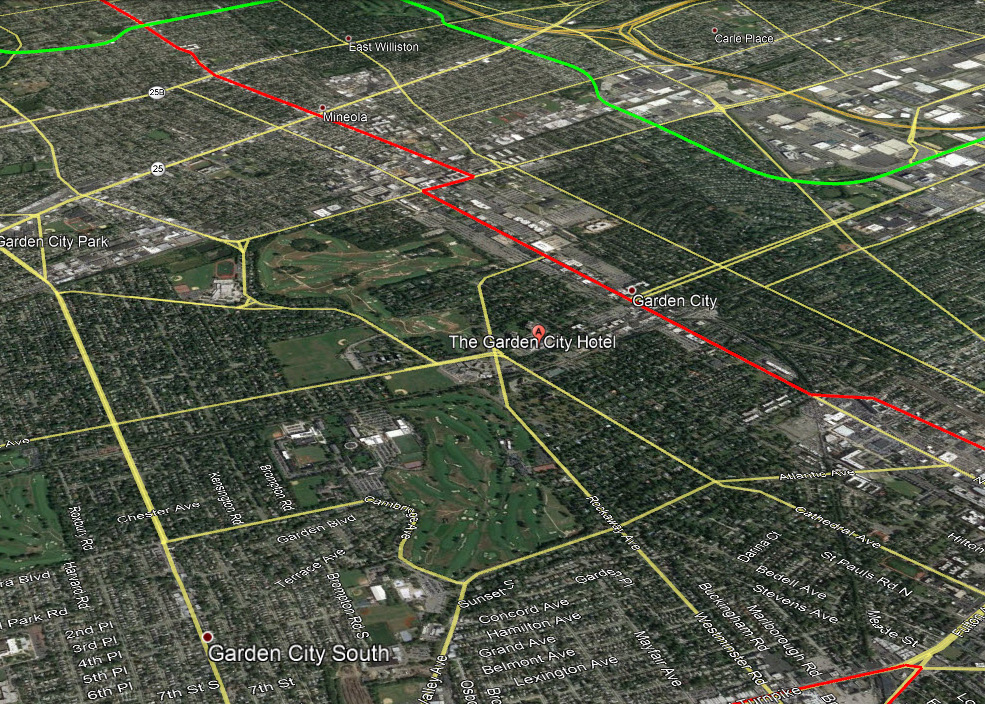
Current Google Earth view
Femenias's Findings (Submitted by Frank Femenias)
Frank Femenias: This image posted 3 1/2 years ago continues to haunt, but it was an excellent capture. Five stars for the capture, 0 stars for the cause.
Kleiner's Korner (Submitted by Art Kleiner)
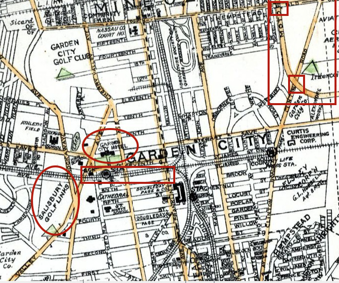
1927 Map


Comments
Cherry valley country club garden city
Identify the location and orientation of the photographer
-Looking North East Over Garden City. Roosevelt Field just visible in the very upper right hand corner.
Where is the Motor Parkway?
-Along the top and top right of the photo. Roughly around Searingtown Rd all the way to just after the Managers’ office off of Clinton.
Which Motor Parkway structures are hidden in this aerial?
-Tough to see any of the bridges, Mgrs house, or toll lodges, but Graves garage and Krug’s are also within the photo’s frame.
Identify the major roads
-Old Country Rd, Clinton, Stewart Ave, Franklin Ave, etc
Link a building in this aerial to the Vanderbilt Cup Races
-Garden City Hotel, The Garden City Hotel was the headquarters for the Vanderbilt Cup Races held on Long Island from 1904 to 1910. Graves garage is in there too, but not able to
Identify the golf course
-Cherry Valley Club
Where is there a train in the aerial?
-Very right side edge of photo ‘C’
What is the date of the aerial? Provide a rationale.
Purely a guess, but I’d say around 1930
Another great shot of Garden CIty! The photographer is over Garden City South looking northeast across GC and Mineola.
- The Motor Parkway is in the very top right of the picture, best seen by close-up C in the top right of the image. The road is coming from the north, crosses over Jericho Tpke, Old Country and bends over to Clinton Rd where you just make out the GC toll (or not).
- Major roads include Stewart Ave and South Ave, Rockaway Ave and 1st Street. Others include Franklin Ave, Washington and Old Country in the distance.
- The course in the foreground is the Cherry Valley club and the Garden City Club off in the distance.
- You can just make out the train thru the trees pulling into the Graden City Station on the Hempstead line.
- I would put the date of this aerial around 1937 since the Mott section is in its very early infancy.
We are over Garden City looking northeast. While difficult to see, the LIMP runs north-south from the upper left to the right center of the photo. LIMP structures that while hidden from view, should be in the photo are: Clinton Road bridge; Garden City Lodge; General Managers office; Mayan ruins; Mineola Lodge (kiosk) and Old Country Road underpass. Additional roads are: Cherry Valley Ave.; South Ave.; Stewart Ave.; Cathedral Ave.; Westminster Ave.; and Franklin Ave. Also visible is the Garden City Hotel, headquarters for the Vanderbilt Race Commission from 1904 to 1910. The Cherry Valley Country Club is in the foreground with the Garden City Golf Club in the distance. The train is at the Garden City station just below (south) of the hotel. Since there appears to be no activity or any cars at Adelphi College, the date could be 1929 just before the first classes were held there.
I’m pretty sure that the photographer is looking northeast over Garden City, and that the large building is the original Garden City Hotel that eventually burned down and was rebuilt to the modern facility that it is today.
I think that I can make out the southbound Motor Parkway and its curve to the east, which was very near what is Roosevelt Field and its parking lot somewhat north of Stewart Avenue today.
I’m guessing that the row of structures running from the west to the east, which look like airplane hangers, were part of an air field; which one, I don’t know, given that the real Roosevelt Field was to the east.
Main aerial photo is over Garden City, facing NorthEast.
In photo C, the hangers along Old Country Road can be seen in the top right corner.
Clinton Road runs perpendicular to it. The LIMP runs parallel to Clinton Road until it veers 90 degrees to the East through what will become Roosevelt Field.
Photo D shows more detail of the runways at Roosevelt Field. The train can be seen on the lower left corner of the shot as well as in Photo E.
Identify the location and orientation of the photographer:
Garden City looking northeast
Where is the Motor Parkway?
Running diagonally from top left to middle right in pics C & D. Next to Roosevelt Field/Curtis Airfield
Which Motor Parkway structures are hidden in this aerial?
Old Country Road bridge, Clinton Road bridge, Garden City Lodge/General Manager’s office
Identify the major roads:
Clinton Road, Stewart Ave., Cherry Valley Rd., Washington Ave., Old Country Road, Motor Parkway, Franklin Ave., Transverse Rd., Cambridge Place (near golf course)
Link a building in this aerial to the Vanderbilt Cup Races: Garden City Hotel
Identify the golf course: Salisbury Golf Links/Cherry Valley Club
Where is there a train in the aerial? Train is between Garden City Hotel and St. Mary’s School/Cathedral in Pic. E.
What is the date of the aerial? Provide a rationale: early 1930s - Adelphi College buildings were built in 1928
Yes, another great aerial courtesy of Mr. Panchyk!
*Location/Orientation: Birds Eye View of Garden City, NE direction.
*LIMP/Structures: The pkwy is best viewed within Closeup D. Pkwy proceeds east from the middle of this closeup, then curves to the north. Garden City Lodge & Managers Office, Clinton Rd Pkwy Bridge, “Open Bridge” ( Mayan Ruins ), Old Country Rd Hwy Bridge, LIRR Mainline Pkwy Bridge, Westbury Ave Pkwy Bridge ( hill like ).
*Major Rds: Clinton Rd. Washington, Franklin, Hilton, Cathedral, Cherry Valley, Rockaway, and Stewart Avenues.
*Building linked to VCR: Garden City Hotel
*Golf Course: Cherry Valley Country Club
*Train: Just E/O Cherry Valley Ave.
*Aerial Date: I’ll guess 1933. Adelphi College established in Garden City 1929. I see buildings on the campus property to the left of Cherry Valley Country Club.
Much more in this aerial. No desire to burn the Midnight Oil.
Primarily of the Village of Garden City and the area to the east and north. Garden City Hotel and cathedral in center of picture ‘E’. Picture ‘D’ shows hangers along Old Country Road in the distance and Camp Mills area north of Transverse Road and the ‘arched’ streets east of Franklin Road. Train is pulling into Garden City in picture ‘B’. Cherry Valley Golf course on picture ‘A’. Motor Parkway cuts across picture ‘C’ from Mineola over to Clinton Road.
Over Garden City South looking NE. Roosevelt Field hangars gave it away for me. Motor Parkway barely seen in photo D on the right edge center, high tree-lined for a short period, parallel with Clinton Rd. The huge, white Garden City hotel just off the center, with amazing RR cars passing on its south side. Those cars appear 1920- 1930s. Never realized how close the RR was to the hotel, even though I’ve passed under the Cherry Valley bridge for ages. The hotel was the meeting place to discuss building the Motor Parkway
- Photo is over Garden City looking northeast towards Mineola
- The LIMP can been seen in the upper center to upper right from around East Williston to GC (Clinton Rd)
- The Garden City Lodge, Managers office , LIRR bridge and others west. The Clinton Rd bridge and Old Country Rd bridges can be seen
- Major Roads, Cherry Valley Ave, Cathederal Ave, Rockaway Ave, Washington Ave, Old Country Rd, Clinton Rd, Franklin Ave and South Ave.
LIRR mainline, LIRR Hempstead branch Stewart RR , LIRR Central, Central branch or etc.
- Garden City Hotel, Vanderbilt Cup races commission HQ’s for the 1904 t0 1910 races
- Golf courses- Cherry Valley Club and Garden City golf club
- The train is on the LIRR Hempstead branch ( Central or etc.) just east of Cherry Valley Ave and west of the LIRR Garden City station
- Date of photo, The 3 building of Adelphi university were built and opened in 1929. The houses in the Mott section were stated being built in 1936 that are in the photo. Some houses around Adelphi were built in 1930-1932. I would say the photo is taken around 1935