Mystery Foto #47 Solved: A House Built on the Long Island Motor Parkway Right-Of-Way
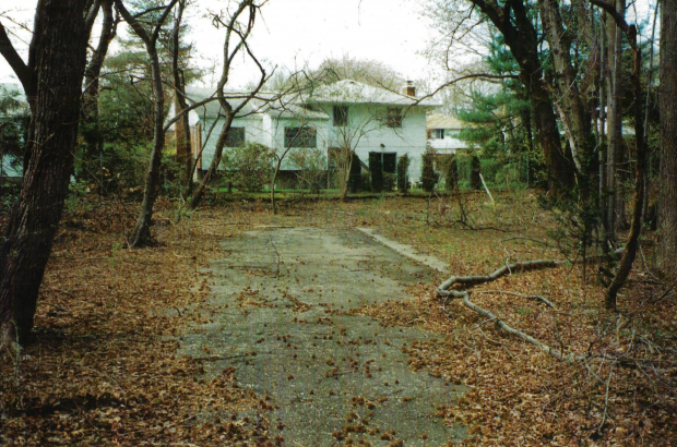
My favorite co-author Al Velocci challenged you to identify the location of this section of the Motor Parkway which he photographed in 1995.
Hint: The house was later built in the area shown in the below 1926 aerial. This link to the interactive map may also be helpful.
Mystery Foto questions:
- Identify the street and village of the house in the Mystery Foto.
63 Green Drive, Searingtown
The Story Behind the Mystery Foto
By Al Velocci
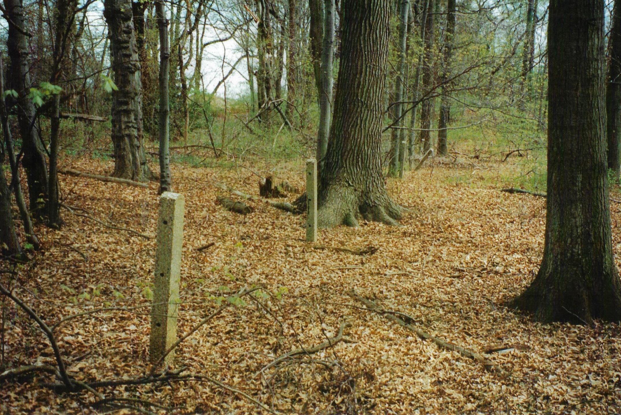
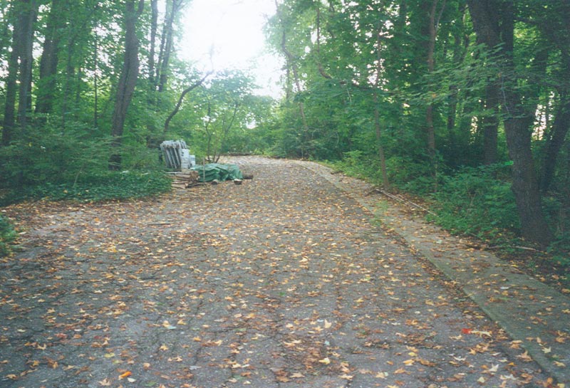
That section of the Parkway ROW was obtained from the Cedar Heights Association in July of 1909. There came at time when Dr. Arthur Sackler bought the ROW and the surrounding 18 plus acres creating a fenced in weekend compound. In 1995 I gained access to the property from the caretaker couple and took the photos. They told me when they were hired they knew nothing about the existence of the Parkway. They discovered it only because while the rest of the property contained many trees, a narrow section several hundred feet long, was treeless. Curiosity led to some digging and they discovered the pavement. As caretakers they had a lot of time on their hands. They continued to clear the the treeless area until they uncovered the entire 22 feet wide ROW. He said it was good exercise and now they had a place where they could take walks and ride their bicycles. At the time most of the cement posts were still in place. As you know, I purchased about 20 of them from the developers of the property. Al.
Comments (12)
Congrats to Joseph Osterle, Brian McCarthy, Mark Lanes and Frank Mendyk for correctly identifying Green Drive.
Enjoy,
Howard Kroplick
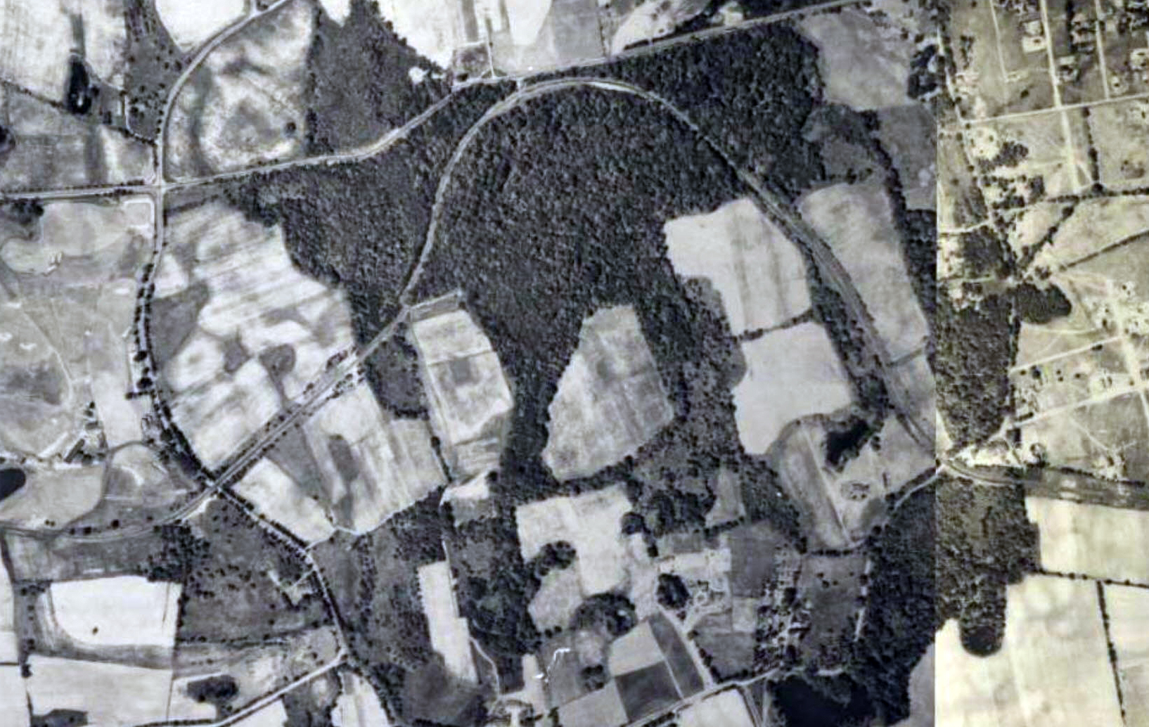
1926 Aerial
All views looking North
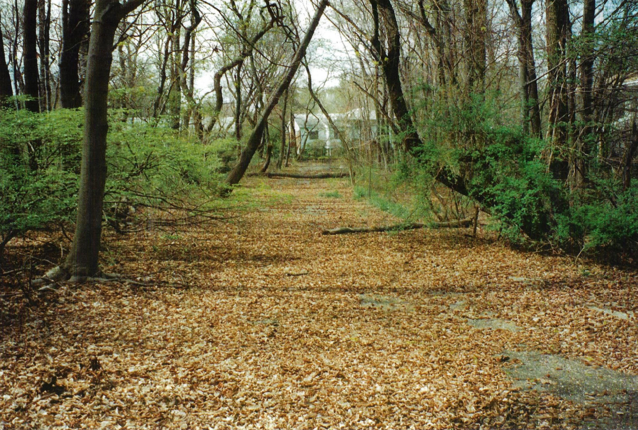
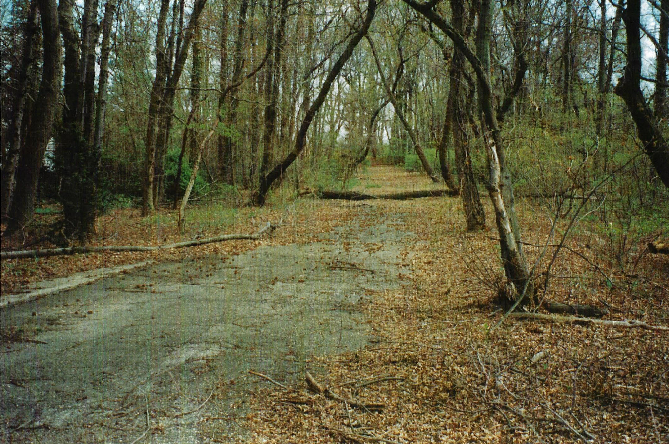

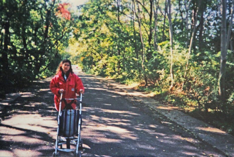
1990s Ground Images
Courtesy of the Mgid Family


Comments
That section is from NHP rd on the west to Searingtown rd on the east. the northern part by IU Willets rd.
Sorry. Too easy for me. 63 Greene Drive. Rosyln.
We are looking at the westbound LIMP, a couple of hundred yards west of Old Searingtown Rd. My brother first found this in the summer of 1975, when I was 9 years old. The house is still there. It was built about 1960. This area of the LIMP survived until 1995.
This home is on Green Dr Searingtown. I never visited this remnant of the LIMP, but wished that I have because of the newer homes along Old Homestead. Connection between the Swamp & St George Lake is very clear on the 1950 map. Appears the LIMP ROW was able to stay clear of the swamp?
The 1926 aerial shows the LIMP in Searingtown, the only place where it curves like that. I’m placing the house on the south side of I.U. Willets Road, between Carriage Road and the northern entrance to Herricks High School, in Searingtown. My rationale is it’s one of the view places where the LIMP runs south to north.
Just a guess here,but I’m thinking North HIlls.Love these things,Howard & Al-!!!
Definitely Searingtown. Can’t locate the home, but I’ll guess somewhere near where the old IU Willets LIMP bridge was, Reed Drive.
The house is definitely in the Searingtown area, just south of I. U. Willets Road between Searingtown Road and Shelter Rock Road. Possible candidates for the actual street the house is on are: Reed Drive, Sugar Maple Drive, Capri Drive, Green Drive, or Fiesta Drive. I’m going with Green Drive.
This house is located on Green Drive in Searingtown/ Roslyn Heights. The undeveloped land that this section of LIMP was on is located off Old Searingtown Road across from the Albertson VFW on Searingtown Road. Al must have taken this picture soon before the property was developed.
Street and Village - Greene Drive, Searingtown (Searingtown/ Albertson boarder)
The homes on Green Drive were built in 1963. The home on
right in the 1st of the additional photos (Piper Drive) was
also built in 1963. The rear of the properties on Piper Drive
is the boarder between Searingtown and Albertson.
Old Homestead Rd - In 1997 new homes were built on the wooded property and
the remains of the LIMP as seen in the 1995 mystery photos.
Old Homestead Rd was created when these homes were built.
The path of the old LIMP went thru were the homes on the east
side of Old Homestead Drive now sit.
Photos - #1 Old Homestead Drive and Old Searingtown Rd looking north along
LIMP
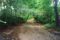
#2 looking north along old path of LIMP and homes on the east side
of Old Homestead Drive
#3 home on Green Drive looking south along path the old LIMP
Photos of previous comments
I was having problems with my computer before. I am not sure if my previous post was received. I believe it was sent before I was completed. If it was not received -
LIMP Searingtown - Green Drive Searingtown/Albertson boarder( Roslyn postal
address). Thanks
That house is on Green Dr at the bottom of Sugar Maple Dr. Near the Searingtown Rd bridge.
Know the area very well as I grew up on Sugar Maple Dr. Covered up now by new houses.
In response to Brian McCarthy, the swamp area led north of Herrick’s Pond. And stayed east of Old Searingtown Rd. The LIMP right of way was it’s northern limit. From what I have been told, the water table dropped about 8 feet when Nassau County built it’s sewer system. This was done about 1960, when many roads in the area, including Searingtown Road, Shelter Rock Rd and Willis Avenue were widened. Plus the land was built up to build the new Searingtown Road. It dried up enough to build the library in about 1965. And the adjacent Williston Park homes on Foch Blvd were also able to be built. Before this time the area was not able to be developed.
The property with the mystery photo had a beautiful small pond. It was full of frogs. A magical find for a nine year old in the summer of 1975. As a kid, I was trying to figure out why someone built sidewalks in the woods.
Joseph O - Thanks for your info. 8’ drop of the water table, that’s significant. With that, all those various ponds that I notice on the older aerials either dried up or filled in over time. Searingtown Rd looks to have been constructed over the one side of the swamp. Dried up enough and built up like you said. Makes sense with the library, too. Which looks to be smack on the LIMP. Just a year behind you, Joe. I grew up in Brentwood, that’s where my memories are : ~ )
I can’t believe this section of LIMP remained until 1995. There is nothing to see now. What a cool little stretch this was. Glad the pics remain. I certainly knew nothing of the LIMP in 1995.