Mystery Foto #48 Solved: Building the Long Island Motor Parkway Through the Stymus Farm in Bethpage
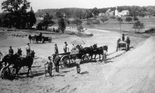
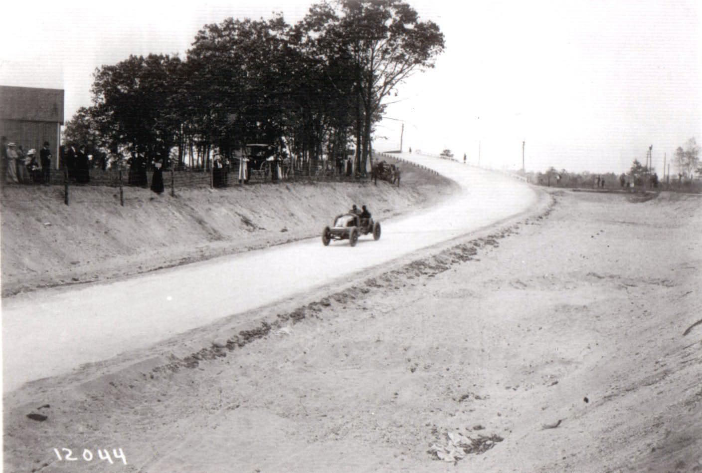
This Mystery Foto is one of my favorite images of the construction of the Motor Parkway.
Mystery Foto questions:
- Identify the exact location of the Mystery Foto and its orientation
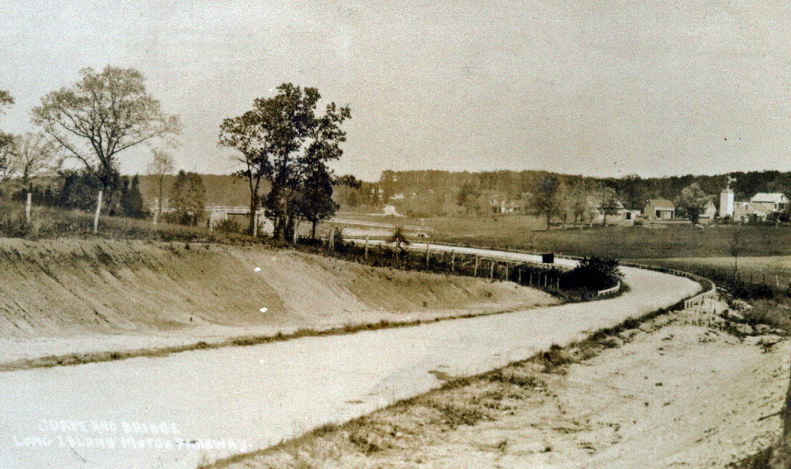
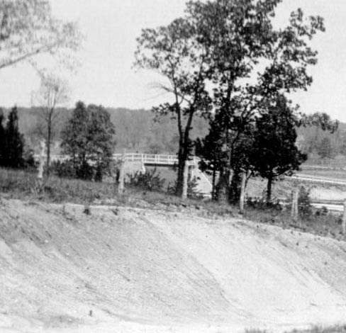
This section of the Motor Parkway was just north of the Central Avenue/LIRR Motor Parkway Bridge in Central Park (now Bethpage). The view is looking north/east as the Motor Parkway curved north through Nibbe's Hollow, also known as Deadman's Curve #2.
- Identify the family that owned the farm buildings in the background
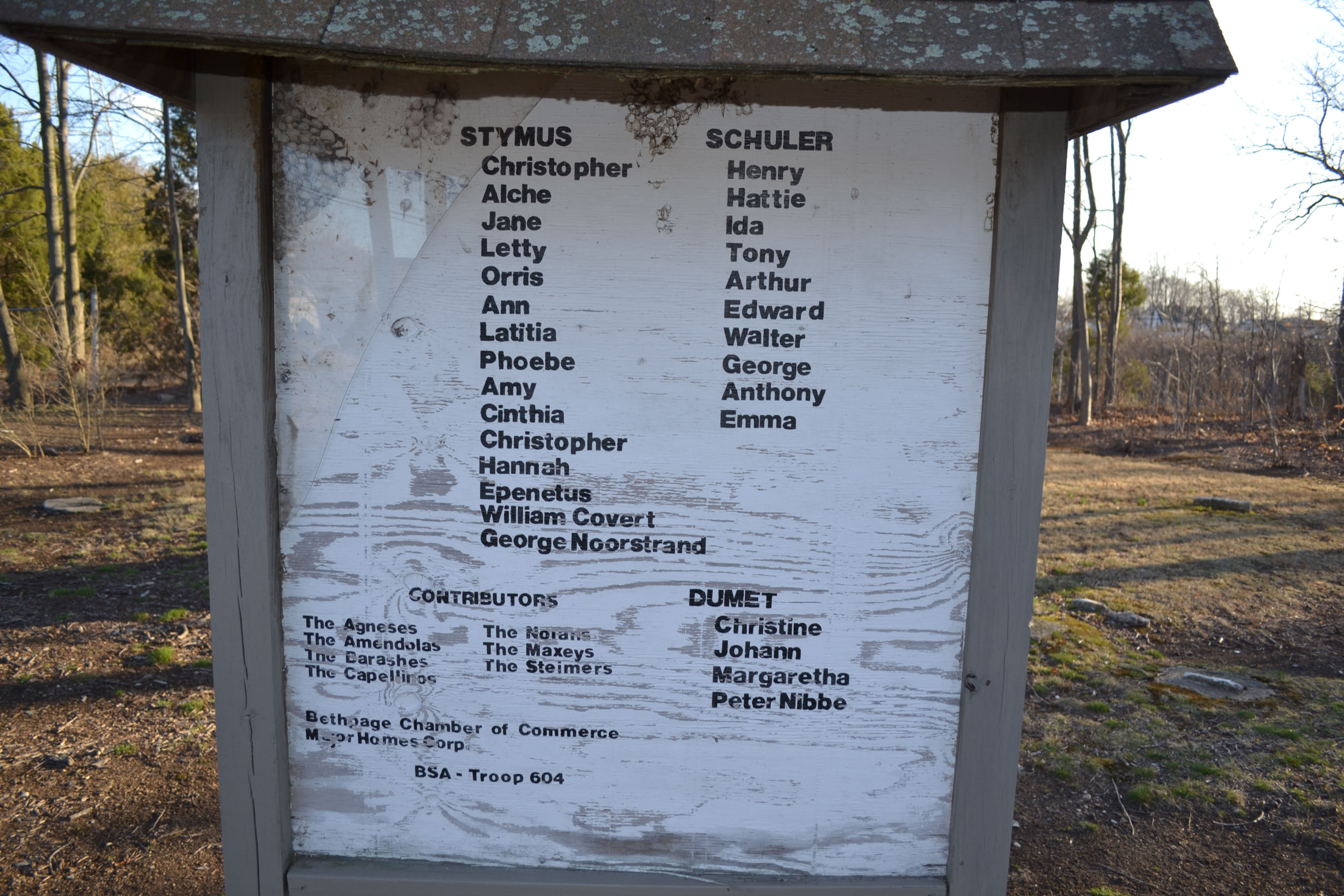
The William Stymus Farm
- When was this photo taken?
Based on the below construction photos, the photo was likely taken in July/August of 1908.
- Which, if any, of the Vanderbilt Cup Races used this section of the Motor Parkway?
This section was used for the 1908 Motor Parkway Sweepstakes (October 10, 1908) and the 1908 Vanderbilt Cup Race (October 28, 1908).
Congrats to Greg O., Tim Ivers, Dick Gorman, Steve Lucas, Frank Femenias and Dave Russo for identifying the Central Park (Bethpage) location. Kudos to Greg O. and Steve Lucas for identifying the Stymus farm buildings, the date of the photo and its use in the 1908 Vanderbilt Cup Race.
Enjoy,
Howard Kroplick
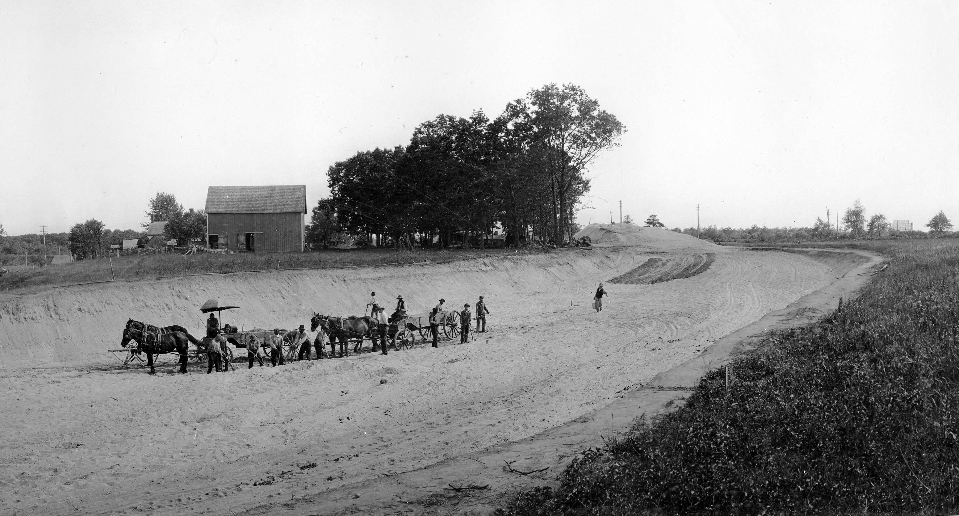
Buidling the Motor Parkway
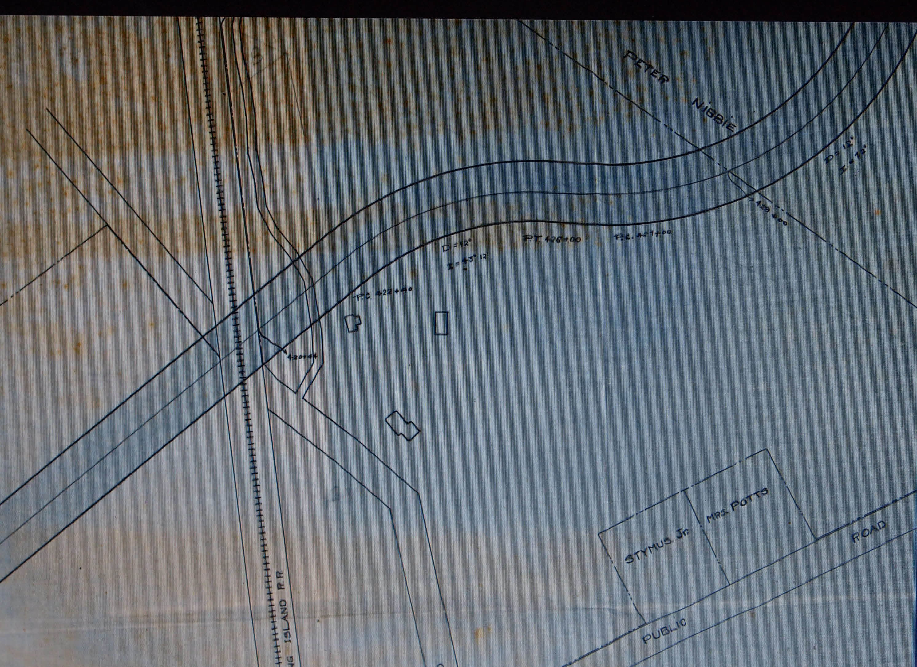
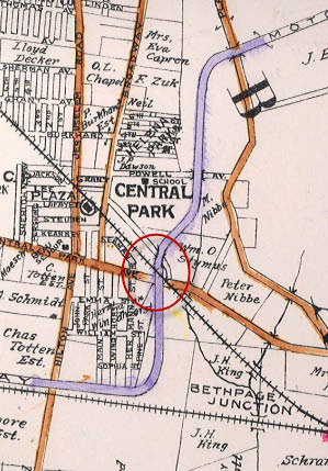
A 1907 survey of Motor Parkway in this section through the Symus and Nibbe properties.
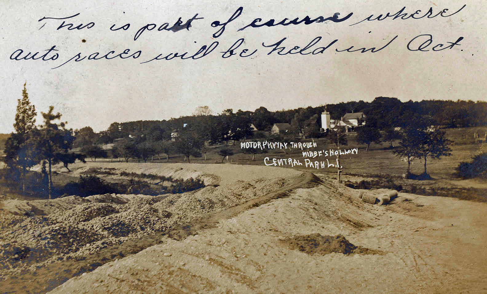
This postcard was sent by a Motor Parkway worker to his sister on August 11, 1908.
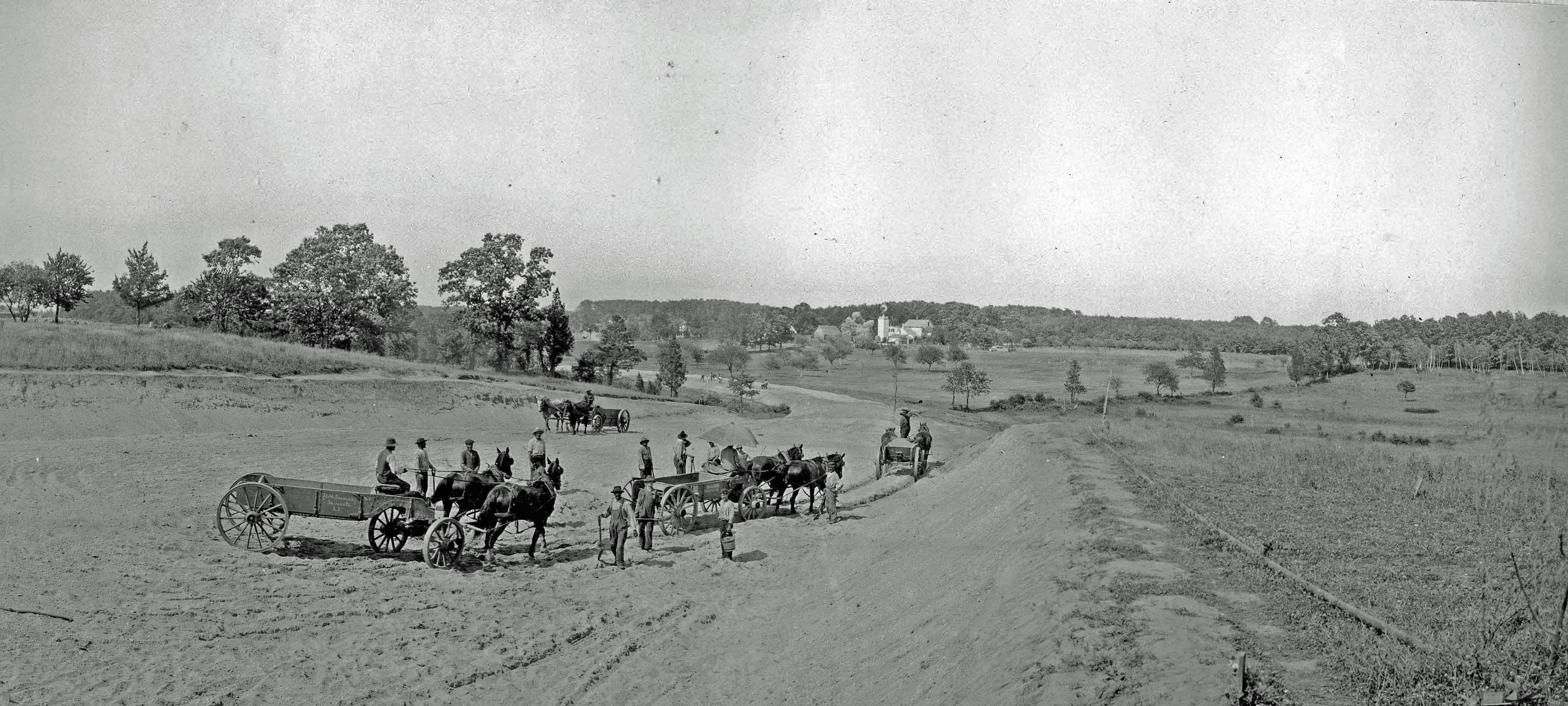
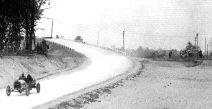
A wider view of our Mystery Foto.
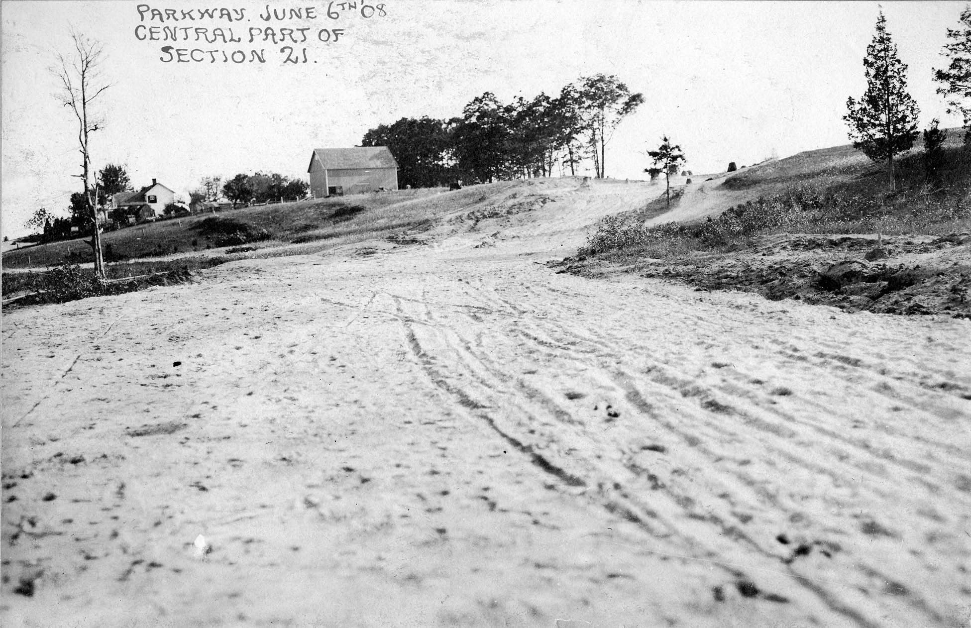
The north/west view of the Stymus section of the Motor Parkway looking as seen on June 6, 1908.
Just a few weeks later, this photo was shot from the same location.
Note: The ramp for the north side of the Central Avenue/LIRR Motor Parkway Bridge can be seen on the top right.
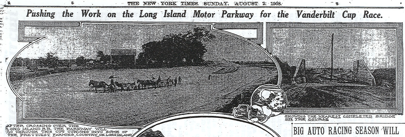
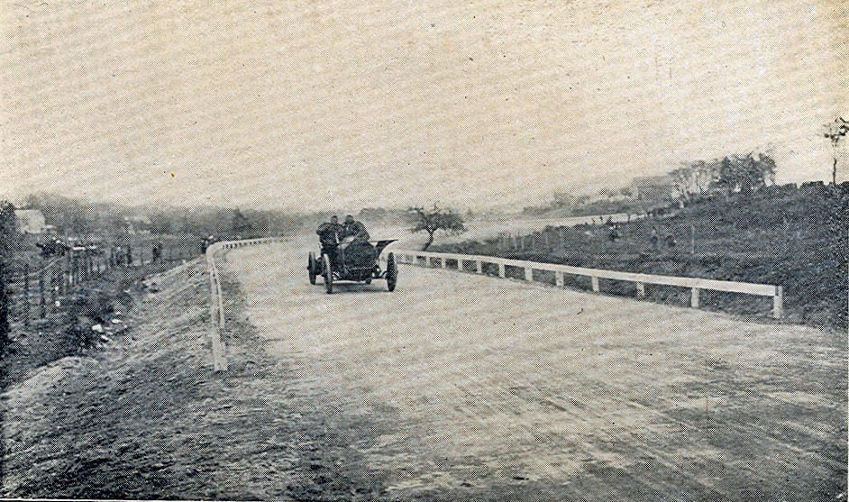
The August 2, 1908 issue of The New York Times featured a photo of the Stymus property with the caption: " After crossing over the Long Island R.R. the parkway will go through this cut curving into some of the prettiest farming country on Long Island."
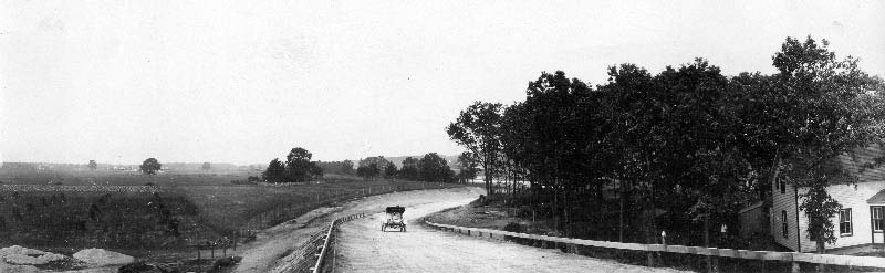
The completed north side of the Central Avenue/LIRR Motor Parkway Bridge in October 1908. The Motor Parkway is banked, protected by guardrails and beginning to curve to the east approaching the Stymus section.
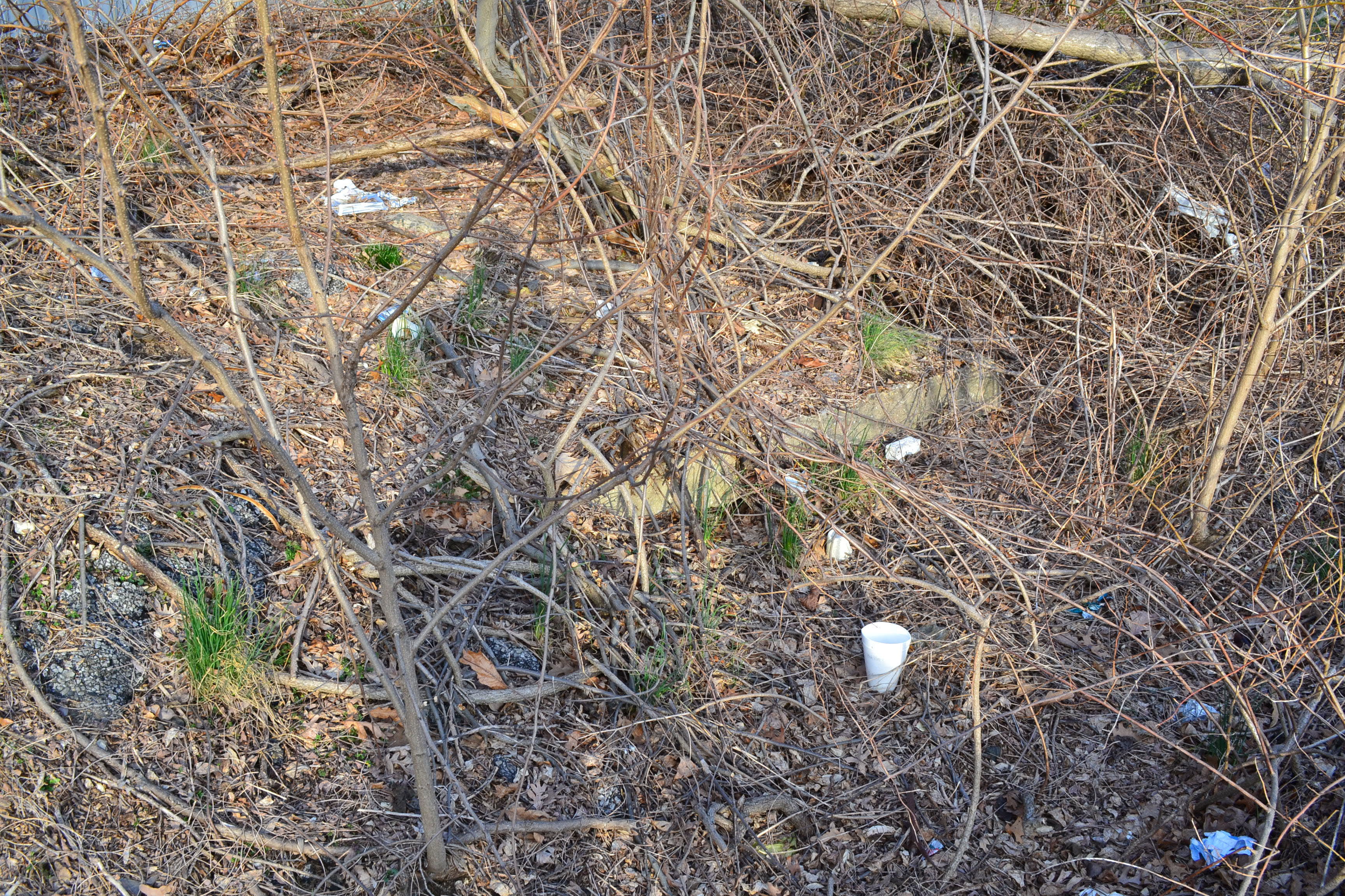
Note: To the left of the curve in the background is the Stymus/Nibbe Family Cemetery (see below current views)..
Take a closer look of the completed Motor Parkway through the Stymus property in October 1908. Behind the trees is the Nibbe Motor Parkway Farmway Bridge connecting Peter Nibbe's Farm located on both sides of the Motor Parkway.
1908 Vanderbilt Cup Race Course
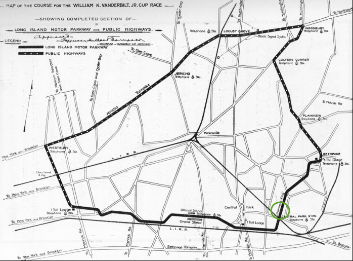
The Stymus section of the Motor Parkway was used only for the 1908 course
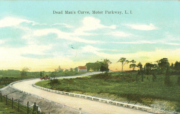
A colorized postcard showing a racer practicing on the Motor Parkway.
The #P46 Renault driven by Lewis Strang seen competing during the Motor Parkway Sweepstakes held on October 10, 1908, the opening day for the road.
The #N3 Buick driven by C.E. Easter making the curve during the 1908 Nassau Sweepstakes held on October 10, 1908.
This is the only known photo of the 1908 Vanderbilt Cup Race held in this section of the Motor Parkway. It appears to be the #3 Mercedes driven by Emil Stricker.
1938 Map
1938 Aerial of Bethpage
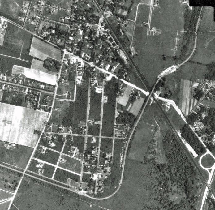
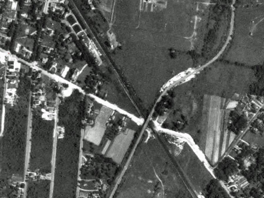
This aerial indicates that sometime in the 1920s or 1930s, the sharp curve seen in the 1907 survey and 1908 photos was modified.
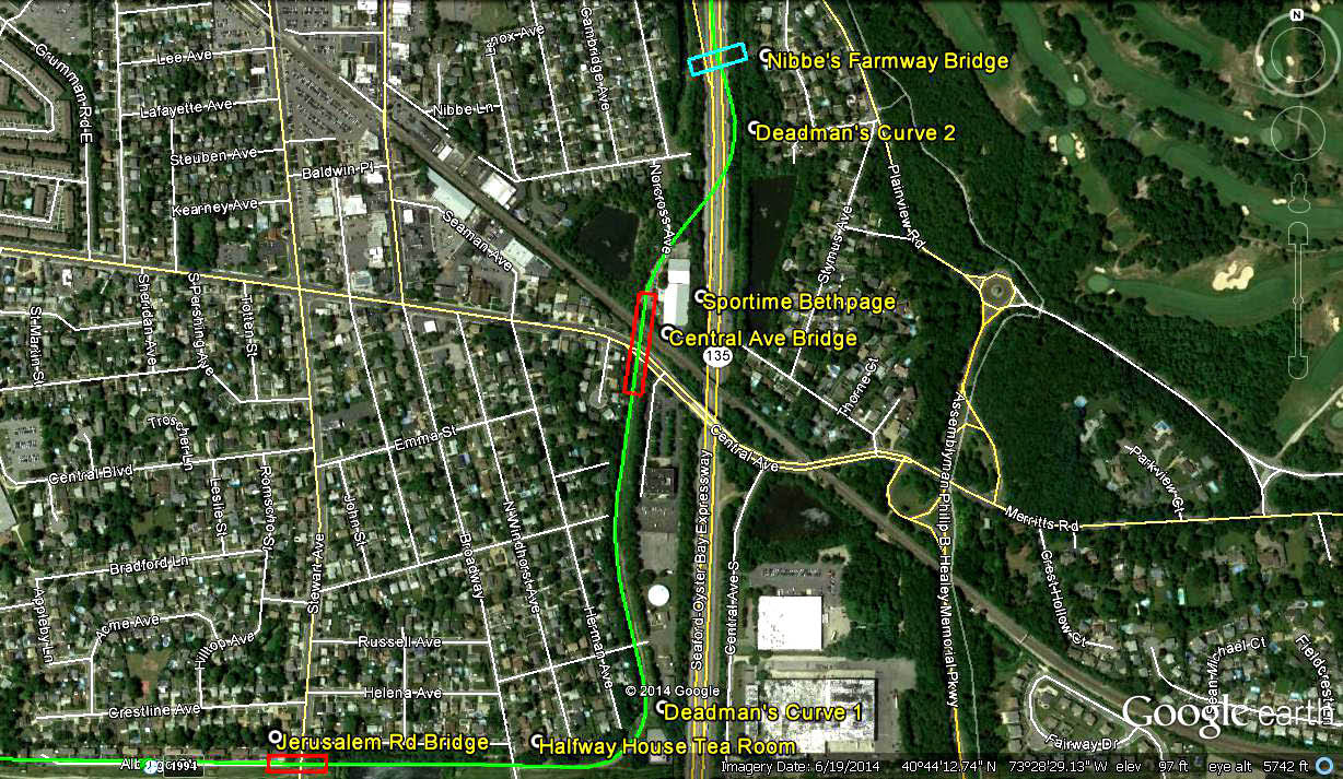
Current Views
Courtesy of Frank Femenias.
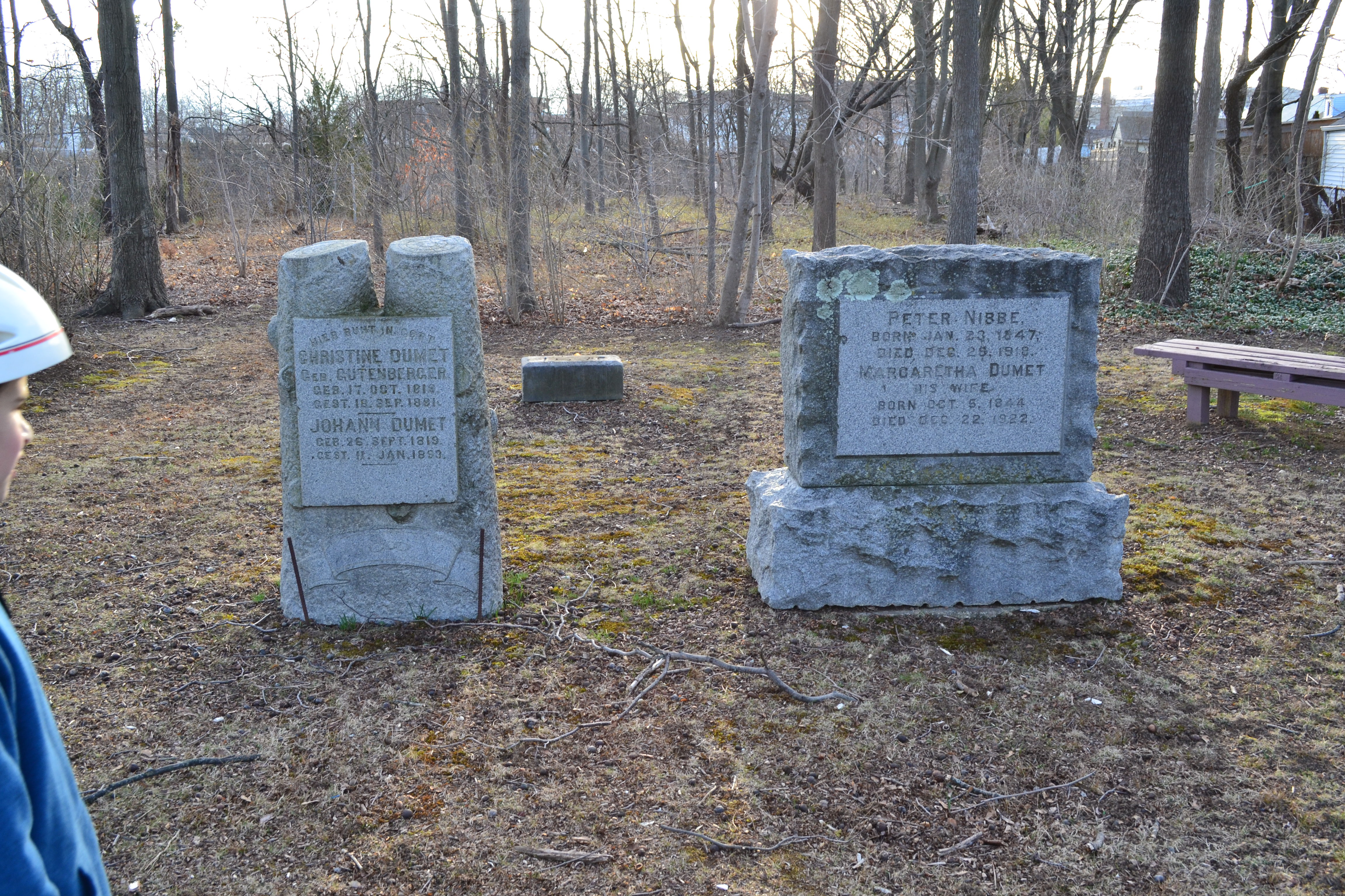
The Stymus/Nibbe Family Cemetery located west of Norcross Road. Courtesy of Dave Russo.
Courtesy of Dave Russo.
A section of the Motor Parkway discovered by Dave Russo in the area.
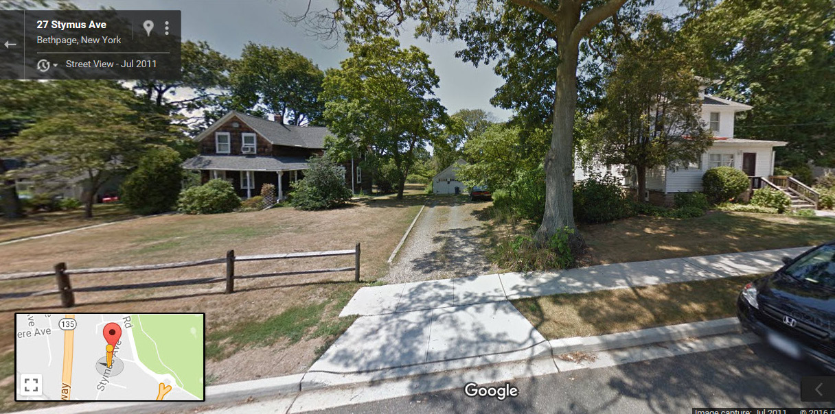
Several of the original buildings of the Stymus Farm are still standing on......Stymus Avenue.


Comments
I say bridge over Plainview Rd. Looking south west. Nebbe Farm.
Photo taken in the summer/fall of 1908, prior to the 1908 VCR.
Always loved this photo as well and instantly remembered it can be found on Page 32 of your book!
-Identify the exact location of the Mystery Foto and its orientation
Bethpage (Central Park) looking Easterly. This is the Northward turn at ‘Nibbe’s Hollow’ (Deadman’s curve #2) just before the Nibbe Framway Bridge.
-Identify the family that owned the farm buildings in the background
The William Stymus farm.
-When was this photo taken?
June/July,(probably) 1908
-Which, if any, of the Vanderbilt Cup Races used this section of the Motor Parkway?
1908 VCR
Sept. 1908 The Peter Nibbe farmhouse in the distance looking northwest from the Bethpage Central Avenue Railroad bridge and the Nibbe Bridge in behind the trees.
Used in the 1910 Cup race.
Mystery Foto #49…. The photo shows the Christopher Stymus farm on Norcross and Central Avenues looking east in what is now Bethpage. Photo taken in the summer of 1908. The 1909 and 1910 running of the Vanderbilt races ran on this section of the road.
I felt very proud and excited to have rode in the Black Beast race car, with Howard Kroplick. And to think we drove on a former site of the Motor Parkway on Long Island.
I have no answers but enjoyed seeing this very early picture of Long Island…
I think we’re looking north (or slightly northeast) from a point between Central Avenue and Powell Avenue through an area that was known locally as Nibbe Hollow in Central Park (today’s Bethpage). Off in the distance are the farm buildings belonging to the Stymus family. The photo was probably taken around August, 1908 and this section of the LIMP was completed in time for use in the 1908 Vanderbilt Cup Race. A large portion of this area was utilized for construction of the Seaford-Oyster Bay Expressway.
Looks like Bethpage farmer Peter Nibbe’s (1847-1918) place and windmill in the back, late 1908 looking southwest. The LIMP roadway being built was used in the 1908-1910 Vanderbilt Cup and Sweepstake races, and is today located in Bethpage State Park (Central Park) where the bike path meets the curve under the power lines. The men working on the roadway further back after the curve is today’s southbound lanes on route 135. The photographer was standing on top of what’s to become the new Plainview Road bridge’s north abutment (no longer existing). Plainview Road was slightly relocated during Motor Parkway construction.
Bethpage facing west toward Nibbe’s Farm, probably 1907 just before it was completed in 1908. I think it is section 23, North of the Dead Man’s Curve and east of today’s Seaford Oyster Bay Expressway (looking from the Plainview Road Bridge area). The races were 1908, 1909 and 1910, which dumped off at Round Swamp Road before heading north onto local roads. The tree lines are still there, on the western side of the Seaford Oyster Bay Expressway.
This looks familiar. I’ll give it a try:
Just north of Central Ave in Bethpage, we are looking south in this picture. Stymus family farm - small cemetery is now there.
I’m thinking pic must have been taken in 1909-1910 as this was being built. Strangely the parkway went west first (1909 Courthouse Rd) and then east (1910 Bethpage Restoration). So I’ll guess late 1909 / early 1910.
Darn it,I knew that was the 2nd dead mans curve the minute I saw it,I should have answered,well at least I know that I would have gotten that part right.
Looks like Stymus Ave is evident in the 1938 aerial. Definitely worth a trip to check out the original buildings along there.