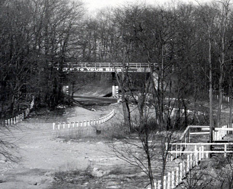
Mystery Foto #52 Solved: The Creedmoor Motor Parkway Bridge in 1928
Long Island Motor Parkway Preservation Society member Syd Lefkoe challenged you to solve the final Mystery Foto of 2018.
Answers to the Mystery Foto questions:
- Identify the location and orientation of the photographer
1,500 feet east of Winchester Boulevard in Queens, looking west on the Creedmoor property
- Identify the Motor Parkway Bridge and its original purpose
Creedmoor Motor Parkway Bridge. Likely part of the 1911 agreement between the Motor Parkway and owners of the Creedmoor property to connect the north and south side of future hospital buuildings.
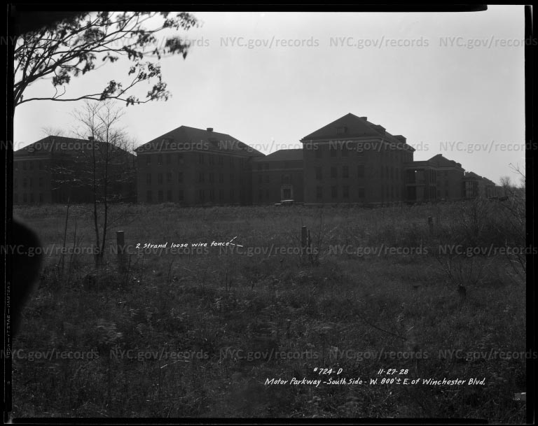
- Identify the building in the background
One of the Creedmoor hopsital buildings.
- Who was the likely owner of the automobile seen in the Mystery Foto?
It was likely the photographer's automobile.
- What was the month and year of the Mystery Foto? Provide a rationale.
November 27, 1928 Rationale: Prior to the expansion of Union Turnpike.
- Kudos question: This image can be found on which online photo database?
New York City Municipal Archives Type in Motor Parkway and discover more images.
Comments (7)
Congrats to Joe Osterle, Frank Femenias (see Femenias Findings), Art Kleiner (see Kleiner's Korner), Greg O. and Brian McCarthy for identifying the Creedmoor location.
Kudos to Greg O. and Art Kleiner for identifying the NYC Municipal Archives database.
Enjoy!
Happy 2019!
Howard Kroplick
Become a member of the Long Island Motor Parkway Preservation Society
Close-Ups
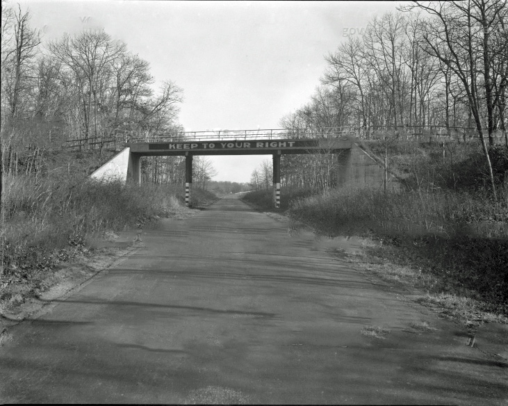
The view from the opposite side of the bridge looking east.
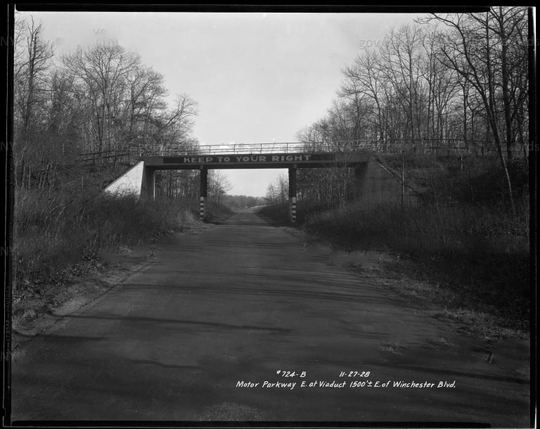
Above photo with captions.(November 27, 1928)
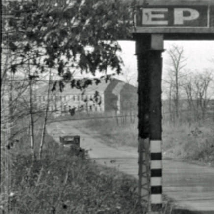
A Creedmoor hospital building in the background and the photographer's automobile.
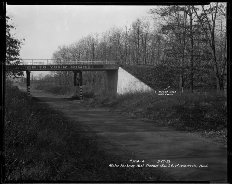
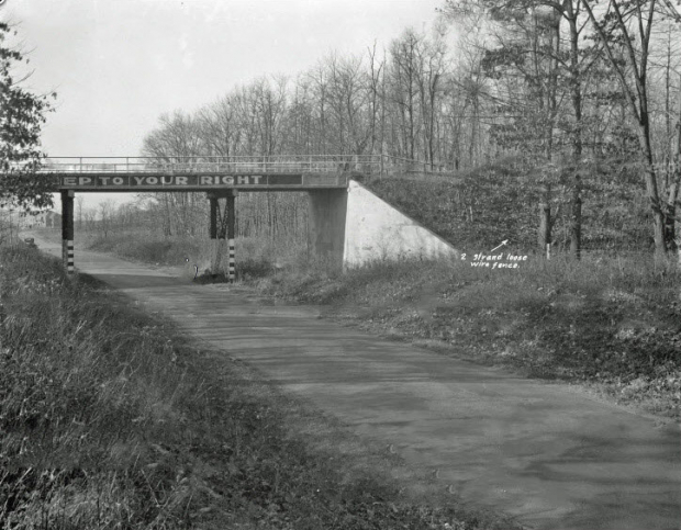
Mystery Foto with Captions (November 27, 1928)
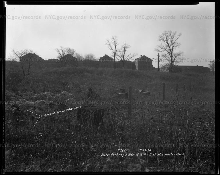
View from the Motor Parkway looking towards the Creedmoor buildings (11-27-1928)
Note: The Motor Parkway concter posts and two rows of wire.
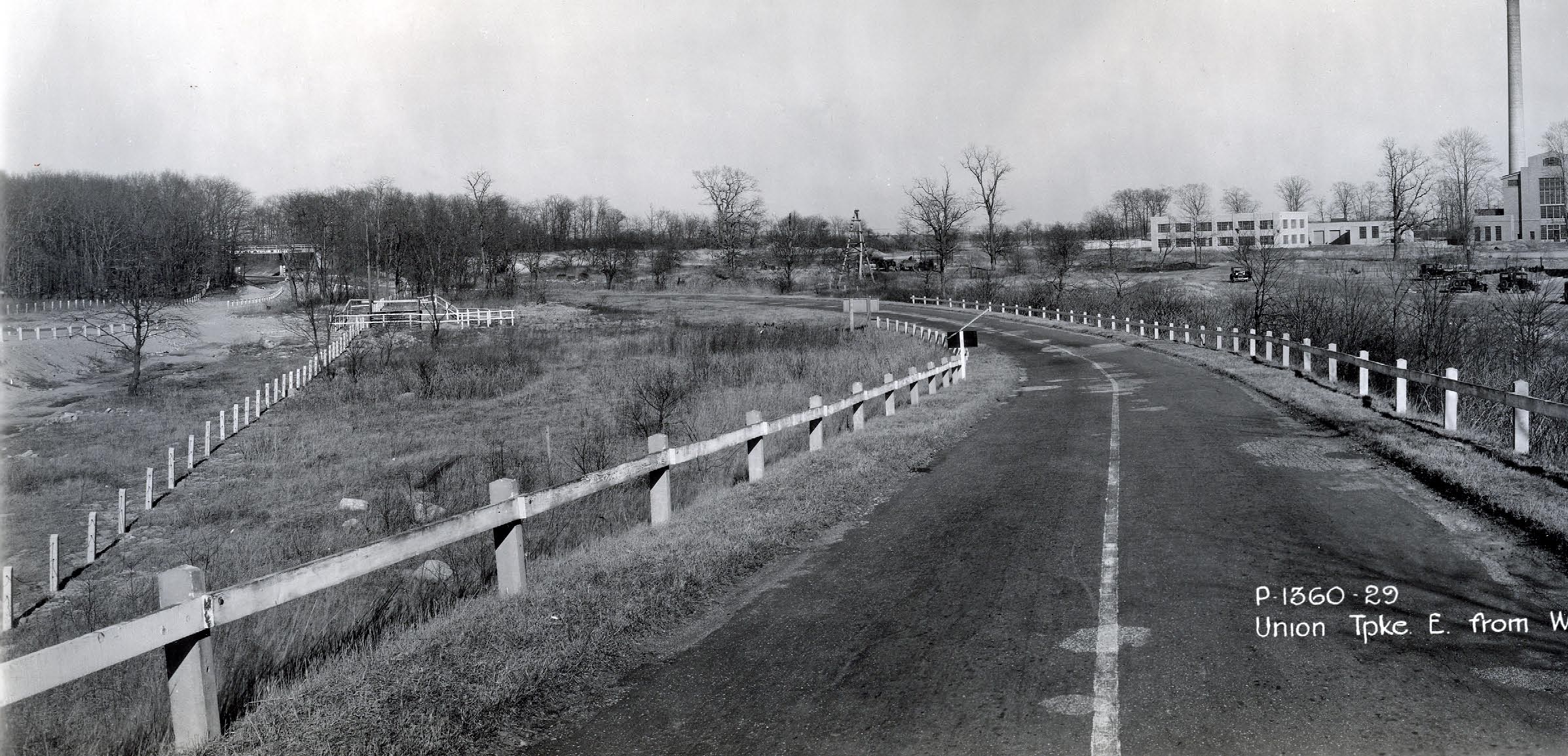
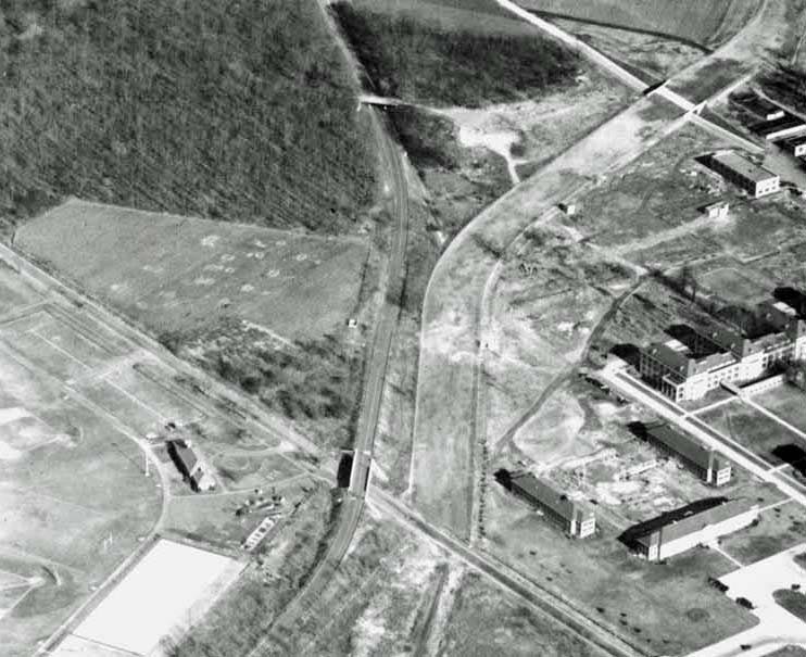
View looking east towards Creedmoor Motor Parkway Bridge from the Winchester Boulevard Bridge (March 3, 1932).
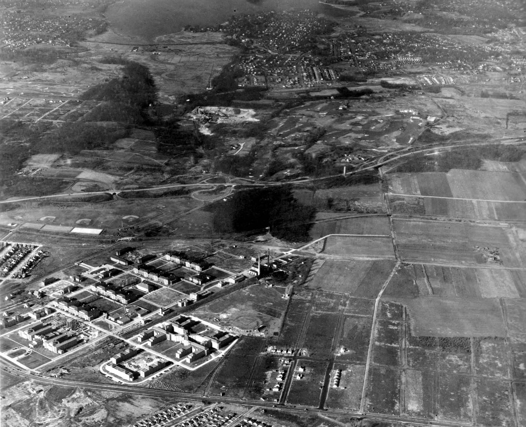
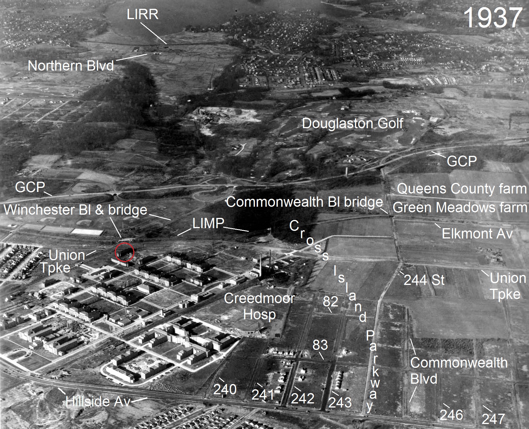
Creedmoor Motor Parkway Bridge, Winchester Boulevard Motor Parkwary Bridge and Creedmoor building (11/23/1937)
Femenias' Findings (Submitted by Frank Femenias)
Kleiner's Korner (Submitted by Art Kleiner)
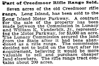
New York Times, January 20, 1911
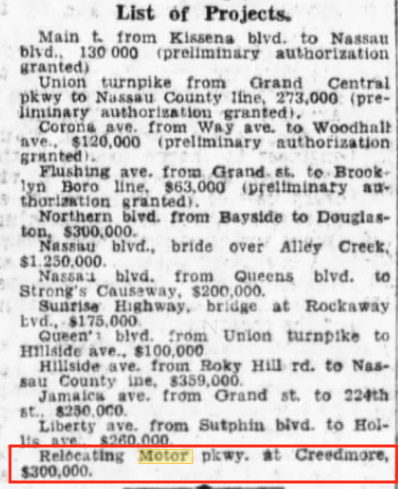
Brooklyn Daily Eagle, November 10, 1929
Booklyn Daily Eagle, January 4, 1930

Booklyn Daily Eagle, June 22, 1930


Comments
Great Photo !!! Great Find !!!
LIMP looking on what is today the Credemore property. Just east of Winchester Blvd, and north of Union Tpke. Original used as pedestrian bridge.
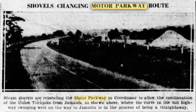
Another amazing photo with the driver’s view traveling down the Motor Parkway! Location is at Creedmoor highway bridge, in today’s hospital rear parking lot, looking SW towards the former Creedmoor hospital complex once located south of Union Tpke. The bright abutment wall was located on the northeast corner of the Creedmoor bridge (1912-1940s). The opposite facing photo looking NE, has its bright abutment wall once located on the northwest corner of the bridge. This is the original Motor Parkway roadway (1912-1932) before being relocated to accommodate expansion of nearby Union Turnpike. The Farm Colony of Brooklyn State Hospital opened here in 1912, so this bridge likely was used as a farmway bridge to connect the lands. I have suspicion this photo was taken soon after the bridge was built in winter of 1912. The auto likely belongs to the unknown photographer. No clue where this gem was found but anticipating the answers to find out.
Great photo to end the mystery year. Thank you Syd and Howard for this holiday treat.
Hoping a safe and happy 2019 to all!
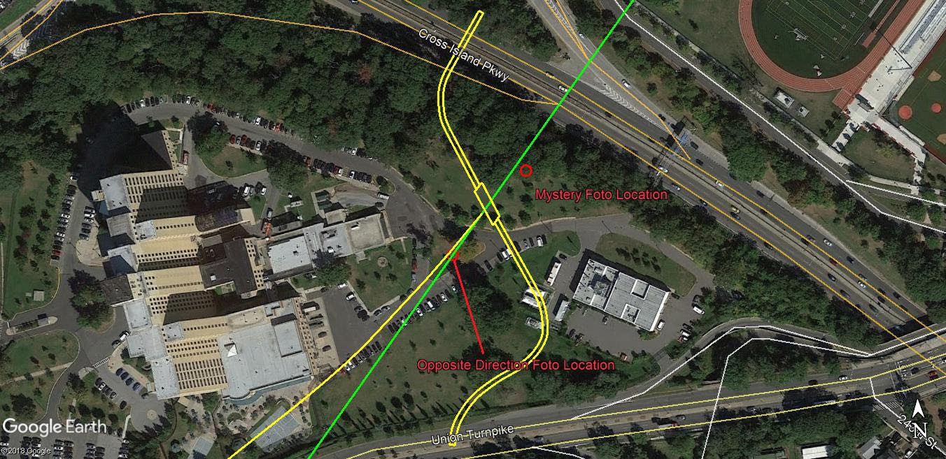
https://www.google.com/maps/d/viewer?mid=1396j0_672hYkvbcNFJInbc1mXNJspD9f&ll=40.74155505816334,-73.73021411336094&z=18
Identify the location and orientation of the photographer
Queens, 1500 feet east of Winchester Blvd. looking east
Identify the Motor Parkway Bridge and its original purpose
Creedmoor Bridge, original highway bridge built in 1912.
Identify the building in the background: Creedmoor hospital building. One source also said a National Guard building was also in the area.
Who was the likely owner of the automobile seen in the Mystery Foto? Three choices: Relative of Howard, Willie K. himself or toll-keeper of the nearest lodge.
What was the month and year of the Mystery Foto? Provide a rationale. Nov. 27, 1928. Caption on actual photo.
Kudos question: This image can be found on which online photo database?
Queens Borough President archives, NYC Municipal digital archives
Changing answer - looking west.
And original bridge connecting parts of the Creed farm.
-Identify the location and orientation of the photographer
On the LIMP (West bound going away from the photographer) looking through the Creedmoor bridge
-Identify the Motor Parkway Bridge and its original purpose
Creedmoor Bridge; a highway bridge connecting the properties belonging to the State Hospital at Creedmoor.
-Identify the building in the background
Creedmore. That specific building still stands and houses the Lifeline Center For Child Development.
-Who was the likely owner of the automobile seen in the Mystery Foto?
My first guess would be the photographer of the photo.
-What was the month and year of the Mystery Foto? Provide a rationale.
Nov 27, 1928, prior to Union Tpke expansion
-Kudos question: This image can be found on which online photo database?
NYC Dept. of Records
http://nycma.lunaimaging.com/luna/servlet/detail/RECORDSPHOTOUNITARC~32~32~1153000~561862:bpq_00724-a?qvq=q:Motor+Parkway&mi=12&trs=14
Safe to say this image will replace/become a Bridge Series main photo!
Location & Orientation: Oakland Gardens, Queens NY. View is SW, then curving a true west.
ID Bridge & Purpose: Creedmoor Hwy Type that provided vehicle access on either side of the LIMP. Hospital buildings to south, farm fields to north. Guess this overpass was long enough to require 2 steel supports.
Building in distance: large building for Brooklyn or Creedmoor Hospital.
Owner of Auto: Thinking the owner may be a road inspector for the Motor Parkway. The Auto is parked in the grass, owner likely snapped this photo and made notes about the condition of the boundary wire fencing.
Time of Image/Rationale: I’ll say February 1930. The bend to the west looks to be original, before the re-locating to the north due to Union Tpke widening.
I’m skipping the Kudo. Happy New Year to All!
The Creedmoor bridge in Queens, used as a pedestrian and possibly vehicle overpass over the LIMP. (“Highway ” bridge) connecting Creedmoor State Hospital properties.
The two pillar supports are unique and different from other LIMP bridges.
The background buildings appear to be hospital buildings.
Approximate date :1925 based on looks of auto.
I believe the photographer is looking west from a position about 50 feet east of the Creedmoor bridge which was original built as a farmway bridge to allow access to and from several farms that were on both sides of the LIMP. The building in the background is Creedmoor State Hospital on the south side of Union Turnpike which was using the bridge as a pedestrian crossing to its property on the north side of the LIMP. I’m not sure but I think I’ve seen a similar photo with a November, 1932 date so that’s my guess. Could that car belong to Robert Moses who was out looking at the road he would eventually put out of business? I couldn’t find it but I think the photo may be on the Queens Borough President’s Collection of the NYC Municipal Archives.
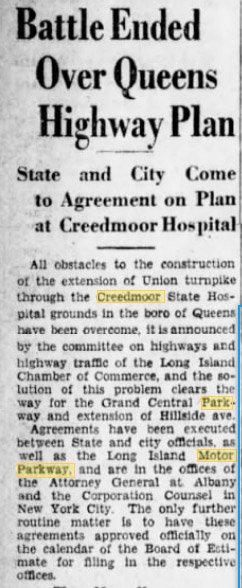
Here I go thinking again…The article in The Brooklyn Eagle explains the construction of the underpass we all visited a couple of years ago. The oncoming Union Tpke severed the path south of the Creedmore Bridge.Wonder why the underpass wasn’t built where the path was severed? Wouldn’t have to remove the Creedmore Bridge and the tunnel would just be under Union. Would’ve / Could’ve I guess. Very glad that this image of the bridge is known!
Good job guys. I have a questions regarding this location. Why was a bridge with three openings on the Parkway level built here ? This is the only location I’m aware of where multiple openings are on the Parkway level, all the others are on the highway level.
Good point Al. This is one of only three bridges I’m aware of, where steel beams were used to help support. The other two were Westbury Ave and Central Ave. They all share in common the long span but why was this necessary for Creedmoor? I’m guessing it was cheaper/easier to just reach for the nearest high ground on both sides, than building a concrete bridge requiring more dirt to fill in the gaps. This 1925 photo taken from on top of the bridge three years earlier shows the outer openings still inactive.
http://www.vanderbiltcupraces.com/images/made/images/blog/3-1-2013_3-30-21_PM_edited-1_210_161.jpg
Unless Howard has a blueprint or schematic of this bridge, I figure the bridge length between the abutments was 50+ ft. Maybe heavy farm machinery drove back and forth across this bridge, therefore requiring additional bridge supports.
________________________________________________
Howard Kroplick
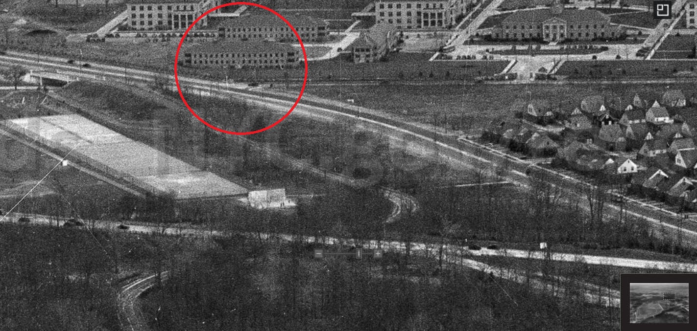
I believe that this bridge was never used . When it was built, New York State probably had plans to develop the hospital property on both sides and required that the Motor Parkway build the bridge as part of the sales agreement.. However, the 1937 aerial indicates the north side of the bridge led directly into heavy wooded area.
I’m in agreement with Howard that the bridge was part of any development that was to take place in the future. The only highway frontage the property had the time was on today’s Winchester Blvd.The north/south alignment of the Parkway in this area effectively divided the property into two parcels so a request for a crossing of the Parkway was certainly reasonable. My guess is that the bridge, which was a proper highway bridge, was going to be part of a roadway that some day would run from Winchester Blvd. eastward to what at the time was Clinton St., today’s Commonwealth Blvd. A bigger question I have is why was the Parkway required to build a crossing at the time? Historically, the Parkway would commit to a crossing and would agree to do so when needed. An example are the Mayan ruins in Garden City Okay, the State insisted on a crossing at the time, but why was a highway bridge built ? Did they really care if the crossing went under or over the Parkway? The Parkway preferred to go under highways rather than over as it was a lot cheaper to do so. Did the decision to build a highway bridge have any thing to do with the the triple Parkway opening ? So far, unable to find another example where the Parkway did this.
Happy New Year to All,
Here’s the Google Maps link to an elevated satellite view of the scene from the above photo captioned “View looking east towards Creedmoor… (March 3, 1932).”:
https://www.google.com/maps/@40.740609,-73.7337802,99a,35y,97.32h,73.26t/data=!3m1!1e3
(Nerd Note: I found that, on my laptop, the Microsoft Edge browser loads the Maps link in an oddly delayed, ‘special effects reveal’ stop-motion manner, which shows how the complete image is composed of many separate photo segments; perhaps you can experience the same effect.)