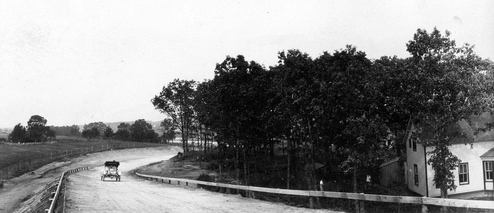
Mystery Foto #94 Solved: The Stymus Farmway Underpass of the Motor Parkway’s Longest Bridge
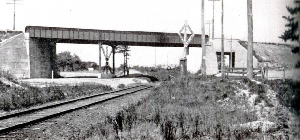
Al Velocci and Hector Gavilla challenged you to solve these mysteries associated with the Central Avenue/Long Island Railroad Bridge in Central Park (Bethpage). This unique bridge was the only Motor Parkway bridge to go over road (Central Avenue) and a railroad track (LIRR Mainline).
Answers to the Mystery Foto questions:
Al Velocci: What was the purpose of the large rectangular opening surrounded by concrete on one side of the bridge? Hint: Its primary function was not for use as a road or a public pedestrian walkway.
The area surrounding the future location of the Central Avenue/LIRR Bridge was purchased by the Long Island Motor Parkway, Inc. from William O. Stymus. According to Al Velocci, as part of this transaction, the Motor Parkway agreed to build the "Stymus Farmway Underpass" connecting the east and west sections of the Stymus farm that was blocked by the bridge.
Hector Gavilla: Was this rectangular opening north or south of the railroad tracks? Accordingly, what is the orientation of the above Mystery Foto: looking east or looking west? Provide your rationale.
Although there is not 100% agreement, the consensus of comments believe the Farmway Underpass was located north of the LIRR tracks. Accordingly, the above Mystery Foto is looking to the west (which will require a revision in the next edition of The Long Island Motor Parkway book. This opinion is supported by the following:
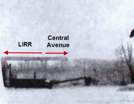
-1938 Aerials submitted by Frank Femenias: The aerials below clearly show a bridge opening north of the railroad tracks.
-An eyewitness account submitted by Ann and Bob Albertson: "Bob remembers this bridge as he played on it as a kid. Looking at the photo of the bridge you are looking west. Left side of the bridge you are going to Dead Mans Curve. Right side of the bridge you are headed to Old Bethpage. We hope this helps. Ann"
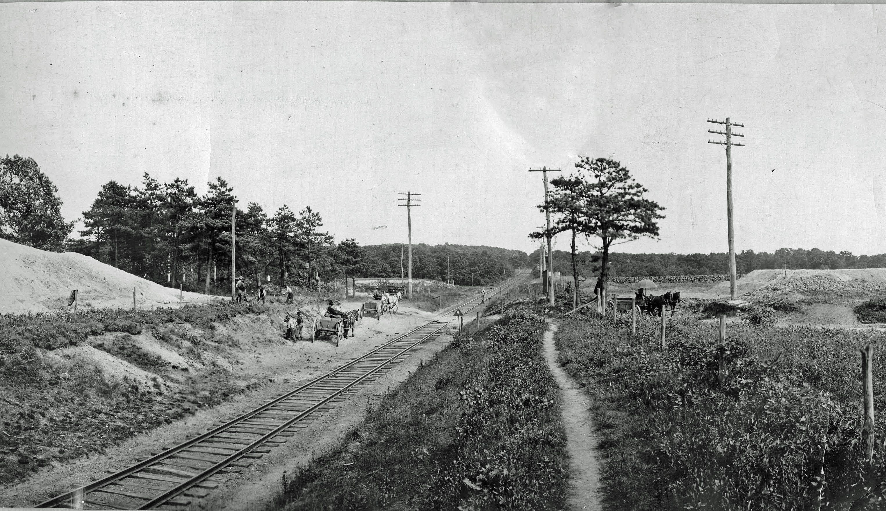
-The positioning of the bridge girder: Check out the image of the bridge with the Starlight coal bunkers in the foreground. A girder divided the bridge into two sections; the smaller section was for Central Avenue and the larger section for the railroad tracks adjacent to the Farmway Underpass. Based on the Starlight photo taken east of the Motor Parkway, the train section and the Farmway Underpass were to the left. Accordingly, the Mystery Foto view would be looking west.
-The 1907 survey and maps of Central Park indicate a path north of the LIRR tracks.
If you believe the view is to the east, please document your opinion in the Comments section.
Congrats to Robert Greenhaus, Ron Ridolph, Steve Lucas, Tim Ivers, Joe DeBono, Greg O., Michael LaBarbera and Brian MCCarthy for correctly identifying the farmway function of this section of the bridge. Special kudos to Frank Femenias for submitting the aerials and images.
Enjoy,
Howard Kroplick
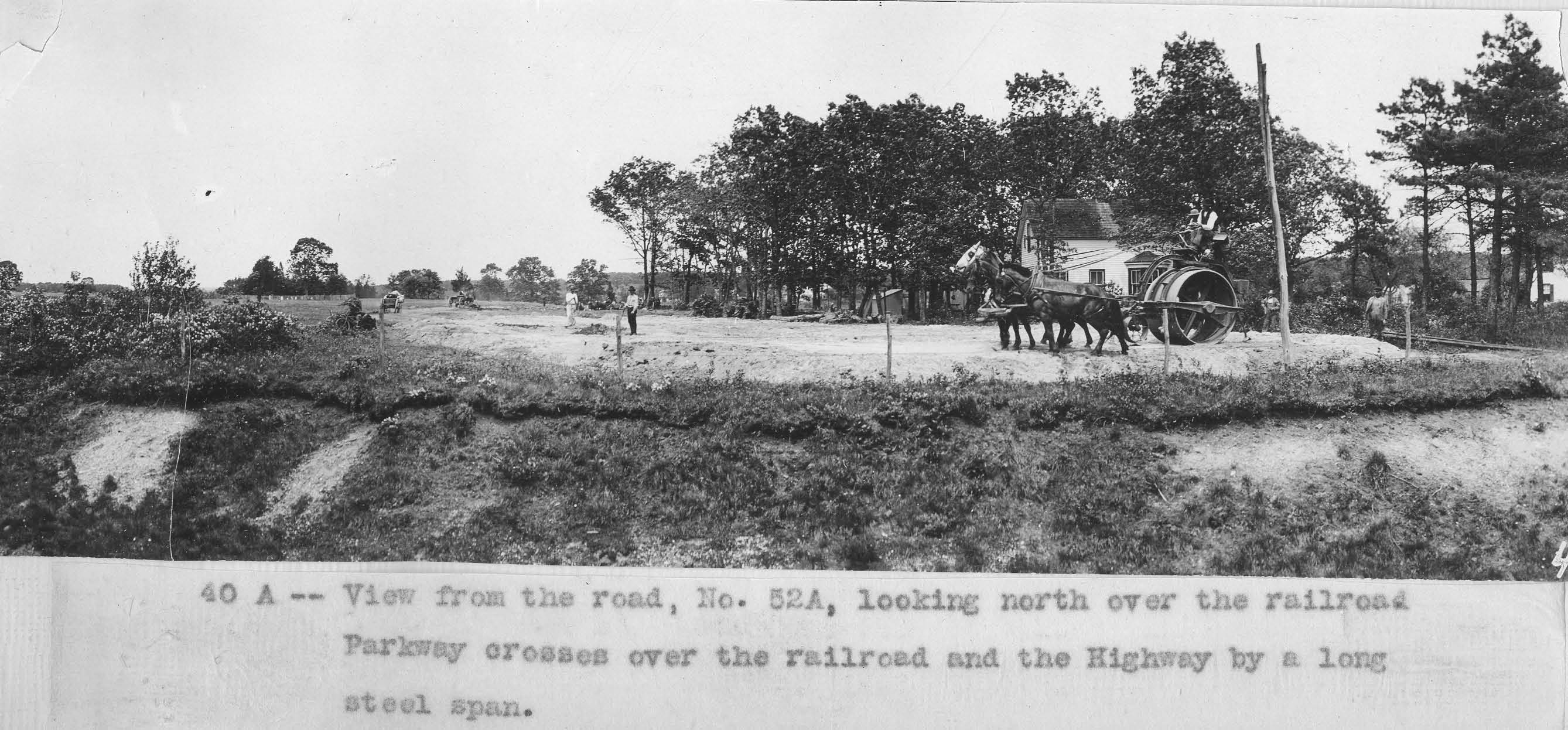
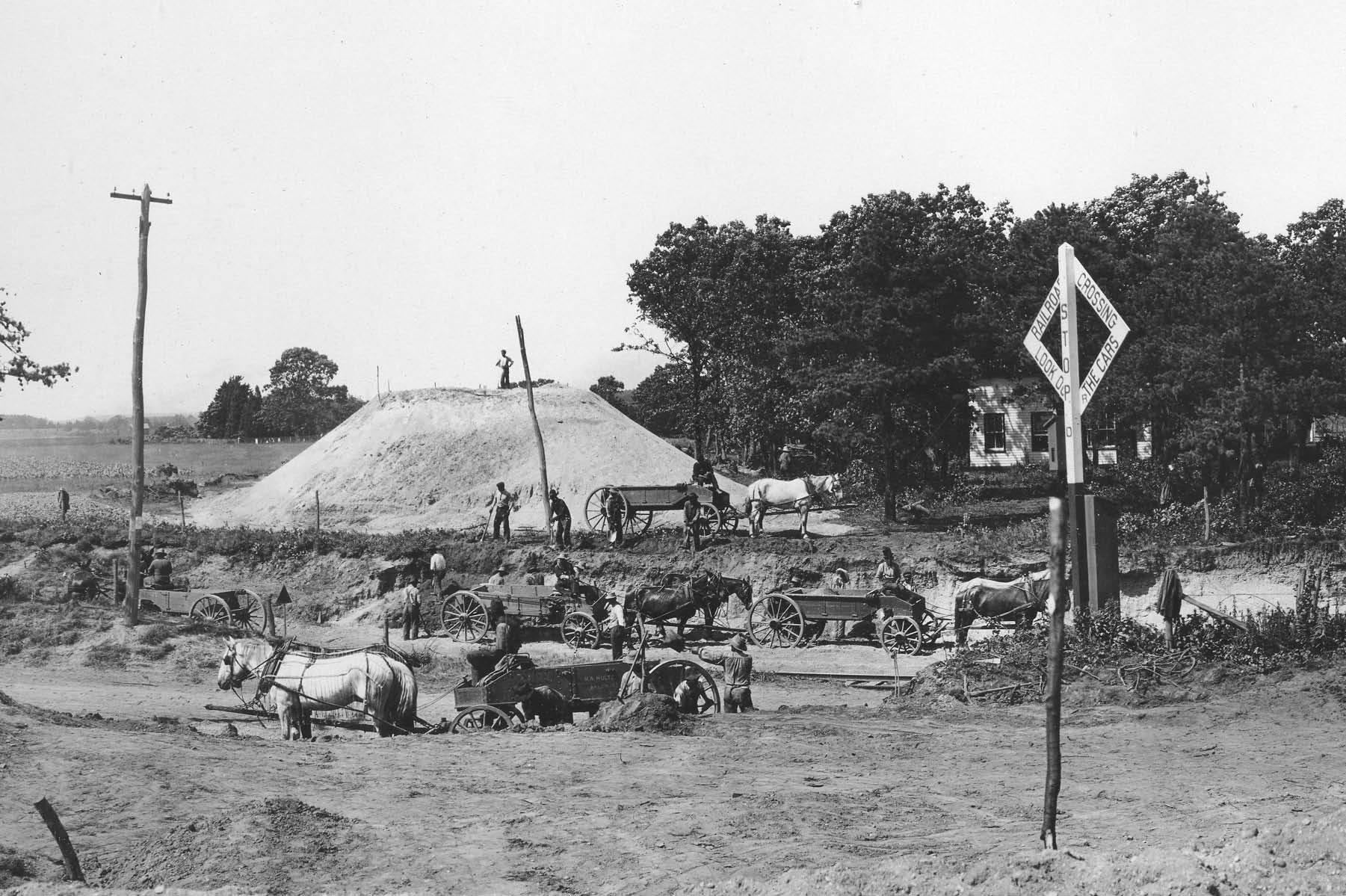
Views of the Central Avenue/LIRR Bridge
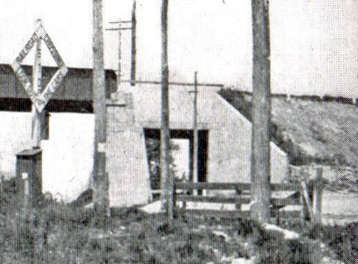
A close-up of the unique Stymus Farmway Underpass.
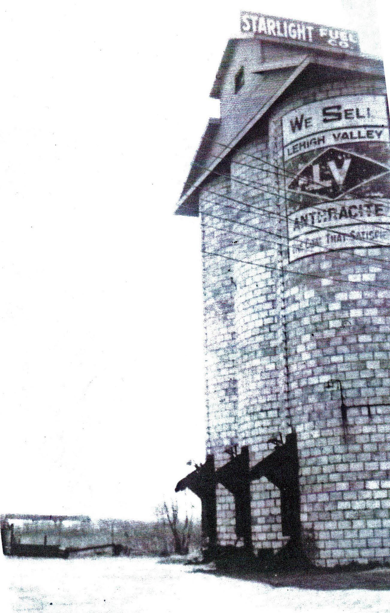
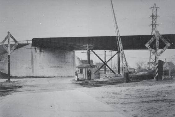
This view looking east shows the Central Avenue Bridge in the left corner. The coal bunkers of the Starlight Fuel Company were located at the intersection of Lexington Avenue and Schneider Lane. Courtesy of Bob and Coleen Albertson.
A girder divided the bridge into two sections; the smaller section was for Central Avenue and the larger section for the train tracks adjacent to the Farmway Underpass. Based on the Starlight Fuel Company photo taken east of the Motor Parkway, the railroad track section and the Farmway Underpass were to the left.
With this view looking to the east, the railroad track section and the Farmway Underpass were to the left.
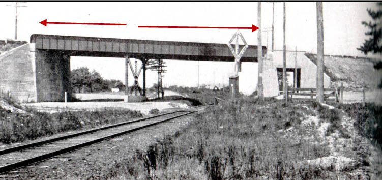
Accordingly, the Mystery Foto view would be looking west with the railroad track section and the Farmway Underpass to the right.
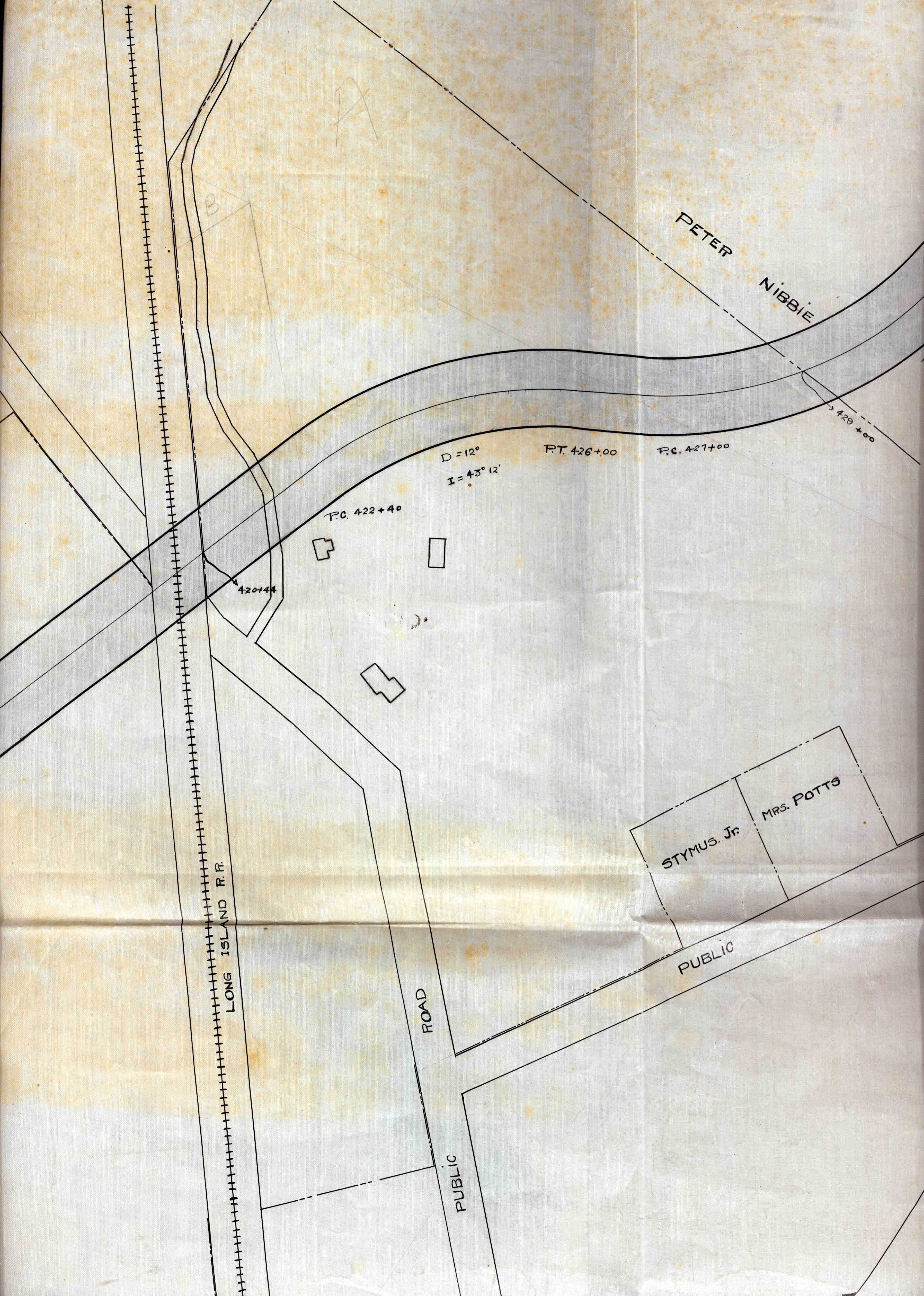
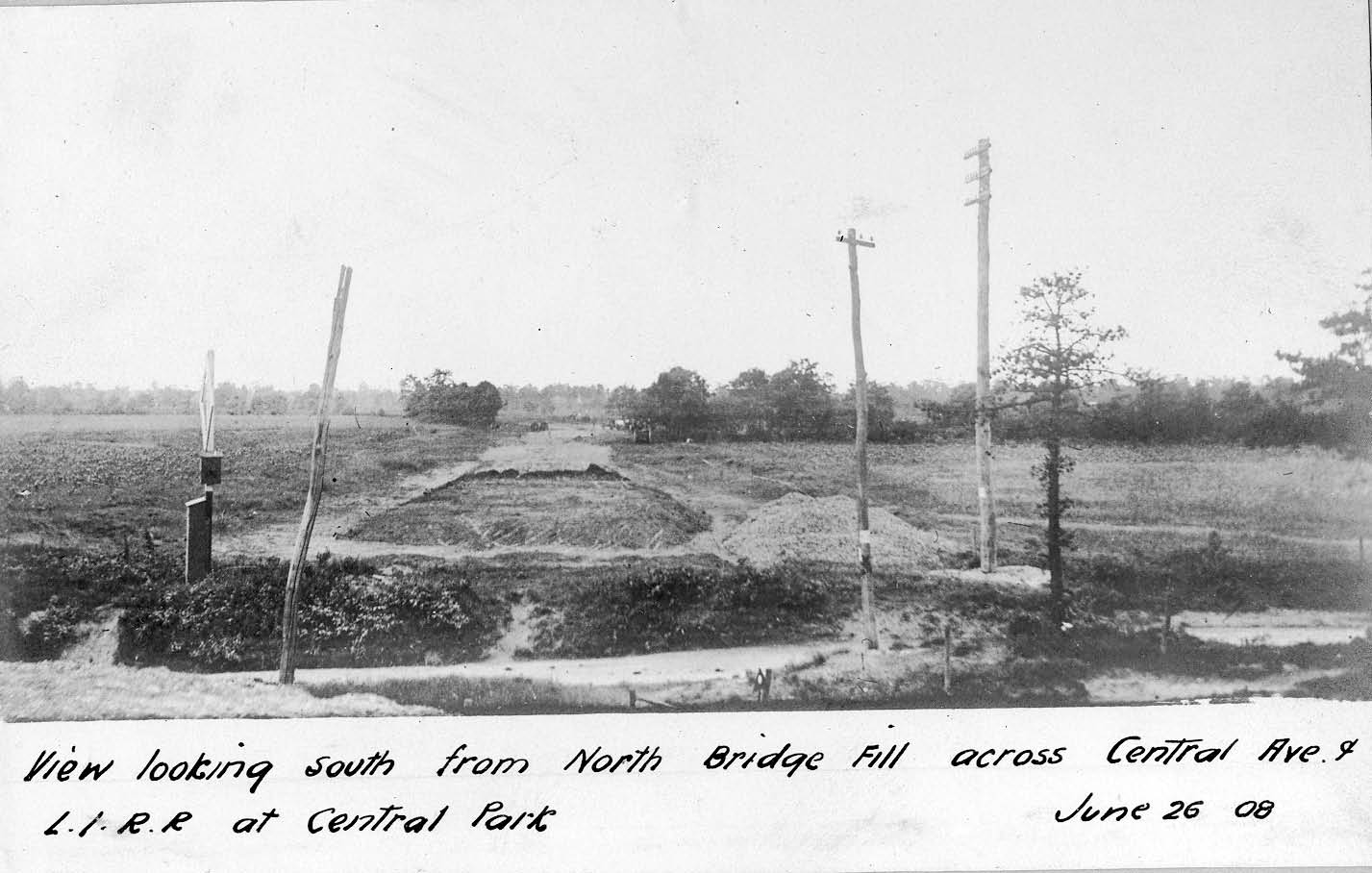
Map and 1907 Survey
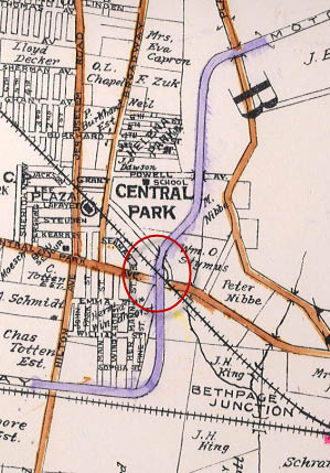
William Stymus owned the property to the east and west of the bridge.
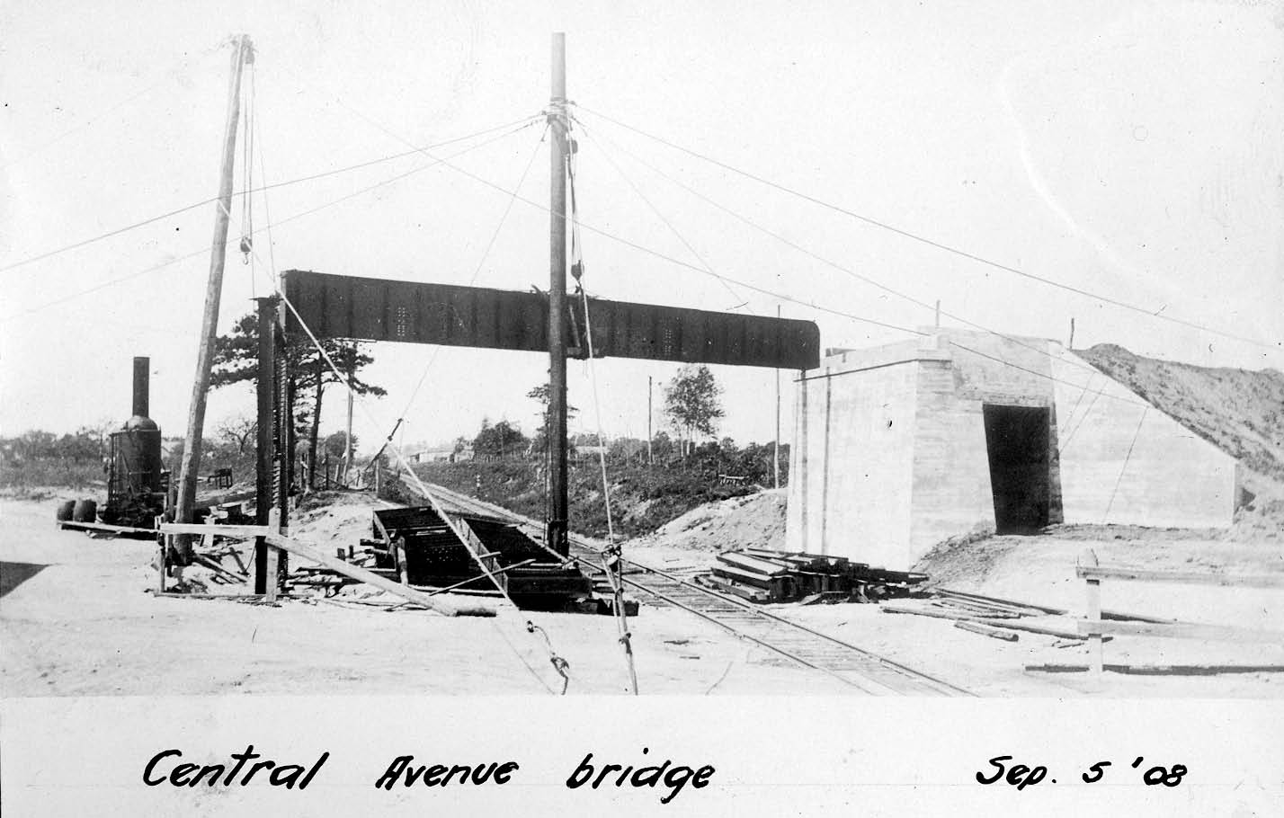
Construction Photos Looking East
Construction Photos Looking South East
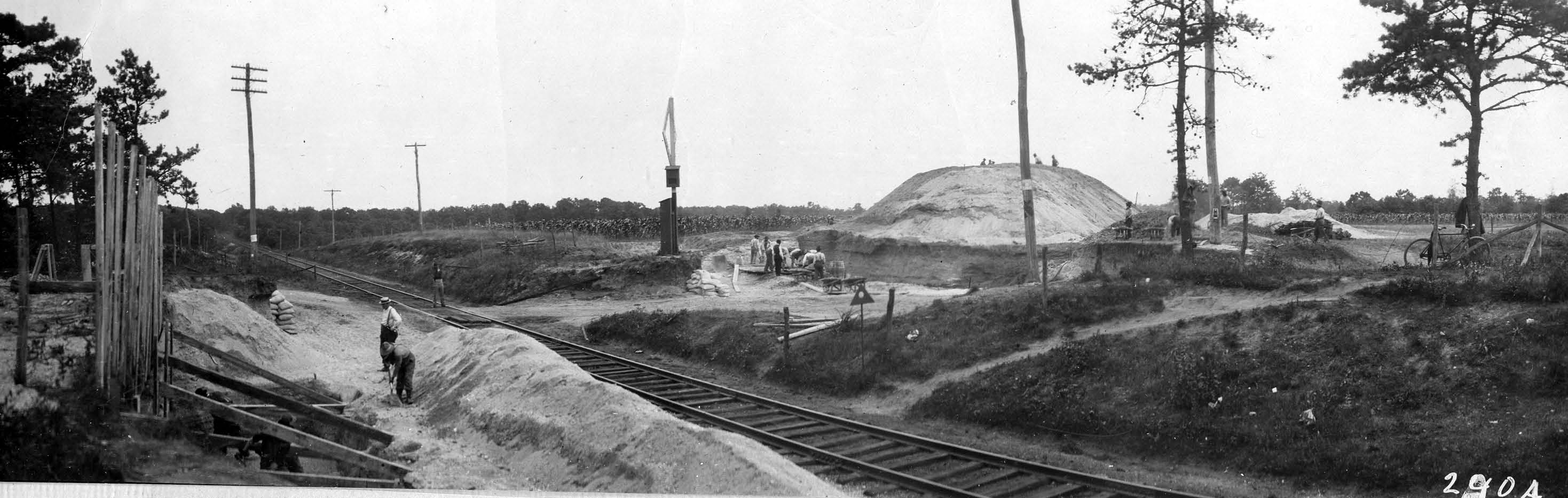
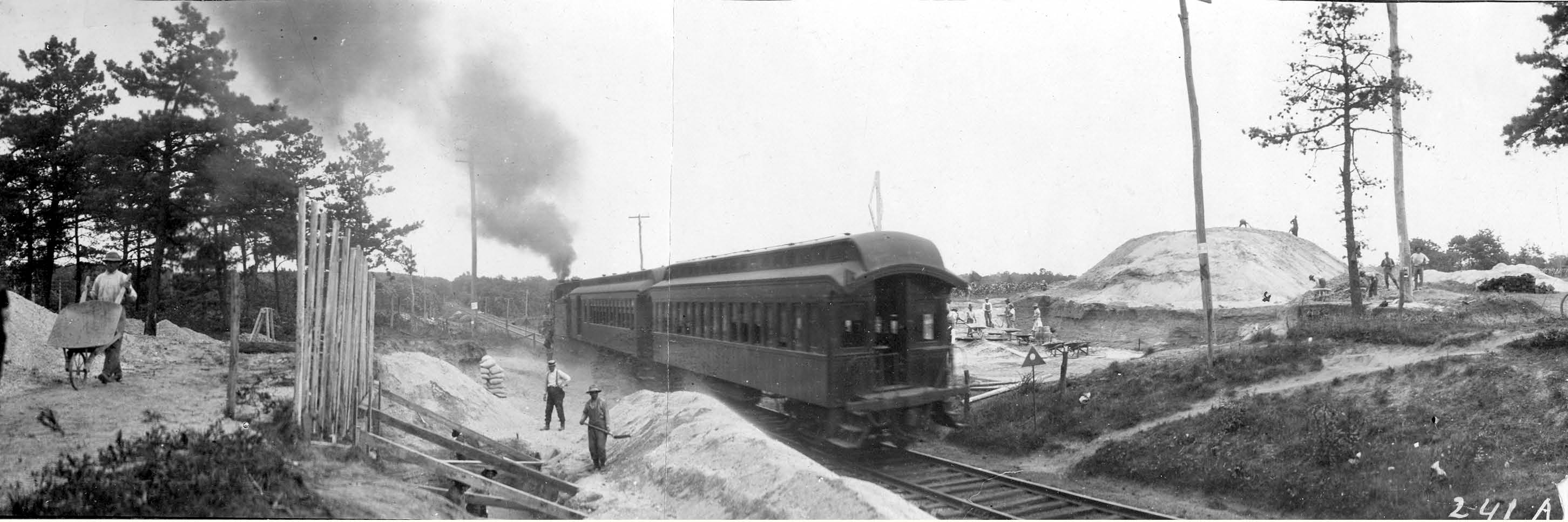
Construction Photos Looking South
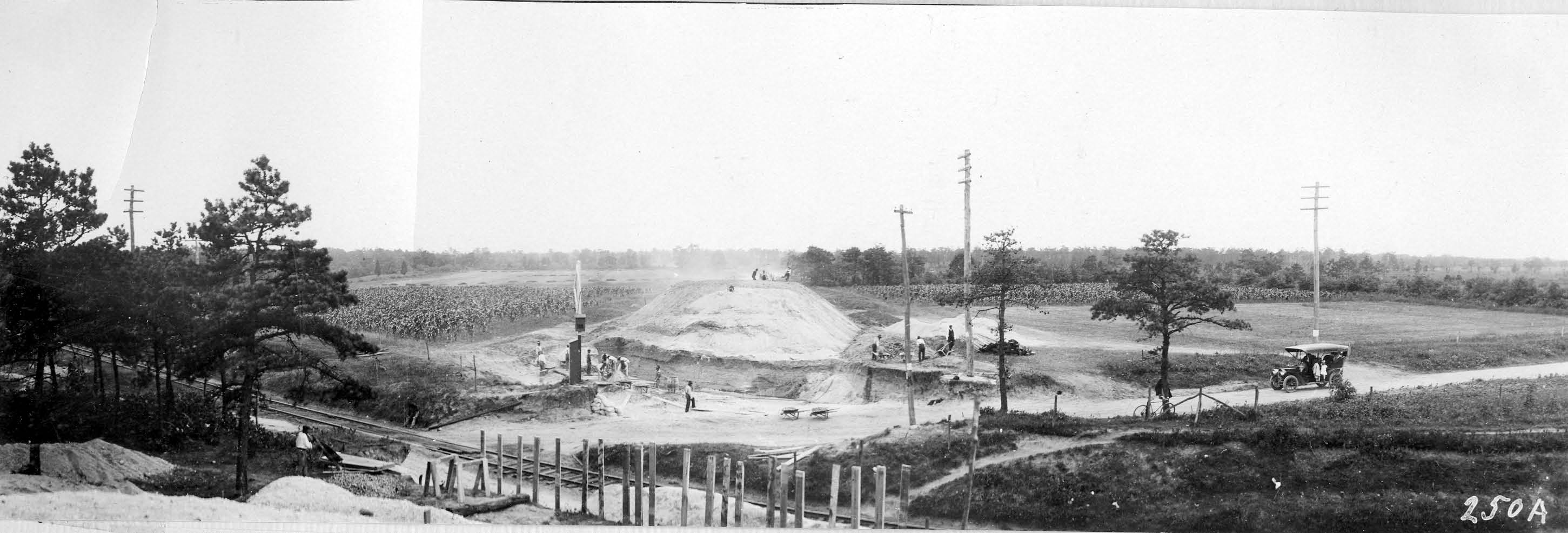
Construction Photo Looking West
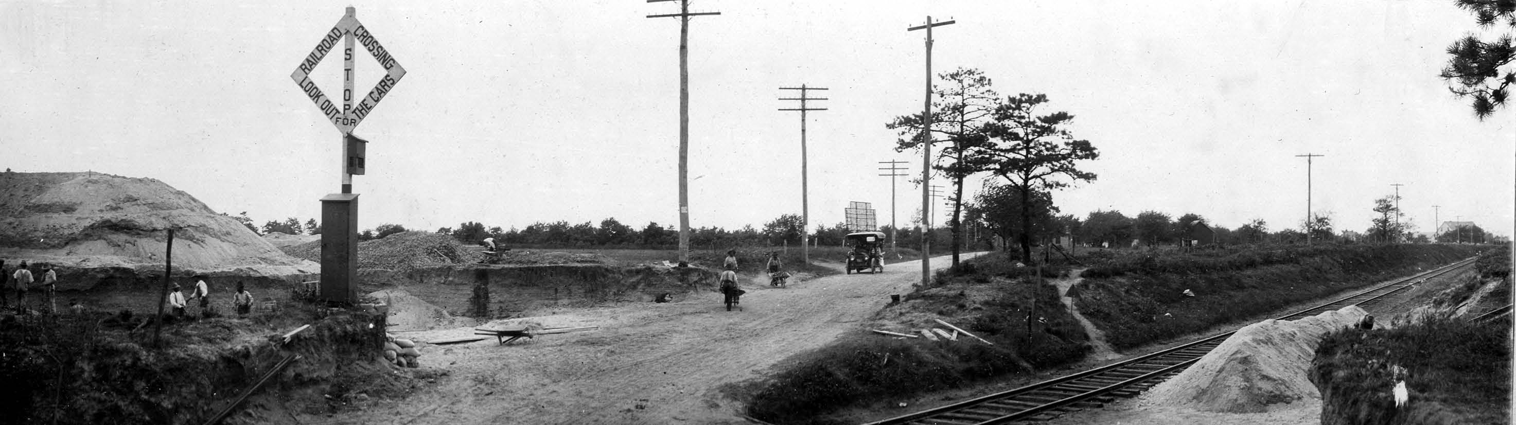
Construction Photos Looking North
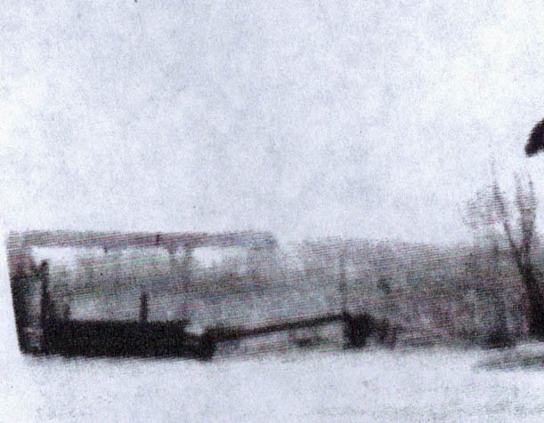
1938 Aerials of Bethpage
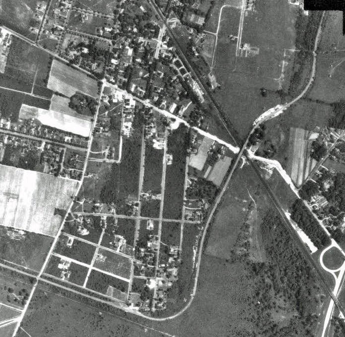
Frank Femenias submitted these 1938 aerials from the map collection of Stony Brook University. (Huntington map 4-9).
Link to the 1938 aerial photos of Suffolk County at Stony Brook University.
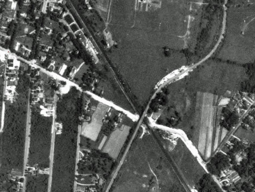
The Stymus property completely surrounded the bridge.
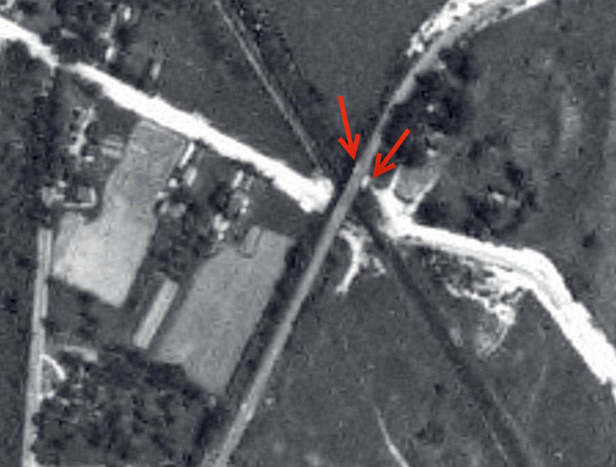
A close-up appears to show the Stymus Farmway Underpass. The underpass in this location would allow access to the eastern section of the property blocked by the bridge and railroad tracks.
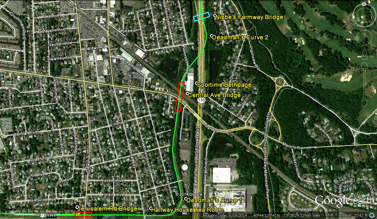
A Google Earth aerial submitted by Frank Femenias.
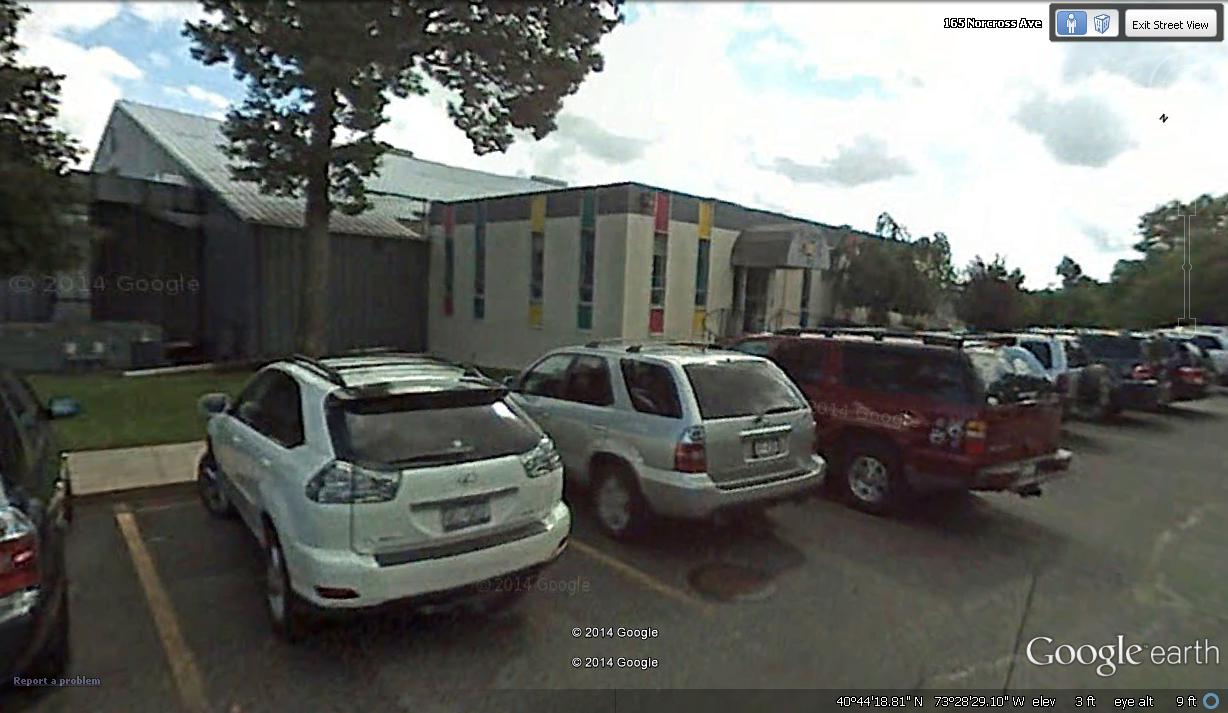
Frank Femenias: "the present-day Sport Time building on Norcross Ave is what now stands in place of the house located east of the bridge and north of the LIRR tracks, which was accessed by the rectangular portal under the Central Ave Bridge. "


Comments
It looks as if the rectangular opening was meant as a farmway bridge to provide William Stymus with pedestrian and horse cart access under the Motor Parkway to both sides of his property.
The rectangular opening was on the North (Northeast) side of the tracks.
The photo was taken facing roughly West, since the path of Central Avenue is on the South side of the tracks to the West of the bridge; crossing the tracks on the Southeast side of the bridge, then continuing East on the North side of the tracks.
The path of the Motor Parkway right-of-way is clearly visible to the south of Central Avenue on Google Maps’ satellite image and would have continued to the North roughly where the aptly named Norcross Avenue is today.
Bob
Hi ALL: Re: Bridge Opening——-It was to link the divided farm that was
severed by the construction and location of the LIMP.
Cheers and Best !!!!! Ron
When I first saw at the photo, I thought I would just search through Howard and Al’s book because it looked familiar. And there it was on page 84 with the caption; case closed, mystery solved. But then I thought what if the caption is wrong and there really is a mystery. Let’s assume we’re actually looking west. That means the large rectangular opening is on the north side of the tracks and could be a “farmway” opening for William Stymus to have easy access to both sections of his property.
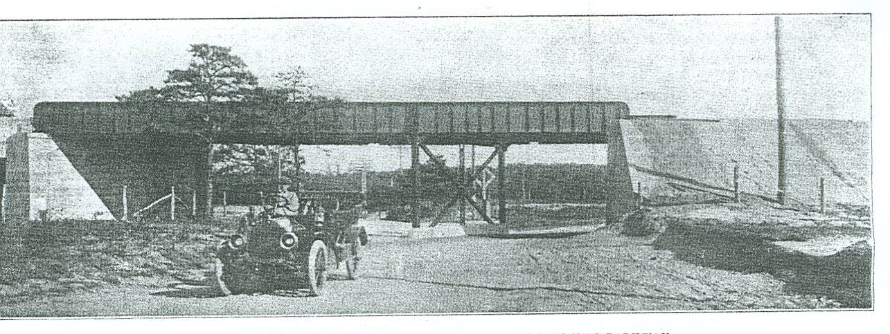
Confusing indeed. These pictures of the Central Ave bridge were always difficult to determine their correct headings, and the construction photos never helped as well. But based on the second picture of the gent driving the auto may have helped resolve the mystery. The utility pole on the right is casting a shadow towards the left (the north), and the rectangular bridge opening can be barely seen along the left border. So I’m betting that the mystery photo is looking west, putting the opening on the north side of the tracks. I once believed the opening was used for general pedestrian use but there is a photo out there showing the opening dead-ending into a small lot, making the opening inappropriate for general pedestrian use. I was unable to find that photo again.
I have to do this now or I won’t have a chance to do it Sunday or Monday. I’m pretty sure of my answers on this one. Well here goes nothing, wish me luck. Looking at the pictures over and over, they are a bit confusing, as you said. This is what I got out of it. The purpose of the rectangular opening is only for the construction workers. As for the directions, I hope I’m right, The bridge is going north and south, the opening is east and west, am I right on that? That’s it
I’m going at this methodically. Purpose for the rectangular opening on one side of the abutment, and is this opening on the N or S side of the overpass? If not PRIMARILY a passageway for horses,cows, etc.( OK, I believe this is on the north side of the overpass; probably on farmland property.) After looking at old topo maps of this area, I noticed blue lines(water) close to this location. So I’m thinking that the opening allowed water passage. The opening looks high enough for “other uses”. I would be looking west if taking the picture. The Starlight Fuel Company photo gave me a clue. The closeup of the overpass has the steel divider for Central Ave towards the right(looking east). The mystery photo has the divider towards the left. Hope I answered this correctly. Good luck everyone.
Howard: Page 83 of your book shows a photo indicating the view is “looking east” with Central Park to the left of the tracks, and the concrete opening is described as a pedestrian walkway. The opening appears to be large enough to accommodate a railroad car, or an equestrian path. The accompanying map shows there may have been a farmway right of way pass through.
Mystery Foto #94 The rectangular opening was north of the rail road. The opening was NOT a Farm bridge, BUT a Farm Tunnel. It connected the Rizzo property together. Keep up the good work guys
Al Velocci: What was the purpose of the large rectangular opening surrounded by concrete on one side of the bridge? Hint: Its primary function was not for use as a road or a public pedestrian walkway.
Hector Gavilla: Was this rectangular opening north or south of the railroad tracks? Accordingly, what is the orientation of the above Mystery Foto: looking east or looking west? Provide your rationale.
All complete guesses this time, but judging by the 1907 survey blueprint, it looks like the opening would have been for an access road to the Nibbe farm. That puts the opening on the north side of the tracks and makes the photo’s view to the West.
OK the rectangular opening lies north of the bridge, looking at the maps and their confusing orientation is what makes this a good question but the LIMP ran due north and south, the RR kinda northwest south east, so if the opening was not a public roadway or pedestrian path, then it must have a private farmway underpass for Stymus’s Farm, who owned property on both sides of the bridge (and a path on the 1907 street map looks like a foot path between the town Plaza by the school and the other side bordering his neighbor Nibbe). I was also thinking that it could have been a drainage culvert, but it looks too high up in the air to serve that purpose, so, yep my best guess is that the opening is on the north side of the bridge, then used as a private farmway underpass.
And, as the 1907 survey seems to point out, the path under the opening joins central avenue, indicating that perhaps it was the actual driveway leading to the Stymus farm. The map may have been printed a few years after the farm’s “Hayday”.
Never thought of looking in your book. This was a very good mystery, challenging one, many ways to answers, but which one is right. Waiting to see who got what right, including myself,
Hi Howard! Bob’s remembers this bridge looking west as he climbed on it in his youth. The opening allowed the farmers, Stymus and Nibbie to go into the village.
Was I right about the bridge going north and south, which makes the opening east and west? Thanks.
_______________________________________
From Howard Kroplick
The bridge is approximately north/south.
Learning about our local history is a hobby for me, and I normally don’t take it too seriously. Yes, it’s quite obvious that the opening was a road /path for farm use. The question what was the use of this opening, it’s primary function wasn’t as a road or ped path. So I tried to come up with a not so obvious answer. Although the creek waters didn’t exactly extend to the opening, they certainly reached into the farm property. So water never ran through this opening, OK. I left other info within my answer like “passageway for horses,cows and other uses”. From what I gather, it was a underpass for farm use.Primarily a farm road. I wasn’t correct word for word, but I had the right idea; not with the drainage hypothesis though.
Howard, I’m sticking with the north-side-opening theory and Bob’s account should nail the case tightly closed, but that circular dirt path south of the tracks in the ‘38 aerial throws a wrench into the machine and no doubt, will keep this debate burning bright for years to come. Open the popcorn and enjoy the show! Thank you Al, Hector, and Howard for the wonderful challenge.
Not getting definite answers on this one are we? It’s all guessing, logical answers. The pictures are misleading and confusing. I’m agreeing with Frank on this one
Hey Frank. It’s great that you supply these older aerials here. In that time period, the LIMP is totally intact and you can also see the beginnings of the present time. Too be quite honest, I did’nt think Howard would approve my previous post. A bit angry I was, that’s not what this is all about. Sorry, Howard. And thankyou.
In looking back at this whole thing, and scratching my head days later, the facts are plain to see:
#1 Central Avenue crosses the railroad tracks east of the bridge and continues east.
#2 Central Avenue runs parallel to the tracks on the west side of the bridge and under the bridge, only crossing the tracks east of the bridge.
#3 the RR always ran north west \\ southeast. LIMP ran due North South II, Central Avenue Due West and East =.
#4 Why we are so confused today is because what we see today is a complete erasure of what was where central avenue crosses the tracks further southeast and goes over the SOB expressway (in the old days it connected due east of the bridge onto the now truncated road on the other side of the SOB that has that kneebone bend south and re connected with central avenue near the entrance to the BSPkwy.
Please correct me if im wrong, but I conclude that the actual mystery foto was taken east of the bridge, north of the tracks, and the photographer was standing right smack on Central Avenue looking west after the railroad crossing (not pictured) , right next to the driveway leading into the Stymus Farmway underpass. Mike
I put it on the north side based on the shadow.