Kleiner’s Kolumn: Part 2- Mapping the Motor Parkway, Mitchel Field & Mitchel Gardens
This post continues with my examination of Mitchel Field documents provided by the Nassau County Dept. of Public Works and pertains to post-WWII development of the area. Sorry for the length, but tons of information for those who are interested!
Art Kleiner
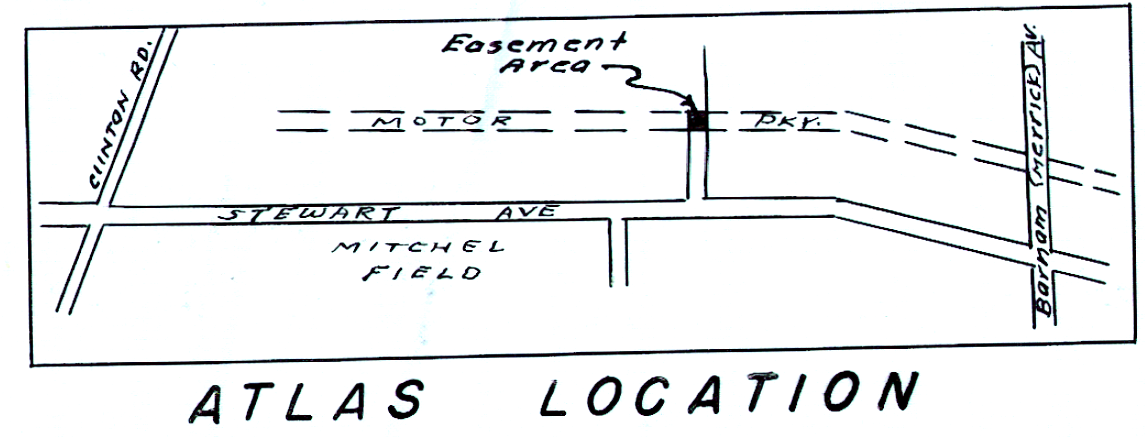
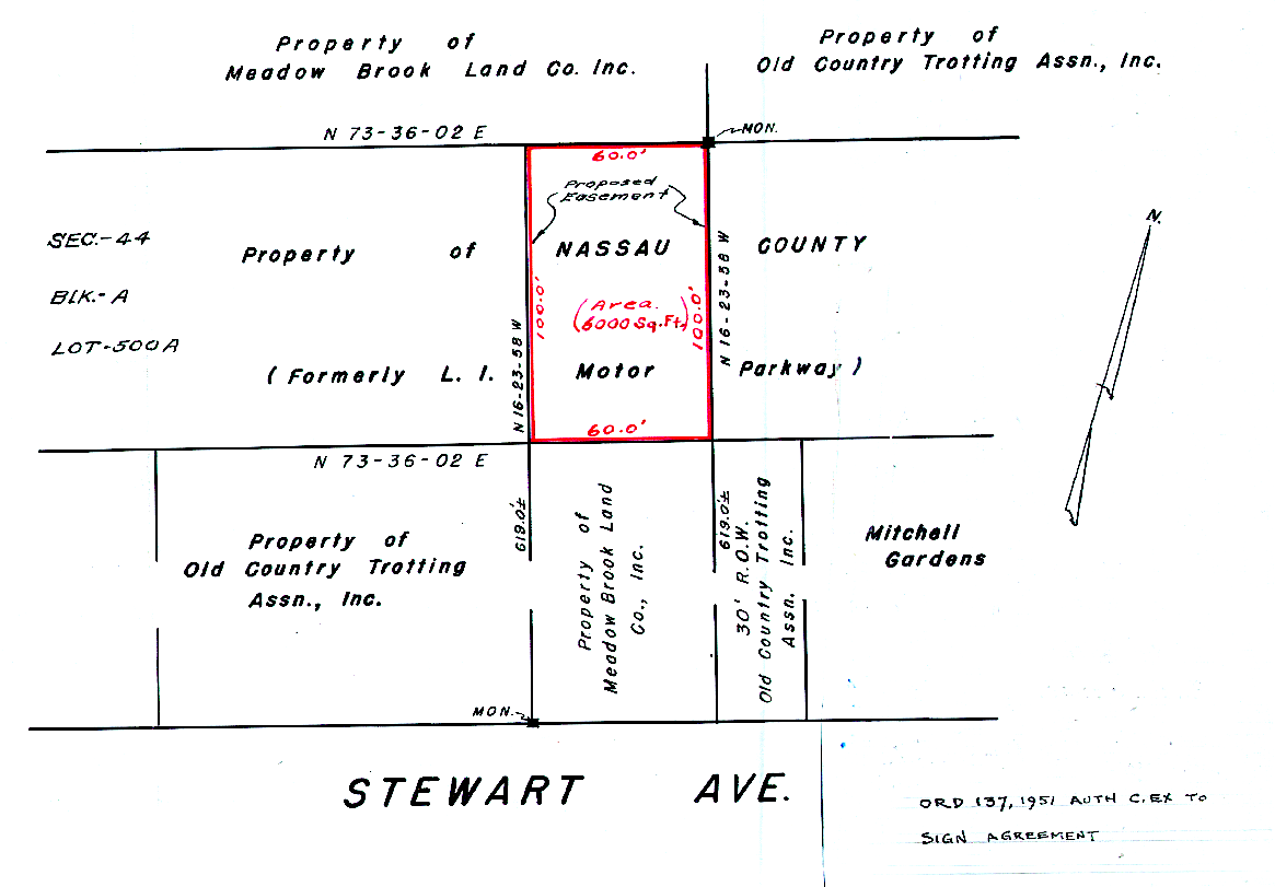
1951 Transfer of Land
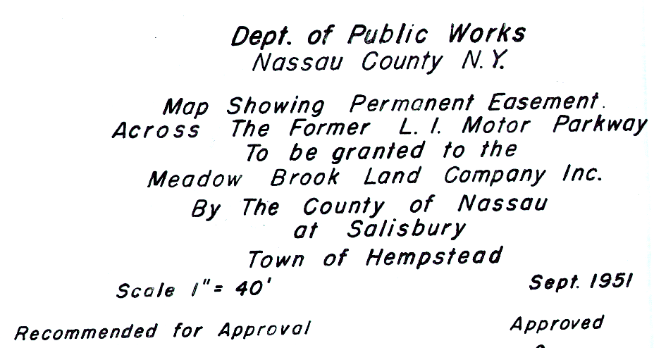
Transfer of land between Nassau County and the Meadow Brook Land Company.
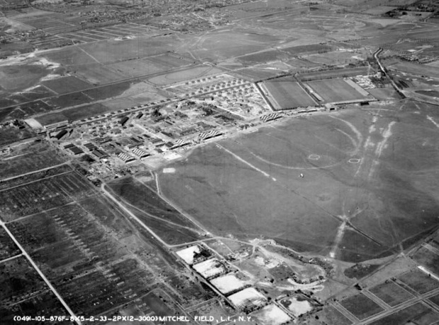
1961: Land Use and Street Plan
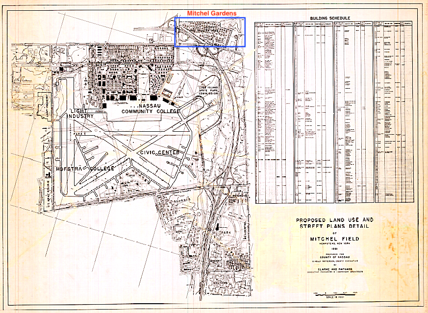
Overall map showing then current structures.
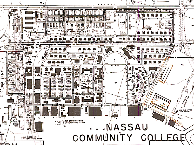
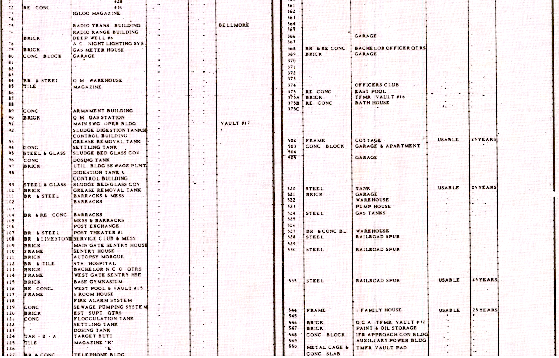
Every building was accounted for. I never realized how many buildings there were (additional lists of buildings are not shown here)!
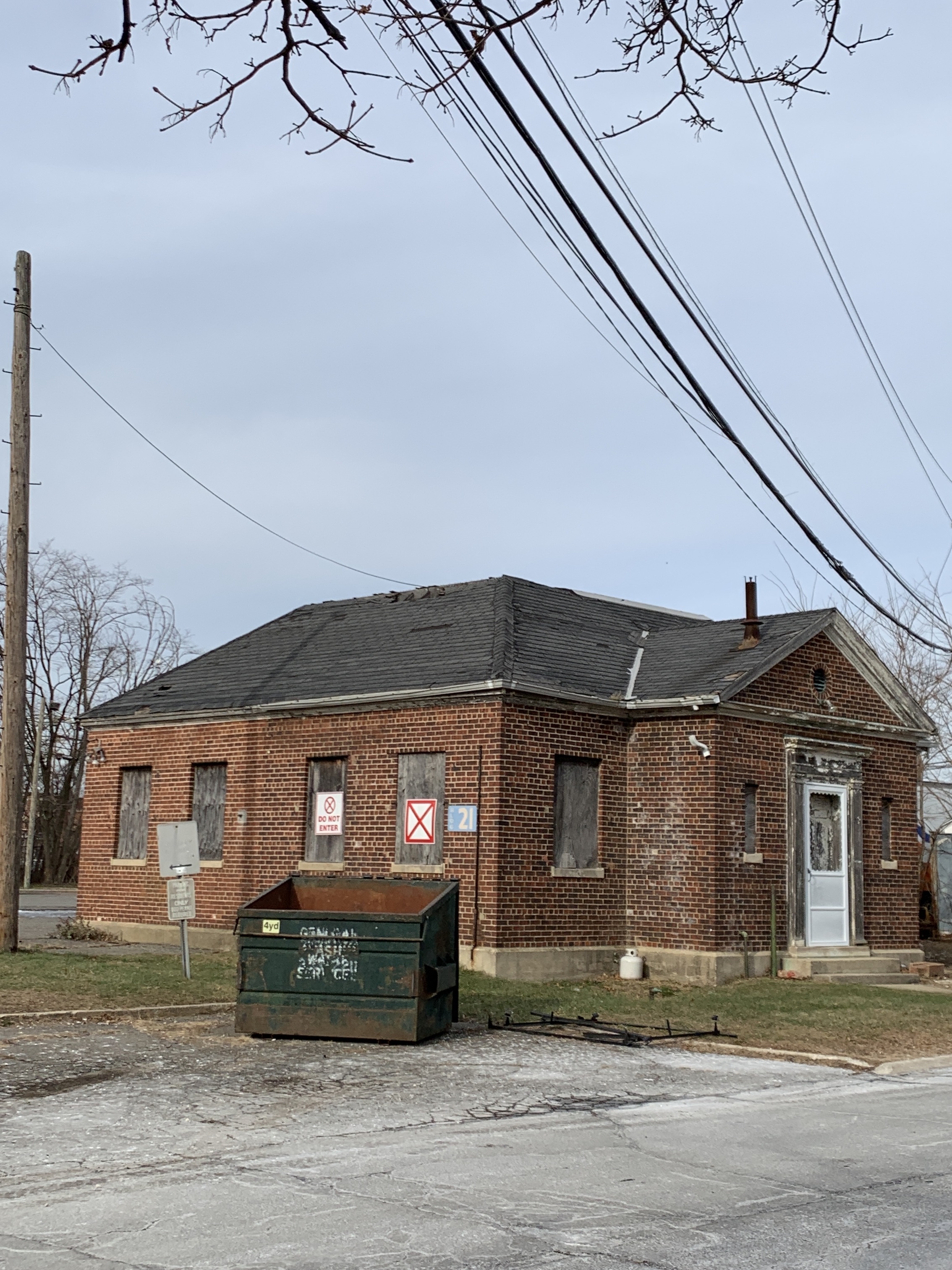
Current picture of Building 21 which according to the list of buildings was the base radio station.
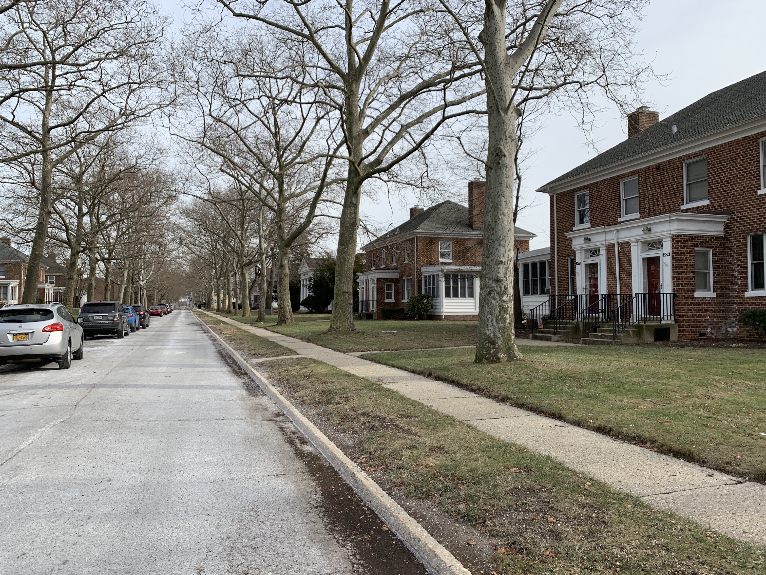
Current picture of Mitchel Field homes.
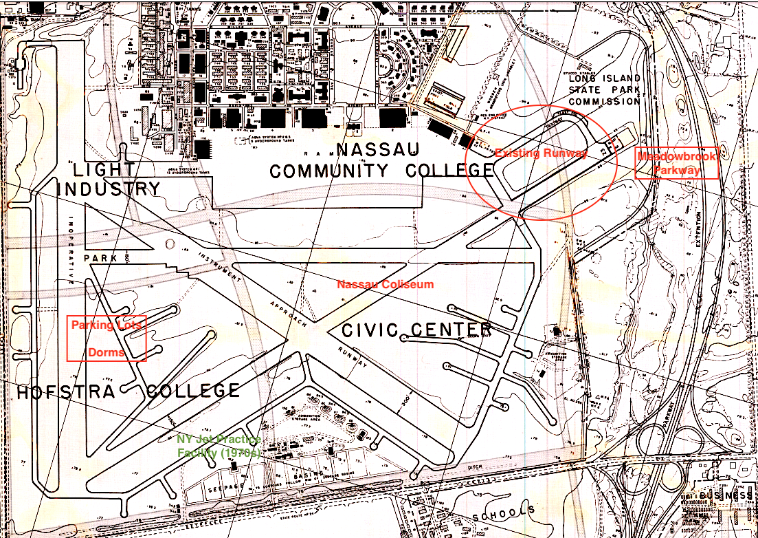
Note the Civic Center (Nassau Coliseum) and where the NY Jets (Joe Namath days) practiced. On another land use map I've seen the Civic Center named the JFK Center.
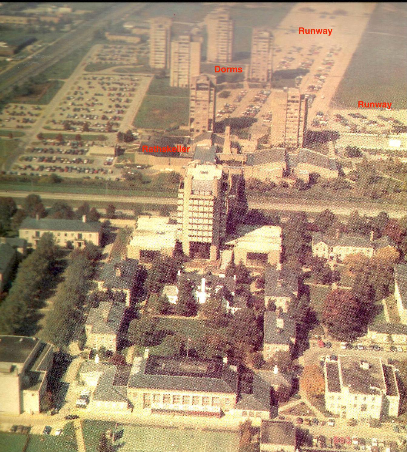
1978: Having spent 5 years commuting to Hofstra University in the mid-70s, I was acutely aware of the Mitchel Field runways which were home to our dorms and parking lots. North of Hempstead Turnpike were the dorms and student activities center, including the Rathskeller which I frequently visited. And yes, I did make it to classes most days on the south side of the turnpike!
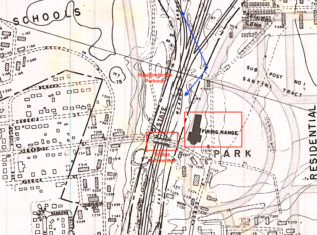
South of Hempstead Turnpike near the Meadowbrook Parkway and Front Street. Note the bridge over the parkway which I've named the Bridge to Nowhere which still exists today.
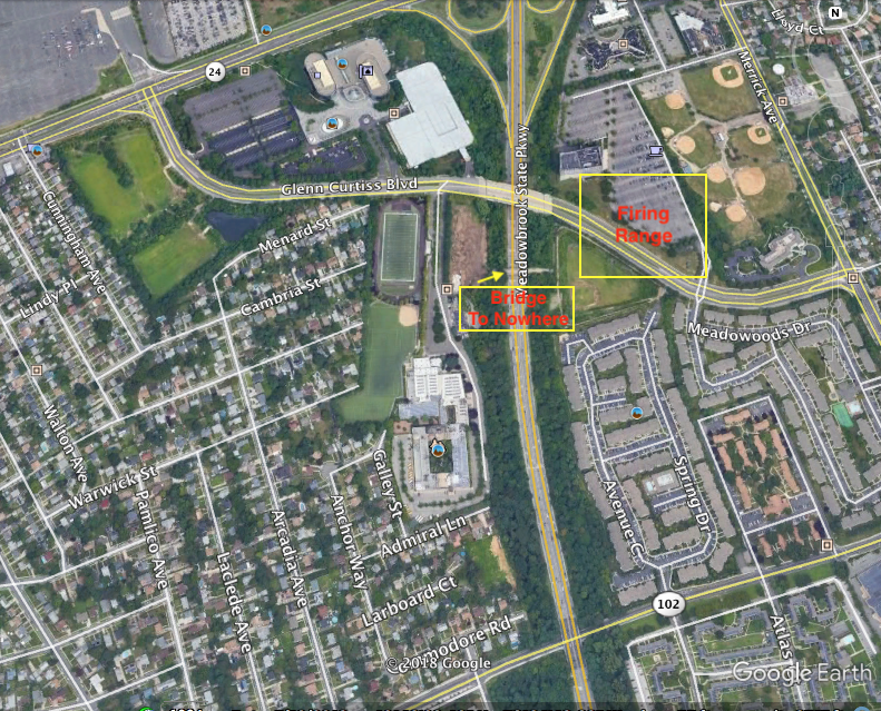
1994 Google Earth: Kellenbergh HS is directly to the left (west) of the parkway and the Bridge to Nowhere (actually leads to a ball field close to where Mitchel Field's firing range was).
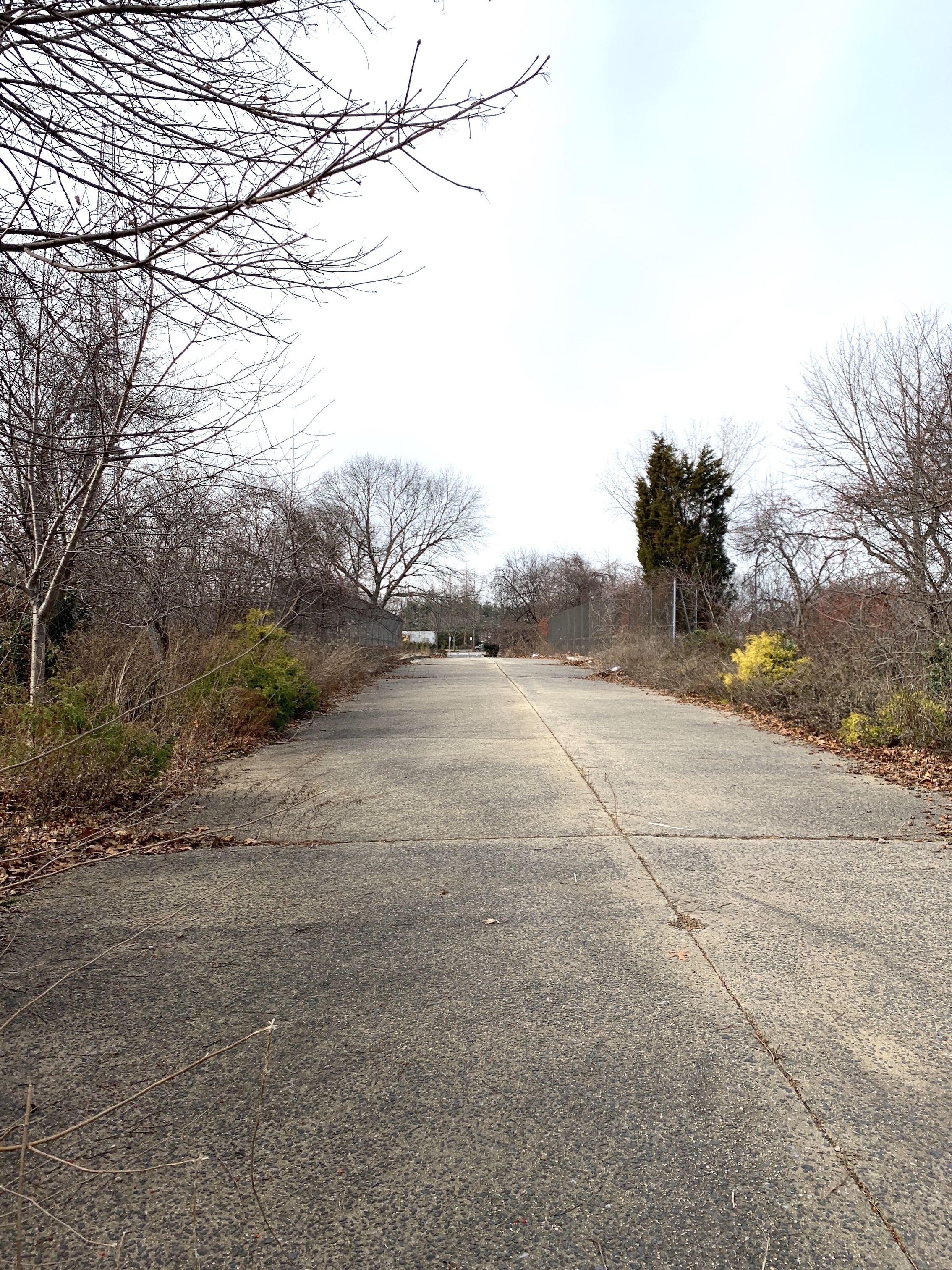
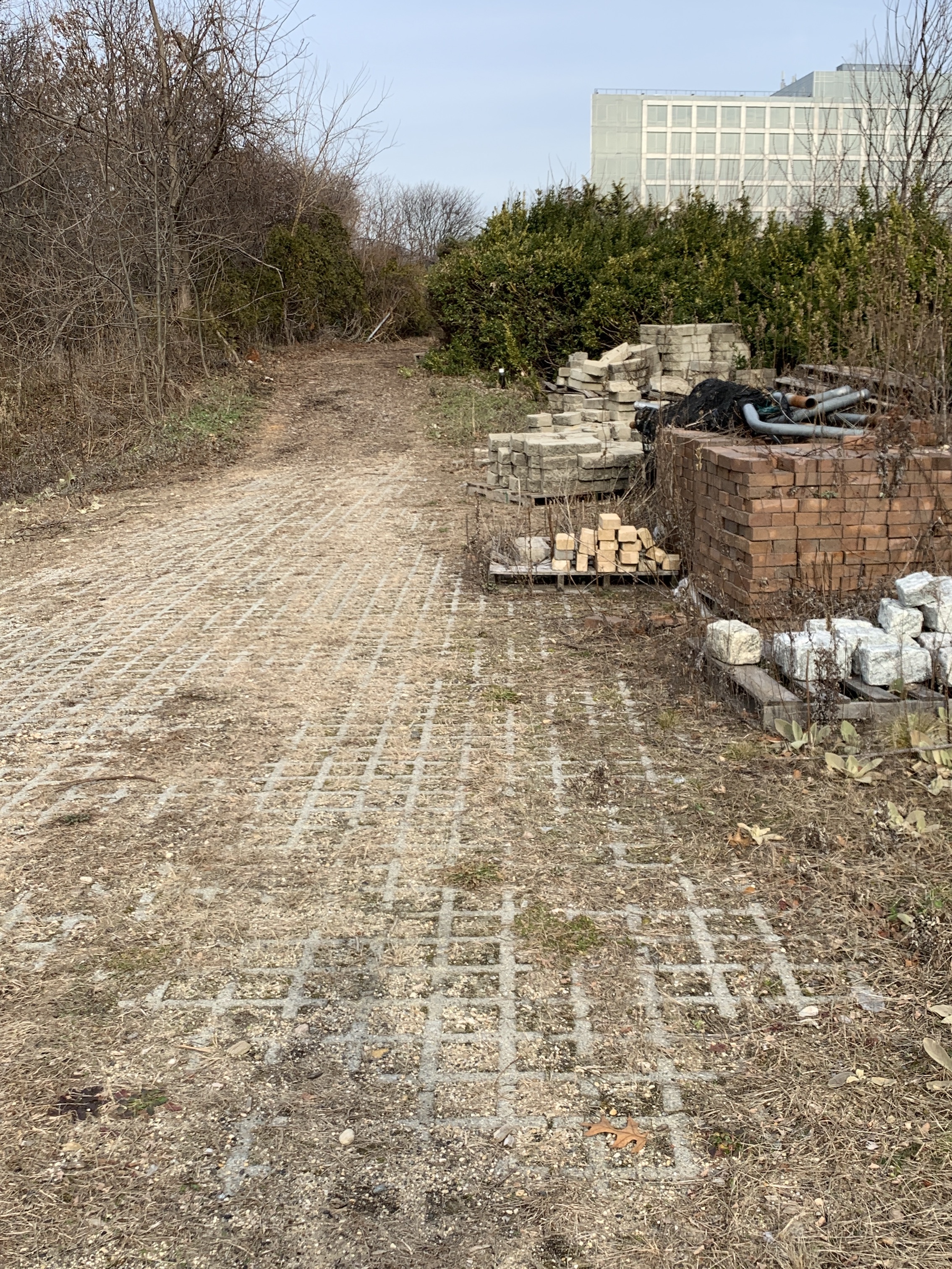
Looks like some kind of roadbed!
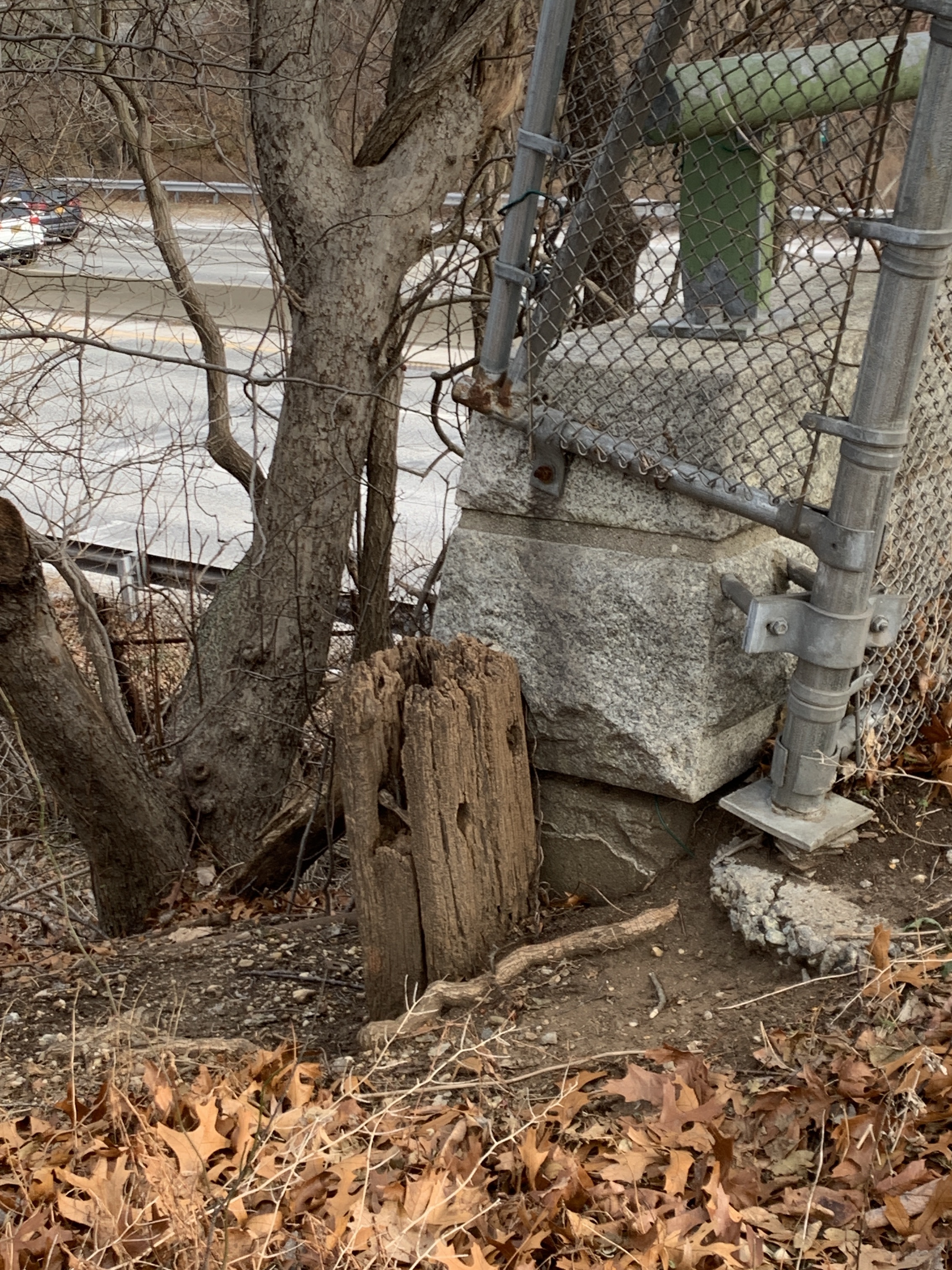
And possibly an original wooden post!
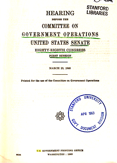
In 1963 the U.S. Senate held hearings on the plans to dispose much of Mitchel Field and how the land was to be used. (Courtesy of Stanford University)
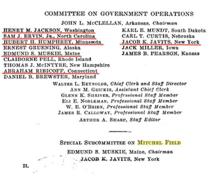
Many on the Committee were well known Senators.
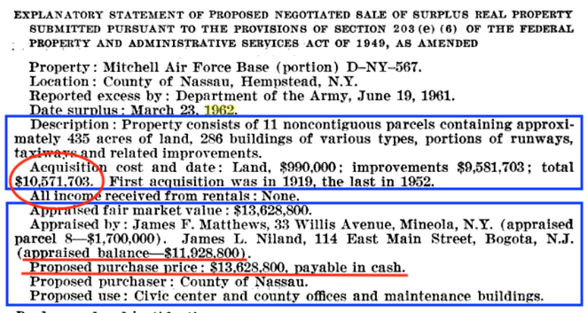
The proposed property was to be sold to Nassau County for $13.6 million. The cost to build just the Nassau Coliseum in 1972 was $32 milllion.
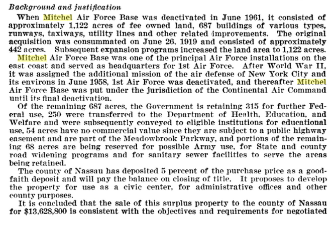
Nice summary of the plans.
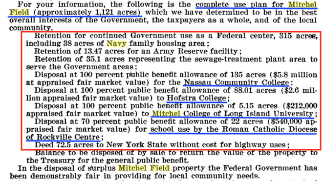
Specific allocation of property. What ever happened to Mitchel College of Long Island University? See the answer at the end of the post, before the comments.
1970 Nassau County Property Survey
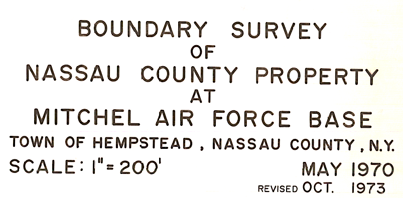
In 1970 (revised 1973) the county surveyed its property at Mitchel Field.
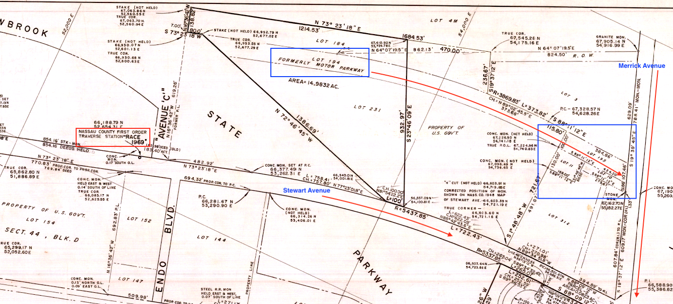
Lot 194 still appears as former Motor Parkway property. And 195, 10 and 11 are the lots that comprised the Meadowbook Lodge and entry point. Notice Traverse Station "Race". Traverse points are used as reference points by surveyors.
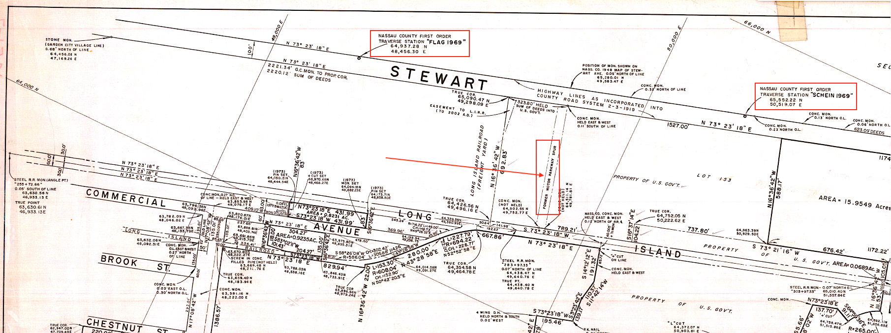
A former Motor Parkway spur is indicated between the LIRR and Stewart Avenue. And a stone monument on the top left indicates the Garden City village line.

Brian McCarthy has provided this brief summary of Mitchel College mentioned above. Thanks Brian!


Comments
Great stuff here Art! I went to Nassau Community College 1970-1972 and had classes in the barracks. Many of the base buildings and remnants of the runways were still there. I drove through the property a few years ago and it’s amazing to me that several of the base buildings are still there now just rotting away. Thanks for the interesting post.
Server was down and thought the problem was on my end. You may receive multiple copies of this comment
Neat stuff Art. In the 1961 Building Schedule, does it also indicate street names in relation to building numbers? I’m particularly interested in Rice Circle and the roadway leading to it. Great hidden info that’s tough to access!
Yes Art, very interesting info. Sure your having fun exploring through this area!
Not a surprise for most of us, the motor parkway spur noted on the last image is certainly Quentin Roosevelt Blvd and South St north of Stewart Ave, both once planned to be the Hempstead Spur that would’ve continued southwest to today’s Westbury Blvd.
The aerial photo of Hofstra sure brings back memories, as I attended from 1972 through 1976. And, growing up in Merrick, I traveled the Meadowbrook Parkway and adjacent roads many times. If I had a nickel for every time I went under the Bridge to Nowhere, I’d have enough money to buy a Tucker 48! OK, maybe a pristine ‘57 Chevy…
Brian McCarthy has provided an answer to Art’s question regarding Mitchel College. See at the end of the original post. Thanks Brian!
Brian, I have the Hempstead spur further east, about where the hotel/inn is on the north side of Stewart Ave. Some have it where there is a railroad crossing east of Quentin Roosevelt Blvd. between the Post Office depot and Mitchel Field.
For more on the bridge to nowhere see book-Hidden History of Long Island by Richard Panchyk
Frank,
The long gone roadway running across the former Camp Mills which ran from West to East roughly between 7th and 8th Streets, cutting through the future Hospital, proceeding across what would become the Parade Grounds, going directly through the future Commanding Officer’s Quarters at the center of Rice Circle and terminating at East Road evaporated with the Base Reconfiguration of 1927-1932.
Looks like these documents are from after that time frame. Art?
Yes Al, I see what you mean after looking at a few maps here on the site. Still think the Motor Parkway Spur indicated above is pertaining to a section of the unbuilt Hemp Spur. The 3 maps below show where the spur was to be.
Terrific. I do wish the maps were larger to read details.
From Art: Yes, all documents are after 1951.
Re. The Hempstead Spur. Never been able to discover why the spur starts with a curve from the Parkway . If built, motorists heading east would have had a awkward turn onto the spur. For those coming from the east were the to cross the westbound lane or did the Parkway plan to go under/over the west bound lane. Anyone?
Al - Just a guess but I noticed on some of the old maps the proposed Hempstead Spur is depicted somewhere between Clinton Rd and Merrick Ave, and always starting with a curve on the north end. I’ve also noticed the spur’s location slightly different for each map. I based my findings of its location from a survey (below) that shows a north exit/entrance plaza instead, accessible from either direction, and located at the end of the Clinton Rd curve just east of Raymond Ct. The survey at the curve shows a bearing of N 73*36’50” E, equivalent to the actual curve’s coordinate N 40*43’59.53”, W 73*36’50.00”. Another sketch shows Meadow Brook St. (Rd.) at the southern end of the spur, and Fairview Av. (Blvd.) running parallel just to the west of the spur. There’s also the Hempstead/Garden City boundary line defining the wider southern exit/entrance plaza, north of Fulton Ave. I’m not entirely confident the proposed spur was correctly drawn on the maps
Map link:
https://www.google.com/maps/d/viewer?mid=1396j0_672hYkvbcNFJInbc1mXNJspD9f&ll=40.7234069836966,-73.60931890643269&z=15
Very interesting collection and comments. I enjoyed looking it over very much. Thanks, Art!
I know why the LIMP is interesting to me, but can’t figure why a road that only existed in minds and maps? A crystal clear 1940 aerial came upon me here. Interesting because it shows the old and new at the same time. I added information from a couple of older maps below. Fairview Blvd isn’t carved out yet on the aerial, but presently is just E/O and parallel with Surrey La. I didn’t line in the proposed Hempstead Spur, but I agree with the below 1923 and 1939 atlases.
Brian, After the 1927 Belcher Hyde Atlas of Nassau County we see various versions of development in and around the southern part of the Hempstead Spur. In 1926 the Parkway sold that portion of the spur below the 50 foot wide section to a Jacob Breen. He later sold it to developers who laid out a sub-division called Marvin Terrace which had California Ave. extended north of Hempstead Tpke. to the top of the sub-division. There already was a road of sorts there which on early maps was referred to as “Highway” leading from Scott’s to Wright Fowler’s, most likely just a dirt lane with no official dedication. As we know there was no development in this area as the government acquired all the property up to the Oliver W. Bird estate for the extension of Mitchel Field.