Open Discussion: Powerhouse Road
As requested by Sam Berliner III and my favorite co-author Al Velocci, here is an open discussion on Powerhouse Road.
Be Safe, Stay Healthy, Save Lives,
Howard Kroplick
1906 Vanderbilt Cup Race
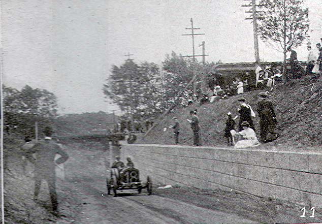
Then: 1906
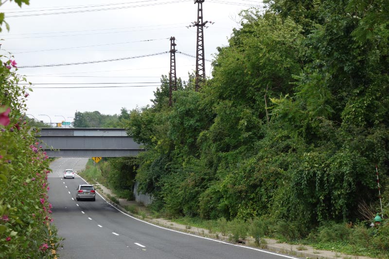
Then: 2012


Comments
North service road to the Long Island Expressway, I-495
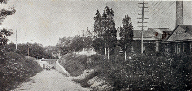
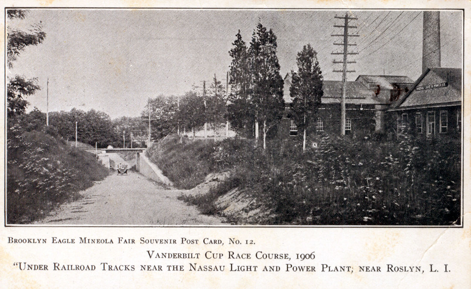
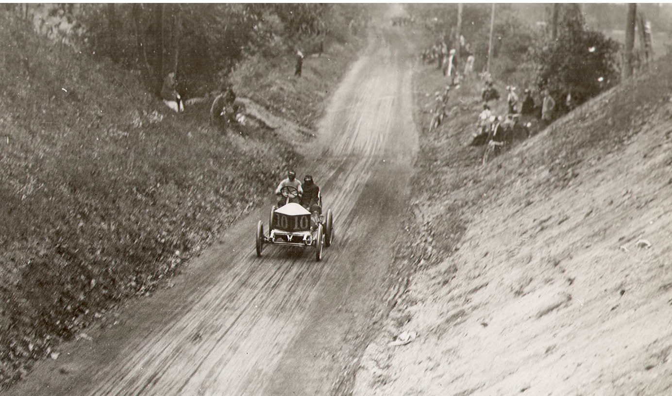
You can see that the postcard image was captured further west/at Mineola Ave than the 1906 photo race photo. Remember the question of the train being so far from the main line and bridge? Nassau Power & Light utilized a RR siding, this also allowed for spectators to arrive by rail; good plan.
From Art Kleiner:
Some info. on the Nassau Power & Light Company (which evolved from the Roslyn Power and Light Company and then into the Long Island Lighting Company). The plant on Power House Road in Roslyn was closed during its expansion in the early 1900s.
Al Velocci:
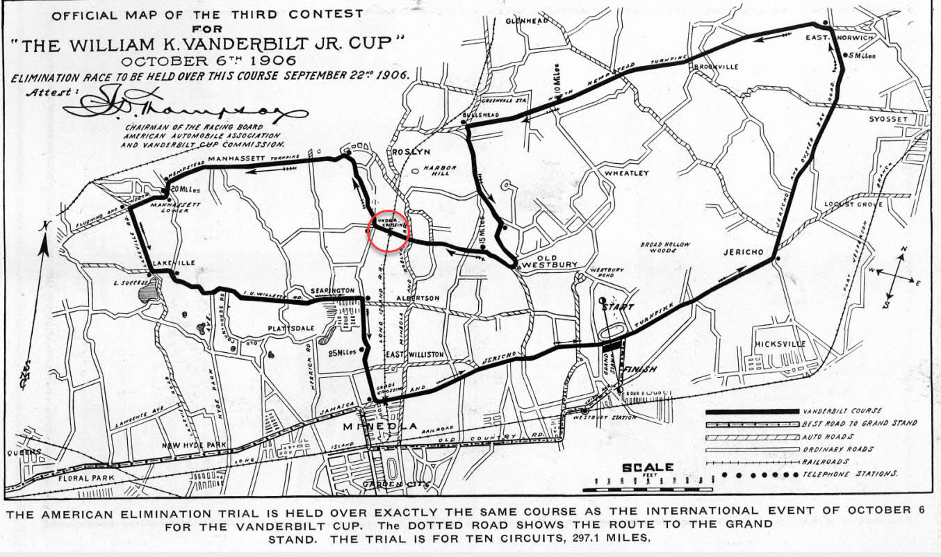
Art, Yes, the Nassau Light and Power Company moved to Glenwood Landing in the spring of 1904 but they retained the property in Roslyn. Today, at the south east corner of Willis Ave. and the South Service Rd. of the LIE is the National Grid complex that stretches east ward to the LIRR. This is whats left of what was originally the Roslyn Light and Power property which, prior to the construction of the LIE, stretched northward all the way to today’s Power House Rd. Prior to the building of the LIE, that section of the roadway from Roslyn Rd. west to Shelter Rock Rd. was generally referred to as Power House Rd. Today Power House Rd. stretches from Roslyn Rd. west ward to Mineola Ave. East of Mineola Ave. it becomes Old Power House Rd. and continues west ward beyond the split at the beginning of the north service rd of the LIE. The last couple hundred feet is unpaved, reaching to Christopher Morley Park.
What hath I wrought? And I thought I knew this area! Thanks, Al et al. Something’s still missing, though. There’s that Browers Lane/PHR sign on my Odd Streets page <http://sbiii.com/oddstrts.html>, it’s on the SOUTH side of the LIE (the South Service Road). PHR *IS* the north side of the RL&P/NL&P/LILCO/NG property. By “stretching northward all the way”, Al, did you mean across the LIE to the North Service Road? ‘Tis a puzzlement. Sam, III
What hath I wrought? And I thought I knew this area! Thanks, Al et al. Something’s still missing, though. There’s that Browers Lane/PHR sign on my Odd Streets page <http://sbiii.com/oddstrts.html>, it’s on the SOUTH side of the LIE (the South Service Road). PHR *IS* the north side of the RL&P/NL&P/LILCO/NG property. By “stretching northward all the way”, Al, did you mean across the LIE to the North Service Road? ‘Tis a puzzlement. Brian’s maps don’t blow up well. Any hope for higher resolution? Sam, III
Sam, Yep, The Roslyn Light and Power Company northern boundary was Power House Rd. (by the way, right after the LIE was built, some maps show the south service road also as Power House Rd.) With regard to Brower Lane, before the LIE was built access to that road was from Power House Rd. and also Garfield Place.. Today Garfield Pl. exists only north of the LIE.
The 1926 map below shows the original route of Powerhouse Rd, exists today as Al explains above. I can now see that Nassau Power & Lights property expanded over the LIE, larger than the utilities property today.
The 1950 map also shows the original route of Powerhouse Rd, but also the road that branches off W/O Mineola Ave, then runs parallel with Northern State Pkwy; and joins with Powerhouse Rd at the lower left corner of the map. This newer branch is now the S Service Rd/Powerhouse Rd of the LIE.
I marked these aerials as clear as I could.
Sam, Regarding your Browers Lane /Power House Rd. street sign, ( on the south service rd. of the LIE, between Willis Ave. and Searingtown Rd.), that one is gone. BUT ....it has been replaced with another with the exact same designation. So, Power House Rd. still exists west of/Willis Ave. but only up to Searingtown Rd. Not only that, the south service rd. of the LIE, between Willis Ave. and Roslyn Rd., is also designated Power House Rd., just like the North Service Rd. That has to lead to some confusion as neither of the two roadways is designated North or South!
A similar photo from The Motor Way of September 20, 1906 showing the power plant which in this photo is called the “Mineola Light and Power Plant”. Anybody want to comment on the significance of the dragon guarding the cup?
Art, In September 1906 the Dragon Automobile Company was organized…... Maybe ?