Sam and Dave’s “Excellent 2019 Vanderbilt Day”- #2 Manhasset Hills
Our favorite Motor Parkway father and son team Dave and Sammy Russo journeyed once again on their bikes to explore our favorite parkway from Lake Success to Melville. In the second of our new series, Sammy and Dave explored the Manhasset Hills section of the Motor Parkway including one of two remaining extant bridges in Nassau County.
The Russo series helps to document the current condition of the Motor Parkway and uncovers several new surprises. Great job!
Enjoy,
Howard Kroplick
2019 Vanderbilt Day
March 30, 2019
Dave Russo
So we did it yesterday. After a one year hiatus, Sam and I resumed our annual Vanderbilt Day tradition.
What better starting point than the Deepdale Mansion in Lake Success, William K. Vanderbilt, Jr.'s residence in the early 1900s. The home is still standing, just steps off of the Motor Parkway. I'm sure not by coincidence.
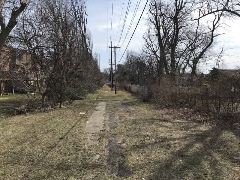
Moving west to east as always, we traveled 18 miles by bike from Lake Success to the Maxess Road Bridge in Melville We had a great time!
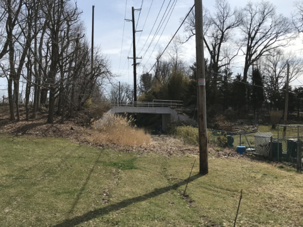
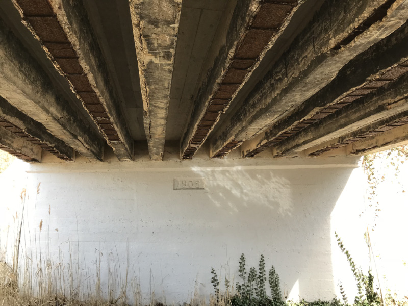
Moving on....to New Hyde Park Road bridge we go......
This wall still holds on the east embankment of the bridge.
Hi Brian...I miss You!
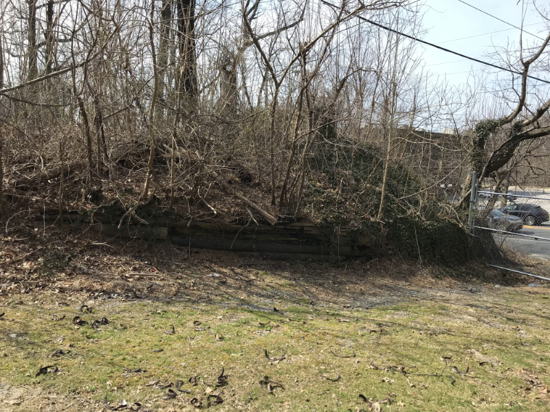
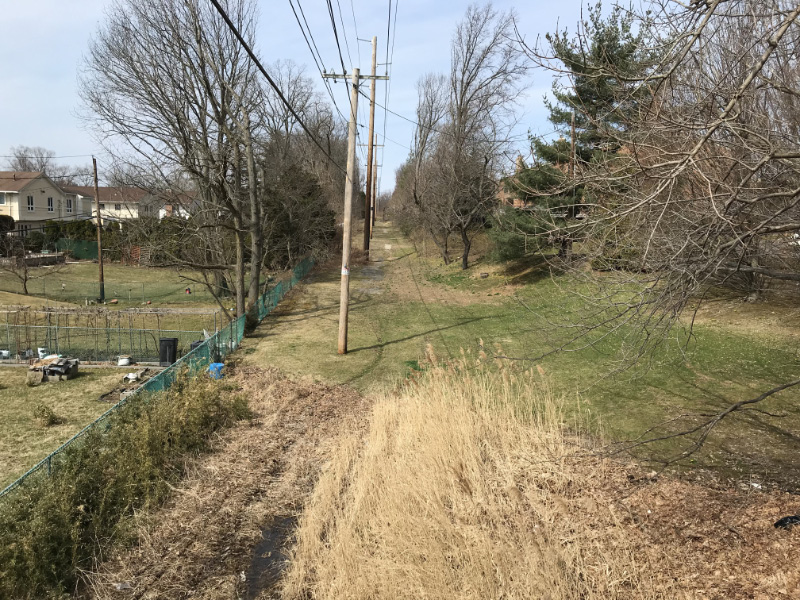
Heading east from New Hyde Park Road bridge - condominium association on the north side and nobody knows about the history right next to them.Those concrete extension pieces are hard to get rid of!

The landmark nobody in Nassau County knows about
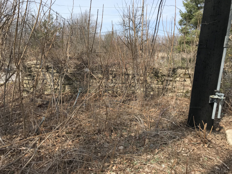
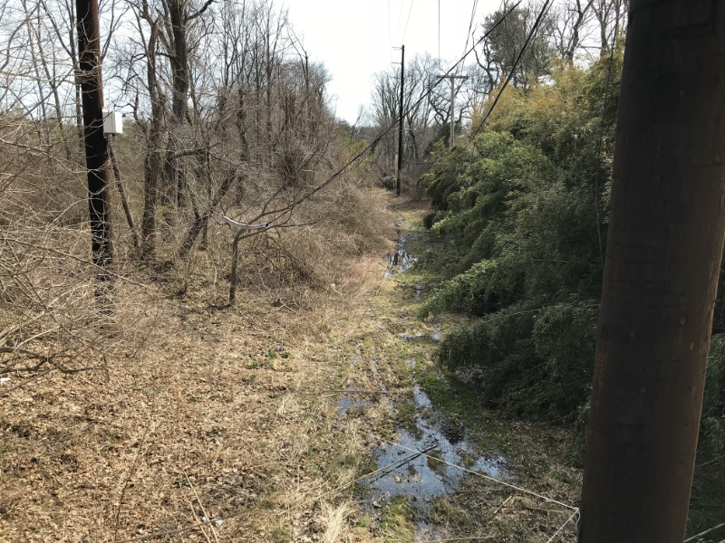
Knock on wood....the graffiti monsters haven't come back here in a while - maybe because it is always super wet down here
1
On top of bridge looking west
On top of bridge looking east
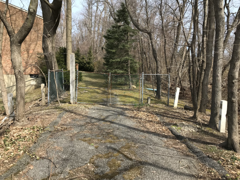
Former entrance into an estate north of the bridge from what a local resident tells me - when this person was a child in the 70's he tells me the mansion was abandoned and it was a popular hang out spot! You can see the gate posts on each side.
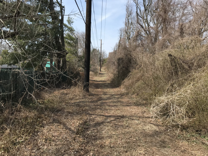
Back on the LIMP - heading east
Video depicting my personal favorite stretch of LIMP
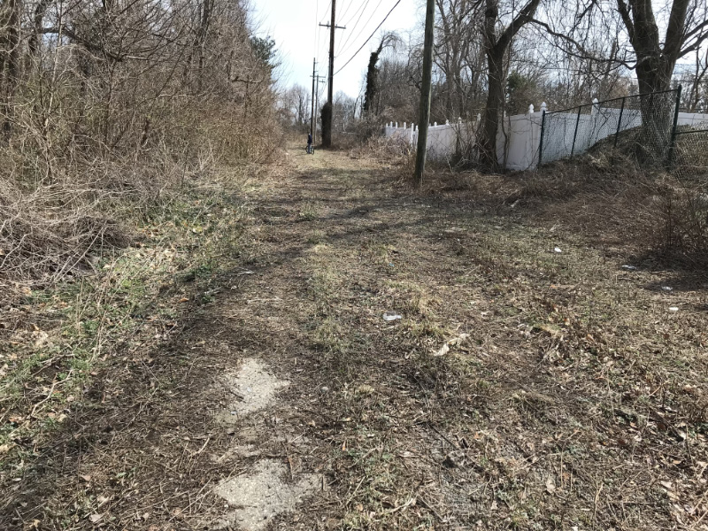
More
Road fragments
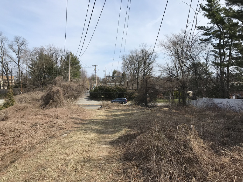
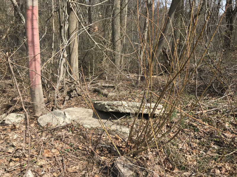
On the bridge embankment, approaching Shelter Rock Road


Comments
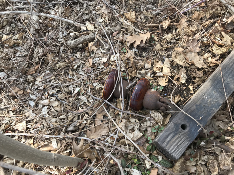
Lol’s, Dave. Those insulators will be there for years to come. Flooding beneath that bridge must have always been an issue. Remember large gravel being laid there by LIPA, but it’s never ending. Just realized your image with the gates is the ‘north dead end’ of Old Courthouse Rd ( which continued north to IU Willets Rd in the far past ). Nice job with your youtube video!
Great update shots of the LIMP Sam and Dave! I’ve yet to see that fence north of the OCR bridge but yes, Old Courthouse Road once terminated northward at I.U. Willets Road. Beyond that fence I believe it’s now backyards on private property. But there is a section north of these properties that is barren, likely NSP property. begging for exploration. I’ve added this to the “To Do List”.
Frank—it’s easy to get back there. I’ve never done it because I assumed the new development there surely took away any remnants of the old house. Use your map skills and lay out the old house vs the development now and if you think it’s worth pursuing I’ll get on over there and check it out. This house was not on the “estate” level so was never on my radar in that regard either. Let me know if for worth looking at. Send me link as to where house was vs development.
This section of LIMP is the best. You can just look around, take a breath and just imagine it’s a century earlier and you are on the parkway rolling on back to your Gold Coast estate.
Always so glad when Motor Parkway season comes around each year. Really appreciate the great efforts of Sam and Dave. Just warms my heart to see the pics and video. I get that “wish you were here moment.” From Michigan, many thanks.
Raining on your excellent parade! The bridge is the only one remaining in Nassau that goes OVER the LIMP; the Old Bethpage Village bridge is also in Nassau (but goes UNDER the LIMP). Sam, III
Dave - The mansion was included on the online map here
https://www.google.com/maps/d/viewer?mid=1396j0_672hYkvbcNFJInbc1mXNJspD9f&ll=40.764558695284585,-73.68657189047963&z=19
Built sometime between 1926-1950, the mansion was once located exactly where the new apartments are today. Most definitely the builders wiped the slate clean of any remnants. You could’ve easily fit 5 of the new units inside the building. At the time there were no neighbors around anywhere in this quiet little corner surrounded by the NSP, OCR, NHP Rd, and the LIMP. This homeowner had a REAL private property.
I’m interested in exploring the old OCR RoW indicated by the arrows. Let me know if you’re heading there, I’ll try to join, maybe others too
Not sure if the homeowner owned all the property in this corner but the area within these constraints is approx 18 acres. I believe he did own it all being the sole occupant
We had a gathering at the Old Courthouse Road bridge a few years ago, and I thought that a “security camera” had been placed on the pole just to the west of the bridge, to discourage graffiti artists. I do not see it in the photo here.
Update: As per Sam III’s correction, the Old Courthouse Road Bridge is one of two remaining extant bridges in Nassau County,
Maureen—our pleasure! New York is stressful but there is history here which I too will miss one day when I move, hopefully, if Sam permits me! But I’m going south, not north!
Frank—thanks for the overlay. So it seems clear there are no remnants of the house but the road is worth investigating one day. I know it runs behind the condos for a bit beyond my pic but I’ll wait until the winter to investigate as we are now in weed grow season and the thickets are back as my legs can attest to.
Maureen - An aerial photo of Melville containing your home surfaced a few months ago. This photo was taken when it served as the Motor Parkway Huntington Lodge. Not sure if you’ve seen it but will send to Howard to post here. You can zoom in by clicking on the photo. Will also send an aerial containing your neighbor Edith’s home just south of Ruland Road. Thanks for the memories of revealing the lodge. It was an exciting time not to be forgotten!
Dave - You’re welcome. It was definitely worth the try!
The estate mentioned in several previous posts was Brookwood, the residence of Henry Miller Minton. It was designed by Thomas H. Ellet c. 1929 in North Hills. Minton was chairman and president of Church & Dwight Co., the company behind Arm & Hammer Baking Soda.
I had a classmate in the Herricks School District who lived on the corner of Executive Drive at the Old Courthouse Road/VPM Bridge. My classmate sister was friends with a family member who lived on the estate. The family of the estate gave my classmate sister a number of first edition books from their library.
The timeline for this was in the mid 1960s. I was a caddie at the Links GC during this time period. The estate was not visible in the area closest to the golf course along the 14th fairway. When the property was developed around 1976-1977 some of the townhouses were adjacent to the golf course property line. Those owners had a terrific view of that fairway.
Attached are a couple of pictures of Brookwood.
And one more image.