Sam & Dave’s Excellent “Lost” Motor Parkway Adventure V: The Motor Parkway East of Roslyn Road
In the fourth post of the "Lost" series, Dave Russo and his 11-year old son Sammy explore the Motor Parkway wilderness hidden east of Roslyn Road in East Williston.
Enjoy,
Howard Kroplick
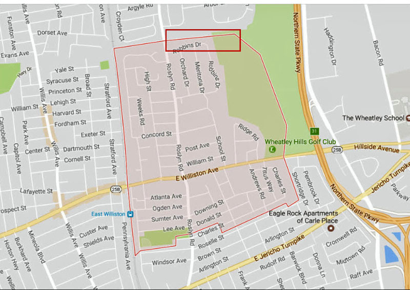
In our quest for most "lost Motor Parkway" one spot that always stuck in our minds was the area just east of the Roslyn Road Bridge. There is a house that sits just east of the former bridge on Roslyn Road. Proceeding east you come to the site of the former Robin Lane Parkway Bridge. This is a map of the exploration area.
Howard Kroplick Note: East Williston's northern and eastern borders were the route of the Motor Parkway.
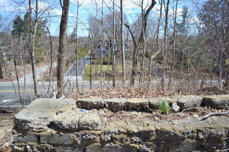
From the top of the Roslyn Road Bridge embankment looking over Roslyn Road, you see the house just to the east.
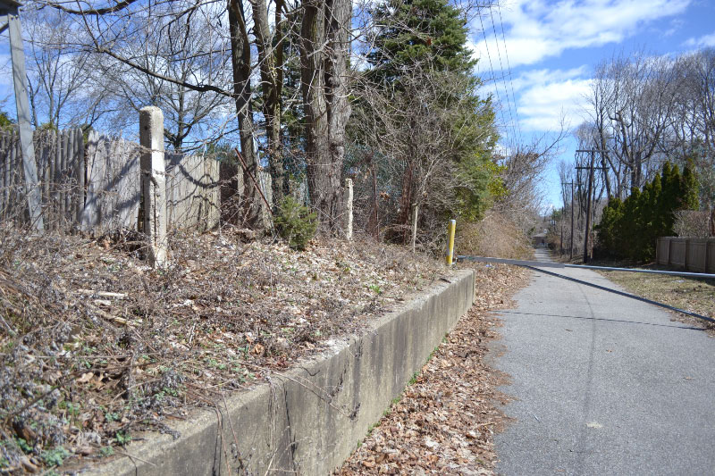
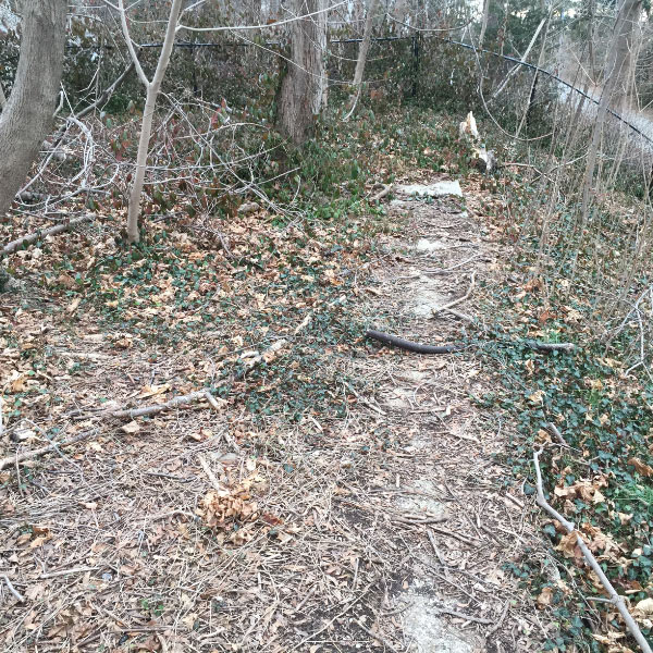
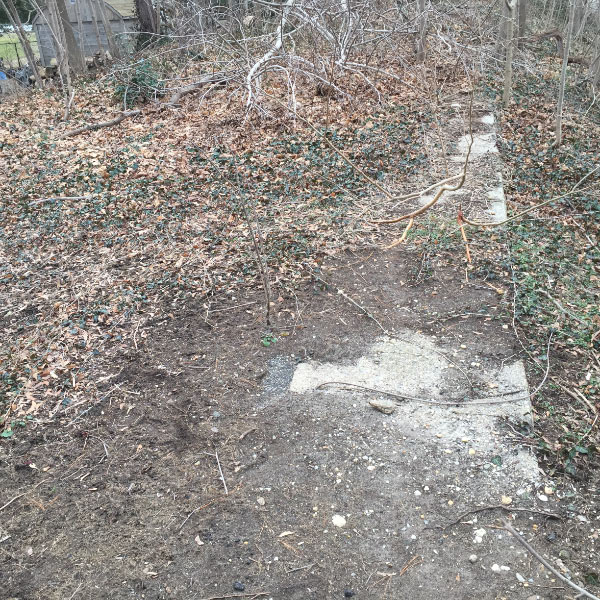
Most of us are aware of this side road lined with posts leading up to the town water district site.
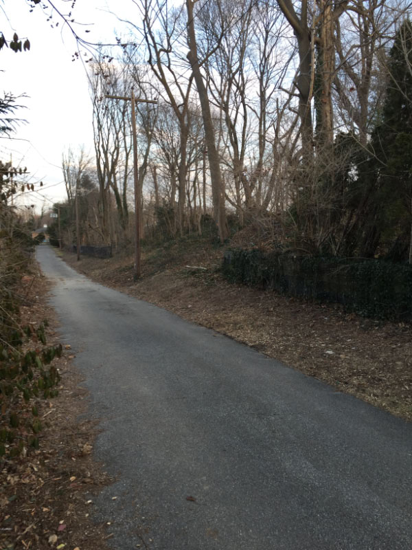
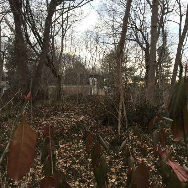
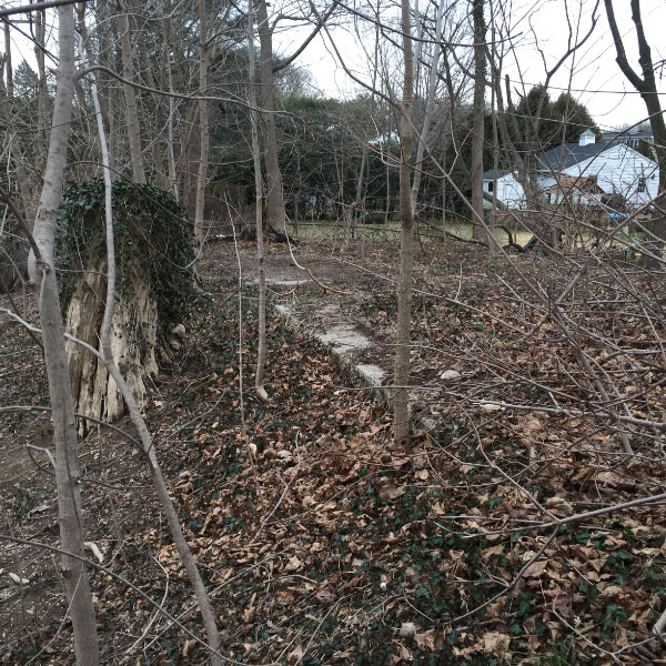
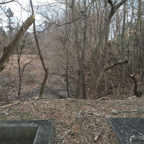
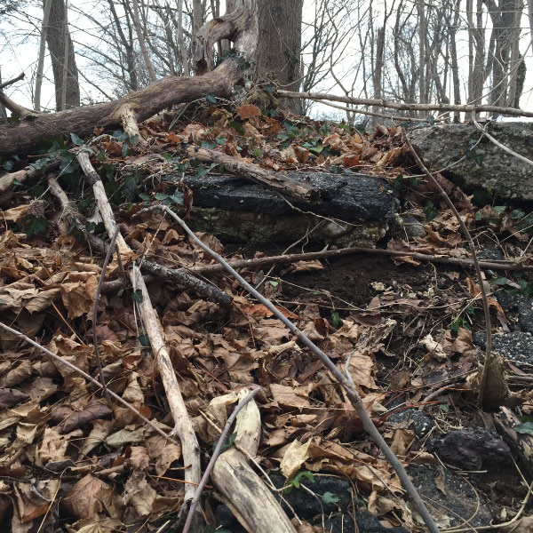
Looking east on this road, behind the house on Roslyn Road, you can see the former LIMP bridge location, and you can see that the area is still elevated. We had gone up here in the past and found nothing. As much as I hate winter, the only good thing about it is the vegetation dies down quite a bit making "woods exploring" much easier.
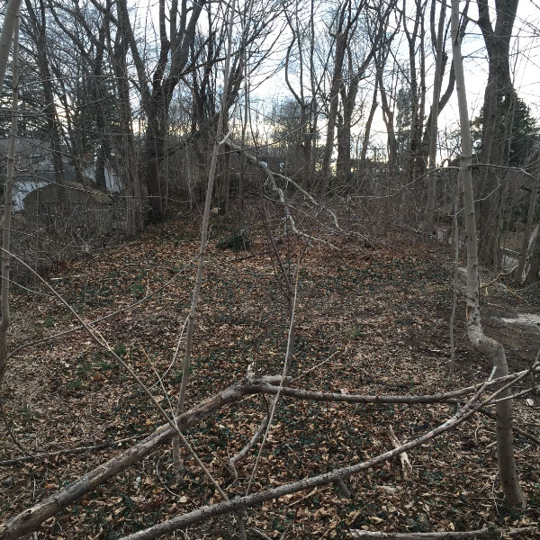
At the top of the former bridge location looking east, this is the view.
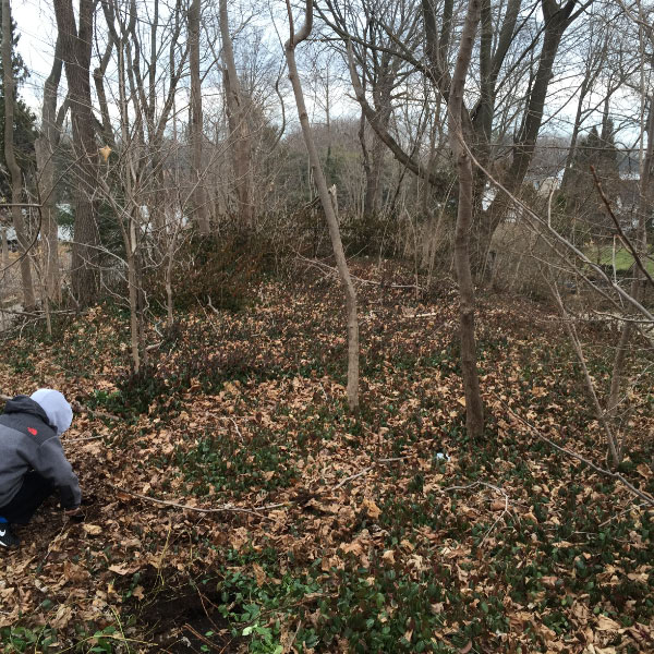
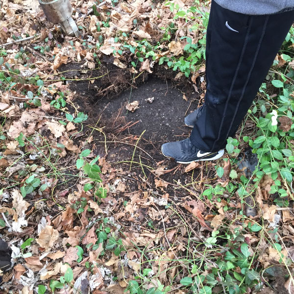
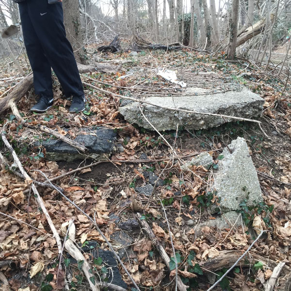
We started just east of the house on Roslyn Road. We started to dig a bit. We first wanted to see if there were any abutment pieces remaining.
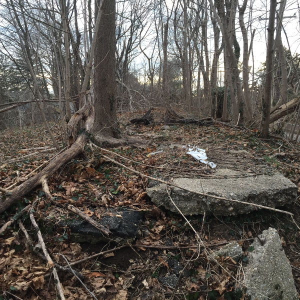
We could not find any but at the top of the slope we saw our first piece of LIMP.
This is the location looking west back towards the house. As you can see the weeds are quite thick.
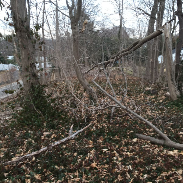
Looking east.
We picked a random spot and dug. The road is absolutely there, throughout the entire stretch.
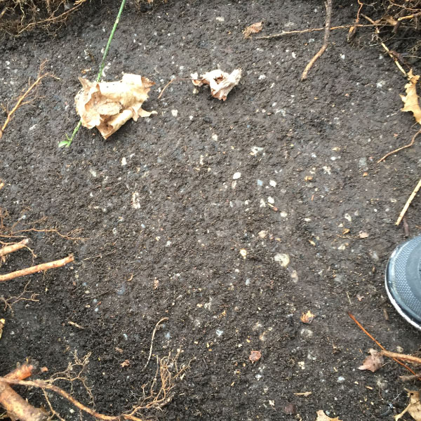
A close-up of our road piece.
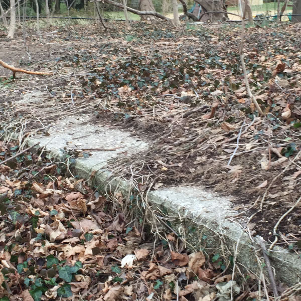
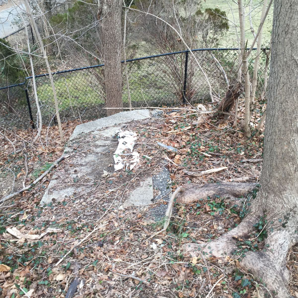
As we looked up the slope again we noticed a very visible piece of concrete extension.
It is clear to us that from the point behind the Roslyn Road house to the water station, the entire road and concrete extensions are there and in perfect tact.
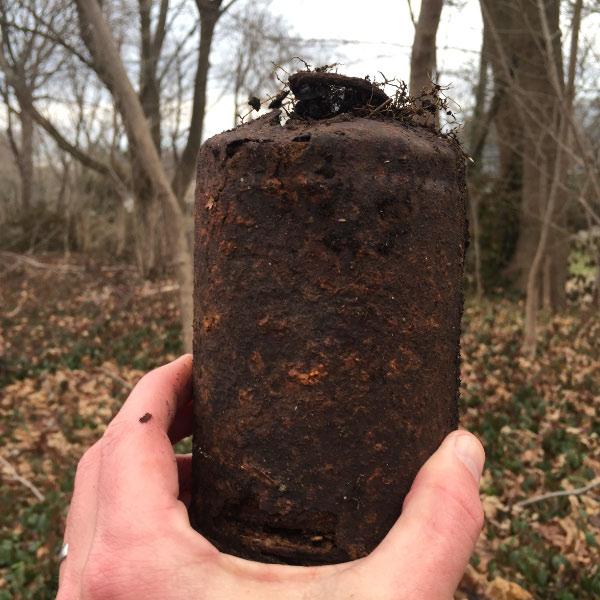
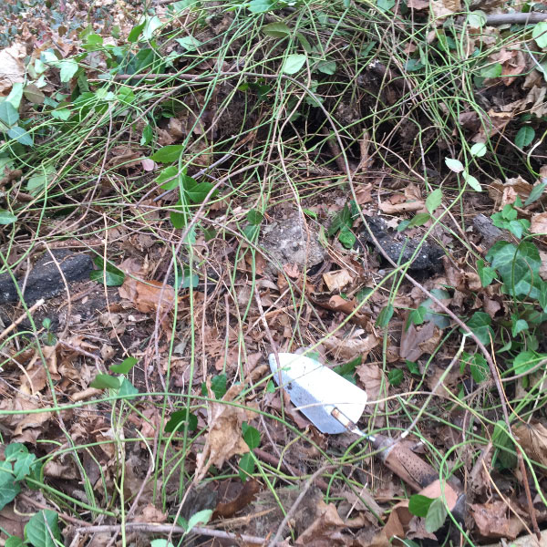
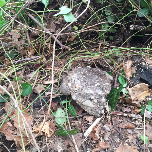
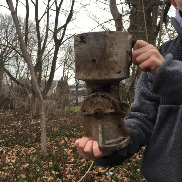
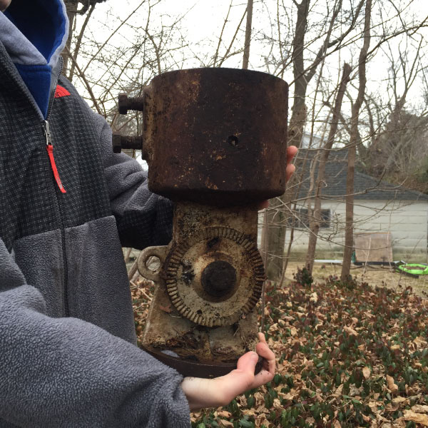
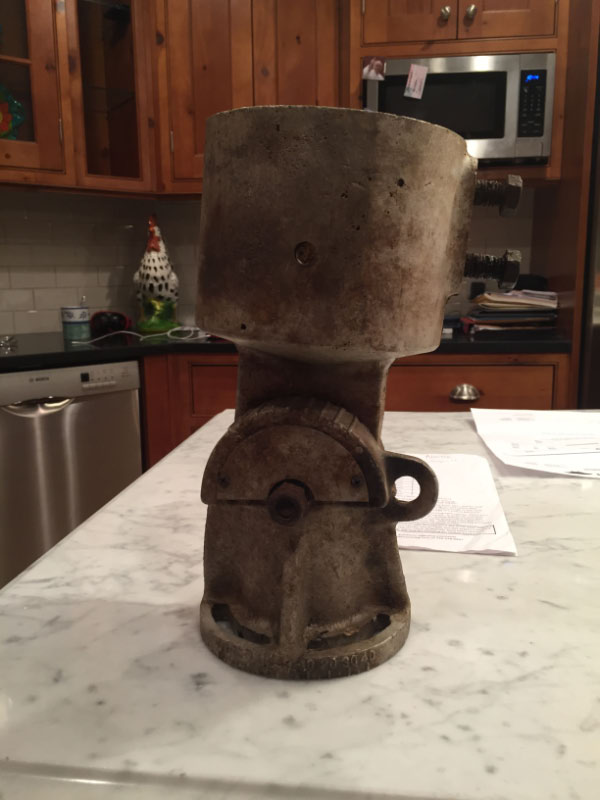
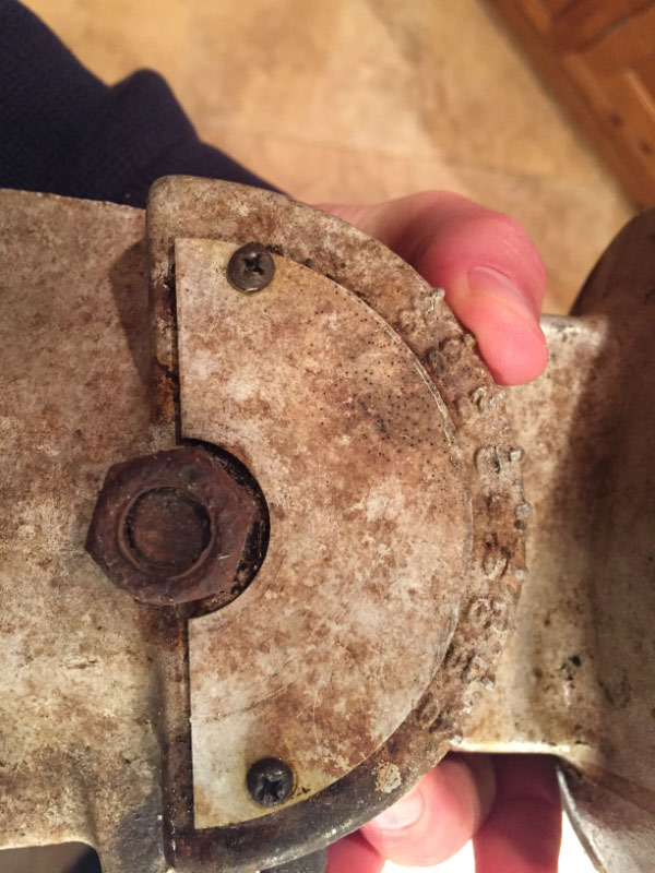
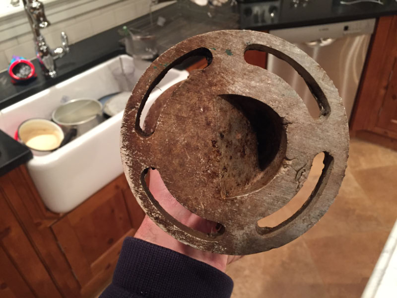
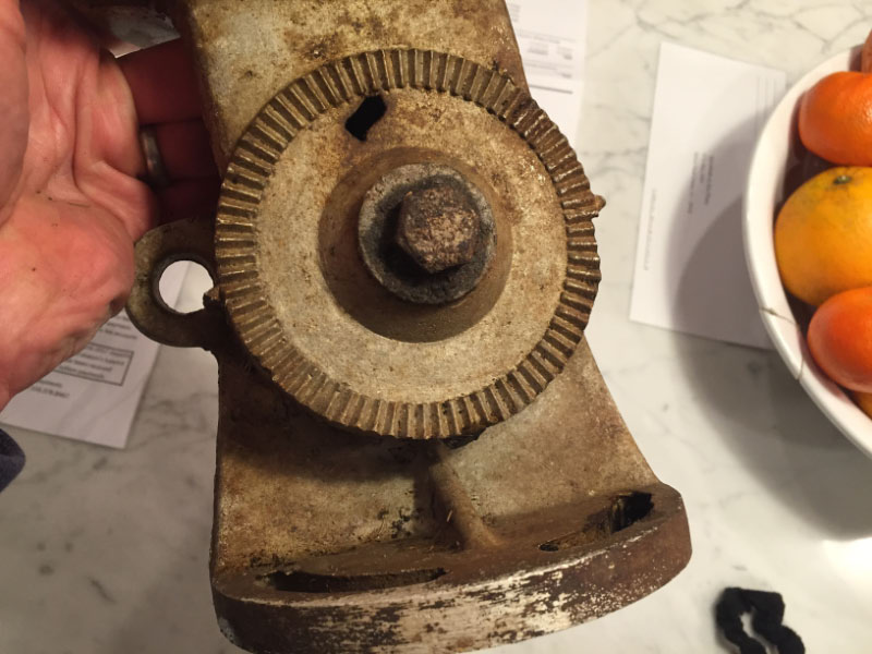
In this same area, under the weeds, we uncovered two artifacts. Perhaps someone can shed some light on these?
Update : February 14, 2017
Maybe this will help shed light on the artifact in question.
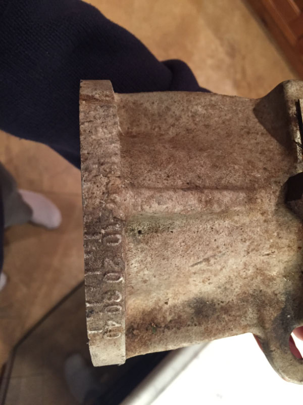
On one side there are two locations where there are numerical inscriptions: 0, 10, 20, 30, 40. Goes both ways, left and right.
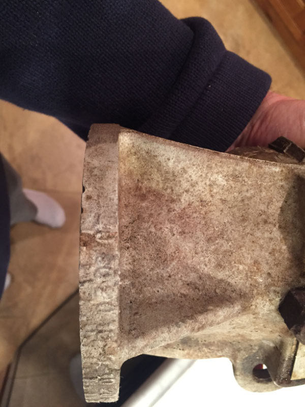
Finally, some asked to see top and bottom and I included a close up of the other side (no numbers on this side).
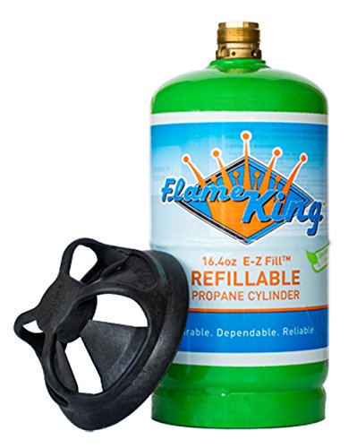
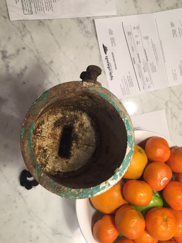
Gary Hammond: Can't prove it, but the mystery object reminds me of a small propane tank/bottle - measures about 8"x4" diameter (see attached photo). Note the rounded shoulders, and the "creases" around the top & base areas. The # 2 object is obviously part of something else - any markings, top & bottom views, dimensions, etc. would have helped the ID process. Interesting finds!
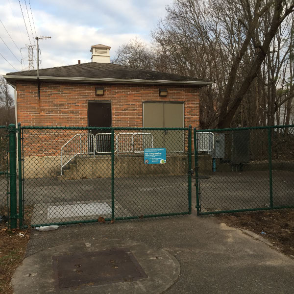
The fun ends at the water station at the end of the "entrance road".
And then you see there is a sump built which eliminated the LIMP in this location.
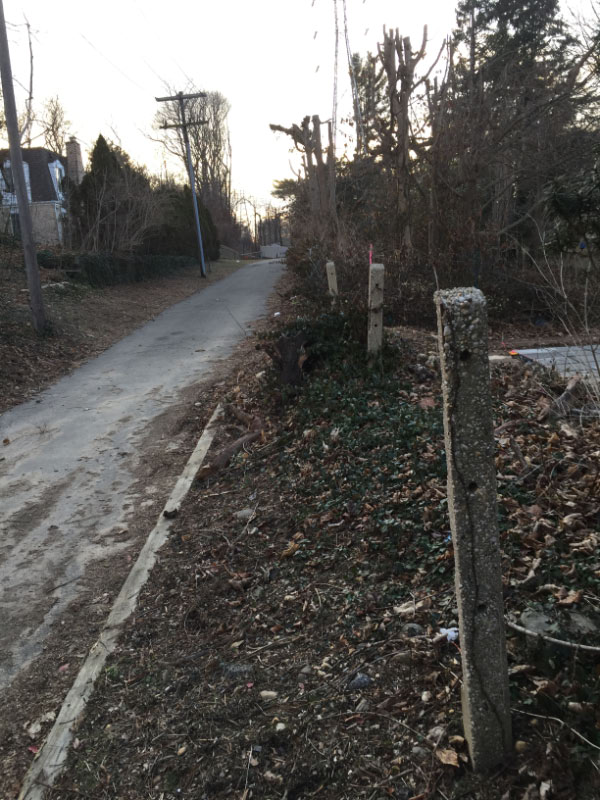
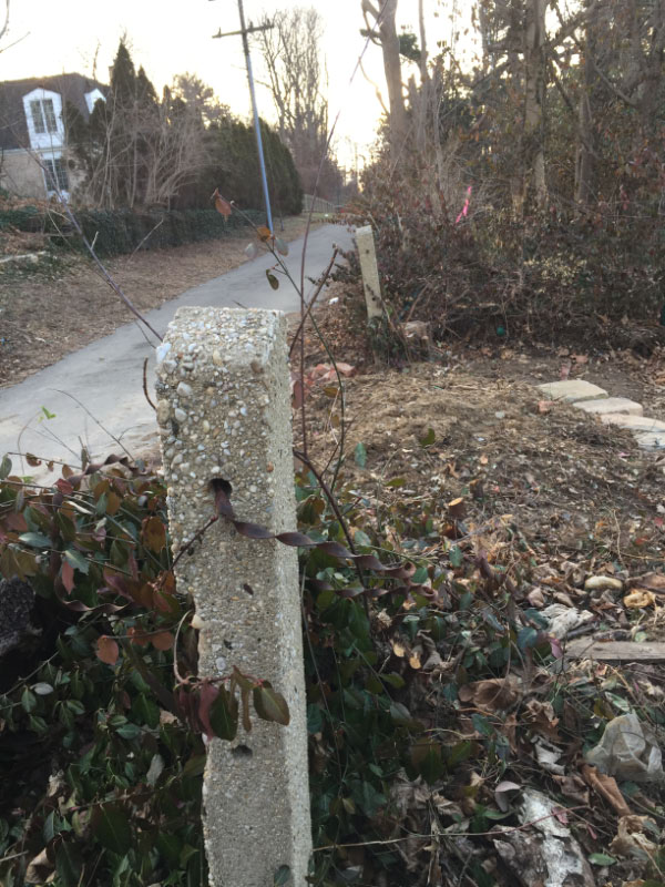
Heading back west on the "entrance road" you can see many posts still remain, including one with original connector cable in it!
A great find!
I saw the old pictures of when Al and you cleaned up the LIMP from the Roslyn Road bridge heading west. This portion east of Roslyn Road could be restored in the exact same way. The LIMP is there, in perfect form under the weeds.


Comments
Sam & Dave…try beginning your next exploration off of Executive Drive. There is an Old Courthouse Road listed on modern maps where an existing bridge over the old MP still exists…you can begin here and progress all the way to where you ended up in this post. Great job documenting the remaining history, guys!
I remember playing over there, and exploring as a kid. Back in the late 1970’s. The East side of Roslyn Road, before they built the house, looked much like the west side. With a waist high stone wall built across the road. The area was a gradual downhill, down to the sump, and the back entrance of WHGC. We used to laugh as kids. Because someone put up a sign near the side road to the water district that said “missile silos.”
great work, I think you found transmission parts. Enjoy the series very much
Gram and I can’t wait to hear about observations on the artifacts. This was one of OUR favorite sections of the roadway!
The LIMP is still very evident east past the sump on the Golf Course before it turned south through same. Much of the original road with extensions are used by the Golf Course for maintenance vehicles.
Meant to say when “all of you” cleaned the parkway west of Roslyn Road. Not Al and you.
This was a great find. Very exciting to realize the full LIMP remains under this brush.
Two questions:
1) This road that leads to the water station with the posts lining it….do we think this might have been an entrance/exit ramp? Or was this made after just to access the water station? It just seems odd that the posts align this road perfectly.
2) this portion of the LIMP, who do we think owns this property? Would this just be part of the backyard of those that live to the south of this? Would this be part of the water station property?
Brian I await you analysis of the mystery pieces. I can tell you they were deeply buried. The power lines are not directly above this location so I’m actually hoping you don’t know what this is and it could be something good!
Hate to be a spoil-sport but I remember a blistering lecture on private property delivered in 1999 so by a very-irate homeowner of the north side of Robbins Drive who claimed that he and his neighbors had BOUGHT the RoW to extend their back yards. Other than that caveat, nothing seems to have changed in there in all these years; for 1999, see <http://sbiii.com/limpkwy2.html#RoslynRd>! Thanks again, Sam and Dave! Sam, III (the much older one)
You know I’ve been thinking about the 2nd apparatus, Dave. The first piece looks like a rusted propane tank for a Coleman camping stove?
Did you and Sam find these near the area where it looks like a house was demolished? Frank and I were in this area where the driveway leads to the Water District last Fall. I remember a house was there in the past ( Small basketball court ).
Lots of eyes here, someone must know what the 2nd apparatus is.
That one pc you are holding may have been for a gate at the entrance???
Dave and Sammy were incredibly persistent in uncovering remnants of the LIMP. Congrats to them both.
Rog
Great job as suburban explorers. You must be very lucky. Almost every time I’ve been to that area I get yelled at by somebody: cop, adjacent property owner, or random dog walker.
Deeply buried? I thought you and Sam just came across these objects. Metal detecting, that’s dedication. You recall my email. With those 2 bolts on the side, and the round shape; I’m envisioning a pipe entering the top. And then tightening the bolts enough to secure a pipe. Does the base have holes? If so, then bolts likely secured the base to whatever structure. The one side has a cogwheel? The opposite side has like a half cog. The cogs obviously served a purpose. I’ll try my best, but hoping more experienced eyes here can help identify. BDM
Eric—after the sump heading east there is one house and then the golf course. Using Bing Maps birds eye I can see the golf cart path there but it doesn’t appear to have the extensions or be very wide. Do you have pics you can send? We might have to investigate this one.
Brian—both of the relics were found on the elevated LIMP just east of the house on Roslyn road, very deep in the weeds. I’m sure these things haven’t been touched in a very long time. There was no house at this location, ever. Or any of the portion of LIMP that is related to this post.
Sam III—-two years ago Sam (mine) and I were at this location and one of the homeowners came out and met us as well. He was quite nice however and we talked history for a bit. He knew nothing of the history of his backyard, if it is in fact his land. He didn’t discuss that, more interested in what the heck we were doing! It is fenced in on both sides and elevated. Nobody goes in here. Even the kids haven’t figured this one out yet, no beer cans were observed.
Nature has taken this great spot over but it is all there to recover should that ever be an option.
Interesting adventure. Funny that when I delivered mail on Robbins Lane never thought about the east side of Roslyn Rd. I also think that second remnant could be connected to a gate. Good stuff. Bob
My wife grew up in Williston Park on Yale St., and the ROW was behind her back yard (also behind her aunt’s, uncle’s and great-grandmother’s house over near Sigsbee Avenue). At that time (late 1940s-1950s), the bridge over the LIRR was still intact, and she used to use it to go visit friends in East Williston.
Not sure about both artifacts but the first one does resemble a 1lb propane tank in comparison to Sammy’s hand size. The second with the large set bolts as Brian noted, is to accommodate and lock a large pole/rod, that also has an adjustable gear to angle into any position as needed, also with the holed base to mount onto a pole. The closest I can come to resemblance is an over sized, adjustable flag pole bracket. Unlikely though.
I just sent Howard some more detailed pics of object #2. There are numerical inscriptions on there: 0, 10, 20, 30, 40 at two locations in two directions each. Maybe this will help someone recognize it.
Brian—no metal detector. Not that crazy yet! I do plan to do that when I retire one day. I have several Gold Coast locations in mind to detect.
When we were digging just east of the house in the first location, we simply dug these items up. We sort of felt item #1 was nothing special, a glorified can of sorts, we left that one there on site. But item #2 was pretty unique so we took that one with hopes that it was unique in some LIMP way. It sort of looked like a trophy when we pulled it out!
Nobody has commented on whether or not this “ramp” leading to the water station was perhaps a LIMP enter/exit ramp? I defer to the masters Howard and Al for some input? Is it possible? It just seems that this “ramp” is aligned perfectly with the existing posts which I guess is possible if the town people built the road and they just maintained the posts and left them alone? Or was this perhaps an entry or exit ramp?
________________________________________
Howard Kroplick:
Dave, it is likely this road was built after the Motor Parkway closed in 1938 in order to reach the pump station. The road was built within the right-of-way of the Motor Parkway with the posts marking the northern boundary,
New pictures of object #2 are posted above. There are numerical inscriptions on there. Hoping someone can figure this out!
The first item you found definitely looks like a disposable propane tank. The other item looks like it could be a part from a well drilling rig being you found it near the water station. Those numbers 0-40 could be degrees of angle. The round flange with slotted holes meant it could be rotated on it’s mounting. The “cup” with the two set screws meant a large diameter steel pipe went in it. I believe there is a piece missing though. That part would have serrations to match the serrations on the piece you have. The bolt in the middle would have held them together, being able to adjust another angle.
Thanks for posting the additional photos of the mystery apparatus, Dave. Still don’t know what it is.
* It was definitely bolted vertically at the base. I now see there’s not drilled out holes, but 4 openings that would allow for maneuvering. The numbers are maybe like degrees, they seem to be in line with the openings.
* With the rectangular cutout at the bottom, whatever bar that was inserted was formed with a rectangular end. Seeing this ensures the bar is secured, the bolts would be tightened to the bar as an extra measure.
* Quoting Frank, the top rounded piece is designed to be adjusted ( You’d probably have to let this contraption sit in a bucket of WD-40 for a week to get any parts moving again )
Whatever this is, it appears heavy duty. If your on Facebook, post it so the whole world can see. Someone knows what it’s purpose is/was.
Dave, a 1938 aerial (attached above) shows no access ramp there, but visible right across Roslyn Rd on the other side is the Roslyn Lodge access ramp.
Brian, Dave - That contraption will need some serious anti-freezing penetrant like liquid wrench for a few months :D
It’s definitely heavy equipment.
Another possibility, this could be an attachment for a supporting pole that are sometimes seen mounted on sidewalks (usually at a location that midly obstructs pedestrian right of way), that help stabilize the larger utility pole. Heavy cables are also used with this method of support.
Old school Pole Plate for Sidewalk Guying.
Dave,
Photo #4 (update 2/14) shows what appears to be markings including “USA” - can this be cleaned up any better without wearing down the embossed markings - might give a clue to maker or location made. Of course this just might be wishful thinking!
Gary, no USA inscription on there. Just the numbers in both directions. I was just hoping this thing was somehow LIMP related. It seems like it’s not. I don’t really see how you could stick pipes in there as the bottom is not open. In fact when you look in there it almost looks like you put money in their, coins, and that would make sense with the number inscriptions. We were hoping it was some kind of primitive toll collection device. But I doubt it.
At the end of the day this section of LIMP was a great little discovery. I like these forgotten locations, undisturbed. History that will always be there for those who seek it out.