Then & Now: The Botto Farmway Bridge in Bethpage State Park
When the 48 miles of the Motor Parkway were completed in the late 1920s, a total of 65 bridges had been built over and under the parkway. Most of the bridges were used to avoid intersections of major roads. However, many of the bridges were built to connect adjoining properties and farms. These "farmway" bridges were part of the negotiations when the Long Island Motor Parkway, Inc. purchased the right-of way. One of the farmway bridges connected the east and west sections of the Botto farm located in Old Bethpage, now the north section of Bethpage State Park.
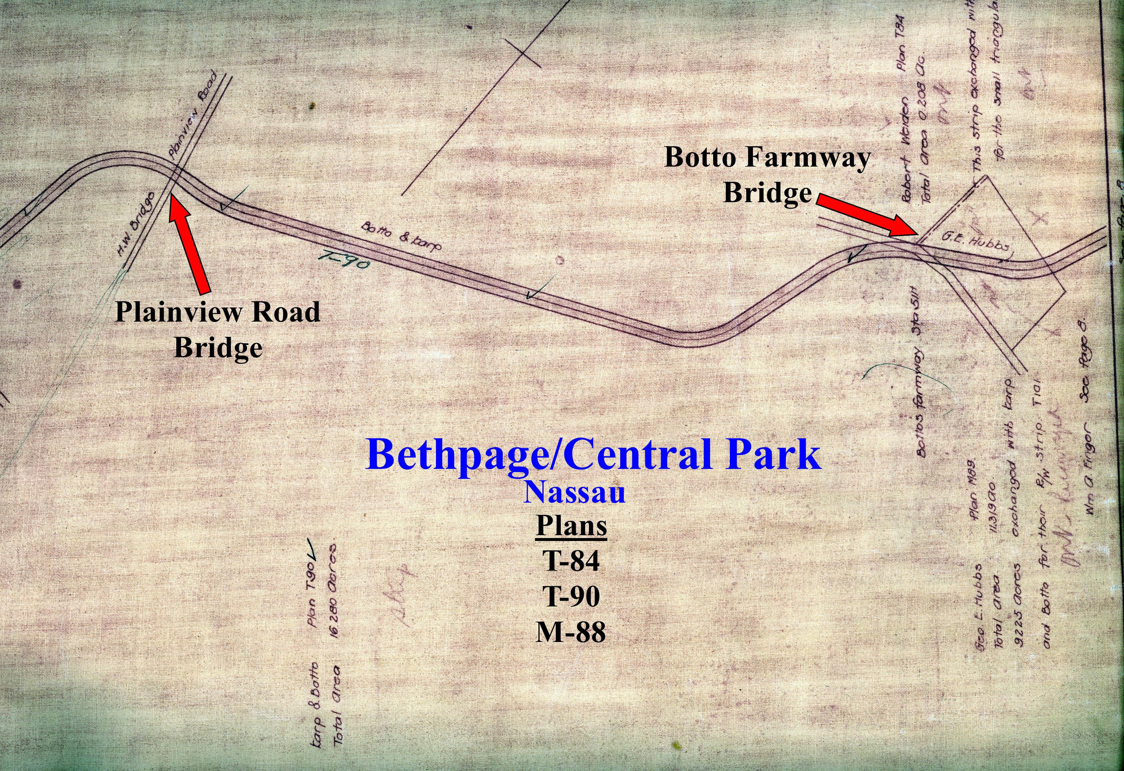
The 1928 Motor Parkway Atlas shows the planned bridge connecting the Botto farm.
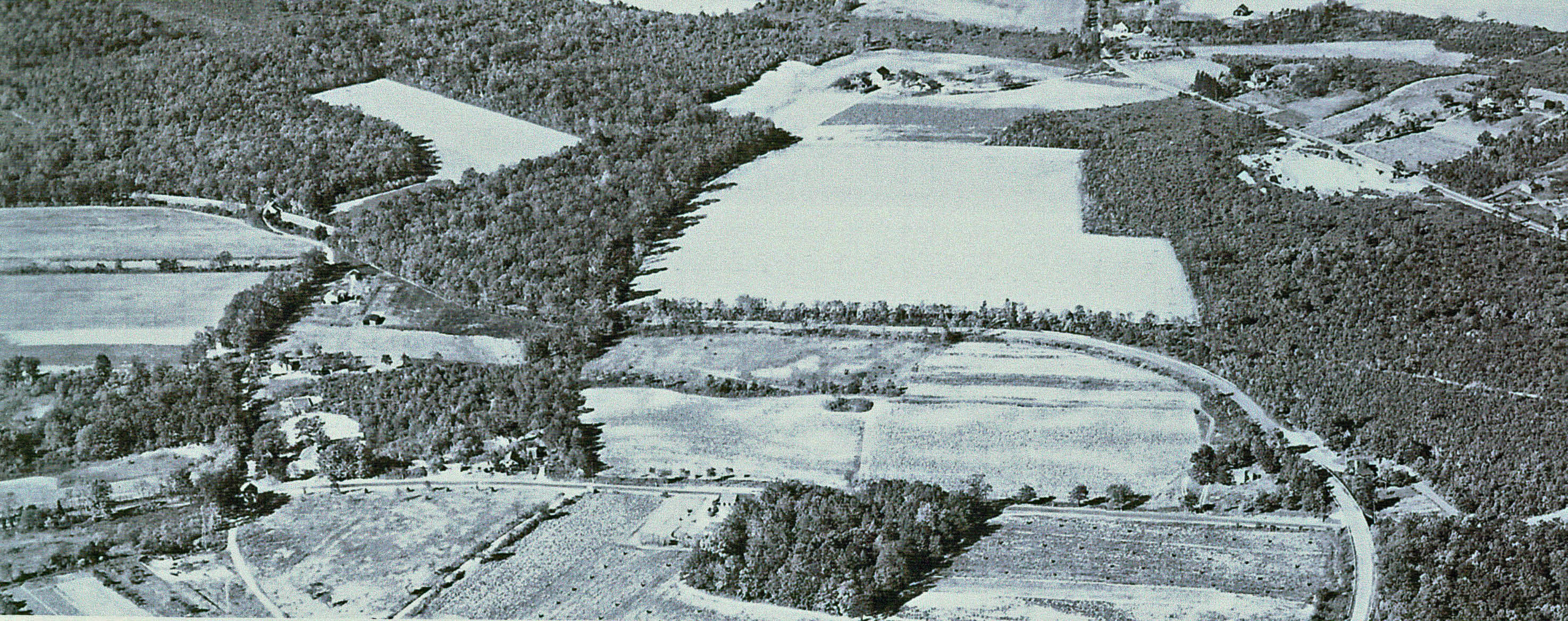
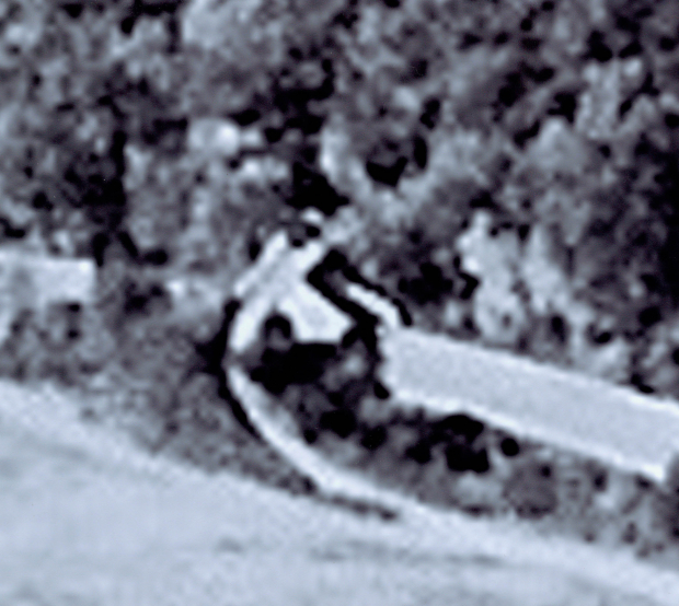
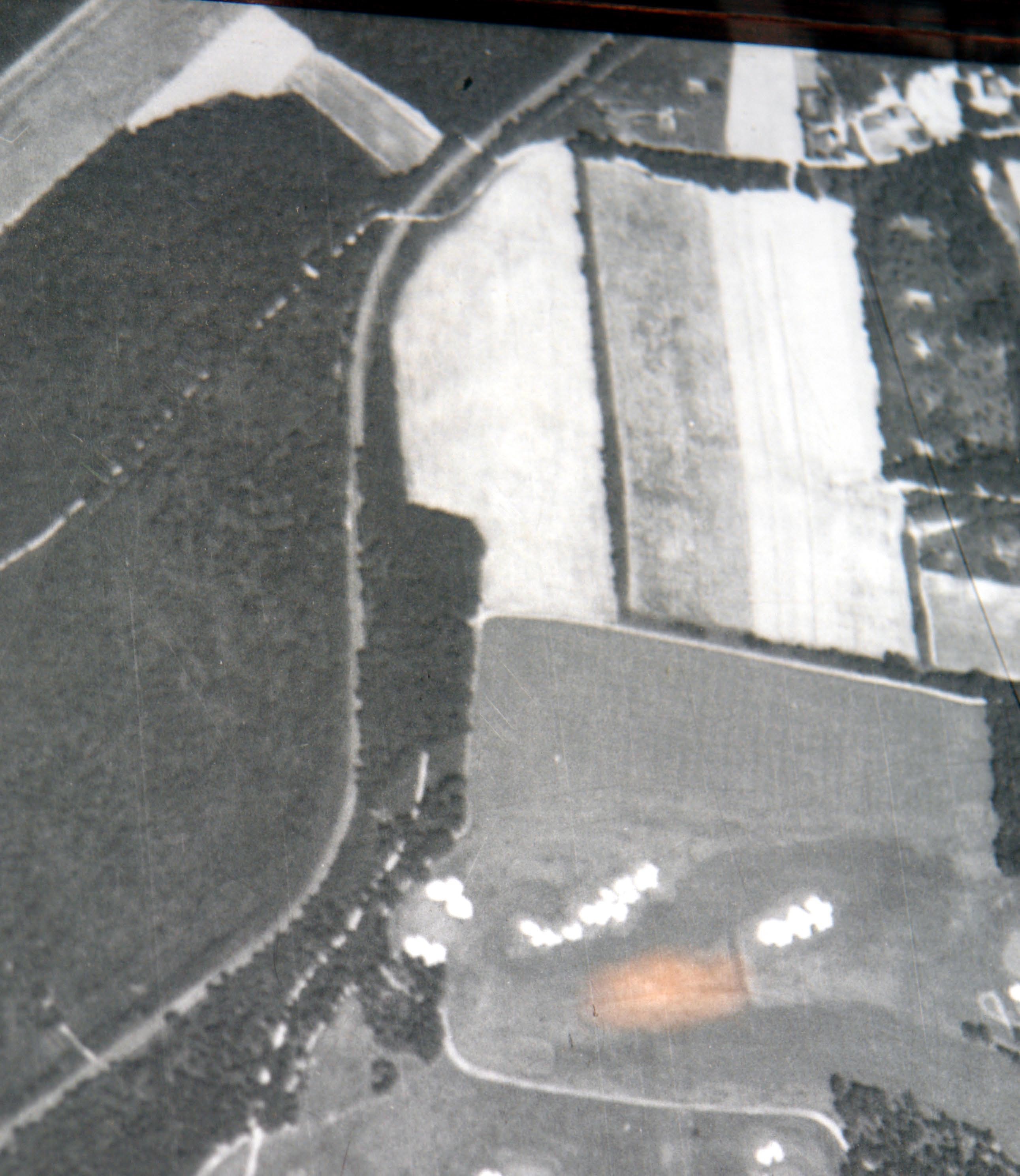
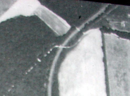
Then: This 1935 aerial of the northern section of Bethpage, looking west. The Motor Parkway is in the center of the photo crossing Round Swamp Road on the right. The Botto Farmway Bridge (close-up) can be seen crossing the Motor Parkway on the left corner of the aerial.
This 1939 aerial of Bethpage is hanging in the Bethpage State Park Clubhouse, home of the 2000 and 2009 US Open. A close-up of the aerial reveals the Botto Farmway Bridge.

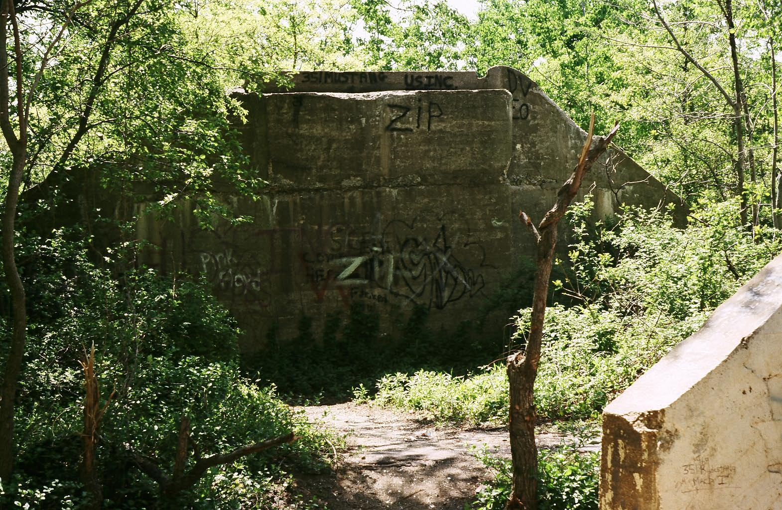
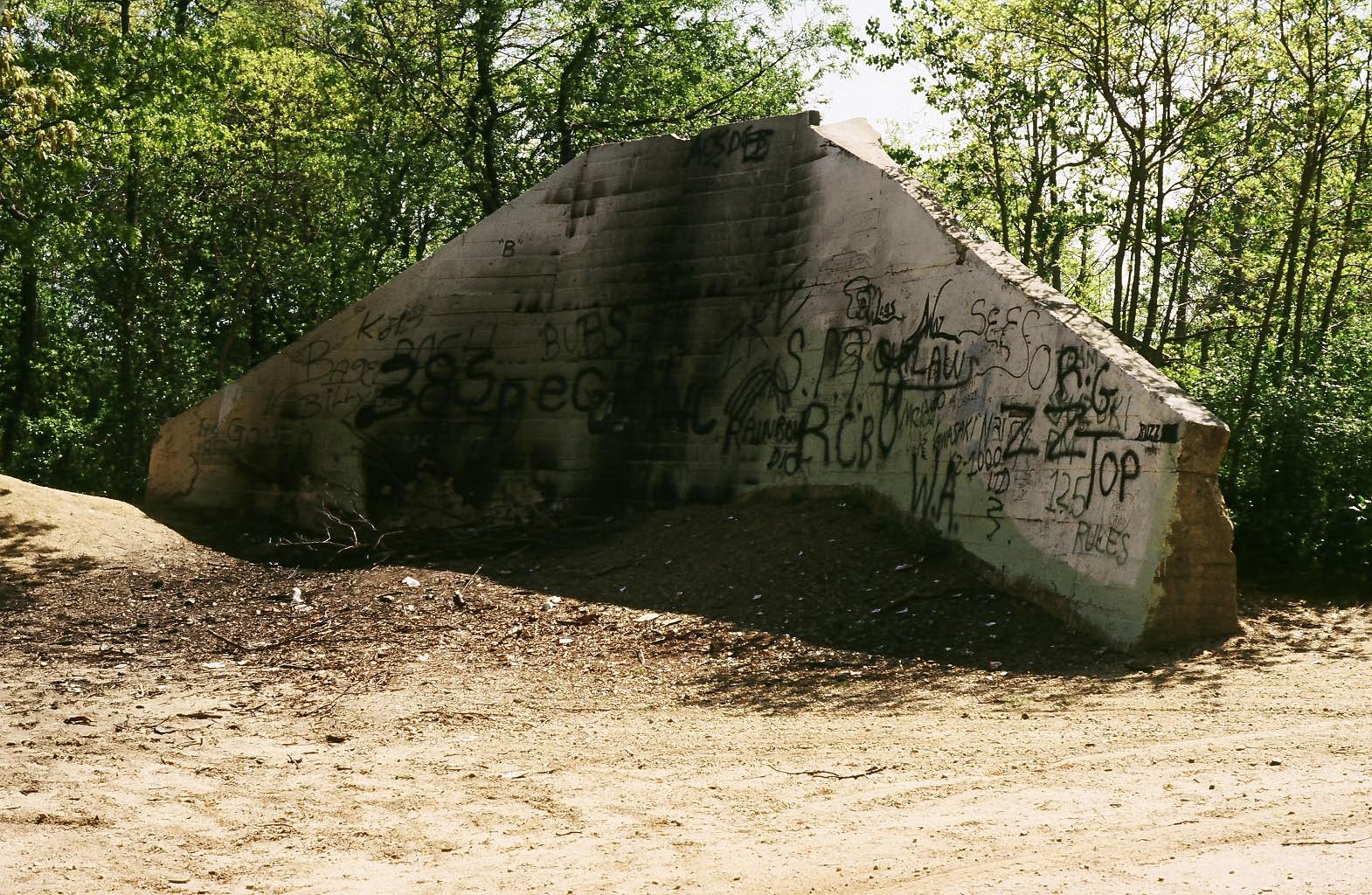
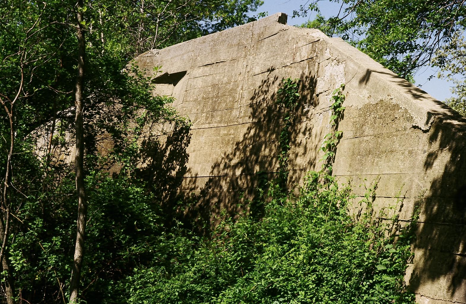
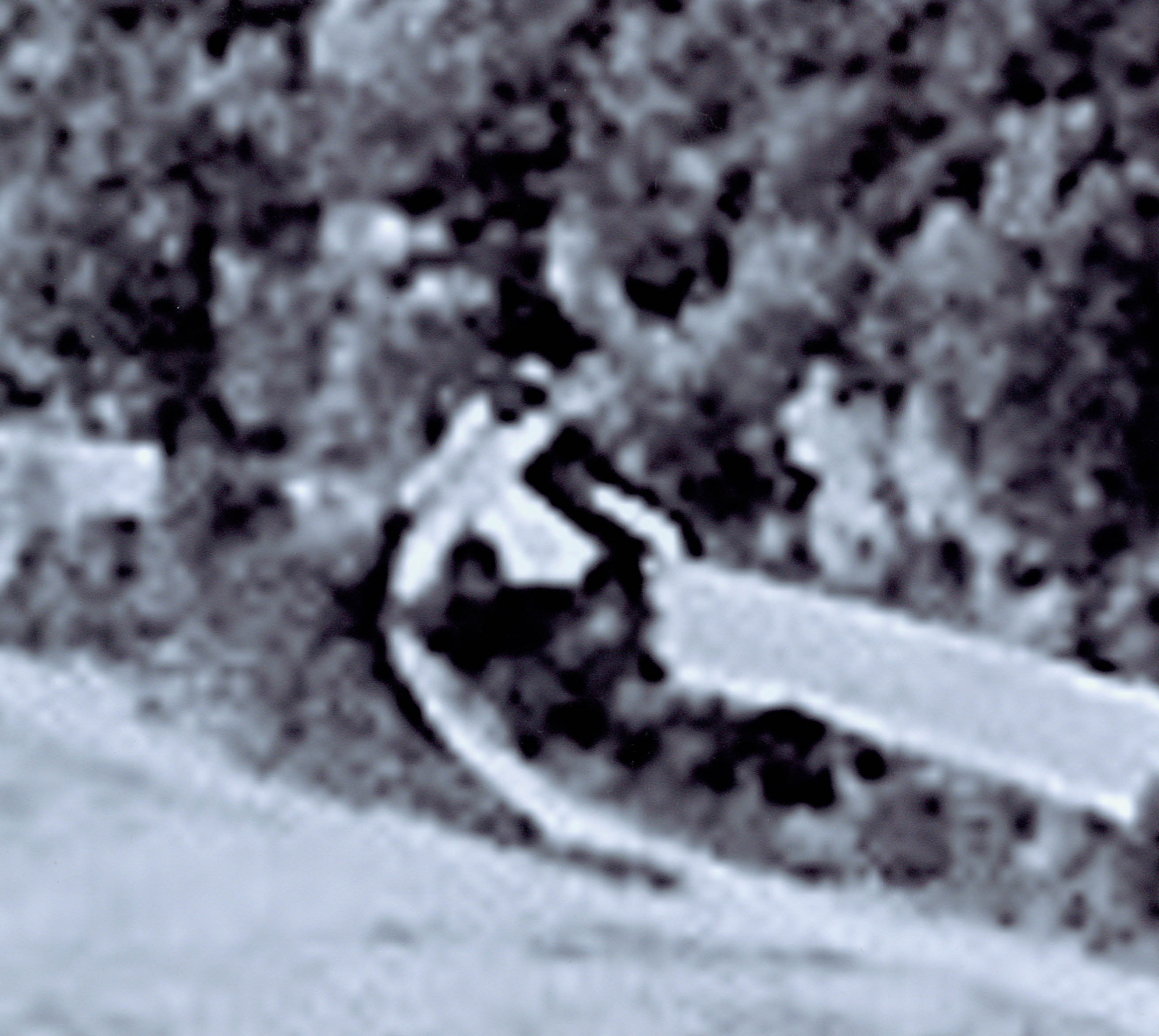
These four photos of the Botto Farmway Bridge were taken in early 1980s by Ron Ridolph when he made a photo survey of the Motor Parkway.
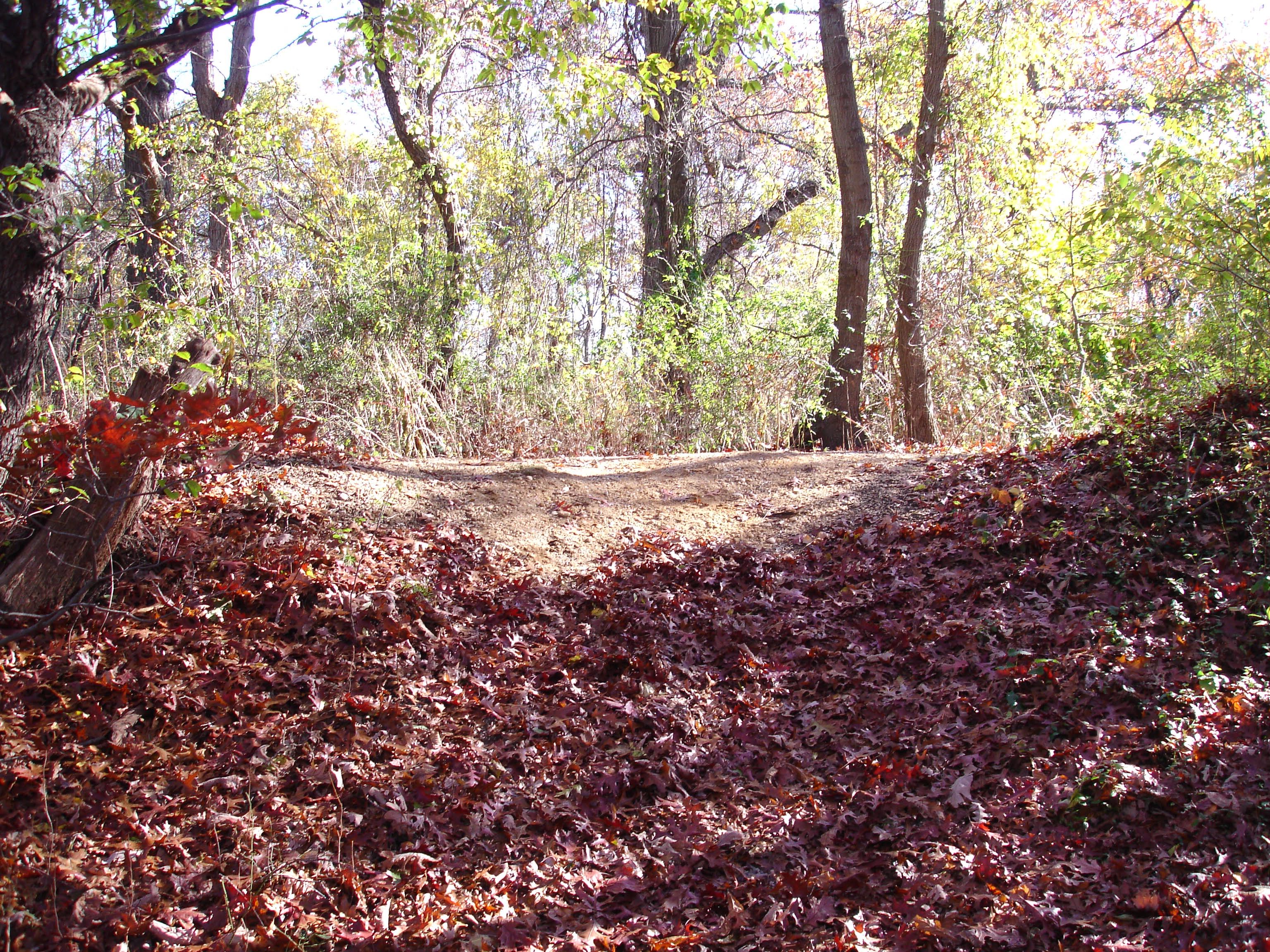
Now: Due to safety concerns, Bethpage State Park removed the concrete abutments sometime in the 1990s. A dirt hill is the only remnant of the bridge.
Links to related posts on VanderbiltCupRaces.com:
Index: Long Island Motor Parkway- Bethpage
Index: Long Island Motor Parkway- Ron Ridolph Collection
Original Survey Maps of the Long Island Motor Parkway Discovered!


Comments
Happy 2011 Howard,
I noticed on the ‘35 aerial on this page where the Bethpage toll house is located. Today there is a structure that is located exactly where the Bethpage toll house was (40*45’44.69"N, 73*27’15.76"W). Not only is this structure approx the same size as the original, but it is positioned just like the original toll house that was destroyed in the ‘60s. It is totally surrounded by trees and can be easily missed. Perhaps they built a new house over the old foundation. Have a safe and happy new year.
Coming upon this area in the late 1980’s initiated my interest with the LIMP. We were tree trimming in the area, and took a little trek in the park. My foremen stated that it was a “the old motor parkway”. The same road near my house in Central Islip? I still work in Nassau, and yes; the abutments are gone. Not all can be saved with the parkway, but the work that Mr. Kroplick and other dedicated people put in is keeping the history of the parkway alive.
Sincerely,
Brian D McCarthy
I remember this bridge well. As a child, in the 80,s I would frequently visit this structure as well as “Dead Man’s Curve” In my hometown of Bethpage. t was so strange to see it in the middle of a wooded section of the park. I later worked at the OBVR and became more interested in the parkway. It was from the many visitors here “hunting” for clues that I figured out the purpose of the bridge. I am happy to see that 25+ years later the Parkway is finally getting more recognition! I was sad when I went back to this site in the 90,s to find they had removed a piece of the parkway history.
Growing up, my backyard boarded the 8 th precinct parking lot, which was motor parkway. As a kid, While digging for China with some friends, we dug up a motor parkway sign, which after doing some research may be a license plate! Then later growing up I ran cross country in high school, 1974. I must have ran past that concrete structure a hundred times on that cross country course wondering how and why that was there! I went on the trail recently looking for it and couldn’t find it. I can’t believe it’s gone, it was a piece of history. I had my suspicions that it was there for a purpose. Now it’s confirmed. Thank you for everyone that contributed to this article. It was first the Vanderbilt parkway, then motor parkway then part of it the lirr, now where the power lines run! ... (in bethpage between the 8th precent and the Levittown fire house.)