The Helck Family Memoirs: 1973 Newsday “What Ever Became of the Vanderbilt Parkway?” Updated 7/14/16
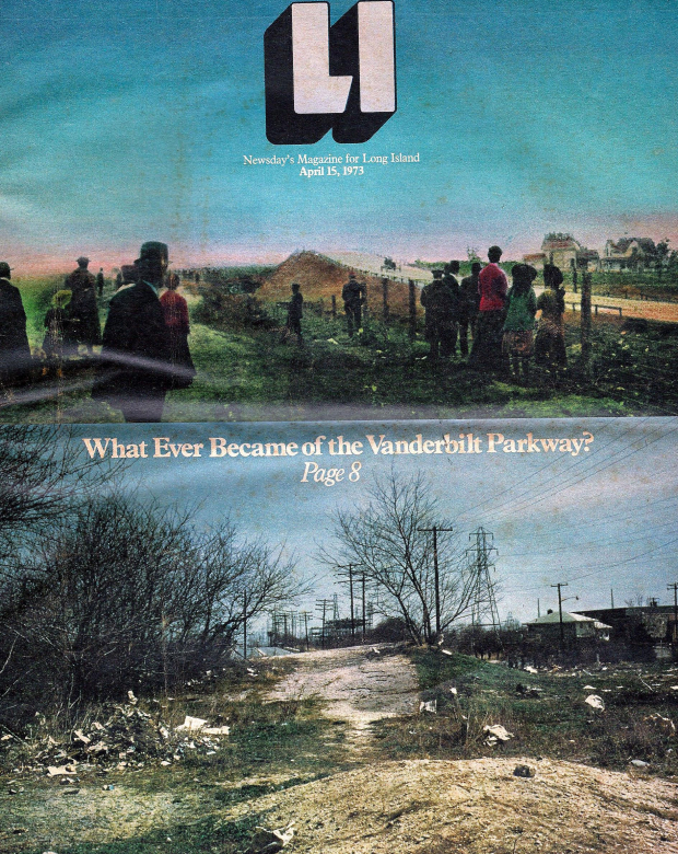
Jerry Helck has forwarded this April 15, 1973 Newsday article from the collection of the Helck Family Library. Updated: June 30, 2016
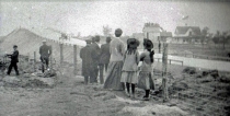
I have added several notes to the article. Can anyone identify the location for the above lower image of the Motor Parkway?
Enjoy,
Howard Kroplick
Note: While the article refers to the road as the Vanderbilt Motor Parway, the ccorrect name was always the Long Island Motor Parkway.
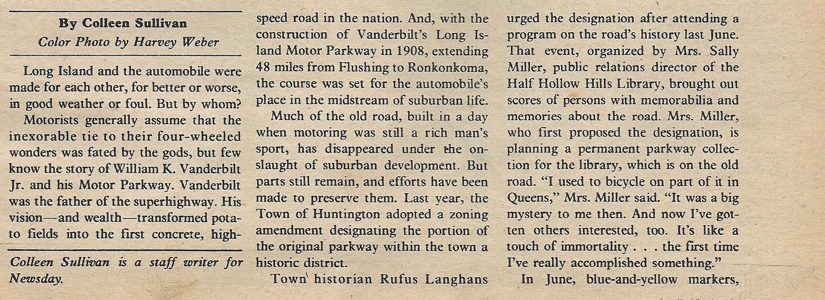
The article was written by Newsday staff writer Colleen Sullivan.
Note: Nice shout out to Bob Miller.
Note: The Vanderbilt Cup Races left Long Island in 1910. The impact of New York State laws was minimal.
Note: John Russell Pope designed only the first six toll lodges. Overall, there were 20 toll collection structures on the Long Island Motor Parkway.
Tim's Treasures (Submitted by Tim Ivers)-June 30, 2016
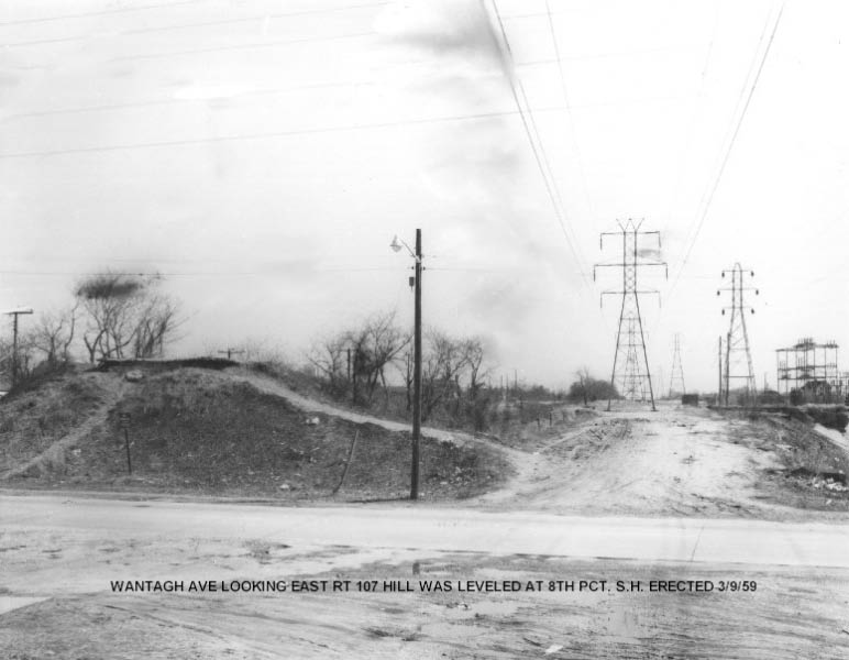
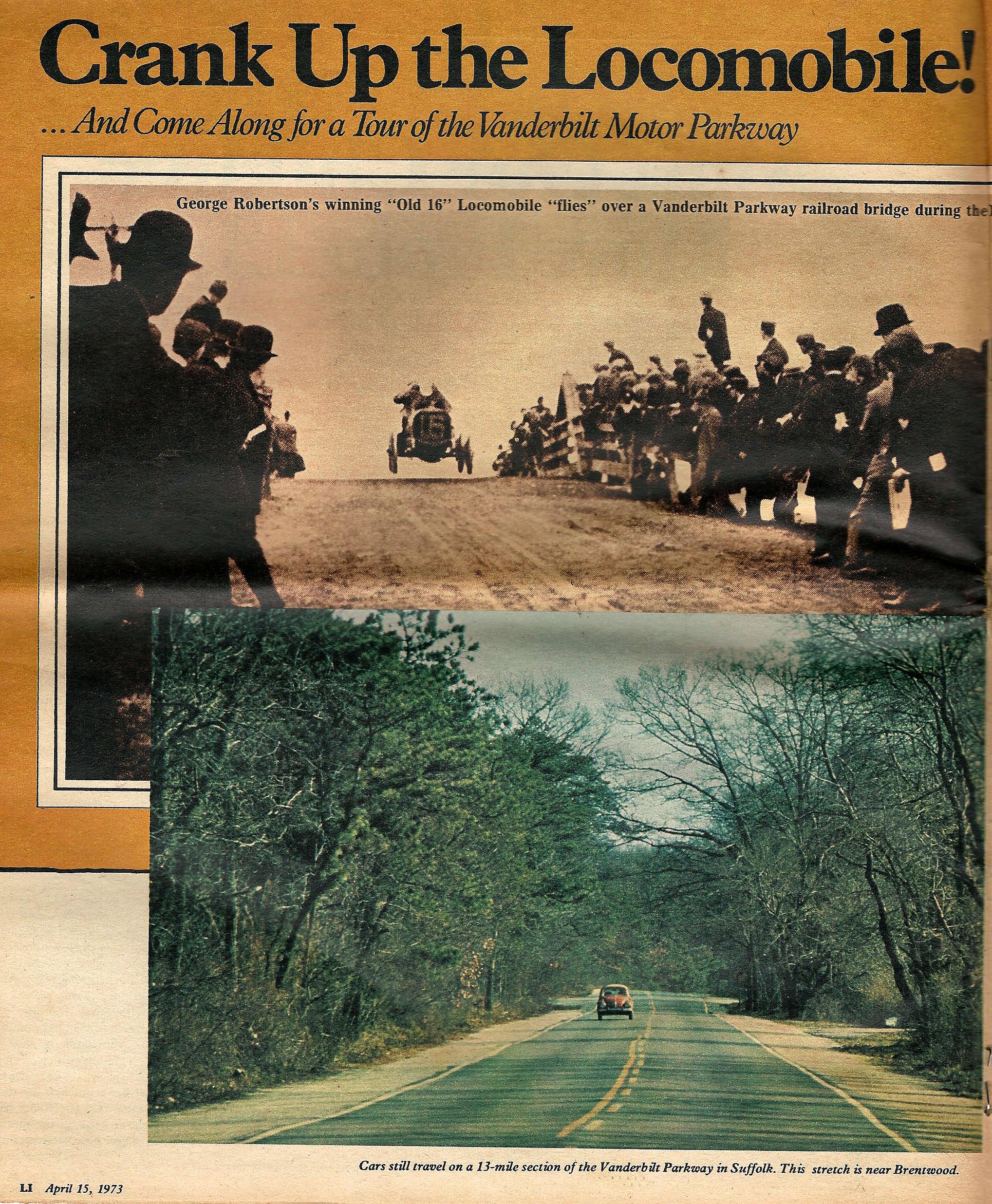
Tim: Wantagh Avenue facing east. Both the bottom and top photos.
Tim: Top shows view from Wantagh Ave. bridge looking towards Hicksville Road and the Massapequa lodge.
Howard Kroplick: Given the direction of the racer and the location of the Newbridge Hotel, I believe the direction is looking west.
Femenias' Findings (Submitted by Frank Femenias)
Russo's Adventures (Submitted by Dave Russo) Howard---this is the exact location of the picture in question.
Dave Russo (7/11/2016): Howard---this is the exact location of the picture in question.
McCarthy's Marvels (Submitted by Brian McCarthy)
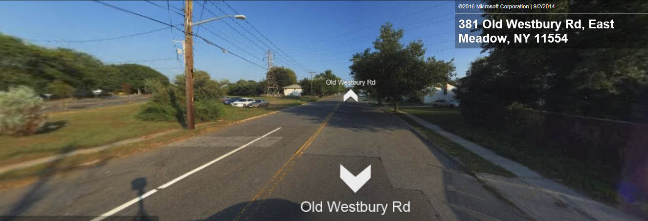
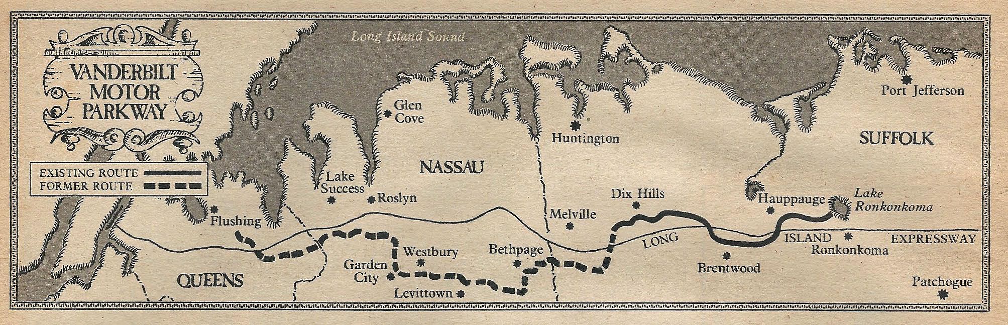
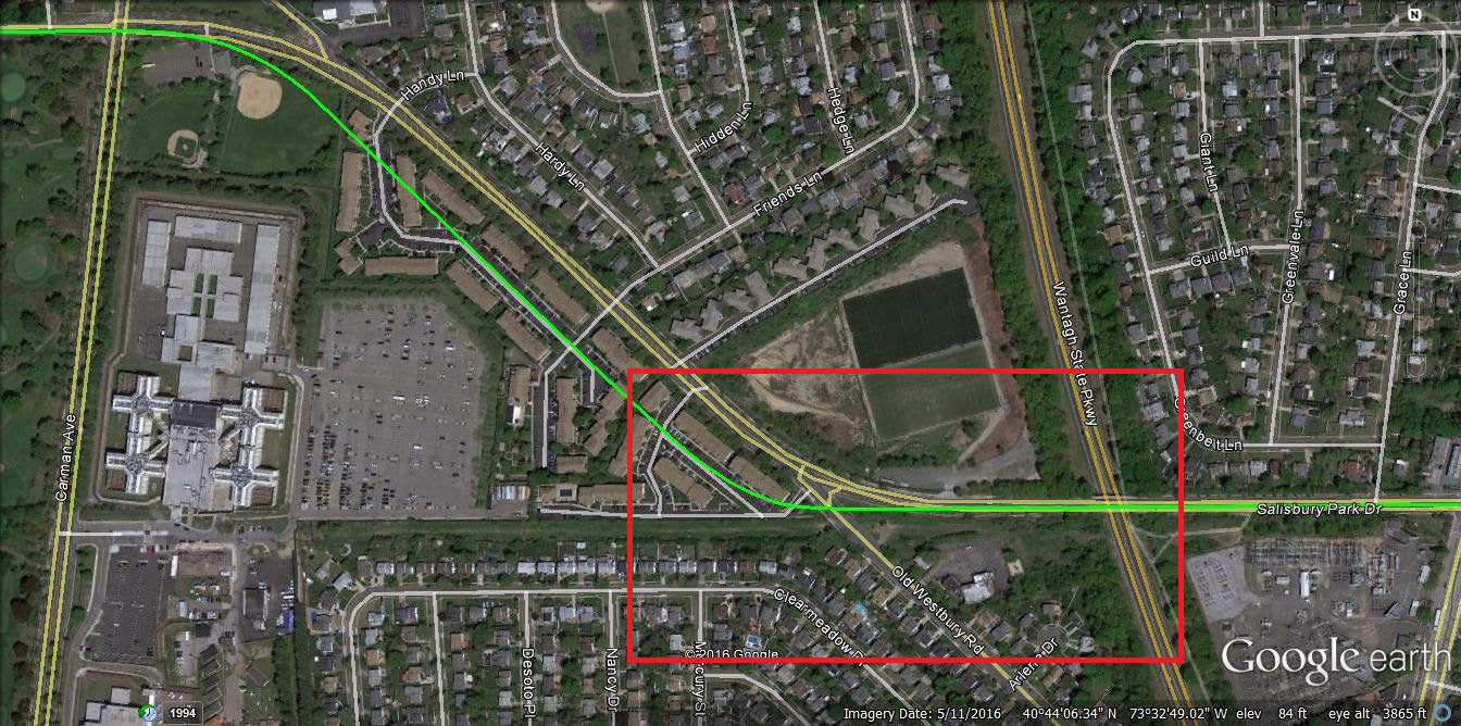
Brian McCarthy: Howard. This streetview map is intended for your 6/28/16 blog “The Helck Family Memoirs”. I’m no expert with this online map designing, Trying to emulate the 1973 Newsday photo, keeping in mind this was 40 yrs ago. Agreeing with Frank Drebins comment regarding the location of the 1973 photo, the orientation would be southeast of Old Westbury Rd. The LIMP remnants could be on what is now the southbound traffic side of Old Westbury Rd.


Comments
Great article. Is it possible that the Half Hollow Hills Library has retained some interesting information about the parkway? I’m sure you’ve already checked into that Howard.
________________________________________________
From Howard Kroplick:
Mike, they do have some files on the Motor Parkway.
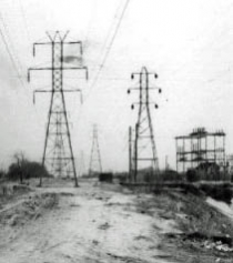
Hello all. I believe it was determined that the photo below the painting is just W/O Wantagh Ave. If you enlarge the photo, the Levittown substation is in the near distance to the right. Also, the steel towers that are on the south side of the ROW have been replaced with the present day steel poles. On the north side of the ROW , the wood poles that have 3 cross arms each have been replaced with the present day steel towers.
______________________________
From Howard Kroplick:
Brian, thanks!
I believe Brian is correct. Wantagh Avenue facing east. Both the bottom and top photos.
Top shows view from Wantagh Ave. bridge looking towards Hicksville Road and the Massapequa lodge.
___________________________________
From Howard Kroplick:
Thanks, Tim. Images added above. Given the direction of the racer and the location of the Newbridge Hotel, I believe the direction of the top image is looking west.
Hi all. The location of the lower part of that picture look so familiar,but I can’t exactly say where it is.I recognize where the power lines are. Could it somewhere around Deadmans Curve,Stewart Ave or Wantagh Ave Bethpage,that’s my best guess?
Great article. Really well written, thorough and concise. Well done Colleen.
Brian—so you are saying this picture is just WEST of Wantagh Ave? That would be Universe Drive directly ahead?
Hi Dave. That photo just below the painting, I guess you can see the remains of the LIMP; and the uprise of the bridge abutment at the W/S of Wantagh Ave. I’m think the road ahead may be the entrance road into the precinct. If the photo was taken a little more to the north, you would probably see Universe Dr. The LIMP ROW and Universe Dr are VERY parallel with each other in this location. Being that the Newsday article is 1973, maybe this photo is; too?
Almost missed this one, recovering from major surgery, but couldn’t resist coming back and taking a peek. Can’t investigate this one but viewing from a phone, if that’s the newbrIdge hotel, there should be a tunnel portal under the bridge, and railroad tracks where the gent in the foreground is standing. I don’t see any on this little screen. On lower photo, my first hunch was Brian’s suggestion but can’t dig deeper. Brian worked the lines and Tim worked the precinct. These would be two excellent sources to start from
Ted, near Wantagh av/deadmans curve could quite possibly be
It’s me again, Dave. I was just viewing a 1953 aerial of this area. Universe Dr is well established running west of Wantagh Ave. It’s blurry, but I think there’s a abutment remnant at the intersection of Wantagh Ave; W/S ( it doesn’t appear to block traffic ). Then east of Wantagh Ave, you can see the LIMP roadbed. So, no surprise; a good part of Universe Dr was built over the LIMP roadbed. And just south of here is former Central ROW/ presently PSEG LI ROW. So I’m not quite sure what road is seen “ahead”, but pretty sure from my “photographic memory”; that the Levittown substation( PSEG LI facility ) is in the distance to the right. This substation is closer to Hicksville Rd ( Rte 107 ).
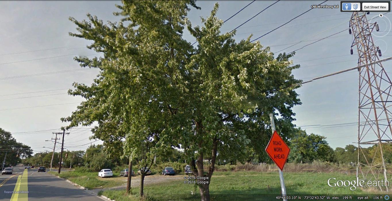
The bottom photo from the article cover page looks like where Salisbury Park Drive and Old Westbury Road split. It looks like the Suburban Park Jewish Center on the right.
You may be correct, Frank Drebin. The LIMP bridged over Westbury Rd. Then the road seen ahead would be Salisbury Park Dr ( Gradually uprising eastward over Wantagh St Pkwy ). You can’t see Westbury Rd because of the photo angle. And the tower line is still on the S/S of the ROW. In this area, there’s underground electric transmission basically on the N/S of the ROW. This transmission replaced the wood poles w/3 cross arms each in the past. And what I see in the distance to the right is the R/O the Newbridge Rd substation. It appears that we are looking at the remains of the LIMP just W/O Westbury Rd, and this would’ve been demolished with the widening of the intersection there, or because of the apartment/condo complex where the 2 roads meet.
Yes. Kudos to Frank. That is definitely the location.
And once you cross the wantagh parkway there are original wood posts that still stand. . Pictures to come as part of Vanderbilt day II pics sent to Howard!
I don’t believe a “mystery photo” had as many comments as this blog post. Thanks for initially questioning my assumed location of the 1973 photo, Dave Russo. If it wasn’t for Frank Drebins comment, I might be still scratching my head over this. I even sent Howard an email about all this. If your paying attention Frank, thank you.
Hey Brian—-LOL it just didn’t look like the location you said it was for a few reasons but I’m glad it’s solved. That being said, you guys are marvels at figuring out these things with all the topographical skills that you have and that some discover via the internet and aerial photos, etc. It’s really amazing.
The discussion about the Caroline Street posts (Bethpage) was my favorite, and still unsolved despite great info that was uncovered. Between you guys that like to research extensively and myself who would rather go the site and explore we make a pretty good team.
Don’t know why I threw my two cents in here…been a long-time reader but have always been blown away by the depth and breadth of knowledge all of you have. But there is something about this area that always intrigued me. That corner has remained so desolate and barren, which seems odd in today’s LI. Sure, the obvious chunk of the road that is on the cover is not there, but it’s really not all that different now.
Hey Brian—-LOL it just didn’t look like the location you said it was for a few reasons but I’m glad it’s solved. That being said, you guys are marvels at figuring out these things with all the topographical skills that you have and that some discover via the internet and aerial photos, etc. It’s really amazing.
The discussion about the Caroline Street posts (Bethpage) was my favorite, and still unsolved despite great amounts of info that was uncovered. Between you guys that like to research extensively and myself and Sammy who go the site and explore we make a pretty good team.
Here it goes, comment #17. Dave/Sam…I’m sure Howard and the rest of us appreciate you and your sons field work.And there are others doing the same. Because I worked in Nassau County, I became familiar with the LIMP and Central RR remnants. But I never thought to take photos, etc. Sam Berliner’s websiteshas lots of info, as well as some others. I’d like to get out there and re-explore; but my Parkinson’s symptoms have become an obstacle.
When you get a chance, Dave Russo; take a look at the Historic Aerials website. After viewing a 1966 aerial along with a 1947 topo; you’ll see the LIMP roadbed is just to the left/SE of Salisbury Park Dr between Carmen Ave and Old Westbury Rd. This makes sense of past visible LIMP remnants in this area before the building of the condo/apartment complex that is there presently.
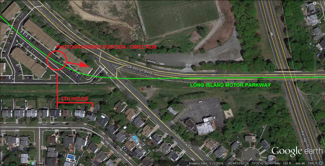
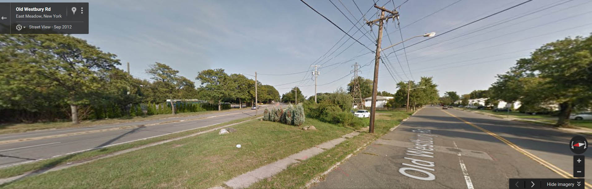
Hi Brian, Dave, and Frank – Is the bottom photo of 1973 now being located as just SE of the Salisbury Dr / Old Westbury Rd split, and we’re looking NW from a still undeveloped (and possibly under construction) Old Westbury Rd, with a small piece of Salisbury Dr visible on top of the dirt mound? I’ve attached a Google street view photo where I think the location is of the new find. The different style utility poles seem to match but can’t get a clear shot in street view.
Hi Frank Femenias. Hoping the surgery you had went well. After reading Frank Drebins comment about the location of the 1973 photo, it made more sense to me. 99% sure this photo is facing to the SE ( existing towers still on S/S of PSEG ROW ), and the Jewish Center building is visible on the Eastside of Old Westbury Rd. The pole with the street lamp is intended for Old Westbury Rd. There’s 2 woodpole lines parallel on the N/S of the ROW, the pole line w/3 xarms each is no more. And in the distance, I see the R/O the Newbridge Rd PSEG substation. If I was standing on the LIMP pavement seen, it would be right where the condo/apartment complex is on the SW intersection of Salisbury Park Dr/Old Westbury Rd.
This picture from the article is looking EAST at Salisbury Park Drive (which was basically the Motor Parkway) from where the Old Westbury Road bridge was. I sent Howard the current picture. You can see the house on the right is exactly the same. We are looking at current location where Salisbury Park Drive goes over the Wantagh Pkwy. The Suburban Jewish Ctr is just before the Wantagh straight ahead on the right. The power station is just over the bridge on the right side. Original wood posts remain on the right side over this bridge today.
To all you guys—-I love the back and forth and LI history discussion in general. I’d love to meet you guys one day. Maybe we could have a group tour one day going to a few/several LIMP locations and discussing each one on site. Brian I’m sorry to hear about your situation. Would love to meet.
There’s others with worse medical issues than mine, Dave Russo. I just have to adjust and accept what I can and can’t do.
Glad you left the current street view of the 1973 photo. I was trying to match a street view on my PC today, but man; it’s frustrating to get it just right. Have to keep in mind this was more than 40 yrs ago. I hope whoevers paying attention agrees with the location of this 1973 photo.
Brian, I think it’s impossible to see this view from a current Google Map street view. I looked back at the 1966 aerial view, you can see the mound of roadway and trees where the photographer would have stood and how the angle would have show Salisbury Road rise over the Wantagh Parkway. It looks like it would have been where the entrance/exit and shuffleboard courts for the apartment complex are now.
I see it now!! Thanks for posting the street views guys. I also think Frank Drebin has nailed the location. Also true is the Historic Aerials ‘66 view of the mound with trees scattered that match in shape and configuration to the ‘73 article photo, where the photographer was standing and direction of photo. That Motor Parkway roadway dirt mound remained undisturbed for at least 7 years (‘66-‘73), and possibly up to 27 years when the coops were built in ‘93.
http://www.zillow.com/homedetails/555-Salisbury-Park-Dr-East-Meadow-NY-11554/83044318_zpid/
I’ve attached a current view of where photographer approximately stood comparing to the ‘66 dirt mound view. To exactly match the ‘73’s article view, a visit to the site would be required, and only if free of obstruction from the condo units. This could be a field trip worth taking with camera in hand. Guys- I’m In! Surgery went well and recovery is progressing smoothly. Thanks for your kind thoughts.
I knew once you took a good look at all of this, your mapping skills would put this in perspective; Frank Femenias. Quite surprised to see the map I sent to Howard. According to the PC, there was in error in sending. Glad you received the transmission, Howard; thank you. And a thanks to Frank Drebin. Without his initial input, this location may be still a mystery. Comment #24, over and out.