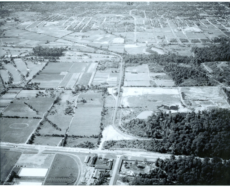
The Western Terminus of the Motor Parkway in Fresh Meadows Circa 1938
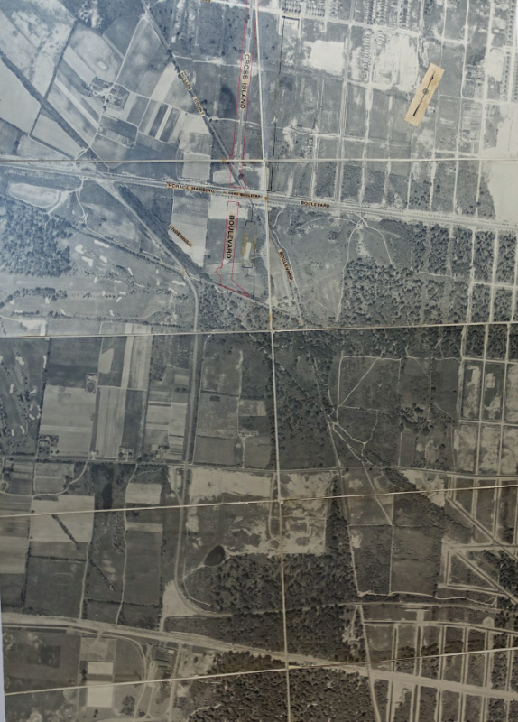
My favorite co-author Al Velocci has recently discovered a 60" x 28" aerial of Fresh Meadows and Cunningham Park circa 1938. The aerial provides new insight into the Western Terminus of the Long Island Motor Parkway.
The aerial was undated. Can anyone figure out the date based on the below other dated aerials?
Enjoy,
Howard Kroplick
The 60" x 28" aerial is made up of 14 separate sections pasted on a canvas.
Based on the notes on the right, the aerial was likely used to indicate the expansion of the "Cross Island Boulevard" which later became Francis Lewis Boulevard. The name was changed to avoid confusion with the Cross Island Parkway. Francis Lewis was a Whitestone resident who signed the Declaration of Independence.
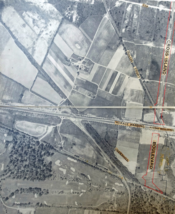
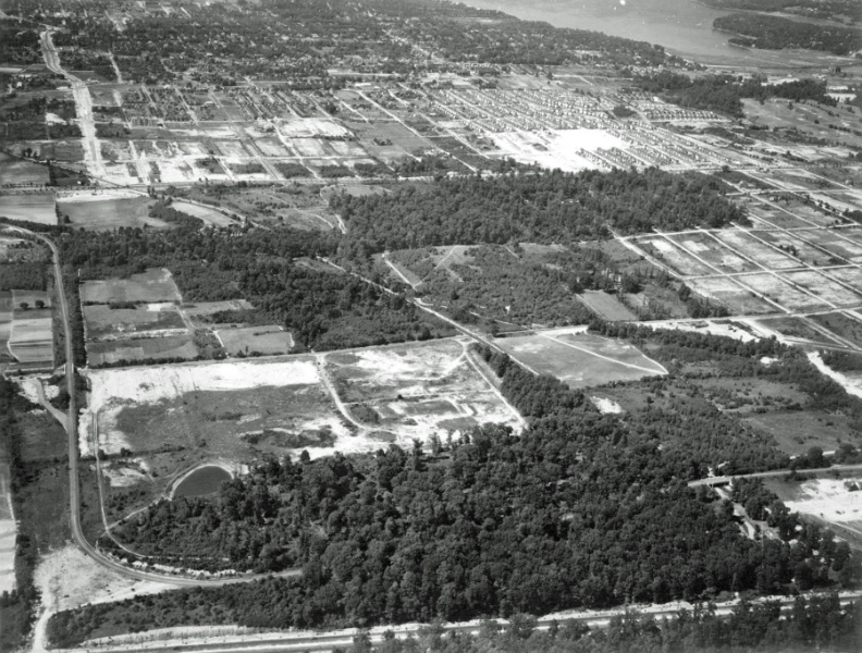
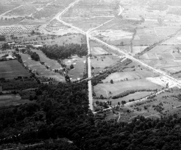
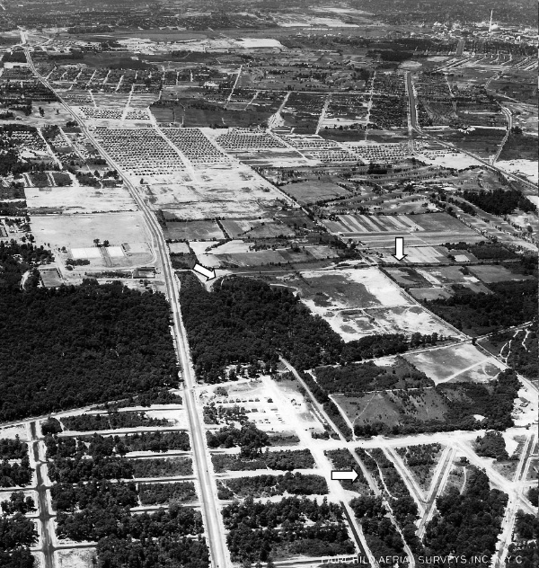
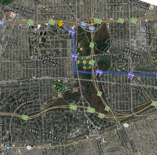
Western Terminus
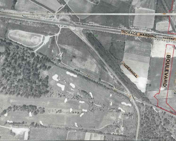
The Western Terminus of the Motor Parkway.
Note: The Fresh Meadows Golf Club and the North Hempstead Turnpike Motor Parkway Bridge.

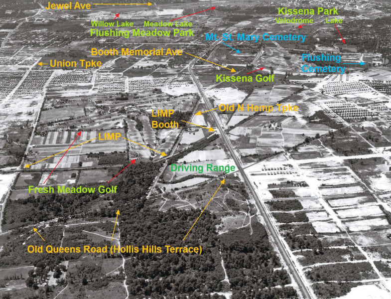
A close-up of the Western Terminus reveals some fascinating details:
-A possible roundabout north of Horace Harding Boulevard.
-Parking stripes -likely used for automobiles bringing cyclists to the area. The bike path officially opened on July 9, 1938.
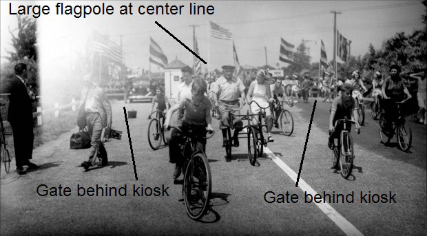
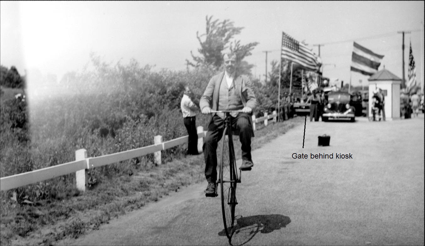
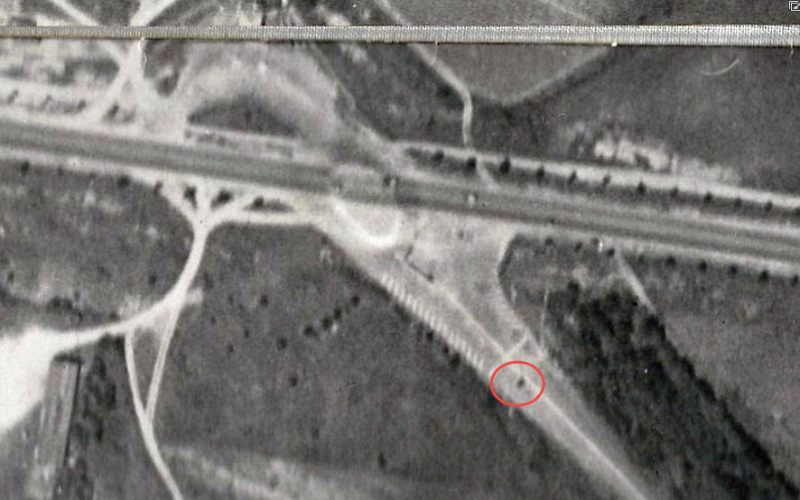
-The Nassau Boulevard Lodge (red circle)
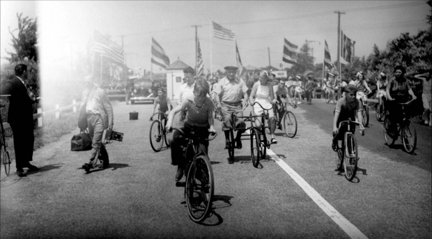
The Nassau Boulevard Lodge was actually a ticket kiosk. It can be seen behind the cyclists on the bike path's opening day.

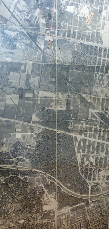
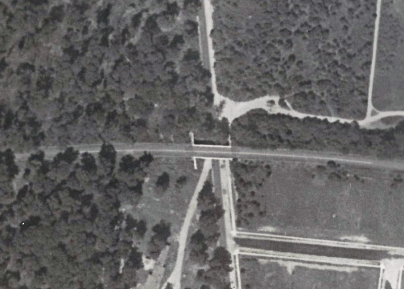
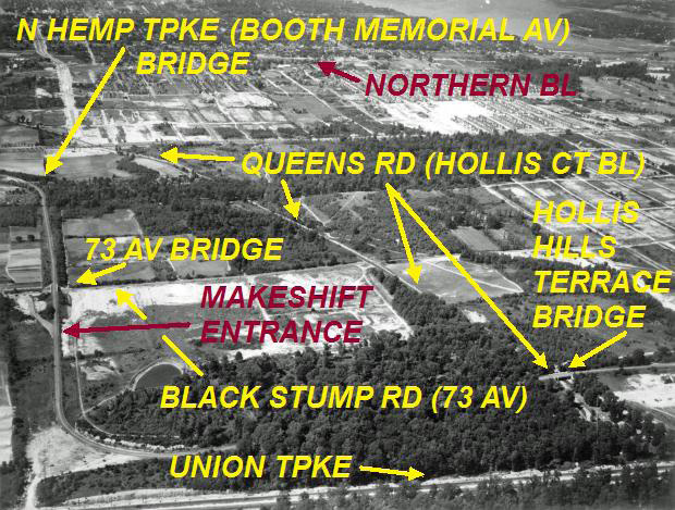
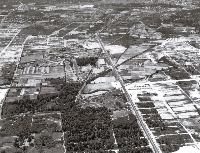
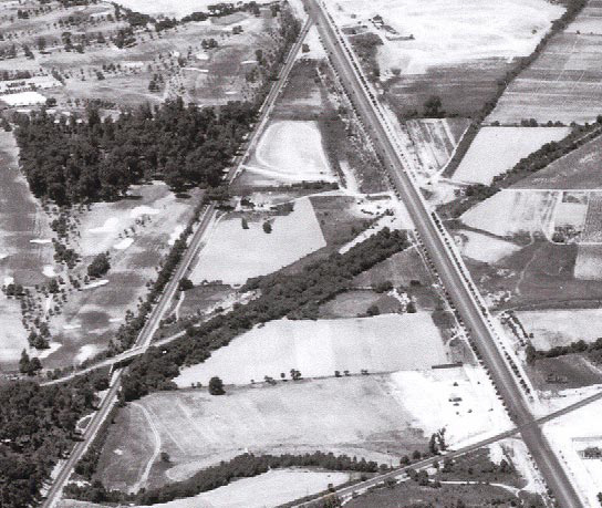
73rd Avenue, Hollis Hills Terrace and Union Turnpike
The still being constructed Union Turnpike can be seen across the bottom of this close-up.
The 73rd Avenue Motor Parkway Bridge. Note: Tthe unofficial entrance and exit to the Motor Parkway from 73rd Avenue.
The Hollis Court Boulveard Motor Parkway Bridge (now Hollis Hills Terrace).
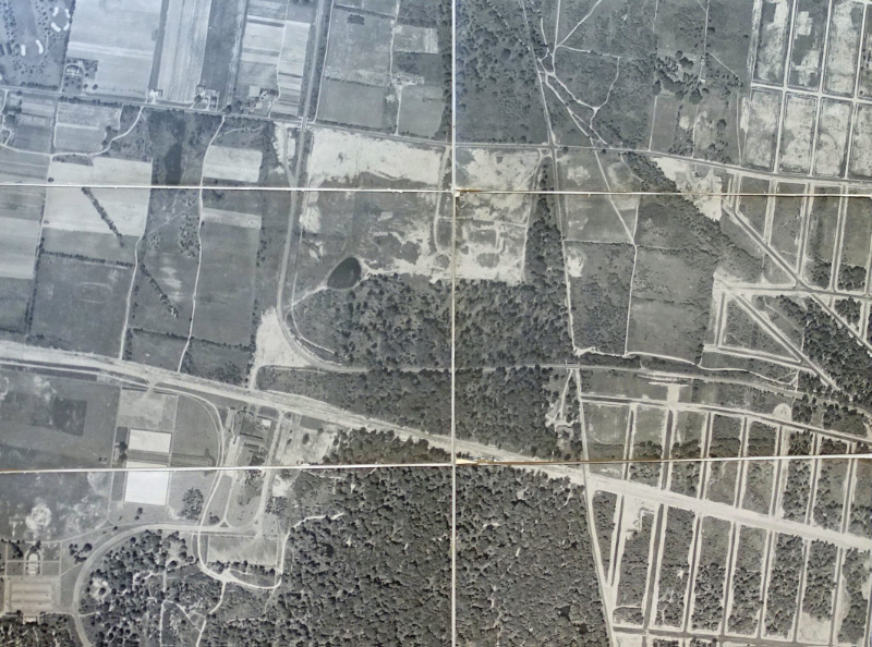
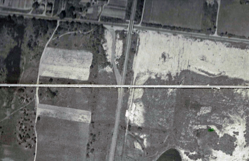
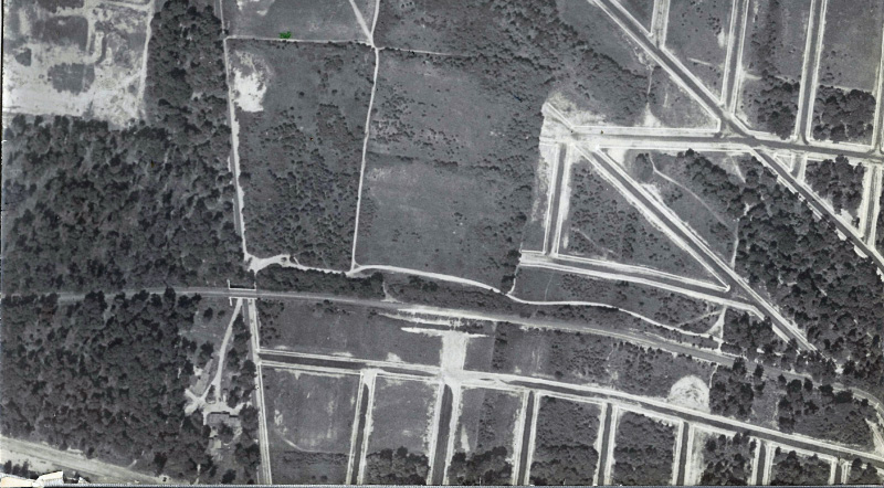
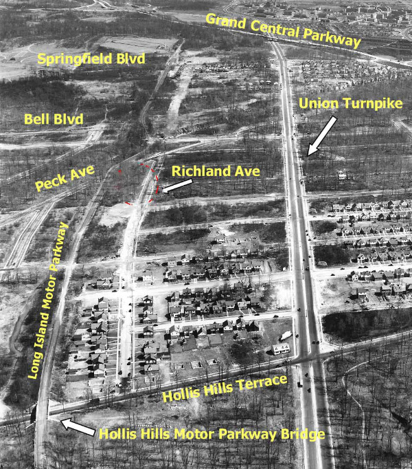
Fresh Meadows Aerials
June 24, 1938
Note: The road constructionin the upper left corner.
Courtesy of Frank Femenias.
June 24, 1938
Looking east. Union Turnpike was under construction.
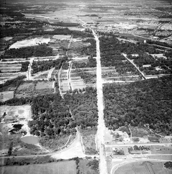
June 24, 1938
Looking north.
June 2 ,1939
Looking west-north.
July 23, 1939
Looking west.
July 23, 1939
Looking west. Check out the World's Fair seen in the right corner.
March 26, 1941
Looking east. The expanded Union Turnpike had been completed. Courtesy of Frank Femenias.
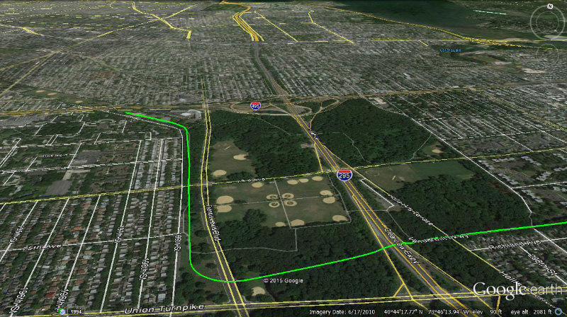
Current Views
Femenias' Findings (Submitted by Frank Femenias)


Comments
I grew up on 199th St. near 53rd Ave; my parents bought a new house there in 1952. So I know the are well. The big aerial was most probably taken at the end of 1936 or during 1937.
1. My public school (PS 162) can be seen at the corner of 201st St. and 53rd Ave., with houses across the street. The school opened in 1936, the same year that Bayside High School opened.
2. Cross Bay Blvd., as indicated in the article, had its name changed to Francis Lewis to avoid a conflict with the new Cross Island Parkway, which opened towards the end of 1938 in preparation for the new Whitestone Bridge, which opened in 1939, and the ‘39-‘40 World’s Fair. The ongoing construction, when considered with the existence of PS 162, implies that the photo was taken at the end of 1936 or during 1937.
Nice group of aerials! Keep up the good work.
Ken
Al Velocci has discovered a presentation that supports one of the Regional Plan Association’s transit improvements offered as a contribution the NYC’s master plan in mid June 1938. The plan called for Cross Island Blvd to run to the intersection of the Stewart (Central RR) right-of-way, where it could connect to North Hempstead Tpke, as Al’s discovery shows. By extending CIB to the Stewart right-of-way, someone at RPA may have still thinking about a “Stewart Parkway,” an idea that had been floated by Queens civic leaders for about a decade.
Robert Moses rejected the RPA’s suggestions by memorably saying that there was “no talent” at the RPA, among other things. One week later, Moses was much nicer addressing the first-day bicyclists! Ironically, Moses later become instrumental in extending Francis Lewis Blvd further south.
(Also shown is a segment of Underhill Avenue that was built much later but then later demapped for private use by St. Francis Prep.)
Fantastic find Al! Hoping to see this aerial in person someday.
The zoomed photo of the Motor Parkway terminus shows a lot. Considering the parking stalls at the entrance, the flagpole on the center line, and the erected gate blocking motor vehicles from entering indicates the aerial date to be just before, or sometime after the bike path’s opening on July 9, 1938 at 11 AM. I need more time to get a closer date.
Thanks Al and Howard for sharing this new gem.
Roy Warner or anyone here who grew up in this area are the best estimators of this maps date. Something caught my eye that didn’t “look right”. There’s streets carved out in the area bounded: North by 73rd Ave, South by the LIMP, West by 210th St, and East by Bell Blvd ( If the map covered a bit more east, you’d be able to see Bell Blvd. ) At some time before 1951, The Windsor Park Apartments were built on this same squared area. The former street patterns don’t line up with the existing roads within this apartment complex. Change of plans, I guess. Also sort of wondering why they didn’t just follow the original LIMP route when constructing the bridge over the future Francis Lewis Blvd? I don’t see any reason why they built the bridge north of the actual ROW?
It’s a minor point, but I believe that PS 162 opened in 1937. I was a student there when it celebrated its 25th anniversary.