Then & Now: The “Meadowbrook” Motor Parkway Bridge in East Meadow
One of the first bridges built by the Long Island Motor Parkway was captured in a 1939 aerial view in last Sunday's post. Here's a Then & Now of the curved "Meadowbrook Bridge" in East Meadow built for the 1908 Vanderbilt Cup Race:
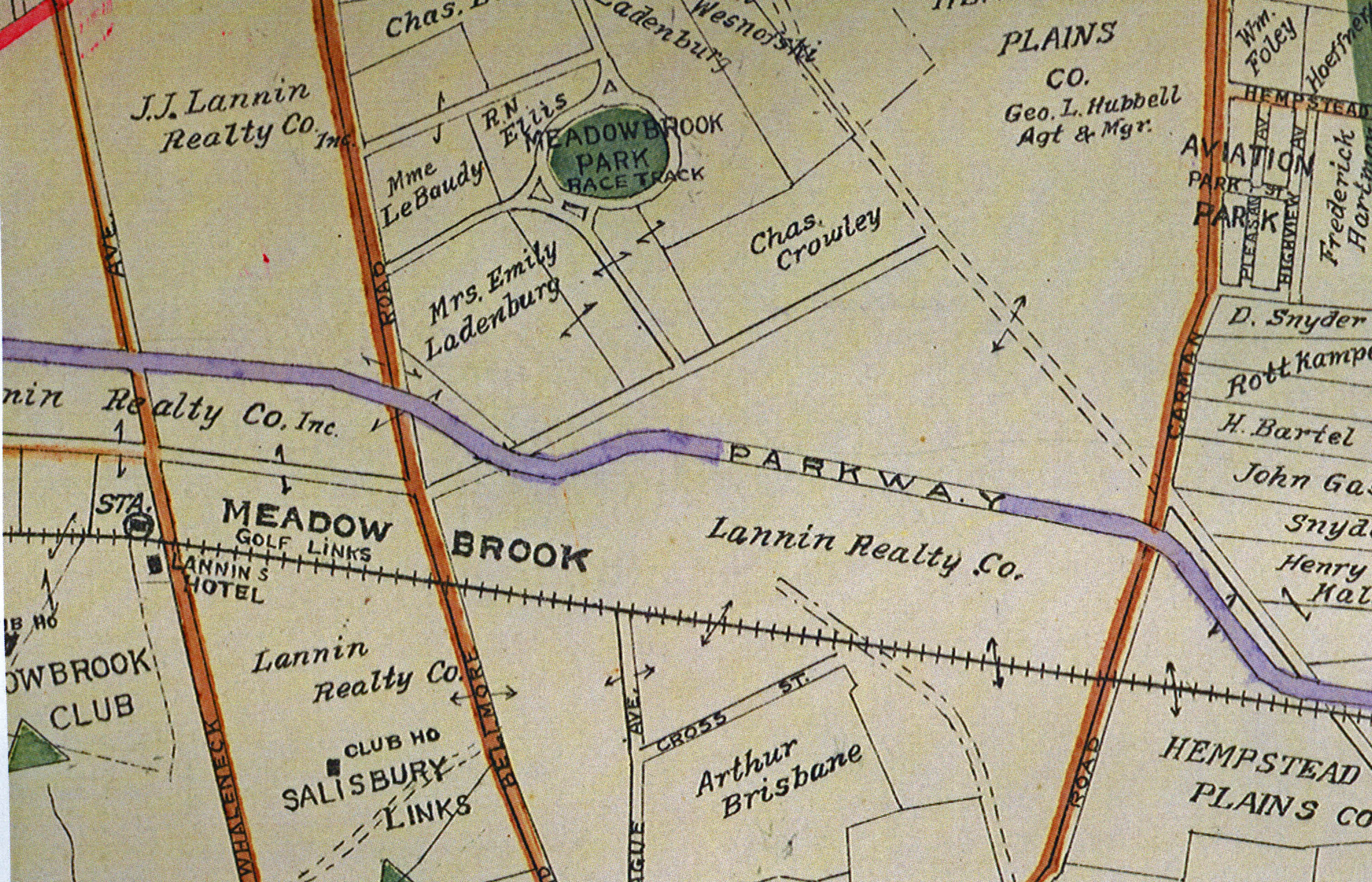
This Belcher-Hyde map shows the route of the Long Island Motor Parkway around Mrs. Emily Ladenburg's property. The map shows the Long Island Motor Parkway Bridge went over Bellmore Road in the area called Meadowbrook. The Meadowbrook Racetrack was located north of the Ladenburg property. As Art K. commented last Sunday, south of the Motor Parkway, Bellmore Road was called Newbridge Avenue and later changed to East Meadow Avenue to avoid confusion with Newbridge Road. I was raised in East Meadow and still confuse these two roads even today!!
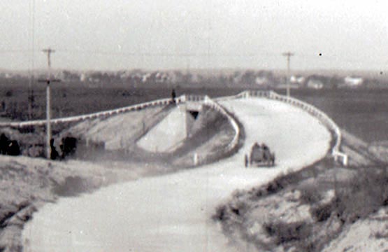
The Meadowbrook Bridge was built in time to be used as part of the first Vanderbilt Cup Race course held partially on the Motor Parkway. This view was looking southeast of the Meadowbrook Bridge soon after it opened in 1908. The distinctive windmill of the Landenburg property can be seen in the background. It was a virtual oasis of trees in the barren Hempstead Plains.
Then: October 30 1909
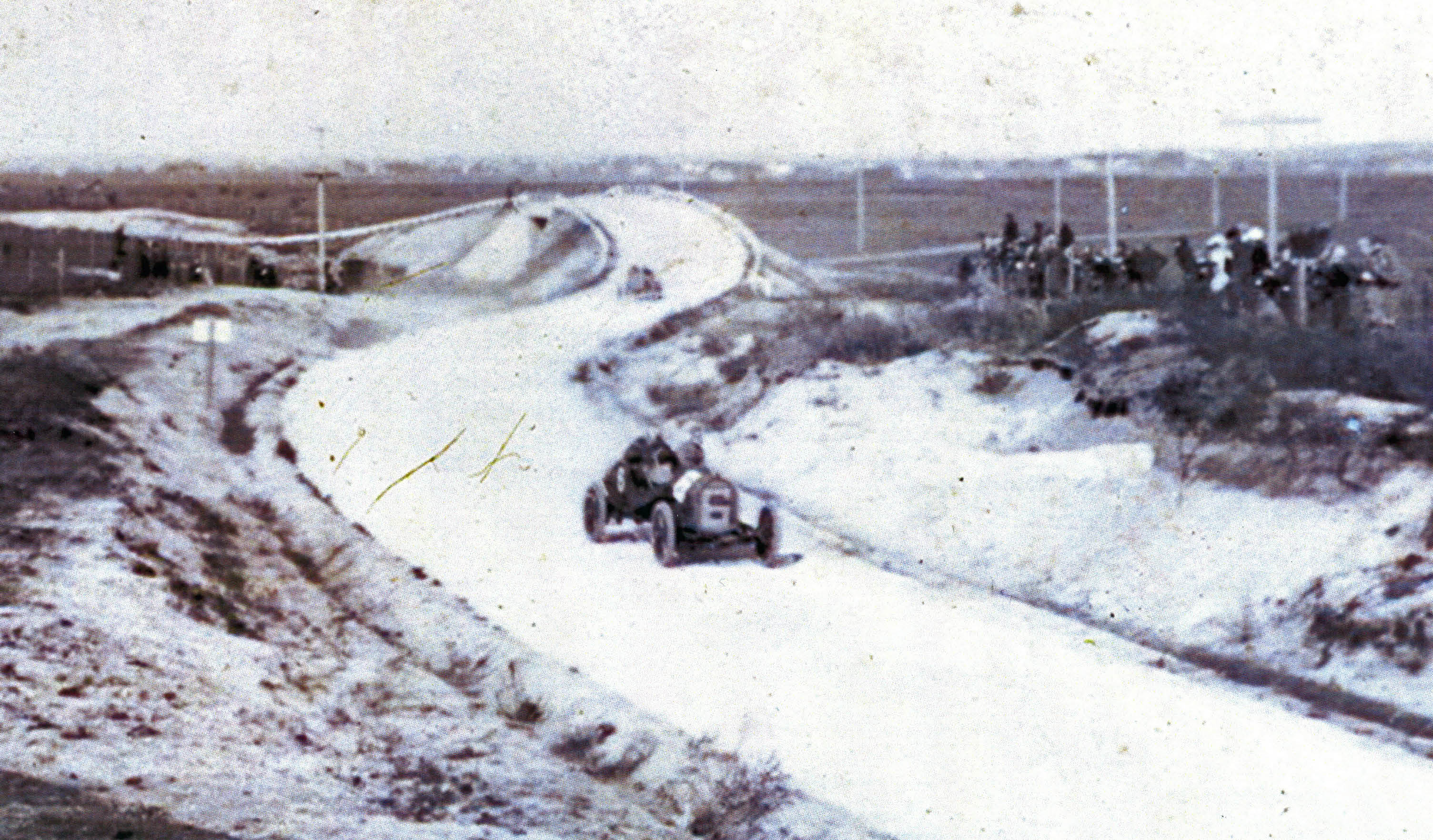
A view looking northeast of the bridge during the 1909 Vanderbilt Cup Race. The #6 Apperson driven by Hugh Harding was passing a group of spectators
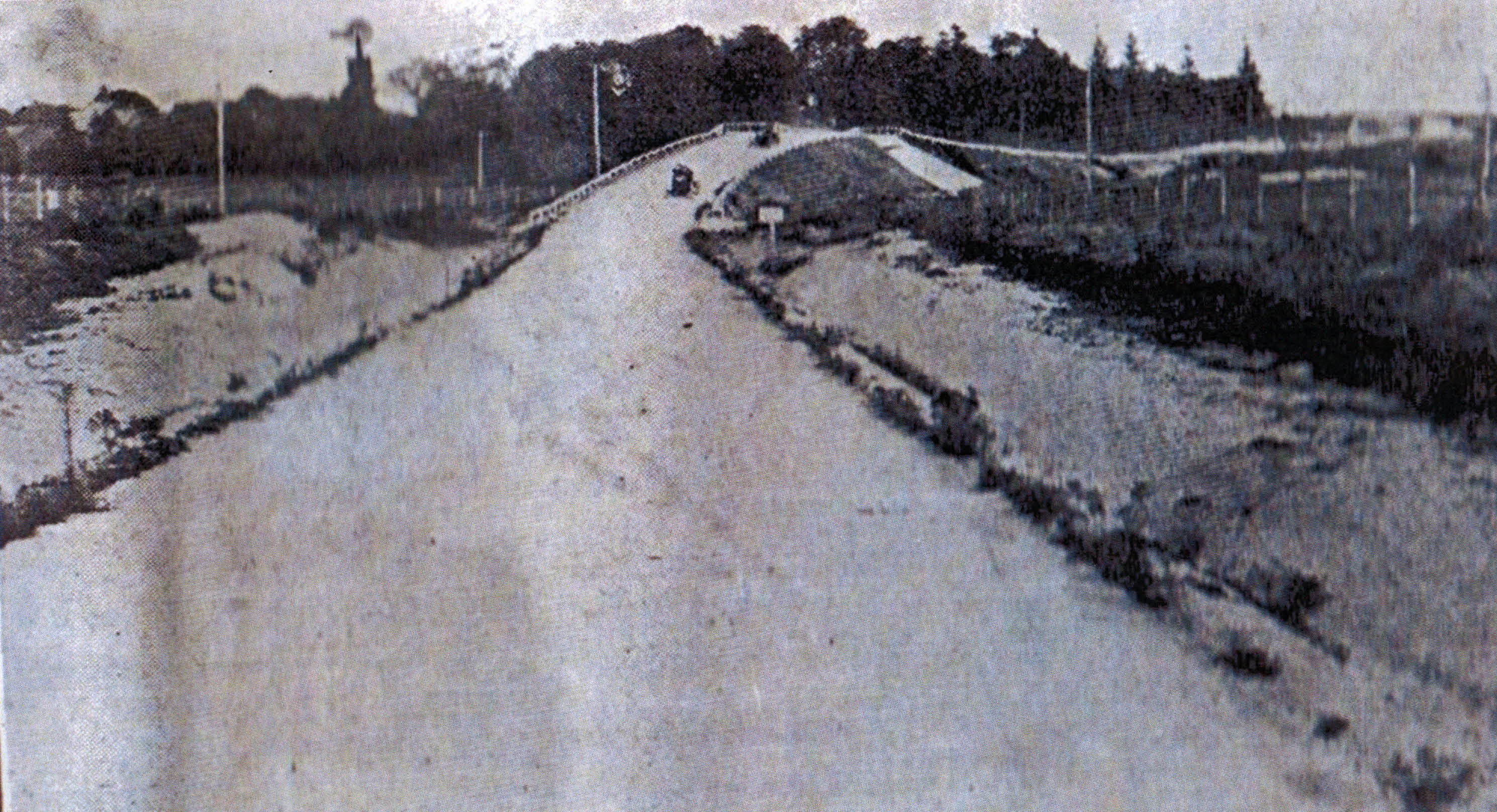
Then: October 1, 1910
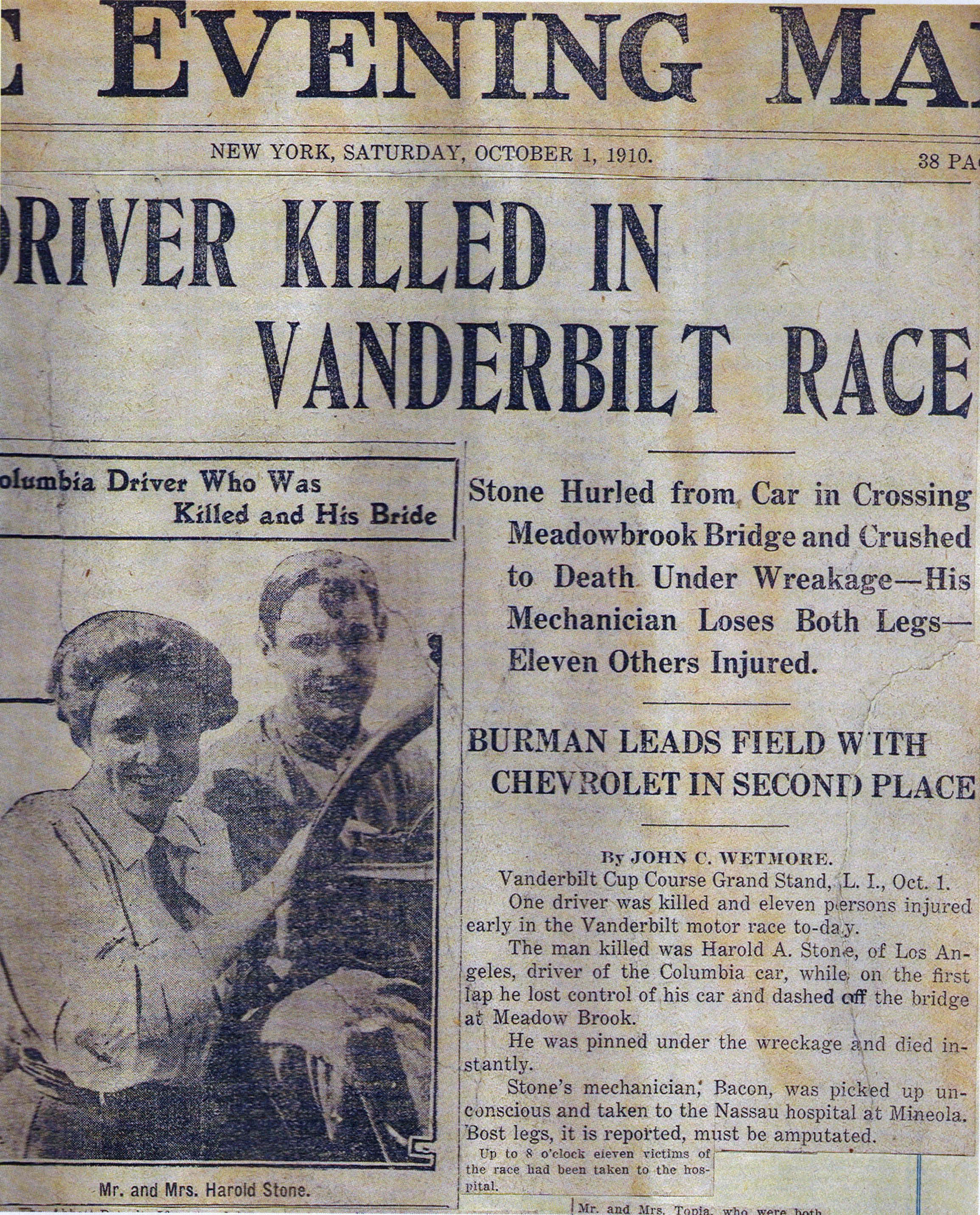
The bridge was the scene of a tragic accident during the 1910 Vanderbilt Cup Race. Driver Harold Stone lost control of his Columbia racer trying to make the curve on the bridge at speed. The car ran off the bridge killing the mechanician Matthew Bacon. Although some newspapers announced his death, Stone survived and was able to recover from his injuries.
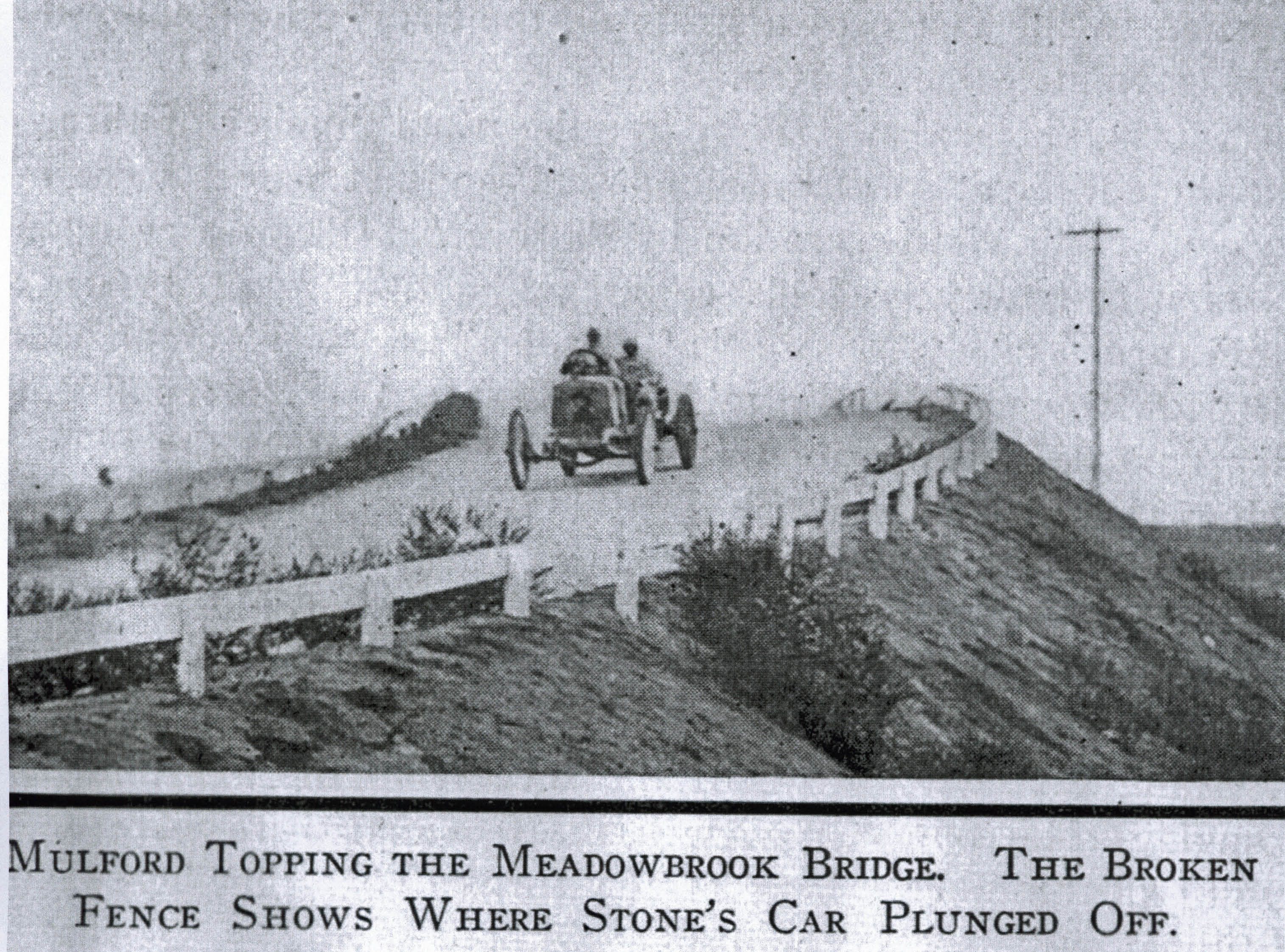
The fence barrier broken by Stone was located at the top of the bridge.
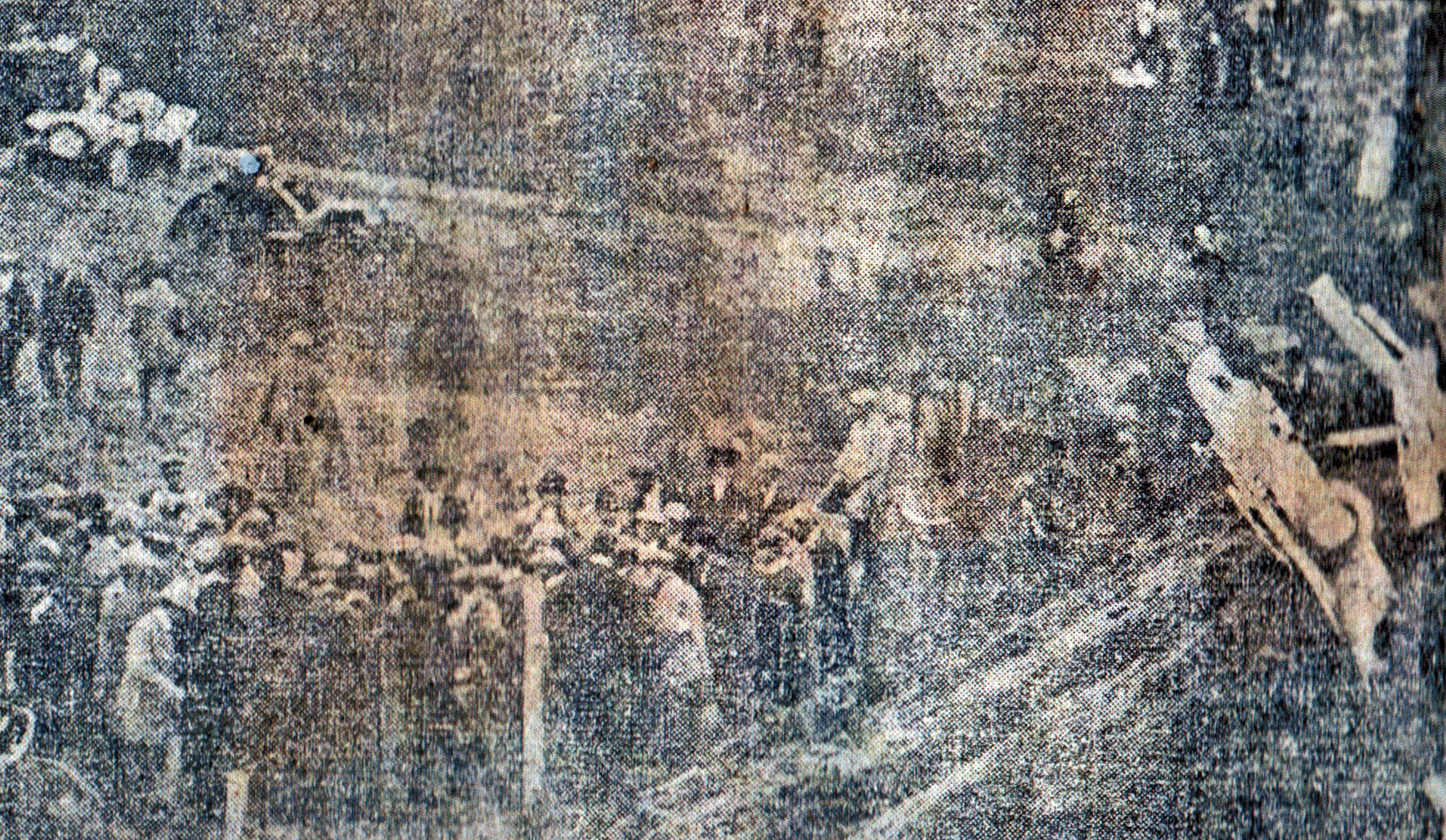
This newspaper image captured the crowd scene around the accident at the foot of the Meadowbrook Bridge.
This accident and another fatal accident by Louis Chevrolet's car during the 1910 race resulted in the end of the Vanderbilt Cup Races on Long Island.
Then: August 8, 1938
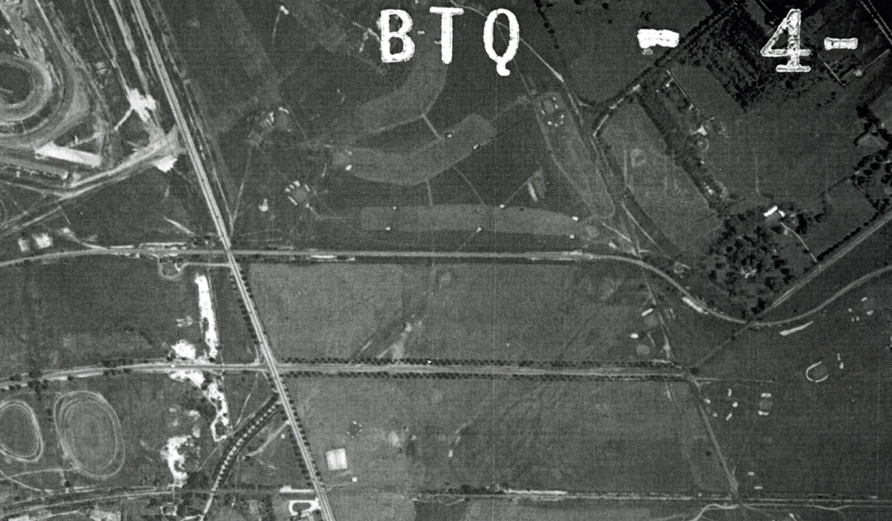
This 1938 aerial shows the Motor Parkway in East Meadow. The Long Island Motor Parkway runs parallel to Stewart Avenue. Merrick Avenue is the north/south road on the left. The Central Railroad right-of-way is on the bottom of the aerial.
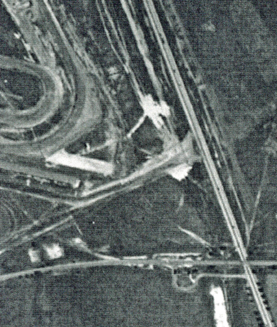
Roosevelt Raceway can be seen north of the Motor Parkway. The Merrick Avenue Motor Parkway Bridge and the entrance to the Meadowbrook Lodge were seen on the lower right corner of this aerial.
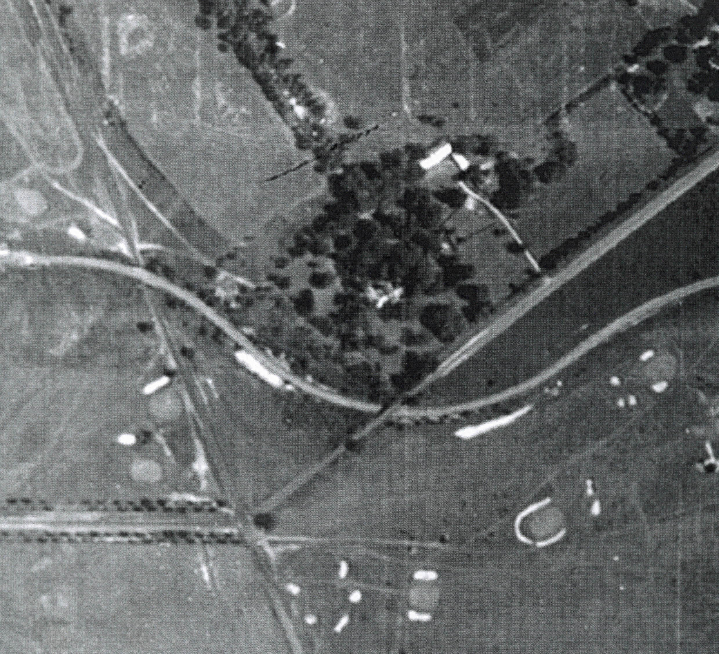
This close-up highlights the Motor Parkway around the Ladenburg property. The Meadowbrook Bridge was on the left followed by the bridge over Stewart Avenue in the center. Note the golf greens of the Salisbury Links, now part of the Eisenhower Park golf courses.
Now: 2011
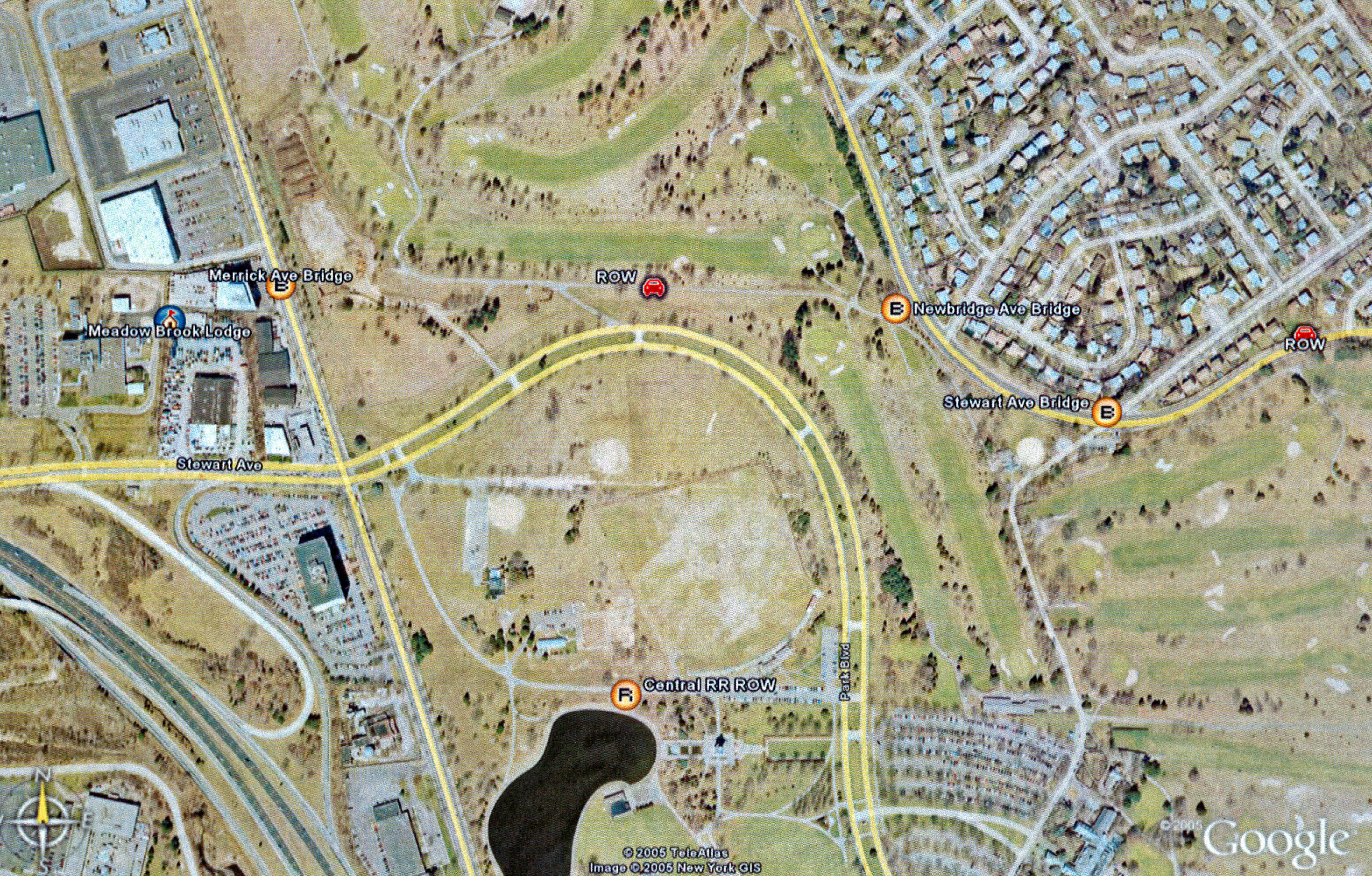
A current Google Earth image showing the location of the Motor Parkway, the Meadowbrook Lodge and the Motor Parkway bridges.
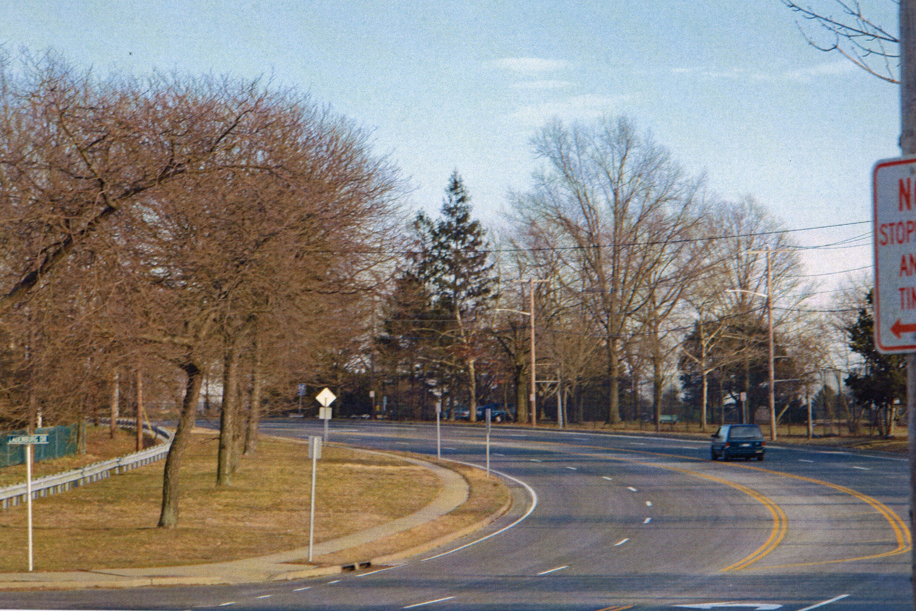
In the early 1940s, the Meadowbrook Bridge was taken down. As seen today looking south, Salisbury Park Drive was built over the Long Island Motor Parkway right-of-way.The cross-road is "Ladenburg Drive" in honor of the former property owners.
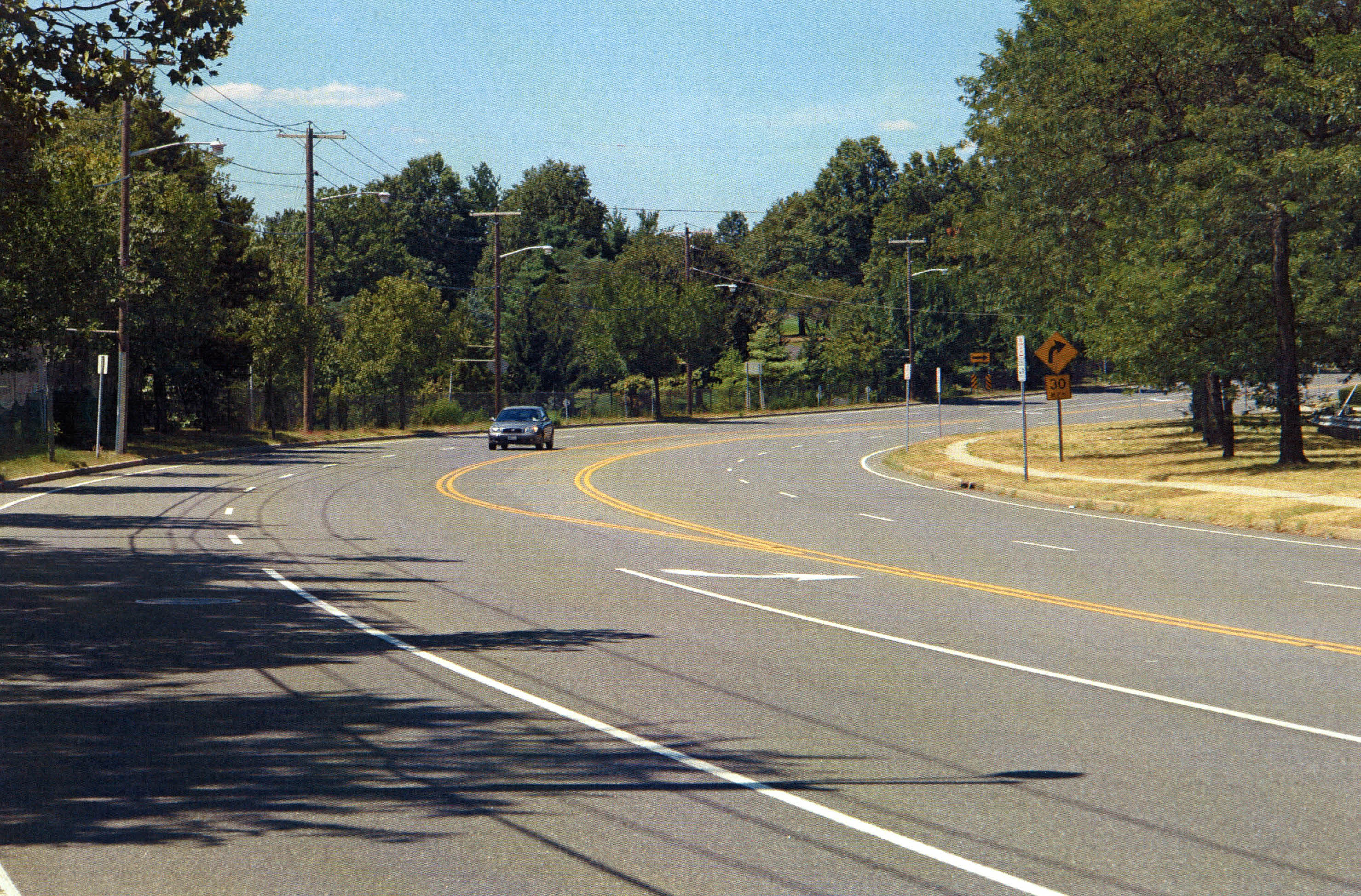
The view looking north on Salisbury Park Drive. Very few people on Long Island and, even in East Meadow, know that this road was part of the historic Vanderbilt Cup Races courses.
Links to related posts on VanderbiltCupRaces.com:
Midget Auto Racing at Roosevelt Raceway in 1939


Comments
More good reporting Howard. Thanks for the pics. I’m usually on Salisbury Park Drive 3 or 4 times a week and many times daydream about it being the Motor Parkway. Speed limit is enforced at 30 mph. so I try to limit the daydreaming however.
Interestingly, the Ladenburg property is actually in today’s unincorporated area of Salisbury, which at one time was called South Westbury and which is now generally thought of as being Westbury (using Westbury’s zip code). And Long Island’s way of assigning school districts makes it more complicated, with Salisbury containing an elementary, middle and high school of the East Meadow school district (which may be why you’ve considered it East Meadow). What’s more, I live in a section of Levittown, bordering Salisbury, and my children went to one school in East Meadow and two in Salisbury (i.e., Westbury). And if you want more, my water is supplied by the Hicksville Water District. I’m sure it must have been much less confusing in Willie K’s days!
Hi Art:
And back during the Vanderbilt Cup Races the area was called Meadowbrook for the Meadow Brook that ran through the area.
Salisbury Park Drive inlcuding sections of the Motor Parkway right-of-way) is the border between East Meadow and Salisbury.
I was raised in East Meadow and was at the 1965 ceremony when Salisbury Park was renamed for Eisenhower by President Lyndon Johnson!
Enjoy,
Howard