Then & Now: Deadman’s Curve in Bethpage (1908-2014) Updated: April 8, 2014
This "Then & Now" provides an updated view of the most famous curve on the Long Island Motor Parkway- the first Deadman's Curve in Central Park (now Bethpage).
Over the last several months, PSE&G has been trimming trees in the area. The "Now" photos are amazing!
Enjoy,
Howard Kroplick
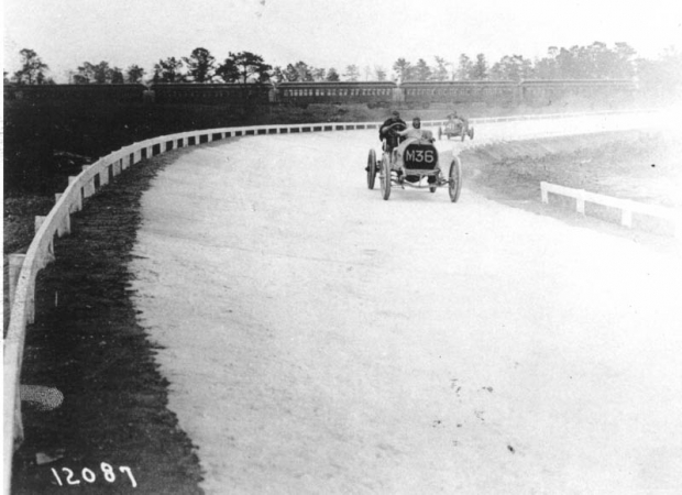
Then: Looking South
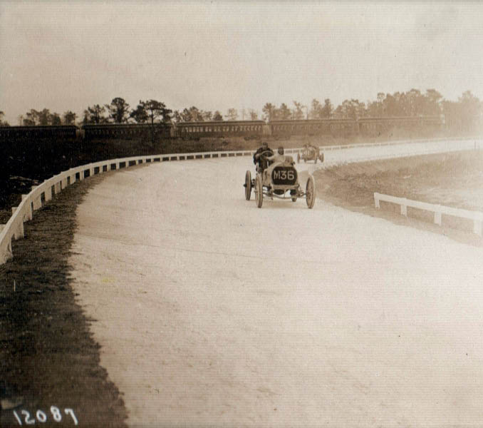
October 10, 1908
October 10,1908
August 15, 2007
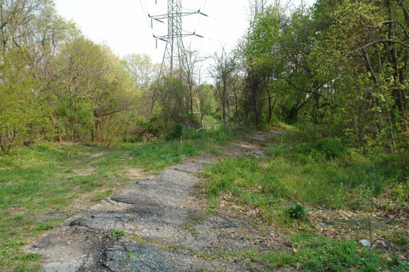
May 1, 2008
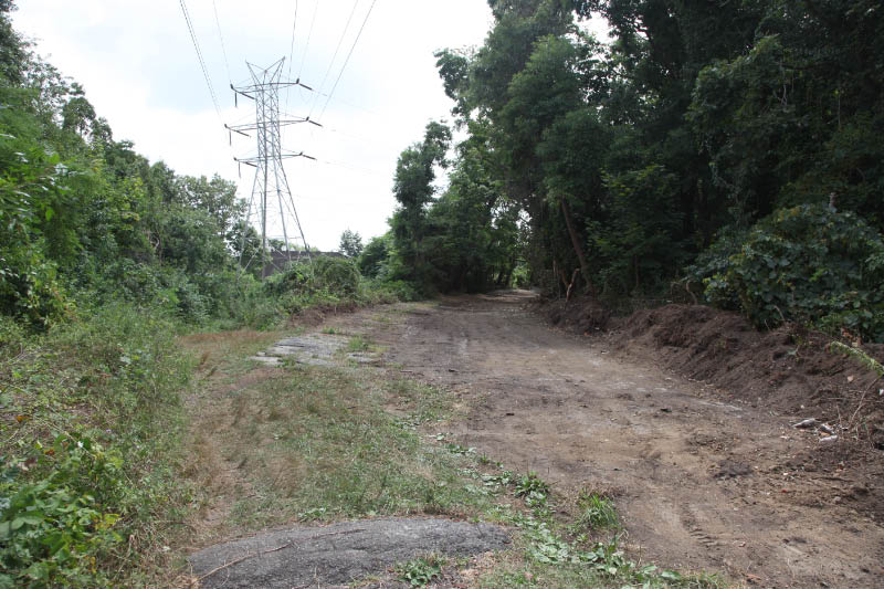
April 12, 2013
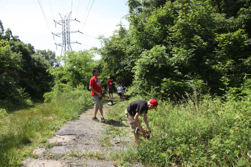
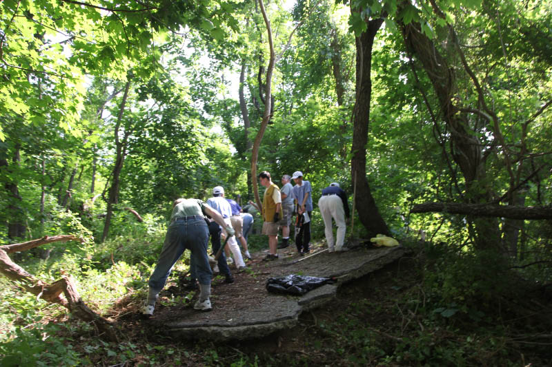
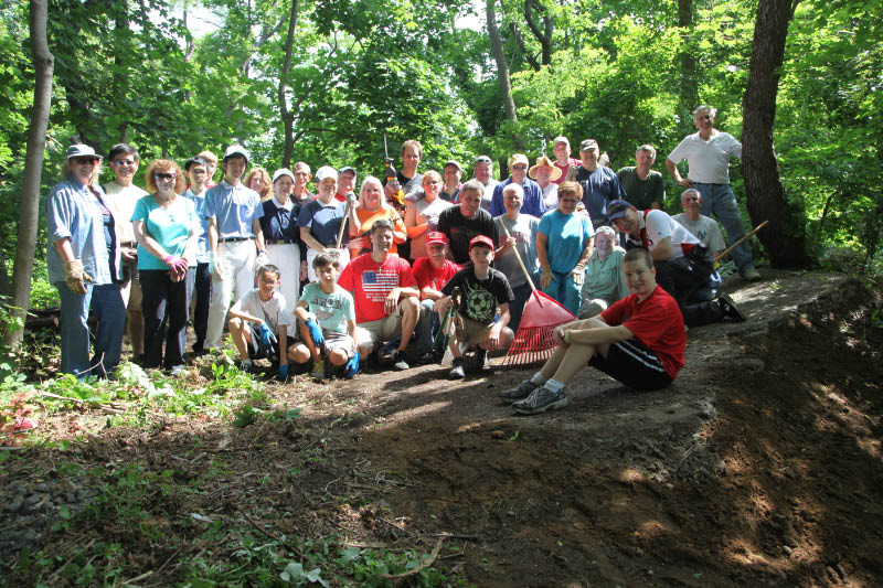
June 22, 2013: On June 22, 2013, the Long Island Motor Parkway Preservation Society, the Bethpage community, Boy Scout Troop 604 from Bethpage and the Long Island Branch of the Tzu Chi Foundation came together to clean-up the historic Deadman's Curve in Bethpage.
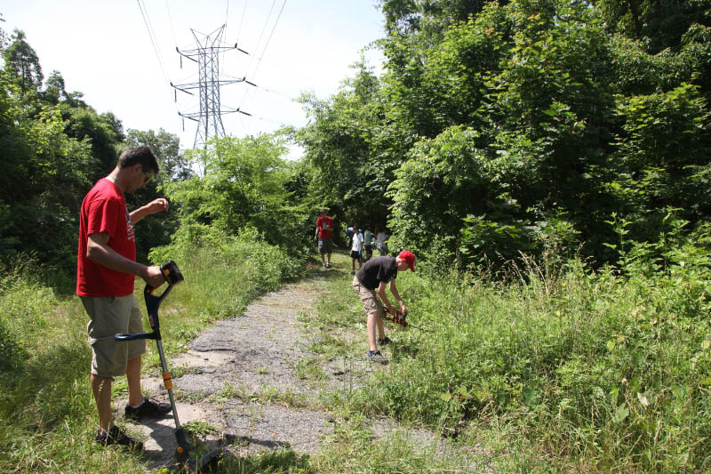
August 22, 2013: During the summer, the clean-up continued with heavy lifting provided by contractor Andy Campanelli.
August 22, 2013
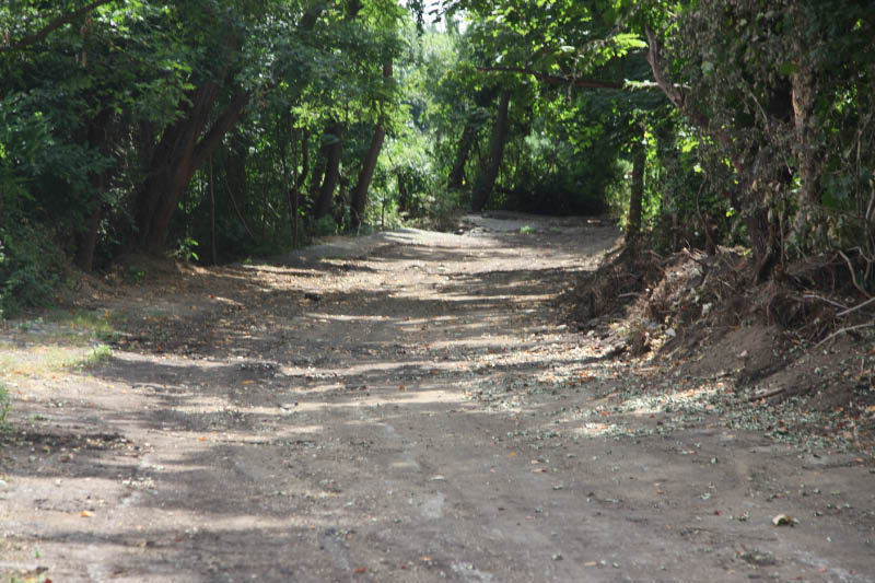
October 9, 2013
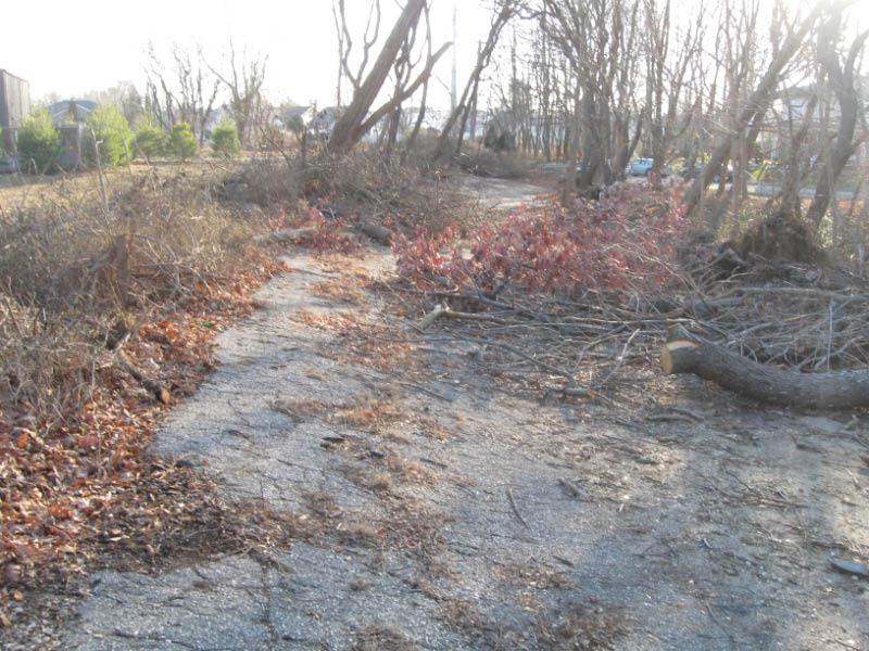
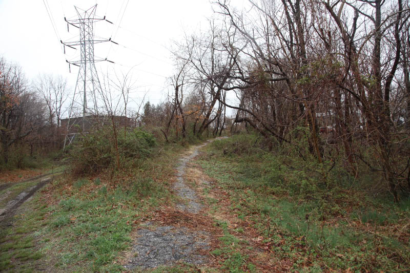
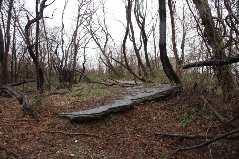
January 17, 2014: Trees cut down by PSE&G and left on the road.
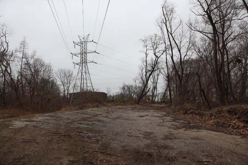
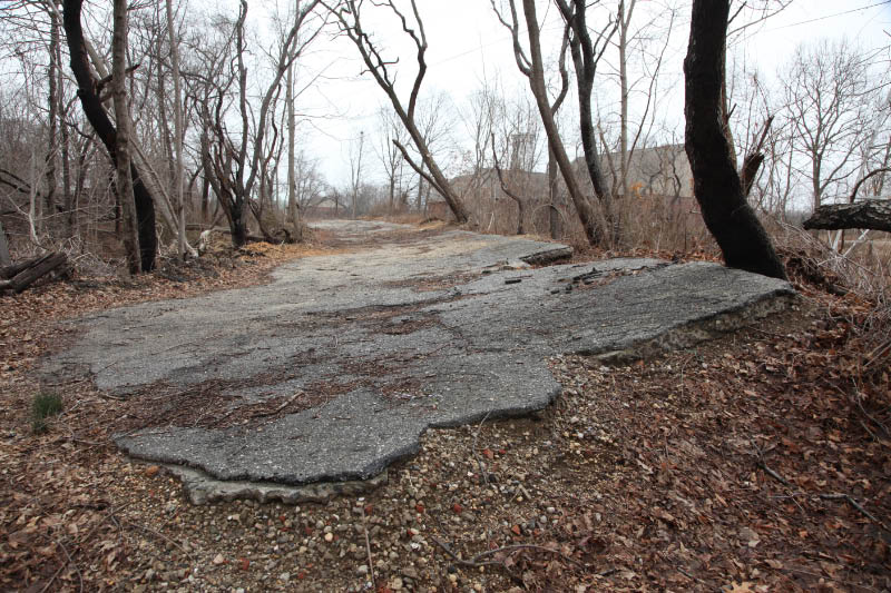
Now
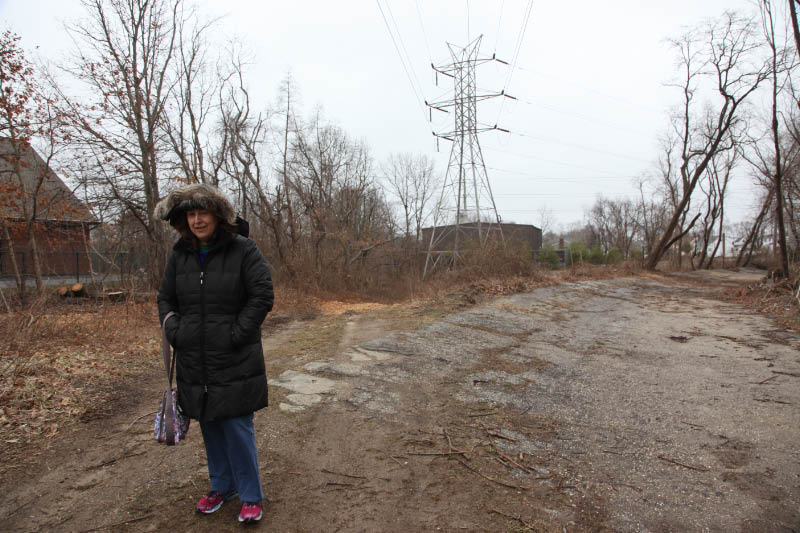
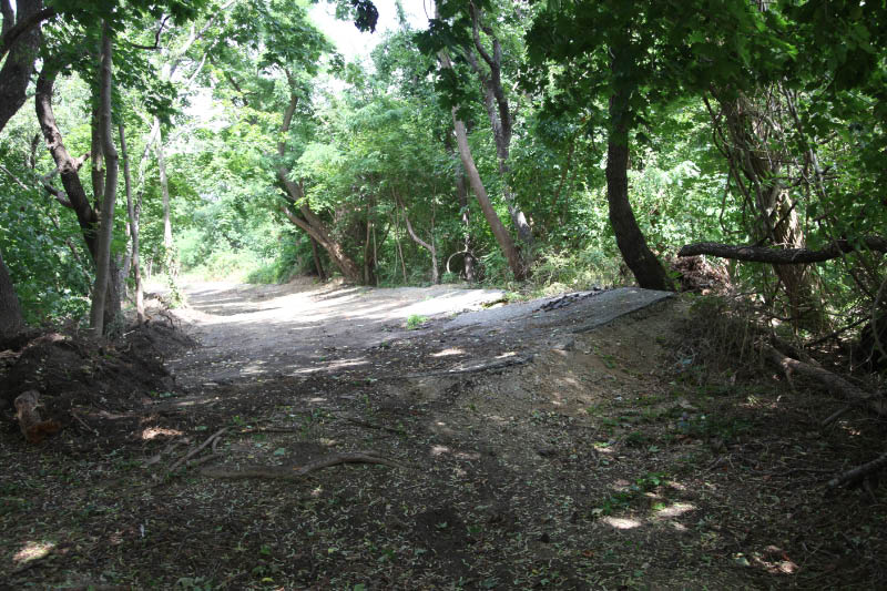
March 30, 2014: PSE& G has cleared and trimmed trees in the area. Compare this photo with the June 22, 2013 photos.
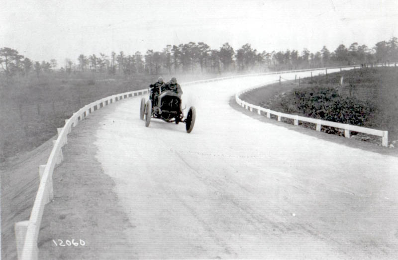
Then: Looking East
August 1914
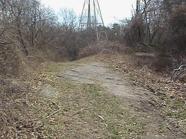
April 1, 2006
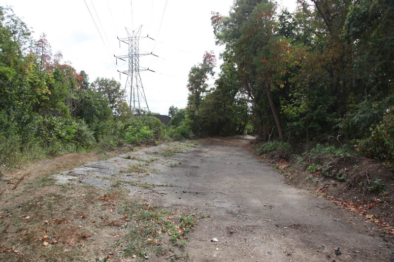
April 12, 2013
June 22, 2013
June 22, 2013
August 22, 2013
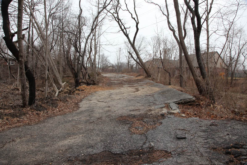
Now
March 30, 2014


Comments
I remember playing on the “Old Motor Parkway” when I was a little girl… It is now part of Salisbury Park Drive. Black raspberries grew there and it was a dumping ground for old furniture etc. there was the broken remains of a bridge that was between the elevated remains and Newbridge Road. We used to walk down to the bridge over Wantagh Parkway. It bordered the “G"section of Levitt homes which are part of the East Meadow School District.
Judith: Sounds like the remains of the Carman Ave bridge. Now that would be interesting to see! If you have any photos of the playground, please post them.
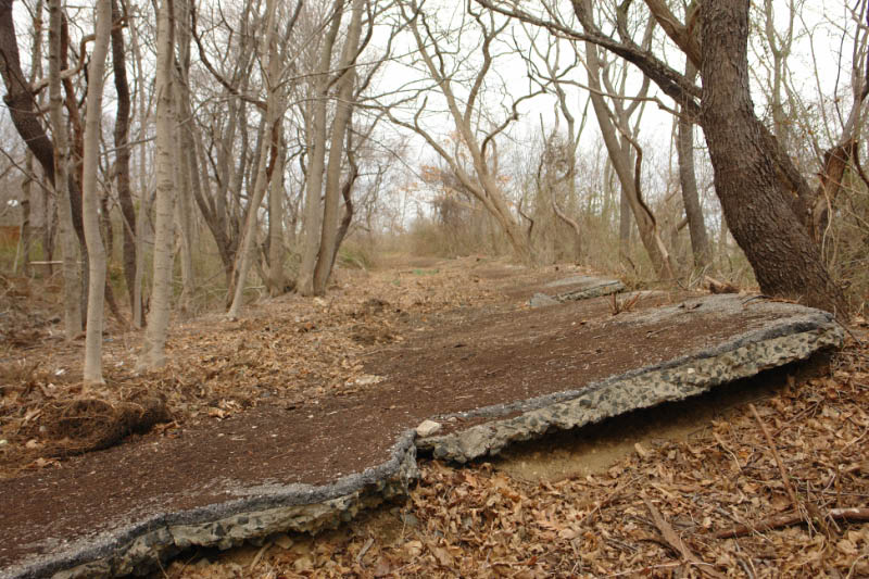
In the late 50s that portion of the “curve” in Bethpage was nearly fully intact and not only walkable but able to literally serve its banked responsibility of sustaining our cruiser bikes at top speed! My grandfather’s house (which he built with my uncles and father) is just two blocks from the road right off Central. It has now been confirmed by relatives that he bought his small piece of property in Bethpage shortly after actually working on the roadway and the house he built became a sort of vacation home to replace the small house and land he sold that became part of the land zoned for LaGuardia Airport.
From Daniel S.:
I have been fascinated by the Motor Parkway since my childhood when I would walk the stretch in northeast Queens and listen to stories told my dad, who, as a child, experienced the thrill of driven on the road by a rich uncle and still had vivid memories many years later. (He would be 100 years old if he was alive today.)
From him, I first learned about deadman’s curve, although from your 2010 post, I realize that he was talking about the “second” curve. He, and other, older relatives with contemporary memories of the Motor Parkway vividly recalled that flat, unbacked curve that your reproductions of the 1909 postcard and the 1908 photo shows. To them, that second curve was “the” deadman’s curve, so it is a puzzle to me how, over time, the other banked curve became known as that while the other curve was somewhat forgotten.
They certainly did do a great job of cleaning up, because I was their about the middle of March and it didn’t look anything like what it looked like on March 30, only hope it will stay that way. I’ll keep you posted on that
Howard..You have done a truly fabulous job of preserving the history of this famous and very much loved road. I rode my bicycle on it from west of Lakeville Road to the underpass at Jericho turnpike east of Mineola. The long, banked curve in Queens where Glen Oaks apartments now sits was a favorite place for my lunch. The bridge near New Hyde Park Rd. over the Northern State Pkwy. was still intact until the parkway was widened in the 50s. I WISH I had taken pictures…but at age 13…history didn’t mean much. I have an extensive collection of postcard photos…and I do not know where it was. One card depicts the bridge, but it is obviously not the correct one. What did the bridge go over?
Thank you SO much for all you do! I’d like to share he photos I have with you….possibly some you haven’t seen…but I doubt this.Best to you…
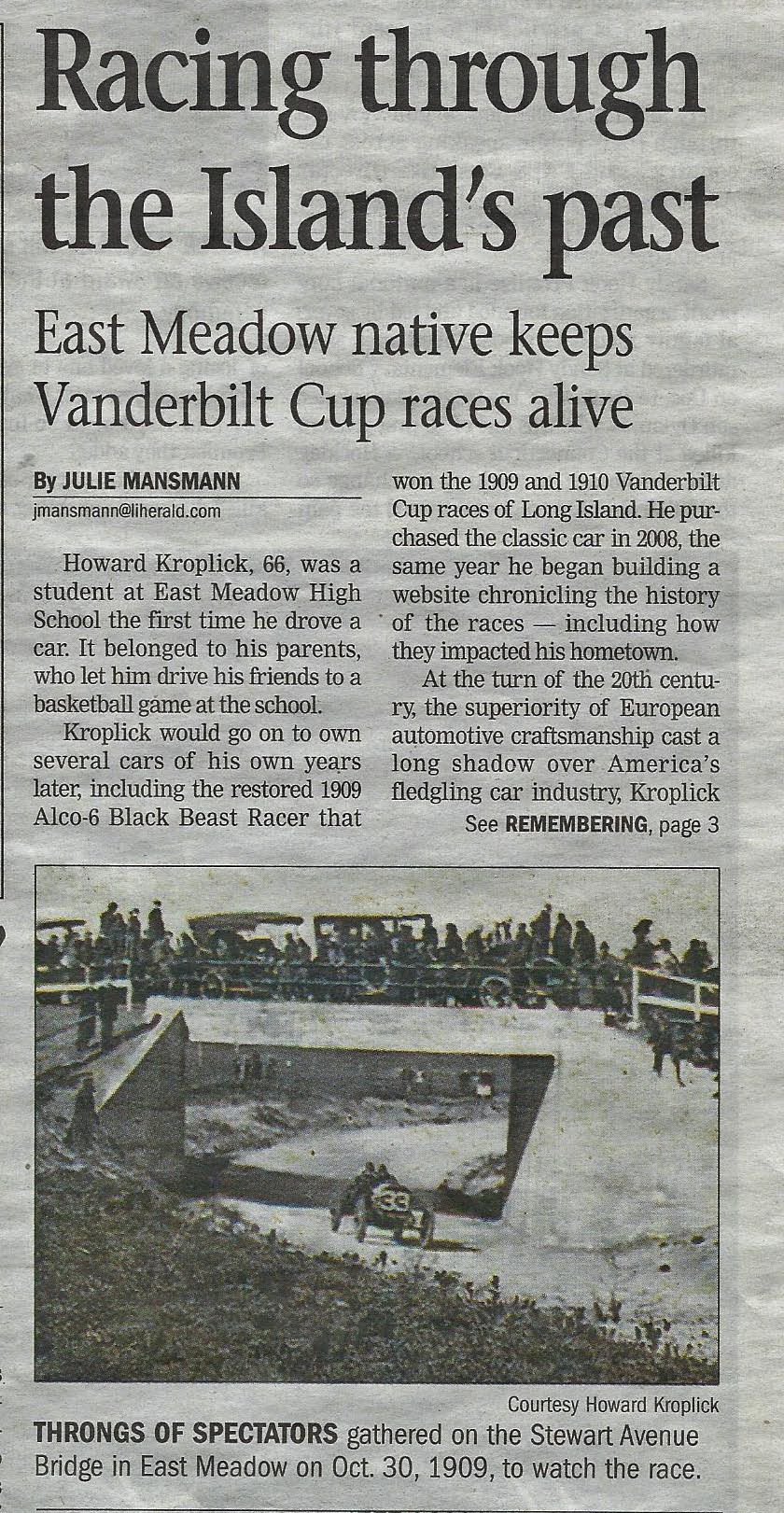
my great grandfather had a boarding house in Lake Ronkonkoma his son Merrit had some involvement with the race. Before WWI he was going to try to help find crews to extend the race track to Riverhead. If you ever visit the Ronkonkoma museum you can see a picture of the Locomobile at the finish line. The war changed everything and the racetrack was shelved.