Then & Now: The Ronkonkoma Lodge
Andy Hartwell comments: "A few months back I took a ride to the eastern end of the current motor parkway - right up to the lake - looking for any signs of the old Ronkonkoma Lodge. Nothing jumped out at me. Any chance you can pinpoint the exact location on a google earth map for me? Maybe some then and now pics too?" Andy, you ask for it , here is your: Then and Now: The Ronkonkoma Lodge
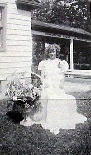
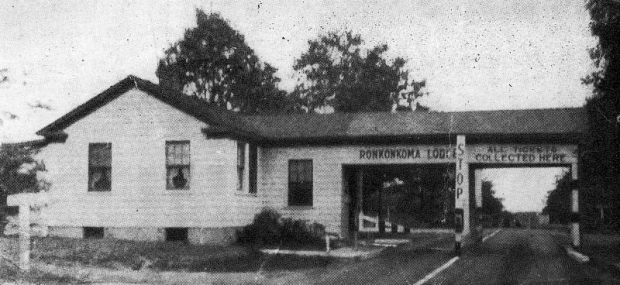
Then: The Ronkonkoma Lodge was built in 1923 and was on the north side of the Motor Parkway approximately 1,500 feet west of Rosevale Avenue. This 1920s photograph published in The Long Island Motor Parkway shows the Ronkonkoma Lodge porte cochere in the background. The young lady is Evelyn Ericson, the daughter of Eric Ericson, the Ronkonkoma gatekeeper.
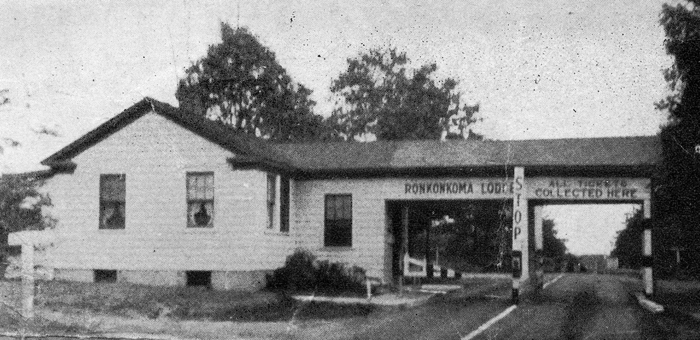
As seen in 1930, the porte cochere straddled the road, which became the style of modern-day tollbooths. When the parkway was closed in 1938, the building was purchased by Eric Ericson. He removed the port cochere and moved the building off the 100 foot right-of-way of the Motor Parkway and approximately 150 feet west of its original location. The Erickson family continued to live in the lodge into the 1960s.
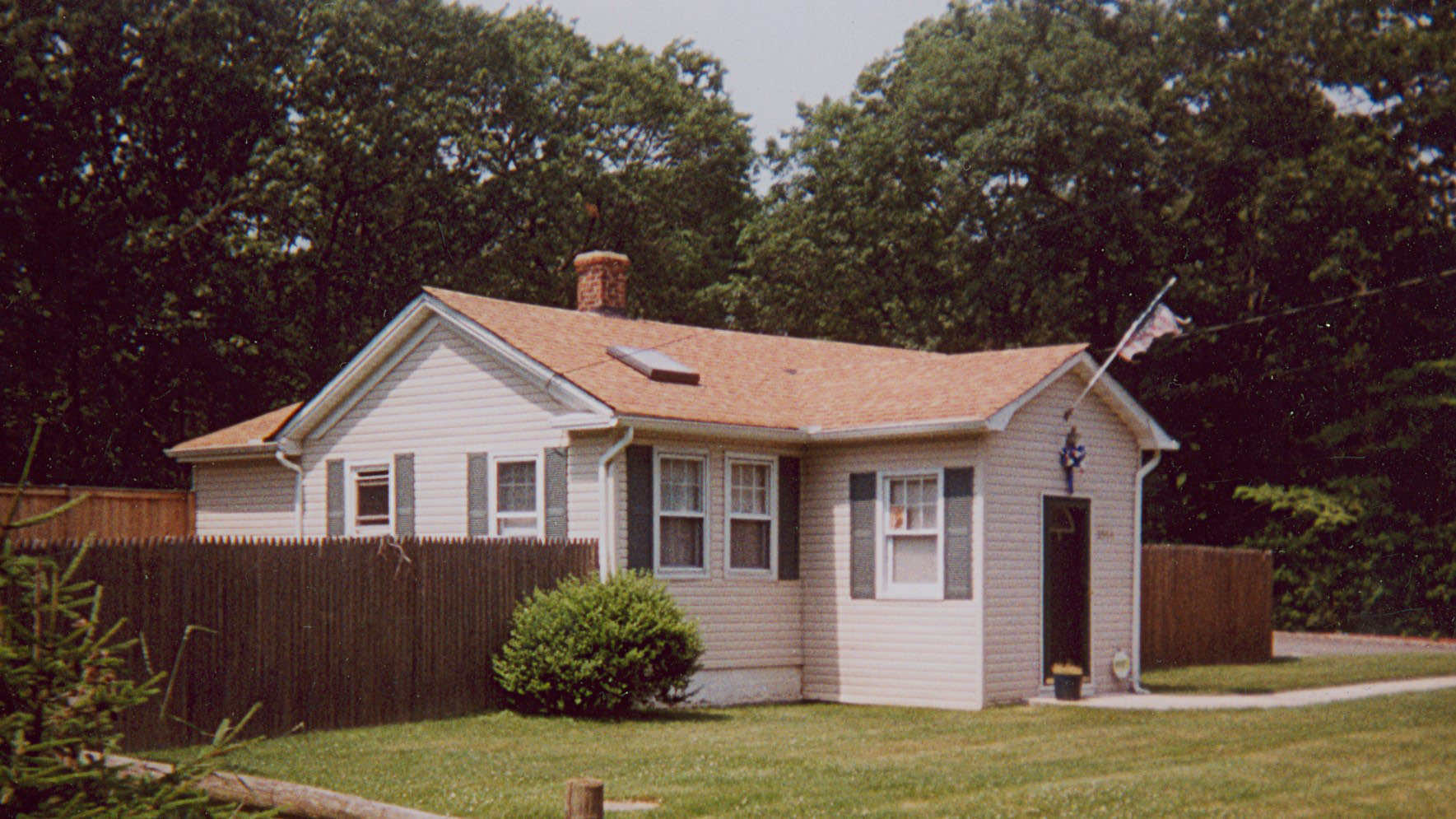
Now: The Ronkonkoma Lodge is still standing as a a private home on the Motor Parkway near Woodlawn Avenue. As seen in 2007, the distinctive frame of the original lodge is easily recognizable. The building design was the same prefab that was used for the Mineola Lodge.
Of the 20 toll collection structures built for the Motor Parkway, five are still standing or partially incorporated into other buildings; Great Neck Lodge, Roslyn Lodge, Garden City Lodge, Mineola Lodge and the Ronkonkoma Lodge.
Links to related posts on VanderbiltCupRaces.com:
Long Island Motor Parkway Toll Lodges


Comments
Howard,
I took a ride at lunchtime today and stopped by the Ronkonkoma house at Woodlawn. What I found really interesting was the fact that the front lawn - parallel to the current pavement yet elevated above it- was flat. The lawns of the homes running on both sides of the house were also flat. What I am saying is, based on the photo of the overhanging section of the original structure, the front lawn of the current house is probably the original parkway road surface. It looks like the neighboring yards all were flat and part of that roadway too. Today of course, the flat stretchs are broken by driveways but it was obvious that the yards all were aligned and level.
Just thought that was interesting! I wonder if you dug down in the lawn a little ways if you might find pavement!
By the way, where was the lodge in relation to the current house? Further east? West? Just curious.
Correction, I confused ‘lodge’ and ‘toll booth’. I assumed the current house was the latter. My mistake.
I guess there wasn’t another structure in that area then?
Andy Hartwell… I know this blog is 6+ yrs old, but visit the “suffolkcountyny.gov” website ( imaps ). Motor Parkway E/O Old Nichols Rd specifically. I measured between property lines on either side of the parkway at various points, and 100 ft is the average distance ( which just happens to be the original width of the entire LIMP ROW ). Pretty much every house on either side of the parkway has anywhere between 30 to 40 ft extra front yardage in this area because the original LIMP ROW remained established. The imaps go back as early as 1947 and up to 2013. The parkway width appears original in 1947, and widened of course in 2013. In this area, I think the parkway wasn’t diverted from it’s original path.