Nassau County Department of Pubic Works Surveys and Maps: Closing the Motor Parkway
In a new Kleiner's Kolumn, Art Kleiner has obtained maps and surveys (1938-1968) from the Nassau County Department of Public Works detailing the plans for Motor Parkway after it closed in 1938.
Enjoy,
Howard Kroplick
Kleiner's Kolumn:Nassau County's Plans for the Motor Parkway After It Closed in 1938
By Art Kleiner
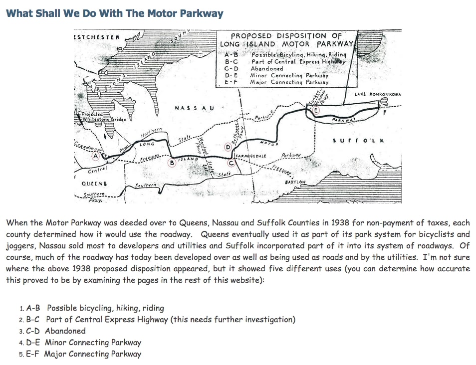
Once the Motor Parkway was deeded to Queens, Nassau and Suffolk Counties in 1938, each county needed to decide what to do with their acquired property. Over time some parts were used as bikeways, sold to utility companies, sold to developers for building construction, used as the basis for further highway development or jest left to be unused. Apart from deciding what to do with the Parkway, public works projects were initiated to dismantle the bridges as some became a safety hazard. Many of these projects have already been featured but new documentation has been uncovered with more detail about each. Future blog posts will highlight the demolition plans from the Nassau County Department of Public Works. But first, here are some maps showing what Nassau County had planned to do with the Motor Parkway.
Map by Art Kleiner
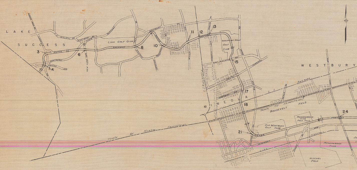
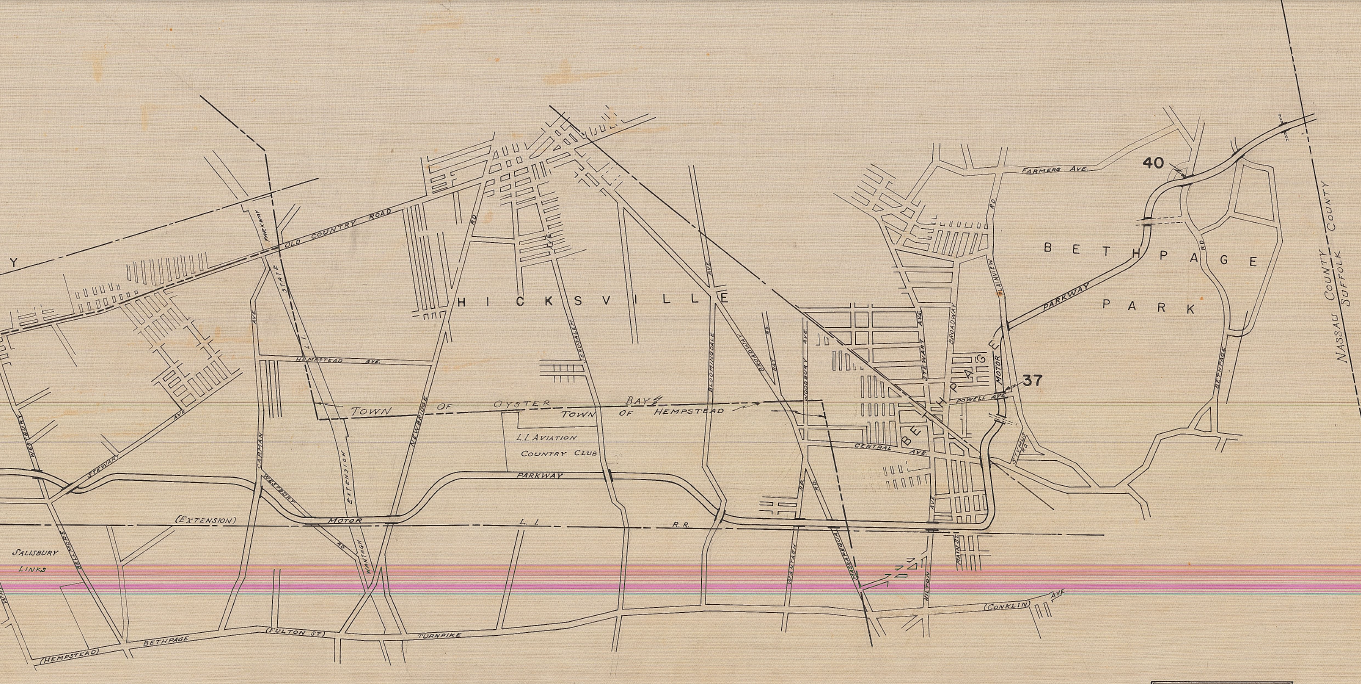
Plans for the Motor Parkway Bridges in Nassau (1938)
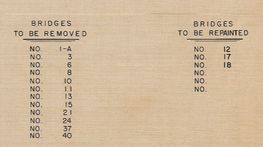
In 1938 Nassau County began laying out plans for how to utilize the Motor Parkway. Many bridges were to be eliminated while others were to be painted or not have anything done with them. See if you can find your favorite bridge (numbers match those on the following maps) and see what the county had planned to do with them.
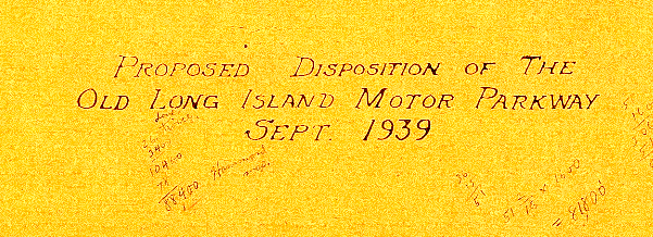
Disposition of the Motor Parkway (1939)
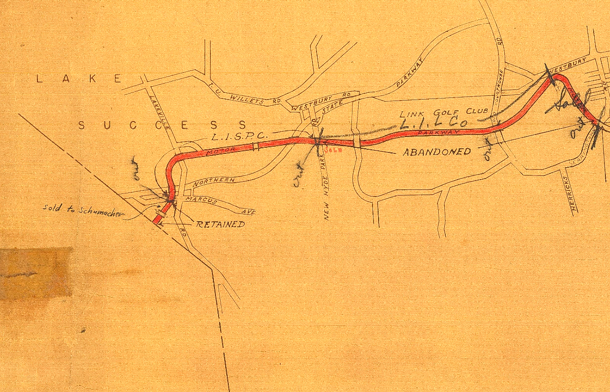
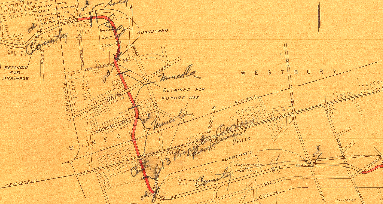
Here's a more informal map from 1939 highlighting who purchased the properties, which bridges were to be removed ("out"), land exchanges (i.e., Levitt) and abandoned sections.
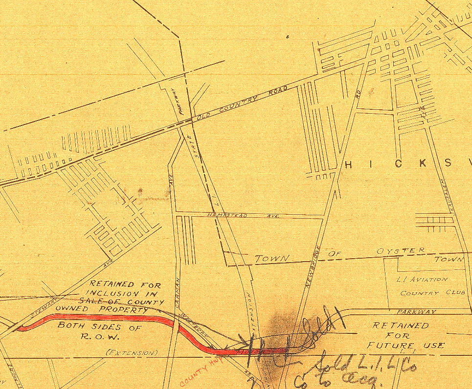
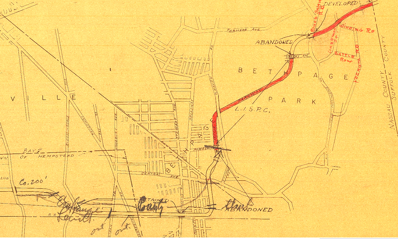
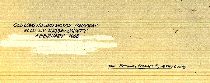
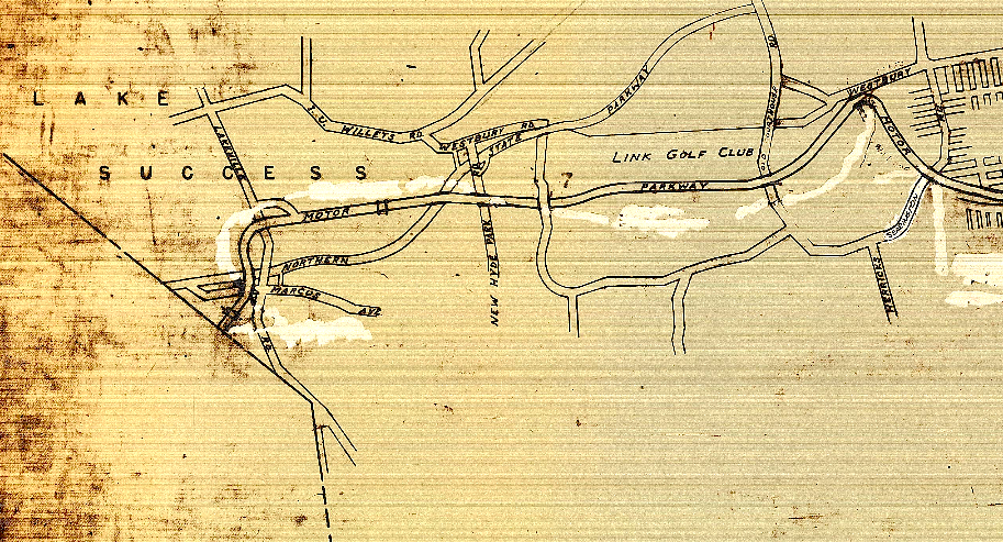
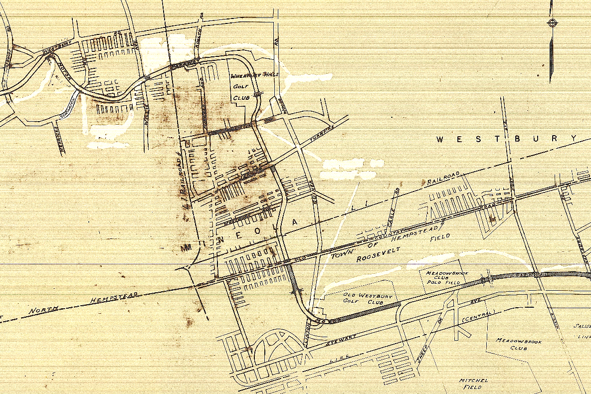
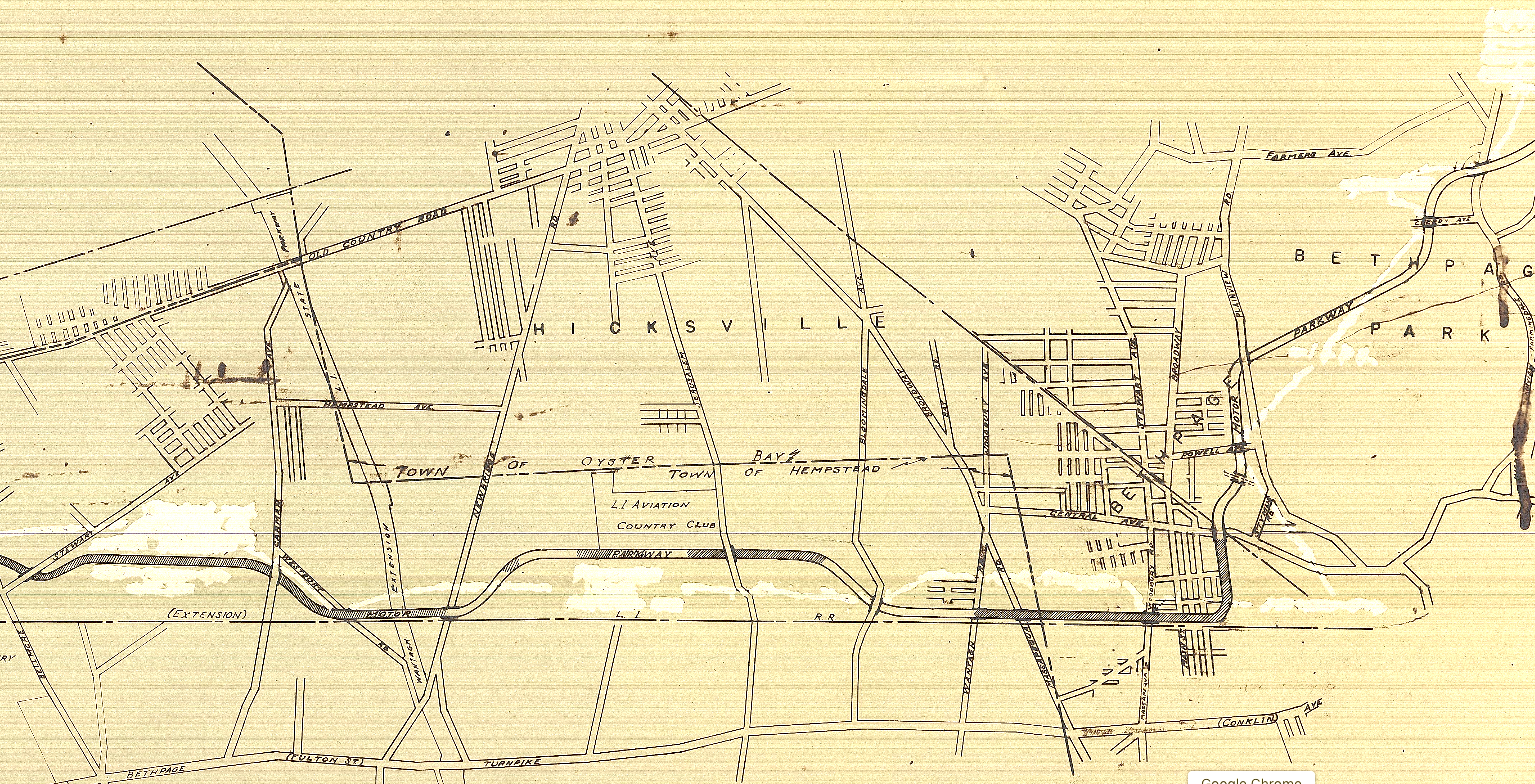
Nassau County owned Parkway property (1968)
These1968 maps depict the parkway right of way and which sections were still owned by Nassau County (indicated by the cross-hatching pattern in the roadway). However, by examining each section it appears the map, while dated 1968 is actually from an earlier time frame. For example, the Levittown/Hicksville area still is undeveloped, and still shows the LI Aviation Club that had closed 20 years prior. Can you find other areas that would prove the 1968 date wrong? The many white areas might actually have been some way of overwriting previous notations.
What ever the year, the maps shows Nassau County having possession of much of the Motor Parkway near Roosevelt Field and further west. Over time we know that further development (and the need for tax revenue) probably had decreased the amount of county owned Motor Parkway right of way.


Comments
Nice work Art! If I’m reading the notes correctly the Westbury Road bridge was retained for future use and the Newbridge Road bridge was sold to LILCO. I believe both were torn down during or just after World War 2. Looking forward to seeing more of the information.
Art Kleiner:
Thanks Mike, yes looks like the Westbury Road bridge was retained, however not sure about the Newbridge Road bridge going to LILCO. Might just be the roadway between Wantagh Parkway and Newbridge Road that went to LILCO, however as we know LILCO does have high tension poles east and west of Newbridge, so maybe they took the bridge too. But if I was LILCO at the time why not have the county bear the burden of dismantling it? The Newbridge Road bridge may have more details in the future, if so will do a specific post on that.
I’m guessing your maps might be from around 1937. On the Bethpage view, north of Central Avenue, there are streets visible where Grumman was located.
This is like a scrapbook, thanks for pursuing this Art. My mind is already working:
* Old Courthouse was still active north to I U Willets Rd, so that’s why this bridge survived.
* Recall an old Newsday article about the LIRR planning to utilize the LIMP between Roslyn Rd & Mineola Ave, maybe this is why #12 and perhaps 18 survived until the 1980’s, but #17 ( Westbury Ave ) I’m not sure of. Trolley line use ended in the 1920’s. Maybe there were plans for a LIRR spur?
* The road over the Botto bridge in Bethpage was known as Cherry Ave. I’ll look into this.
Too many thoughts, I’m going to bed.
Cherry Ave noted at the Botto Bridge location ends up being quite obvious. I actually remember walking on this wood chip path while “looking for motor pkwy” a long time ago. Maps below:
Art,
Major clue on the alleged 1968 maps - the absence of the Meadowbrook Parkway extension which opened in 1956. Many of the local roadways cutting through or adjacent to Mitchel Field were long gone by then too.
In 1968 streets of Cambridge and Norcross off of Powell ave would have been on map
Neat maps Art! Cherry Ave (Botto bridge) is new news to me. As Brian noted it appears to once have traveled through Botto’s private farmland (in today’s Bethpage Park), that also included Broadway over the SOB. Walking old Cherry Ave sounds neat Brian, perhaps this early Spring.
I thought of Lee’s childhood street passing through the Camp Mills area in Garden City, but I think these maps are too new to reveal it.
Below is the article I commented about above, LIRR had plans for the LIMP from Roslyn Rd to Willis Ave in 1960.